Archaeological investigation of a medieval city in the Oasis of Chach (Tashkent)
| 2010 | 2011 | 2012 | 2013 | 2014 | 2015 | 2016 | 2017 | 2018 | 2019 | 2020 | 2021 | 2022 | 2023 | 2024 |
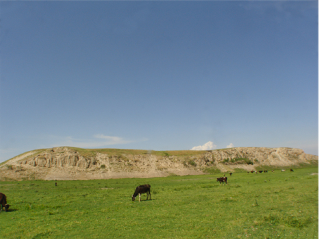
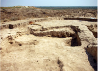
General view of Qarshovul-tepa facing north-west..
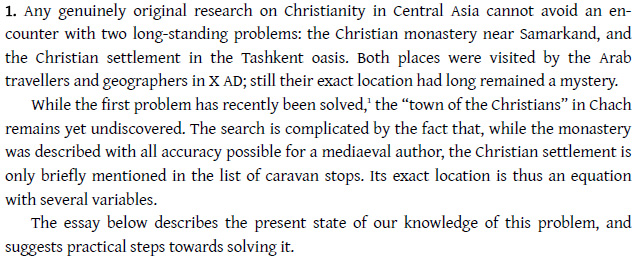
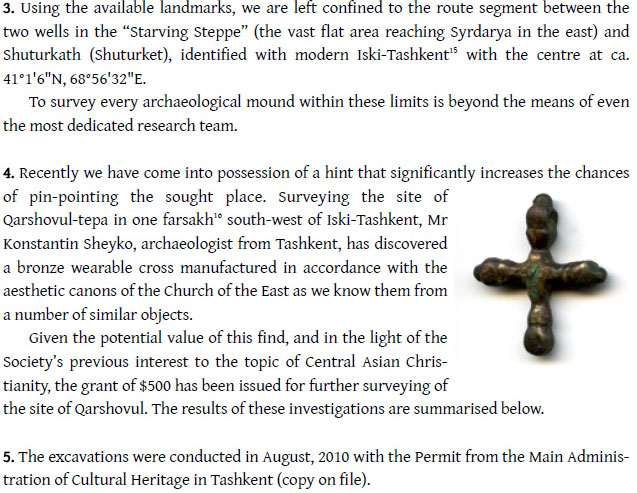
Starting point and relevance
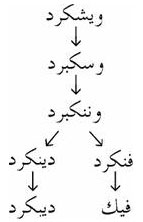
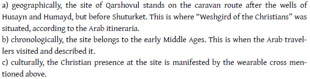
The Arab geographers of the 10th century mentioned in the territory
of today’s Uzbekistan two places related to Christians: First
the monastery near Samarkand, which was successfully identified and
excavated at Urgut by Dr. A. Savchenko and the Society for the Exploration
of EurAsia in the years 2004 – 2008 (see
here under “completed Projects"). Second the Christian
settlement called Weshgird in the Oasis of Chach (present Tashkent).
A preliminary investigation in 2010 revealed cultural remains from the
6th to 9th centuries at least.
Goals
Search for this medieval Christian settlement and investigate/excavate
a medieval city in the Oasis of Chach.
Partner in Uzbekistan
Dr. Konstantin Sheyko, archaeologist and head of Dept. at the Fine Arts
Academy of Tashkent.
Project Team
Dr. Konstantin Sheyko, Tashkent
Dr. Alexei Savchenko, Kiev
|
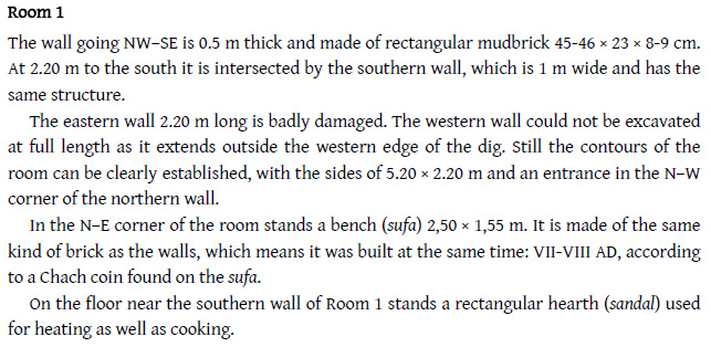
 Part of the sufa in Room 1. |
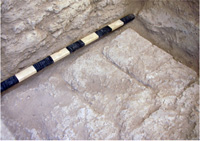
 Remains of fired plaster on the southern wall of Room 1. |
 Room 2, facing north-west. |
Conclusion
Decision
The
archaeological project of Qarshovul-tepa will start 2011.
| © A. Savchenko & K. Sheyko 2011. |
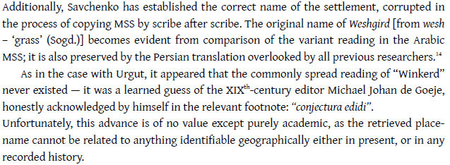
In May 2011 the East Sogdian Archaeological Expedition started the excavations of the site of Qarshovul, tentatively identified with the Christian settlement of Weshgird described by the mediaeval Arab geographers.
The background to this research and the description of the area v. at www.exploration-eurasia.com.
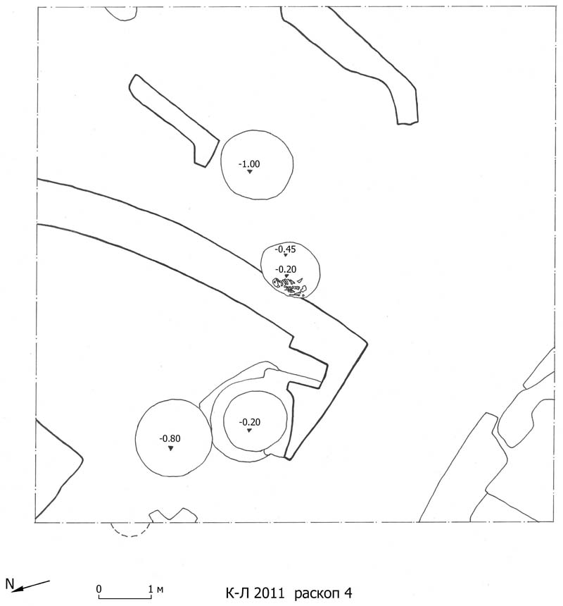
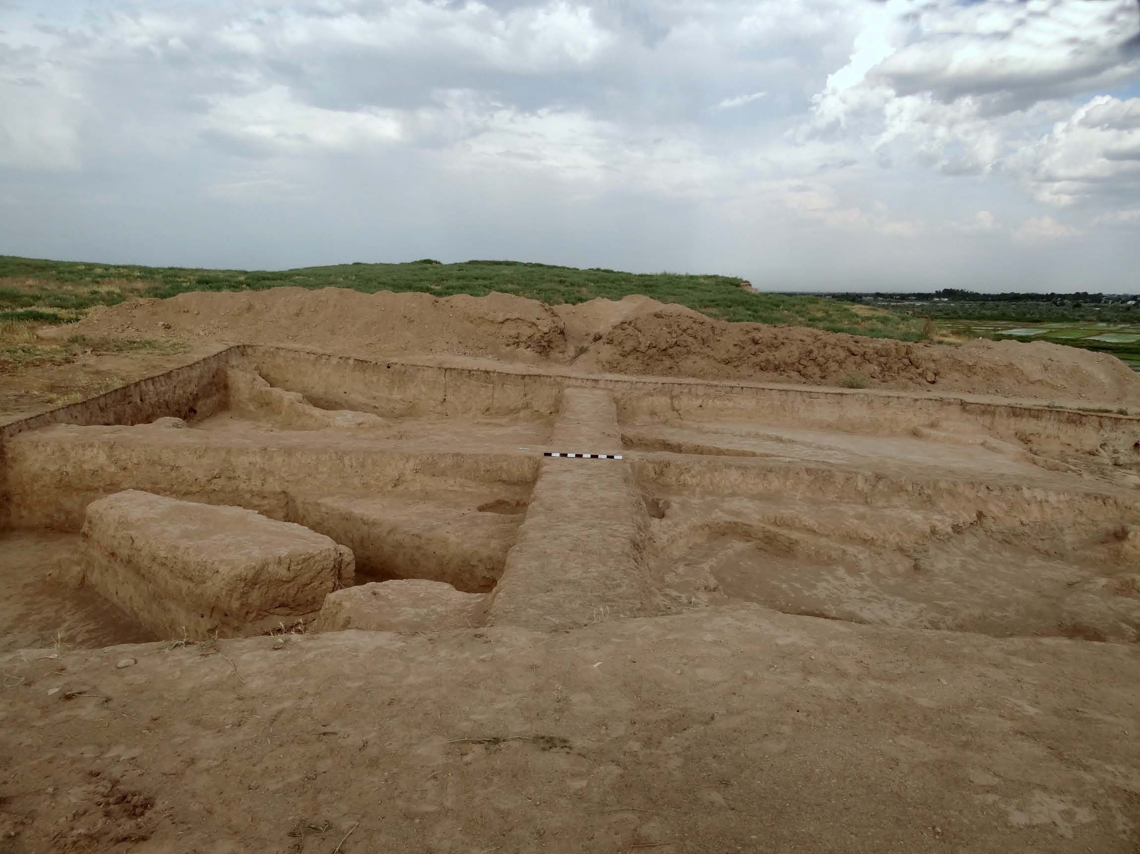
The works were conducted at three sectors numbered as Excavations 1, 3 and 4 (the label "Excavation 2" is reserved for the probing excavation laid in 2010). Before the start, an absolute referring mark for all excavations was fixed at the highest point of the mound (R0).
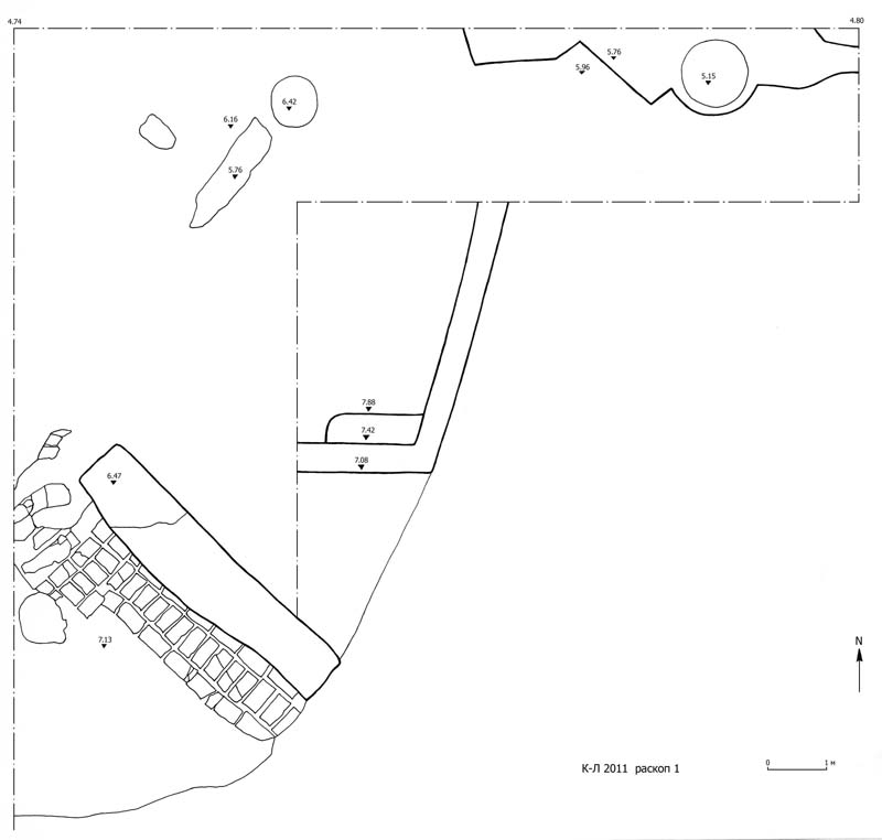
Excavation 1
This excavation was an extension of the trench laid in 2008, where the bronze wearable cross was found.
The cultural layer at this part of the site exceeds five meters in depth. Under the 12 cm of surface turf appeared loose earth with many fragments ofthick-walled pots and pitchers. This stratum lies on a floor marked by a pronounced layer of hard clay 10-30 cm thick, which must reflect the last in time habitational period at the site. The only intact vessel found here is a moulded pot withturndown rim and concave bottom.
The economic activity is further marked by clusters of ashes sometimes 25-40 thick spread throughout the excavation, especially in its eastern sector which probably was the open part of a courtyard.
In the western sector, at depth 7.08 m from R0 was detected a corner of a room, the walls of which go beyond the edges of the excavation. Only the southern andthe eastern walls were revealed, 1.10 m and 1.90 m long respectively, built ofmudbrick pieces 49-51×25-26×8-9 cm. Several pottery sherds were found on the floor.
In the east the room sided with another room, most part of which has fallenfrom the steep slope of the mound.
To the south from these two rooms, at the very edge of the excavation stands awall built of mudbrick pieces 49-51×25-26×8-9 сm. The area around the wall is paved by mudbrick 58-60×29-30×9 сm. On this pavement stood a large pot (khum), crashed by the fallen wall; the surviving fragments show a five-pointedstar scratched on its shoulders (Plate 5 top).
The western part of the excavation probably served for household needs, judging from the two cesspits 0.76 and 0.68 m in diameter.
There is no immediate explanation for the presence of two important artefactsthat were found in this sector:
– the stem of a goblet or vase which does not belong to any known type of Sogdian pottery, and looks like the bottom of a chalice (Plate 18) If this assumption iscorrect, then the first proof of permanent Christian presence is found, since a chalice is only used in a church and is thus sign of organised liturgy;
– a jar with two crosses scratched on its body and handle (Plate 23 top). The jar,belonging to a common type, has been repaired, which testifies to its peculiar function, like serving as a receptacle for holy water (no traces of wine inside).
Given that this context is situated at the very edge of the slope of the hill, it ispossible that both items could have rolled down from the upper area.
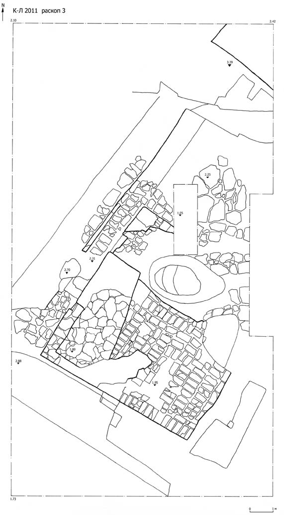
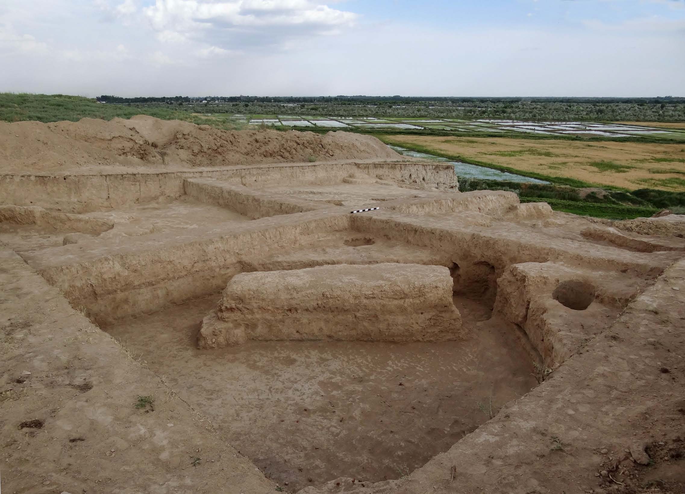
Excavation 3
Beneath the 5-7 cm of turf appeared a layer of loose earth 0.6-0.65 m deep, withfew fragments of non-glazed pottery, sometimes with white and light red engobe.The lower limit of that stratum is a layer of clay 12-15 cm thick at depth 1.80 m from R0. Below the clay level lies pavement made of rectangular mudbrick 4849×23-24×8-9 cm laid very thoroughly, with joints 2-3 cm wide. Immediately below this pavement starts a platform made of adobe blocks 0.5-0.7 m wide. In the centre of this construction there is a late pit which might have been left by treasure hunters.
Excavation 4
Just as in the case with two other excavations, the cultural layer showed up atdepth 8-9 cm, right under the surface turf. The remains of several separate wallswere revealed, as well as a round stove 1.15 m in diameter, standing 20 cm high from the floor surface.
The traces of household activities were revealed in the form of three pits 1-1.20m in diameter, full of ashes and coals. In one of them was found a male skeleton without signs of a regular burial.
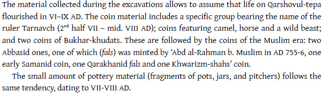
The excavation provided a wide selection of pottery, mainly thick-walled vesselswith wide flat bottom, extended body and sloping shoulders. Some sherds show traces of white engobe and strokes of red and black paint. Several oinochoe fragments were found (Plate 5 bottom).
According to the pottery material, the occupation of this part of Qarshowul-tepaends in late VIII–early IX AD, while several singular sherds suggest the terminus ante quem in the antique times.
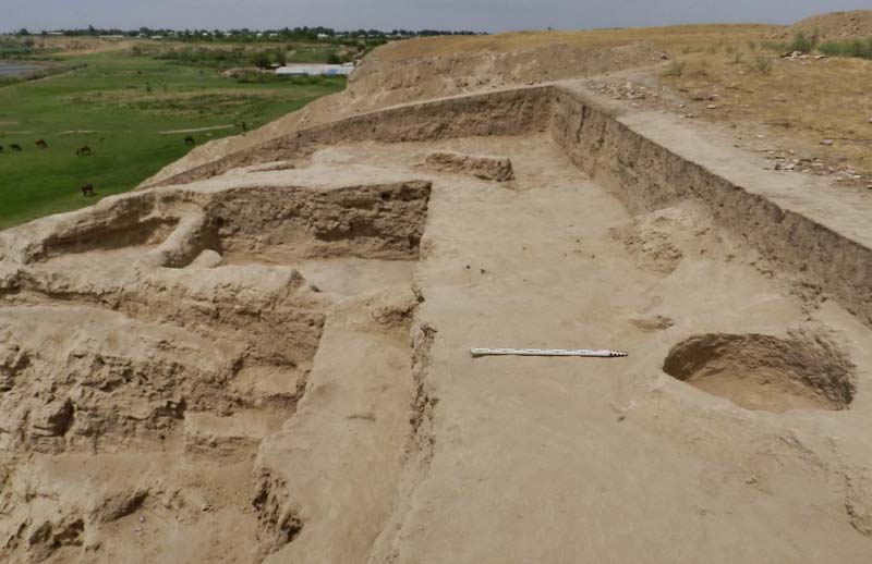
Photo 1: Excavation 1, facing west.
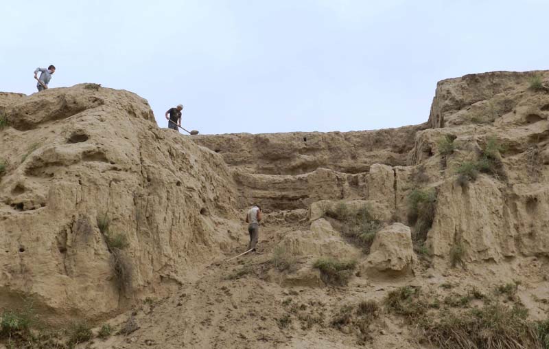
Photo 2: Excavation 1, view from the foot of the tepa.
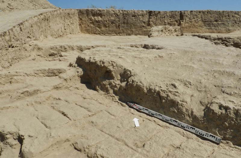
Photo 3: Excavation 1, facing north.
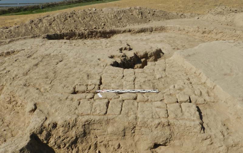
Photo 4: Excavation 3, top.
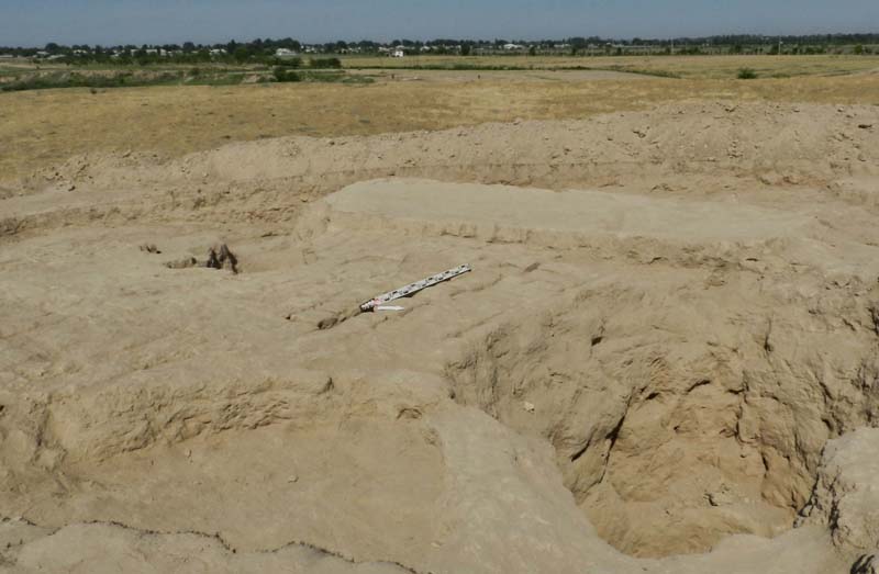
Photo 5: Excavation 3, top.
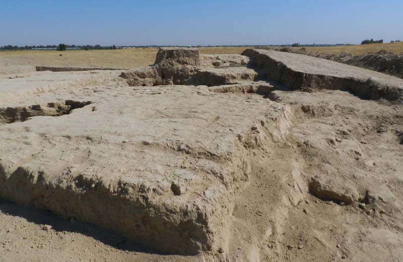
Photo 6: Excavation 3, facing north.
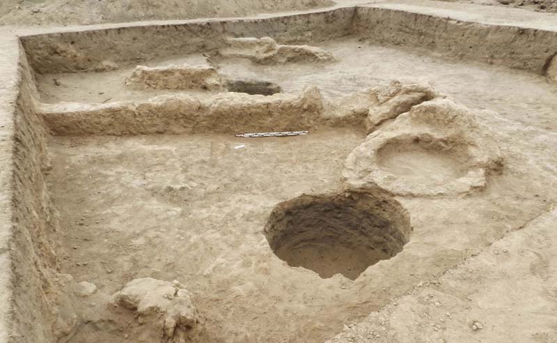
Photo 7: Excavation 4.
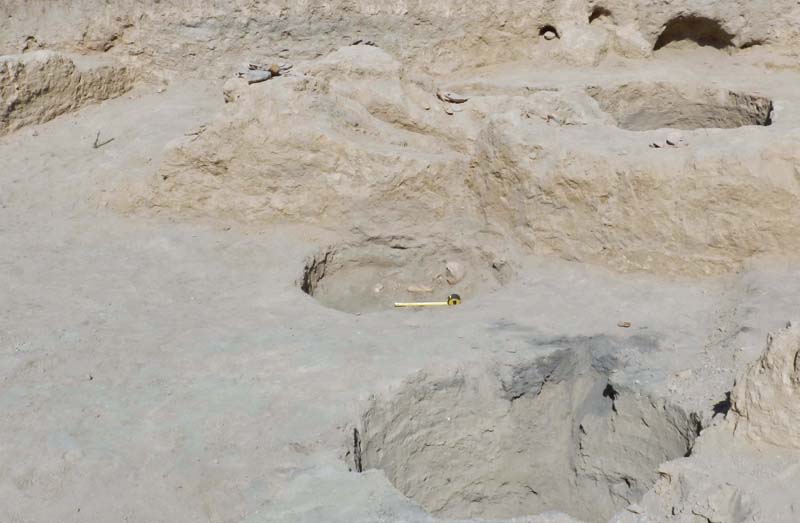
Photo 8: Excavation 4 with the burial.
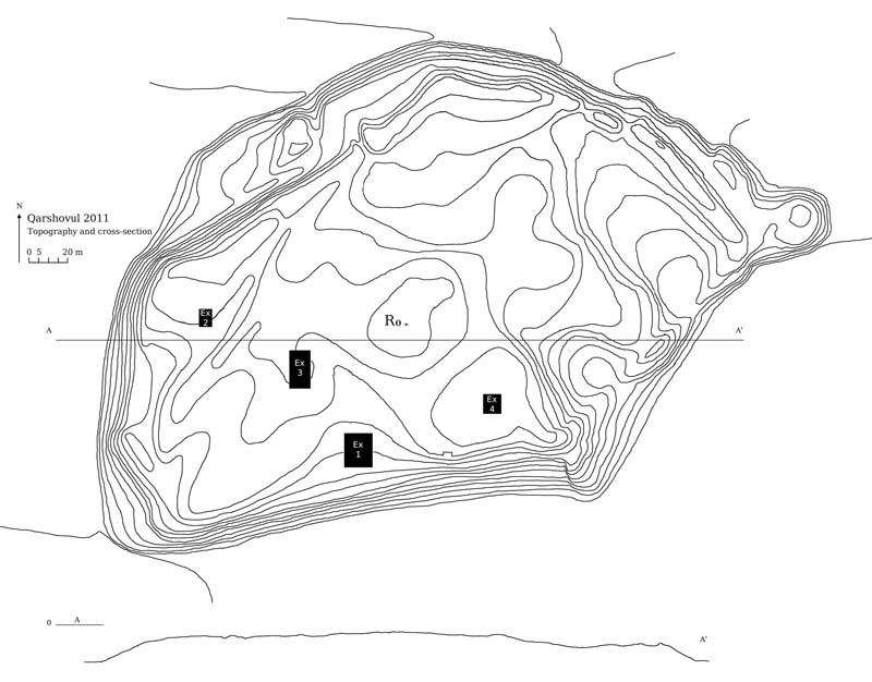
Topography of Qarsovul-tepa with the excavations marked.
Excavation 1, ground plan.
Excavation 3, ground plan.
Excavation 4, ground plan.
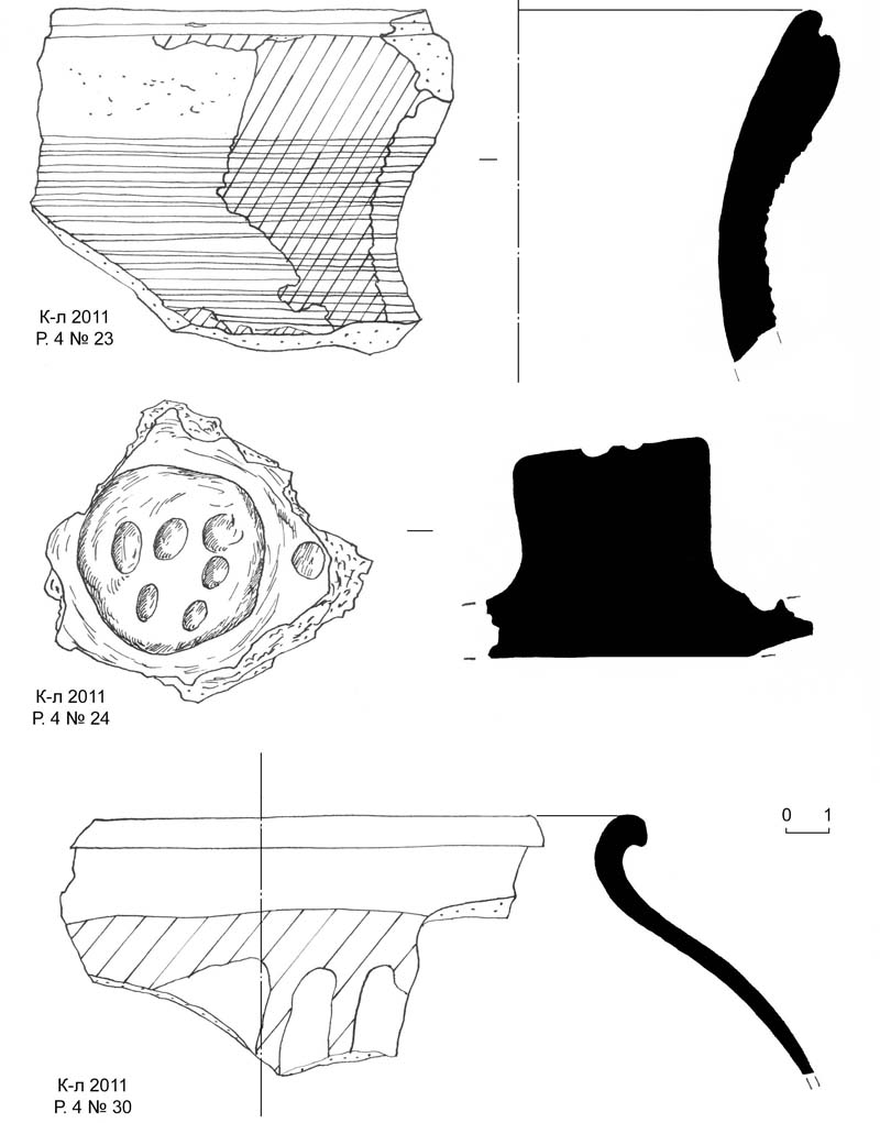
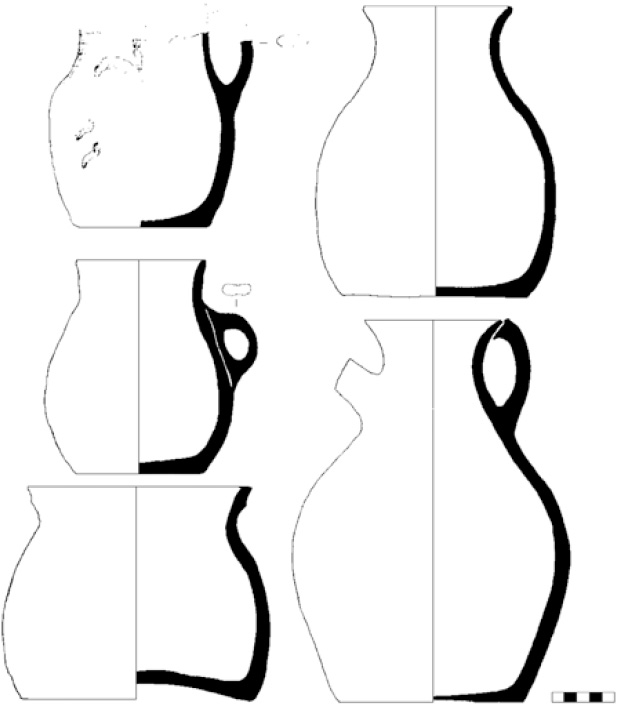
Plate 1. № 23: rim fragment; № 24: handle of a lid; № 30: rim fragment.
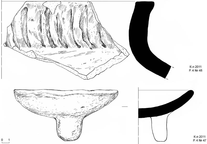
Plate 2. № 48: fragment of the rim of a khum; № 47: fragment of a ceramic tray on stems.
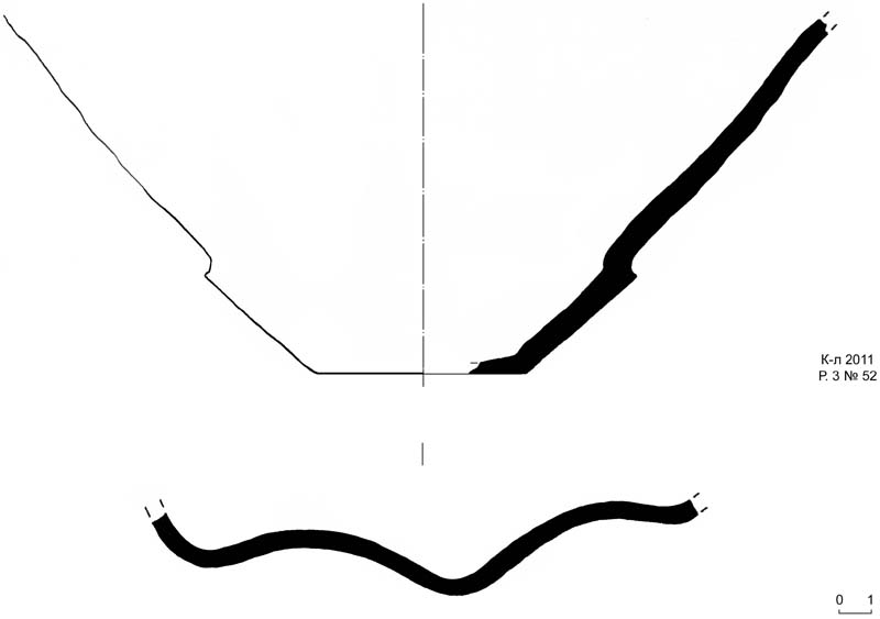
Plate 3. № 52: plate with scallops.
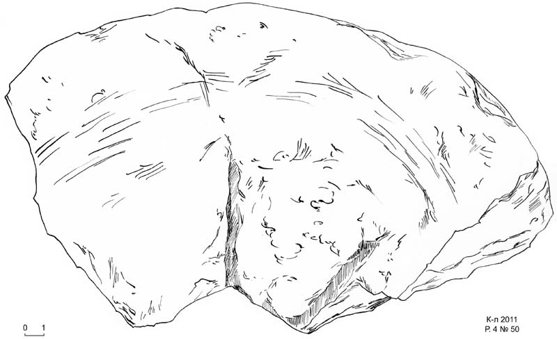
Plate 4. № 50: stone graters.
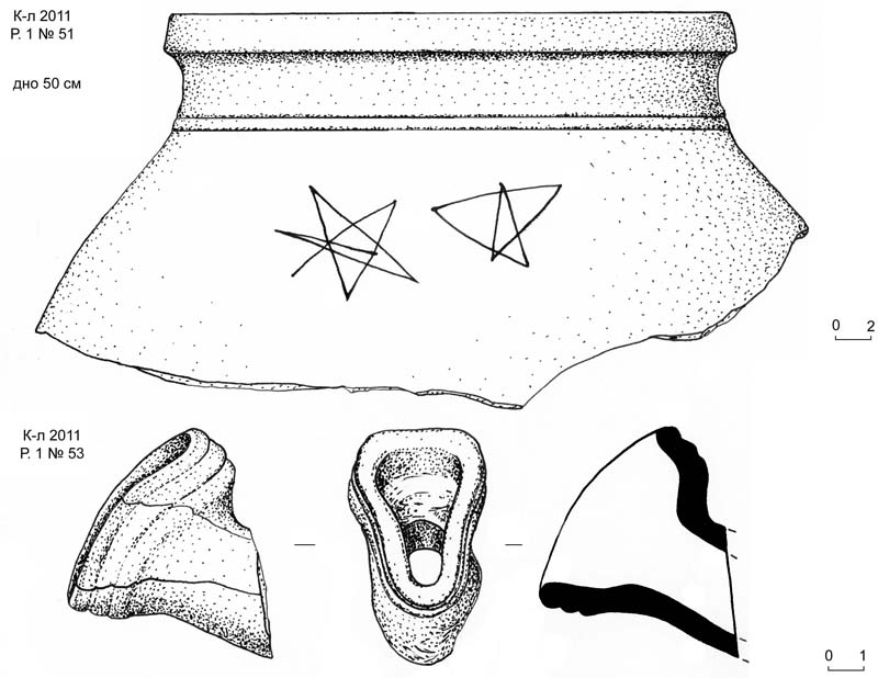
Plate 5. № 51: upper part of a khum with scratched stars; № 53: fragment of oinochoe vessel.
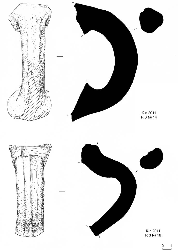
Plate 6. № 14: jar handle; № 16: jar handle.
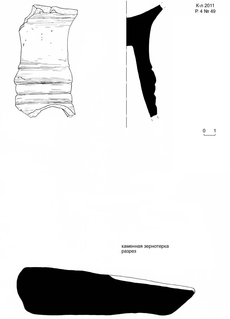
Plate 7. № 49: stone graters.
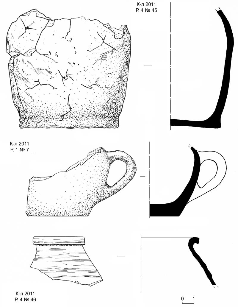
Plate 8. № 45: body and bottom of a moulded vessel; № 7: fragment of a mug with handle;
№ 46: rim fragment.
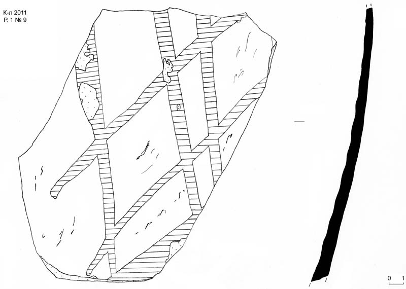
Plate 9. № 9: side of a vessel with net-like stains.
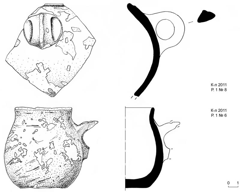
Plate 10. № 8: side of a vessel with handle. № 6: small glass.
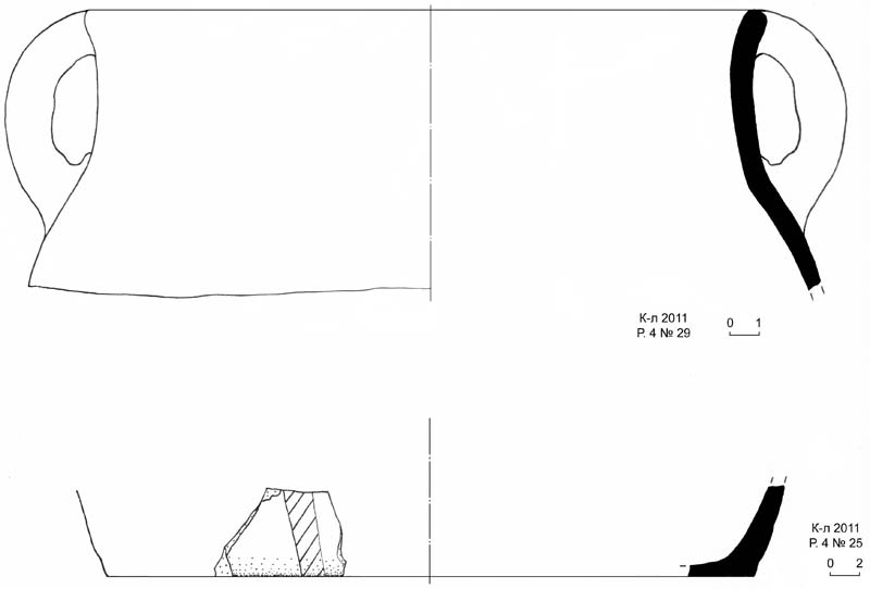
Plate 11. № 29: rim fragment with handle; № 25: fragment of a bottom.
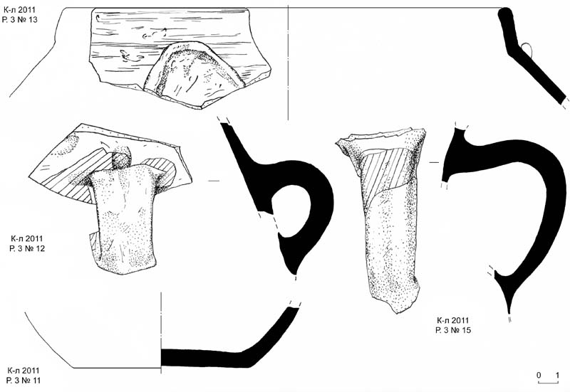
Plate 12. № 13: rim of a cauldron; № 12: side of a vessel with handle; № 11: bottom of a
jar; № 15: jar handle.
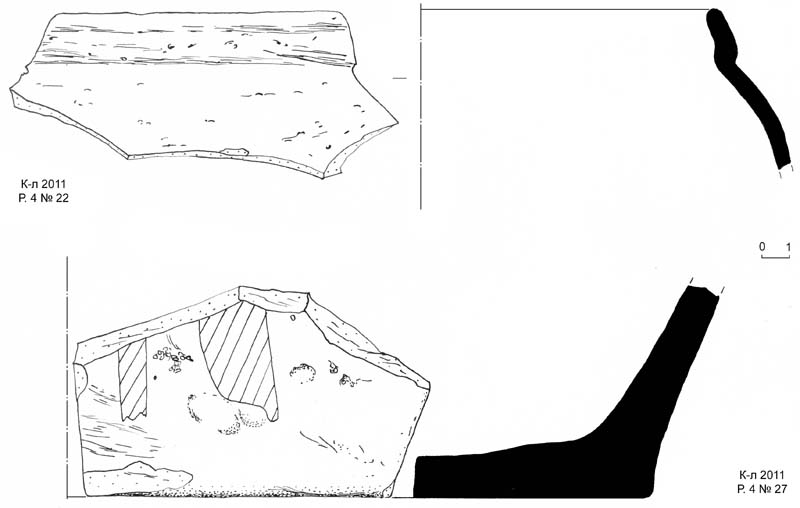
Plate 13. № 22: rim of a jar; № 27: bottom of a khum.
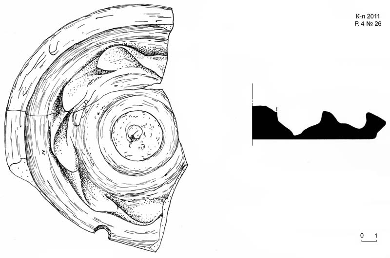
Plate 14. № 26: lid fragment.
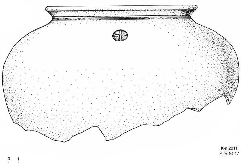
Plate 15. № 17: upper part of a cauldron with a tamgha under the rim.
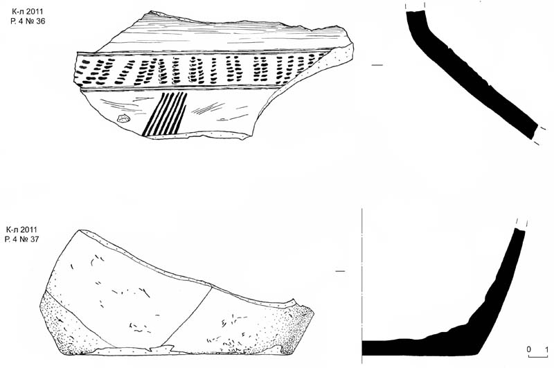
Plate 16. № 36: side of a vessel with scratched ornament; № 37: bottom of a jar or of a pot.
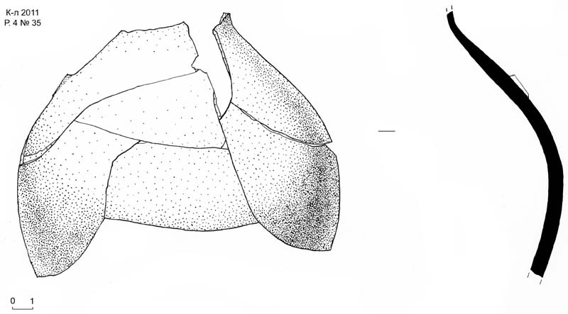
Plate 17. № 35: side of a jar.
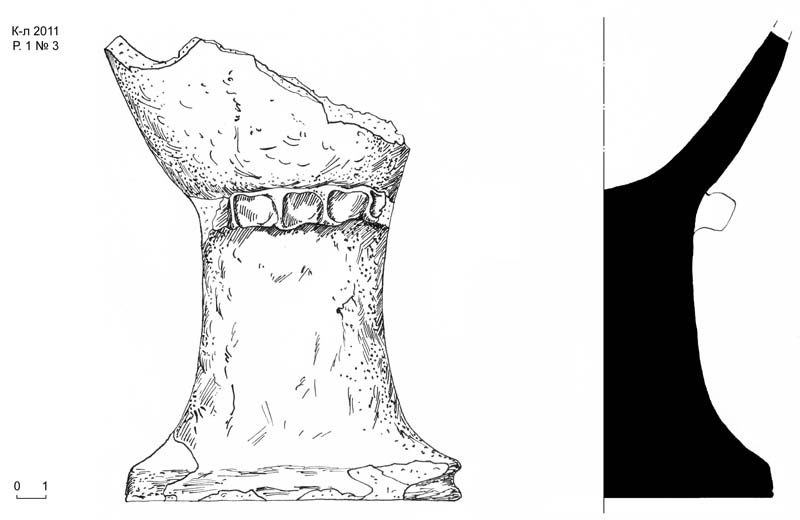
Plate 18. № 3: fragment of an Eucharist bowl?
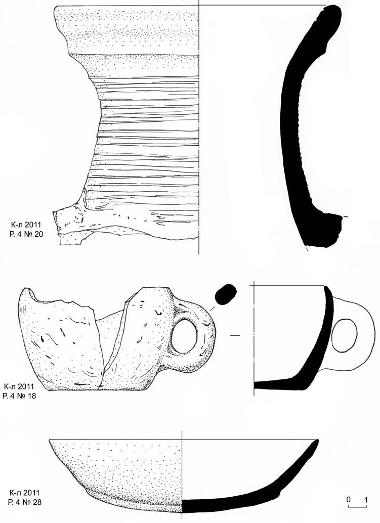
Plate 19. № 20: rim of a jar; № 18: bottom part of a mug or glass with a handle;
№ 28: fragment of a bowl.
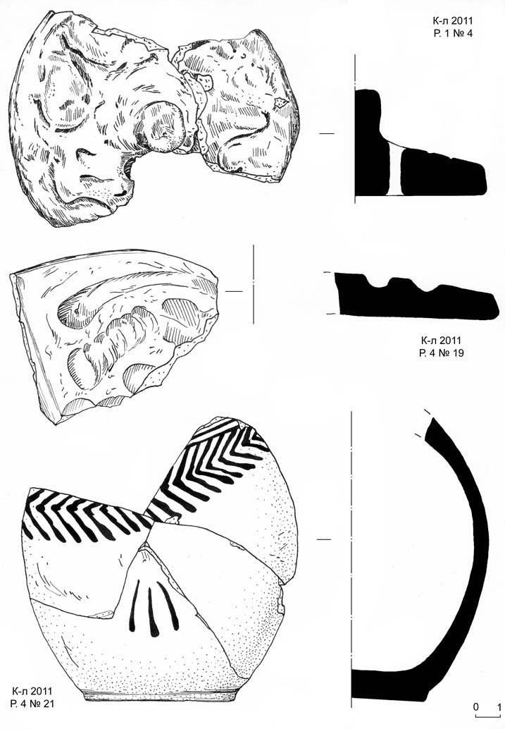
Plate 20. № 33: rim fragment; № 34: lid handle.
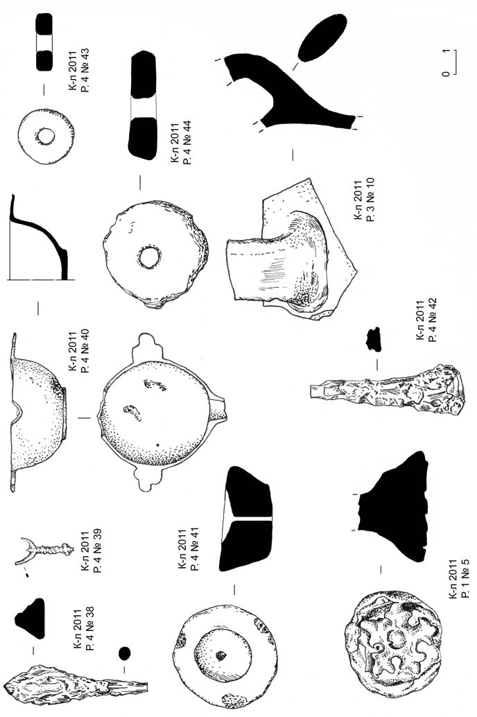
Plate 21. № 38: iron arrowhead; № 39: copper pendant; № 40: hair dye container (surmadon);
№ 43: ceramic spindle; № 41: top of a lid handle; № 44: spindle; № 5: top of a lid with
an ornamental stamp; № 42: unidentified iron item.
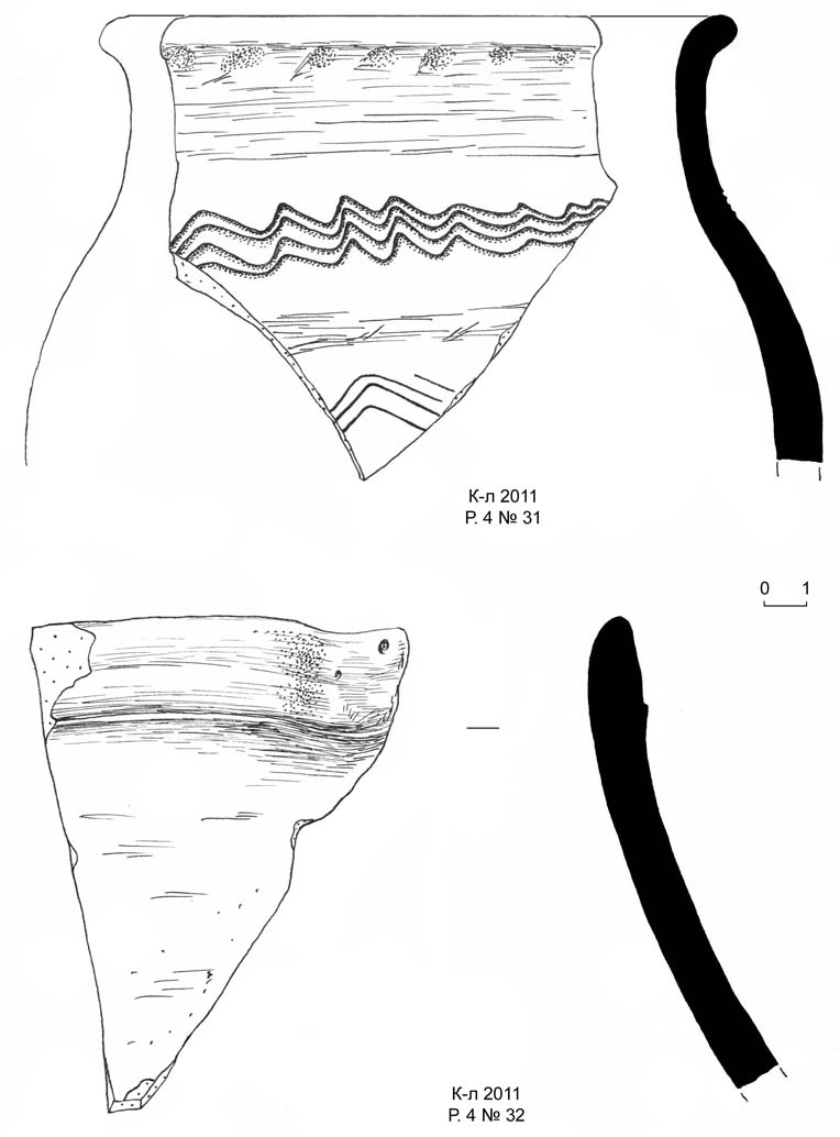
Plate 22. № 31: rim fragment; № 32: fragment of an oinochoe rim.
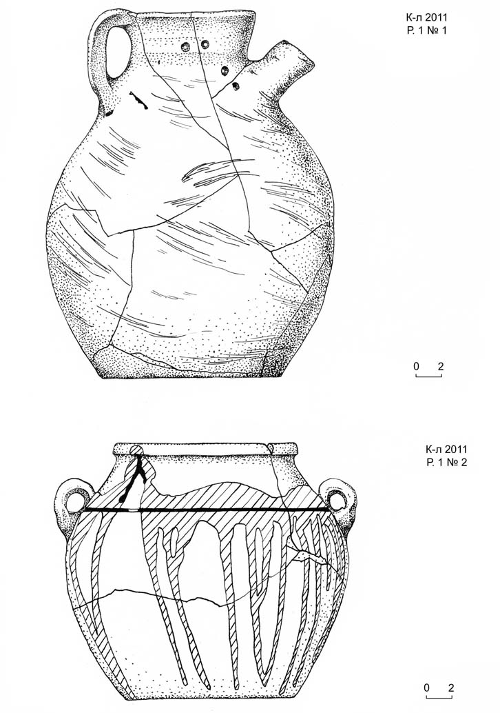
Plate 23. № 1: repaired jar with two scratched crosses. № 2: pot with two handles.
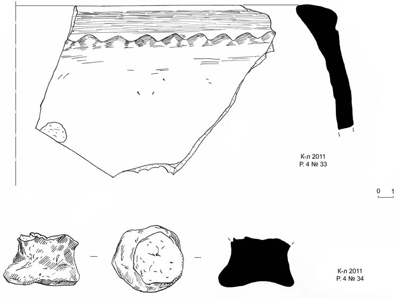
Plate 24. № 4: lid; № 19: lid fragment; № 21: rim of a jar.
This year the investigations focused at three sectors:
– Excavation 1, being an extension of the previous excavation by the southern edge of the site;
– Excavation 3, continuing investigation of the man-made elevation in the centre of the tepa;
– Nameless tepa in 500 m to the east from Qarshovul.
Apart from the archaeological works, a full topographic survey of Qarshovul Tepa was made (Plates 1, 2).
Excavation 1 revealed living quarters, residential and housekeeping areas dating to VII – beg. VIII AD, according to the pottery types (Plates 6-8).
Excavation 3 has fully exposed the central platform, giving access to its from all sides and at full height.
The investigation of the neighbouring tepa revealed a burial ground. Four burials were investigated, with many more awaiting anthropological analysis (Plates 3-5).
Excavation 1, facing east
Excavation 1, facing south-east)
Excavation 1, household context with a pit (badrab)
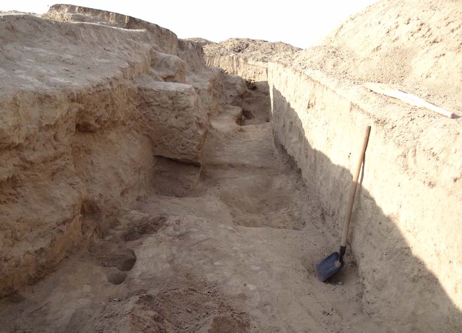
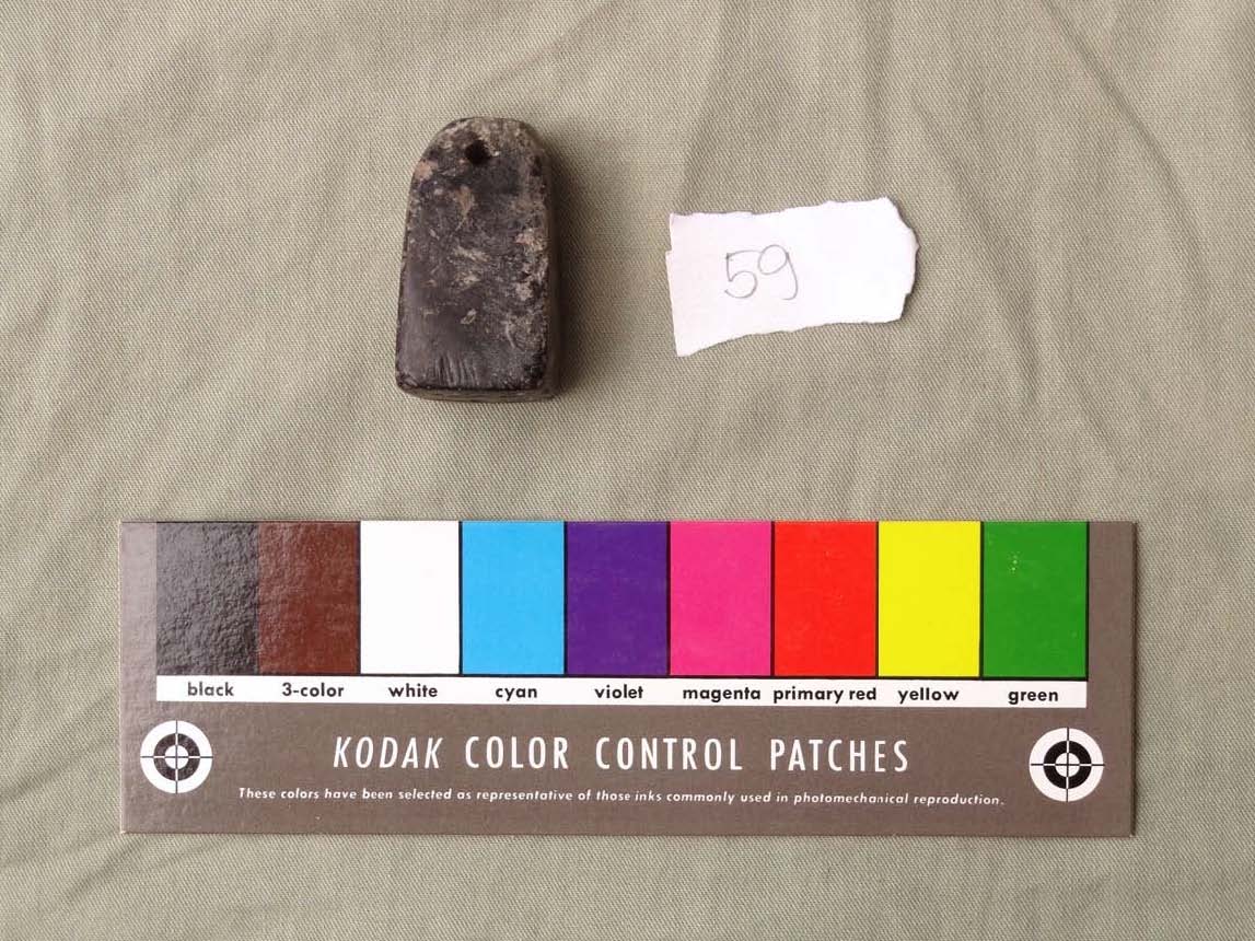
During the excavations of the raised platform at the highest spot of the tepa, a circumventing trench was dug in order to establish the edges of the platform and its depth. Approximately in the middle of the trench there appeared something like a manhole going inside the platform (i.e. westwards). At the outer opening of the manhole, on the ground was found a scattering of small items, some of them made of jade and other gemstones, as if suddenly lost or dropped (Plates 9-11). Among them was found a stamp made of jadeite (Plate 9, № 59) with a carved inscription reading βγy-prn, 'Vaghi-farn' (lit.: ‘glory’ -‘lord’),1 used as a personal name2.
This name is attested by the Mugh document A-13, dated by the 14th year of the rule of the Panjikent prince Dewashtich: “From the Panjikent counsellor and from the community to Tarkhan and Waghifarn. And when you receive this notice, pay out 150 drachmas from the seventh day according to this document from the yearly tax for the use of the bridge”.3
The same name is also attested by seven coins, of which two were found in Aq-Beshim and five in Ili, north of Xinjiang, China. Here is the best preserved one:
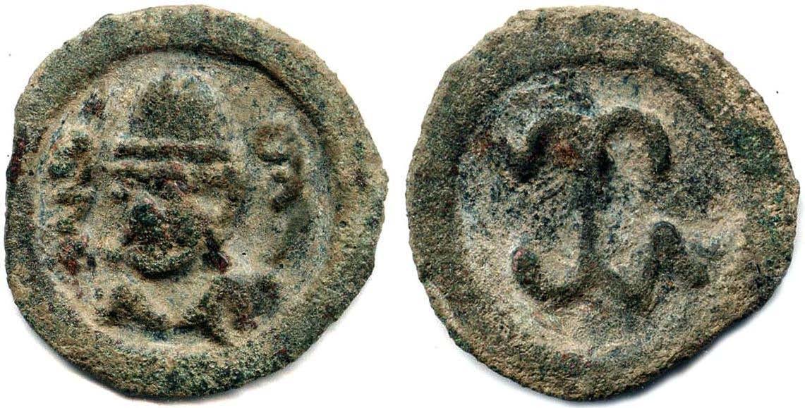
The place of issue of these coins has not been established yet.
Surprisingly, the stamp appears to be a "straight", non-mirrored one, i.e. not intended for making mirrored readable offprints (the text on it is read as is, without mirroring). The purpose of its use can thus be identified as embossing – creating raised relief with male and female dies that fit together and squeeze the substrate. Embossing can be used for sheet metal, paper and leather.
The metals suitable for embossing and known in the Early Middle Ages are brass and copper, melting at the same temperature as the die itself, which would make the die unusable.
1 I owe my sincere thanks to Prof. Nicholas Sims-Williams for the reading.
2 As shown by W. B. Henning, ‘Zum sogdischen Kalendar’, Orientalia VII (1939), S. 89 Anm. 1.
3 V. A. Livshits, ‘The Leader of the People of Chach in the Sogdian Inscriptions and Coin Legends’,Iranian languages and texts from Iran and Turan: Ronald E. Emmerick memorial volume, Wiesbaden 2007, p. 177.
The only kind of paper known at that time was Chinese paper (on which the Mt Mugh
letters are written), too thin to handle embossing.
We are therefore left with the option of leather. However, the leather used for the
production of belts or shoes must be much thicker than this female die could fit.
Still there is one more specific use of leather in the relevant époque, which is parchment.
It can thus be argued that the discovered stamp belonged to the Sogdian ruler Vaghifarn, and was used used to produce a unique signature on particularly important documents intended to last for long.
Eastern segment of the circumventing trench, facing north
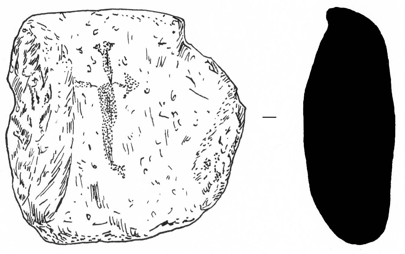
| Another particular find to be mentioned separately is this gravesone (qayraq) found in one of the burials, with a cross scratched on its surface. The carving is not too deep or accurate, as if made in the last minute before the funerals. This find will be discussed in more detail after a thorough anthropological analysis of the burials is done during the next campaign. |
 |
The manhole and the place where the treasure was found
Jadeite stamp carrying a carved inscription
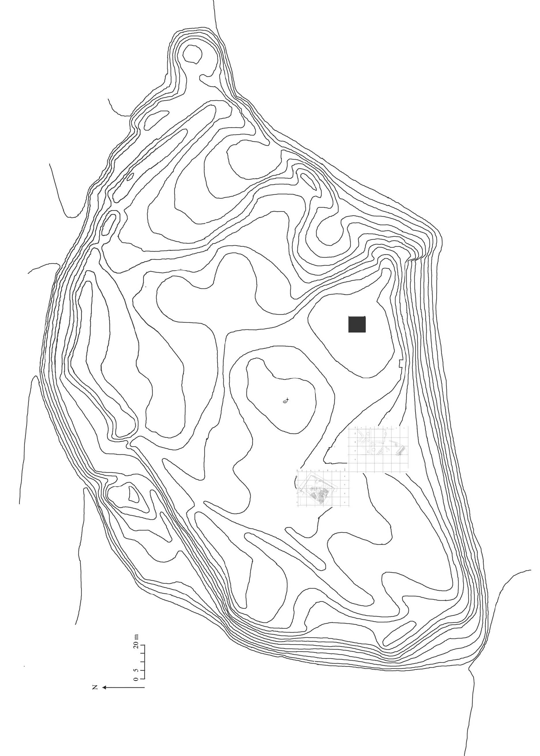
Plate 1
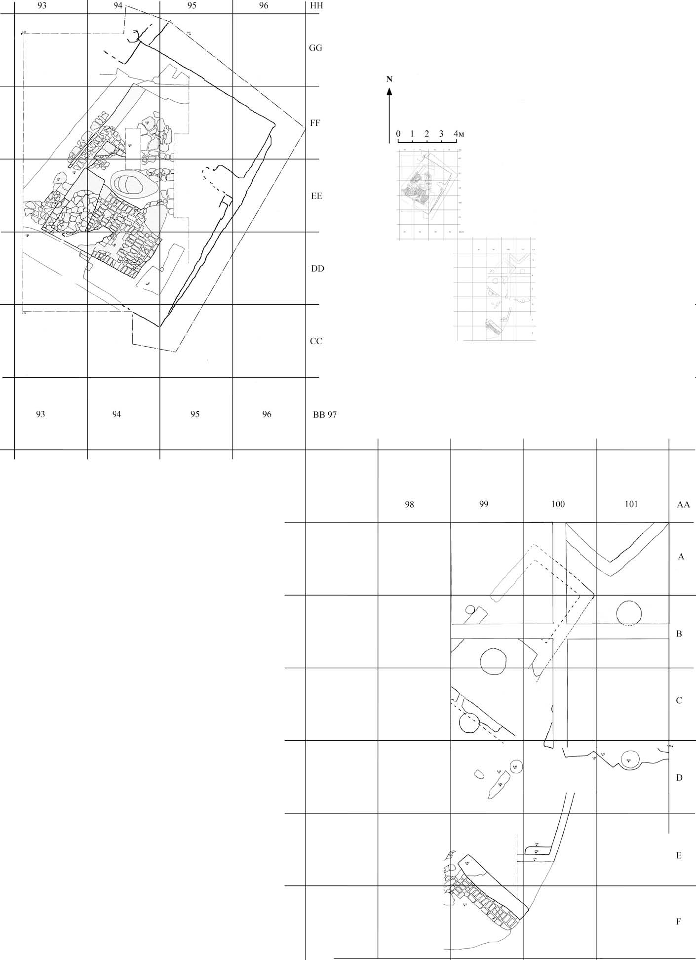
Plate 2
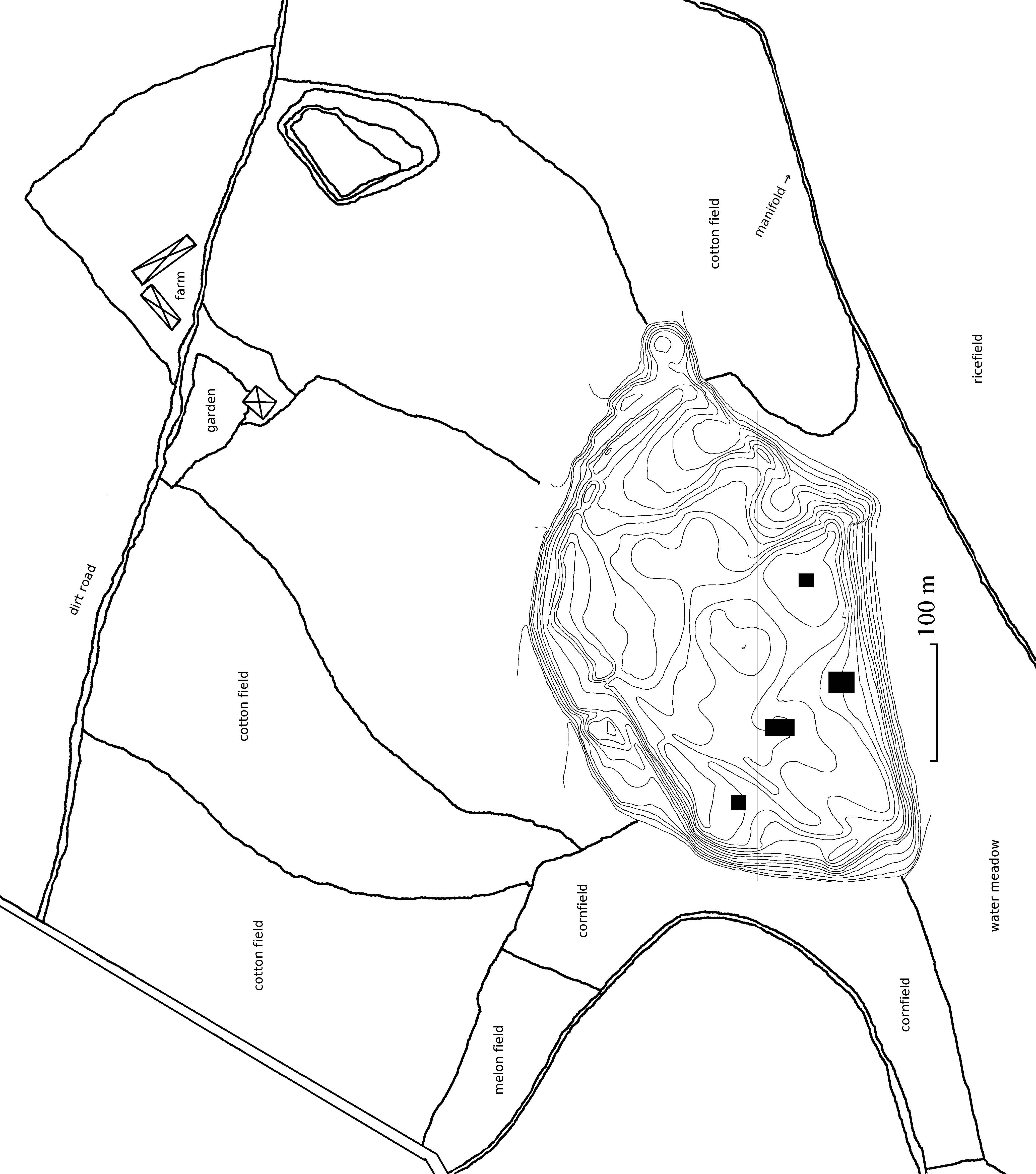
Plate 3
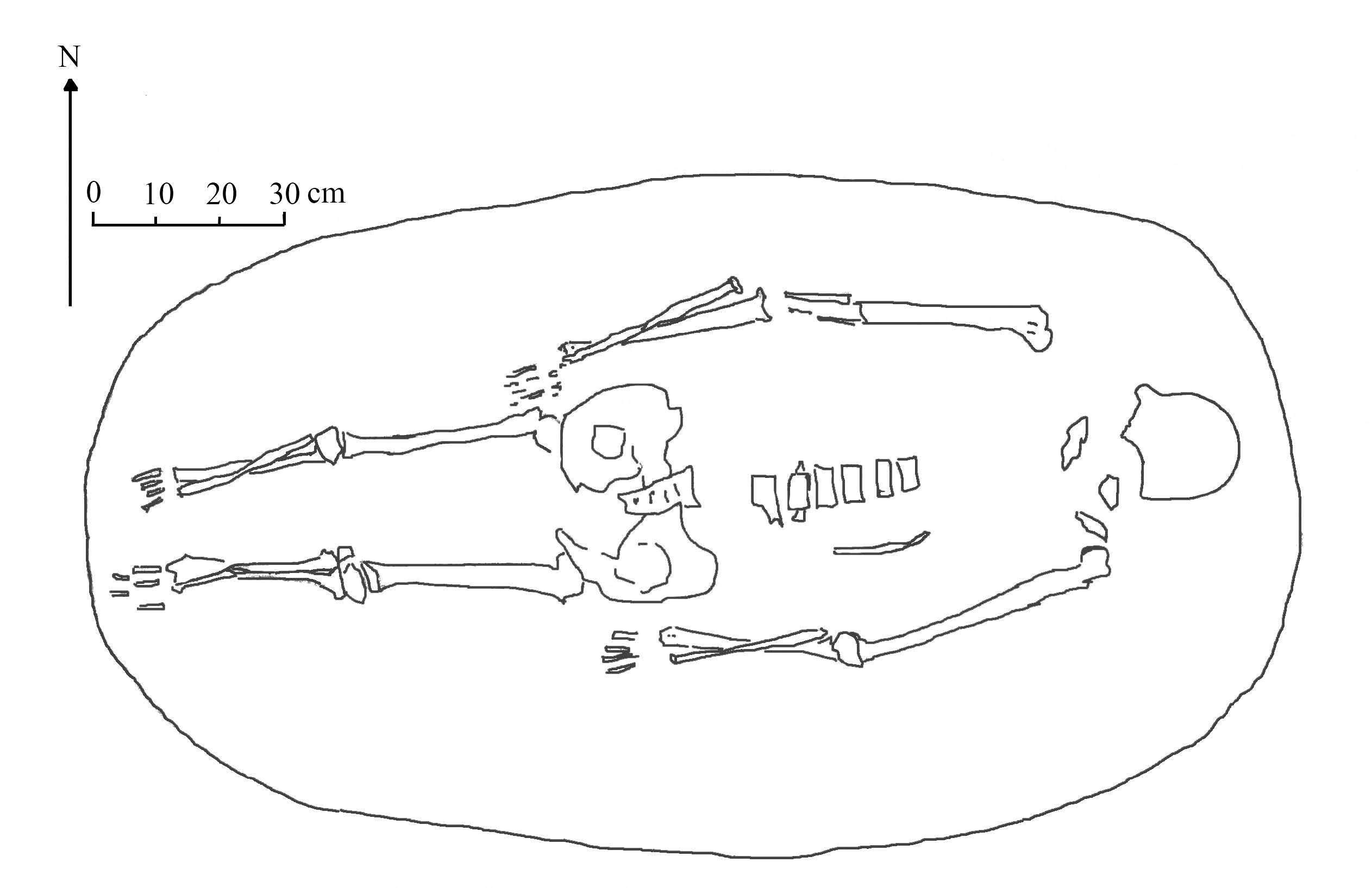
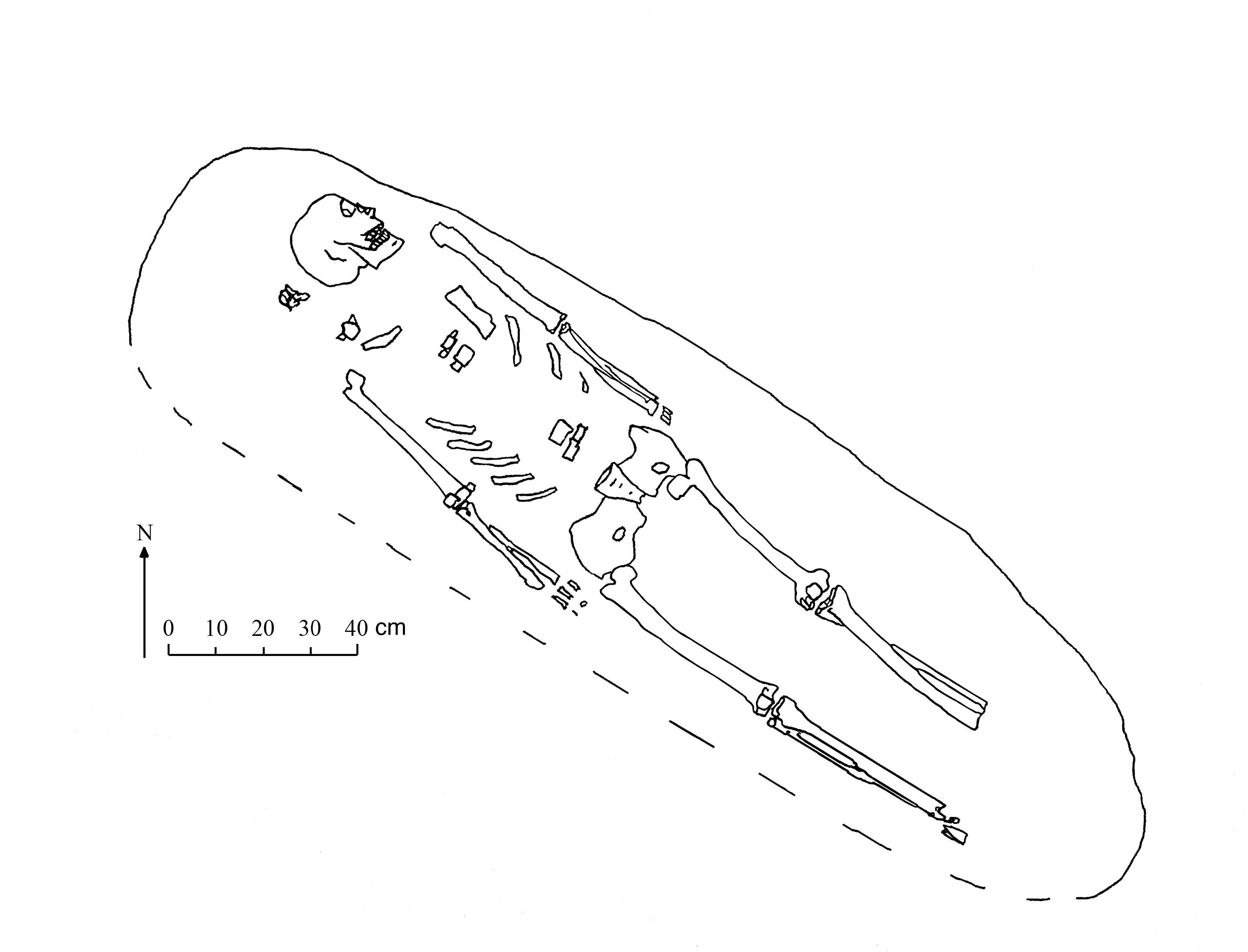
Plate 4
"Plate 5
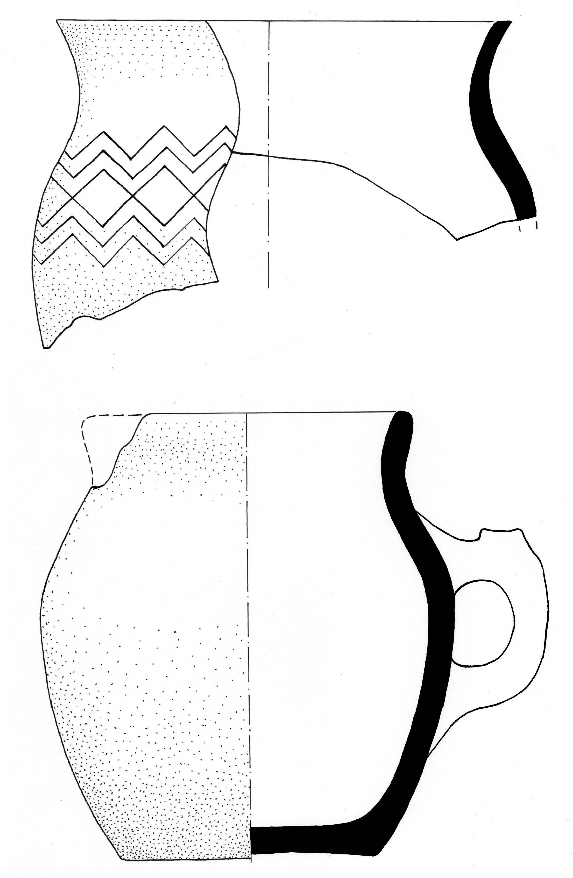
Plate 6
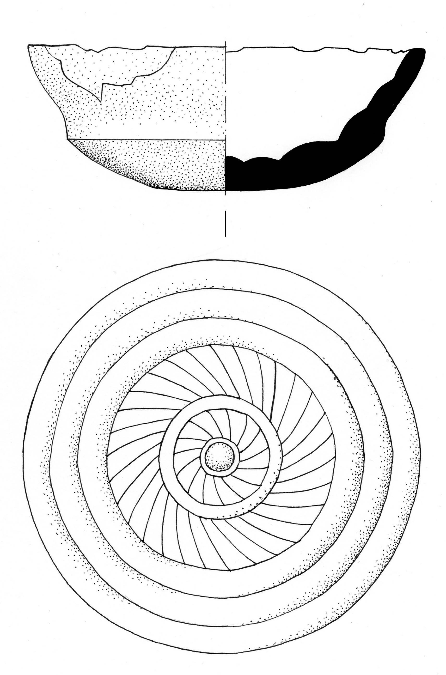
Plate 7
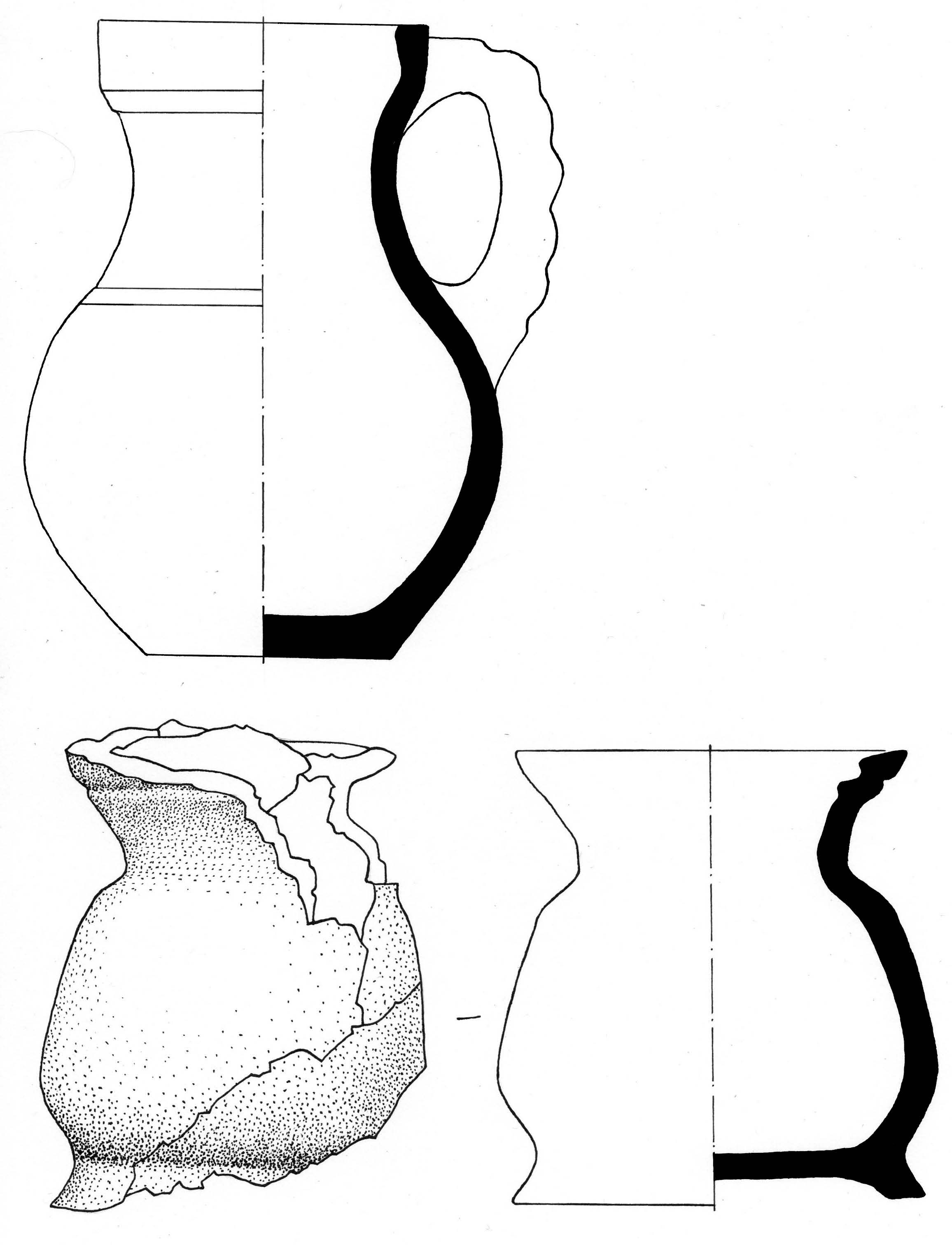
Plate 8
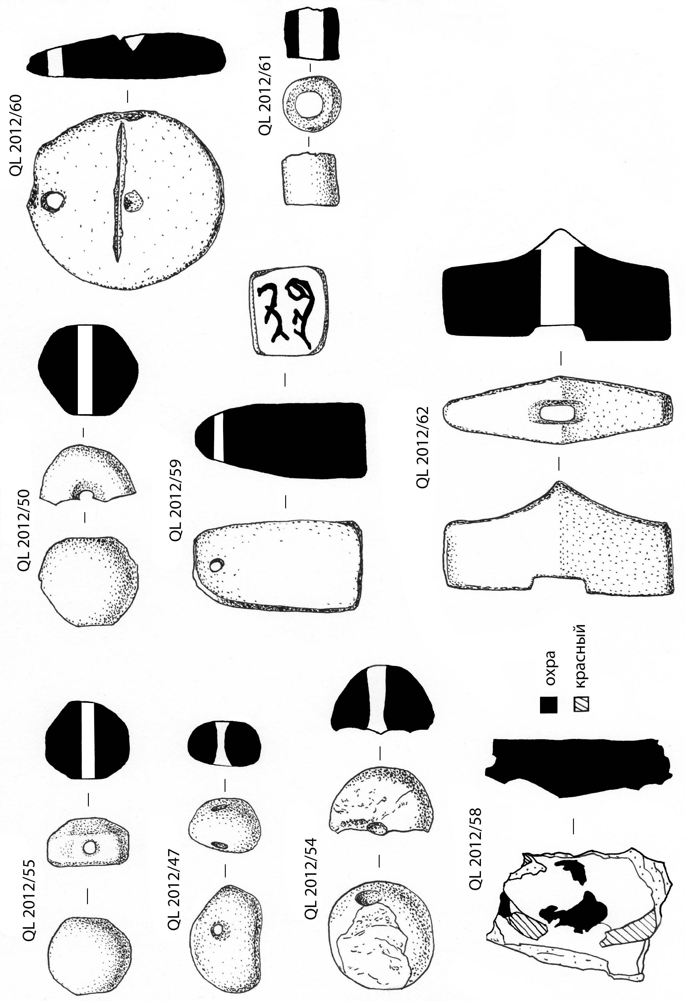
Plate 9
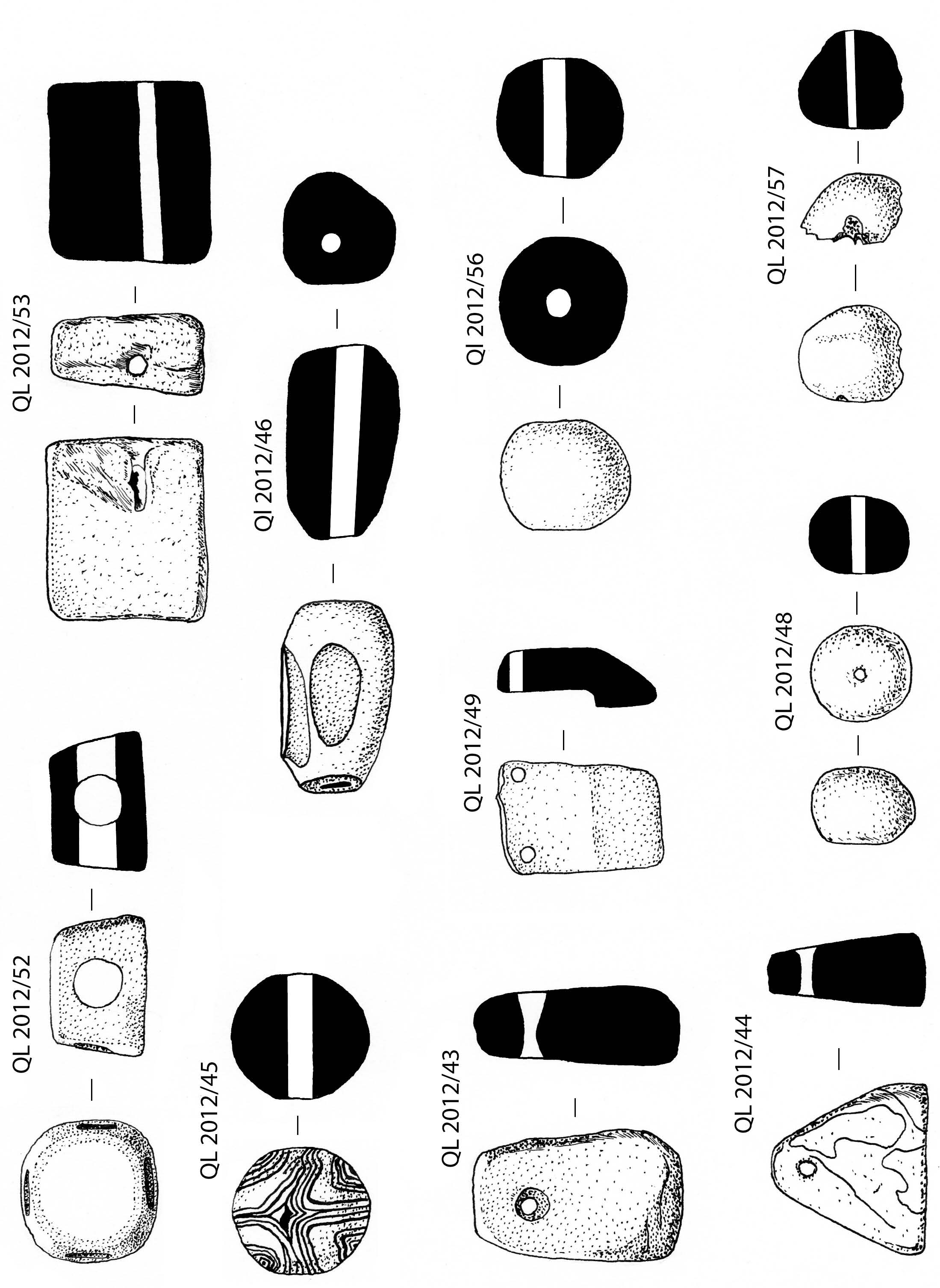
Plate 10
Plate 11
Archaeological investigations at the site of Qarshovul
(Tashkent Province, Uzbekistan)
October – November 2013
K.A. Sheyko, Dr. G.P. Ivanov, Dr. J.Ya. Ilyasov, Tashkent 2014
In October–November 2013 archaeological works on a monument of Qarshovultepa (Karshaultepa) in Chinaz district by members of the Chach expedition of the International Caravan-Seray of Culture have been continued.
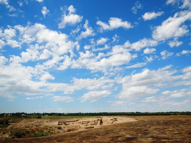
Fig. 1. Qarshovultepa. View on Excavation 3 from the South-East
The basic works were conducted on the Excavation 3 (so called Platform and surrounding area) and Excavation 5 (necropolis which is 250 m east from the main site). The total area of the Excavation 3 in 2013 has reached 800 square meters.
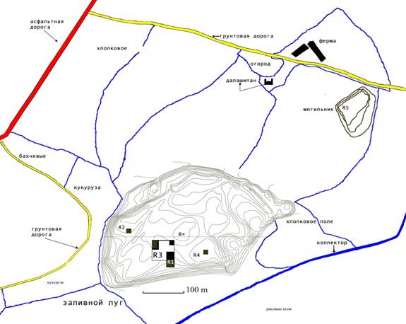
Fig. 2. Situational plan of excavations for 2013.
Works on Ecavation-3
During the previous seasons in the years of 2011 and 2012 a platform which is built from mud bricks and pakhsa (beaten clay) was outlined. A platform is oriented to the four cardinal points with its corners.
To understand the function of this mysterious construction we decided to excavate areas to South and East from platform. Before that we should clean up surrounding territories from the swell of the ground which was accumulated in the previous years. This work took a lot of time. Then we started our excavation. First of all it was necessary to finish opening of a room № 6 which was partially studied during the previous season.
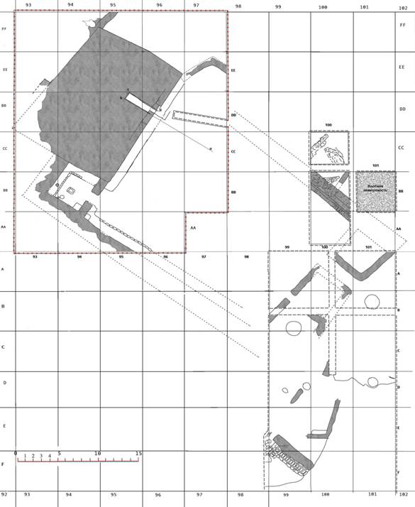
Fig. 3. Excavations 1 and 3
The room № 6 situated south from a platform and has the sizes 4.95 х 3.50 m. As a north-eastern wall of this room the part of south-western face of a platform was used, which is built from pakhsa blocks with the size from 0.60 х 060 m to 0.90 х 0.9 m. The height of this wall is 1.10–1.20 m, it has been covered by mud-straw plaster. The north-western wall has length of 4,95 m. It has better remained in a northern part of a room where its height reaches 0.75 m. The south-western wall has remained worse than others, and its height does not exceed 0,15–0,23 m. Its length is 4.60 m. South-eastern wall has the length 4.60, the height which has remained is 0,25 m. In the middle of this wall is a doorway which connects the given room 6 to the big court yard situated to the south-east from the platform. Its width equals 1.25 m. North-western, south-western and south-eastern walls of room № 6 are built from rectangular mud bricks with the size 48-49х23-24х8-9 sm. There are sufa (banks) along walls, except south-eastern wall, the width of banks varies from 0.90 m to 1.10 m. Sufa constructed as follows: mud bricks are laying in a row which is parallel to wall, and space between row of bricks and a wall is filled up with soil and broken bricks.
Room’s filling consisted of fragments of mud bricks which most likely dropped out of the failed walls of a room. This soil lies on a burnt layer which in turn lies on floor which was the last in the time of functioning of this room. In the middle of a room № 6 a square hearth was found. On the sufa at northern wall fragment of a burned wooden pipe was found which was used, most likely, as a chimney. Near to it one more wooden pipe is found out, but smaller in diameter.
To the east from hearth the copper coin with an image of ruler was found (№ 10). His eyes and nose are remained better, the rest of face is erased. At a southern wall of a room another copper coin (№ 11) but in the worst condition is found. There is a pair portrait on the coin, the ruler with the spouse. Judging by tamgha (dynastic sign) and attributes this coin belongs to the 5th group of 1st type, according to the A. Kuznetsov’s and V. Shagalov's classification.
During a field season of 2013 fragments of the stone beads were found in the burnt layer which covers upper floor in the room № 6. A lot of such beads were found in the same room in 2012. From this layer we have also bronze or copper buttons with a hole in the centre. They are cast in special moulds and have on the one side plant or geometric ornamentation in relief. The button № 3 has same ornament on the both sides (Fig. 4)
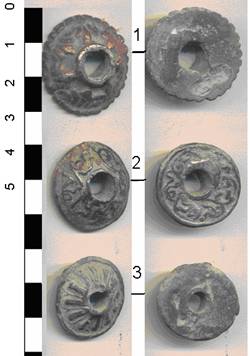
Fig. 4.
The small amount of ceramics was found in the room № 6. For instance, the top part of a jug with the loop like handle and a beaklike spout (fig. 5: 1). Diameter of a rim of 5.7 cm, a mouth – 3.5 cm, length of a spout – 4.5 cm. The fragment of a bowl in diameter of 24 cm, from light-coloured clay with a sand impurity, without a slip (Fig. 5: 3); a fragment of a large jug with a diameter 16 cm from clay of greyish colour with a sand impurity (Fig. 5: 4). A fragment of the top part of a jug with the loop like handle and beaklike spout, diameter of a rim – 14 cm, a mouth – 9 cm, the spout and the handle are broken off (Fig. 5: 2). A weight (or button?) which was made from a wall of a vessel which was covered by red engobe (fig. 4: 5). 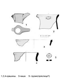
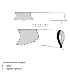
Fig. 5. Ceramics from room № 6
In the room some fragments of modeled vessels were found: a fragment of a cauldron with diameter of 20 cm (Fig. 5: 6). The clay is grey with inclusion of quartz and chamótte, from the outside cauldron is smoked. Another fragment of a pot (or a cauldron) with the loop like handle has diameter of 17 cm, the body is with quartz and chamótte inclusions.
Courtyard
Excavations of the area which is laying immediately south-east from platform has begun at a southern corner of a platform, near to a room № 6. Judging on a relief of this area something like a big courtyard most likely was there. The further works have confirmed this assumption. After removal of the turf layer which capacity varied from 10 to 15 cm, on all area of excavation (squares AA 93-96, BB 95-97, CC 96 and 97, see Fig. 3) the layer of loose soil is fixed. It lies on the last floor on time of its functioning. This floor of courtyard is on depth of 4,15-4.60 m from the top point of the site (R0), and on depth of 45 cm from level of a today’s surface. On different places on a floor burnt layers are fixed.
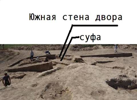
Fig. 6
In the squares AA 94 and 95 the wall which is constructed from mud bricks with the size 48-49х23-24х 9 cm was fixed. This wall is the wall of courtyard and its north-western end is, in fact, the south-western wall of the room № 6. Along the courtyard wall the sufa is attached, its width of 1.20 m. In a southeast direction the wall gets on an external corner of a room № 2 which are on Excavation № 1 (Fig. 3).
In the western corner of courtyard and in the doorway to the room № 6 (square BB 94) dispersed fragments of khum (big store jar). It is covered from the outside by red slip (engobe) (Fig. 5: 8). The top part is covered completely, the bottom part on 2/3. Height of the khum is 53 см, diameter of a rim – 27 см, diameter of a mouths – 23 см, diameter of a bottom – 20 см. The coin (№ 1) is found in square АА 95 near wall of a courtyard, this coin belongs to the mint of ruler Sochak.
To definition of stratigraphic layers and finding-out of presence of earlier floors of a courtyard an excavation with the sizes 4 x 2 m was dug up near so called technological junction, where two parts of platform (old one and newer one) are joined together. It looks like platform at first was smaller in size, then, after some period of using, the platform area has been increased by the constructing from pakhsa blocks of an additional extension in the north-eastern direction.
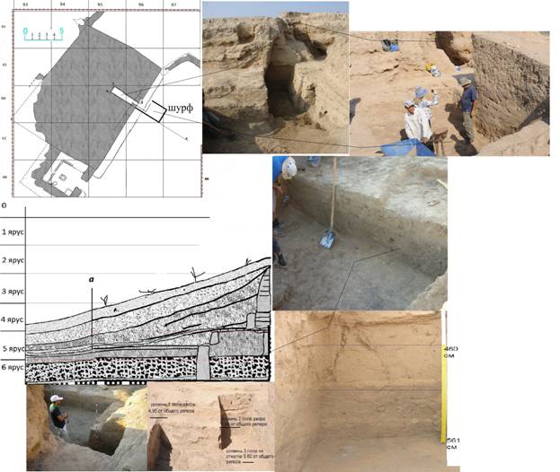
Fig. 7. Trench in the courtyard to the south-east from a platform
Level of a floor of a courtyard is 4,15 m immediately near façade of a platform, and slightly goes down in the south-eastern direction. So, on a distance of 4 m from a platform courtyard floor is 0,5 m deeper (i.e. 4,65 m deep from R0), forther it is more equal. In north-eastern direction the floor also tends to increase and its difference with a south side makes 50 cm. There are traces of a heavy fire are fixed, the rests of a burnt layer lie directly on a floor.
During a field season of 2013 two whole and three fragments of stone beads have been found in this layer. It should be noted, that exactly within this area a quantity of stone beads and various stone objects were found in 2012.
Under the upper floor, within excavation near platform, the second floor was found on the depth of 4,45 m. The filling between floor 1 and floor 2 is the soil of middle density with the inclusion of the small charcoal pieces and ashes. Floor 2 is made by 10-12 cm thick mud layer which covers the 10-25 сm thick layer of fragmented bricks. Under this layer is a soft soil layer with the inclusion of the small charcoal pieces, ashes and sand. This layer lies on the floor 3. Floor 3 goes under so called cover of platform and should be the level of rebuilding of the platform in the time in which the platform was made bigger. The works on this stratigraphical trench will continue next season.
Fig. 8.
During a field season of 2013 in the layer of burnt soil which lies on the floor 1, small objects have been also found. For instance, a flat nacreous pendant with a round aperture (possible for a stone insert) (Fig. 8, 4), a fragment of a terracotta figurine of a horse, a round flat plate button from a bone with one round aperture (Fig 8, 5), a splinter of dark blue glass (Fig. 8: 7) and three fragments of stone beads (Fig. 8: 6, 8, 9). We will especially note a find of a fragment of a stone vessel with carved plant decoration (Fig. 9), which under the assumption of J. Ilyasov could be from a stone mortar. It made from, most probably, serpentenite, and has diameter about 12 cm. Maximal thickness of the wall is 1,8 cm, dimensions of a fragment are 6,2 x 3,1 cm.
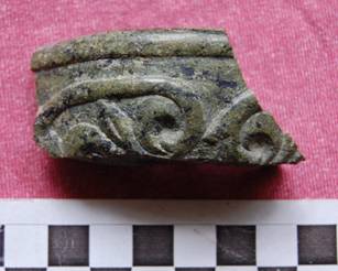
Fig. 9. A fragment of stone vessel
Within squares AA 100, BB 100, 101 and CC 100 immediately to the north from Excavation 1, a new section was excavated in the eastern corner of supposed courtyard (Fig. 3). The excavated area was of 75 sq. m. Purpose of these excavations was to find out of north-eastern wall of courtyard and eastern corner of courtyard. After removal of a turf layer on depth of 15-20 cm top part of the wall was found. This is built from rectangular mud bricks (49-50x24-25x9-10 cm). Direction of this wall shows us that it is a north-eastern wall of the courtyard. Excavated part of this wall is 6 m long; it is about ¼ of the full length of the wall. But it should be proofed in our future excavation works. The wall is 1,3 m thick; there is a sufa along the wall which is on the south-western side of the wall. Sufa is 0.8-0.9 m width.
Ceramics
All ceramic finds of the 2013 can be subdivided on two basic groups – fragments of vessels made on a potter's wheel and fragments of modeled vessels.
First group. In the vessels that made on a potter’s wheel jugs quantitatively prevail; their rims are in diameter of 14-20 cm (Fig. 10: 6-17, Fig. 12: 13, Fig. 19: 3, Fig. 20: 6). Next group are bowls (Fig. 10: 2, 3, 4), one of them has a rare shape: with wavy rim and edge in the lower part (Fig. 10: 3, Fig. 21: 4).
Fig. 10
Among finds there are also pots of different sizes. Another type is toghora (basin) with the deep tank and figural rim (Fig. 13: 3).
Pots are in different proportions; rims in section are different shaped (Fig. 10: 20, Fig. 11: 1, 2), sometimes close to described above jugs (Fig. 10: 18); there are also handles which are oval-convex in section (Fig. 10: 19-20). Larger jars (khumcha) are presented by fragments of two vessels with massive rectangular in section rim (Fig. 11: 5, 6).
Besides vessels of the above described types, there is a fragment of small biconical a vessel to slightly unbent rim in diameter of 6 cm, covered by dense brown engobe, with pressed ornamentation and polishing (Fig. 10: 1, Fig. 19: 1).
Fig. 11
Bottoms of vessels are flat, sometimes slightly bent (Fig. 10: 20, Fig. 16: 6); in one case the bottom of a vessel have sticked legs (Fig. 11: 9); bottom part of one vessel with apertures, most probably for decantation of liquids (Fig. 11: 3) also was found.
Typologically modeled wares are more various. The basic modeled forms are: jugs (Fig. 12: 1, 4–13), mugs (Fig. 12: 2, 3, Fig. 16: 1, 2), small and large bowls (Fig. 13: 1-3), pots (Fig. 13: 5–8, 10, 11, Fig. 16: 6), khum and khumcha (big and smaller store jars) (Fig. 14: 1–8, Fig. 21: 1–3), couldrons (Fig. 15: 1–3, Fig. 17: 1–3).
Modeled jugs are close to jugs which made by potter’s wheel (таб.4, 2-3, 9), (Fig. 12: 1, 4, 5, 7, 12-14). Special kinds of vessels are one-handled jugs with spouts (Fig. 12: 1, 4, 5, Fig. 16: 3-5).
Pots are presented by several archaeological whole vessels and a number of rim fragments. The shape of vessels of this type varies from spherical (Fig. 13: 5) to egg-shape (Fig. 13: 6, 10). On some pots loop like and jut-handles are remained, most likely all those vessels were two-handled (for example, Fig. 13: 6, 10, 11).
Fig. 12
We will note the modeled pot (Fig. 13: 7, Fig. 19: 5). Diameter of a rim of 14,5 cm, bottom – 9,2 cm. Walls of grey-brown colour, a surface carefully polished. The wavy ornament is outside, the bottom is also ornamented from the outside.
Modeled bowls are thick-walled, in one case (Fig. 13: 1) the rim is slightly bent inside. Modeled khums and khumcha are almost identical to potter’s wheel analogues. Shapes of modeled kitchen vessels are standard. A fragment of the burnt through one-handeled vessel (Fig. 15: 3, Fig. 17: 2) and a spout of a kitchen vessel, probably teapot are interesting (Fig. 15: 4, Fig. 17: 3).
Bottoms of modeled vessels are flat, sometimes slightly curved; in some cases we meet vessels on flat disc-shaped pallets. On a number of fragments apertures in walls and pallets are noted, for instance four symmetrical apertures in a pallet (Fig. 12: 16, Fig. 17: 6).
Besides vessels, modeling was used to produce lids (Fig. 15: 5-8, Fig. 17: 4, 5), handles which are round, oval or oval-convex in section. Such handles were attached both to modeling and potter’s wheel vessels and lids (Fig. 15: 10-16). From one of the variants of vessels only modeled legs are remained of various configurations (Fig. 15: 17-18, 20-22), quite often they are hollow. Also various hand-made articles were found. For example, small round suspension weights made from the burnt clay, with a through aperture (Fig. 15: 9, Fig. 18: 1). And also roundish weights, spindle whorls or buttons worked from walls of vessels, with a round aperture in the middle and the grinded rand (Fig. 13: 9, 12-13, Fig. 21: 6).
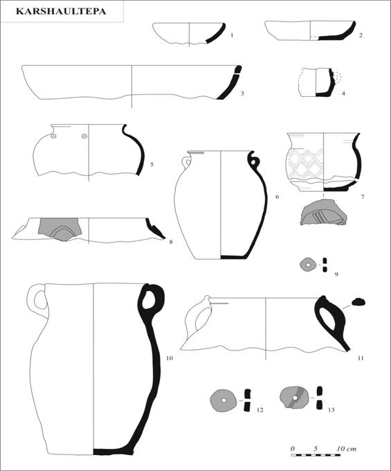
Fig. 13
Photo table 6. Ornamentirovannye fragments and ceramic грузики.
The complex of ceramics from Qarshovultepa can be characterized as a set of forms of modeled ware and vessels which are made on potter’s wheel of an average level of manufacturing. We will notice that a number of fragments of the vessels made on a potter's wheel is a little assymetric that allows to conclude that the potter's wheel of the slow rotation was used. Some modeled vessels, on the contrary, are of very good manufacture.
The considerable part of ceramics of Qarshovultepa is decorated. On a number of potsherds the rests of engobe coverings are noted. Judging by the found fragments, it was used engobe, giving after burning white, brown, red, orange colours to vessels.
Fig. 14
Fig. 15
Another kind of decoration is typical for the ceramics of 7th-8th centuries, namely flowing paint (i.e. engobe). The colour could be light brown or red. (Fig. 20, Fig. 21:1-3, 5).
Some vessels are characterized by careful polishing. There are also stamped, notched, pressed and engraved decoration on Qarshovul pottery (Fig. 12: 7, Fig. 13: 5, 7, Fig. 15: 8, 22, Fig. 17: 4, Fig. 19:1-6, таб. 3, 7,).
Fig. 16 Fig. 17
Fig. 18 Fig. 19
Fig. 20 Fig. 21
Fragment of a jar (khumcha) with a property sign (tamgha in Turko-Mongolian languages and nishan on Iranian laguages) was found near platform on the upper floor. It has diameter of rim 28 cm. Tamgha was engraved before firing on the “shoulder” of the vessel (Fig. 22) and has dimensions 9,7 x 5 cm. It is very ancient tradition in Central Asia, most popular between 2nd century B.C. and 8th century A.D. [Ilyasov 2003; Ilyasov 2010]. Another potsherd with kind of tamgha is surface find from the south-estern part of the site. The vessel with a thick wall was made by modeling and was polished over orange engobe. It is bottom of vessel with relief decoration inside and engraved sign outside (Fig. 23).
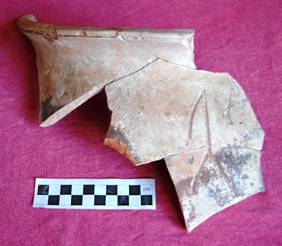
Fig. 22 Fig. 23
Coins
During excavation of 2013 on Qarshovultepa 15 coins from which 2 coins occur from a room № 6 are found. 7 coins are found at the courtyard excavation, 2 coins to the north-east from a platform, and 4 coins are found to the south-west from room № 6 .
Fig. 24. Typology of coins and tamgha
№ 1. Obverse: the image of a predator going to the left which on appearance reminds a hybrid of a lion with a leopard. The right paw is slightly raised, back left has not remained on a coin. Over a predator a Sogdian inscription “ruler” has remained. Reverse: tamgha in the shape of a trident (№ 6 in table №1). Around tamgha is Sogdian legend (“ruler Sochak, possessing glory”). It is found in square АА 95 near sufa which is arranged at a south-western wall of a court yard. The coin belongs to group 6, type 6, a variant 1, it is made from copper or bronze, diameter is 20 mm, weight 1.7 g. This type of coins is from the mint of ruler Sochak or Stuchak [Shagalov, Kuznetsov 2006, pp. 226-230].
№ 2. Obvers: a panther (leopard) going to the right, the image is very grated. Reverse: tamgha in the shape of a trident, sogdian legend “ruler Tarnavch”. The coin is found on a courtyard floor 1 in square СС 96. Weight of a coin is 2,2 g., diameter of 19 mm. The coin is made in the technique of casting, and belongs to the 1st variant of the type 8 of the group 6 [Shagalov, Kuznetsov 2006, pp. 235-237].
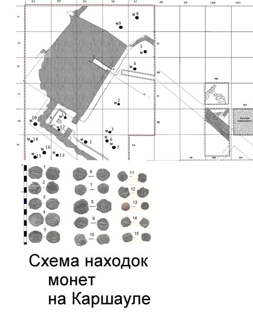
Fig. 25. Coin findings on Excavation 3
№ 3. Obverse: the image of a predatory animal, probably, a lion or a leopard going to the right. Over a predator traces of badly remained legend are seen. Reverse: tamgha in the form of a trident, with incomplete Sogdian legend around. It is found in square ВВ 96 in a loose layer. The coin belongs to the variant 4 of the type 6 of group 6. It is made in the technique of mintage. Diameter of 18 mm, weight 1.27 g. Coin belongs to the ruler Sochak [Shagalov, Kuznetsov 2006, p. 227].
№ 4. Obveres: a predator (leopard?) going to the right, bad condition. Reverse: tamgha in the shape of trident. It is found in square DD 97. The coin is from the variant 1 of type 8 of the group 6. It is made in the technique of casting. Diameter 24 mm, weight 2 g. [Shagalov, Kuznetsov 2006, p. 229].
№ 5. Obverse: the predator going to the right. Reverse: tamgha in the form of a trident in linear rim. It is found in square ЕЕ 97 and belongs to the variant 1 of the type 8 of the group 6. This coin is made by casting. Diameter – 19 mm, weight – 1,9 g.
№ 6. Obverse: the image of predator is not looked through, most likely, from for stamp displacement at stamping. Reverse: tamgha in the shape of trident (№ 6 under the scheme). It is found in square АА 96. Coin is made in the technique of minting. Diameter of 19 mm, weight 1,6 g.
№ 7. Obverse: the stylised image of an animal going to the left. Reverse: tamgha in the shape of trident (reminds letter Т on which letter M have set up). Legend is erased. Among coins considered in the catalogue of Chach coins, this coin is closer to coins of governor Sochak from group 6, type 7, variant 1. Diameter of 16 mm, weight 0.9 g.
№ 8. Obverse: the animal, reminding camel which goes to the left is represented. Reverse: tamgha is represented in the shape of П. Sogdian legend is around. It is found to the north-east from a platform, outside of a court yard in square FF 97. It is made by minting. Diameter of 21 mm, weight 2,1 g.
№ 9. Obverse: the image of an animal going to the left. Reverse: forkshaped tamgha, traces of Sogdian legend are around. Found in square FF 96. This coin could be of the ruler Sochak’s mint. Group 6, type 6, a variant 1. Diameter of 19 mm, weight 1,4 g.
№ 10. Obveres is strongly jammed, but the image of a person with specific headgear (so called bashlyk) could be traced. Reverse: lyreshaped tamgha (tamgha № 7 under the scheme) is represented. It is found in square ВВ 93 behind the north-western wall of room № 6. This coin belongs to the group 7, type 1, and a variant 2. According to Shagalov and Kuznetsov the given group of coins is known in small quantity and was in use in the second quarter – the middle of 8th century AD [Shagalov, Kuznetsov 2006, pp. 332-334]. It is made in the technique of casting. Diameter of 15-18 mm, weight 1,6 g.
№ 11. Obverse: the female portrait in three quarters to the right. Reverse: lyreshaped tamgha from which the right party remained only. Coin is found in a room № 6, in a layer of fallen soil at the centre, near hearth. It is made in the technique of casting. Diameter of 17 mm, weight 0,9 g.
№ 12. Obverse: the portrait of the ruler with the spouse. The image of the ruler has remained better, the face of his wife is grated, the hairdress and eyes is looked through. The ruler is represented on the right side. The top part of a forehead is absent, because the edge of coin is broken off. Reverse: tamgha reminding a tree (№ 5 under the scheme), around which are the rests of Sogdian legend. The coin is found in a room № 6 at a south-western wall in square ВВ 94. It is made in the technique of minting. Diameter of 21 mm, weight 1,4 g.
№ 13. Obverse: the portrait of the ruler in a profile to the left. The face is roundish, without moustaches. There is a diadem on his hair, looking as a row of points. Reverse: tamgha with a roundish body and three hooks; two of them goes up and one goes down. The legend on a coin is absent. The coin is in scyphate shape, and belongs to group 1, typ 3, and a variant 3. The coin is minted. Diameter of 15 mm, weight 1,3 g.
№ 14. Obverse: a predator (leopard) going to the left, the right paw is raised. Over a head there is a Sogdian legend. Reverse: tamgha in the shape of a trident, the left-hand side is erased. It is found in square АА 93. The coin has the cut off edge; it belongs to group 6, type 6, and a variant 1. Diameter of 14 mm, weight 1.9 g.
№ 15. Obverse: the image of a predatory animal similar to a leopard going to the right, the bent tail is lifted over a back. Reverse: trident shaped tamgha whith a Sogdian legend around. Diameter of a coin of 19 mm, weight 1,2 g. Most likely a way of manufacturing is casting.
Most of coins which were found in course of Qarshovultepa excavations are dated back to the 7th-8th centuries AD.
Necropolis (Qarshshovul 2)
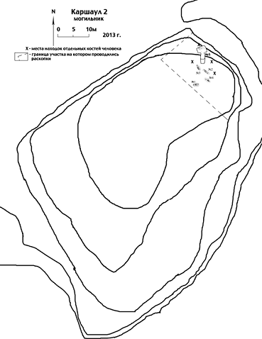
Fig. 26. Nekropolis Qarshovul 2
In accounting year as well as in previous, works were made on northern part of natural hill which is the rest of former right river bank of Chirchik River. This terrace of ancient river-bed was pulled down and ploughed up in course of cultivating of these territories. The mound is situated 200 metres to the north-east from a site of Qarshovultepa and was used as necropolis for people who inhabited town. A hill of the oval form 60 х 40 m, will extend in the area of SW – NE (Fig. 26). It is about 4 m height over the level of a modern surface. The south-western and north-western parts of a hill on 1,5–2 metres are removed by the bulldozer.
Fig. 27. Burial № 5
On all surface and in bulldozer cuts, it has not been fixed signs of that on this area burial places were once made. During excavation of a season of 2012 in a northern part of a hill it has been opened four burials. Then it has been defined that all burials in territory of a necropolis of Qarshovul 2 were made in very loose and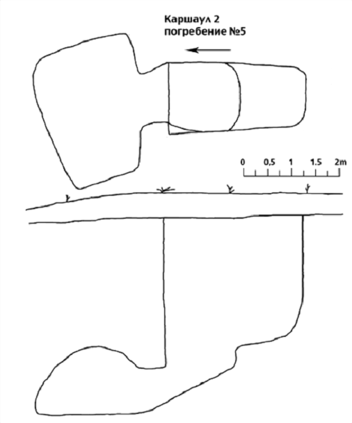
Fig. 28. Plan of burial № 5
salty, loessial ground with a sand impurity. Besides, over ancient tombs in centuries it was formed powerful, about 1 m thick inflatable layer of a friable soil with sand. These circumstances strongly complicate search of sepulchral holes and definition of their form. In that connection, this year it has been decided to clean alluvial layers in a north part of hill to more or less dense ground, i.e., presumably to an ancient day surface. The area of the prepared site has made 450 square meters (30 х 15 m). The ground was cleaned on depth from 40 cm to 1 m. All surface of the chosen site was levelled. The soil was cleaned stratum by stratum, each layer on 10 cm and all finds. On whole area of excavation some not expressive fragments of ceramics have been found. Among them were 6 pieces of strongly smoked walls of different kitchen pots. Besides, in east part of a site, three fire-places were found. That shows, most likely, that on territory of an ancient cemetery funeral feasts were made. As, it was logical to assume that fires was burnt in immediate proximity from places of burials, between two fire-places the trench 2,5 х 1,5 m which has been deepened to depth 2,60 m from a modern surface. But we don’t found any signs of a burial place within this trench. Same attempts were undertaken to the east from burial № 3 and to the north from burial № 2. In four cases we managed to find out separate bones of a human skeleton, on depth nearby 60–90 cm from a modern surface, in strongly dug over ground and without what or hints on a special burial place. Only in one case, in 2 metres to the north from burial № 2, we managed to find out walls of an entrance hole of burial № 5.
Burial № 5
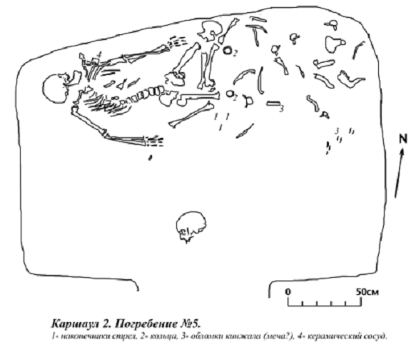
In two metres to the north from burial № 2 a line outlining sepulchral pit was found (Fig. 27). The pit has trapezoid plan and is extended strictly in the area of North –South. Its length 290 cm, northern wall had almost right angles with longitudinal walls, width of a pit here is 150 cm, in a southern part corners are rounded, and width of a pit is 125 cm from above and 100 cm below. Depth of a pit under a southern wall is 225 cm from an ancient surface. In 175 cm to the north from a southern wall the pit bottom breaks a step to depth 300 cm. Further to the north the bottom falls to 375 cm under northern wall of an entrance pit of burial. In this wall arch pass of dromos is arranged, in height 75 cm and width slightly less than width of an entrance pit. Dromos in the length 50 cm conducted to a catacomb. Floor of dromos inclined and at level 425 cm from an ancient surface it join with a catacomb floor. Inside of dromos there was only a friable soil. The catacomb of burial № 5 is extended in the area of East–West and located to an almost perpendicularly entrance hole. A deviation to line North-East – South-West is no more than 10 degree. The catacomb chamber is trapezoidal in the plan; its western wall is 140 cm, while eastern wall is 210 cm. Length of the chamber is 260 cm. Chamber walls are vertical only on height 20–25 cm, above it is a dome shaped and excavated in the virgin soil. The maximal height of a catacomb is nearby 140 cm. The catacomb’s vault has failed in a northwest corner of the chamber (or is punched that it is more probable).
The floor of the funeral chamber is levelled and stamped. In northern part it was possible to fix the rests of an organic decay of brownish colour (a felt laying?). Burials in a catacomb were made twice and both times along northern wall (Fig. 28, Fig. 29). The skeleton of the initial buried lay directly on a floor (on a laying), but bones of feet only were not disturbed. Judging by their arrangement, the dead man lay in the extended position on a back, a head on the east. Other bones of this skeleton, beginning from a pelvis and above have been scattered by all northeast part of a catacomb in the disorder. The skull has been thrown almost to the dromos. Over bones of feet of the dead lay thick enough (15-30 cm) a layer of a friable soil,
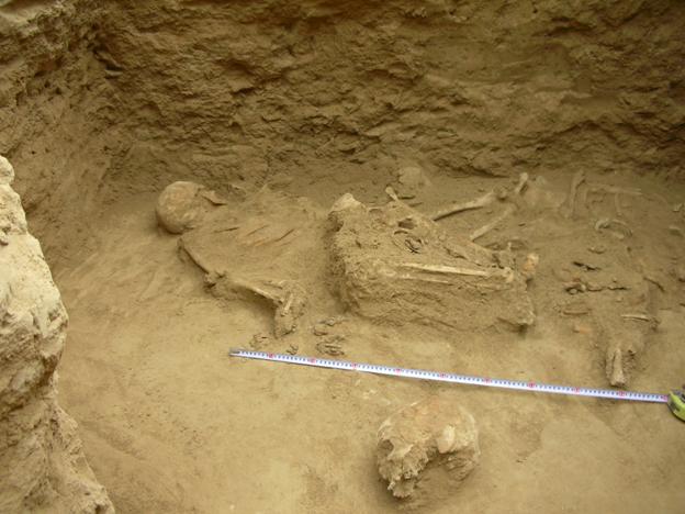
Fig. 29. Qarshovul 2. Burial № 5. A view from the south
which is poured through a hole in the vault. On this soil the skeleton of the second buried lay. The dead man has been put in the extended position on a back, a head to the West, the face to the north. Later, but not much later, as a shin-bones and fibulae are not divided, bones of feet have been removed to northern wall of a catacomb. Judging by an arrangement of bones the catacomb has undergone to a robbery twice. The first time when a ceremony of the second burial was made and grave-diggers have failed in a catacomb not known befor. And the second robbery took place some time after the second burial.
Findings. To the south from a place where pelvis bones of both skeletons were 15 threelobed iron arrowheads has been found (in drawing № 1). They are in different sizes and degree of preservation. Two big arrowheads lay a little aside from the accumulation of smaller. All arrowheads belong to the type with a shank.
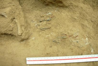
Fig. 30. Qarshovul 2. Burial № 5. Arrowheads in burial № 5.
№ 1. Arrowhead is of stepped shape. The lower part is 40 mm long, threelobed, extending to top and with almost horizontal edges from above; the upper part is 28 mm, trihedral, the shank has remained almost completely, its length is 25 mm.
№ 2. Threelobed. The laurel leaf-shaped; its one blade has completely remained only. Head is 55 mm long, the shank has remained in the length of 22 mm.
№ 3. Threelobed. Head is 32 mm long. The remained part of a shank is 15 mm long.
№ 4. Threelobed. The lower parts of two blades are broken off; head is 35 mm ana a shank only 7 mm long.
№ 5. Threelobed. The shank is broken off; head is 36 mm long.
№ 6. Threelobed. The lower parts of blades are broken off; length of the remained part of a head is 41 mm, a shank 20 mm.
№ 7. Threelobed. The lower parts of blades are broken off; head is 36 mm, a shank is 4 mm long.
№ 8. Threelobed, with triangular outjuting rear parts. A head is 40 mm, a shank is almost whole and is 20 mm long.
№ 9. Threelobed. The lower part of one blade is broken off; a head is 32 mm, a shank is 17 mm.
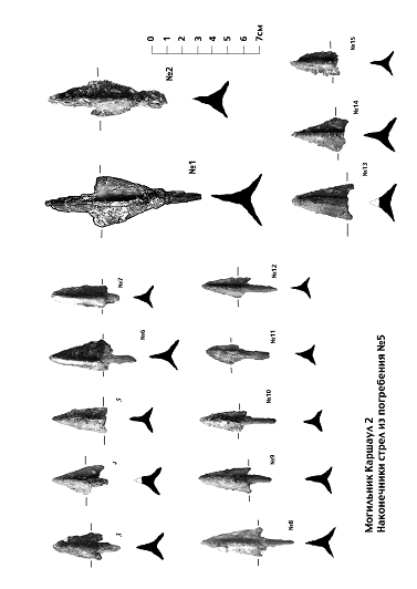
Fig. 31. Arrowheads from durial № 5
№ 10. The lower parts of two blades are broken off, with outjuting(?) blades. A head is 30 mm, a shank is 20 mm.
№ 11. Threelobed. “Stings” are broken off; a head is 26 mm, a shank is 17 mm (the tip is broken off).
№ 12. Threelobed. The blade has completely remained only one, “stings” are outjuted, head is 30 mm, a shank is whole and is 21 mm long.
№ 13. Threelobed. Two blades have remained completely only, the shank is broken off, a head is 40 mm.
№ 14. Threelobed. “Stings” and a shank are broken off; a head is 34 mm long.
№ 15. Threelobed. “Stings” and a shank are broken off; a head nearby 30 mm.
In area where waist of first buried person should be two iron rings (one is split in two parts) are found.
Ring № 1. Diameter is 54 mm, section is 12-16 mm.
Ring № 2. Diameter is 53 mm, section is about 10 mm.
We assume that these iron rings were details of sword-belt (or, less possible, of horse equipment).
Through central and east part of catacomb small parts (the largest piece № 3 on our drawing) of big iron dagger or a sword have been scattered. It is also fragment of small modeled ceramic vessel with the pressed ornament has been found near northern wall of catacomb.
Dating. As a basis for dating, because almost total absence of a ceramic material in burial, arrowheads have served. Small threelobed arrowheads, especially with outjuting “stings”, were spread on an edge and in the first centuries of our era. Larger laurel leaf-shaped arrowheads appear after 4th century AD.
Analogies to big stepped arrowhead № 1 are known, in particular, on finds in Chach (ancient Tashkent Oasis), for example, in a catacomb barrow at settlement Achamayli near the Buka [Alimov, Bogomolov 2000, pp. 172-173, fig. 2: 6, fig. 5]. These arrowheads dated back to the II century BC – I century AD.
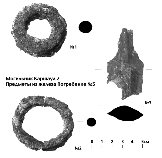
Fig. 32. Iron rings and fragment of a sword
The construction and type of catacomb are characteristic for burial grounds of nomad tribes of the Central Asia. It seems possible to date the first burial in a
catacomb to the first centuries AD. As to the second burial in the same catacomb it seems to us, it is result of an accident. The early catacomb on the territory of a city cemetery of Qarshovul was not known to grave-diggers and they have casually got it in the time of preparation of a tomb in the early Middle Ages.
Bibliography
Alimov, Bogomolov 2000 – Alimov K.A., Bogomolov G.I. About ethnic-cultural links of nomads of Bukhara and Chach // The History of Material Culture of Uzbekistan. Issue 31. Samarkand, 2000, pp.164-177 (on Russian).
Ilyasov 2003 – Ilyasov J.Ya. On a number of Central-Asian Tamghas // Silk Road Art and Archaeology. Vol. 9. Kamakura, 2003, pp. 131–157.
Ilyasov 2010 – Ilyasov J. Nomad Heritage: Kushan Tamga-Signs From Southern Uzbekistan // Traditional Marking Systems. Dover, 2010, pp. 213–225.
Shagalov, Kuznetsov 2006 – Shagalov V.D., Kuznetsov A.V. Catalogue of coins of Chach. III–VIII AD. Tashkent, 2006.
Society for the exploration of Eurasia
Archaeological investigations
at the site of Qarshovul
(Tashkent Province, Uzbekistan)
May-July 2014
K.A. Sheyko
Dr. G.P. Ivanov
Dr. J.Ya. Ilyasov
Tashkent 2014
From May, 28th till July, 12th 2014 archaeological excavations of Qarshovultepa (Karshaultepa) in Chinaz district by members of the Chach expedition of the International Caravan-Seray of Culture have been continued. Our works have been concentrated to 4 objects. In addition to the basic objects of excavation (R-3 – the platform and a court yard, R-5 – a necropolis), two new excavations were added in a season of 2014. R-6 is on the small tepa (hill) which is situated outside of a fortification in the eastern part of the site. And R-7 is in the northern part of Qarshovultepa (fig. 1).
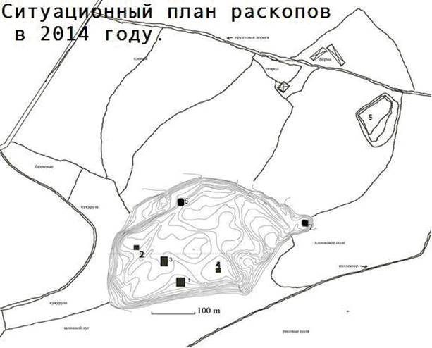
Fig. 1. Qarshovultepa. General plan
Excavation-3
In previous excavation seasons 2011-2013 constructional seam located in northeast part of a platform has been found, which is going in a direction from the southeast on the northwest. There were assumptions that the platform was constructed and functioned in some consecutive stages. For checking this assumption, works were conducted at southeast side of a platform within squares EE97, DD96-97, CC96-97, BB97. They allowed us to define stratigraphical situations and structure of a platform (fig. 2). Here three levels of a floor and some details of its construction are revealed.
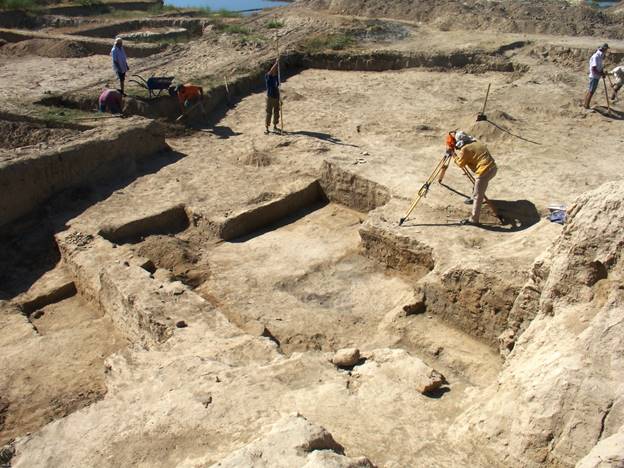
Fig. 2. Excavation 3 to the south-east from a platform
Apparently, originally the platform was smaller and occupied a northeast third of subsequent construction (fig. 3). Its extent from the southwest on the
Fig. 3. South-western surface of initial platform
northeast was about 5 m. From the southwest to this platform the floor 3 (the third from above) adjoined. Near a platform the floor 3 is on depth of 5,65 m from a zero reference point; it is fixed in squares DD96-97, СС96-97. Probably, according to a lay of land, the floor raises to 5,38 m in a northern direction, and in a southeast direction it smoothly goes down. The floor 3 is cleared away on the area apprx. 25 sq. m. yet. At some instant the size of a platform became not enough to satisfy users. For increasing a size of platform the mud-brick wall in the thickness 25-26 cm (i.e. a half-brick) has been constructed in a direction the northeast – the southwest (fig. 4). The space lying to the southwest from an initial platform was filled up by a homogeneous loose soil of grayish colour (fig. 5). Thin wall served as external border of a filled area from the southeast. Grayish colour of a fill, possibly, speaks that soil for it was taken from the layers containing ashes. After the floor 3 has been covered by a layer of a loose soil in the thickness of
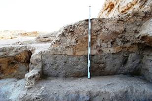
Fig. 4. Surrounding wall and loose fill Fig. 5. Surrounding wall, view from the south-east
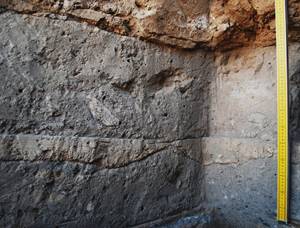
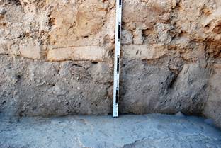
Fig. 6. Layers of fill under platform Fig. 7. Upper layer of fill
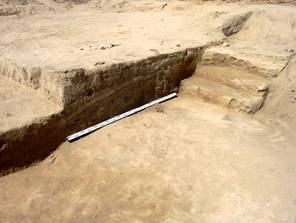
Fig. 8, 9. Stairway for lifting from the floor 3 to a platform
15-20 cm, the layer of liquid clay has been plastered upon this filling to level a surface (fig. 6). The thickness of the first layer together with coating is 25 cm. Upon the clay plaster the second layer of a loose soil lies on (fig. 7). That is, filling of platform’s ground was carried out in two stages. The upper layer of fill has a thickness of 35-40 cm, in it the pieces of clay are also traced here and there. The second part of a platform, and also bench (sufa), adjoined to it from the southeast, are built from the beaten clay (pakhsa) on a horizontal surface of the second layer of filling (fig. 5). For a construction of a sufa mud-bricks are also used. The general thickness of a ground layer makes, thus, 60-65 cm from level of a floor 3. And the height of a sufa, together with pakhsa and brick layers, which lies under sufa, reaches 55-60 cm. To carry out lifting on sufa which horizontal surface is at height of 1,15-1,25 m from level of a floor 3, from the southeast side the stairway has been attached to a bypass wall (fig. 8, fig. 9). The stairway consists of three steps in height of 15-20 cm and in the width apprx. 30 cm, its general height 50 cm. It is cleared away for the width about 1,20 m, but its full width is not known, as its southern part leaves under edge. The surface of a stairway and steps is covered by plaster.
After the certain period of functioning of a complex the level of the court yard adjoining to new bigger platform, has been raised. The court yard has been filled up by a layer of a friable grayish earth to level up the third step of a stairway. This layer’s thickness is 45-50 cm. Over it clay plastering of the floor 2 was made, its thickness is 7-10 cm. The filling and a floor 2, as well as a floor 3, go with fall in a southeast direction. The floor 2 began from sufa, adjoining a platform. Through the certain period of functioning the floor 1, last on time has been made. It practically coincided with a floor 2 nearby sufa and in a southeast direction went horizontally, that is had no strong bias, as floors 3 and 2. Apparently, the floor 1 also has been made to level a court yard surface. In a southeast direction layers of earthen fill and clay getting thicker that has allowed to create a horizontal surface.
Fig. 10. Stairway which is covered by loose fill and floors 2 and 1
Fig. 11. Floor 3, loose fill, floors 2 and 1
The layer which lies on a floor 1 formed as a result of a fire after which the city has been abandoned. In this layer and on a floor various subjects which, possibly, were a part of gifts (a stone beads, stone details of arms, a fragment of a stone mortar, the stone stamp with sogdian inscription, etc., see reports for previous years) have been scattered. This layer fixes the final stage of a life of a monument.
Court yard
In the summer of 2014 works on clearing of the extensive court yard adjoining from the southeast to a platform proceeded. The purpose of excavation – research of a lay-out of a court yard. For the accounting period squares АА97-99, BB98-99, CC98-99 have been dug out on a total area about 175 sq.m. On this space the court yard is opened, basically, on the floor 1 (fig. 12).
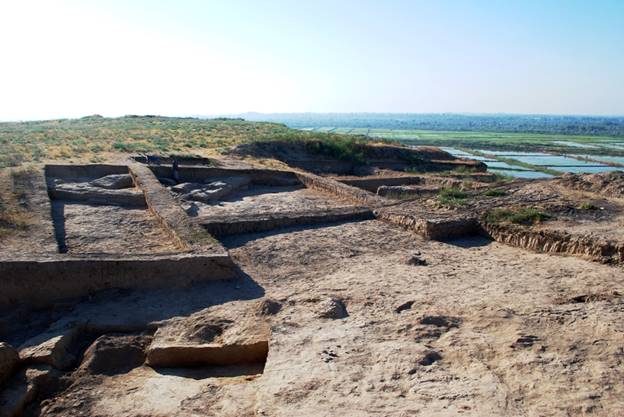
Fig. 12. Court yard, view from the west
By results of excavation of last year (2013) we assumed that the northeast wall of a court yard revealed by us goes in a northwest direction directly to a platform. This year, thanks to clearings within squares СС98-100, it was possible to define that the wall turns on the northeast at right angle. Probably, the court yard had not rectangular, but more difficult lay-out, extending in a northeast direction (fig. 12).
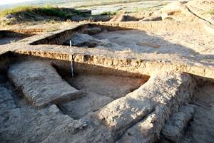
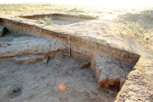
Fig. 13. The turn of court yard wall Fig. 14. Eastern corner of court yard, square АА100
and room 8. From the north
The court yard wall is traced on 4,70 m before turn, from turn on the northeast it is traced on 4,60 m (fig. 13). In a southeast corner of square АА100 the part of the brick wall limiting a court yard from the southeast is cleared away (fig. 14). By results of excavation of 2013 presence of this wall was only assumed.
Within square BB100 the structure of a wall of a court yard was studied. Its thickness of 1,90-2,00 m, and it was under construction in some stages (fig. 15, fig. 16, fig. 18). Originally it had a thickness of 1,30 m and consisted from pakhsa wall in the thickness of 80 cm closely attached from the northeast to a mud-brick wall in the thickness of 50 cm, combined from a bricks in the sizes 48-50х24-25х9-10 cm (fig. 21). Probably, along a wall there was an easy canopy, at least, in the eastern corner of a court yard – here, on distance apprx. 2,40 m from initial wall the rest of a burned wooden column in diameter of 25 cm has been dug up (fig. 15, fig. 17). As a result of a fire the column and canopy overlapping have burnt down, and the floor and a southwest surface of a wall of a court yard were annealed until red (fig. 19, fig. 20). Apparently, to strengthen a wall, on distance of 25 cm to it the second wall was built over floor 1 in the thickness in one mud-brick (i.e. 50 cm). And space between the calcinated wall and an second wall have filled with clay (fig. 22). Under an extension, on a floor layer in the thickness of 10-11 cm which was
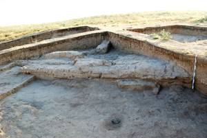
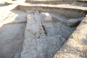
Fig. 15. The wall of court yard and the rest Fig. 16. The wall of court yard, view from south-east
of column, from south-west
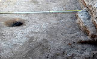
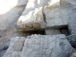
Fig. 17. The rest of a burned column Fig. 18. The section of court yard wall
calcinated at a fire, extra leveling a soil was made. It has a thickness 6-15, in some places up to 20 cm. On this ground bricks of the extension are put, of which have remained in height to 40 cm, i.e., 3-4 rows of bricks. The basic wall in height of 50-65 cm has remained. It is could be that the bricklaying erected on a burnt layer, was not an additional wall, but a sufa (bench) in the width of 70-75 cm (fig. 22).
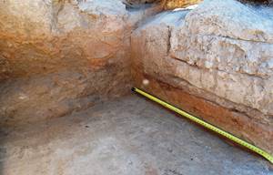
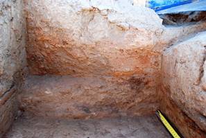
Fig. 19. Initial wall of court yard and floor 1 Fig. 20. Calcinated surface of court yard wall
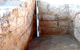
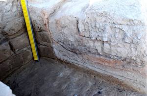
Fig. 21. Structure of initial mud-brick wall Fig. 22. Secondary wall of court yard or bench
In a northwest part of a wall of a court yard the niche in width of 90-94 cm is revealed and depth apprx. 70 cm (fig. 23). The distance from northern (internal) corner of a niche to northern border of the square ВВ100 is 63 cm. Probably, the niche has been made when additional wall or sufa was attached. After additional wall or sufa was attached the top floor (a floor 1) with the calcinated surface, continued to be used. About 30 cm below it is a floor 2; between floors is a layer of friable earth which was accumulated on a floor 2. According to a lay of land, floors tend to some bias in a southern direction.
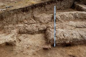
Fig. 23. Niche in the court yard wall, Fig. 24. Whetstone on the floor 1
view from the south-west
Fig. 25. Whetstone on the floor 1 Fig. 26. Coral bead
Finds in a court yard
Square АА100: in a layer over a floor 1 a slice of metal slag was found; 2,12 m from southern and 1,22 m from east borders.
Square ВВ100: near to a niche, on a floor 1, having the reddish surface calcinated at a fire, the whetstone – kayrak was found, on distance of 63 cm from a wall of a court yard and 2,77 m from northern border of a square ВВ100 (fig. 24, fig. 25).
Square ВВ100: on a floor 1 the grey coral bead of the cylindrical form is found; 9 cm from a wall or sufa and in 3,62 m from a place of a joint of a wall with east border (fig. 26).
From the northeast several rooms are adjoining to court yard walls. They are built from mud-bricks and pakhsa. In the limits of Excavation 3 it was possible to reveal only parts of these rooms (fig. 27).
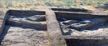
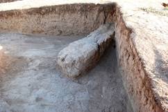
Fig. 27. Rooms outside of court yard, view from the west Fig. 28. Wall between rooms 7 and 8, square ВВ100

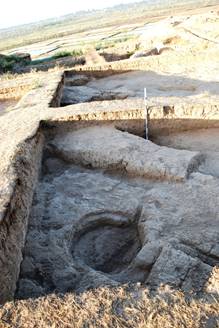
Fig. 29. Room 8, square СС100 Fig. 30. Room 9, square СС100, view from the north
Rooms 7 and 8 (numbering continues the general numbering of premises of Excavation 1 and Excavation 3) are divided by a mud-brick wall in the thickness in 1 brick (50 cm), revealed in last year and located in a northeast corner of square BB100 (fig. 28). A southern corner of room 7 with a southeast wall (or sufa) of it is revealed in square BB100. Small room 8 is located within squares BB100 and СС100 along a wall of a court yard and it is connected by passes with room 7 and room 9 (fig. 29). From the northeast it is limited by a brick wall in the thickness of 1,15-1,20 m, extent of a wall of 2,70 m from a southeast corner of square СС100 in a northwest direction where pass in room 9 is located, with a width of 90 cm. From the northwest the room 8 it is limited by a wall of a court yard which is combined from mud-bricks and pakhsa, and has a thickness of 1-1,20 m. Room 9 of which only small part is opened within square СС100, had, apparently, sufa at a northwest wall. At some stage the corner of sufa has been cut down by the round hole served, most probably, for installation of big jar (khum). Diameter of a hole is 90х96 cm, depth is 26 cm. Filling of room 9 is dense enough, possibly, it have hammered clay to raise floor level (fig. 30).
To study a lay-out and history of functioning of the premises adjoining a court yard from the northeast, the future excavation will allow.
Excavation 6
For the purpose of the further studying of topography and the structure of Qarshovultepa outside of a city wall, in a southeastern part of the site new Excavation 6 with an area of 142,5 sq.m. has been started on the small hill of a roundish shape. In some cases buildings for special proposes were found on some of archaeological sites (for instance, so called “Fire Temple” on Kurgantepa, Samarqand province).
During works following stratigraphical situation has been fixed. In a southeast corner of Excavation 6, on depth of 30-80 cm from a day surface a level has been found which lies unevenly, with the constant tendency of falling from northwest to southeast (– 6,79-6,93 m from a reference point). Here and there this level is a dense trampled down loam of dark brown colour with small fractions and pieces of coal (fig. 32). The layer which is lying down over level, represents a accumulate and blown soil of light brown colour with an insignificant impurity of
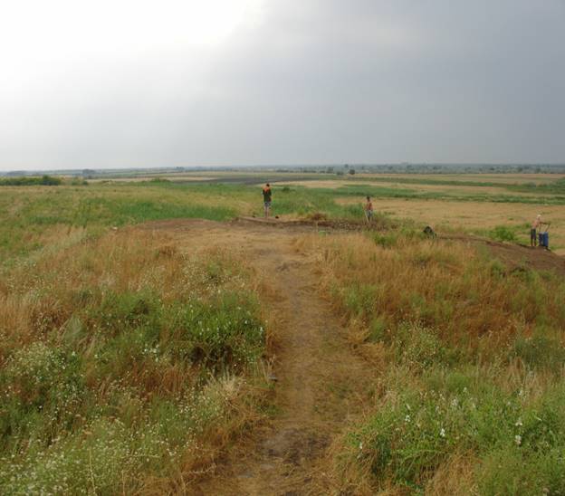
Fig. 31. Excavation 6. The beginning of works
pieces of coal and fragments of ceramics which is most often fixed in northwest border, on distance of 2 m from a northwest corner of excavation. In south-eastern corner of Excavation 6, behind the border, the significant amount of fragments of mud-bricks, pieces of clay and the mud-brick lying have been revealed. On distance of 1,15 m from edge of excavation and 1,1 m from trench edge the roundish hole has been revealed in the sizes 28×28×7 cm (fig. 33). In hole filling there was a soil of light brown colour, without visible impurities.
In the stratigraphical trench which has reached 2,2 m deep from modern surface, 10 cm under inhabited level, an ashpit is fixed. Under ashpit the calcinated level in the thickness of 1-2 cm and of dark red-brown colour is located.
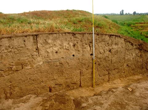
Fig. 32. Section of northern border
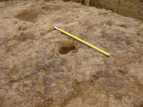
Рис. 33. Burned level with a hole
No architectural remains were found here yet. To understand the history of this part of the site further excavations should be done here.
Excavation 7
Already at making of the general topographical plan of a Qarshovultepa, it has been assumed that on the northern side of the site the gate of the town could be found. This place situated directly to the north from the Excavations 1 and 3.
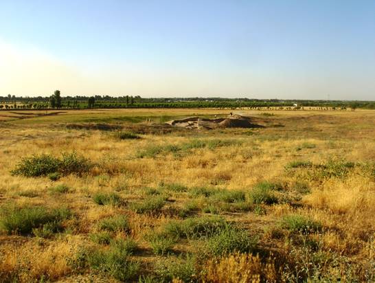
Fig. 34. Excavation 7, view from the south
To check this assumption this year a new Excavation 6 was started within the limits of squares a101-102, b101-104; c101-103 and d102. Sizes of squares are as usual 5х5 m; total area of excavation has reached of 250 sq.m. The place chosen for the Excavation 6 is a roundish hill in diameter about 12 m which is slightly extended from the north-west to the south-east (fig. 34). The northern foot of the hill is on a level of 4,25 m from a zero point in the centre of a site. From the northeast the hill was adjoined by a bank in width of 6-7 m. The slopes of a hill turned towards site (i.e. southern side) are more flat. Northern slopes are sharply going downwards. The highest point of excavation is in a southeast corner of a square b102, on the brink of the one metre width border which has been left on southern edges of squares b101 and b102. Its mark is 2,70 m from a zero reference point. The turf layer, as well as on all territory of ancient settlement, makes 10-20 cm and has considerable density because of an interlacing of roots of plants. Deeper is a blown layer consisting of friable soil with sand, till the depth of 50 cm. Deeper is a dense bed of building clay. As height marks of this area tended to fall from 2,70 m in a northeast corner to 4,00 m in the western and southern parts, the level of Excavation 6 goes to a mark of 4,00 m in squares c101-102, and to 4,25 m in a square d102.
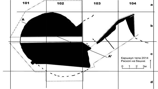
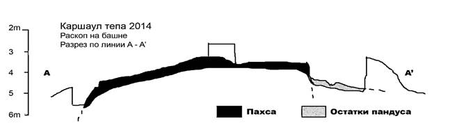
Fig. 35. Tower, plan and section
Within the specified squares (a101-102, b101-104, c101-103) the rests of fortification, namely a roundish massive tower, which is flanked city gate from the northeast, and a small part of a city wall are revealed (fig. 35). The wall adjoined a tower from the northeast. The semicircular (?) platform, probably, serving for lifting on a wall is attached from the south to a wall.
Diameter of a tower of 8 m, the remained height of pakhsa walls reaching 1 m to 1,6 m (fig. 36). Internal structure of a monolithic tower still should be studied, as well as to reach tower foot outside. Within a square b102, in one metre from the eastern border of a square and in 2,5 m from southern, the city wall which is built from pakhsa is adjoined to the tower from the northeast. Its external surface has been cleared away throughout 1 m. From the southwest, that is, from an opposite side of a tower, a pylon adjoins on the all remained height of the tower wall. It protruding on 30 cm from a surface of a wall of a tower and has width 40 cm. Apparently, it was a pylon which framed the gateway. The further excavation will allow to clear away a southwest tower and a gateway.
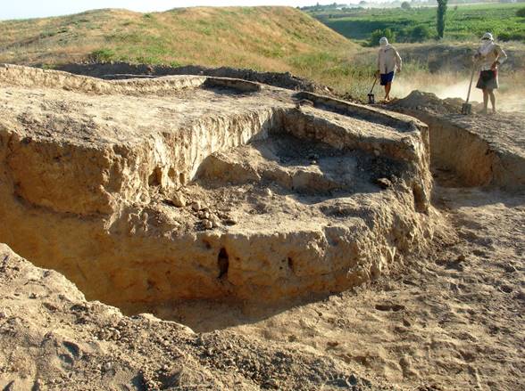
Fig. 36. Tower, outer view
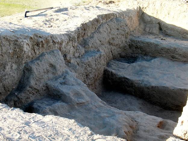
Fig. 37. Fortification, inside view
The internal side of a fortification is cleared away in squares с103, b103-104. It goes in a direction from the southwest on the northeast and is tracked on 8 m, its thickness – 4 m (fig. 37). In a square b104 a cross-section wall, which is roundish in the plan, adjoin it. It is tracked on a distance of 3 m in a southern direction. The corner between these two walls is cleared away in 1,5 m from northern border and 0,5 m from the western border of a square b104, on depth of 3,45 m. Probably, it is the semicircular massif propping up a fortification from inside and serving for lifting on it.
On distance about 1 m from a junction of an internal side of a fortification with a tower the “doorway” in width of 1,20 m, deepened in a body of a wall is traced on. Its threshold on depth of 3,95 m from a zero point. To a threshold an upgrade way in width about 4 m goes from the south. Under southern border its surface on depth of 4,65 m. Between edge of a ramp and a wall of an internal semicircular structure our excavations reached depth of 5,30 m and floor traces are revealed. The ramp surface has remained very badly. Judging on solidity of a defensive wall it is possible to assume that the “doorway” which we found out could not be an entrance, to say, in a corridor inside the wall. Most likely, there were steps, which have been cut down in the monolithic body of a wall and allowing lifting on a wall and a tower. And specially built ramp led to it. It is necessary for specifying in a following campaign.
Coins
№ 1 is found in filling of square ВВ101 in a southeast corner at southern border and in 10 cm from east border, on depth of 0,5 m (fig. 38). Obverse: the portrait of the ruler in a profile looking to the left. There is a diadem on a long hairs going down on shoulders. Reverse: tamgha in the shape of circle with three hooks. Bronze, diameter 15 mm, weight 0,5 gr. This coin belongs to the group 1 period 3 of the mint of early dynasty of rulers of Chach [Kuznetsov, Shagalov 2006, pp. 55-57].
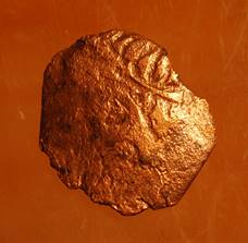
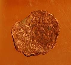
Fig. 38 a, b. Coin № 1
No 2. Found in a court yard in filling of square АА99 in 2.15 m from southern and 1.16 m from western borders, on depth of 10 cm (fig. 39). Obverse: A predator with the lifted tail over a back, reminding a leopard and going to the right. A linear rim is around. Reverse: In the middle tamgha (sign of a dynasty) is represented in the form of a trident, with a Sogdian inscription around. Bronze, diameter 20 mm, weight 2,3 gr. Belongs to the mint of ruler Tarnavch (group 6, type 8) [Kuznetsov, Shagalov 2006, pp. 235-243].
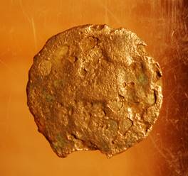
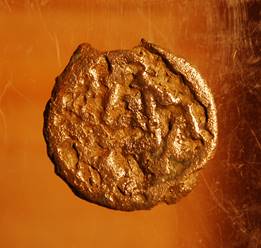
Fig. 39 a, b. Coin № 2
No 3. Found in a court yard on the second floor, on distance of 10 cm from northeastern and 3,45 m from eastern borders in square ВВ100 (fig. 40). Obverse: a predator with the lifted right paw going to the left, with a mane as at a lion, over a back the rests of a Sogdian inscription could be seen. Reverse: in the centre of a coin tamgha in the shape of a trident is represented, with a Sogdian legend around. Bronze, diameter 17 мм, weight 0,9 gr. Belongs to the mint of ruler Sochak or Stachak (group 6, type 6) [Kuznetsov, Shagalov 2006, pp. 226-230].
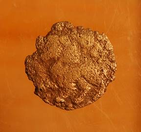
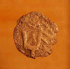
Fig. 40 a, b. Coin № 3
No 4. Is found in a court yard, on 2nd floor, within square ВВ100, on a distance of 10 cm from a northeast wall of a court yard, in 3,40 m from northern and 3,45 from eastern borders (fig. 41). Obvers: the portrait of the governor in three quarters to the right in a linear rim. There is a Sogdian inscription to the right of the person. Reverse: tamgha in the form of lyre around which there is a legend. The coin belongs to the group 7, type 1, a variant 3 of Chach coins [Kuznetsov, Shagalov 2006, p. 275].
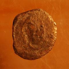
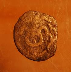
Fig. 41 a, b. Coin № 4
No 5. It is found in square ВВ96. Obvers: two-humped so called Bactrian camel going to the left. Reverse: in the centre tamgha in the form of a rhombus is represented. The rests of inscription are around. Belongs to group 8 [Kuznetsov, Shagalov 2006, p. 278-283].
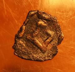
Fig. 42 a, b. Coin № 5
No 6. It is found in square ВВ98, on depth of 25 cm from a modern day surface, between a layer of accumulation and a cespitose layer, in 1,5 m from the western and southern borders of a square (fig. 43). Obverse: in a square dotted cartouche – a creed (with errors) and date: La illahi ila Allah Muhammad rasuli l-lah. 781 [translation: There is no God except the Allah, Muhammad is His Prophet. 1379]. Reverse: In the field: Siyurghatmysh yarlighi amir Timur kurakan (uge manu?) [translation: By the order of Siyurghatmysh amir Temur Kuragan (my word)]. Around the cartouche – the mint name: from above darb [mint], at the left and from below – is illegible. Silver, diameter 16 mm, weight 1,53 gr.
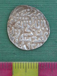
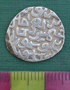
Fig. 43 a, b. Coin № 6
In conclusion of the description of coins we will tell little more about coin No 6 which is dropping out of the general context of excavation of a site of ancient settlement of Qarshovul. It is a silver coin of a small value (miri). The coin is minted in 1379 on behalf of the puppet khan from the house of Chinghiz Khan named Muhammad Siyurghatmysh (Suyurghatmysh), who was "a ruler" in 1370-1388, and Amir Temur (1370-1405). This coin, certainly, is visitor’s, as, judging by the archaeological data, the territory of a site of Qarshovul was abandoned not later than 8th century.
We will note interesting fact: in May, 1365 between Tashkent and Chinaz, on the bank of river Chirchik, that is somewhere in vicinities of Qarshovultepa, there was so-called «a Mud Battle». In it armies of Temur and his brother-in-law Husayn have suffered defeat from the Mongolian army [Amir Temur 1996, p. 36]. 5 years after of this unsuccessful battle Temur has been proclaimed as ruler of Mawara al-nahr and has begun his victorious campaigns. Since that Amir Temur became invincible and in 14 years, or a bit later, someone has dropped the silver coin on ruins of the small town which was abandoned six centuries ago.
Excavation 5 – Necropolis (Qarshshovul 2)
In 2014 excavation of the burial ground located in 200 metres to the northeast from a site of ancient settlement of Qarshovul have been continued. Nekropolis is situated on a hill, which is remained after of a pulling down of high ancient bank of Chirchiq river. For the previous two seasons in northern part of this hill we had already been opened 5 burials. Last year the top layer on the area in 200 sq. m, on depth from 50 cm to 1 m has been removed here. In the central part of this ground the first 5 burials have been found out. From the north and the south there were spaces approximately on 50 sq.m. each. It has been decided to open these sites. Works have begun with northern part.
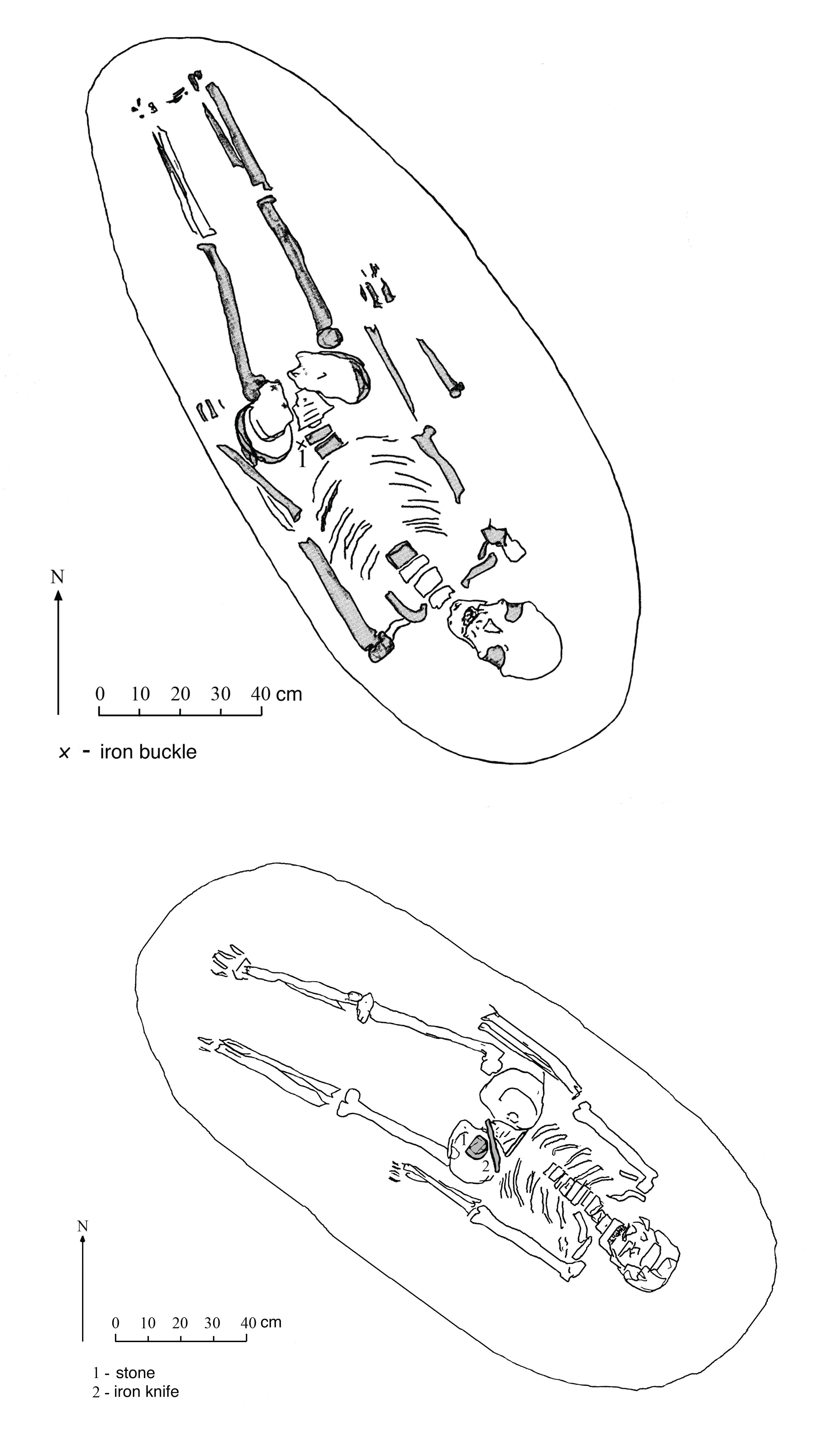
Burial № 6. Judging on the rests of the vault we can say that this burial was made in the northeast side of entrance pit (so called podboy burial). According our reconstruction, the height of the vault was not less than 50 cm, the maximum length – 2,00 m and the maximum width – 0,90 m. Floor was on depth of 2,20 m from a modern surface and 20 cm deeper than floor of entrance pit. On a floor the skeleton laid in the extended position on a back (fig. 44, fig. 45). The head of the buried person was turned to the south with a small deviation to the southwest. The head is inclined to the right shoulder. A skull is strongly deformed by artificial, so called ring deformation and it is visibly extended upwards. Such custom was spread between Chionite and Hephthalite tribes in the 4th-5th centuries. On the left bone of a pelvis one-bladed dagger was found, nearby a small knife (fig. 46). The length of a blade of a dagger is 20 cm, the maximum width at a shank is 3,5 cm. A dagger’s shank has not remained. The knife had length of 8,5 cm and the maximum width is 2,5 cm. The shank is broken off. There were no other finds in a burial. But in 30 cm to the west of a vault on depth of 1,90 m the ceramic pear-shaped mug made on potter’s wheel has been found. Handle is broken off. The mug height – 13,5 cm, diameter of a mouth – 7 cm, diameter of a bottom – 7 cm. There is a narrow groove on the transition from body to a neck of mug. The paste is terracotta coloured, without a engobe covering. The handle at a mug was loop like, but it is broken off completely, only bottom part in a place of joining with the body has remained. Mugs of such shape were widespread in Chach (Tashkent oases) in Qovunchi period (i.e., in the 2nd century B.C. – 6th-7th centuries A.D.). It is possible to assume that this mug was initially in the entrance pit of burial № 6.
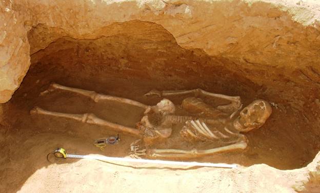
Fig. 44. Burial № 6
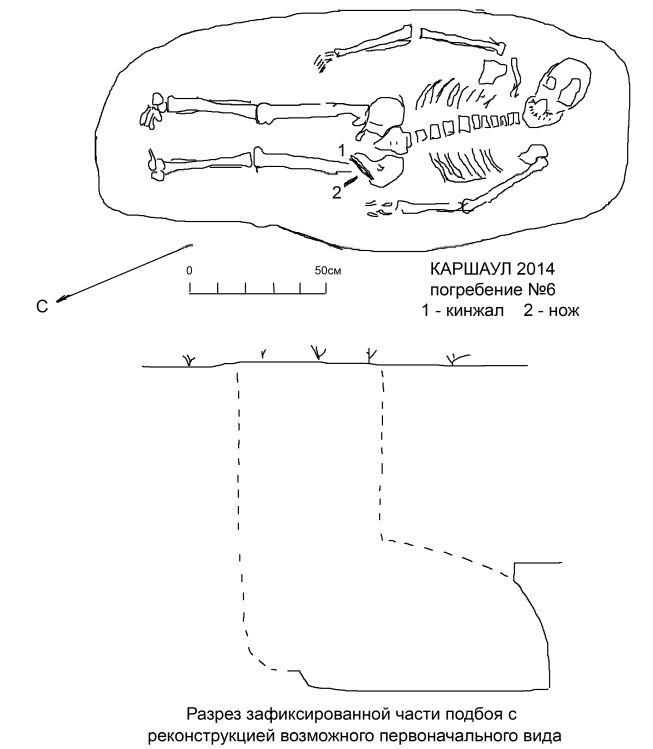
Fig. 45. Burial № 6
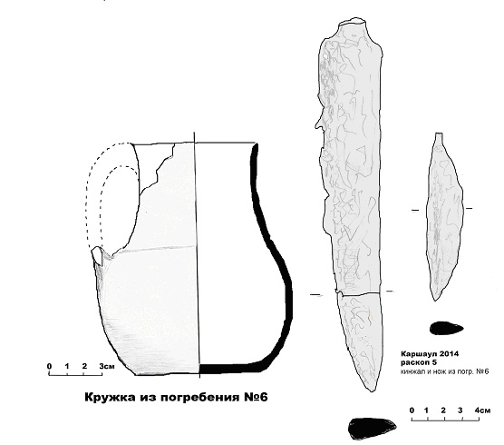
Fig. 46. Findings from burial № 6
The further excavations were conducted in a southern part of a site.
Burial № 7. It is revealed in 5 m from burial No. 4, it is strict on the south. The grave of the extended oval form, its upper part have been destroyed. Its maximum length of 2,05 m, width – 0,80 m. At the bottom on depth of 2,00 m from a modern surface the skeleton of the man of average years, buried in the extended position on a back was cleaned up (fig. 47, fig. 48). The head is oriented strictly to the north. The skull is turned with face side to the left, i.e. on the east. Bones of the right hand below an elbow have not remained. Bones of the right foot have not remained also. The dead lay in «a pose of the horseman». Any accompanying stock was not found in this burial. Apparently, it has been plundered in the ancient time. It is the reason of destruction of the upper part of burial pit and the absence of a part of bones of the right hand and foot.
Fig. 47. Burial № 7
Fig. 48. Burial № 7
Burial № 8. It is revealed on depth of 2,40 m from a modern surface, the entrance pit is not remained. In burial two skeletons were found (fig. 49, fig. 50). One skeleton, probably, belonged to the young woman. It lay in an anatomic order in the extended position on a stomach, oriented by a head on the northeast. The skull is inclined to the right shoulder with the face down. Bones of the right hand below an elbow are absent. At the right shoulder from this skeleton, i.e. from the east, the skull and bones of the child were found. The child was, likely, no more than two-three years old. Bones of the baby lay without an anatomic order. Funeral inventory has not been found.
Fig. 49. Burial № 8
Рис. 50. Burial № 8
Bibliography
Amir Temur 1996 – Amir Temur in the World history. Tashkent, 1996 (on Russian).
Shagalov, Kuznetsov 2006 – Shagalov V.D., Kuznetsov A.V. Catalogue of coins of Chach. III-VIII AD. Tashkent, 2006.
Archaeological investigations
at the site of Qarshovul
(Tashkent Province, Uzbekistan)
June-July 2015
K.A. Sheyko
Dr. G.P. Ivanov
Tashkent 2015
From June, 9th till July, 6th 2015 archaeological excavations of Qarshovultepa in Chinaz district by members of the Chach expedition of the International Caravan-Seray of Culture have been continued.
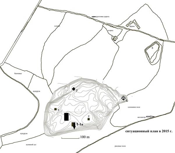
Fig. 1. General plan of Qarshovultepa
Our works have been concentrated on 4 objects: R-1A – stratigraphic sondage in the area of the old Excavation 1, R-3 – the platform and adjacent area, R-5 – a necropolis, and R-7 – fortification in the northern part of site (fig. 1).
Excavation 1A (R-1A)
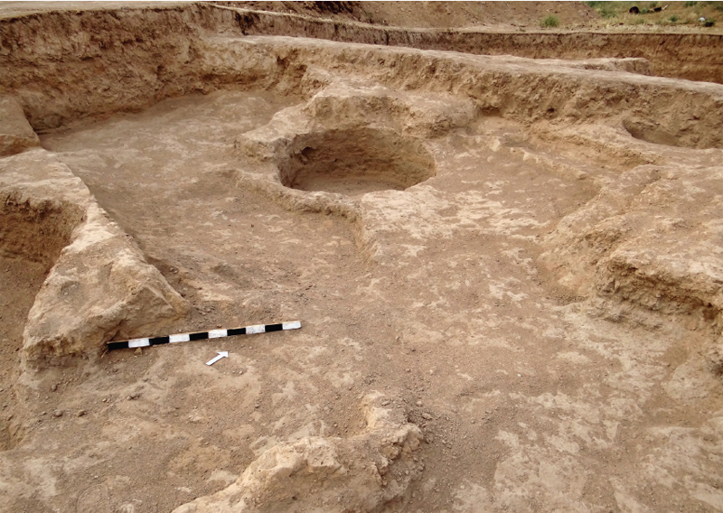
Stratigraphic sondage has been put on a place of 2008 excavation in a southern side of the central part of the site (fig. 2). Its sizes 10,9×3,5 m, depth of 6,5 m from level of a modern surface. This side of the site was partly destroyed by Chirchik river, and we don't have rests of fortification here. The goal of this excavation was to know when the life on this territory has began. Our description of layers of R-1A runs from below upwards.
Fig. 2. R-1А (stratigraphic sondage). View from west
Natural soil (or sub-soil) is the dense loamy soil of light brown colour, it lays in the deep of minus 10,28 m from a zero reference point. Over natural soil thick layers of friable grey coloured cindery ground as well as friable greenish coloured ground lay down. This kind of layers were the basic kind of soil throughout our stratigraphic sondage. Their thickness is 4 m over a natural soil. (fig. 3).
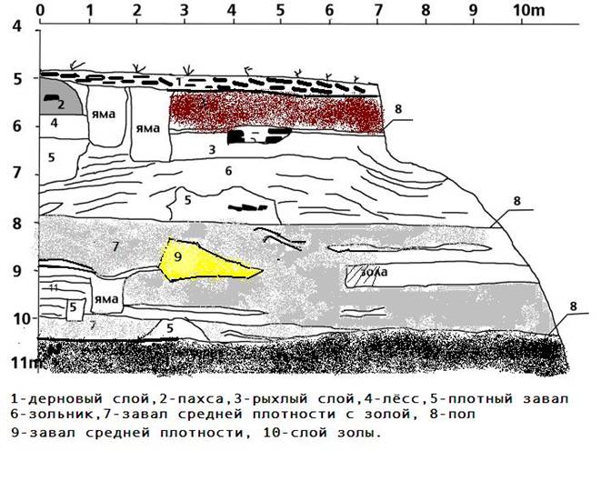
Fig. 3. R-1A. 1 - cespitose layer, 2 - pakhsa, 3 - friable layer, 4 - leoss, 5 - dense layer, 6 - ashpan, 7 - dense layer with ash inclusions, 8 - floor, 9 - broken wall, 10 - ash layer.
On distance of 2,5 m from northern board of a trench, direct over natural soil the layer of a dense layer of clay is fixed. It passes for the length about 1 m, its thickness about 50 cm. One more precisely same layer of dense clay 50 cm in the thickness is fixed on depth from a minus 5,50 to 6 m from the modern surface, and situated in 50 cm from northern board of a sondage. The southern edge of this clay massif is adjoined to a pit with a depth of 1 m and a width of 70-80 cm. The dense clay layer (possibly, the rests of pakhsa wall) about 2,1 m in length and about 1 m in height have been fixed on depth a minus of 4,4-5,4 m from the modern surface. On a depth of minus 3,25-4 m (from the modern surface), on 2,6 m from northern edge of a sondage another dense clay structure in length apprx. 2 m was found. Two mud bricks by a format of 25×?×8-9 cm were also found here. On the depth of minus 2,5 m from the modern surface ash and organic soil accumulation have been covered by a layer of a friable ground of light brown colour. On distance of 3,9 m from northern edge of sondage within this soil the rests of a bricklaying in length of 1,25 m have been fixed, with a thickness in 0,65-0,7 m. In a laying 2 rows of bricks by a format 40×?×9-10, 30×?×9-10 cm were found. In the same friable ground 2 adjacent, nearly rectangular formed pits have been cut down. One of them, which had 0,75 m in width and 1,25 m of at depth, situated in 1 m from northern board of a trench. The adjacent pit had width of 1-1,1 m and a depth about 2 m. Both pits were dug up from the level of 0,35-0,4 m from modern surface. The given level is a thin clay layer of about 3 cm thick which was the floor of the final stage of living on Qarshovultepa. Directly near to pits, at northern board of a trench, in the depth of 0,15 m from modern surface the pakhsa wall in height of 1,5 m is fixed, which had 2 m in thickness. Under this wall there was a one meter thick layer of greenish soil (on the depth from 1,5 till 2,5 m from modern surface). The uppermost layer of the site is a very friable soil of the light-grey-brown colour which is 15-40 cm thick. It is covered by roots of plants, so called cespitose layer.
Сeramics which has been found at R-1A is basically modelled. There are many fragments of kitchen and store utensils, such as kettles, pots and big jars. This fact, along with the above described character of soil layers can in our opinion testify that on the given space was used mainly as courtyard between dwelling structures and southern line of city wall. Judging from ceramics, using of this part of the site began from the 4th century AD.
Excavation 3 (R-3)
On R-3 to the north from a platform six more squares – HH93, 94, GG93, 94, 96, 97 have been started to excavate. Under a cespitose layer in all these squares a layer of destruction consisting of fragments of mud bricks and a congestions of pieces of pakhsa. In square НН94, in its southwest corner on a mark a minus of 2-2,05 m the clay congestion is fixed. The similar congestion is fixed on a mark a minus of 1,90 m in the middle of square GG93. At cleaning it was found out that clay lies on a loose coating which passes on all excavation area. Most likely, it was the mud which was prepared for some kind of building or repairing works. Excavations on this square has shown that it was also court yard (fig. 4).
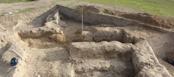
Fig. 4.
Other picture was observed in a northeast corner of square GG97 where on a depth minus 2,40 the top part of mud brick wall was found. The wall was built from mud bricks (39-41×23-24×6-7 cm), both whole, and halves. The length of this wall is not clear as its northern part leaves under edge of square НН97. The opened length of this wall is 4,25 m, a thickness of 1,10-1,20 m. There is a doorway which is situated between southern edge of this wall and another wall which goes in the perpendicular direction and has length of 2,9 m and a thickness of 0,75 m. Thus, on this site 3 "rooms" from which 7 and 8 probably are court yards come to light. In building of walls on this site clay which was used in the form of repair "patches" on a place of the destroyed bricks was widely applied. The rests of this clay are fixed on floors in all dug out premises. On the floor of room № 7 (square GG97) a fragment of a copper coin is found which is could be not recognized because of very bad condition. Two other coins are found in a rests of the fallen wall near the western wall of a room № 8. The first coin has the broken off edges, and the obverse is strongly damaged, but metal in a coin is of good condition. It belongs to the coins of governor of Chach named Tarnavch, it is shown by an image of a predator going to the right and characteristic fork-shaped tamgha (fig. 5). V.D. Shagalov and A.V. Kuznetsov qualified such coins as Type 8 of Group 6 and dated back to the second half of the 7th ‒ the middle of the 8th century after E.V. Rtveladze [Shagalov, Kuznetsov 2006, pp. 235-239].
Fig. 5. Bronze coin
The second coin also of bad condition, but on obverse a pair portrait of the governor and his wife is recognizable, as well as tamgha on reverse (fig. 6). This coin belongs to the Group 5 of Chach coins which dated back to the second half of the 7th ‒ the beginning of the 8th century, according to catalogue of Shagalov and Kuznetsov [Shagalov, Kuznetsov 2006, pp. 187-198].
Fig. 6. Bronze coin
Inside the room № 8 a lot of ceramics are found such as fragments of big jugs, jars, kettles and a broken pieces of vessels which are not recognizable. Two clay fragments which were found here should be noted as they could be details of architectural decoration, or fragments of clay sculpture (figs. 7 & 8).
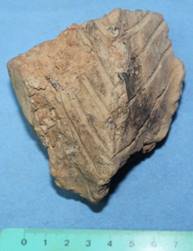
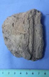
Figs. 7 & 8. Clay fragments
Northern wall of a room № 9 has length of 3,25 m, and its thickness – 0,75 m. The western wall is dug out not completely as it continues under control section which adjoins northern part of a platform. Here the stairway has been found which is attached directly to the western wall and was cleaned up. The height of stairway which has remained is 0,9 m, width of steps – 0,75 m (fig. 9).
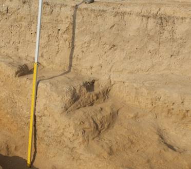
Fig. 9. Stairway in room 9
Near northern wall a ceramic vessel was found which has a shape of semi-spheric bowl with thick walls and "toothed" rim. Its internal surface is strongly smoked that shows that it was used to burn some substance (fig. 10). As the surface of northern wall is partly annealed until red on its upper part, it could mean that here stand kind of incense burner consisted from semi-spheric bowl putted on some separate (ceramic?) support.
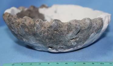
Fig. 10. Incense burner
Works on R-3 were conducted also to the southeast from a platform. Part of court yard to the south from a stairway which was found last year was excavated, as well as continuation of the court yard to the East, in the direction of eastern part of big court yard of the last period of Qarshovultepa which was excavated in previous years by J. Ilyasov [Sheyko, Ivanov, Ilyasov 2013; Sheyko, Ivanov, Ilyasov 2014]. In 2013-2014 three levels of floors has been fixed to the southeast from a platform (fig. 11).
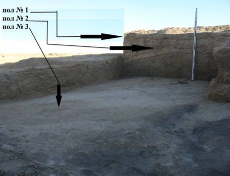
Fig. 11. Three floor levels near platform
On the third floor (from above) the stairway has been built which allowed to get on sufa, attached to eastern part of a platform (fig. 12).
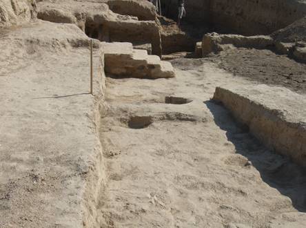
Fig. 12. Stairway attached to platform
At the same level the small court yard was adjoined to the platform from the southeast. This small court yard is surrounded by walls of various thickness. On distance of 3,15 m to the northeast from a stairway in course of opening of the third floor and a layer lying on it, northern wall of a court yard has been fixed. Its total length of 6 m at a thickness about 1 m. The wall in the thickness in one brick, limiting a platform from the southeast and found out during a season of 2014 is tracked on 3,20 m. It limited a court yard from the northwest. Southeastern wall of a court yard has length of 2,20 m, there is a pass in width of 1,40 m in it. This wall is tracked further throughout 2 m, and reaches edge of excavated area. Probably, other part of this wall is destroyed.
From finds on this site we will note a coin with the image of the predator, found at clearing of a stairway from southern side. By preliminary definition it can be coin of governor Sochak or Stachak. These coins belong to the Type 6 of the Group 6 according to catalogue of Shagalov and Kuznetsov and dated back to the second half of the 7th ‒ the middle of the 8th century after E.V. Rtveladze [Shagalov, Kuznetsov 2006, pp. 226-230] (fig. 13).
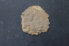
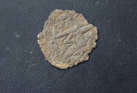
Fig. 13. Bronze coin
The second find is a rare bronze ear cleaner which has been found out to the south from a stairway on the last – the third from above – court yard floor (fig. 14). The length is 6,2 cm. The shank with the termination in the form of a miniature oval spoon has top part in the shape of human figure. It represents the standing character in a long attire, with the face shown in three quarters, a body en face and feet in a profile. It is not clear yet is it female or man image. The left hand is pressed to a hip, and probably, is bent in a wrist, or there is a small jug in this hand. The lifted right hand the character supports some attribute, or a certain figure. The find demands additional studying.
Fig. 14. Bronze ear cleaner
To more detailed studying of a structure of the platform, building materials used, and also the layers which are lying down under platform, it has been decided in this season to cut it from southeastern side. The cut was dug up on this side of a platform on a place of a small sondage which was made in 2013. Till now, works on this cut is revealed three building periods which in turn have the own stages of the repair works which were carried out during functioning of a platform. Works on this place are not finished yet and were stopped on a depth minus 6,75 m. Numbering of the building periods goes from below upwards. The first building period is found out on a depth minus 6,75 m from a general reference point. The rests of a floor and walls of the first period which have remained on height of 1,05 m were found in the eastern part of a cut. Walls are built from mud bricks in the size 49-50 х 23-24 х 8-10 cm, they stand on good prepared floor surface and have traces of repair work which are perfectly visible on east and southern walls of this room. Only three walls of this room are fixed yet. Eastern wall is opened for all its length – 1,75 m, and has remained on height of 1,10 m. Two plaster layers passed from a wall to a floor. Obviously, sometime after erection of this room repair works were done here, traces of which are fixed on east and southern walls. They could be seen in strengthening of these walls by "shirt" from fragments of mud bricks with the further plastering. Northern wall is dug out for the length 1 m only as it goes under northern edge of the cut. The southern wall is dug out for the length of 5,80 m and goes under the western edge of a cut. Its remained height – 0,45-0,5 m. It could be kind of corridor.
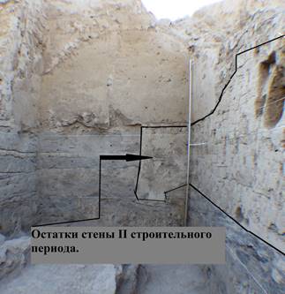
Fig. 15. Structure of platform
The wall which belongs to the second building period has been put directly on the rests of a room of the first building period (fig. 15). It is necessary to notice that eastern part of this wall functioned also some time in the last, namely the third building period. At this time, when above mentioned stairway leading on a platform was in use, this wall was used as a northeastern wall of a court yard. The third (last) building period has two stages. At the first stage the western part of northern wall was cut and directly on it pakhsa blocks are erected which were used to increase the platform area. During this period all lay-out at a platform changes. From its southeastern side the small court yard was formed and the stairway was erected, allowing to rise on sufa attached to platform. And, as it has been found out during works of 2014, after certain period of functioning, this small court yard has ceased to satisfy inquiries of inhabitants, and was fully filled up together with stairway, and there was a substantial growth of the area of a court yard. On the platform the repair works were made such as covering it with mud brick “shirt”; the court yard floor rises to the level of sufa.
Finds in a cut are not numerous. Basically, it is fragments of walls of large vessels and some rims from jugs, kettles, pots and jars. The ceramics found in the upper horizons of Qarshovultepa is possible to consider as one complex. Some researchers of the Tashkent region, in particular, M.I. Filanovich and S.R. Ilyasova, noticed already existing of imported Sogdian ceramics in ceramic complexes at some archaeological sites of Tashkent Oasis. We can observe a similar picture in a ceramic complex of Qarshovultepa too. For this group of ceramics we can mention, first of all, a fragment red slipped and polished jug, found over a floor in the third building period, and also similar kind of ceramics from the previous years of excavations. There is also influence of another type of ceramics on materials which were found on Qarshovultepa, namely, ceramics of Dzhetyasar culture of Lower Syr Darya region. Such influence could be traced on many other sites of the Tashkent Oasis. It, first of all, big size jugs with trumpet shaped and corrugated necks. During the previous seasons such vessels have been found in a considerable quantity on excavations of court yards on R-1. At excavation of rooms in squares GG96, GG 97 and FF97 three fragments from vessels of "teapot"-shape (fig. 16). To these vessels we find analogy on some monuments of the Tashkent oasis (Aktepa, Ming-Urik, Shashtepa). We will note also a fragment of a small kettle with plaited handle under rim.
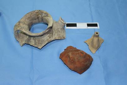
Fig. 16.
In the course of excavations on a platform some observations have been made. A massiv block of pakhsa inside a platform was found which is much bigger than another blocks situated in northern, eastern and southern parts of a platform. Its dome-shaped configuration reminds on specific Buddhist constructions, known as stupa. However, on materials from Old Termez (Karatepa, Fajaztepa, Zurmala) is known that stupa, for example, of Kushan period, were constructed from mud bricks. Besides, any architectural remains which could be connected with the Buddhism, are not found on territory of Shash till now. Thus, further careful archaeological investigations are necessary for understanding of functions of so-called platform.
Excavations 7 (R-7).
Works on R-7 are conducted since 2014 when on a line of northern defensive wall of settlement the rests of oval shaped are necessary tower № 1, the western (internal) facade of a tower № 2 (to the east from a tower № 1) and an internal facade of a defensive wall between them have been opened (fig. 17).
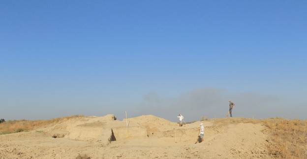
Fig. 17. R-7, view from southwest.
The primary goal of works on R-7 in 2015 was finding-out of gate construction, architectural features of fortification and chronology of northern part of fortification of Qarshovultepa (fig. 18).
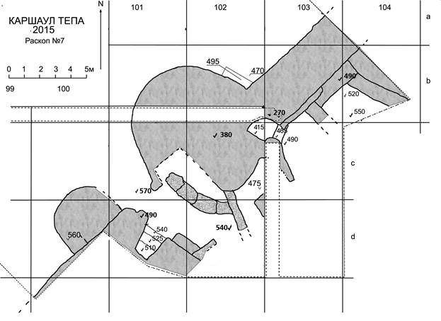
Fig. 18. R-7.
In northern part of R-7 within squares a99-103, b99-103 and c99-101 on a hill slope to the north and the northwest from a tower № 1 and an external facade of a defensive wall, the ground has been removed completely to level a minus of 4,70 m in east part and a minus of 5,70 m in western parts of excavation area (all depth marks on R-7 are given from the highest point of settlement). Thus, all external facade of a tower № 1 and 8 metre long part of external facade of a defensive wall was completely open. The removed ground was homogeneous in structure. Uppermost cespitose layer was about 15 cm thick. Then, direct at walls, were large fragments of fallen pakhsa. To the northwest from constructions, the friable ground of dust deposits and washouts from walls was observed. Any architectural remains or traces of economic activities were found here. The external facade of a defensive wall is opened on 8 metres to the northeast from a corner where the wall joined with a tower № 1. In seven metres from this corner, i.e. in that place where the tower № 2 should be designated, was only a vertical seam and wall protrude to 5 cm. It means that for some reasons tower № 2 was directed inside the settlement only. A thickness of a defensive wall between towers of 3,20 m in a northwest part and 3,60 m in the southeast. In a corner between a tower № 1 and wall the trench 1 х 2 m, extended along a tower facade has been excavated, to the level below minus 4,70 m. Here under a layer formed by collapsing parts of walls, on depth of 4,95 m, well stamped floor adjoining facades of a defensive wall and a tower is fixed (the same floor in a gateway lay on depth minus 5,70 m). Below a floor in this trench excavation reached a depth of minus 6 m. Below a floor the layer of fallen pakhsa of average density was found. Under the floor facades of walls stepping inside about 15-20 cm, it means that below a floor of level (minus 4,95-5,70 m) we have, most likely, earlier building stage of fortification.
To the southeast from a defensive wall the works between towers № 1 and № 2 have been continued. Excavation has been begun from a minus 4,70 m level on a site in width of 3 m from a corner of a defensive wall and a tower № 2 and from level of a modern surface in squares c and d 103. On depth of minus 4,90 m, along interior facades of a defensive wall and a tower № 2 the pakhsa benches (sufa) in the width 90 cm and in height 30 cm have been opened. The well stamped floor level lay on the depth minus 5,20 m near sufa adjoining a wall, and minus 5,50 m near southeastern section. Over a floor there was very thin layer with lenses of greenish soil and pieces of coal. Above this layer there was a layer of destructed pakhsa of average density. This space is closed from southwest by 80 cm thick pakhsa wall which adjoining perpendicularly to a fortification in 3,25 m from a tower № 2. This wall is strongly destroyed, in a place of an adjunction to a fortification its height is 1,05 m from a floor fixed on depth a minus 5,20 m, and in 2 metres to the southeast it comes to naught and merges with a floor going down here. To the west from the described wall, in corner space between a defensive wall and a tower № 1 floor even more inclined, than to the east. It falls from a mark minus 4,90 m at a defensive wall to a mark minus 5,50 m in 2 metres to the south from it. To the south of squares c103 and d103 excavation was not spent. Over a floor in a square c103 was a dense layer with large fragments of fallen pakhsa blocks. In a square d103 under a cespitose layer to level the minus 5,50 m friable alluvial layer was taken out. In a defensive wall, on a joint with a tower № 1 bow-shaped pass with the steps conducting on the top of a tower has been cleared away. Width of pass of 80 cm on a facade of a wall and 1,20 m at the top step. The first step begins with floor level before a wall on depth minus 4,90 m. Its surface at level minus 4,65 m, width is 60 cm. The surface of the second step is on level minus 4,15 m. It is bow-shaped, length of its arch in the south about 60 cm, and in the north about 2 m. The third step is on the level minus 3,80 m. To the south from the pass the wall 2,5 m in length is directed to south-southeast. It was not possible to establish the thickness of this pakhsa wall, as its northern part is under section, and to the south the southwest facade of a wall is destroyed. Height of a wall is 1,60 m from a floor to a cespitose layer.
Excavation on a tower № 1 has shown that at different height its structure is not identical. On all area of a square с102 (except for territory of bow-shaped pass) and eastern part of a square с101 from depth of minus 3,80 m to depth of minus 4,50 m only dense pakhsa was fixed. From the south the edge of upper pakhsa layer has been formed by the large pakhsa blocks lying densely adjoining to each other. Top parts of these blocks are inclined more than on 20 degrees in direction of tower's inside. These blocks lay on a layer of ashy soil on depth of minus 5,20 m. On border between squares с101 and в101 in 1,5 m to the west from border of columns 101 and 102 line of edge of a tower turns on the southeast and in 1,20 m from a corner leaves on a ledge on a southwest (external) part of facade of the tower opened in last season. The southern facade of a tower in 50 cm to the north from the border between squares с102 and d102 turns on the northwest. It is traced on a distance of 1,5 m yet. The width of a chain of inclined blocks has appeared no more than 1,2 m. Space between them and a prospective line of earlier facade of a tower has been filled by a friable soil.
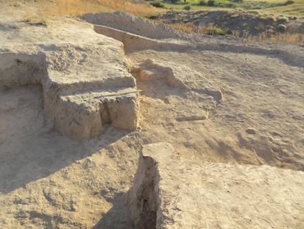
Fig. 19. R-7. Gateway, view from northeast
In a square d101, in 1,70 m from a ledge on a tower № 1 facade, the end face of a defensive wall continuing a line of a defensive wall in a square b103 has been opened (fig. 19). A thickness of a protruding part of a wall on an end face is 1,60 m, further to the southwest it became thicker up to 2,20 m. Opposite to the ledge of a facade of a tower № 1 the vertical groove in width 30 and depth of 20 cm is situated. It means that between this wall and a tower № 1 wooden gate could be placed in the ancient time (fig. 11). So, width of northern entrance in the ancient town which is known us today as Qarshovultepa archaeological site, was about 1,70 m.
In the gateway on depth of minus 5,70 m densely stamped surface has been cleared away which is smoothly rising to the southeast. In a square d102 this surface (floor) is at level of 5,40 m. On this floor was 5-10 cm thick layer of organic soil and thin clay layers originated by flowing water. Layers of a friable soil lay above it. From the southeast is a trapezoid in the plan premise adjoined to the defensive wall (fig. 20). Its width is 2 m on the entrance, and 1,20 m in depth (on a southwest wall), it is limited by walls only from three sides. The length of a premise is 2 m. The floor of this premise tends to increase in the western direction. Apparently, the space was opened on the one side and could be roofed by a kind of canopy. It was, seemingly, used for resting of gatekeepers. To the southeast from a premise the surface of pakhsa wall has been opened throughout 1,75 m. Sufa in the width of 70 cm and of height 35 cm adjoined this wall. The wall originally proceeded further, but at some period, from level of minus 5,10 m, thin wall was attached to it almost perpendicularly. This wall is 40 cm (i.e. one mud brick) thick and of 1,60 m in length. It partly locked the space near gateway.
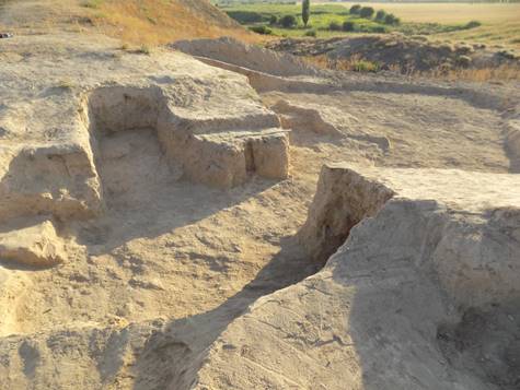
Fig. 20. Northern gateway of Qarshovultepa, view from northeast
The Northwest facade of a southwestern part of defensive wall has been opened throughout 8 m to the southwest from a gateway. The wall is strongly destroyed as a result of the long period of desolation. It is necessary to find out at what level is a foundation of this wall because this year we not excavated below a floor which is at level of minus 5,70 m. In 50 cm to the southwest from an end face of a described wall the rests of strongly destroyed construction (height of the rests no more than 25 cm), similar to the monolithic tower adjoining a wall have been opened. Width of construction of 4,20 m, its northwestern facade is bow-shaped with the greatest removal from a defensive wall in 3,20 m. It was, possibly, a kind of the second, much smaller tower defending the gate.
As a result of excavation of 2015 on R-7 we can say that it is confirmed that here was entrance to the settlement. Also, we found out that the tower № 1 had, at least, three stages of building:
| 1) | Building of initial (internal) walls below level of 4,95 m. | |
| 2) | Building of walls limiting entrance space from the south and the east from level of 5,10 m and, probably, during the same time the external perimetre of a tower above level of 4,95-5,70 m has been built. | |
| 3) | Time of overlapping of all new space of a tower by powerful pakhsa layer. Dating of gate constructions is extremely inconvenient because of scarcity of finds during excavations on R-7. But, judging by those not numerous fragments of ceramic ware which we have received here, time of using this territory – not earlier than 4th and not later than 8th century AD. |
Excavation 5 (R-5) - Necropolis
In 2015 excavations have been continued on a burial ground of Qarshovul 2 on remains of the hill in 200 m to the northeast from Qarshovultepa settlement.
New excavation area (5 х 6 m) has been put in a southern part of the hill, extended across the part of a hill cut off by the bulldozer in the northwest - southeast direction. The surface on this place had traces of passage of the bulldozer, but to find out, on what depth the ground in this place has been removed was not possible. On all area of excavation to depth of 1,1 m from a modern surface the friable sandy ground was observed in which any traces of sepulchral holes were found. From depth of 1,1 m on all area is light, dense enough loess ground in which, along a southwest edge of excavation, outlines of two sepulchral holes were seen. In total three burials has been opened within described territory.
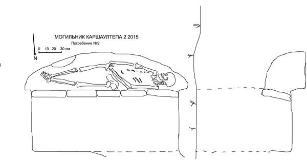
Fig. 21. Burial № 9, plan and section
Burial № 9. A funeral construction is in the form of so called podboy burial, i.e. a rectangular entrance pit and vault. It has been found in a southern corner of excavation area (figs. 21 & 22). The entrance pit was well traced on the upright, vertical walls separating dense natural soil (loess) of a hill from friable filling. It strictly squared, is 1,9 х 0,8 m and extended in the east - west direction. A flat floor of a pit is on depth of 1,5 m from a modern surface. Walls are remained on height 40 cm only. Western half of northern wall of a pit has not remained, as it was destroyed during of process of another burial (№ 11).
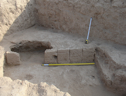
Fig. 22. Burial № 9, view from the north
Along a southern wall of entrance pit there were seven mud bricks in the size 35? х 25 х 9 cm which were in vertical position. Length of bricks cannot be defined precisely as they could be slightly cut during ours clearing of surfaces separating the top loose coating from the bottom dense loess. These bricks were used to close the vault which was excavated in the south wall of entrance pit. The vault-podboy is like a segment in the plan: northern side is straight and southern side is bow-shaped. Its maximum width is 0,5 m, length is 2,10 m, height of vault is 0,5 m. Floor of vault is 20 cm below a floor of entrance pit. On a floor, slightly touching with the left shoulder and the left part of a pelvis northern wall of a vault (seemingly, it could be connected with narrowness of a vault), the skeleton of the adult person lay in the extended position on a back, directed by a head on the west. The skull has been turned to the south. Bones of the right foot lay upon bones of the left. The left hand is slightly bent in an elbow, bones of the left hand lay on the right part of pelvic bone. Bones of the right hand were upon them. Without having the professional anthropologist on excavation, it is possible, with the big share of probability, to tell that the skeleton belonged to the 35-40 years old woman. Any burial goods were found here. In eastern part of podboy, at a southern wall, a depression has been found which led to a catacomb of neighboring burial
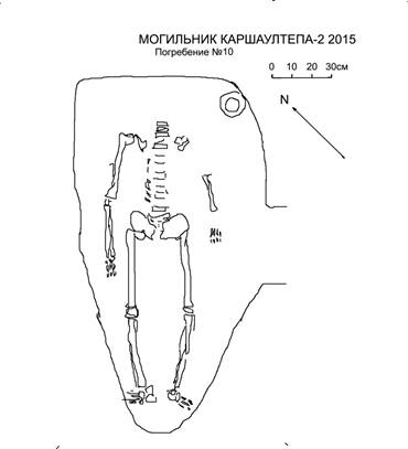
Fig. 23. Burial № 10.
Burial № 10. It is catacomb burial construction; only catacomb was excavated because dromos and the entrance pit, settling down to the southeast direction, are destroyed in course of bulldozing of the hill (figs. 23 & 24). The catacomb is in rather triangular shape, and is extended in the direction of northeast - southwest. The northeastern wall is straight, its length is 80 cm, to the southwest the chamber is narrowed to 30 cm and is roundish. Length of a catacomb of 1,80 m, a floor is on depth of 2,70 m from a modern surface.
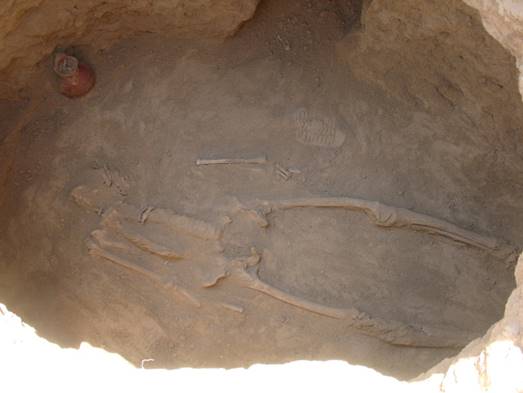
Fig. 24. Burial № 10, view from the west
The ceiling in many places has fallen off, but its height was not less than 1 m. The entrance (part of dromos) is 40 cm width and 50 cm height 50, it found out in a southeastern wall of a catacomb.
On a chamber floor the skeleton lying in extended position on a back has been cleared away. A skull and bones of the left shoulder were absent (it could be results of ancient robbery). Judging by an arrangement of other bones, the skeleton has been oriented by a head to the northeast. On the left side from that place where skull should be, near to a wall, there was a small jug with the loop like handle, covered with red slip. Besides, under a skeleton one bead made from glass paste has been found.
Burial № 11. It is another catacomb burial (fig. 25). The entrance pit settled down to the northwest from entrance pit of burial № 9. It is rectangular, 75 cm width; it was not possible to define the length, since its southern part has been dug in a friable fill of entrance pit of burial № 9 and its southern borders have not remained. Nevertheless, it is obviously that the length of entrance pit of burial № 11 was not less than 1,7 m. It is extended in the direction northwest - southeast. Judging by a relative positioning of floors of two entrance pits, the catacomb of burial № 11 has been dug later. Diggers of this tomb have stopped in a southern part of entrance pit at the level of a floor of entrance pit of burial № 9, and gradually lowered level to the northwestern direction, from 1,5 to 1,9 m at a northwest wall. In a northwestern wall of entrance pit a dromos leading in a catacomb has been dug (fig. 26). Its width is 55 cm, height is 40 cm and length is 45cm.
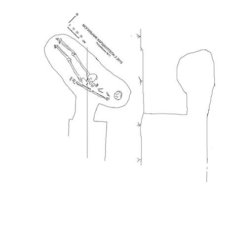
Fig. 25. Burial № 11
Catacomb is extended oval form in the plan, located almost straightly on a line east – west, at an angle to an entrance pit. Length of a catacomb on a floor is 2 m, width is 80 cm, height of the vault not less than 60 cm, a floor is at level of 2 m from a modern surface. The skeleton of the adult person in the extended position on a back lay on a floor. A pelvic and leg bones are almost on a line east – west, and bones of trunk and a skull are slightly pushed to the north. Probably, it is connected with a robbery as bones of a skull and the right part of a trunk are strongly disturbed, and bones of the right hand were absent. Any burial goods were found.
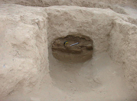
Fig. 26. Burial № 11, view from southeast
Dating questions
Stratigrphically earliest of three is burial № 10. The jug found in it has analogies among ceramics of Chach region of the middle of first millenium AD. In burials № 9 and № 11 we found any material, but the sizes of bricks in burial № 9, probably, are close to early medieval standards (i.e. 50-52 x 25-26 x 9-10 cm). As both these burials are of same type, we can date them to the same period and synchronise them to last periods of living on Qarshovultepa settlement.
Bibliography
Shagalov, Kuznetsov 2006 – Shagalov V.D., Kuznetsov A.V. Catalogue of coins of Chach. III-VIII AD. Tashkent, 2006.
Society for the Exploration of EurAsia
Archaeological
investigations
at the site of
Qarshovultepa
(Tashkent Province,
Uzbekistan)
(download here)
in 2016
K.A. Sheyko
Dr. G.P. Ivanov
Dr. J.Ya. Ilyasov
Tashkent 2016
The site of the ancient settlement of Qarshovultepa is located in the neighborhood of the settlement Dustlik, in the Chinaz area of the Tashkent Province (fig. 1). Its stationary archeological excavations are carried out by the group of International Caravanserai of Culture, Ikuo Hirayama, Tashkent, since 2008, since 2010 with financial support from the Society for the Exploration of EurAsia, Switzerland.
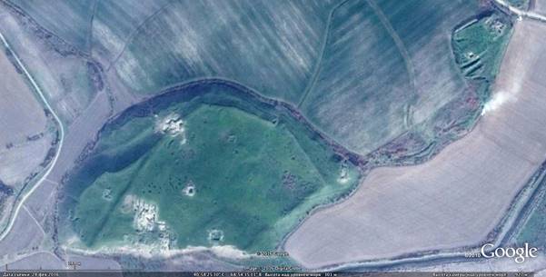
Fig. 1. Qarshovultepa and Qarshovul 2 (Necropolis). Google Earth
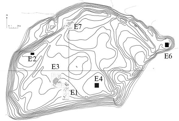
Fig. 2. Qarshovultepa, general plan
In 2016 the excavations on Qarshovultepa were conducted during 30 days from May to the beginning of June, and also again for 20 days in an additional campaign in July-August. Works have been concentrated on a so-called platform with an adjoining extensive area (Excavation 3) and on the complex of the northern gate (Excavation 7) (figs. 1, 2). On Excavation 3, seven premises which are located to the north and the west from the platform have been opened. The description begins with Excavation 7.
Works
on a complex of northern gate (E-7)
In 2014 the excavation of the gates and adjoining fortifications begun.
The primary
goal of works
on Excavation 7 is studying the city fortification and its chronology. Here, on a line of the northern
defensive wall, the rests of an oval
shaped tower № 1, a part of a facade of tower № 2 (to the east
from tower № 1), facing inside the ancient settlement, an external facade
of a tower № 3 and a place of the city gate in width of 1,8
m and located between towers
№ 1 and № 3 (figs. 3, 4) have been opened. During the season of 2016 the
excavated area has reached 200 sq.m. (Squares a-e, 100-104).
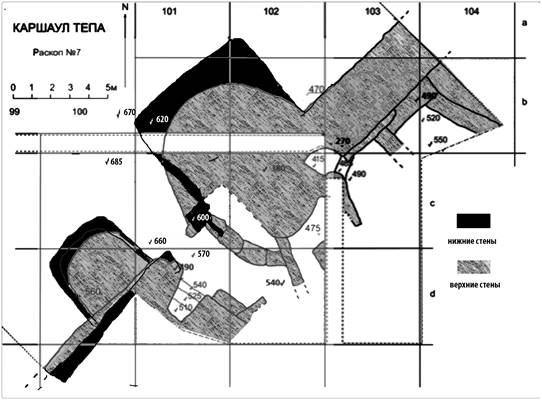
Fig. 3. Excavation 7 (Northern gate)
In the northern part of Excavation 7 the soil has been removed completely on a hill slope to the north and the
northwest from tower № 1 and an external facade of a defensive wall up to the level
of 6,70 m in the eastern part and up to the 6,90
m in western part (all deep marks on Excavation 7 are given from a zero reference point, which is the settlement’s
highest point). Thus, all external facades of the two towers and 8
meter of an external facade of a defense wall were completely opened.
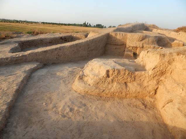
Fig. 4. Excavation 7, view
from the west after completing of works of the year 2016
The removed soil was of a homogeneous structure. From above it is 15 cm of cespitose layer, while deeper, direct near the walls, there were large fragments of fallen pakhsa (beaten clay). On another area, to the northwest of the constructions, a friable soil was observed which is formed as a result of flowing water and dust deposits. There are no architectural remains or traces of economic activities on the given area, except for a level with traces of humus on the depth of 6,70-6,90 m. The external facade of a defense wall was opened on 8 meters to the northeast from a corner formed with a tower № 1. The thickness of a defense wall between towers № 1 and № 2 is 3,20 m in a north-eastern part and 3,60 m in south-western.
In spite of the fact that on Excavation 7 we have not reached the natural soil (or sub-soil) yet and we cannot judge on an initial lay-out of this part of settlement, it was possible to identify three constructions at the gate. At an early stage tower № 1 and tower № 3 were of a square shape with rounded corners, beginning from the level of 6,20 m. The size of tower № 1 by the bottom part is 6,05 m х 5,25 m. It is built from dense pakhsa. The preservation of the walls of a tower is not the same in different parts. Northern and western corners of tower were opened from a depth of -6,20 m to a depth of -6,60 m; we didn’t excavate deeper in this season. The upper part of the tower walls are destroyed, or blocked up by the walls of the upper tower (fig. 5).
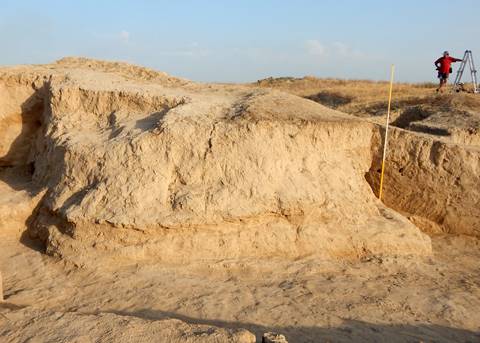
Fig. 5. Excavation 7, north-western
facade of tower № 1
Another picture could be seen on the southern part, where the tower is joining to the northern defensive wall of the settlement. The wall of the upper part of the tower overhangs the wall of the older tower parts (fig. 6), because the tower configuration was slightly different at the different stages. The wall of former tower № 1 is 1,30 m high in a joining place with a defensive wall. It is traced from depth -5,00 m to -6,30 m.
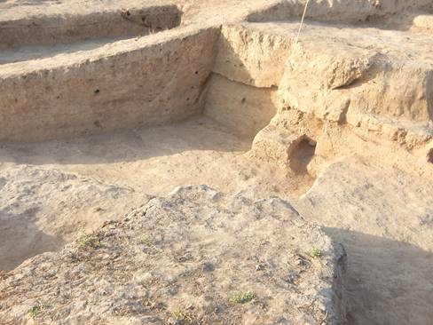
Fig. 6. Excavation 7, view
on south-western part of tower № 1
Layers to the west and the southwest from the tower lay down inclining. Under a modern surface, the dense cespitose layer about 20 cm in the thickness was opened, under it there was a layer of a friable blockage in the thickness no more than 5 cm over a wall of a tower and more than 40 cm thick in the western part. The top surface of the upper wall of the tower was found in the depth of minus 3,90 m from a zero reference point. The bottom of this wall was in the depth of -5,00 m. Directly at the bottom of the upper wall the layer of dense clay in width about 40 cm was adjoined, traced from depth -5,00 m to -6,00 m. Between it and a facade of the older tower there is a floor which gradually goes down from a mark minus 6,00 m to level -6,40 m. It is a continuation of the floor which has been opened in 2015 at the gate at the level of 5,70 m. Under the floor and a layer of dense clay there was the blockage of average density which had a thickness of 40 cm near the western facade of the bottom wall of the tower, and it gradually falls to zero in the distance of 5 metres to the west from it. There is a floor about 10 cm thick under this layer, between them there is a burnt layer with pieces of coal and ashes which is settled down at level -6,50-6,60 m. The sole of the bottom wall of the tower is at level -6,30 m. Under it there is a small layer of ash. As under the bottom floor we have not reached a sub-soil, it is possible that we will find earlier tower constructions still deeper.
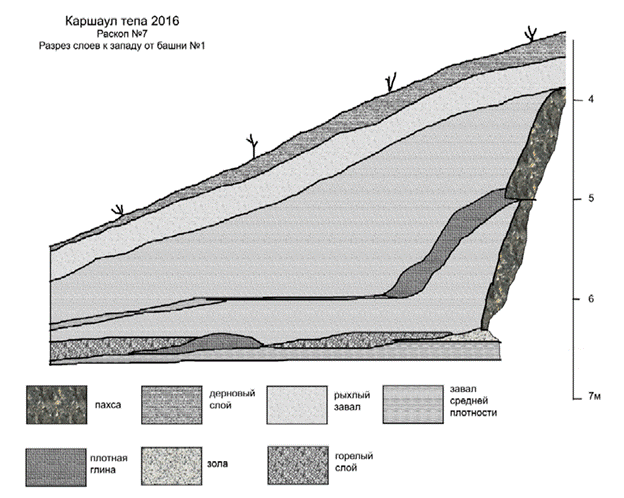
Fig. 7. Excavation 7, stratigraphy near tower № 1:
1 – pakhsa; 2 – cespitose
layer; 3 – friable
blockage; 4 – blockage of medial density;
5 – dense clay; 6 – ashes; 7 – burned layer
To the west of the gate the part of defense wall was dug out during the 2015 season. The wall is strongly destroyed as a result of the long period of desolation. It was necessary to find out at what level there is a bottom of this wall, because last year we didn’t excavate deeper than the floor level which is laying on the depth -5,70. In 50 cm to the southwest from the gate rests of a strongly destroyed tower № 3 (with the height no more than 25 cm) have been found. Width of construction is 4,20 m. Tower № 3 was semi-circular in shape, with dimensions 4,20 m from northeast to southwest and 3,20 m from northwest to southeast.
In 2016 the given territory was dug out to a mark -6,70 m. As a result it was possible to outline the shape of early tower № 3 (figs. 8, 9).
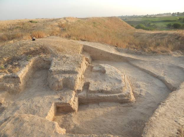
Fig. 8. Excavation 7, defence
wall, gate and tower № 3, view from the northeast
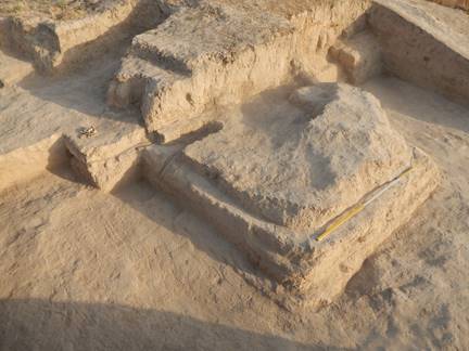
Fig. 9. Excavation 7,
tower № 3, view from the north
Tower № 3 has a square shape with rounded corners, like tower № 1. It is smaller than tower № 1, its sizes are 4,30 х 4,00 m (fig. 9). At the joining points with the defense wall the height of the tower wall is up to 1 m. Distance between towers № 1 and № 3 is 3,60 m along the defense wall and it increases up to 4,00 m in the northwestern direction.
Between towers № 1 and № 3, on a place of the gate which was found in 2015 (fig. 10), excavations were from level of 5,70 m to level of 6,65 m. It is revealed that during previous phase of existence of the entrance complex the gate was located slightly to the eastern direction (fig. 11).
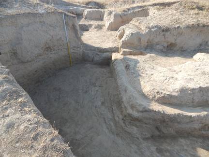
Fig. 10. Excavation 7, place
of the gate (upper level), defence wall and part of tower № 3, view from
northwest
The walls which formed the gate of the second (deeper) level are not identical. Both of them are built from pakhsa, but the eastern wall is put a little forward to the north and its thickness is 0,95 m, the western wall is 1,05 m thick. Width of gate was 1,80 m. We didn’t excavate here deeper than -6,65 m.
Dating of the gate complexes is hard because of a scarcity of finds. But, judging by those fragments of ceramics which we have found here, it should be not earlier than 4th and not later than 8th centuries AD.
Further features of the gates and fortifications as well as the questions and matters of relative and absolute chronology will be settled during the forthcoming excavation works.

Fig. 11. Excavation 7, place of the gate (second level)
Works on Excavation 3
The main works in 2016 were concentrated on opening premises to the north and the west of the platform, as well as inside the platform. According to our system, all area of a site of ancient settlement is divided into a network of 5×5 m squares. Works have been concentrated to the west from so-called "platform", in squares 92 СС, 91-92-93 DD, 91 92-93 EE, 91-92-93 FF, 92-93-94 GG, 92-93-94 HH. The area of opened territory on the west side is of 400 square meters. In the northern part, in squares 95-96-97 HH, 95-96-97 GG, 95-96-97 FF, the area of excavation is equal to 225 square meters. Thus, the total area of a dug out site has made more than 600 square meters (fig. 12).
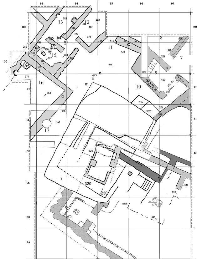
Fig. 12. Plan of
Excavation 3
To the north of the platform several premises which belong to one complex have been dug out. All these structures are of the latest constructional horizon. Works in these premises consisted in the establishment of time of their functioning and studying of their stratigraphy. Walls of all premises are built from rectangular mud-bricks in the size 39-41 х 23-24 х 6-7 cm.
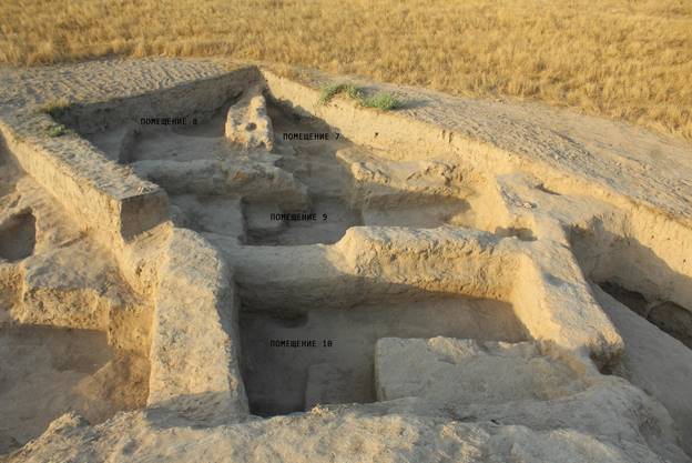
Fig. 13. View from the
platform to the north-eastern part of Excavation 3
Within Excavation 3 in 2015, the western part of a room 7, a southern part of a room 8, and also rooms 9 and 10 had been opened. In 2016 the excavated area did not extend in a northeast direction, therefore rooms 7 and 8 are not dug out completely yet. The room 7 is with square GG97 and, partially, НН97, it is limited by walls from the northwest and the southwest, in each of which there is a passage (figs. 12, 13). The northwestern wall is traced for 4,25 m, its thickness is 1,10 m. The length of the southwestern wall is more than 3 m, the thickness of 0,75 m, it is the wall between rooms 7 and 9. The passage to room 8 is about 1,20 m wide. The passage to room 9 is in the southwestern wall and has a width of about 1,50 m.
In room 8, the southeastern wall,
which is common with a room 7, and also the southwestern wall have remained on a height of 0,15-0,25
m only. The southwestern wall is traced on 7
m to the north from the passage to room 7 till the end of the excavations area. It is common with room 9, its
thickness is from 0,8 m to 1 m. On the floor near this wall a coin was found (table
I, 1). Obverse of this coin is strongly erased, but, judging by the lyra-shaped tamgha on the reverse, it can be
put to a variant 1 of
type 1 of group 7 (according to V.D. Shagalov's and A.V. Kuznetsov's classification). In their
opinion, such coins belonged to small group of mint of rulers of Chach. They
dated them back to the second quarter – the middle of 8th century [Shagalov, Kuznetsov 2006, pp. 269-272]. Another
coin was found in the centre of a room and belongs to
the mint of ruler Tarnavch. On the obverse a predator
is depicted, which goes to the right with his tail lifted, on the reverse is fork-shaped tamgha in
the centre with Sogdian legend around is represented (table I,
2). Coin group 6 to which various types of coins with fork-shaped tamgha belonging,
dated back from the second half of the 7th till the beginning of the second half of the
8th century CE. [Shagalov, Kuznetsov 2006, pp. 199, 235-239].
In
room 8 the fragment of a dastarkhan (round ceramic table) and a fragment from a clay
object with a zoomorphic image were found. In the Central Asian archaeology it
is accepted to call similar objects as shish-kebab supports.
The room 9 is to the southwest of rooms 7 and 8. Its sizes are 7,25 х 3,45 m. The northwestern wall has a length of 3,50 m; to it a stairway from raw brick conducted to the second floor or to a roof to the extent of 2,90 m. The height of the stairway is 0,90 m, the width 0,75 m, it consists from 4 steps in width of 25 cm. The southwestern wall has a length of about 5 m, in the western corner of the room it joined to a stairway. The south-eastern wall has a length of 3,45 m. The north-eastern wall is divided by the passage in a width of 1,50 m, which leads to room 8. Its total length makes 7,45 m. On the last floor of room 9, a hearth functioned near the northern wall. At cleaning of the northern corner of the room some fragments of a vessel with engobe polishing were found, possibly, belonging to a mug. During works the second floor which is fixed on a mark -4,59 m was found. On this floor 3 coins were found, two of which belong to variant 1-2 of type 7 of group 6. On the obverse the image of a predatory animal – a lion or a leopard, – going to the left with the lifted right paw is depicted, around him is a dotted frame. On the reverse a fork-shaped tamgha is represented; on one of the coins over tamgha a cross is placed (table I, 3, 4). Group 6, as we have mentioned above, dated back to the second half of the 7th till the beginning of the second half of the 8th century [Shagalov, Kuznetsov 2006, pp. 199, 231-234]. The third coin has on obverse the image of the ruler with his spouse, tamgha, on the reverse reminds the stylised image of antlers (table I, 5); it belongs to a variant 1 of type 1 of group 5; the given group suggest to date to the second half of the 7th – the beginning of the 8th century [Shagalov, Kuznetsov 2006, pp. 187-192].
Room 10 was attached to the north-eastern platform, like Room No. 6. The size of the room is 9,40 x 3,46 m. Its peculiarity is a monumental sufa, added to the platform build of pakhsa. Its length – 2,45 m, width – 1,83 m, height – 0,60–0,65 m. The walls are made of mud-bricks, with the brick-size being 50 x 25 x 10–11 cm. The given room could play a role of couloir, flanking the room 11. The similar picture is observed also on the west side of the platform with room 17 (corridor). The southwestern wall of room 10 is the platform side. The southeastern wall has a length of 3,46 m. Special feature of the given room is a monumental bench (sufa), attached to a pahksa platform. Its length of 2,45 m, width of 1,83 m, height of 0,60-0,65 m. Near the sufa, on the western side, a bronze coin was found on the floor (table I, 6). On the obverse an animal (a leopard?) is represented, going to the right. On the reverse a fork-shaped tamgha is placed. According to Shagalov/Kuznetsov it belongs to variant 3 of type 8 of group 6 [Shagalov, Kuznetsov 2006, pp. 240-241].
Room 11 is probably an iwan, because it has no wall on the south-western side. The north-western wall is 4,60 m long; the north-eastern wall is 5,40 m; south-eastern wall is 3,50 m long. Along the north-eastern wall there is a sufa 1 m wide and 4,15 m long. Sufa does not reach the north-western wall. In the centre of the sufa there is a round-shaped fire place 30-35 cm in diameter. Room's filling consisted of friable soil in which there were fragments of mud-bricks from the failed walls. The northwestern wall was very badly preserved because it was partly destroyed by the graves dug here later, when the site was abandoned. A coin withruler's portrait en face on obverse was found in this layer. On obverse a tamghain the form of a square with sprouts growing up from its corners is placed, with Sogdian legend around (table I, 7). According to classification of Shagalov/Kuznetsov it is possible to put this coin to a variant 7 of type 4 of group 4. These researchers dating back this group to the period from the second quarter – the middle of the 7th century to the first quarter of the 8th century [Shagalov, Kuznetsov 2006, pp. 142, 183-184]. The function of room 11 is not clear yet. Here, near the hearth on the sufa, a coin with ruler's portrait was found, to the left of his face the swastika (table I, 8). E.V. Rtveladze considers that these coins were minted by the ruler known from the Chinese sources as Mohedu tutun (700-740 AD). Unlike it, А.В. Kuznetsov reads the name of the governor as "Nirtnk (Zirtnk) the ruler of Chach". According to Shagalov/Kuznetsov this coin belongs to variants 1-2 of type 2 of group 6 [Shagalov, Kuznetsov 2006, pp. 205-208]. The third coin has images of the ruler and his wife on the obverse (table I, 9), it can be put to a variant 1 of type 1 of group 5, as well as a coin № 5 from a room 9 [Shagalov, Kuznetsov 2006, pp. 189-192]. Out of ceramic material from this room we will note some fragments of walls of vessels, most likely, from jugs, on which are flows of red engobe, as well as fragment of the handle from a large vessel.
Room 12 has been partially
excavated. It is located to the north-west of Room 11. It is 3,50
m wide. The north-western wall has been traced for 4,70
m, till the northern edge of excavation area. There is a doorway in the
southern corner. Its width is 1,05 m. The south-western wall is 2,50
m long, there
is a doorway in it which is 1,05 m width. This doorway connects room 12 with
room 14. The south-eastern wall is traced for the length of 3,50
m and just as the north-western wall goes till the edge of excavation. Room walls bear traces of destruction
by late tombs which were dug out here,
as well as in the room 11. Fragments of the big ceramic jar (khum) with the tamgha (individual or clan property mark) which was incised before burning were
discovered in the room. On the chronologically latest floor a coin was found with a Sogdian
legend on the obverse and an fork-shaped tamgha on the reverse (table I, 10). According to
Shagalov/Kuznetsov it belongs to the first or second variant of type 14 of
group 6 [Shagalov, Kuznetsov 2006, pp. 261-266]. The second coin from this
premise has been found in a layer of a blockage above a floor. On the obverse there is a double
portrait of ruler with the spouse, on the reverse a tamgha in the shape of antlers with Sogdian inscription around (table I, 11).
Room
13 is located to the north-west from room 12. Elongated in the direction of
southwest – northeast it has been only partially excavated. The south-eastern
wall has been identified for 6 m. The width of the room is 2,80
m. Same as in room 11, there is no southwestern wall there. It joins to a kind
of communicating room (room 14) which connects this room with rooms 12 and 15.
In room 13 there has also been found the iron bottom part of a spear, fragments
of big ceramic jars (khum), a modelled fire-resistant clay pot with two
holders in the shape of roundish ledges. Near the communicating room's wall, at the side of room 13, a
thin-walled ceramic mug was discovered with polished surface and the incised
decoration in the shape of a cross inside a diamond (fig. 14).
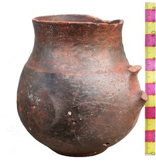
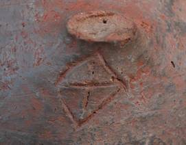
Fig. 14. Ceramic mug with tamgha from room 14
On the floor of room 14, near the passage to room 15, a coin was found which is in bad condition. On the obverse the ruler's image could hardly be traced, on the reverse a lyre-shaped tamgha is represented. Nearby one more such coin was found (table I, 12, 13). A third coin was found near the western wall, on the floor. On the obverse is an animal going to the left, on the reverse a fork-shaped tamgha is represented (table I, 14).
Room 15 has two passages into the communicating room 14 and is located to the south-west from it. The north-western passage is 1 m wide; the second passage is 1,30 m wide. The room is 5,20 x 3,50 m. Along the south-western and partially, the north-western and south-eastern walls there is a sufa between 0,90 and 1 m wide. The height of the sufa at the north-western wall is 37-39 cm, at other walls, it is 23-25 cm. Closer to the western corner of the room there was a fireplace that rested upon the brick base. Another fireplace made in a style of the wall-mounted one was at the wall that separated the room 15 from the communicating room. The traces of a strong fire have been spotted here: on the upper floor level found burnt wooden roof beams were found and the room walls were red from fire. The filling of room 15 consisted of a friable ground of light brown colour which lay once under a cespitose layer. Its thickness is from 35 cm to 50 cm. In the western part of the room this layer reaches a thickness of 70 cm. Deeper is a layer of a blockage from pieces of mud-bricks from falling walls which in turn lies on a burnt layer formed as a result of a fire. The fire layer is fixed on a mark -3,70 m under a zero reference point.
Near the wall-mounted hearth 2 coins were found. The first coin is of the type with a pair portrait. On the obverse is a circle of points surrounding the ruler's and his wife's portrait. On the reverse is a tamgha in a kind of "antlers", with Sogdian legend around it (table I, 15). The second coin is found closer to the passage to room 14. On the obverse a predator is going to the left, and on the reverse the fork-shaped tamgha is represented (table I, 16). In the centre of room 15 one more coin was found on the floor (table I, 17), on the obverse a predator going to the left; it is interesting that on the reverse we have a cross instead of the traditional fork-shaped tamgha (fig. 15). Two other coins were found near the south-eastern wall over a fire layer. They are bad preserved; on one of them, possibly, a predator and fork-shaped tamgha are represented (table I, 18, 19).
In room 15 also the fragments of khums and a modelled intact mug were discovered , the mug with relief decor, polished red engobe and tamgha, scratched under the handle before burning of mug (fig. 16, 1, 2). All ware bears traces of fire in the form of burnt stains and soot.
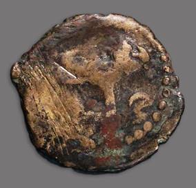
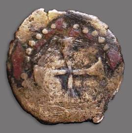
Fig. 15. Coin with cross from room 15
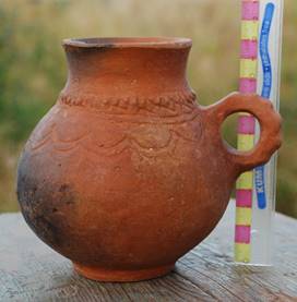
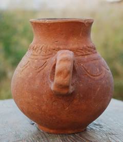
Fig. 16. Mug with tamgha,
room 15
Room 16 is to the southwest of room 15 and is isolated from rooms 15 and 17. It is dug out partially, the sizes of the opened part are 10,45 x 7,50 m. Judging by the size, it may have been a courtyard. As well as all other premises, it is oriented by its corners to the cardinal points. The thickness of the south-eastern wall is 1,5 m, height of the remained laying is 0,45 m. The thickness of the north-eastern wall is 0,70-0,75 m, height is 1,3 m in the western part and 0,45 m in the east.
The stratigraphy of room 16 is as follows:
1. A cespitose layer – the rests of the root system of plants. Thickness is 1-3 cm.
2. An inflatable layer – a friable soil (loam) of light brown colour. Thickness of a layer is 40-100 cm; it increases from north to south.
3. The light-greenish friable ground, its thickness is 25 cm.
4. A blockage – a light brown friable ground with fragments of bricks.
5. A floor – a dense ground of light brown colour (clay-coat) with fragments of pieces of coal. Thickness is 5-10 cm.
On the first floor in room 16 a coin with the image of the ruler with his wife was found, it is similar to a coin from room 12 (table I, 11, 20). Below level of the first floor, ceramic vessels of the spherical form, with four loops like handles, with red engobe and with relief decor and polishing were found (fig. 17). Apart from this ware, fragments were found in a considerable quantity from various table and kitchen ware.
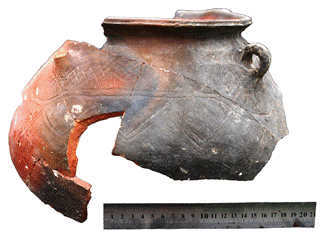
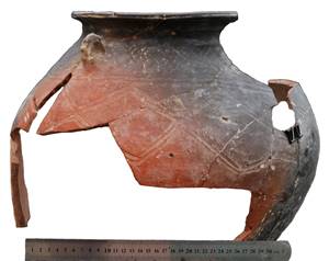
Fig. 17. Pots from room 16
To the south-east of the room 16 there there is a corridor that divides it from the platform and has been named room 17. So the area between rooms 10, 11, 12, 15, 16 and 17 could have been used as an inner yard which included the iwan (that is, room 11). The width of the corridor in the southern part – 2,75 m, in northern – 3,05 m. In the corridor, on distance about 6 m from the external corner formed by the north-eastern and south-eastern walls of room 16, there was a pit. This pit partially cuts the corridor wall. Its size is 1,25×1,3 м.
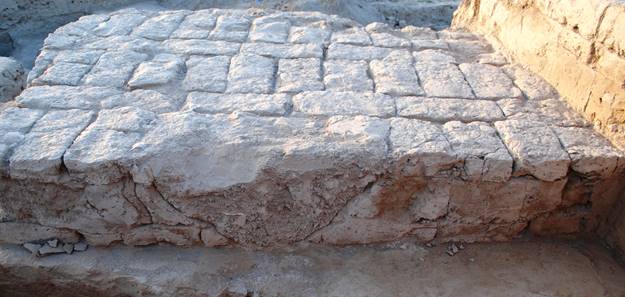
Fig. 18. One of the robbers’ pits in the
platform, view from the northwest
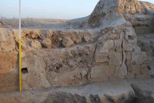
Fig. 19. The main robbers’ pits in the
centre of the platform, view from the east
In the previous reports it was repeatedly noticed that the platform had been built from layers of beaten clay (pakhsa) and layers of mud-bricks (figs. 20, 21, 22). In this season it was possible to specify its structure. It was erected on the filled up rests of premises of the second constructional horizon. The filling clay had given a massive basis 1,50 m thick and more in some places. The surface of this basis, which is in the depth of -3,20 m from a zero reference point, has been carefully levelled. Directly on an ideal horizontal surface of this clay basis one row of mud-bricks had been laid (figs. 19, 20, 22). Then, the vertical seams between bricks were filled up with a clay mortar that allowed keeping over bricks an equal horizontal surface. The sizes of bricks are 48-50×24-25×8-9 cm. Over a brick row there is a layer of pakhsa, and on it – again one row of bricks, and so on (figs. 19-22). The thickness of pakhsa layers is 20, 25 or 35 cm. The maximal remaining height of the combined part of platform is 2,10 m, thus, general thickness or height of the platform is 3,60 m. Taking into account wash-out of mud-made building materials it is possible to speak about a platform of about 4 m height.
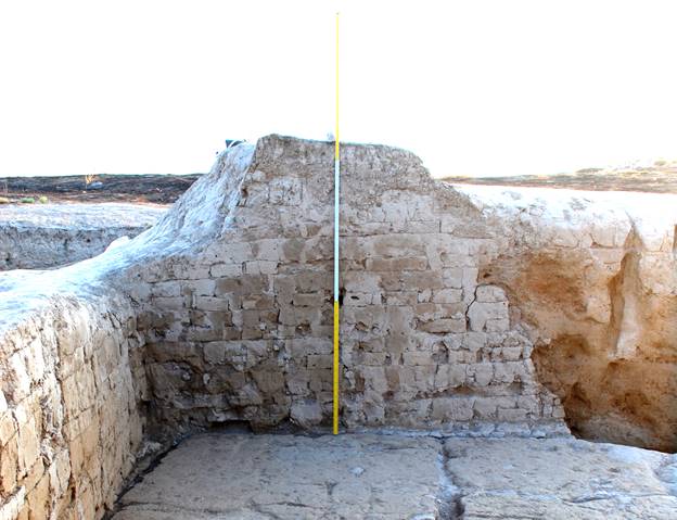
Fig. 20. Top part of remaining
platform structure, view from south
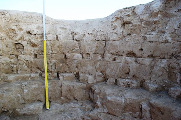
Fig. 21. Structure of the platform
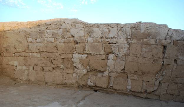
Fig. 22. Clay basis and combined
part of the platform, view from the east
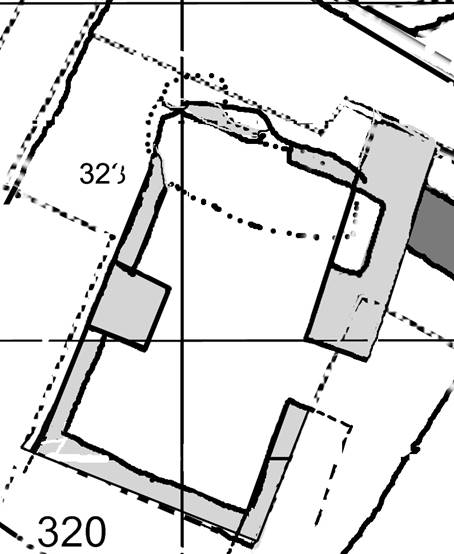
Fig. 23. The plan of a Room No. 1of the Second constructional horizon
Before
constructing the platform, the upper parts of the walls of the building related
to the second constructional horizon were levelled. Under the central part of
the platform the Room No. 1 of the abovementioned premises has been excavated.
It is a rectangular room, and its walls are orientated mainly on cardinal points, with a small declination
towards east (figs.
12, 23). The
layout of the room No. 1 on the level of first (i.e. uppermost) floor (–5,22 m
from the zero point) represents a replication of a throne or parade (guest)
rooms so typical for the early medieval palace or castle architecture of
Central Asia (figs. 23, 24). Classical examples of the «throne room» were
square in plan, although they can sometimes be rectangular in plan. The best
examined examples are in Northern Tokharistan, Sogdiana and Chach (Nil'sen
1966: figs. 24, 50, 65, 66; Lunina 1984: 98–100, fig. 28; Hmelnickij 2000: 57,
figs. 38, 54, 60; Ilyasova 2004: 207–213, figs. 2, 3).

Fig. 24. Room No. 1 of the
2nd constructional horizon
Room No. 1:
the western wall is 5,40 m long, the width along the southern sufa is 2,81 m,
the room goes slightly wider to the northern direction. Its width is 2,90 m at
the distance of 1 m to the north from the podium. Along the southern and
western walls there are benches (sufa). The height of the sufa is
50 cm in the south-eastern and 47 cm in the southwestern corners; it's width is
44 cm. The height of sufa at the western wall is 50 cm, the width 39-42
cm. Here, 1,66 m from the southern sufa a «place of honour» was made
(figs. 24, 25). It was organized as follows: the sufa has a niche of 90
cm wide, the back wall of which is angled at about 30 degrees. The northern
side of the niche is 15 cm deep; southern side is 20 cm deep. A brick podium
covered with the fine clay plaster on the sides and on the upper surface is attached
to the niche. Its sizes are: southern side is 50 cm; eastern side is 94 cm and
northern side is 63 cm. The height of the podium is 39-40 cm. The space of
72-81 x 90-94 cm (which is the area of podium plus niche) made it possible for
one person to sit in this place of honour. The sufa continues to the
north from the niche, but as a more complex structure: for 54-55 cm it is 50 cm
high, the width being 37-38 cm. Then it is getting 8-10 cm lower due to one row
of brick less than in the other part. So, figuratively speaking, this is a kind
of an armrest sized 55 x 38 cm and 10 cm high.
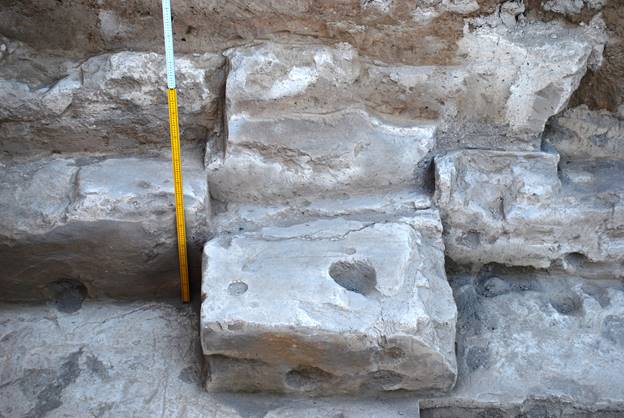
Fig. 25. "Place of honour" at the western wall in Room No. 1
On the
distance of 1,10-1,20 m to the north from the podium sufa a robbers' pit
was cut. The cut coming down from the top of the platform had partially
destroyed the surface of the northern part of the western wall of the room 1.
Because of the fact that the pit had completely chopped off a significant part
of the northern wall together with the north-western and north-eastern corners
of the room No. 1, there is no way to prove that the sufa continued
along the northern wall, although it looks logical from the point of view of
the planning scheme of this type. The «place of honour» is placed vis-a-vis the
entrance to the Room No 1 at the eastern wall (figs. 26, 27). Such configuration
is typical for the gala-halls, where the walls are lined with sufas and
opposite the main entrance there is a «kiosk», i.e., widened part of sufa.
The entrance is 87 cm wide. Its southern cheek is 2,28 m away from the
south-eastern corner of the room; northern cheek is 2,15 m away from the
northern wall. The entrance was bricked-up with mud bricks (46 ×?×9 cm, ?×23×10
cm). Under the brick, there is a layer of a dark grey fine soil, 10–20 cm
thick. The height of the brick laying of the entrance is 70-75 cm from the
level of the floor 1. Above this is a layer of smoothing filling, and above, at
the height of 84-85 cm pakhsa had been applied, which served as a
platform’s basis.
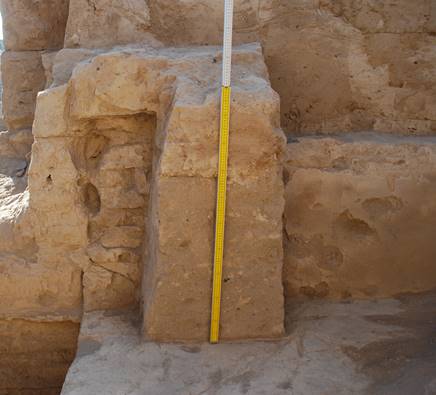
Fig. 26.
A layer of greyish fill of premises of the 2nd constructional horizon
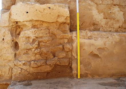
Fig. 27. The bricked-up entrance in eastern wall of Room No 1
Room No. 1 had
another niche, which was arranged at the northern side of the eastern wall by
the north-eastern corner. It was 1,12-1,14 m wide and 46-48 cm deep. The bottom
of the niche was 5-6 cm higher than the level of the floor 1; the walls of the
niche have only survived for 45 cm. As the niche in the western wall, this
niche correlated with floor 1. We can assume that the niches were used for
storing certain objects, like statues, ceramic or wooden containers, ceramic
vessels and so on. But considering that the podium is right in front of the
first niche, as well as the fact that the back wall of this niche has a gradient
back, we can propose that it was used as a «front seat» that was covered up with
mats, carpets and cushions (figs. 24, 25). As for the niche in the
north-eastern corner, it had most probably been used for keeping the objects
described above, so that they would be standing above the floor 1 level for just
several cm.
The
abovementioned pit of robbers destroyed one third of the room No. 1 (fig. 24).
The pit had, of course, been dug up after the settlement was abandoned by its
inhabitants. The robbers started digging the pit to the west from room No. 1. The
pit was round in shape, about 3 m in diameter and shaped like a funnel. At the
depth of 3 m from the preserved top of the platform the pit changed its shape
into an elongated oval, because the robbers intruded into the pakhsa foundation of the platform in the direction of the East. The treasure seekers
managed to break through the extremely tough platform body, having demolished a
part of the northern wall of room No. 1, they also broke through the floor 1,
as well as several lower levels of floors that were related to Constructional
horizon II. Within the Room No. 1 the size of the pit is 3 x 1,30 m. At about
the level of floor 4, which is located at the depth –6,40 m from the zero
point, the size of the pit gets smaller and it is occupying the north-western
corner of Room No. 1. The depth of the pit is at least 7 m from the zero
point.
In room No. 1,
the excavation at the level of floor 2 (–5,76 m) has been partially done (fig. 24). Apparently the floor plan at this level is somewhat different to
the plan at the level of floor 1 (–5,22 m), for instance, the entrance to the
room was, possibly, different, as well as the disposition of sufas. This
is going to be examined in the next seasons of excavations, during the gradual,
level-by-level clearing of the Room No. 1 and the adjacent premises.
In the
stratigraphic trench, that links with the Room No. 1 from the East, there can
be tracked the structure and phases of the platform construction, as well as
the remains of the Room No. 2 (or a small courtyard?) of the Constructional
horizon II, the northern wall of which is joining the eastern wall of the Room
No. 1 (figs. 28-32). It is built of the mud-brick sized 49×?×8 cm, 52 ×?×8 cm,
? ×26×9 cm, about 1 m thick and is traced back 4,50 m to the east. After that
the wall turns to the north. Entrance to the Room No. 1 was through this room
(or yard). Details of the plan and attribution will be clarified during the
coming seasons.
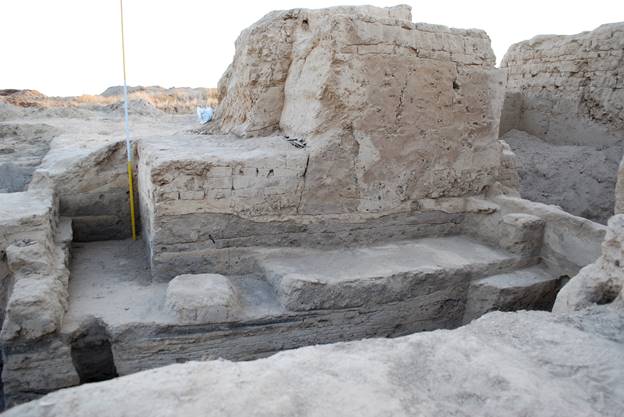
Fig. 28. Section of
platform and layers of 2nd constructional horizon, view from north
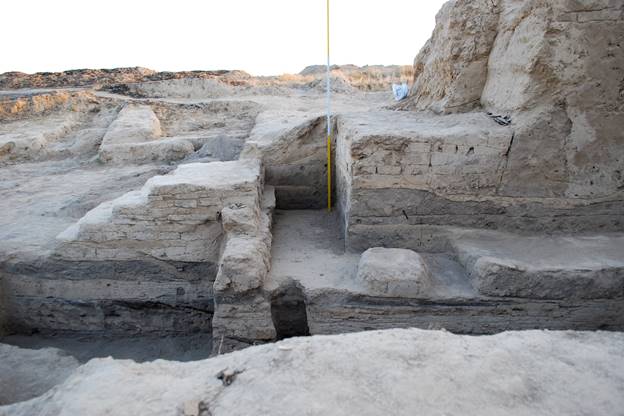
Fig. 29. Section of
platform and stairway of 1st constructional horizon, view from north
(continuation)
The stratigraphic survey reveals the following: At the level of the eastern wall that was horizontally cut as preparation for the platform construction in room No. 1, there was a layer of clay coat consisting of several layers of thin clay and identical to the fine plaster, covering the walls of rooms No. 1 and 2. The clay-coat layer is between 5 and 25 cm thick. Evidently, this was not the real floor, but a multilayer coating spread through the premises of Constructional horizon II, that was applied over the friable layer of backfill in order to level the surface for the construction of the platform. This level spreads for 5 m to the southeast from the wall of Room No. 1 and is adjacent to a small, 30 cm thick, brick wall that limits the courtyard (Room No. 2?) of the Constructional horizon II from the East. At about 1 m from the wall of Room No. 1 the layer is horizontal, but then it smoothly lowers for 10-15 cm, but after 2,50 m it increases again. The lowering could have appeared due to the fact that the filling and plaster have sagged under the weight of the platform that was initially built from this level. Underneath the layer of filling and plaster at about 40-50 cm lower there was discovered Floor 1, which coincides with the floor 1 in Room No. 1 (–5,20-5,22 cm from the Zero point). It is continued horizontally from the eastern wall of Room No. 1. The abovementioned one-brick thick wall is standing at the same level. Lower is the floor 2 (–5,39-5,49 m), the floor coating is 5 cm thick. This floor has a fired surface. It is holding another thin wall (40-45 cm thick) that limits a courtyard or Room No. 2 from the East. This wall is standing right under the first thin wall that was built 15 cm off. So the distance between this thin wall and the eastern wall of Room No. 1 is 4,85 m. These two thin walls are adjacent with a staircase (related to the Constructional horizon I) leading to the platform (figs. 29, 32). On the floor 2, at 85 cm to the west of the limiting thin wall and 3,45 m from the wall of Room No. 1, a square structure has been cleaned. It possibly was a base for the wooden (?) column that supported the roof or canopy. The floor 2 coating is 3-4 cm. Underneath Floor 2 there is a 6-8 cm thick soft crumbling layer of the dark-grey colour, rich of ash. Continued further to the east and south-east, this layer becomes the ground level of a spacious courtyard that is linking to the platform. The lower ash layer continues to the east with the swell of 20-25 cm.
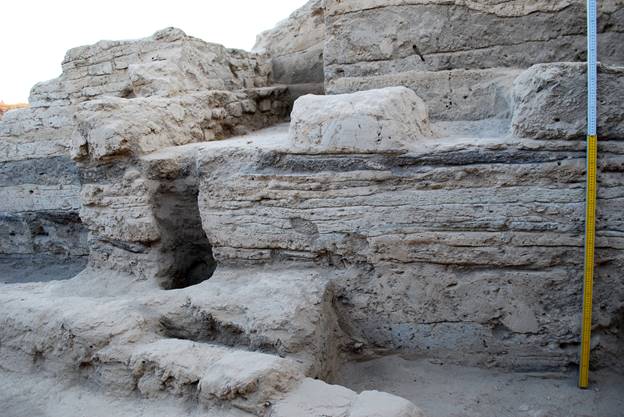
Fig. 30. Layers of the 2nd constructional horizon, view from north
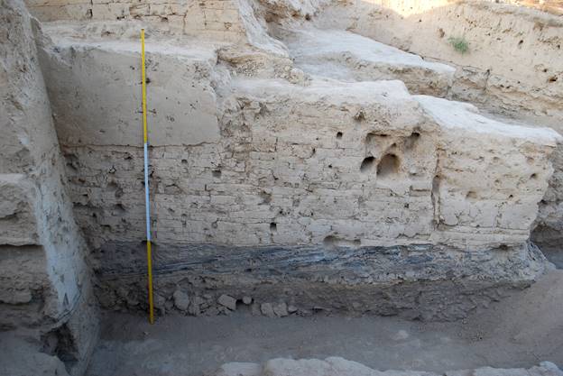
Fig. 31. Section of platform and wall of the 2nd constructional horizon, view from south
Inside the
Room No. 2 under the ash layer there is a Floor 3. The coating of the floor is
3-4 cm thick, underneath are the accumulation layers 25 cm thick, one of which
is of greenish colour. Lower there is the Floor 4, about 5 cm thick, and below
it is a layer of a lumpy soil about 10 cm thick. Underneath there is a layer of
rubble about 25 cm thick. Below it, on the level of Floor 1 which belongs to
the Constructional horizon III, there is a dense loam layer. Detailed
investigation of this horizon is a matter of the future.
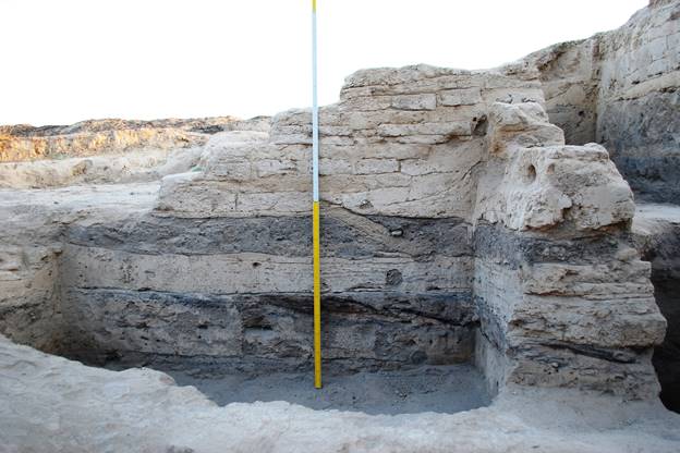
Fig. 32. A stairway
of the 1st constructional horizon and layers of the 2nd constructional
horizon under it Section of platform and stairway of 1st horizon,
view from north
Bibliography
Ilyasova 2004 –
Ilyasova S.R. Raskopki paradnogo kompleksa Aktepa
Yunusabadskogo, in: Istoriya materialnoy kultury Uzbekistana 34, Samarkand,
2004: 207–213.
Khmelnickiy 2000 –
Khmelnickiy S. Mezhdu Kushanami i
arabami, Berlin/Riga, 2000.
Lunina 1984 –
Lunina, S.B. Goroda Yuzhnogo Sogda v VIII-XII vv.,
Tashkent, 1984.
Nil'sen 1966 –
Nil'sen, V.A. Stanovlenie feodalnoy arhitektury
Sredney Azii (V-VIII vv.), Tashkent, 1966.
Shagalov, Kuznetsov 2006 –
Shagalov V.D., Kuznetsov
A.V. Catalogue of coins of Chach. III-VIII AD. Tashkent, 2006.
Society for the Exploration of EurAsia
Archaeological investigations
at the site of Qarshovultepa
(Tashkent Province, Uzbekistan)
in 2017
K.A. Sheyko
Dr. G.P. Ivanov
Dr. J.Ya. Ilyasov
Tashkent 2017
In June-July 2017 archaeological
excavations on the archaeological site of Qarshovultepa near the settlement Dustlik in
Chinaz District of Tashkent Province
(fig. 1) have been continued. The basic
works on the site in 2017 were conducted on Excavation-3 (platform and adjoining area).
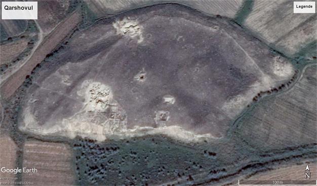
Fig. 1. Qarshovultepa archaeological site. Google Earth
E-3 Platform and adjoining area
Constructional horizon I. Last year, thanks to
satellite pictures, it was possible to reveal a bank limiting the so-called
«sacred site» from the north-west side. To study the territory lying between
the platform and the given bank which was, probably, the first fortification of
a small town, the area of E-3 has been expanded on the western and northern sides, within
the limits of squares FF 90-91, GG 90-91, HH 89-92, II 90-97 (fig. 2).
On this area 7 premises which were
established on the northern and western sides of the platform have been exposed
(fig. 3). Works on premises N ͦ ˢ 7, 8, 9 and 10, which were
exposed in previous years, have also been continued.
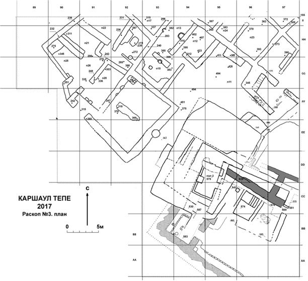
Fig. 2. Plan of the north-western and
northern parts of Excavation-3
Throughout the excavated area, under
a cespitose layer about 10 cm thick, a very friable salty layer with rare lumps
of the rests of building materials (pakhsa or beaten clay, mud-bricks) has been
laid down. The
thickness of this layer varies from 60 to 80 cm. Deeper areas of a dense floor
surface (- 2,4 m deep from a reference point) have been fixed, over which two
burnt layers, each 5 - 10 cm thick, can be traced (fig. 4). One of them lies
directly over the dense level, the second 15 - 20 cm above it. These layers as
well as a floor have a fall from the north-west to the south-east, adjoining
the southwest wall of room 25 at a depth of -2,77 m. These layers have been
particularly well traced in the western part of squares GG 89, HH 89 and II 89.
Apparently both this dense level and these burnt layers represent one of the
final stages of
life at Qarshovultepa (most probably in the middle of the 8th century), when the abandoned settlement
was used for some economic activities, and some light buildings were erected,
whose walls have not survived. In some places this level has also been
destroyed by amorphous pits.
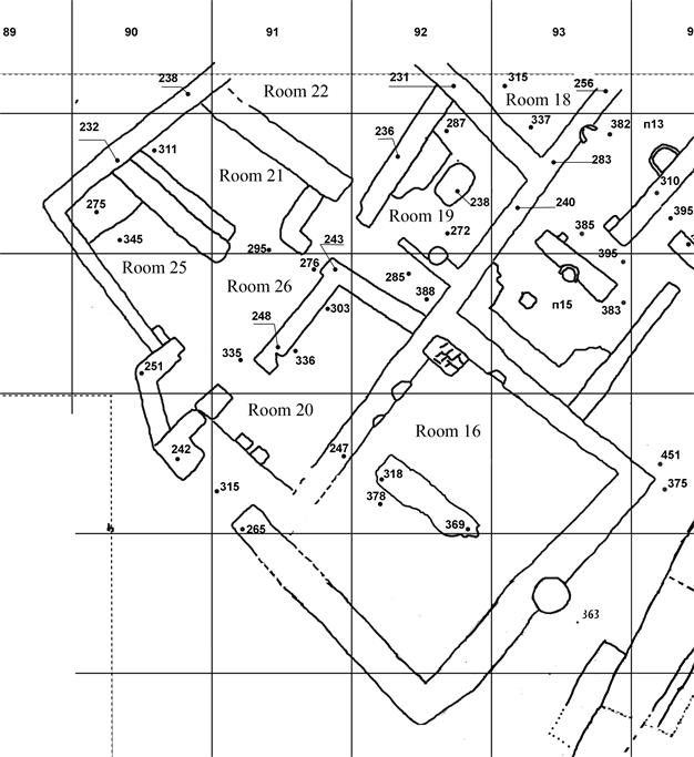
Fig. 3. Excavation-3. Premises
north-west of the platform
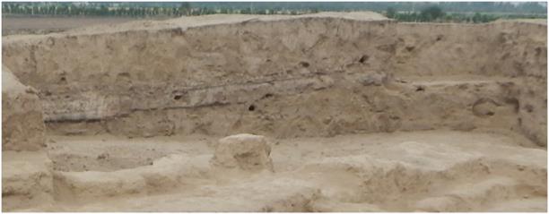
Fig. 4. View of the northern edge of E-3
We were able to trace the walls of premises from the first building
horizon filled with destroyed parts of these walls below the specified dense
level throughout the north-west part of the excavation area. The excavation has
enabled us to reveal the block of premises which were probably intended for
some public activities. These premises (N ͦ
ˢ 16,
19-22, 25, 26), though they formed part of a complex of buildings surrounding a
platform, were isolated, unlike earlier excavated premises (N ͦ
ˢ 10-15 and
17: corridor), which were directly connected to a platform.
We will begin the description with
the complex of premises N ͦ ˢ 16, 19-22, 25, 26 (fig. 3,
fig. 5). The entrance to the complex is located approximately at the centre,
from the south-western side. It should be noted that the entrance is quite wide
(2,20 - 2,30 m). That means that the given pass is wider by 0,50 m than the
northern city gate, which was 1,80 m wide. It clearly shows that this complex
was not in usual home ownership. It most probably served public purposes, and
was not established casually next to the platform, which is likely to have had
a cultic or ceremonial character.
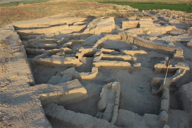
Fig. 5. The northern and north-western parts of E-3, view from the north-west
The wide entrance facilitated the access
for a large group of people without being crammed. This is another indication
of a special purpose of this building. Entering this wide gate, visitors first
reached the rectangular premise № 20, but before going inside, they
passed two hearths on the right and left, arranged in the form of short pakhsa
columns, oval in plan, tapering slightly towards the top (fig. 6). Intensive
traces of fire can be seen on these columns at the side of premises № 20
(Fig. 7). The purpose of these architectural elements was very likely ritual
purification of the persons visiting the complex. This suggestion needs further
evidence since we have as yet no analogous structures.
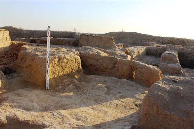
Fig. 6. Entrance to the
complex and columns in premises № 20
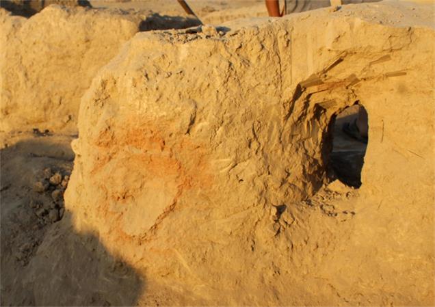
Fig. 7. Room 20, columns
with hearths
We now give a more detailed
description of premises № 20 and other rooms of the complex.
Due to recent extensive excavation
the late or top levels of floors in room № 20 have not survived. The
rectangular premises are extended from the south-west to the north-east, its
size is now 8,30×3,40
m. To the north-east they are limited by a blank wall, and to the north-west by
a wall with a gate to room № 26. The south-eastern pakhsa wall is
1 m thick, its maximum preserved height above floor level (in the eastern
corner of the premises) is 1,20 m. At the southern corner it is reduced to
naught.
Floors inside room № 20 have
been cleared away at level -3,35 to -3,25 m from the reference point. In the
main entrance of the complex the floor level is higher, at -3,15 m, and the
room here is wider (4,20 m). At a distance of 1,10 m to the northeast from the
main entrance the floor is stepped down by 15 cm. Exactly here the two pakhsa
columns mentioned above with purification fire were built (fig. 7).
Three coins were found in room
№ 20. The first was found by the north-west wall in a blockage. It is
strongly abraded, but it is possible to identify a predator walking to the
left. On the reverse is the fork-shaped tamga of Chach. The second coin was
found on the floor by one of the pakhsa columns. Its obverse is again
strongly abraded. On its reverse there is a tamga in the form of a lyre. The third
coin belongs to a group of coins with paired portraits. The ruler (on the left)
is represented with his spouse. On the reverse is a tamga reminiscent of horns,
in the middle of which is set a cross (see table № 1. 4,5,6). For the
coins, pls. refer to the attached report.
On turning to the right from the
entrance, it was possible to reach premises № 16, which were partially
dug out last season. This year it could be revealed completely to a size of
7,50 × 10,50 m. Judging both from
its size and the filling, premises № 16 should be identified as a
courtyard, which extends a little from the north-east to the south-west (figs.
2, 3, 8).
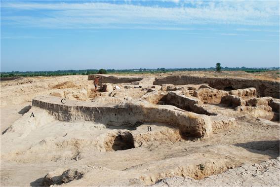
Fig. 8. Excavation of premises № 16
(court yard). A: SW wall; B: SE wall; C: Section
The south-east and south-west walls
completely isolate both a courtyard and the whole complex from a platform. In
its final phase the courtyard was divided by a wall into two roughly equal
parts, situated to the north-east and south-west, with a gate between them in
the north-west wall. It was possible to trace this wall for 4,40 m. To the
north-west this wall remains 60 cm high, but the south-east part has been badly
damaged; it rises to only 8 cm above floor level. The wall does not reach the
south-east wall of the courtyard.
Throughout the exposed area of the
courtyard (premises № 16), below a cespitose layer, is a friable ground
of light brown colour, from 45 cm to 1,05 m thick. Deeper down a light green
layer has been established in some parts, which is 25 cm thick. Below this, a
further layer lies over a floor. It represents a blockage, which is light brown
in colour, consisting of lumps of clay and bricks. A considerable quantity of
fragments has been found in this layer consisting of large jars (khum) and jugs. Here two coins were found
on the floor. The first coin was found on the floor in the gate between the two
parts forming the court yard in the last period, when it was divided. Its
condition is so bad that it is hard to identify to what type this coin belongs
to. The second coin was found at the northern corner. It is also in bad
condition with about a third of it absent. Nevertheless, a paired portrait of
the ruler and his wife can be made out (see table № 1. 15,16).
Thus the south-eastern part of the
complex represents a courtyard connected with a front entrance and premises
№ 20. In favourable weather, meetings and collective activity were
probably organised in this courtyard.
A gate 1,50 m wide is situated in the
southern part of the north-west wall of premise № 20. This leads to other
premises of a complex located to the north-west and north.
Division into rooms here is somewhat
speculative. Premises №№ 26 and 25 represent uniform spaces. The
access from premises (more exactly, lobby) № 26 to premises № 21
was possible through a gate 1,70 m wide. We should therefore speak about
compartments here rather than about separate premises. Once again, this
striving for maximum openness suggests that the building had public functions.
To the north-east premises №№ 19 and 22 are located, which are
connected with premises № 26 by a corridor and the usual gate about 80 cm
wide. Possibly, these are premises of economic or warehouse character intended
for the service of the complex.
Premises № 26.
They were dug out in squares GG 90
and 91. Two floor levels have been exposed at -2,70 m and -2,95 m. The top
floor level has a difficult layout practically without a north-west wall (fig.
9). It extends in a southwest northeast direction. The average size of the
premises is 6,50×2,50
m. In the north-east it is partially limited by the south-western wall of a
corridor with a gate to it. The gate to premises № 21 is 1,70 m wide.
From the south-east the premises are limited by a pakhsa wall 0,75-0,80
m wide, which is at the same time the wall of the next premises № 20.
Between the two premises there is a gate 1,50 m wide. All the remaining walls
are not higher than 0,4 m above the top floor. The premises were filled with a
blockage of the average density consisting of pakhsa clods, which has been excavated.
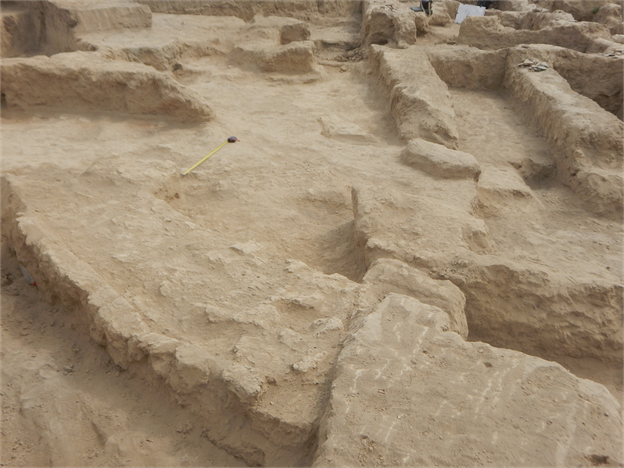
Fig. 9. Room № 26. The upper floor. A
view from the west
The bottom floor of premises №
26 has been exposed up to a depth of -3,35 to -2,95 m. It rises from the
southern to the northern corner. The layout of the premises on the level of the
bottom floor is somewhat complicated (fig. 10). The pakhsa wall, which
is about 1,20 m thick and 1,90 m long (its external facade is difficult to
trace because of a pit), limits premises № 26 from the south-west; it
meets the south-eastern wall at an acute, not a right angle.
The floor at the point of transition
into premises № 25 shows signs of a fire, with a layer of ashes. The
filling between the top and the bottom floors, with two - three layers, is
relatively dense. On the upper floor two coins were found at the south-west
wall. One belongs to the so-called mint of ruler Tarnavch. Its obverse is
strongly frayed; the image of a leopard walking to the right is hardly
recognizable. On the reverse there is, however, a well-recognizable tamga typical
for coins of this group with a Sogdian legend around the edge. The second coin
belongs to the group with paired portraits, but differs slightly from our
previous finds. The ruler's image is on the right side (see: table № 1.
13,14).
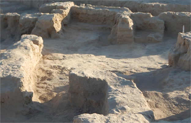
Fig. 10. Room № 26.
The bottom floor. A view from the north-east.
Premises № 25.
The trapezoid premises №№
21, 25 and 26 are situated in the north-western corner of the area. On the
upper floor level the length of premises № 25 is 6,50 m, its width in the
north-western part is 1,20 m, and 2,60 m in the south-east (figs. 11, 12). All
the walls of the premises are made of pakhsa, i.e. beaten clay. From
the north-west the premises are limited by the continuation of the
north-western wall of premises № 21. From the south-west, premises
№ 25 are limited by a thin wall only 0,50 cm thick. It was probably much
thicker originally.
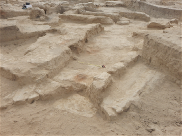
Fig. 11. Premises №
25. The upper floor. A view from the north-west.
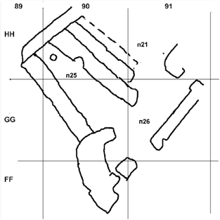
Fig. 12. Layout of
premises №№ 21, 25 and 26 on the upper floor level.
The floor of the room lies at a level
of -2,70 m at the entrance, and at -2,75 m in the north-western part of the
premises. The floor has a plain surface up to 1,70 m from the north-western
wall. In the rest of the room the floor is uneven, though also dense.
Approximately at the centre of the plain-surfaced floor an intensively burnt
hole was cleaned up. It is 25 cm in diameter, 5 cm deep and was filled with
ashes. The walls of the premises have been preserved to a height of no more
than 0,45 m from the floor level. There is a hearth in the north-eastern wall,
at 1,8 m from the northern corner, on the level of the upper floor. The hearth
has been cut into a wall, and has been arranged in double-semicircular shape with a depth of 60 cm (figs. 12, 13, 14). The width of the
mouth is 80 cm. Inside the hearth two partitions forming a V-shape (apparently,
two mud-bricks were used) separate
the central part of the hearth. This part is covered with a thick layer of
clay, which shows traces of fingers (fig. 15). The walls of the hearth are very
strongly calcinated, its central part almost before slag formation.
The firing place of the hearth was
apparently situated in the bottom part over the floor. However, a pit about 2 x
1 m large was later dug here along the wall, which damaged the upper floor and the fire place.
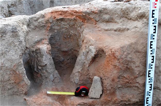
Fig. 13. Premises № 25. The
hearth in the north-eastern wall.
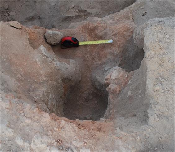
Fig. 14. Premises № 25. The
hearth in the north-eastern wall, view from the top
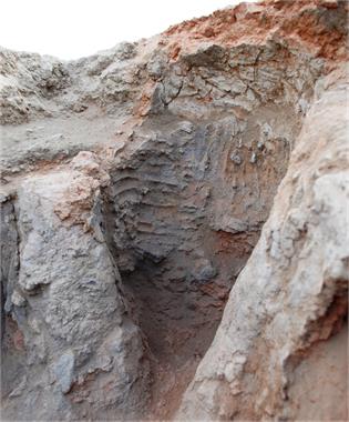
Fig. 15. The central part
of the hearth in room № 25
The construction of the hearth and traces
of high temperature allow us to assume that this hearth was used not just as an
ordinary household fire place, but for some kind of craftsmanship.
The second floor in room № 25
lies at -3,35 to -3,45 m, that is 60-70 cm below the upper floor. This floor
slopes slightly down from the wide entrance to the north-west. At that time the
plan of the room was somewhat different. Between premises №№ 25 and
21 there was a wall, which was removed in the course of putting in the upper
floor, and nearby a new wall 1 m thick was built. That means that when the
lower floor was in use, premises № 25 were wider and had a more correct
rectangular shape (fig. 3). In the north west its width is 2,6 m. The length of
the south-western wall is 6 m. To the south a rectangular pakhsa lump is added with a
dimension of 1×1 m, symbolically fencing
off premises № 25 from premises № 26.
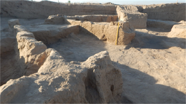
Fig. 16. Premises № 25, level
of the bottom floor. View from the south
There is a pedestal 1,20×0,70 m in the southern corner whose
function remains unclear (fig. 17). Its upper part is destroyed by a hole.
Along the wall it is preserved up to a height of 0,65 m, and 0,10 m closer to
the external edge. Probably, this extension was used for storing objects used
during the ceremonies (utensils, incense burners, lighting devices, etc.).
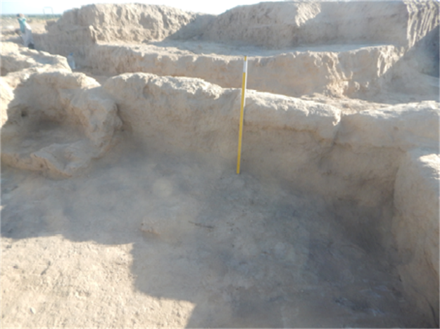
Fig. 17. Premises №
25. Extension in the southern corner
In the north-western part of premises
№ 25, under a smooth upper floor surface, we found a pakhsa
platform 2,30 m wide, adjoining all three walls. The height of the construction
is 0,7 m. Because the room is 1 m wider at this point, the traces of a
fireplace on the platform surface are closer to the south-western wall, instead
of at the centre as was the case on the upper floor. The length of the wall
limiting the premises from the north-east was reduced to 1metre.
Two coins have been found on the
floor. They belong to the paired portrait type. Like on the previous coins, the
governor is represented on the left. The tamga on the reverse is of the horn-shaped type (see table
№ 1. 11,12).
Premises № 21.
They are located to the north of
premises № 26 and are connected to it through a wide gate. They extend
along a south-east north-west line. Their shape is trapezoid, the size on the
upper floor level is 5,20×3,20 m. The level of the upper floor is at -2,70 to -2,80 m.
From the south-east the premises
№ 21 are fenced off by a wall forming a corridor which connected premises
№ 26 with room № 19 (to the north-east) and room № 22 (to the
north). The gates leading to the corridor and to the above-mentioned premises
have the usual width of 0,80-1,00 m; that means that this part of the complex
was probably not intended for the simultaneous reception of big crowds.
The filling of premises № 21
consisted of dense debris from the destruction of the pakhsa walls. In some places,
for example in the northern part of the premises, the filling consisted of
friable blockage with accumulated mud and dust. From the north-west the premises were limited by the
long pakhsa wall, which is common for
premises 22, 21 and 25, and stretched from a south-east corner of square HH-89
to square II-91. The thickness of this wall is 0,80 m. The south-western wall
of premises № 21 is 1 m thick, the upper floor connected to this wall
lies at a level of -2,70 to -2,80 m. A south-eastern wall 1,20 m thick, which
was constructed at this level, reflects the latest stage of reorganisation of
the given premise.
Below the level of the upper floor
the area of the premises is slightly smaller because formerly the south-western
wall stood closer to the north-eastern wall. It was 50 cm thick. On the level
of the upper floor another pakhsa wall 1 m thick was built close to it, then the former wall
was demolished. The floor of the premises gradually slopes down from -2,95 m in
the southern corner to -3,11 m in the north-west. The gate leading to the
premises is 1,50 m wide; it was in the southern corner between the end of the
south-western and the south-eastern wall.
Premises № 19.
Room № 19 is located in the
area of squares HH-92 and HH-93 (fig. 18). The eastern part of the premises was
exposed during the season of 2016. The premises are rectangular, 4,60 × 3,50 (in the south-western part)
to 4,00 m (at the north-eastern wall),
extending approximately along a line from the south-west to the north-east. All
the walls of the premises are pakhsa walls. The south-eastern wall (exposed during the season of 2016)
is 0,70 m thick, the north-eastern wall 0,90 m, the north-western wall 0,80 m.
The thickness of the south-western wall is 0,70-0,80 m at a distance of 1 m
from the south-eastern wall. Further to the north-west it is destroyed at a
length of one metre by a later pit, whose diameter is about 1 m. The wall
continues till the entrance; it is only 0,30 - 0,40 m thick. The entrance,
which is in the western corner, is 1,15 m wide. Originally it may have been
narrower. The floor of the room lies at a depth of -2,70 to -2,75 m. To the
north-west wall a sufa, 35 cm high, was attached. It begins at a distance of 1,50 m from the
entrance, its width at the south-western edge is 50 cm. This width remains
throughout at 0,80 m, then the sufa widens to 1 m. The northern part of the sufa and the floor at a distance of 1,5 m
from the north-east wall were destroyed by the pit which was dug later and
which reached the level of -2,87 m. There are many ashes over the floor and in
the filling of the premises.
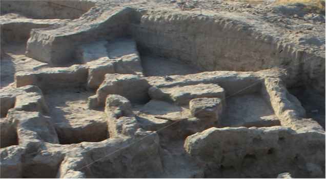
Fig. 18. Premises №
19. A view from the south-east.
At the centre of the room, 30 cm to
the south-east of the sufa, a podium 35 cm high above floor level was built (fig. 19);
it is rectangular with the corners rounded off. The size of the podium is 1,80×1,10 m. Its northern part was cut off
by the above-mentioned later pit. The basis of the podium is made of pakhsa, and it is covered by a
layer of ceramic tiles in the sizes 20-24×15×3,5 cm. Over them was a layer of
burnt clay and ashes. The covering of the ceramic tiles and the layer of pakhsa under them are strongly
calcinated. That means that a fire burnt on the podium for a long time. This
allows us to say that there was a fire altar at the centre of premises №
19.
On the sufa, near the north-western wall, a
small, intact archaeological bowl has been found. It is made of light brown clay.
Near the north-eastern wall numerous fragments of a large jar khum
were found.
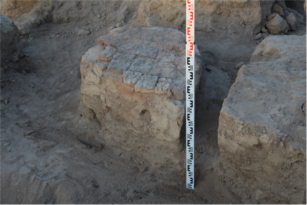
Fig. 19. Altar inside room
№ 19
Premises № 22.
It is a big room occupying all the
northern part of the considered complex. It has not yet been completely
exposed: the northern corner of the premises lies outside the northern border
of the excavated
area. The
upper floor lies at -2,85 m. The south-eastern wall of the premises is adjacent
to premises № 19. It was constructed at the level of the upper floor. A
gate connects it with a corridor which gives access to premises №№
19 and 26. The distance from the entrance to the eastern corner of premises
№ 22 is 4,50 m. The south-western pakhsa wall is 1 m thick. We traced it from
the entrance until the point where the corridor is connected with the
north-western wall. The size of the premises, which slightly extend from the
south-east to the north-west, is approximately 7,20×4,50 m. The filling of the excavated part of the premises was
a dense blockage of fragments of pakhsa. An exception is the friable soil with ashes from the
bottom layers near the entrance. A pit was dug later at this place.
Room № 18 is in squares HH-93,
II-93 and II-92, i.e. to the north-east of premises №№ 19 and 22.
It has not been exposed completely, as its northern part lies under the northern edge of E-3. It is apparently not
part of the public building described above. The south-eastern wall, which is
common with premises № 13, has been dug out partially. No gate between
them has been found in the exposed part of the premises. The south-western wall
of room № 18 is 3,40 m long. The height of the remaining walls varies
from 0,55 m to 0,75 m, their thickness from 0,60 to 0,75 m. The floor is fixed
at -3,15 m. The filling of the partially exposed premises consisted of friable
soil with remains of the destroyed walls and a considerable quantity of
fragments of ceramics, especially large tare vessels. Three coins were found
here. Two of them were found on the floor. On the first coin the ruler and his
spouse are represented. The image is surrounded by a circular dotted line. On
the reverse is a horn-shaped tamga with a cross between the horns, surrounded
by a Sogdian legend. On the second coin the ruler is represented as a
three-quarter portrait looking to the left. One coin is strongly frayed. The portrait is placed
in a circular dotted line. The governors high headdress is recognizable. On
the reverse is the fork-shaped tamga of Chach. The third coin was found above
this floor in the blockage. This coin belongs to the group with an image of a
predator, showing most likely a lion walking to the right, with his mane and
croup clearly recognizable, and his tail lifted upwards. There are traces of a Sogdian inscription on the edge
of the coin. The obverse is frayed, but a tamga with traces of a Sogdian legend around it
can be distinguished (see table № 1.1, 2, 3).
Excavation to the north of the
platform
We now describe the works conducted
in the area adjoining premises № 11 (fig. 20). As noted in the
Qarshovul-Excavations report for 2016, because of the absence of a southern
wall of premises № 11, we could call it iwan. In 2016 the space
between the platform and the south-eastern wall of premises № 16 (court
yard) has been designated as premises № 17. As a matter of fact it is a
wide corridor which leads to premises № 11. It leads to the small
rectangular free area which was connected with a building with premises
№№ 12-15, and also premises of the iwan type at numbers 10 and
11.
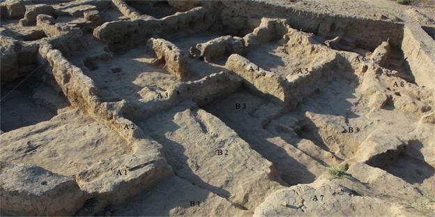
Fig. 20. Excavations to the
north of the platform: A 1 - SE wall of courtyard (premises 16); A 2 - NE wall
of courtyard (premises 16); A 3 - SE wall of room 15; A 4 - SW wall of room 12;
A 5 - SE wall of room 12; A 6 - NE wall of room 11; A 7 - northern corner of
platform; A 8 - altar in room 11; B 1, B 2, B 3 - floors
A small stratigraphic excavation has
been carried out on the site. Layer В1, which was cleared away throughout the area, was the last
floor for the whole complex of the premises exposed in 2016. At its opening it
was found out that it is a thick clay coat, similar to the one we observed to
the east of the platform. Its thickness is 13-17 cm. There is a similar layer
deeper down, also a dense clay coat which belongs to the other building period.
Between these two layers (В1 and В2) we dont have any traces of a cultural layer. Before
building the upper floor here, all the accumulation was probably cleared away.
In the centre of the stratigraphic excavation
and in an area closer to the north-western side of the platform a considerable
quantity of fragments of ceramics has been found: khums, jugs, plates, bowls, frying
pans/braziers and other kitchen utensils.
Premises № 23.
This room is located to the
north-east of premises № 11. Its south-western wall, 3,9 m long, separates
it from room 11. Its south-eastern wall, 6 m long, separates it from premises
№ 8. That means that the size of the room is 6×3,90 m. There is a doorway, 0,80 m wide,
in the north-western wall, at a distance of 4,10 m from the western corner of
the room. It was neither possible to expose the continuation of the wall nor
the northern corner of the premises, as the northern edge of the excavated site is situated at this
point. The
remaining wall is 0,7 m long and 0,6-0,7 m thick. The upper, i.e. the last floor
is fixed at -3,7 m. It represents a dense ground of light brown colour.
Directly on the floor and above it a small amount of table and tare ceramics
and two coins were found in a blockage layer. The first coin has a square
aperture in the middle with a Sogdian inscription around it. It is impossible to see any details
on the other side because of strong corrosion of the metal. The second coin was
found directly on the floor. On the obverse a ruler is represented. The
governors eyes and nose are well recognizable. On the reverse are a
lyre-shaped tamga and remains of a Sogdian inscription (table №1 see.
7,8).
Premises № 24.
Located in the area of squares НН-95, II-94,95, to the
north-west of premises № 23. The wall separating rooms 23 and 24 (the
above-mentioned south-eastern wall of premises № 23) has not been dug out
completely, only up to a length of 4,06 m, as its north-eastern part lies under
the northern edge. The remains of the wall
are 0,60 - 0,80 m high. It is 0,50 m thick at the top, and 0,80 - 0,85 m at the
bottom. That is because the wall has been partially destroyed; fragments of
mud- bricks are in the filling of the premises. The south-western wall has been
dug out completely. Its length is 3,25 m, and it also shows traces of
destruction. The north-western wall, as well as the south-eastern one, have not
been dug out in full length. It has been traced for a length of 2,60 m till the
northern edge of E-3. In addition, this wall was destroyed by a later tomb,
which was dug out after Qarshovultepa was abandoned, most probably in the 9th
or 10th century. The filling of room № 24 consists of a burnt layer with
ashes and pieces of coal covered with fragments of mud-bricks. On the floor
near the south-western wall a coin with a paired image of a ruler and his
spouse has been found. Another coin has been found in a corner at the
north-eastern wall. On the obverse the ruler is represented en face, on
the reverse there is a lyre-shaped tamga (see table 1. 9, 10).
The excavation works of 2017 also included
squares СС 93, DD 90-92, EE 90-92,
FF 90-92, HH 89-92, and II 90-92. The relief in this part slopes down, and it
was assumed that in the given territory there was no building. Works of this
season have shown that our assumption was right: on this area there are thick
alluvial layers of sand and clay, without any architectural remains. In these
layers a coin was found with a square aperture in the middle. This coin belongs
to the group of early medieval Central Asian coins imitating Chinese coinage. There
is a Sogdian inscription on our coin and a hardly recognizable tamga. O.I.
Smirnova has interpreted similar coins as the coins of the ruler Ramchitak of
Bukhara (see table 1. 17).
From the finds in this area we should mention the
stone guard of a sword made in imitation of a Chinese sword guard of the
Eastern Han epoch (1st - 2nd centuries AD). The guard is carved out of a
nephrite (?) of light green colour (fig. 21); its size is 50×28×12 mm. A similar find of a
guard, imitating Chinese products, has been made in 2012 in a burnt layer to
the east of the platform. One more interesting find is a small mug with orange
engobe and polishing (fig. 22). The guard and the mug were found in square DD
91.
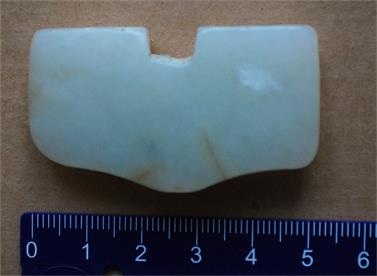
Fig. 21. Stone guard
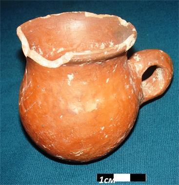
Fig. 22. Polished ceramic
mug
Constructional horizon II. The excavation of the
premises of the second constructional horizon was continued in season 2017.
Last year it was revealed that room № 1 of this horizon represents a
small "guest or parade room" with sufas. Directly opposite the
doorway was the place of honour, the so-called "stage" (or
"kiosk") intended as the seat of the owner when he received visitors
(fig. 23). The size of room № 1 is 5,50 × 2,80-2,90 m. Sufas have been
revealed along the southern and western walls. The sufa at the southern
wall is 44 cm wide and 47-50 cm high; at the western wall the width of the sufa
is 39-42 cm, its height 50 cm. The platform ("stage/kiosk"), which is
attached to the western sufa, is situated 50 cm from the southern and 63
cm from the northern side, its extent is 94 cm. The entrance to the room, 87
cm in width, is in the eastern wall, directly opposite the "place of
honour". The northern part of the premise was destroyed by a robber's pit.
The remaining part of premises № 1 has been cleared away on the level of
floor 1.
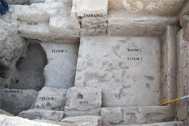
Fig. 23. Room № 1 of
Constructional horizon II, a view from the West
During this season it was possible to
specify some details connected with floor 1. Several thin clay coats of the
floor, possibly connected with seasonal repairs, have been revealed. On the
second layer from above, directly near the "stage", a round structure
with a calcinated surface has been exposed (fig. 24). Probably here, near the
rulers feet, a round brazier with charcoal was placed on the floor in winter.
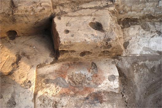
Fig. 24. Trace of a
brazier at "place of honour" on floor 1
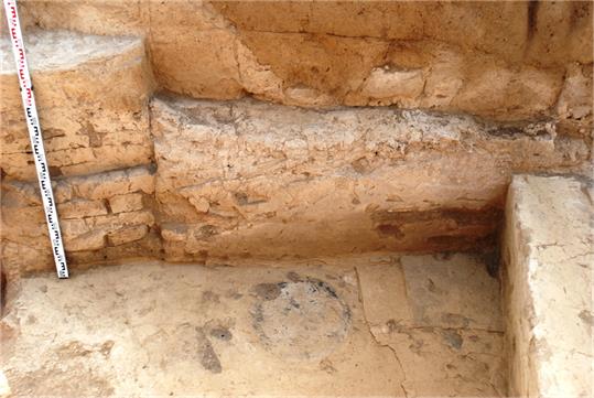
Fig. 25. Trace of a
brazier in the south-eastern corner of room № 1
One more trace of a brazier in the
ideal round shape and black-grey colour was exposed in the south-eastern corner
of premises № 1 (fig. 25), 12 cm from the eastern wall and 78 cm from
the southern sufa (i.e. 120 cm from the southern wall). The diameter of
the stain is 52 cm.
Apparently, a brazier (braziers?)
stood in the northern part of room 1. However, because of the destruction of
the floor by a robber's pit we cannot specify their number (fig. 26).
Nevertheless, the fact of the use of braziers for heating purposes in premises
in which there are no hearths is interesting.
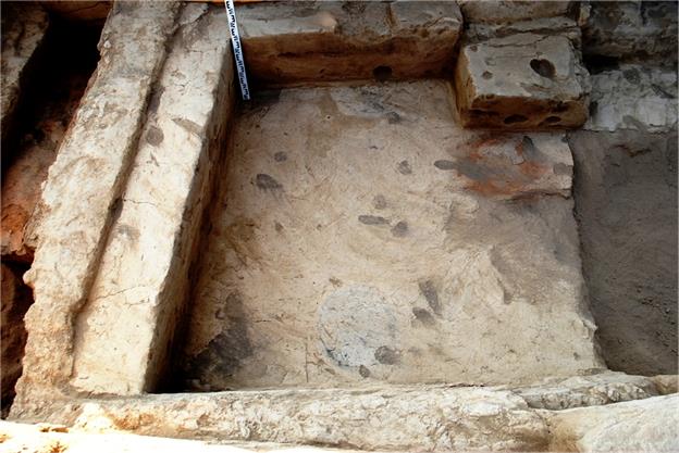
Fig. 26. The southern half of room № 1 with sufas
and traces of braziers
On a winter" floor with traces
of braziers, possibly in the spring, a new layer of clay with saman
(chopped straw) was smeared, 1-2 cm thick. At the same time, seemingly, sufas
and walls were plastered also. Above this very last floor having a whitish
surface, some layers of mud were accumulated in the thickness of 1-2 cm. Then
came a friable filling of the premises (fig. 27), caused by a general
reconstruction when, having cut off walls of the Constructional horizon II and
having filled up the premises, inhabitants of the small town erected a massive
platform using pakhsa and mud-bricks (fig. 28, fig. 29)
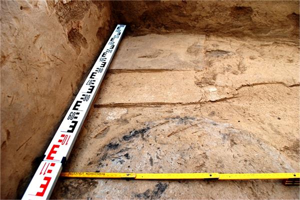
Fig. 27. Coats of floor 1
and accumulation of mud
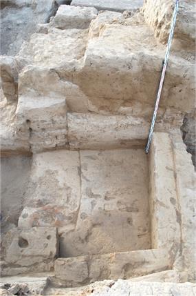
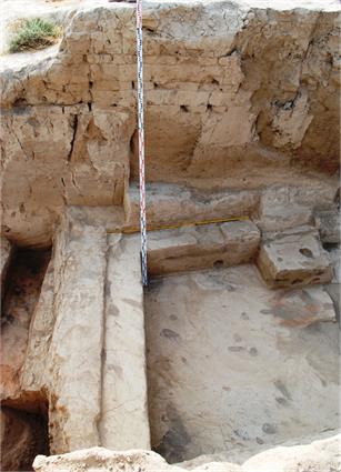
Figs. 28, 29. Platform over room
№ 1, views from the west and east
In room № 1, at a
depth of 50 - 54 cm below floor 1, floor 2 is located. The room has been
completely cleared away on the level of floor 2 (fig. 30, 31). This floor lies
at a depth of -575 cm relative to the reference zero point of the site of
Qarshovul.
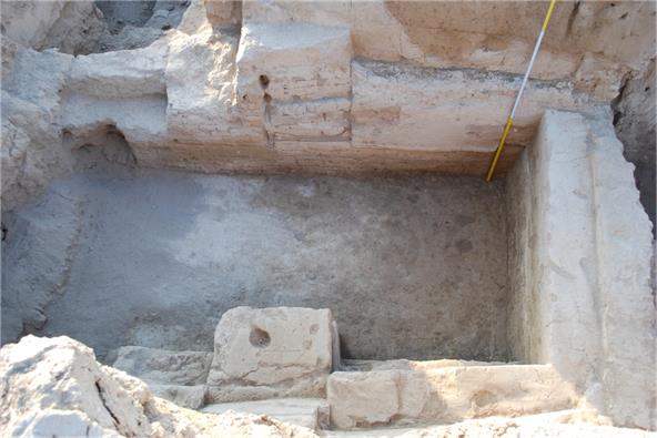
Fig. 30. Room № 1 of
Constructional horizon II at the level of floor 2
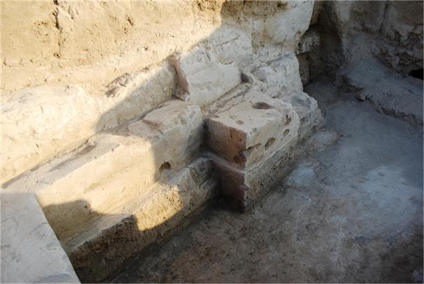
Fig. 31. Room № 1, floor 2,
view from the south-east
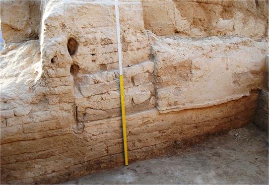
Fig. 32. Doorway in the eastern wall at the
level of floor 1, wall on the level of floor 2
The excavation has shown that the
room had another layout during that period. There is no entrance in the eastern
wall between floor 1 and floor 2 (fig. 31), the wall below the doorway is not
interrupted. There is also a friable levelling filling 15-16 cm thick between
the eastern wall and floor 2 (fig. 32).
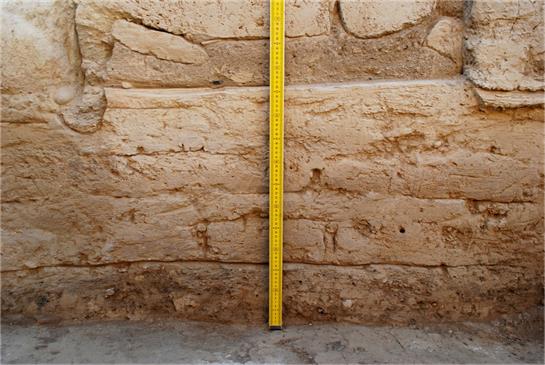
Fig. 33. Floor 2, levelling filling, eastern wall and doorway
on the level of floor 1
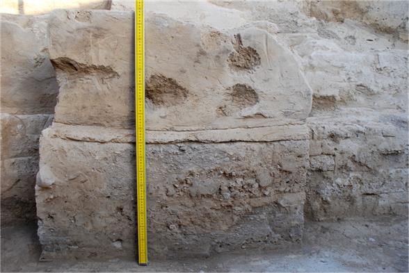
Fig. 34. A "stage" at the
western wall of room 1 and a filling layer under it
A "stage" was also absent
on the level of floor 2. Between floor 1 and floor 2 there is a layer of
friable ground which filled up the whole space of room 1 (figs. 34, 35).
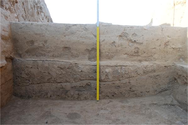
Fig. 35. Southern sufa, floor
1 and filling of room 1 between floors 1 and 2
That is, both the doorway and the
"place of honour" functioned only during the final period of life of
the premises of Constructional horizon II. For the construction of the sufa
with a "stage" room 1 was filled up with friable ground containing
pieces of mud-bricks, and opposite the "place of honour" the eastern
wall was opened for a doorway, which was later closed again with bricks,
probably before the construction of the platform.
There is a sufa below floor 1
along the western wall, which protrudes 35 cm from the vertical side of the sufa
standing on floor 1 (fig. 36). Further research of the layout of the given
premises will be carried out during the season of 2018.
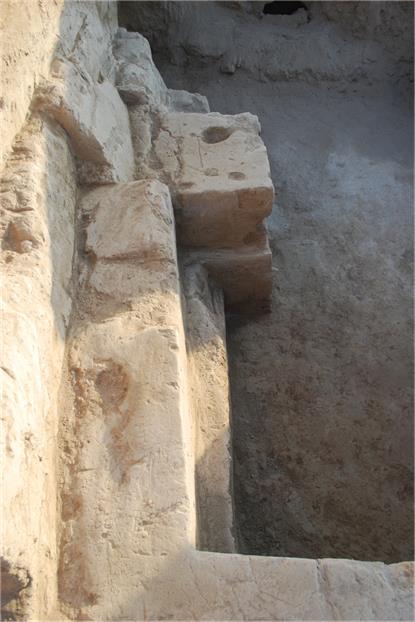
Fig. 36. The western wall and sufa
with a "stage" belonging to floor 1.
Below is a wall or sufa which
belongs to floor 2.
Behind the southern wall of premises
№ 1 part of premises № 3 of the Constructional horizon II was
cleared away (as premises № 2 of the Constructional horizon II we have
designated a room or a court yard located to the east of premises 1). The
southern side of the wall dividing premises № 1 and № 3 was heavily
damaged during preparation works for the construction of the massive platform
of Constructional horizon I. This side was almost completely demolished; it has
partially remained only on the floor level (figs. 37 - 39).
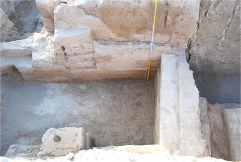
Fig. 37. Part of room № 3 to
the south of room № 1, Constr. horizon II
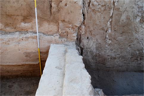
Fig. 38. Wall between rooms № 1 and
№ 3 whose southern side was cut off during construction of platform
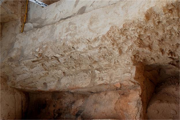
Fig. 39. Southern side of the wall
dividing rooms № 1 and № 3
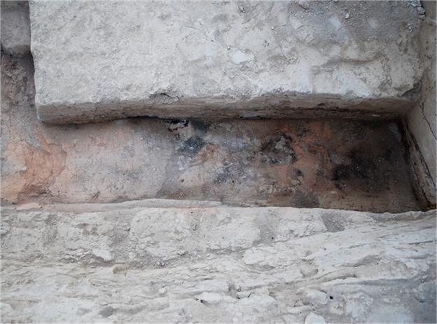
Fig. 40. The cleared part of floor 1
in room № 3, Constr. horizon II
Floor 1 in room № 3 lies at -534
cm relative to the zero reference point, that is 10 cm deeper than floor 1 in
room № 1. The wall and floor 1 in room № 3 are heavily calcinated
and orange in colour (figs. 39, 40). This shows that in the given premises
constant fire was supported for a long time.
Further excavation will allow us to
speak more definitely about the layout and the functions of rooms № 2 and
№ 3, as well as of other premises of Constructional horizon II.
The
excavation of 2017 has given us further information about buildings to the
north and the north-west of the platform. Here the complex has been revealed
which apparently served public purposes and which was, quite naturally, built
near a platform. The examination of the architecture of Constructional horizon
II will also be continued. Future excavations will allow us to understand much
better the history of this unusual monument. Qarshovultepa is a relatively small,
but very important site, because it reflects very well the process of
sedentarisation of nomads and the urbanization of a given region, i.e. the
principality of Chach, which played a key role in the relations between Central
Asian oases and the nomadic population of the Eurasian steppe belt.
Coins from Qarshovultepa excavations found in 2017
|
№№ |
Images |
Place of find |
Weight gr |
Diameter mm |
|
|
Obverse |
Reverse |
||||
|
1. |
Ruler & spouse portrait. Group 5, Type I, Version 3 (Shagalov/Kuznetsov 2006) |
Antler-shaped tamga |
Room 17 |
2.06 |
D-21 |
|
2. |
Predator (leopard?) walking right. Group 9, Type 9 (Shagalov/Kuznetsov 2006)
|
Fork-shaped tamga |
Room 18 |
1.61 |
D-17 |
|
3. |
Ruler's portrait. Group 6, Type 5 (Shagalov/Kuznetsov 2006) |
Tamga |
Room 18 |
1.62 |
D-16-19 |
|
4. |
Feline predator walking left. Group 6, Type 7 (Shagalov/Kuznetsov 2006) |
|
Room 20 |
0.94 |
D-13 |
|
5. |
Ruler's portrait. Group 7, Type 1 (Shagalov/Kuznetsov 2006) |
Lyre-shaped tamga |
Room 20 |
1.25 |
D - 16 |
|
6. |
Ruler (left) & spouse portrait. Group 5, Type 1, Version 2 (Shagalov/Kuznetsov 2006) |
Tamga |
Room 20, floor 2 |
2.01 |
D-20 |
|
7. |
Sogdian legend around square aperture. Acc. O.I. Smirnova, Tutuk coinage of Ferghana (Smirnova 1981, 341) |
Blank
|
Room 23 |
0.96 |
D-15 |
|
8. |
Ruler (left) & spouse portrait. Group 5, Type 1, Version 2 (Shagalov/Kuznetsov 2006) |
Tamga |
Room 24 |
1.97 |
D 20 |
|
9. |
Ruler's portrait. Group 7, Type 1, Version 3 (Shagalov /Kuznetsov 2006) |
Tamga |
Room 24 |
0.93 |
Д 16- 11 мм |
|
10 |
Ruler (left) & spouse portrait. Group 5, Type 1, Version 2 (Shagalov/Kuznetsov 2006) |
Tamga |
Room 23 |
1.85 |
D-18 |
|
11. |
Ruler's portrait. Group 7, Type 1, Version 3 (Shagalov /Kuznetsov 2006) |
Lyre-shaped tamga |
Room 24 |
0.52 |
D-14 |
|
12. |
Ruler (left) & spouse portrait. Group 5, Type 1, Version 2 (Shagalov/Kuznetsov 2006) |
Tamga |
Room 24 |
1.38 |
D-21 |
|
13. |
Feline predator walking right. Group 6, Type 8, Version 2 (Shagalov/Kuznetsov 2006) |
Tamga |
Room 25 |
1.87 |
D-20 |
|
14. |
Ruler (right) & spouse portrait. Group 5, Type 1, Version 1 (Shagalov/Kuznetsov 2006) |
Tamga |
Room 26 |
2,15 |
D-20 |
|
15. |
Coin of Chach (?) |
Rests of Sogdian legend |
Court yard |
1,52 |
D-14-20 |
|
16. |
Ruler & spouse portrait. Group 5, Type 1 (Shagalov/Kuznetsov 2006)
|
Tamga |
Court yard |
1.39 |
D-20 |
|
17. |
Sogdian legend with name of Ramchitak (Smirnova 1981, 320)
|
Rests of tamga
|
Court yard, near south-western wall of premise 16 |
2.35 |
D-18 |
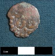
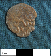
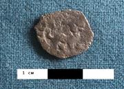
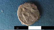
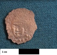
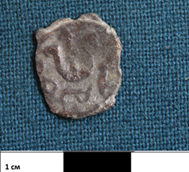
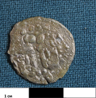
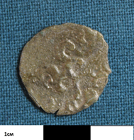
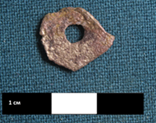
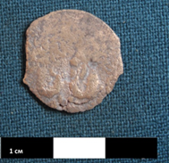
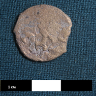
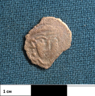
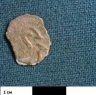
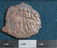
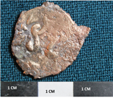
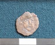
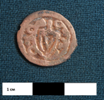
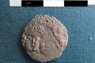
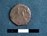
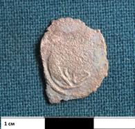
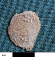
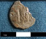
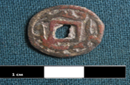
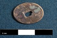
Literature
Смирнова О.И. Сводный каталог согдийских монет. Бронза. Москва, 1981 (Smirnova O.I. Comprehensive catalogue of Sogdian coins. Bronze. Moscow, 1981).
Смирнова О.И. Каталог монет с городища Пенджикент (Материалы 1949-1956 гг.). Москва, 1963.
Шагалов В.Д., Кузнецов А.В. Каталог монет Чача III-VIII вв. Ташкент, 2006 (Shagalov V.D., Kuznetsov A.V. Catalogue of coins of Chach III-VIII A.D.).
hagalov V.D., Kuznetsov A.V. Catalogue of coins of Chach. III-VIII AD. Tashkent, 2006.
Society for the exploration of EurAsia
Archaeological investigations
at the site of Qarshovultepa
(Tashkent Province, Uzbekistan)
in 2018
K.A. Sheyko
Dr. G.P. Ivanov
Dr. J.Ya. Ilyasov
Tashkent 2018
The site of the ancient settlement of Qarshovultepa (fig. 1) is located near the modern settlement of Dustlik in the Chinaz region of Tashkent Province. Since 2008, its stationary archaeological excavations have been performed by a group from the International Caravan-serai of Culture initiated by Ikuo Hirayama (since 2010 with financial support from the Society for the Exploration of EurAsia).
During 30 days in April-May 2018 archaeological excavations were conducted on the site. Work was concentrated on four excavation areas: R-3 (a so-called platform); R-7 – a fortified area in the northern part of the site of an ancient settlement; R-8 – excavation area, located on the highest point of the site of an ancient settlement, to the northeast from R-3; R-5 – a necropolis.
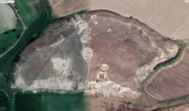
Fig. 1. Qarshovultepa. Photo Google Earth, 10/24/2018
R-3.
Investigations continued of the architectural remains of a second building level hidden during creation of a monumental platform and structures from the first building horizon. Work was undertaken in room No 1 ("throne-room") and to the east of it (figs. 2-5).
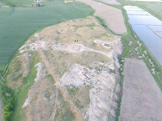
Fig. 2. Excavation areas R-3 (Excavation-3), R-7 (E-7) and R-8 (E-8), viewed from the west
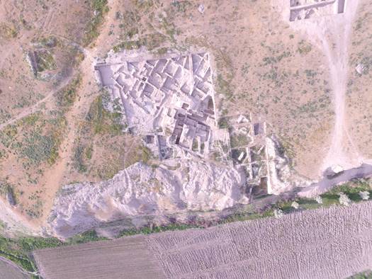
Fig. 3. Excavation area R-3
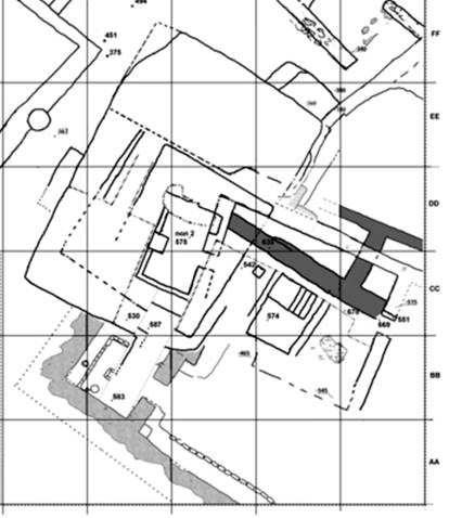
Fig. 4. Southeastern part of R-3
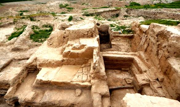
Fig. 5. A general view of part of R-3 investigated in 2018
From excavations in prior years , it has been found that the room, located under the center of the platform, represented a small-sized (5,50×2,80-2,90 m) “parade hall” with sufa, i.e. mud-brick benches, along its southern and western walls. The western wall, directly opposite to the entrance which is located in the eastern wall, had a special widening or "place of honour" intended to be used by the owner when receiving visitors (figs. 4, 5). This lay out existed only at the last stage of use of room 1, corresponding to the uppermost floor 1. Afterwards, the entrance into the room has been closed using mud-bricks (fig. 6) and the room was filled up with friable earth, and a substantial platform was erected above it. The bottom part of the platform consists of dense clay with a thickness of 1,50 m and more. The top part of the platform was built on this carefully leveled surface, consisting of alternating layers of pakhsa (beaten clay) 20, 25 and 35 cm thick, and mud-bricks laid in one row (figs. 10, 13-15). The top part of the platform was 2,10 m in height, so the total height makes about 3,60 m. Taking into account erosion it is possible to estimate that the platform had a height of not less than 4 m.
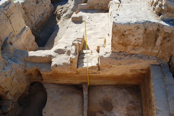
Fig. 6. Eastern wall of room 1 with the closed entrance
Up to now we have assumed that the sequence was as outlined above. However this year’s excavation has shown that the process was more complicated. So, to the east of room 1, room 2 was created with dimensions which are not known to us precisely. After the passage from room 1 to room 2 was fully closed with mud-bricks (figs. 6-8, 11), room 1 ceased to have a function. From the east, that is from the side of room 2, a brick wall was built with a thickness of 1,25 m (figs. 7, 10-13). We note that with an entrance width of 88 cm (from the side of room 2), the newly created wall completely closed the off the former passage. Its southern side is situated to the south of the southern side of the passage of 23 cm, and its northern side is 21 cm to the north of a northern branch of the passage. Thus, instead of room 2, two separate rooms were created, namely room 2a (southern) and 2b (northern), divided by a substantial wall whose thickness, together with plaster coats, reaches 1,34-1,35 m (figs. 7, 11). This wall is therefore thicker than the eastern wall of room 1 (in other words, the common wall of rooms 1 and 2) to which it is attached. Probably, this was caused by necessity to give more support as with such a thickness, the created wall leans not only against the layer of bricks by which the passage was closed, but also against the initial wall. On the other hand, one could take the view that the newly created wall has been built with such a thickness so as to completely hide the former entrance to room 1. To close the passage, mud-bricks with the sizes of 48×29×10 cm, 52×26×11 cm (upper row), 48×24×9 cm, 51×25×? cm, 52×25×10 cm, ?×23×10 cm were used. In one of the rows the bricks were laid inaccurately, since there are wide gaps between them (fig. 7). Probably, this is as the result of haste or negligence. In the lowermost row the mud-bricks have been placed more accurately and are laid out as follows: the headers of four intact bricks are laid to the northern side of the passage i.e., they lie in the north–south direction, across the passage (their sizes: 53×26×?, 50×24×?, 53×26×?, 50×25×10 cm), one whole brick (50×24×9 cm) is laid in the west–east direction, that is, along the southern arm of the passage. To it two halves of brick were added (fig. 8).
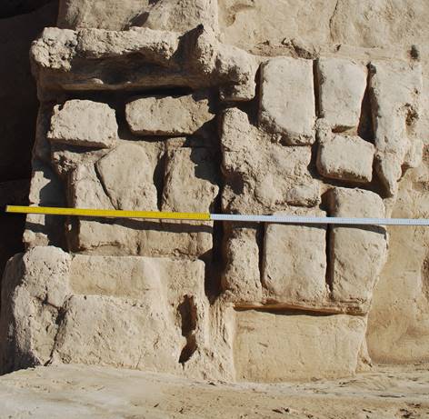
Fig. 7. Careless bricklaying in the passage to room 2 in room 1. Also the layers of the newly created wall which have been cut down at an angle in the course of building a platform. 2nd building level.
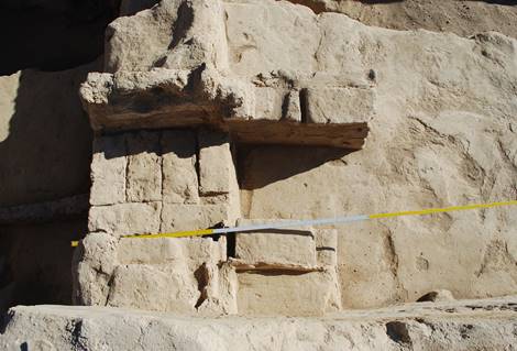
Fig. 8. The lowermost row of bricks in the door to room 2 in room 1.
2nd building level
Thus, to the east from “parade room” 1, two rooms were created instead of room 2, i. e. rooms 2a and 2b.
Let us continue our stratigraphicalobservation. Floor No 1 of room 2, at the same level as floor 1 of room 1 (when it was a parade hall), has been filled up by a layer of the friable greyish earth to a height of 40-45 cm (fig. 9). In this layer one can see pieces of mud-bricks as well as trampled down earth formed in the process of filling the room and the preparations for erection of an additional wall. The level of the trampled earth is 18-25 cm above floor 1.
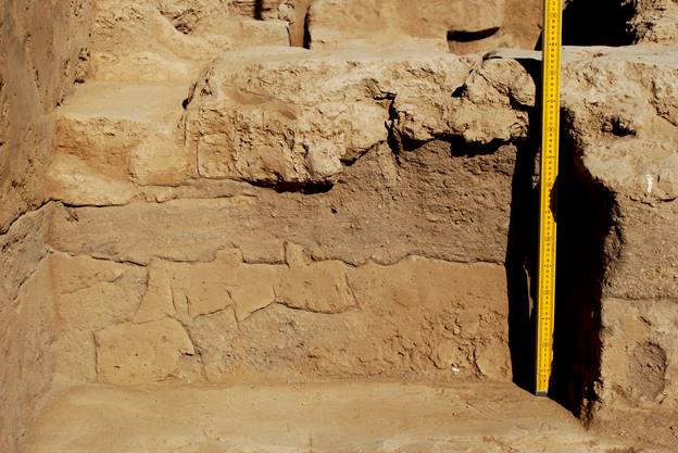
Fig. 9. Filling over floor 1 in room 2 and foundation of the newly created wall, viewed from the east
The foundations of the additional wall, thus, lies 40-45 cm above the level of floor 1. It is built from brick with the sizes of 52×26×10, 52×27×10, 41×28×10 cm. That is, they are the same sizes, as the bricks from walls in the second building period, and from the brick-layers of the passage, and from structures of the first building period. The wall only has a height of two rows of bricks. The mud-filled gap between the rows of bricks is 7 cm thick, and the vertical gaps are 2-4 cm. Floors in the newly formed rooms 2a and 2b (we will conditionally designate them as floor 0) lie on a layer of clay with a very fine structure which has a thickness of up to 13-15 cm. This mud was used to level off a surface of friable earthen fill of the room before making the floor. The same clay has been used for plastering the walls. The floor in room 2а, located to the south of the newly created wall, has a slight slope in the eastern direction. We only know the width of room 2b, which is 2,90 m along the western wall (which is common with room 1). This wall is covered with a plaster coat up to 6 cm in thickness on the side of room 2.
The use of rooms 2a and 2b, as well as all constructions of the 2nd building level on the site, stopped with the beginning of the construction of the platform. The eastern part of the building has been cut down in the course of shaping the contours of the future platform. Thus, rooms 2a and 2b were cut down at an angle, in accordance with the direction chosen for building the platform. For this reason the newly created wall, which is dividing the two rooms, has a length of 1,10 m on its northern side and 0,70 m on its southern side (figs. 7, 10-12, 14). In summary, the top parts of the walls of rooms of the 2nd building level, the top part of a bricks of the passage between rooms 1 and 2, as well as the top part of the newly created wall have been cut down also and the rest of all the mud-brick structures have been covered with pakhsa (figs. 13-15).
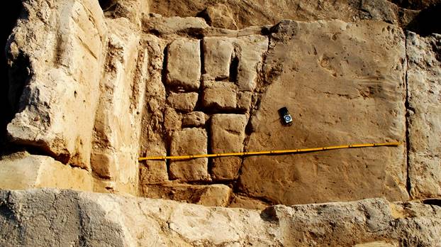
Fig. 10. From the left to the right: a platform foundation made of pakhsa over the brick layers inside the passage between room 1 and room 2. The newly created wall has been cut down at an angle and covered with pakhsa
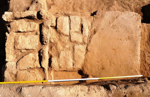
Fig. 11. From the left to the right: the brick layers of the door between room 1 and room 2, the newly created wall which has been cut down at an angle, corners of rooms 2a and 2b, covered with pakhsa
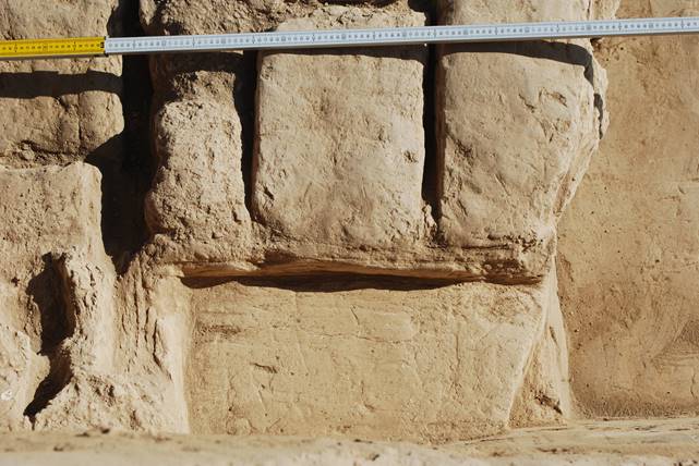
Fig. 12. The northwest corner of room 2a with floor 0
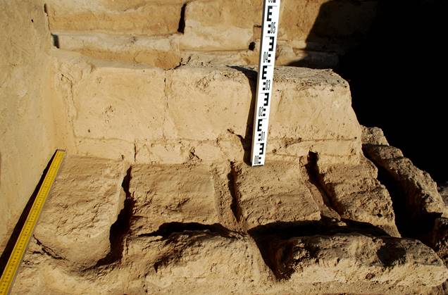
Fig. 13. The bottom layer of pakhsa over the cut down brick layers in the passage between rooms 1 and 2
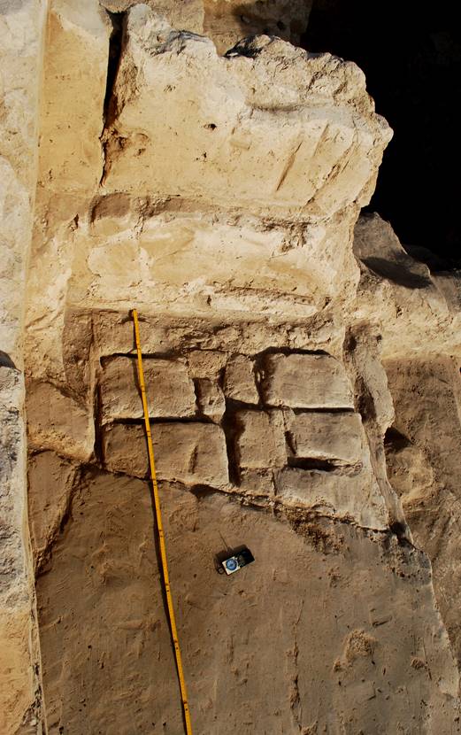
Fig. 14. The pakhsa foundation of the platform over a brick layer in the passage between rooms 1 and 2
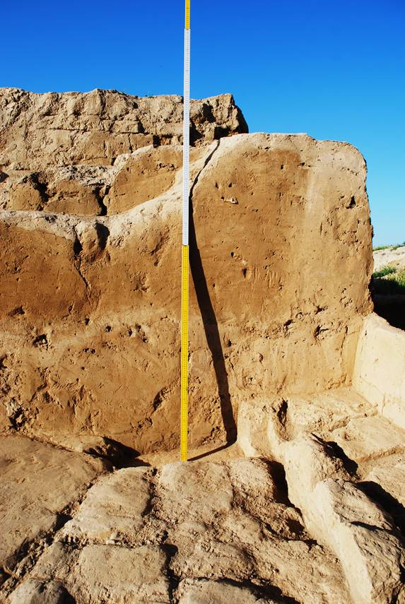
Fig. 15. A 1,5 m thick layer of pakhsaover the rest of the cut down walls of a building of the 2nd building horizon (closed passage). Above is the combined laying of the top part of a platform visible
Besides excavations to the east of room 1, room 1 itself was also investigated, more precisely, the bottom levels of floors which are, actually. There are no architectural relation to the "parade hall".
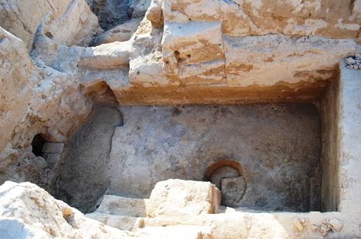
Fig. 16. Floor 2 (so called "winter floor") in room 1 of the 2nd building horizon At the left is a robbers' pit
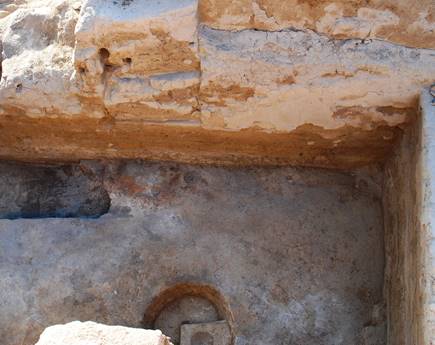
Fig. 17. A calcinated spot on floor 2, above it is the bricked-up entrance
In the 2017 season the uppermost level of floor 2, lying 56-57 cm below floor 1, that is the floor of a "parade hall", has been cleared.. In the 2018 season, under the top mud-and-straw plaster of floor 2, having a thickness up to 2-2,5 cm, the second join has been excavated. We call this "a winter floor" as it is characterised by a dark grey ashen surface and has a calcinated round area about 80 cm in diameter (fig. 18). Once a fire burnt on this area or a brazier stood here, therefore the layer under it was calcinated to a depth of up to 5 cm. Such features on floors, namely, the calcinated stains from braziers and their dark, ashen surface, have allowed us to mark out such "winter" floors, and to differentiate them from the "summer floors ", which were plastered in the spring or at the beginning of summer to hide the dirty surface formed during a cold winter season. The stain on floor 2 under the eastern wall shows, that somewhere in the building there could be an area which was later transformed to a smaller "parade hall" with sufas.
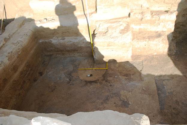
Fig. 18. Floor 2 ("winter floor") with a pit filled with a mud-and-straw mix
From the level of "winter" floor 2 a pit was excavated with a diameter of 79-80 cm and depth of 16,5-17 cm, filled with mud-and-straw plaster. Its walls are slightly sloping down to its bottom, therefore the diameter of the flat bottom is less than the diameter at its mouth, i.e. 70 cm. The bottom has been covered with a thin white coating. The pit, with its lose coloured filling, stood out very clearly against the background of the dark surface of the winter floor (figs. 18-20). The function of the pit is also clear: it was used for kneading clay (mud-and-straw mix) which was used to plaster "summer" floor 2. Furthermore the pit was also covered with plaster at its mouth so this means that on the level of the "summer" floor 2 the pit was not visible.
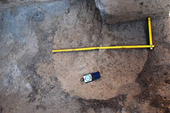
Fig. 19. Floor 2 ("winter floor") with a pit filled with mud-and-straw mix
It is curious that in the big pit there is a smaller one, located with a displacement to the southwest from the centre of the big one (fig. 21). The diameter of this small pit is 20 cm and its walls have been covered with a 1 cm thick layer of clay, its bottom is semicircular, and its depth is nearly 6 cm. It can be assumed that this additional small pit was filled with water which was used for smoothing down the surface of "summer" floor 2.
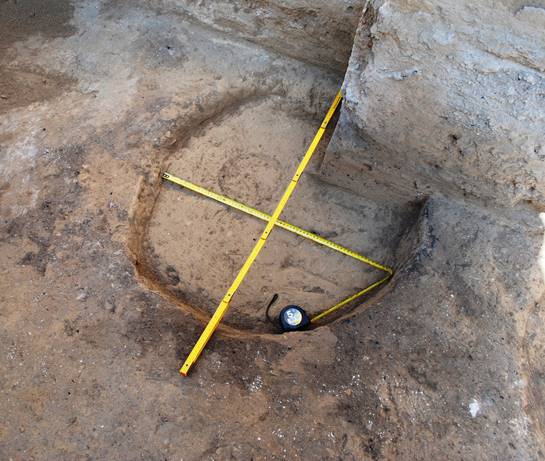
Fig. 20. The pit after partial clearing
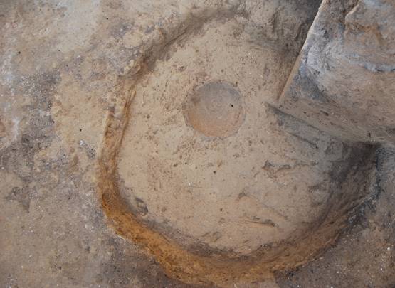
Fig. 21. The cleared away pit in floor 2
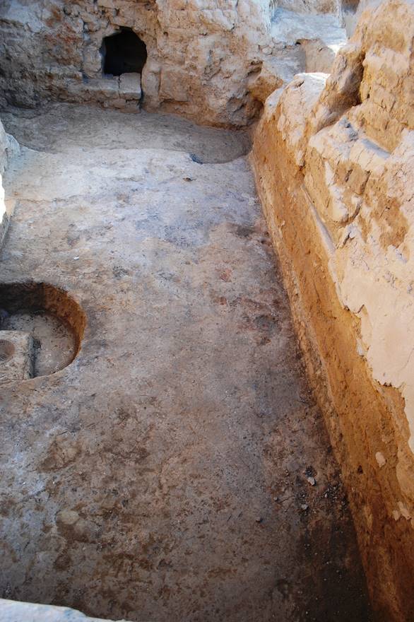
Fig. 22. Room 1 on the level of the"winter" floor 2
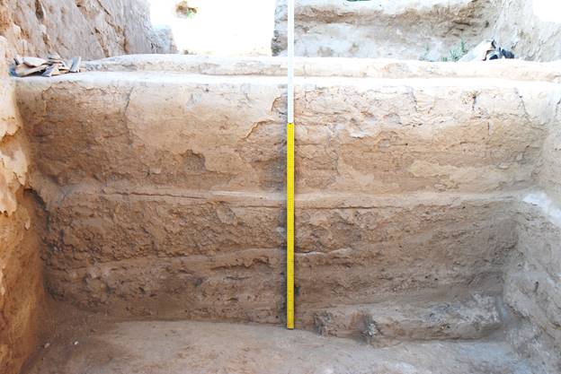
Fig. 23. Room 1: the remains of the cut down southern wall, southern sufa with the remains of plaster, floor 1, filling between floor 1 and floor 2.
The next floor excavated in room 1 was floor 3 (figs. 24, 25), located 76 cm below floor 1, and 20-22 cm below floor 2. Floor 2, accordingly, is below floor 1 by 56-57 cm. Its excavation began from the robbers' pit which has cut down all the northern part of room 1. Floor 3, as well as floor 2 is smooth, and unlike floor 1, is not pitted by burrows of rodents or beetles as it is located already at a depth where these could not reach. The surface of floor 3 is covered by whitish thin coats, over which lay cindery coats, as the layer between floor 2 and floor 3 consists, basically of friable cindery accumulations or a special fill. Under the plaster of floor 2, which has a thickness of 3-5 cm, are ashen layers of accumulations. They slope from the western to the eastern wall.
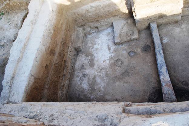
Fig. 24. Room 1, southern part, floor 3, viewed from the east
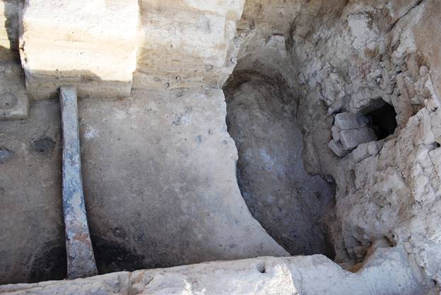
Fig. 25. Room 1, northern part, floor 3, robbers' pit, viewed from the east
On floor 3, just under the roundish calcinated area located on floor 2, is a similar fireplace. It is distinguished on the surfaces of floor 3 as a round black-grey stain with a diameter of about 90 cm (figs. 24-27).
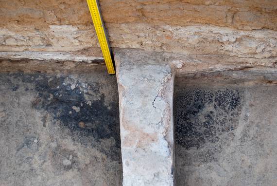
Fig. 26. A calcinated stain on floor 3, continuing under the eastern wall of room 1
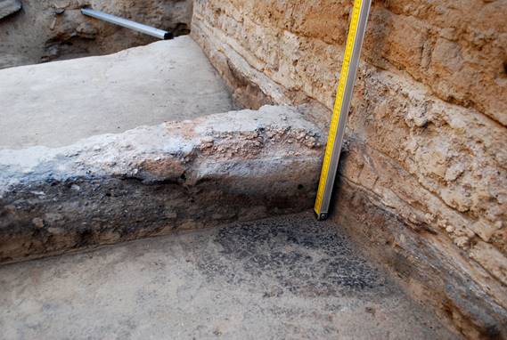
Fig. 27. Calcinated stains on floor 2 (section) and on floor 3
Further study of this extremely interesting area will, probably, allow us to find out, whether these sites of intensive fire were connected with the heating of the premises in the periods of use of floors 2 and 3, or whether it was a sacred fireplace with a cult meaning.
One more preliminary conclusion, to which we have come during excavation of the remains of buildings of the 2nd building level and the platform constructed over them, is as follows. Results of excavations show that the "parade hall" has been specially isolated shortly before the final stage of existence of the building. The entrance has been closed to a closed room, and the newly constructed wall has completely hidden an existing doorway. A bit later, the top part of the walls of all the building and their edges have been cut down, the premises have been filled up, and the massive platform has been built on top. We assume that its purpose was probably to hide something in the former reception hall. The considerable efforts made to erect this massive and thick platform over the central part of the building constructed from pakhsa and mud-bricks (some kind of "sarcophagus"), even though robbers made the way into room 1 through an almost 4 metre thickness of very dense clay, hints at such a possibility.
Anyway, a continuation of research in R-3 promises interesting results.
R-8.
During the 2018 season work began on R-8 (figs. 28-30), which is to the northeast of R-3 (platform). This is the highest point on the whole site of Qarshovultepa. The central reference point (zero point) is situated at a distance of 3 metres to the south of the edge of R-8
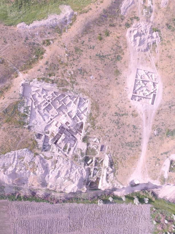
Fig. 28. R-3 and R-8
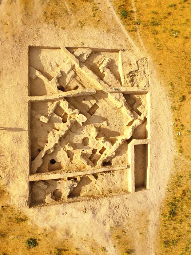
Fig. 29. R-8
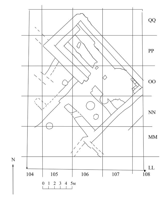
Fig. 30. R-8, plan
The first attempt to work on this area was undertaken in 2016 when a small excavation (5×5 m) was made. In 2018 it was decided to continue excavations in this area. In our opinion, this site is of a special interest because of its dominating position over the entire Qarshovultepa site, and, secondly, it seems to us, this place, for functional purposes, was connected with neighboring R-3. The area of the excavation has been increased to 25×20 m.
The excavations in 2016 were spent in squares ОО 107, 108 and NN 107, 108. At a depth of 0,65-0,75 m the remains of very badly preserved walls were found. In 2018, the similar results were observed in other squares in all parts of R-8. This layer belongs to the last period of life of Qarshovultepa. It appears, that after periods of destruction, mainly repair works occurred on this settlement¹. We found traces of destruction, better to say, of conflagration, under the walls of the last building/repairing period at a depth of 0,95-1,05 m. At this level in squares PP107 and ОО108 the top bed of a wall of the premises was found at a depth of 0,98 m which has been given number 1. The termination of functioning of this building was connected with a powerful fire which occurred on this site. We observed a similar result at neighbouring excavation R-3. It is obvious that after such a powerful fire, repair works were made in the building. They were filled up to ground level, and the upper parts of old walls were reused and new walls were attached to them which repeated the lay-out of the previous rooms. Unfortunately, the remains of these walls do not exist on all areas of R-8, because of the strong erosion. It should be noted that in the rooms of this area no thorough excavation works were completed. Directly above the layer of the eroded walls and of a burned roof, a pavement was made from pakhsa, and partly from mud-bricks, which played a role of a new level for the rather modest architecture of the last building period of Qarshovultepa. The remains of walls of this time are in better condition in the northern part of R-8 and could be well traced into the control section. Fillings of this building period consisted of a friable ground in which there were fragments of mud-bricks and pakhsa. A lot of ceramic fragments were found here such as big storage jars (khum), basins (tagora) and jugs. In the center of room 1, was found on the floor a very poorly preserved coin (see Coin register, No 1). The coin's obverse is strongly corroded, so the image of a beast of prey going to the right is not really recognizable. However on the reverse side a fork-shaped dynastic sign (tamga) and the rests of Sogdian inscription remains. Judging from this, the coin could belong to the mint of the ruler of Chach named Tarnavch, who ruled sometime between the second half of the 7th and the middle of the 8th centuries, according to E.V. Rtveladze.
The repaired premises most likely continued to carry out the same functions as the previous premises. But it is clear that the repair works were of a very poor quality. Most likely, such a poor quality was caused by the necessity of the urgent repair of the areas destroyed by fire. It is possible to assume that it was influenced also by the factor of human losses if the fire was connected with the Arab's attack on Qarshovultepa.
¹ We suppose that the conflagration of the Qarshovultepa settlement could be connected with the military campaign of Qutaiba ibn Muslim, Arab governor of Khurasan and most successful conqueror of Mawara al-Nahr, whose army, according to historian Tabari, plundered and burned al-Shash (i.e. Tashkent Oases) in 713-714 CE.
Room № 1
Room 1 is rectangular in plan. It extends from the southeast to the northwest, with the dimension of 14,25×5,35 m. Its walls were built from rectangular mud-bricks with the size of 47-49×23-25×9-11 cm. Their height is from 0,30 (in the northern part) up to 0,99 m (on the western and eastern parts of the building) with a thickness of 0,65-0,80 m. The remnants of the northwestern wall have a height of only 10-15 cm. The length of the wall is 5,25 m and its thickness is 0,95-1,10 m. The northeastern wall has a length of 14,25 m, with a thickness of 0,90-1,05 m, the southeastern wall has a length of 5,60 m. In the southern part the wall the remains are better, and the wall height reaches 1,10 m. The southwestern wall has a length of 14,15 m, and a thickness of 0,60-0,80 m. Its height ranges from 0,80 m up to 1 m. The entrance to the building is in the southwestern wall, in its middle part. Near to a doorway, on the floor a small hollow with a diameter of 40×45 cm has been excavated, which probably contained a stone step. The step itself was found nearby at a depth of 1,90 m. On the perimeters of the northeastern, northwestern and southwestern walls are sufas (i.e. mud-brick benches) with a width of between 0,60 to 0,95 m. They are at a depth of 1,97-2,01 m from the general reference point (Zero Point). The same sufa is situated in the middle of room 1, connected to the northwestern sufa and stretches in the southeastern direction. Its width is between 0,95 and 1,05 m. Most likely, these sufas were used to put in rows storage jars, the remains of which were found here. Over this is a layer, which remained after the powerful fire we have already discussed. This layer is full of burnt wooden beams from the fallen roof. Between them were found pieces of clay with clear traces of cane and other vegetables used to construct the roof.
On the floor at the southwestern wall, near a doorway, a coin was found with the image of the ruler portrayed in three quarters to the left (see Coin register, No 2). He has a headdress looking like a crown. On the left side is a Sogdian inscription. On the reverse there is a lyre-shaped tamga with the remains of a Sogdian legend. These inscriptions are illegible.
In the filling under the fire layer, a considerable quantity of thick-walled pottery was found, basically fragments of khums and big jugs. Directly on the floor between the sufa at the eastern wall and the sufa which passes in the middle of room 1, a small vessel was found, with traces of soot on its bottom and sides. Most likely, it was used as an incense-burner. Near to the entrance, on the floor a ceramic mug with a broken handle was found.
Room № 2
This is situated to the southwest from room 1 and with a common wall. That is, the southeastern wall of room 2 is a continuation of the southeastern wall of room 1. The wall’s length is 3,25 m, and it has a thickness is 0,85 m. The remains have a height of 0,80 m. The northeastern wall of room 2, which is also common with room 1, has a length of 7,10 m and a thickness of 1-1,10 m. The remains have a height ranging from 0,65 m to 1 m. The southwestern wall has a length of 6,00 m. In its northwestern corner there is a door frame with a width of 0,80-0,90 m leading to the next room № 3. At a distance of 3 m from the southern corner of the wall is a partly destroyed grave from the end of the 19th – the beginning of 20th century. The northwestern wall has a length of 3,80 m. Leaving the western border of excavation, it became a wall of room № 3??. At a distance of 1,60 m from the northwestern wall and 2,05 m from the southeastern wall, that is in the center of the building there is a round pit in its floor with a diameter of 1,50 m and a depth of 0,6 m. Its walls were plastered, that means it was of a special use. At a distance of 1 m from the southeastern wall one more hole was found which is smaller in diameter (0,80 m). As in room 2 we do not have remains of a burned roof, so it is possible that it was a small courtyard.
On a floor near the southeastern wall a coin was found with a pair portrait (see Coin register, No 3). The coin is severely damaged but the image of the ruler and his wife can still be distinguished. Although the reverse of the coin is substantially eroded, it is still possible to distinguish a fragment of tamga.
The occupation layer of this building, especially in its southern part, is permeated with ashen layers which lay directly on the floor. In them were found bones of animal as well as a small amount of ceramic fragments of pots, cauldrons and jugs.
Room № 3
Room 3 is situated to the northwest of room 2, having a common wall with it which is southeastern for this building, and is northwest for a room 2. Room 3 is badly preserved, mainly because of a hole dug in a subsequent time period. The length of the northeastern wall is 3 m, the southwestern wall has a length of 2,4 m. Most likely in the southwestern corner was a doorway connecting it with another building. The northwestern wall has a length of 2,8 m. This wall is bad preserved because of a later tomb, but it was possible to establish its length: 2,50 m.
Two coins were found here. The first coin was found in a layer over the floor, close to the southeastern corner (see Coin register, No 4). On the obverse a leopard-like predator is represented going to the right with a lifted tail. On the reverse is shown a fork-like tamga. The second coin was found in the northwestern corner (see Coin register, No 5). Represented on the obverse is the ruler with his spouse. On the reverse is a tamga imitating the shape of deer antlers. On some coins of this group, the Sogdian legend is read as “Divine Tun kagan”. Coins of this group are dated to the end of the 6th – the first half of the 7th centuries (E.V. Rtveladze) or to the second half of the 7th – the beginning of the 8th centuries (V.D. Shagalov/A.V. Kuznetsov).
Room № 4
This room was not completely excavated. It has been established that the southeastern wall of this building has been cut partially off by a grave from the beginning of the 20th century. The northeastern wall was completely excavated, and its length is 5,9 m. The northwestern wall was dug out for a length of 5 m, where it goes to the western edge of the excavation site. At a distance of 0,80 m from this wall, a pit was found with a diameter of 0,80 m. Its floor is rough, with a slope in a southern direction. Its filling consisted of a layer of friable earth with pieces of coal. On its floor was found a small amount of ceramic fragments.
Excavations in squares LL, MM, NN 106, 107, 108 has shown that a southeastern wall in rooms № 1, 2 and 4, as well as a northeastern wall in room № 1 were built first and were used as the base walls to which rooms were attached at a later time. A full excavation of these walls is necessary in order to find out the earlier lay-out and functions of this location. Now we can say that since there are no architectural remains in squares NN, MM and LL 108, this suggests that the area served, most probably, as a big courtyard, or it was an empty site between two architectural complexes. Only in square MM 106 is the wall going in a southeastern direction attached to the southeastern wall of the complex. In squares MM and NN 107, 108 the top layers are broken by graves from the end of the 19th and the beginning of the 20th centuries. Similarly to the northern part of the excavation, the last building period is not distinguishable. A lot of later graves are concentrated in the southern part of R-8, therefore the big area of the occupation layer has nearly vanished.
During excavations of the upper layers, two coins were found in the southeastern part of R-8. The first coin is a copper fals which was minted in Samarqand (?) in the year 205 of Hijra / 821 CE (see Coin register, No 6). The second coin belongs to the silver mint of the so-called Bukhar-hudat type, and is partly damaged (see Coin register, No 7).
Three coins were found in squares LL 107, 108. Two of them belong to the mint of Bukhar-hudat type (see Coin register, Nos 8 and 9). The third is a silver coin of the pre-Islamic Choresmian ruler Brawyk/Frawik (see Coin register, No 10), who ruled, presumably, in the second half of the 6th century (D.V. Biryukov). It is necessary to note that it is the first find of a silver coin of this ruler in Chach (i.e., in Tashkent Oases). Two other coins were found in a square of MM 106, at the southeastern wall. The first coin has the image of a predator going to the left (see Coin register, No 12). The second coin bears images of the ruler and his wife (see Coin register, No 11).
Let us shortly speak about the ceramics found in 2018, mainly from R-8. They do not differ from material of the previous seasons. As before, they can be divided into two basic groups – the ceramics made on a potter's wheel and ceramics, made by hand modeling. Ceramic types like jugs, pots, mugs, bowls, plates, braziers/frying pans, khumcha and khums (big size storage jars) are prevailing (fig. 31 a, b). Besides that a unique vessel has been found in R-7, in the layer under the fortifications wall, namely a rhyton. It is in the shape of a one-handled jug with an aperture in the bottom part (fig. 32). Analogies to it were already found in Chach. In some publications such ceramic vessels are named a funnel. But their careful decoration (polished engobe on our vessel, relief decoration and engobe in other cases) speaks in favour of a special use of these objects as ritual vessels for libation in the 3rd-4th centuries AD.
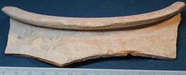
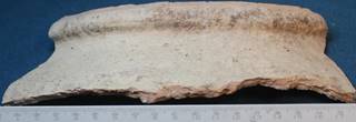
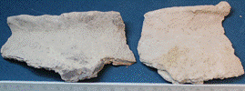
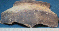
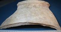
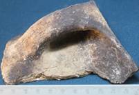
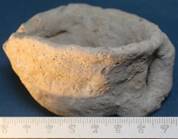
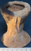
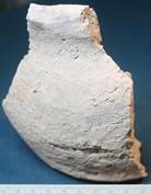
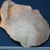
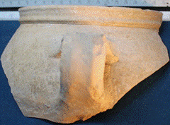
Fig. 31a

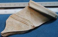
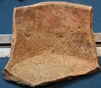
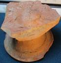
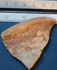
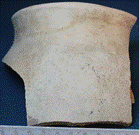
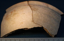
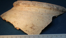
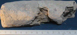
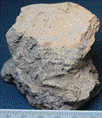
Fig. 31b
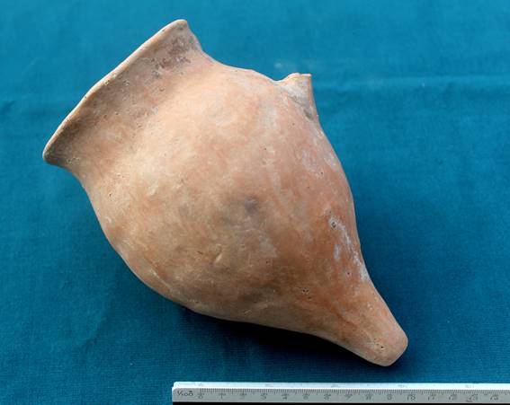
Fig. 32. Ceramic rhyton, R-7, from the lower building period
R-7.
Studying of the stratigraphy of the layers was a main goal of the excavations in R-7. We wanted to find out the stages of construction of the tower № 1, the premises situated to the south of it and the defence wall adjoining to the tower from the east (figs. 1, 33, 34). For this reason, a stratigraphic trench with a width of 2 m was dug to the east of tower № 1 which cuts the city wall. The trench’s length was 22 m. From the north and the west from tower № 3 an excavation with a width of 2 m was opened up to study layers and virgin soil and reached to a depth of 8,00 m. As a result the lay-out of the building could be determined and floors to a depth of 5,60-5,80 m were excavated in the southern part of R-7.
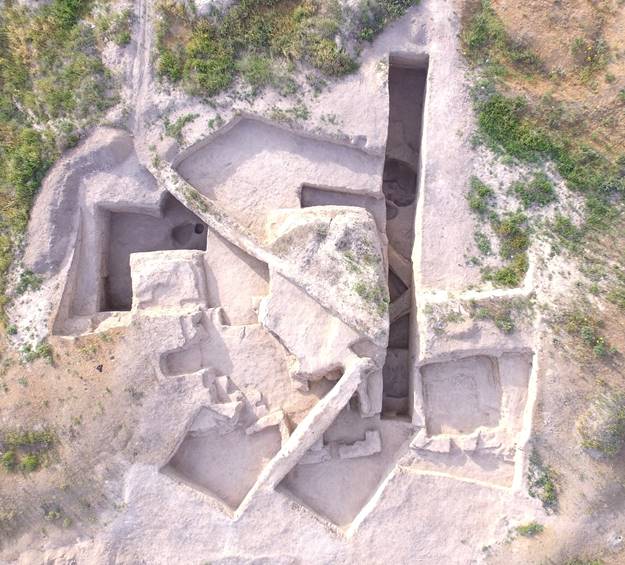
Fig. 33. Excavation № 7 at the end of the 2018 season.
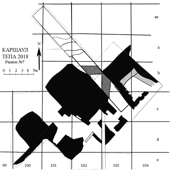
Fig. 34. Excavation № 7. The plan of the city gate and adjoining premises
(floors are at a depth of 5,60-5,80 m)
The trench to the east of tower № 1 (fig. 33, 36) was dug with the purpose of finding out the stages of building of the defense wall and tower. Therefore, its initial length was 10 m. When we found that the wall had been constructed not on virgin soil but on an occupation layer, the trench has been continued in the northwestern direction to 12 m, with the purpose to find out, whether the defense wall was present here at an earlier stage. In the trench, the top point of the northern defense wall is the on mark of minus 3,10 m from the zero reference point. Both parts – lower and upper – of the wall are out of pakhsa. The wall was twice under construction, both times a pakhsa addition (“shirt”) was attached from outside. The thickness of the upper wall at its top is 2 m, and is 2,50 m at the depth of 4,75 m. The shirt is 60 cm in thickness (fig. 35).
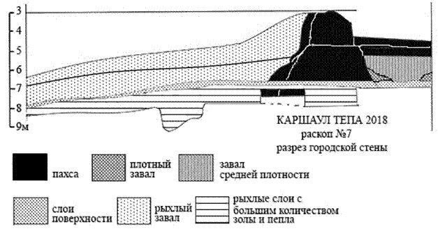
Fig. 35. Section of the city wall: 1 - pakhsa, 2 - a dense blockage, 3 - a blockage of middle density, 4 - upper layer, 5 - a friable blockage, 6 - a friable layer with ashes
The lower wall is horizontally cut off at a depth of 4,75 m, it is thicker than the base of the upper wall and protruding inside the settlement by 25 cm. The base of the lower wall is at a depth of 6,70 m, hence, the remaining height of the city wall is 3,60 m.
Inside the settlement a building with sufas is attached to the city wall located between towers № 1 and № 2 (fig. 36).
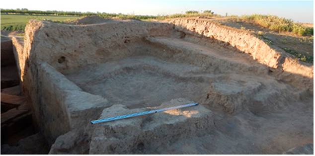
Fig. 36. The western wall cut off by a trench and a building between the towers.
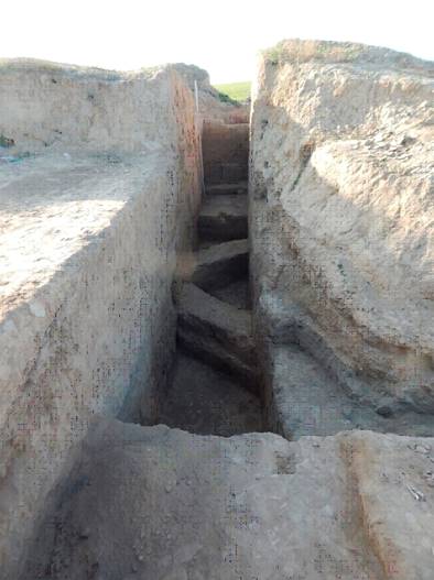
Fig. 37. A trench which cut off the defense wall to the east from tower № 1, viewed from the northwest
To the north of the defense wall, layers of friable ground were observed in the trench which were between the surface and the level of minus 6,70 m (near a wall) and 7,90 m at the northern end of the trench. Inside these layers, the dense surface is visible which was the foundation for the building of the city wall in the second stage, at the level of 5,50 m near the wall and 6,80 m at the northern end of the trench.
Under level 6,80 m in the southern part and 7,90 m in the northern part of the trench the dense layer which is up to 20 cm thick was excavated. Directly on its surface were built the city wall and a tower. Under this dense layer, in the area of the trench, laid loose layers of soil with a considerable quantity of ashes. In these layers, on the joint of squares b-102 and 103, at a depth of 7,50 m, were found two walls with a thickness of 90 cm forming a corner of the building. They have retained a height of 40 cm and are located at an angle of 45 degrees to the defense wall. Hence, they have no relationship to the system of defenses of the city excavated until now. Layers with ashes go to a depth of 8,00 m in the southern and 9,00 m in the northern part of the trench. Lower down is the surface of an equally dense ground of a reddish color without any inclusions. On the same ground Excavation № 5 (Necropolis) with burials is located. It has no topsoil.
Preparation of the western side of the trench has shown that tower № 1 has at least three stages of building. From the beginning it was erected from the level of 6,70-6,60 m, then reconstructed twice at the levels of 6,00 and 5,50 m. Exact dating of these stages is difficult, but we can assume that it was not earlier than the 6th century and not later than the beginning of the 8th century AD.
In order to study the stratigraphy around tower № 3, excavations were made with a width of 2 m. As in the large trench, under the surface at a depth of 6,85 m and until virgin soil is reached at a depth of 8,10 m, there are thick layers of soil with ashes both under the tower, and defence wall (fig. 38).
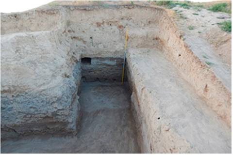
Fig. 38. Excavation around tower № 3. View of the tower's corner and defense wall
In a southern part of R-7 all the territory was excavated until the floors which are at a depth of 5,60-5,80 m from the zero reference point (the second building period). In square s-103, in its southeastern part, the building with three entrances was excavated. Its dimension was 4,50×4,00 m. It extends in the southeastern-northwestern direction. Its floor is at a level of 5,60 m in the eastern part and 5,79 m in the western part. The northwestern wall of the building is the southeastern side of tower № 1. To it the pakhsa block is attached, with dimensions of 2,00×1,20 m, from which, in the southeastern direction, the wall departs and has a thickness of 80 cm (fig. 34, 39). The wall has retained a height of 50 cm in the southern part and 1,50 m in northern part, where it joins a tower. In its southern part, a passage with a width of 1,00 m, leading in a northeastly direction, to a corridor between this bulding and a building with sufas. The width of this corridor is 2 m. The east corner of the building is 40 cm from the doorway. The southeastern wall, with a thickness of 90 cm, has remains with a height of 40-50 cm. The western corner of the building is under the control section and was not excavated. 1,50 m from the eastern corner of the building in the southeastern wall a doorway with a width 70 cm was cleared. It was once closed by large lumps of clay.
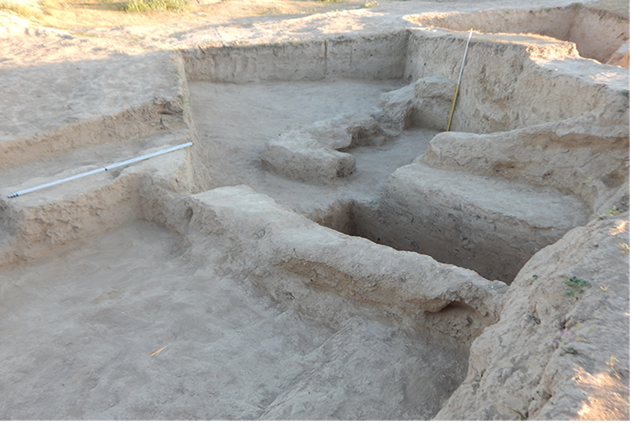
Fig. 39. Building with three doorways, connected from the southeast to tower № 1
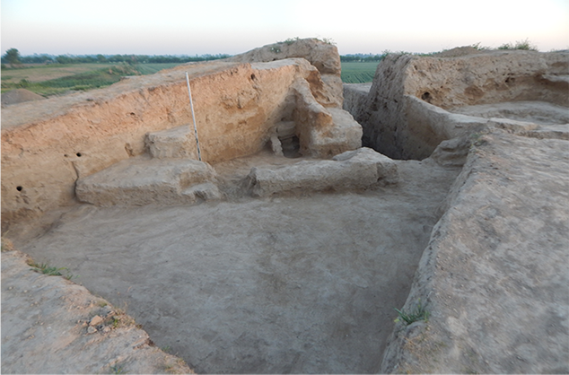
Fig. 40. Southern entrance to the building with three doorways
On the surface of the floor in the city gate, two tracks left by the wheels of carts carrying goods into the settlement were cleared (fig. 41). To the northwest from the gate at a level of 6,50 m the floor has been excavated.
As a result of the excavation work on R-7 it was possible to determine that the defense wall of the ancient settlement and both towers do not stand on virgin ground. There are occupation layers of the previous period of life on the site, before fortifications were built here. Judging by the ceramics from these layers, it can be dated to a time not later than the 5th century. The building of the fortification walls with a gate, excavated by us earlier, has been started from the level located at a depth of 6,50 m from the zero mark. Virgin soil is at a depth of about 8,00 m. As already mentioned above, this fortification can be dated to no earlier than the 6th century. One of the main goals of future excavations on R-7 is to solve the chronological questions.
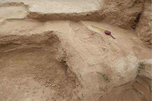
Fig. 41. Traces of vehicles in the city gate
The occupation layer which is up to 1,5 m in thickness contained a considerable quantity of ashes in the form of horizontal layers on a friable ground. Two walls with a thickness of 90 cm forming a right angle have been found in the trench within an ashen layer (fig. 34, 37). This means that there existed an earlier medieval fortification constructed in at least two previous building periods. Whether or not there were fortifications at the earlier stage of settlement will need to be determined by future excavations.
It is possible already to say with confidence that tower № 1 was under construction three times. During the 2018 season it has been determined that the tower configurations during these three periods were not identical. Outside it was always rectangular in plan with rounded corners however its size differed a little. During the last period viewed from the inside of the settlement, it was roundish however during the middle period its southern part adjoining the defense wall was straight and its southwestern wall adjoined the gate.
Necropolis (R-5)
In an 2015 excavation area with dimensions of 5×6 m dug in the southern part of a hill situated 200 m to the northeast of the settlement is an area used as a necropolis.
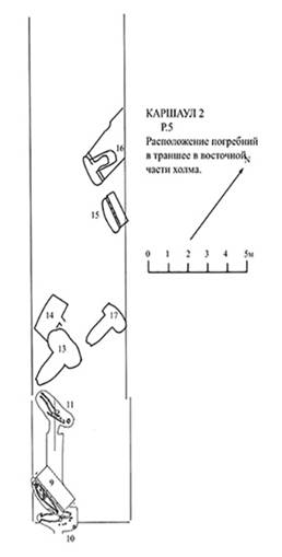
Fig. 42. Plan of trench with burials
During the 2017 season an excavation area has been extended in the form of a trench with a width of 5 m on the northwest up to the edge of a hill (all about 40 m of length). In the trench friable soil has been removed, and the firm surface cleared. Alongside the northern edge of the hill another trench with a width of 3 m was also cleared. On these areas six new burials (fig. 42) have been opened in the 2017-2018 seasons.
Burial № 12
This was discovered in the eastern part of the trench (fig. 43, 44). The dromos extended in the north-south direction, its size is 1,10×0,80 m. The catacomb is 1,75×0,60 m and located perpendicularly to the dromos. The entrance to the catacomb was at the northern end of the dromos. The entrance and the main part of the vault have been destroyed by robbers from above. The vault’s height was not less than 65 cm. On the catacomb floor the bones of a human skeleton were taken out. The left humeral bone has been moved near to the entrance. The skull is pressed against the eastern wall of the catacomb.
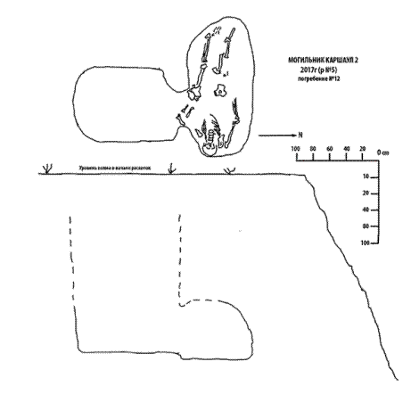
Fig. 43. Burial 12
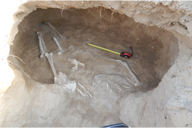
Fig. 44. Burial № 12. A view from the south
A skull lay with face upwards, its lower jaw is pointing downwards. Judging by the state of preservation of the teeth, the skeleton belonged to a youth. One dark blue glass round bead was found near the right side of the pelvic bones.
Burial № 13
This was found 1 m to the northwest of burial № 11, which was excavated in 2015, at a depth of 1,20 m from the modern surface (fig. 45). The dromos is oriented in the north-south direction and extends to the north and is rounded off at the southern end. Its length is 1,70 m, and its width is 50 cm at the southern part and 90 cm in the northern part. The bottom of the dromos tilts from the south to the north, its depth from the modern surface is 1,60 m at its southern edge and 1,95 m at the entrance to the catacomb in the north. At the northern end of the dromos is an entrance to the catacomb with a width of 90 cm and a height of 45-55 cm. The catacomb floor is 15-20 cm deeper than at its entrance. There is a catacomb with an oval shape and is situated perpendicularly to the dromos. Its length is about two metres (it was not possible to establish the exact size because of the activity of ancient robbers), its width is 80 cm in the western part and 60 cm in the eastern part.
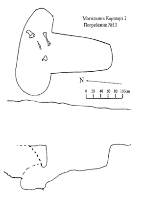
Fig. 45. Burial № 13
The height of the vault of the catacomb was not less than 60 cm. The vault’s central part was broken by a robbers’ hole dug from the northern direction. For this reason the northern wall of the catacomb retains a height of only about 15 cm. Above it there is friable soil with inclusions of fragmented bones. On the bottom of the catacomb some fragments of human bones were discovered .
Burial № 14.
The western part of the catacomb of burial № 13 has broken into the southeast corner of the catacomb of burial place № 14. The chamber has a trapezoid form with almost right angles, and extends in the north-south direction with a small deviation to the west (fig. 46, 47). Its length is 2 m, and width is 1,10 m at the northern wall and 80 cm at the southern wall. The eastern wall of the chamber has retained a length of 1 m from the northeast corner. Located in the eastern wall, 40 cm from the corner, is a door with a width of 40 cm and height of 50 cm. A passage going towards the robbers’ dig, which actually destroyed the dromos, was not excavated by us. The floor is at a depth of 2,15 m from the modern surface. The chamber walls would have had a height of 50 cm from the floor however they are bent as the vault has fallen, probably, as a result of the activity of modern heavy machinery on the hill.
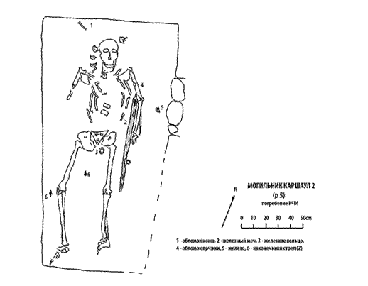
Fig. 46. Burial № 14
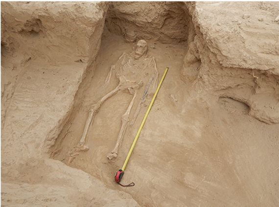
Fig. 47. Burial № 14. A view from the south
The walls and chamber floor have been smoothed down so carefully that they look as if they were covered with a clay plaster. On the floor of the chamber we took away a skeleton of an adult person in the extended position on its back, with its head to the north. The right knee was slightly pointing to the right. The skeleton has been disturbed. The elbow bones and bones of the right hand were absent. The position of the breast bone is disturbed. Four large vertebrae lay to the right of the skull and one is near the left temple. Probably, it is the result of activity of rodents. But, it is more probable that the people who dug the catacomb for burial № 13 searched for something valuable and they destroyed part of burial №14, whose chamber, was not yet filled with soil, From the burial goods we have found only iron objects in the chamber. Laying to the right of the skull under the northern wall was a small fragment of a knife, and there was a small buckle on the left humeral bone. Along the left side of the skeleton, laid an iron sword with a length not less than 80 cm stretching from the humeral bone almost to the knee (part of its hilt and an edge have not survived). Most likely, the sword was in a sheath. Traces of wood decay were found. Besides this, slightly below the hilt and in the lower third of the blade, a crampon and a small ringlet were discovered. Most probably, they were used to suspend the sword to a belt. A large iron ring, most likely part of a belt buckle, lay to the left of the pelvic bones. Also found in the chamber on the floor, near to the entrance to the catacomb, was a fragment of an iron hook. Two small arrowheads were also found, one to the right of the right knee, another between the femurs.
Burial № 15.
This burial was discovered five metres to the north of burial № 14 under the northeastern border of a trench. Loose soil was observed here to a depth of 1,25 m from the modern surface of the hill. Under this there was untouched loess, in which the inlet pit of a rectangular shape with the size of 1,90×0,70 m was found, extending in the east – west direction (fig. 48). The bottom of the inlet pit was at a depth of 1,70 m from the modern surface. I.e., its walls have retained a height of only 45 cm. Along the southern edge of the pit seven mud-bricks were found. They stand on their head in one row to close a podboi (burial chamber). The dimensions of the bricks are 45×24-25×8 m. It could be that originally the bricks were slightly longer, but they are partly cut.
The bottom of the podboi extends along the southern edge of the inlet pit and is 20 cm deeper. The size of the podboi are: length of 1,90 m, width of 40 cm in the western part and 30 cm in the eastern part. The maximum height of the vault is 55 cm in the central part. On the bottom of the podboi a skeleton (probably, young woman of 25-30 years) lay in an extended position, with its head to the west. The face has been turned to the south. The left shoulder has been closely pressed to the northern wall of the podboi. The bones of the right hand were almost completely under the ribs, and the bones of the left hand were on the ribs of the left side and on the pelvic bones.
In spite of the fact that the burial has not been plundered, no funeral goods were found.
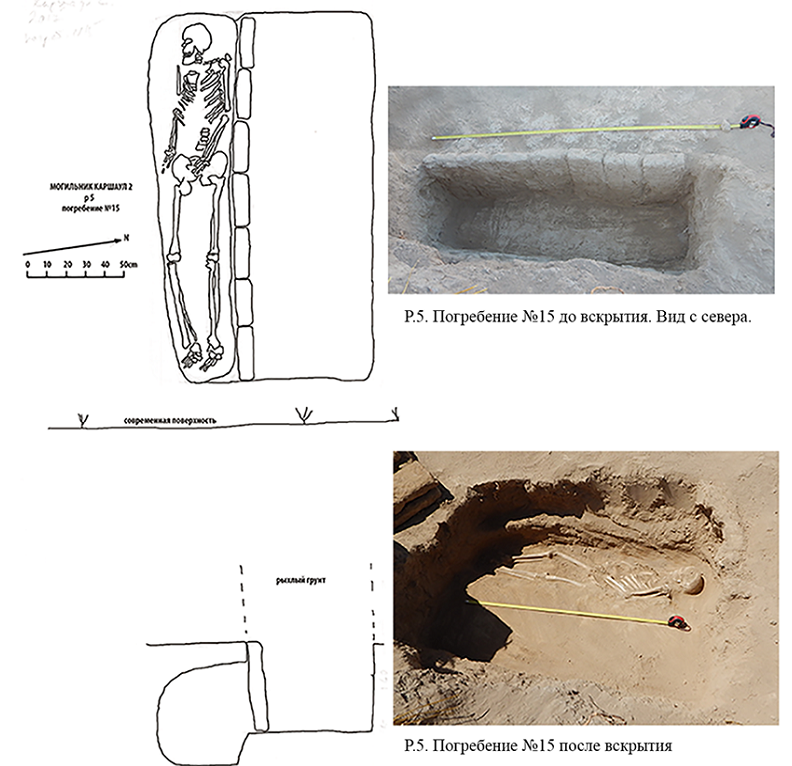
Fig. 48. Burial № 15
Burial № 16.
This was discovered 1 m to the west of burial № 15. The dromos extended in the northeast – southwest direction (fig. 49).
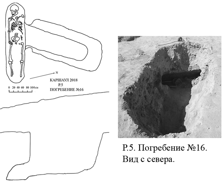
Fig. 49. Burial № 16
At a depth of 90 cm from the modern surface the size of the dromos are 1,70×0,75 m. The walls incline to the bottom so on the floor, at a depth of 1,70 m, the dromos has the size of 1,35×0,45 m. At a distance of 40 cm from the northeastern wall, the floor falls from 1,75 m to 1,85 m at the entrance to the catacomb located in the southwestern end. The width of the entrance is the same as the width of the lower part of the dromos, and the height of the entrance is 35 cm. The entrance has been closed by mud-bricks which are similar to bricks found in burial № 15. Their remnants are on steps between the top and bottom walls of the dromos. The catacomb is not perpendicular to the dromos. Between their axes is an angle of about 45 degrees. The catacomb is oval in plan, its size is 1,70×0,45 m. The floor of the catacomb is 10 cm deeper than the floor of the entrance. The height of the vault is 35 cm. In the catacomb a skeleton was laid in the extended position on its back, with head to the west. The face has been turned to the south. The ribs and pelvic bones were partly disturbed by robbers. The bones of the left hand (near to the entrance) are absent, except for a humeral joint. No burial goods were found.
Burial № 17.
This was discovered 1 m to the north of burial № 13, at a depth of 80 cm from the modern surface. The dromos is rather small with the size of 1,10×0,80 m. It extends in the north – south direction. Its southern end is rounded, its northern end is straight. The floor of the dromos is at a depth of 1,50 m from the modern surface. In the northern end is the entrance to the catacomb. It is 30 cm in height and has been closed not by mud-bricks but by large clods of clay. The level of the floor in the catacomb is 40 cm deeper than in the dromos. The catacomb is elliptic in plan with the size of 1,80×1,00 m. It is located at an angle of 15 degrees to the dromos, in the northwest – southeast direction. Nothing was found in the catacomb, most probably, it was a cenotaph.
Thus, the excavations of 2018 have allowed us to address the important questions connected with the stratigraphy and history of the Qarshovultepa settlement, and also to reveal new prospective areas for the further study.
| copyright by The Society for the Exploration
of EurAsia| E-mail
| Home
| ![]()