| 2015 | 2016 | 2017 | 2018 | 2019 | 2020 | 2021 | 2022 | 2023 | 2024 | 2025 |
Archaeological excavation of a medieval city and presumed Nestorian Christian graveyard
Starting point
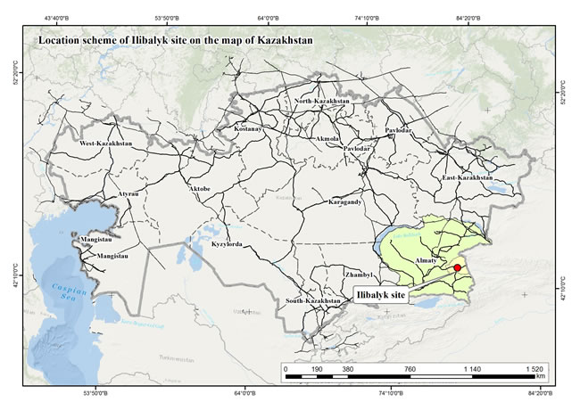
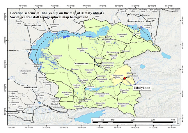
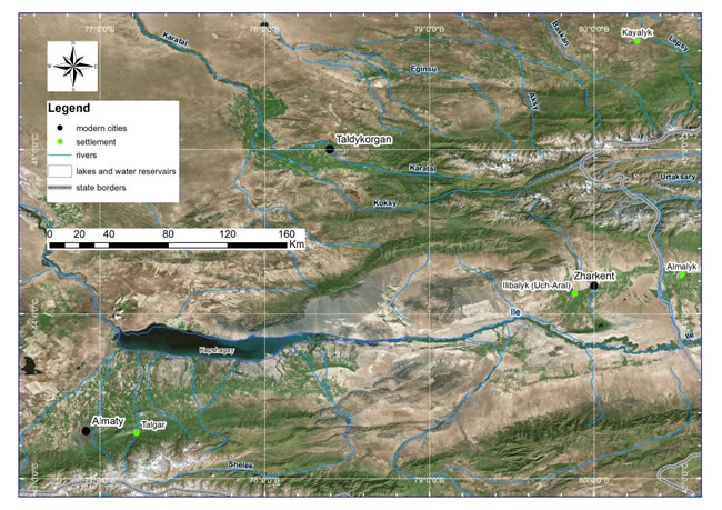
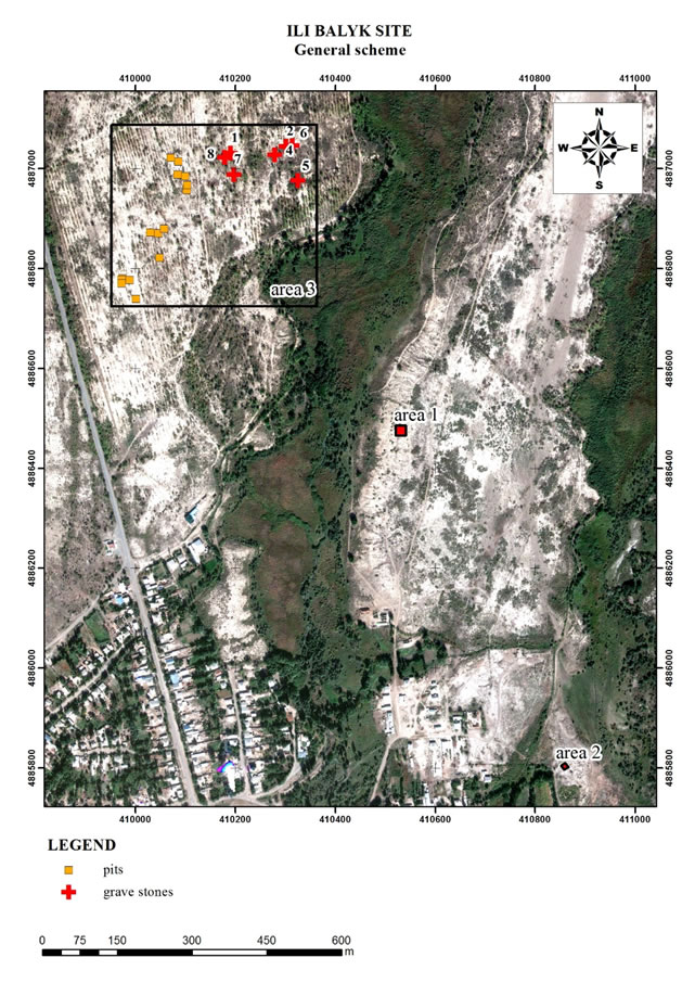
The present project includes topographical and archaeological studies of the large ancient settlement on the territory of the Ili River Valley – Uch-Aral, which is also known in Armenian, Persian and Chinese sources of XII-XIV centuries as Ilanbalyk – Ilibalyk – Ilibaly. The ancient settlement was situated on the left river-bank of the Ili River in a distance of two marches from the city of Almalyk which lies in today’s People’s Republic of China. (See map) A large amount of the coins found on the surface of the ancient settlement, and dating from the XI-XV centuries, reveal an intensive urban and commercial life of the city situated on the territory of the Tien-Shan Corridor of the Great Silk Road.
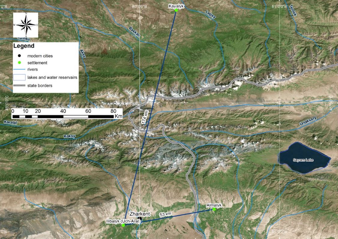
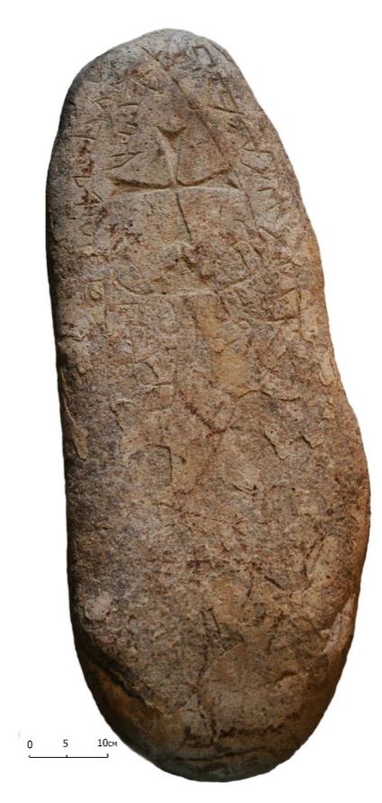
In 2014, a Nestorian gravestone (kayrak) was also found at Uch-Aral. The c. 100 cm long, undated gravestone has an engraved Maltese cross on the main long side and an inscription in Turkic language and Syriac script. The site of Ucharal is identical with ancient Ilan Balik, which was mentioned, next to Almalik and Taraz, by the Armenian Cilician king Hethum I when he returned in 1254 from his tribute-bringing journey to the Mongol Great Khan Möngke.
According to V.V. Bartold, the city was mentioned in Muslim sources shortly before the Mongol expansion. It was the capital of a ruler named Ozar (Buzar). Later the city voluntary surrendered to Genghis Khan. Ozar’s dynasty was ruling the city of Almalyk for two generation at least. It is known, that at that time there were 45 days of travel between Otrar and Almalyk and 2 weeks between Almalyk and Beshbalyk (the former capital of the Uyghur State in toda’s China).The Russian Orientalist from Saint-Petersburg N.N. Paustov visited Almalyk in 1902. In the city of Kuldzha he saw findings from Almalyk – two kayraks with crosses and inscriptions.
The discovery of a Nestorian kayrak on at Uch-Aral allows presuming that the ancient settlement of Uch-Aral are the ruins of the city of Ilanbalyk mentioned by Hethum I as the city near Almalyk.
Goals
1. Archaeological exploration of this medieval city (XI – beginning of XV centuries) on the Great Silk Road
2. Search for the assumed Nestorian graveyard and of further Christian heritage sites.
3. Investigation of ties with the city of Almalik and possibly also with the Catholic community residing there till the 1340s.
Partner in Kazakhstan
The Scientific & Research Organisation „Archaeological Expertise LLC", Almaty.
Leading project team
Prof. Dr. Karl Baipakov, Almaty ![]()
Dr. Dimitry Voyakin, Director Archaeological Expertise LLC, Almaty
_______________________________________________________________________________________
2016
Eurasia Exploration Society, Switzerland
Tandy Institute for Archaeology, Southwestern Baptist Theological Seminary, USA
Archaeological Expertise LLP, Kazakhstan
Archaeological Society of Kazakhstan
Abbreviated Report for Internet
(report download here)
SCIENTIFIC FIELD REPORT
on
COMPLEX ARCHAEOLOGICAL INVESTIGATIONS
OF THE
USHARAL (ILIBALYK) SITE
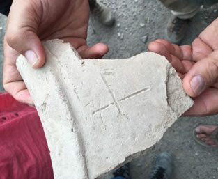
Pottery sherd with incised cross in the hands of Steven Gilbert,
immediately after arrival from the excavation to the camp.
Usharal village, Kazakhstan
Almaty, 2016
Under supervision of:
Prof. Christoph Baumer
And
Prof. Karl Baipakov
Summary
The present project report includes topographical and archaeological studies of the large medieval settlement on the territory of the Ili River Valley – today’s Usharal, Kazakhstan, which is also known in Armenian, Persian and Chinese sources of 12th - 14th centuries as Ilibalyk, Ilibalyk, or Ilibaly. The ancient settlement was situated on the left river bank of the Ili River, a two-day march from the city of Almalyk, now located in northwest China. A large number of the coins, which were collected on the surface of the ancient settlement, demonstrate the significant urban and commercial life of the city from the 11th to the 13th centuries situated in the mountains of the Tien Shan corridor of the Great Silk Road.
In addition, the discovery of gravestones, or "kayraks" with Nestorian crosses and Syriac or Old Turkic inscriptions demonstrates the presence of Christian communities, most likely Church of the East (commonly known as Nestorian) in the city.
Our project includes a report on the excavation of the urban fortifications of the city; topographical studies of its territory; and an analysis of the house-building system and economy. It also includes the research of a potential Nestorian necropolis and remains of structures which could indicate a church and its ties with the city of Almalyk known for its community of Nestorian Christians and a 14th century Catholic mission.
1. INTRODUCTION
1.1
General information about the project
Background
In 13th and 14th centuries numerous ambassadors, adventurers and spies from Western Europe traveled to Mongolia seeking protection and possible alliances as well as to develop various political and commercial contacts with the Mongolian Empire.
Among them there were the famous Venetian traveler Marco Polo, ambassadors of the Pope Innocent IV, the Franciscan monk Giovanni da Pian del Carpine, Frenchman Andrew of Longjumeau, Italian Ascelin of Lombardy, and William of Rubruck – an unofficial ambassador of French king Louis IX, as well as the King of Cilicia, Getum I.
The embassy headed by Getum I travelled to the territory of Möngke Khan in 1253. They were well received by Möngke Khan and obtained an agreement for a reduction of taxes. In 1254, Getum I returned. The description of his return is a well-described and important historical source. Among other things, it provided confirmation of the localities of such medieval cities as Almalyk and Taraz, which correspond to their modern locations.
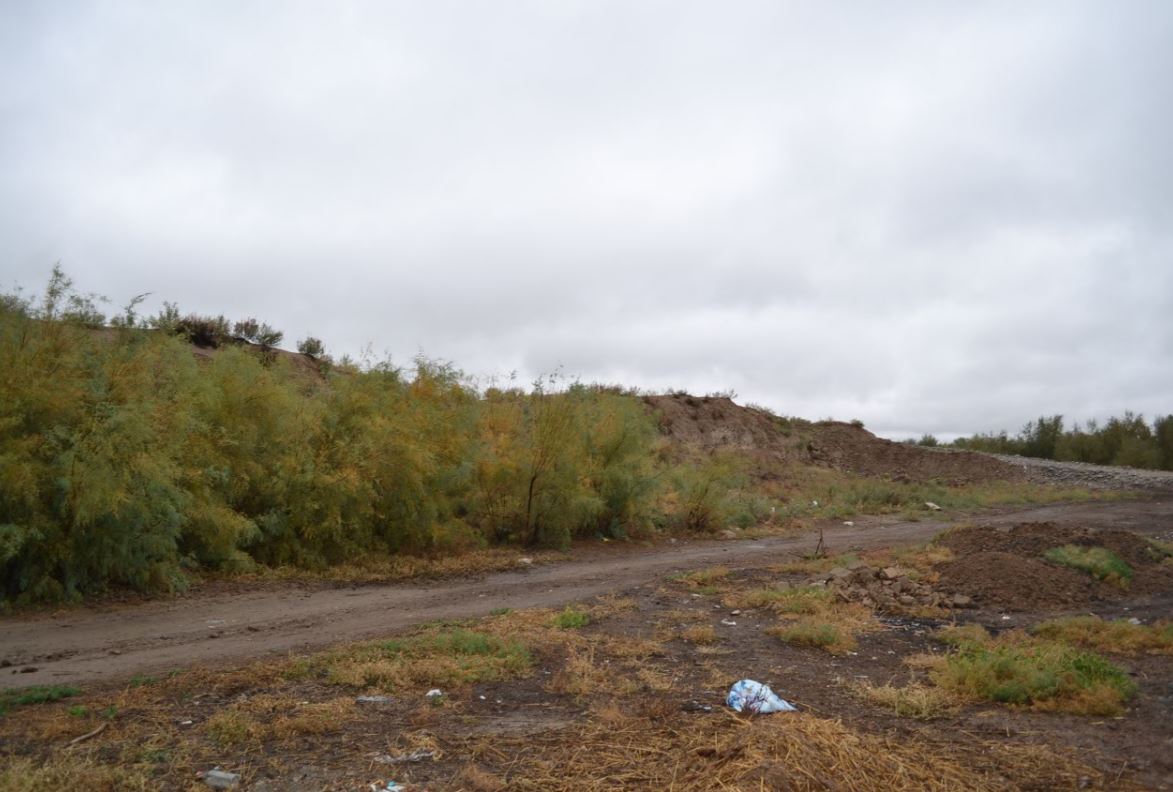
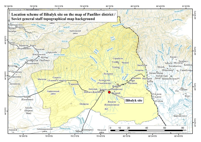
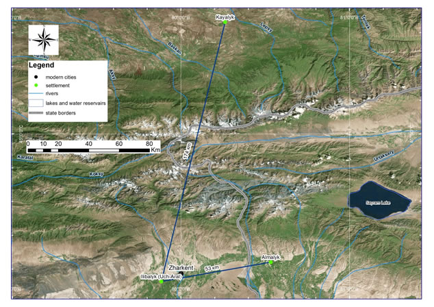
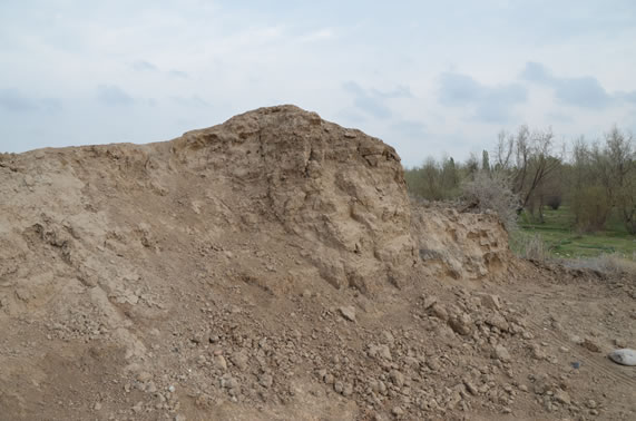
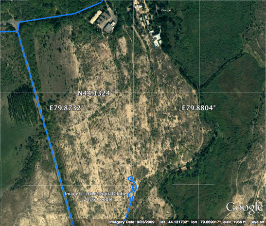
This historical source also mentions the city of Ilibalyk or Ilanbalekh (Ili-bali according to the Chinese sources). However, for a long period of time archeologists were unable to identify the exact location of this city. One theory advocates that the ancient city of Ilibalyk is situated between the modern villages of Koktal and Panfilov (now Zharkent) and potentially corresponds to the ancient settlement of Usharal [See the photo of the remains of the eastern wall on the territory of the site of Uch-Aral: Attachment 1]. Recent findings since 2014 provide more certainly that the ancient city of Ilanbalyk or Ilibalyk corresponds to the ancient settlement of Usharal [See the location of the ancient settlement of Ilibalyk/Uch-Aral in Attachments 2-3].
First, the rich collection of coins found on the territory of the ancient settlement demonstrates the importance of the city. In total three coin caches and another 123 singular coins have been found on the territory of the ancient settlement. All collections were mainly composed of Dirhams of 13th -13th centuries [See the publication on the coin discoveries and pictures of some of them in Attachments 4-11].
The above-mentioned numismatic findings reveal the active financial exchanges in the city during 13th through the first half of 14th centuries. They also show that the city existed in 11th century.
Second, the "kayraks" or gravestones with Nestorian-styled crosses along with two that contain inscriptions were found on the territory of the ancient settlement in the course of this project. The stones with inscriptions are yet to be translated. [See the photos of the kayraks in Attachments 12-16]. It is interesting to mention that Nestorian kayraks were also found on the territory of the neighboring city of Almalyk.
According to V.V. Bartold, Almalyk is mentioned in Muslim sources shortly before the Mongolian expansion . It was the capital of the ruler named Ozar (Buzar). Later the city voluntary surrendered to Genghis Khan. We know his dynasty ruled the city of Almalyk for at least two generations. The location of this city is clearly identified as being on the territory of the People’s Republic of China. Historical sources affirm that travel along the Silk Road took approximately 45 days between Otrar and Almalyk and 2 weeks between Almalyk and Bishbalyk (the capital of the Uyghur State).
As one of the main cities on the territory of Chagatai Khan, Almalyk became a main focus of mission efforts and a center of European missionaries as they spread Catholicism on the territory of the Mongol Empire. In the 1330s, under the rule of Dzhenkshi Khan the Catholics had established a church with a bishop in Almalyk. The Catholic influence ended abruptly during a severe persecution of Christians starting in 1339 or 1340 by Ali-Sultan.
In 1902, the Orientalist from Saint-Petersburg, N. N. Paustov, visited Almalyk. While in the city of Kuldzha (today's Ili) he observed two gravestones with crosses and inscriptions said to be from Almalyk. Therefore, the Nestorian kayraks on the territory of the ancient settlements of Almalyk and Usharal allows us to presume that the ancient settlement of Usharal are the ruins of the city of Ilibalyk mentioned by Getum I as the city located very near Almalyk.
Archaeological exploration of the ancient settlement of Usharal – city of Ilibalyk (Republic of Kazakhstan, Almaty Region)
Aims:
1. The exploration of the large medieval city (ca. 10th to the beginning of 14th centuries) on the Great Silk Road;
2. Geo-archaeological explorations, research and excavation of the Christian heritage sites (gravestones, remains of cult constructions;
3. Introduction to the scientific community of the new materials related to the history of Christianity in Eurasia during the Middle Ages.
Purposes:
- Identification of the borders, topographical studies, and layout of the ancient settlement;
- Studies of stratigraphy and chronology of the ancient settlement;
- Excavation work on the territory of the site to include shurph (trail trench) making and excavation of an area of 100 square meters;
- Studies of the archaeological and numismatic collection and the preparation of ceramic typology and identification of coins;
- Preparation of a scientific report of the findings and two publications in the Russian and English languages.
Time frames
Total period of project implementation – 2016-2018;
2016 – 1 month (May, June or August);
2017 – 1 month (May, June or August);
2018 – 1 month (May, June or August).
Expected results:
Studies of the topography, preparation of the topographical plan, geo-archaeological studies, and excavation work are expected to provide materials (ceramics, coins, metal objects, bones etc), which will allow for the identification of the ancient settlement of Usharal as corresponding to the city of Ilibalyk mentioned in written sources of the 13th century. Research of the remains of Christian heritage, such as gravestones (kayraks) with Syriac and Christian symbols can provide new information on the spread of Christianity along the Great Silk Roads together with its role in the cultural life of the Mongolian Empire and Chagatai State as well as its connections to other religions.
1.2 The Usharal citadel in view of the archeology and historiography of the northeast Zhetysu (Semirechye) region
The powerful Mongolian Empire formed in the 13th century. Extremely complex historical circumstances taking place in Eurasia in the 13th and 14th centuries contributed to alliances which seem very strange at first glance. The Pope, the Russian grand princes, the Il-khans of Mongolian Iran, the kings of France and Genoese merchants, monks of the Franciscan and Dominican orders, the rulers of the Armenian Kingdom of Cilicia and various courtiers of the great Mongol Khan all sought partnerships and alliances during this period.
Direct contact between East and West ended around the 1340s as the Mongol Empire terminally collapsed due to its bulky and fragile political system, which prevailed in Asia during the conquests of Genghis Khan and his immediate successors.
Therefore, the 13th and 14th centuries were narrated by travelers who would go one after another to the horde of the Great Khan in Mongolia proper. Their reasons varied. Some were searching for allies against their enemies; others would seek to arrange trade deals supervised by their new conquerors; still others would speak on behalf of their subjects to ensure their protection from the greed of the Mongolian overlords; while, finally, some were just spies and schemers. These ancient "explorers" left their diaries for us or dictated their impressions to historians. Some travelers remain only in memoirs of their contemporaries. The records vary in significance due to the motives of their travels and the personal qualities of the explorers themselves.
Among the names of the great explorers and travelers of that time stand the famous Venetian Marco Polo; the ambassadors of Pope Innocent IV; a Franciscan monk, Plano de Carpini; a Frenchman, André de Longjumeau; the Italian monk, Nicolas Ascelin of Lombardy; an unofficial ambassador of the French King Louis IX and missionary monk William of Rubruck. Of special note also was the great Arab traveler, Ibn Battuta, who traveled more than 75,000 miles through West Africa, India, Spain, Turkey, Iran, the Volga region and Central Asia. Of special note to our study as one who should be included among these names is the king of Cilicia Minor, Getum I.
During the 1230s, the Mongols invaded Greater Armenia, the rulers of the Armenian Kingdom of Cilicia at first avoided invasion nestled behind the high ridges of the Taurus Mountains. But in the 1240s, King Getum I, secured his small country from the Mongol wrath by accepting vassalage, thus acquiring strong allies. Yet, problems remained.
Getum sought an audience with Möngke Khan in 1253 by leading an embassy hoping to end the harassment of Argun, the Mongolian overlord of Transcaucasia, who was imposing high taxation. Though a king, he left secretly and under disguise, playing the role of a mule driver. His small delegation made it to Karakorum, the Mongolian capitol following a route, which today is little known. Their only references during their travels to Karakorum are to the Volga and Yaik (today’s Ural) rivers, the land of the Naiman and the Qara Khitan state. Möngke’s court welcomed the delegation warmly. Getum secured an agreement with the Mongols and got promises to reduce their tribute payments. On November 1, 1254, Getum I left for his homeland "via the way, which he had (earlier) covered in secretly, he was now returning like a lion..." The return route, detailed by this source, is of great interest.
From Karakorum "He [Getum] arrived in Gumsgur, [from there] he went to Peraleh, [then] Peshpalek ... From there he went via Arlek, Kulluk, Enkakh, Tchanpalekh, Khutapa and Ankipelekh.
Then he came to [East] Turkestan [and] onward to Ekopruk, Dinkapeleh and Polat, passing through Sut-Gol and Milk Sea, he arrived in Alauleh - (Almalyk) and Ilanbaleh - (Ilibalyk), and then, having crossed the river called Ilansu, reached the foothills of the Taurus Mountains. He arrived in Dalas (Taraz), and from there, went through Otrar, Jizzakh, Bukhara, Tabriz, and returned to his homeland. " This list contains the names of cities that are already precisely located, which are Almalyk and Taraz, (called “Alaulehu-Almlyk” and “Dalas” respectively).
This categorized route allows one to specify the location of “Ilanbaleh” (Ili-Bali according to the Chinese sources and Ilibalyk per the Muslim ones dating between 1329-1331). However, due to the fact that archaeologists could not locate a citadel corresponding to this city for a long time, the history of its search dragged on. Nonetheless, various localities for the city have been proposed.
In 1893-94, the orientalist V.V. Barthold, made a research trip along a route that included Tashkent, Shymkent, Pishpek [today’s Bishkek], Kegen, Zharkent, and Verny [today’s Almaty] in which he identified a number of medieval towns with specific archaeological sites. The scholar believed that Ilibalyk corresponded to the modern town of Ikioguz, based on a message by Mahmud al-Kashgari (12th century) also called “Equius” by William of Rubruck (13th century). Bartold proposed to identify it with the Chingil'dy site, which was located on the right bank of the Ili river on the Verny [Almaty]-Zharkent route, 35 km to the east of the crossing of the Ili river.
Interestingly, the first one to mention the site of the ancient Chingil'dy settlement was C.C Valikhanov, the famous Kazakh explorer and cartographer of the 19th century, due to the finds of water ducts there . A.N. Bernshtam agreed with the identity of Ilibalyk at Ikioguz-Equius and placed it at the spot of the Chingil'dy site as well .
Later excavations conducted in the Ili Valley (northeast Zhetysu) region revealed, however, a few dozen new medieval sites and proved conclusively that the city of Iki-Oguz mentioned by Mahmud al-Kashgari and called Equius by William of Rubruckhould actually be identified with the Dungene site located 20 km to the west of today’s Taldykorgan, in the Kazakhstani village of Balpyk-Bi (formerly known as Kirov). The identity of Iki-Oguz/Equius with the Chingil'dy site came into question, since the latter is actually is the remnants of a small settlement, most likely a caravanserai.
Finally, in 2014, new evidence emerged that supports the identity of Ilibalyk at the Usharal site more confidently. First, the location yielded a rich collection of coins, which in itself testifies to the importance of the city, which stood on this site. Three coin hoards and 123 finds of individual coins have been discovered. All three hoards are composed primarily of dirhams dating from the 13th to 15th centuries. These hoards can be described as follows:
Hoard 1. Copper silver-plated Almalyk dirhams [656-660/1258-1262]. Total quantity of eight coins. Hidden in the first half of the 660s/1262.
Hoard 2. Consists of seven silver dirhams of the Chagatid State (during the rule of Kaidu). The hoard was hidden at either the end of the 13th or beginning of the 14th century.
Hoard 3. Consists of 40 silver dinars from the 14th century. The hoard dates no earlier than the 740/1340. It was possible to fix the dates 37 of the coins, of which 36 are from the State of the Chagataids and one is a coin of Ilkhan Abu Zaida.
The set of individual finds can be divided into three groups. The first group has coins minted before the Mongol conquest, the second group are coins from the great Mongolian Empire, the third group are coins of the State of the Chagataids. From the 123 coins, no coins were minted later than the middle of the 14th century.
Seven of the coins (comprising 5.7% of the individual coins) are Qarakhanid dirhams dating to the 12th and 13th centuries and correspond to the first group referenced above. The oldest of these is the dirham of Bughra Karakhan minted in Tunket in 444/1052-1053. Two coins are attributed to the Northern Song dynasty in China, the oldest of which dates from the beginning of the 11th century is by tian-sheng yuan-bao (the issuer's imprint was used between 1023-1032). This group also includes one silver dinar and a chip of a large copper silver-plated dirham dating to the early 13th century. The dirham was minted either by the Qarakhanids or the Anushteginids’ Khorezmshahs. In total, this first group consists of 11 coins, comprising 9% of the 123 coins.
The coins of the second group include 93 items, almost 76% of all the numismatic finds. The greatest period of commercial activity in this locality, according to the collected information, occurs specifically between 630/1232 and 666/1268. The composition of one of the coins from the Mongolian Empire contains a chip of a gold dinar (perhaps the dinar itself had been minted even before the Mongol conquest), as well as 12 silver dirhams. However the greater part of the coins from this period is made of copper silver-plated Almalyk dirhams and copper felse minted during the reign of Möngke Khan and soon after his death. Of particular importance is the fact that the Mint of Almalyk struck the vast majority of the Imperial coins found at the site of the Usharal citadel. Thus, the city of Ilibalyk in the 13th century was in the sphere of the economic influence of Almalyk, a metropolitan center of the Ulus of the Chagataids and located no more than two days away from Ilibalyk. Even the small number of silver coins found dating to the first half of the 13th century indicates the continual supply of dirhams the markets of this city traded in starting from 630s/1233 until 662/1264. Copper silver-plated dirhams stretche the chronological chain to 666/1268.
In addition to the Almalyk coins the complex of individual finds holds coins struck by the neighboring Mint of Kayalyk (the modern village of Koilik), as well as by the mints of Pulad and Imil, and of a yet undetermined mint. Quantitatively speaking, of the 93 coins in this second group the silver dirhams total 12 coins (13%), and the greater amount being to the copper falsies (16 coins = 17%) and the copper silvered-plated dirhams (68 coins = 70%)
The third group of coins is not very numerous with a total of 16 coins (13% of the total individual finds). However, the composition of this monetary grouping is completely different in quality. The third group contains 11 silver coins from the total, or 69%. The youngest of the coins are Almalyk felses with the Uighur legend in the field and the year of 742/1341-42.
Both the hoards and the individual finds recovered on the site of this city indicate trade utilizing currency during the 13th as well as the first half of the 14th century in the city. The numismatic finds demonstrate that the city already existed in the beginning of the 11th century. It remains hopeful that over time it will be possible to collect sufficient information on the coin finds sufficient for statistical association to draw up a numismatic schematic of this citadel which can more conclusively identity these finds with the city of Ilibalyk.
A second identifying factor, a kayrak, or gravestone, with a Nestorian-styled cross and inscription was found near the site of the ancient citadel in 2014, although, the inscription is yet to be deciphered. This entire project got its spark in 2014, when a school teacher near the Ilibalyk site reported to the Kazakhstan Archaeological Society the discovery of a rather large gravestone (perhaps the largest of its kind ever discovered) with a very discernable cross carving and inscription. Prior to this time, no gravestones of this sort had ever been found within the borders of Kazakhstan. All previous stones of this type within the sphere of former Soviet Central Asia were discovered in Kyrgyzstan. Others have been discovered in China, including the ancient city of Almalyk. All of these stones came to light between 100 – 120 years ago. The connection between Almalyk appears significant since Nestorian kayraks now appear to be located in two adjacent medieval Silk Road sites.
Muslim sources, according to V.V. Bartold, mention Almalyk just before the Mongol domination. It was the capital of the sovereign Ozar (Buzar), who went gradually from being a robber and a horse thief to the ruler of Almalyk and several neighboring cities. Later, he voluntarily submitted to Genghis Khan and his dynasty continued to rule Almalyk for at least two generations. The location of the city was defined via the route as outlined by Changchun Tsi, who placed the city at a distance of one day’s travel to the west of the Talki pass on today’s border between Kazakhstan and China.
Further evidence for Almalyk’s location in conjunction with Ilibalyk is what was known concerning the time it took to traverse between the various cities. For example, the way from Otrar to Almalyk took approximately 45 days and from Almalyk to Bishbalyk (the Uighur capital of the 10th century) another two weeks. As the main city of the Chagatid domain, Almalyk served as one of the centers of medieval European missionaries who promoted Catholicism in the Mongol realm. In the 1330s, under Changshi Khan, the Catholics maintained a church and bishopric in Almalyk. These activities came to an abrupt end when a small, but bloody massacre against Christians occurred under the Chagatid ruler, Ali Sultan in 1339 or 1340, due to his sympathies with Islam.
Most likely, V.V. Barthold visited the ruins of Almalyk, along with the ruins of the Tughlugh Timur mausoleum, who died in 1362-1363. Tughlugh was the first of the rulers of the eastern part of the Ulus of the Chagataids who officially adapted Islam. V.V. Barthold described the Almalyk mausoleum and noted the similarities in style with similar structures in Central Asia. Adjacent was another smaller mausoleum belonging, according to locals, to the son of Tughlugh Timur, Shir-il'khan.
In 1902, N. N. Pantuson, an orientalist and graduate of St. Petersburg University who held high positions in the administration of the city of Verny (today’s Almaty), visited Almalyk. In Kuldzha (today’s Ili, China) he saw finds from Almalyk, which included two gravestones with crosses and inscriptions engraved on them.
Thus, the finds of the Nestorian kayraks at both Almalyk and the 2014 find in Usharal also support the argument that modern Usharal is them site of the ruins of Ilibalyk, mentioned in the roadmap of Getum I as immediately coming after Almalyk when traveling from east to west.
1.3. Methodology of archaeological research of settler-type sites
This part of the scientific project report describes the methods and procedures applied to the stages of scientific and research work related to the settler-type site. Depending on the context and situation, some of these procedures were expanded or eliminated completely. During the excavations of the medieval site of Ilibalyk a common research method for such sites was applied. The situation and context determined the various individual approaches during the excavation.
The methodology envisaged complete excavations on site with the purpose of reaching to the level of the original surface. Since the excavation covered multilayered sites (settlement, citadel, etc.), at times excavations reached only the cultural layer, belonging to a particular construction horizon and covered until the entire site was investigated or at least the target object with the adjacent territory.
Sites in which additional information by methods of the natural sciences could be obtained were studied using the expertise of specialists of the natural sciences through taking appropriate samples for later analysis (i.e., soil scientists, geologists, geo-morphologists, paleo-botanists, etc.).
Excavations on the archaeological site were preceded by a detailed examination of both the site and the surrounding area as well as the mandatory preparation of an analytical topographic plan and comprehensive photographic imaging.
The choice of location for the excavation layout of the site and determination of their sizes was dictated by the study.
Initially, photographic images of the terrain were performed using an unmanned aerial vehicle (drone), a topographical plan was conducted using a total station, and surface material was collected.
The process of excavation was accompanied by photography. Identified designs were subject to clearing, they were instrumentally recorded and described. The process of photographing the excavations was considered essential, starting with the overall appearance of the site and its surroundings which was selected for investigation at the various levels of the excavation layer, as well as of all objects which become apparent such as foundations for walls and structures, hearths, sufas, courtyards, streets, vessels and their fragments, and stratigraphic profiles etc.
All types of work on the excavation and analysis of the cultural layer, clearing constructions loci, floor plans and finds were done exclusively by hand, using shovels, trowels, scoops, and brushes. The entire excavation area was cleared of the topsoil to a depth of a spade (25 cm) and then carefully balked and swept to detect traces of building structures, location of midden pits, various stains, and ash accumulations. As the excavations proceeded, the soil was removed from the excavation unit and dumped into heaps. Layer-by-layer finder were collected conducted which included pottery sherds, kitchen residues of domesticated animals (osteological material), metal or other objects.
In order to determine the precise location and features of the hidden archaeological objects, researchers applied non-invasive remote sensing methods. In the case of the Ilibayk site a geophysical scan of one individual section of the territory was conducted.
Analysis of the soil layer was carried out with careful observation of the ground for finds, with special consideration of bare structural loci and layouts. After removing each layer, the surface was swept clean, and a visual survey conducted of the unit for architectural and other loci. Then workers conducted a layer-by-layer penetration (approx. 25-30 cm) until reaching the original level of the entire unit of the excavation or at some pre-determined level. This was followed by sweeping and documentation.
Researching the Ilibalyk citadel required careful identification and systematic pinpointing of all the cultural layer’s artifacts (i.e., fragments and entire ceramic vessels, iron objects and objects made of other materials); remnants of walls and foundations of residential, industrial and religious premises; district planning loci; streets; houses; manor houses their and premises. All layers and objects found on the excavated sites of the ancient citadel were documented. During excavations, the graphic documentation should recorded the location and depth of all finds, including the ones badly damaged and displaced, since this data was considered important to recreate the original structure and topography of the ancient citadel and overall site.
Investigation of cultural deposits occurred all the way to the original surface level, unless the construction and architectural remains uncovered during the excavation process proved significant and preservation was considered necessary, thus altering the process.
While identifying the cultural construction layers and architectural remains, work was conducted to preserve so that these remains until they could be identified and comprehensively catalogued. While not significant constructions were identified, backfilling did take place on all the sites.
Those constructions in a poor state of preservation and which were not intended for conservation, then the research plans included continuing the excavation of selected sites and for the purpose of revealing more features. After proper recording, each feature was eliminated and the plot was leveled and excavation continued until the required cultural layer was reached.
The excavation process included daily record keeping from the field that reflected all the structural features of the cultural strata and various observations. Field records served as the basis for the drafting of this scientific report.
This year’s project (2016) did not reveal any features that required conservation for tourists or further research purposes. Therefore, all three sites were back-filled.
Had such features been uncovered, conservation and restoration work would have been conducted on the basis of field observations during the excavation and through the experience of similar works in the citadels and cities of Semirechye (Zhetisu) and southern Kazakhstan. Archaeological knowledge and conservation techniques and restoration of settlement sites with adobe architecture are of particular importance. Materials with identical or similar physical and chemical properties found at the archaeological sites are used for restoration. They should ensure historical authenticity, resilience to adverse external influences and have high presentation properties. This is the technical conservation philosophy whereby this project was carried out.
All uncovered artifacts were recorded, described, documented and logged into an official inventory of the collection. At the end of the investigation, the excavation was subject to reclamation (back-filling), as mentioned above. The entire process was fully recorded and the results are presented in the form of this written report describing the finds, illustrations, photo appendices, and drawings and graphics appendices.
All photographs of features included the use of a scale ruler and/or surveying rod indicating which direction the camera lens was set.
During the investigation, identification and cataloging took place of all findings that included objects, artifacts, layers, pits, and various structural features. The finds were fully scrubbed, cleaned and restored where possible, drawn and/or photographed and positioned next to a scale ruler.
All artifacts were catalogued with the exact location and depth of the finds and indicating the point of their location on a separate plan. Materials were stored in packets with a label indicating the raw data. The label was placed in a separate small package to prevent damage. Artifacts obtained during the excavation were taken for museum storage and further scientific processing.
The legislative basis of the work:
All work is carried out on the basis of:
- the law of the Republic of Kazakhstan no. 1488-XII dated July 2, 1992
"On the protection and use of objects of historical and cultural heritage";
- Order MCS no. 156;
- Order MCS no. 157;
- Order MCS no. 376;
- Other normative and legal documents of the Republic of Kazakhstan.
2 RESEARCH SENSING
2.1. Geodesy
At this time, as a result of the integration of modern technologies in the area of scientific investigation, various pieces of modern engineering equipment were utilized. One such example is the use of Total Stations, 3-D scanners, high precision GPS and geo-radars to document archaeological sites. The use of this equipment enables extra precise measurements over a short period of time.
In turn, Archaeological Expertise has adopted the latest equipment for documenting and studying both surface and buried objects applying non-invasive methods. The investigations for this project involved the company using the following equipment: Leica TCR 307, 407, TC 407 laser total stations, HDS3000 3D scanner, Trimble R3 ultra-precise GPS tracker, GSSI SIR-3000 geo-radar with a 270 MHz frequency antenna.
The main tool for documenting the sites during the archaeological dig was the total station. This apparatus provided high-precision topographic survey plans of hills and cross sections. Data acquisition was accelerated and convenient due to the fact that the data acquired from a total station is digital.
The Trimble R3 GPS tracker enabled high-precision documentation over large areas. The advantage of this method is this technology’s high speed and accuracy of plane surveys and topography. In addition, only one operator was required to carry out the survey because the device is not attached to fixed positions, thus, one can use it on sites with complex terrain as well as over very large areas which exceeds the range of any Total Station.
A surface survey was conducted of the terrain layout, including the roads, communications, the surrounding infrastructure, hydrology, etc. With the help of the high-precision Trimble R3 GPS receiver a triangulated polygon for project planning and surveying was created. As a result of the research the following data collection and processing method was used:
- An arrangement scheme
This represents a set of information containing communication data related to roads of all types (central/main, dirt), the water resources (rivers, streams, lakes, etc.) and the power lines. All information is overlaid on the basis of topography.
- Surveying
This methodology involves a 3-D survey of the area based on the following:
Surveying technique: Topographic surveying of the object occured in two stages. The first stage involved surveying the micro-topography of each object individually. The advantage of micro-topography lies in its detail, allowing a researcher to determine the layout and features of the object under investigation based on a predetermined model with the ability to select a plot to conduct excavations using the received data. Micro-topography is run with a frequency of 1 m, which provides the possibility to construct a topographic model with horizontal increments equal to 0.2 m.
The second stage of the research involved a general topographical survey of the area and the surrounding landscape. This step facilitated the tracing of the overall arrangement and the relationship between the objects themselves as well as tracing the features of the cultural landscape. Surveying the general topography was made in increments of 10 m with horizontal increments of 0.6 - 2 m.
The peculiarity of the archaeological survey is that the information needed for this study was generated by applying different scales, that is, objects of interest are documented using micro-topography and the buffer area by applying common topography. In this regard, the work was carried out by a trained professional with an expertise in the field of archaeology.
The scale of the arrangement scheme was selected depending upon the area of the research objective. The maximum scale is 1:500 and then proceeds to 1:1000, 1:2000, 1:5000, etc. These limits do not apply to topographic surveying due to the archaeological specifics listed above. It is recommended that one use the following scale grid with a maximum scale of 1:50, then 1:100, 1:200, 1:500, etc., if applying intermediate scales a linear scale was required.
- Planned surveys
This method of collecting information can be both an independent method when conducting documentation and a complementary method to all other types associated with the use of a laser total station. Plan drawing carries the maximum amount of information. It is generated by object section with a plane at the level of 1 m or at the required height with an indication of the information in the drawing. The plan provided all the structural parts with feedback of the related information that included height-marking, explanations of the drawing and dimension lines. The composition of the plan drawings included drawings of individual parts, constructive units and other items requiring more detailed elaboration and carried out on a larger scale. Drawings were done in a linear scale ranging from a scale of 1:10 and less.
2.2 Using GIS technologies
Modern computer technologies have already proven their superiority when processing data. Combining computer technologies (especially data processing and analysis) and traditional maps has opened new horizons for cartography and resulted in the first Geographic Information System (GIS). Geo-information systems now combine precision and high quality digital maps; a tremendous amount of background information; a powerful set of tools for the processing and analysis of data; and also, the ability of specialized information exchange through the Internet. GIS - Geographic Information Systems are new technology that, despite its recent appearance, has spread widely across many scientific disciplines. GIS is successfully applied, for example, in such areas as forestry, water management, geology, economics, criminology etc. The very name itself does not provide the full gamut of a GIS system, below are some definitions that characterize GIS:
- a powerful system for collection, storage, processing, retrieval, and display of spatial data extracted from certain objects for specific practical purposes.
- an information system that generates data relating to spatial or geographic coordinates.
In other words, GIS is a system of databases with specific operational features applicable to spatial data.
- GIS is a computer system whose main purpose is the manipulation, storage, processing and generating of data about geographic space.
- GIS is not a single computer program, but a combination of several different computer technologies.
- GIS is an overlay of all kinds of data to its spatial environment (territory).
GIS for archaeologists is recognized as the best system with the ability to use the latter in the most extensive of studies. This is because the system allows for the analysis, management, and expression of the full range of collected data that is both spatial and having certain characteristics. This is absolutely necessary to maintain up-to-date with the constantly changing human environment. The program allows one to work on the restoration of an ancient landscape and provide further analysis of individual excavation structures, etc.
Despite their appeal, geographic information systems are criticized for its pronounced environmental determinism. Data related to the concept of "environment", such as types of soils, rivers and land usage can be measured, mapped and transformed into a digital format, while the cultural and social aspects are complex and therefore, problematic.
So, GIS technology is used to examine and process sets of various geographically related information. GIS is often used as a tool for mapping and analysis. There are a variety of methods whose use facilitates solving set tasks, and each method has its advantages and disadvantages. They are as follows:
Manual survey via a hand-carried map. -- very low accuracy, extremely time-consuming, low cost.
Instrumental survey (theodolite/total station) - high accuracy, extremely time-consuming, high cost.
Utilizing GPS - accuracy within 5-15 m, extremely time-consuming, low cost, problematic display on a map.
Topographic bases (100,000, 25,000) – Objects and features are not displayed due to their small size.
Geo-referenced satellite imagery -- extremely costly, yet high-resolution imagery.
Aero-photography -- no geo-referencing, distortion, not time-consuming, high cost.
GPS Rover survey (GPS measurement with high accuracy) -- extremely high accuracy, extremely time-consuming, extremely high cost.
The most appropriate way is a combination of these several methods mentioned above, combined into a GIS. This was applied during the excavation.
Гандзакеци Киракос. История Армении. Перевод с древнеармянского, предисловие и комментарий Л.А.Ханларян. Москва, 1976.
Байпаков К.М. Средневековая городская культура Южного Казахстана и Семиречья. Алма-Ата, 1986. С. 37.
Бартольд В.В. Отчет о поездке в Среднюю Азию с научной целью в 1893-1894 гг. Сочинения. Москва, 1966. Т. IV. С. 77-87.
Bretschneider E. Medieval Researches from Eastern Asiatic Sources. Fragment towards the knowledge of the geography and history of Central and Western Asia from the 13th to 17th century. London, 1888. Vol. I, II; 2-ded.:1910.
Бартольд В.В. Отчет о поездке в Среднюю Азию с научной целью в 1893-1894 гг. // Сочинения. Москва, 1966. Т. IV. С. 79-81.
Пантусов Н.Н. Надгробные христианские памятники в Алмалыке //Историко-культурные памятники Казахстана / Протоколы заседаний и сообщений членов Туркестанского кружка любителей археологии. Год седьмой (11 декабря 1902 – 11 декабря 1903 г.). Туркестан: «Туран», 2011. С. 265-267.
GandzaketsiKirakos. History of Armenia. Translation from the ancient Armenian, preface and comments by L.A. Hanlaryan. Moscow, 1976, p.p. 222-224.
V.V. Bartold “Report about the trip to Central Asia with a scientific purpose in the 1893-1894.” Works. Moscow, 1966. Vol. IV. p.85.
A.N. Bernshtam “Historic landmarks of the Alma-Ata region” Proceedings of the Academy of Sciences of the Kazakh SSR. Archaeological series. Alma-Ata, 1948. Vol. 1 (no. 48). p.89, Fig. 1, map insert.
For a history of these finds in English, see T.W. Thacker, “A Nestorian Gravestone from Central Asia in the Gulbenkian Museum” The Durham University Journal (vol. 59) 1967, 94-107. For recent publications on translations for several of these stones see Mark Dickens, “Syriac Gravestones in the Tashkent History Museum,” in Dietmar W. Winkler and Li Tang, eds., Hidden Treasures and Intercultural Encounters: Studies on East Syriac Christianity in China and Central Asia. (LIT Verlag Munster, 2009), 13-49, and Mark Dickens, “More Gravestones in Syriac Script from Tashkent, Panjikent & Ashgabat,” in Dietmar W. Winkler and Li Tang, eds., Winds of Jingjio: Studies on East Syriac Christianity in China and Central Asia. (LIT Verlag Munster, 2016)105-29.
2.3 Satellite imagery
Working with satellite imagery that are geo-referenced and have a resolution of up to 1 m provides researchers with information about landscape arrangement, water sources and all kinds of detail that are also available on a topographical basis, and are provided during the period of drawing these maps. At the same time, satellite images show the current situation of the research area.
2.4 Topographic maps and site topography
The use of a topographic base of 100,000 scale was utilized. A map with such magnitude provides the opportunity to review the entire territory around the research site. Also it provides a good basis for binding together smaller scale maps. This is implemented by using the same scale of geographical data adjustment of the GPS and aerial photos.
The use of a topographic base with a scale of 25,000 allows for a more detailed consideration of the research object as well as of the adjacent territory and can input into the GIS such loci as roads, rivers, canals, villages, etc. This creates the possibility of more detailed aerial photography, GPS and hill-by-hill referencing, digitization of topographic contours and, accordingly, moving the field documentation in a three-dimensional environment via computer.
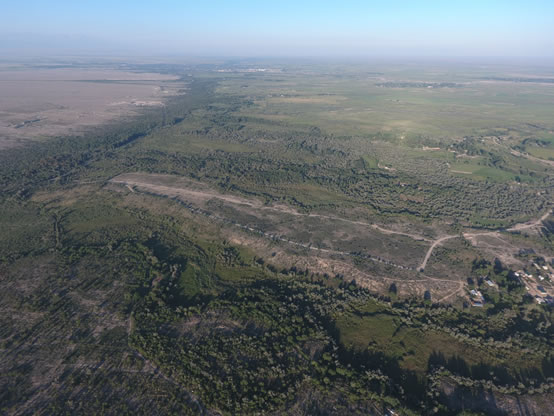
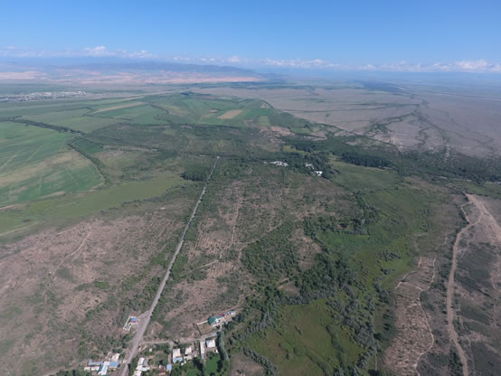
The site of Usharal (admittedly medieval Ilibalyk), as shown by studies in 2016, as per the area it occupies (the area of the settlement in this case is understood as the location of chronologically coherent and spatially concentrated cultural layers) is one of the largest settlements of the Ili Valley. The settlement is located in the south-eastern part of Almaty region, in Panfilovskiy district, Kazakhstan.
Usharal is geographically tied to Jungar-Alatau mountains region and interfluves of branches of Ili to the rivers of Usek and Borokhudgir. The foothills of the ridge of Toksanbay, Itshoky, Altyn Emel and Koyandytau located north and north-west of the settlement, are divided into ridges and crests and form local watersheds, which are nested with uneven-aged loss cones, cut by modern valleys. From the south-eastern side there are natural borders – sands of Muyunkum and Karakum, and to the south of the site – marshy spaces formed by the activities of Usek. The settlement is located at a distance of 30 kilometers to the north of the modern bed of Ili river. Described district, which occupies the area of about 500 square kilometers, is abundantly rich with water sources, which is clearly traced in the satellite snapshots. The site of Usharal is bordered by fertile land which is intensively saturated with river moisture. The ground waters are very close to the surface therefore the use of wells is possible here, although the abundance of pure river and spring water disputes the need for their arrangement, except for force majeure.
The structure of the settlement is difficult to describe, it is primarily due to an active and diversified economic development of the territory. The formation of the settlement is based on two over-floodplain terraces, elongated in the meridional direction. The terraces are cut by floodplains of branched beds of Usek. Rising above the river floodplains to a height of 9 meters, the eastern over-floodplain terrace (peculiar outlier) has overall dimensions of 1.8 km (latitudal direction) x 400-250 m (meridional direction), western – more than 4 km (latitudal direction) x about 1 km (meridional direction).
Eastern terrace is prominent and divided into three main parts: the central, of a rectangle shape, in size of 380x350 meters, dominating in terms of altitude. The absolute height of this territory is 620 m above the sea level; northern with dimensions of 1.4 km x 400-250 m and southern – 1.3 km x 350 m. The absolute altitude ranges from 620 m in the southern part of the terraces up to 630 m in the northern one. The total length of the terrace in the meridional direction is 3 odd kilometers.
Considering the analysis of the topology and topography of described territory, the location of the walls and channels, generality of the surface material, the central part of the medieval town (citadel and shakhristan) was located in the territory of central part of the eastern terrace, utilizing it as a natural platform. As described above, the shakhristan dimensions are 380x350 m. At the moment, the analysis of external factors does not allow to define the space of citadel in the outline of the walls of shakhristan, but, apparently, considering the significant reduction of the relief of shakhristan in the western part, the citadel can be hypothetically placed in the eastern, elevated, half of the represented territory.
The shakhristan, having an area of 10,500 sq.m. on the eastern side, is sharply broken by meandering floodplain of one of the beds of Usek, dominates over it and hole of Chulukay, which was also formed by prior activity of this waterway. The outer eastern wall was erected along the meander of Usek, which sometime, following its curvature undermined the terrace of shakhristan,. On the surface the wall is read by the elevation of 1-1.5 m. The quarry for ground winning, recently arranged in the south-eastern corner of the platform of shakhristan provides an idea on the material and specifics of walling of shakhristan.
The wall was built of adobe bricks with size of more than 25x30 cm, with wall masonry which actually started from the lower level of the floodplain. Thus, resting on the surface level of the floodplain, the body of the wall, adjacent to a natural platform of over-floodplain terraces, is interpreted as its liner with adobe bricks. Further studies should elucidate the details of these construction techniques, which were skillfully applied by ancient architects, apparently, with the purpose of saving the resources in walling by taking into account the features of the terrain relief. The width of the wall most probably reached not less than 5.6 m.
Outer southern wall partly destroyed by the modern landuse. Adobe masonry and falling down bricks are clearly visible.
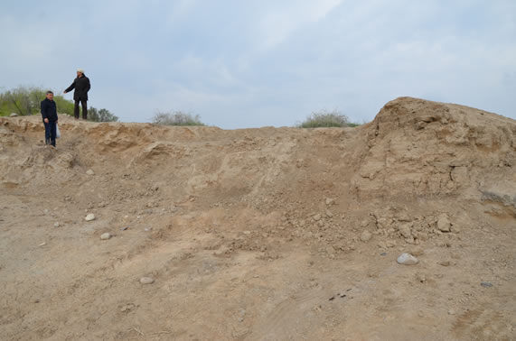
Outer southern wall. View to the north
The southeastern corner of the outer wall of shakhristan which was partially destroyed by a modern quarry, is well defined. In this very part the wall, a little deviating to the south, turns to the west. It is possible to trace it in the terrain relief at a distance of about 250 m. Further to the west the line of the wall is destroyed by modern buildings. In this very part one of the meanders of the river outlines the boundaries of the central part (shakhristan) of the settlement from the east and the south in a natural way. There the terrace has a significant narrowing, actually decreasing up to 170 meters, extending to the south to a distance of 1.3 km with width up to 350 m. In the territory of this part of the over-floodplain terraces there are finds of bones and ceramic articles, but in much smaller amount.
The western line of the wall in the relief can not be traced, but by analogy it is possible to assume that it also stretched to the north, following the western line of the bed. The exact location of the north-western, south-western and north-eastern corners of the walls of shakhristan as per the satellite snapshots, projective and perspective aerophotos as well as full-scale survey of the territory was not found. However, the northern border of shakhristan is marked by sharp depression of several meters and a channel arranged in the latitudinal direction, cutting over-floodplain terrace and thus connecting the eastern and western beds of Usek. Perhaps the channel used today, was set up following the depression, which in turn was probably formed in the course of fortification activities of the northern side of shakhristan.
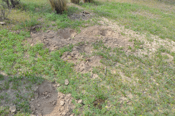
Traces of heavy robbery left by “black archaeologists” are covering huge area
In addition it should be noted that another modern agro-irrigation device arranged in the north-southern line, cuts the territory of shakhristan in the south-eastern part. Modern buildings occupy more than ¾ of the territory of shakhristan and are concentrated in its southern and western parts.
Nowadays it is impossible to assure whether the towers were arranged along the line of the walls of shakhristan.
The northern and, perhaps, the southern part of described over-floodplain terrace were occupied by the buildings of unfortified rabad. The peculiarities of relief do not provide detailed characteristics of architectural and planning features, including fortification elements of considerable scale. Therefore, the rabad is characterized as "unfortified". Surface gathering showed a continuous scatter of finds in the territory of a vast terrace area with the highest concentration along 70 meters width of the edge of the western terrace side. It is in this area there are clearly visible numerous gullies – the traces of denudation processes that might serve as the main reason for the presence of significant amount of surface material. Among the finds there are coins of Chagataid and Karakhanid appearance, ceramics, mainly of 13-14th centuries, ceramic slag, burnt bricks-plinthite, glass, coloured and black metal articles, osteological materials.
the western terrace in the north-southern line is 1,2 km x 600 m in the east-western line. The precise distribution of the cultural layer can not be determined due to two factors: firstly, the modern buildings from the southern side destroyed all visible traces of the ancient city, and secondly, from the western side a vast area (more than 600 000 sq.m.) of the terrace is occupied by the buildings of ethnographic time, most likely related to the presence of the Chinese population.
"Then they went to Turkestan, and from there – to Ekopruk, Dinkapaleh and Pulat and passing Sut-Gol and Milk Sea, arrived in Alualeh and Ilanbaleh; then, after passing the river, called Ilayesu, crossed the foothills of the Taurus Mountains, they reached Dalaye and came to the brother of Mangu Khan, Khulagu, who received the Eastern countries as inheritance."
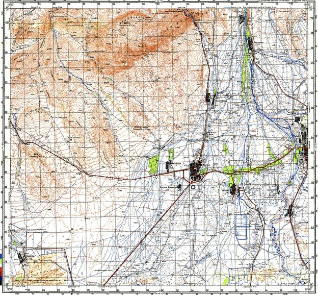
«Soviet» topographical map 100k--l44-136--(1991). Учарал - is the modern village on the medieval Ilibalyk site
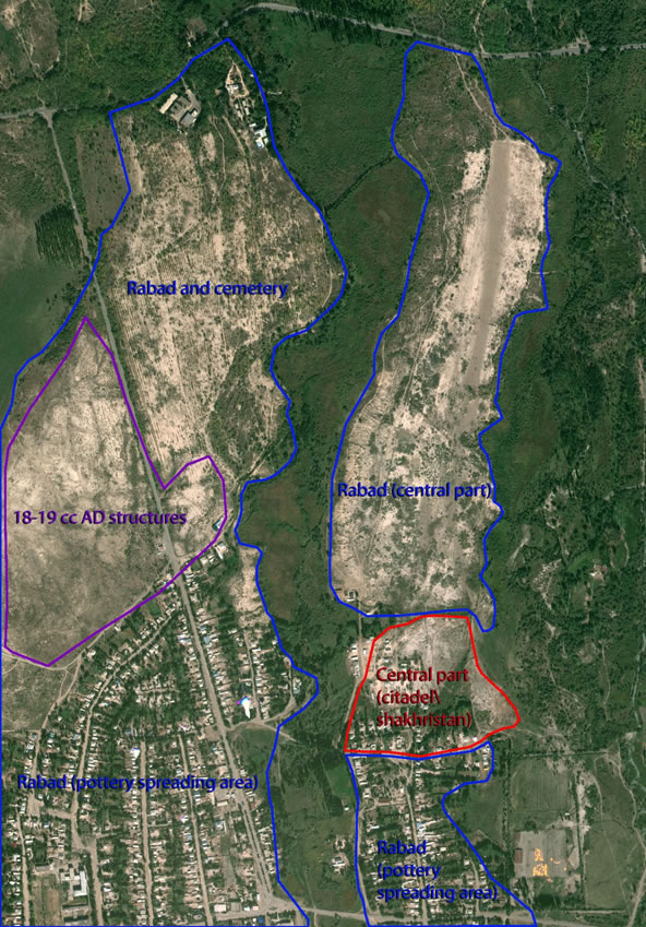
Topology based on satellite, aerophoto, land survey data
2.5 Aerial photography
In the process of this excavation, a new method for collecting and processing information was applied utilizing aerial survey/photogrammetry. A Phantom 4 quadrocopter (drone) was used to perform the job. It facilitated the gathering of a large array of information.
This technique makes it possible to work with small sized objects and cover large areas of research at the same time. Numerous flights at low altitudes (30-100 m) over a specific territorial location made it possible to photograph and apply a so-called "carpet" coverage method, which assumes the production of a large number of pictures with each subsequent photo overlapping the previous one by no less than 80%. In this way, numerous photos cover all of the spatial area of the site.

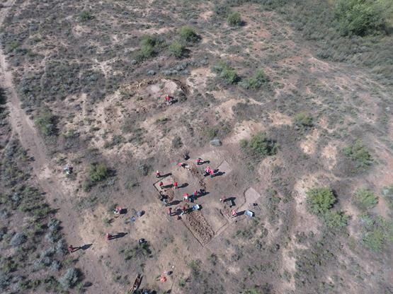
Aerophoto. Oblique view to the south. Citadel on the back view

Aerophoto. Oblique view to the north-east. Rabad and northern part of shakhristan
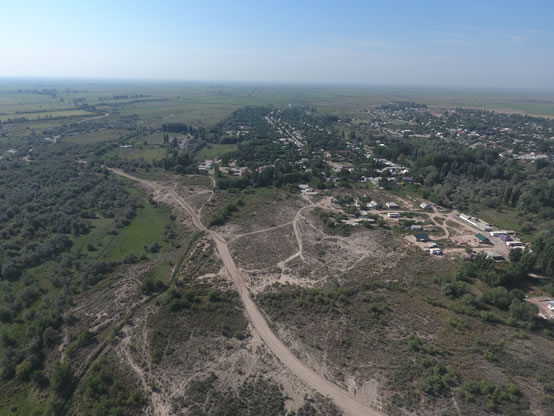
Aerophoto. Oblique view to the south. Shakhristan and citadel
Aerophoto. Oblique view to the east. Rabad “central part”
Aerophoto. Oblique view to the north. Rabad and cemetery
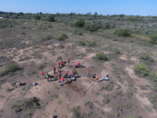
3. EXCAVATION 1
3.1 General description
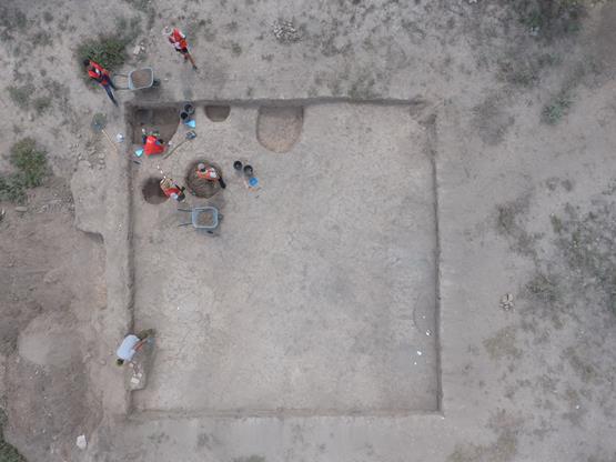
This excavation was located in the western part of the rabad, of the Ilibalyk site (300 m to the north from the edge of Usharal village, in the Panfilov district). This location of this excavation was chosen after a careful analysis was made with unmanned aerial vehicle (drone). The selected plot looked like the remnants of rectangular building under the surface from the bird's-eye view.
Aerophoto. Oblique view to the south-west. Excavation 1 (area 1)
Prior to excavation, the plot was uneven: at the northwest, west and central sections there a small ravine was identified, and in the southwest and south opposite side a low hill was observed stretching from east to west (0.3 m). A large part of the excavation surface was covered with dense vegetation (Fig. 28-30).
The works commenced with the clearing of surface material (Lo. 0), which was lying immediately on the visible surface (Fig. 35-36). In particular, many fragments of glazed red-clay ceramics, mostly from large thick-walled vessels such as pots and storage jars were gathered, along with fragments of jugs, bowls and pots. In addition to the pottery fragments, fragments of broken fired bricks, pebbles and bones of animals, mainly from goats and sheep, were collected from the surface.
After collecting the material from the excavation surface and the removal of organic growth, the plot was photographed (Fig. 37-40) and a layer-by-layer removal process commenced in steps equal to the half spade’s depth, or approximately 15-20 cm (Fig. 41-42). This topsoild layer was quite loose, loamy, and light brown. In the lower part of this layer revealed a large number of pottery fragments, the bulk of which concentrated in the southwestern, southeastern, eastern and central sections.
Aerophoto. Oblique view to the south-west.
Excavation 1 (area 1)
Following removal of the first layer and a thorough sweep of the excavated surface using brushes (Fig. 47-48) the surface was photographed (Fig. 49-54).
Excavation of the second layer, identical to the first in terms of the structure of soil and identified finds of pottery sherds, commenced. After removing the second layer, a depth of 15 cm, there several sites of fragment accumulation were identified consisting of pottery and bones. Among the pottery fragments were green fine-wear bowls covered with transparent glaze, blue fragments decorated with a floral ornamentation, turquoise ones with a black painted pattern, white ones with a transparent glaze, and others with brown and yellow glaze. The first cluster was found in the southwestern part of the excavation (Fig. 59-60); the second in the central part (Fig. 61-62); and the third one in the eastern part of the eastern edge of the excavation unit (Fig. 63-64).
In the course of removing the second layer in the northwestern corner of the excavation unit there a dense gray-brown sandy and loamy layer emerged (Lo. 9). The layers dimensions were 1.8 x 1.7 m; its thickness was 0.25 m (Fig. 67).
The southwestern part of the excavation contained a dense yellow soil layer (Lo. 10). The dense plot was 0.5 m thick (Fig. 68).
In the southern part of the excavation there was a feature resembling a collapsed wall with the dimensions of 3 x 2 m and a thickness of 0.3 m (Lo. 11). The layer, represented by yellow clay, was very dense (see Fig. 70).
In the northern part of the excavation revealed a dense layer 0.3 m thick (Item 12), with a rectangular shape with the dimensions of 3 x 3 m. The layer was light brown, perhaps the base of the wall (Fig. 71-72).
In the northeastern part of the excavation unit there two pits were uncovered (Lo. 13 and 14), round and oval in shape (Fig. 75-79). The pits were shallow, 0.3-0.5 m, filled with loose soil mixed with ash, inside were several pottery sherds and animal bones, some small fragments of glass, along with of fired brick fragments and gravel.
Digging deeper into the western part of the excavation site, closer to the central part of the excavation unit, a cluster of large gravel stones were discovered (Lo. 16) (Fig. 82).
A surface sweep in the southeastern part of the excavation revealed a layer (Lo. 17). The layer was loamy, of average density; its light brown in color. The swept layer contained a small number of fragments of glazed pottery, mostly from thick-walled pots.
Removing the above-mentioned layers and sweeping the surface in the southeastern part of the excavation revealed a loamy yellow layer (Lo. 18). The layer extended from the eastern side of the excavation and narrowed towards the center (Fig. 97). The length of the layer within the excavation along the east-west line measured 5.5 m, width - 3.2 m, thickness - 0.2 m.
Following removal of the yellow loamy layer in the southeastern part of the excavation there was found an accumulation of broken, fired bricks, pottery sherds and animal bones (Fig. 98). The accumulation was circular; its diameter was 0.8 m, and possibly a pit (Lo. 19).
One large amorphous pit was found in the northwestern part of the northern edge of the excavation (Lo. 22). This pits diameter was 1.3 m, its depth, 1.2 m (Fig. 101-102). The pit was filled with friable loam. Several pottery fragments were found in the course of clearing this pit. Among some of the more interesting finds, of particular interest, was a fragment of storage pot rim which has a cross carved into it, a cast metal fragment in the form of a plaque, a small glass tube bead, and three small glass fragments.
Two small pits were discovered in the northeastern part of the excavation. Pit no. 4 (Lo. 23) was located 1 m to the southwest of pit no. 2 (Lo. 14), the pit was round (Fig. 103). Its 0.7 m in diameter with a depth of 0.4 m. The pits contents contained a friable, loamy soil mixed with ash. The pit revealed several pottery fragments, animal bones and a piece of glass.
1.1 m to the southeast of pit no. 4 another pit (no. 5) was found (Lo. 24). This pit is circularly amorphous with a diameter of 0.7-0.4 m, and a depth of 0.3 m (Fig. 104). In the course of clearing the pit pottery sherds, animal bones and a piece of metal in the form of a curved narrow plate with a hole at the end were found.
Another pit, no. 6 (Lo. 26), was cleared in the southwestern part of the excavation (Fig. 107-108). The pit was oval-shaped, 0.7 m in diameter with a depth of 0.35 m. The pit contained friable soil. The pits contents included several pottery fragments, animal bones and fragments from glass vessels.
On the north side of the excavation unit, an expansion unit was dug (excavation expansion unit no. 1.) The expansion unit dimensions were 10 m long in an east-west line with a width of 5 m (Fig. 124-137).
In the eastern part of expansion unit no. 1 pit no. 7 (Lo. 27) was uncovered. The pit was filled with a significant amount of broken, fired bricks, pottery sherds, stones, and gravel (Fig. 141-143). The pit was circular with a diameter of 0.9 m, and depth of 0.4 m (Fig. 144).
In the course of sweeping the surface of expansion unit 1 in its southwestern section there another pit was found. Pit no. 8 (Lo. 28) was round, with a diameter of 1.1 m and a depth of 1.5 m (Fig. 146). The pits soil was friable. This pit, unlike the others, contained only a small amount of pottery sherds.
In the northern part of the expansion unit a plot with friable ashen soil was identified which contained a considerable number of pottery sherds and animal bones (Lo. 29). The plots dimensions were 3 by 2 m with a thickness of 10-15 cm (Fig. 147-149).
From the east side and toward the center stretched a dense light brown soil layer (Lo. 30). This layer occupied more than half of the area of expansion unit no. 1 (Fig. 150-151). Its southeastern section was penetrated by a small ravine, which stretched from the eastern side in a southwesterly direction.
Another expansion unit (no. 2) of 6 by 4.5 m (Fig. 153-157) was dug off of the main excavation from its southwestern side. A dense layer, a continuation of the Lo. 10, was revealed in the eastern part of the expansion unit no. 2. The layer extended in a westerly direction for an additional 2-2.5 m.
Following removal of the topsoil in the western part of expansion unit another pit was revealed (Lo. 31). Pit no. 9 is circular, its diameter is 1.1 m with a depth - 0.7 m. Pottery sherds and animal bone were found in the pit as well as a metal artifact in the form of small metal tube.
In the southeastern section of the expansion balk another pit was discovered (Lo. 32). Pit no. 10 was oval-shaped with a diameter of 0.7 m and a depth - 0.9 m. Excavations revealed pottery sherds as well as goat and sheep bones.
From the northern section of expansion unit no. 2, another expansion unit was dug (no. 3) with dimensions of 5 by 10 m. Within expansion unit no. 3 no cultural material was found, except in removal of the topsoil layer which yielded many pottery sherds. (Fig. 164-167).
From the western part of expansion units no. 2 and no. 3 another small expansion unit was dug (no. 4). The expansion units dimensions were 5 by 15 m. In the course of topsoil removal many pottery sherds, mainly from large vessels like pots and storage jars were uncovered.
In the northwest corner of this expansion unit an amorphous pit was discovered. Its diameter were 0.6-1.3 m with a depth - 0.4 m. The pit contained friable soil with found many sherds and gravel.
To the north of expansion unit no. 1 another expansion unit, (no. 5) with dimensions of 5 by 10 m was dug. Once again, in the course of topsoil removal a large amount of sherds and animal bones were found.
A ravine was found following the topsoil removal in the southeastern section of the expansion unit 5 (Lo. 35). The ravine was 0.7 m wide and stretched from the eastern side of the excavation in a southwesterly direction.
In the northeastern corner of this unit an area with clay soil was identified (Lo. 36), with inclusions of a mass aggregation of pottery. The shape was rectangular, 2.8 by 1.3 m; with depth of 0.5 m (Fig. 182-183).
In the northwestern part of the expansion unit no. 5 another a clay layer was revealed with a large number of pottery sherds and several medium-sized gravel stones.
In the northeastern section of this excavation a round pit was found with a diameter of 1.4 m and a depth of 0.3 m (Lo. 38). The pit contained friable loamy soil. Clearing revealed pottery sherds and goat and sheep.
In the western part of the main excavation at the edge of the balk, a shrub was removed a small pit was dug in its place. The pit dimensions were 1.2 x 1.2 x 06 m (Fig. 99-100). As a result in reading presence of uniform light-brown loam in the pit profiles.
A pit was also dug in the eastern section of the main excavation unit in order to identify the cultural stratigraphic (Fig. 114-126). The size of this pit along the north-south line was 7.5 m, by 2.8 m with a depth of 0.9 m. At a depth of 40 cm from the modern surface a hard, light-brown soil layer was reveal which was sterile of any cultural material. Thus, at a depth below 40 cm is the original surface.(see the Illustration documentation on stratigraphy).
The total area of Excavation 1 was 342.5 m2. The study revealed that the site has a single cultural layer, which, presumably, dates from the beginning of the 12th century. Unfortunately, no distinct structures survived on the site being researched, with only pits being identified with a large number pottery sherds, animal bones, glass shards, one coin, several of manufactured metal, and broken bricks and gravel.
4. EXCAVATION 2
4.1 General overview
Studies of the second excavation site, which were undertaken on the location of the citys citadel, identified three construction horizons. Compared to the first excavation site the ceramic material demonstrates, with only a few exceptions, the absence of glazed ceramic fragments. A few well-preserved walls made of mud brick placed in 9 ranges (size of mud bricks were 27x16 cm) were identified in the southern part of the excavation site. Also the territory of the excavation site No. 2 revealed some rubbish pits from the upper construction horizon in its southern and northern corners.
The excavation process identified three construction layers: An upper layer corresponding to the 13-14th century while the second and third corresponding to the 12-13th century.
According
with the data obtained during excavation three general construction phases
(living horizons) were reviled (see below Harris matrix of the excavation 2). The
upper (late) one is correspond to period of abundance with numerous garbage
pits and mad brick debris; second phase shows well preserved architectural
features as well as the earliest (excavated during this field season), which
gave us baked brick constructions, plenty of slags and kans (heating system)
usually referenced by the scientists with 13th century.
Aerophoto. Top view. Excavation 2 (area 2)
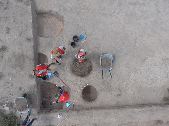
Aerophoto. Top view. South-east part.
Garbage pits. Excavation 2 (area 2)
5 . EXCAVATION 3
Excavation
3 Investigations
By
Dr. Tom Davis, Field Director
Associate
Director, Tandy Institute of Archaeology
Ft. Worth, Texas, USA
Ilibalyk August 2016
Investigations at Excavation site 3 were undertaken as a direct result of the discovery of a suspected Nestorian grave marker in 2014 near the village of Usharal in eastern Kazakhstan. The Tandy Institute of Archaeology team, in partnership with Archaeological Expertise LLC, and the Society for the Exploration of Eurasia, along witha dedicated team of local volunteers,* undertook a combination of remote-sensing (GPR), limited test excavation, and systematic pedestrian reconnaissance in a successful attempt to provide contextualization for the grave marker, the first clearly identified Nestorian artifact ever recovered within the boundaries of Kazakhstan. The stone marker had been recovered from the surface, reportedly near an overhead transmission line, and taken to the field laboratory of Archaeological Expertise LLC in Talgar, Kazakhstan, near the city of Almaty, Kazakhstan. During the course of the field season, ad hoc informant interviews established that the marker had originally been discovered by a local Usharal resident in an unknown location near the village, and taken into the village in the hopes of using the stone in construction. Upon discovering the inscribed cross, the potential builder decided to abandon the stone and re-deposited it in a relatively open area near a dirt track, NE of the village, allegedly near the original discovery point.
Setting
Excavation site 3 occupies a slight rise of land east of the north/south road linking Usharal and route 353. A low-lying floodplain delineates the landform to the east and south, separating the survey area from the main portion of the archaeological site to the east. Route 353 marked the northern limit of the survey area and the survey area occupies the northern half of the landform. The road lines are marked by planted deciduous trees with the marshy area to the east marked by a few remnant old growth trees. The current vegetation reflects the land tenure history of the area, having been a collective farm from 1930 through 1990. Crops were orchard fruits (primarily apples) and open fields planted in watermelon. The ordered rows of orchard trees are clearly visible on satellite imagery and although many have been uprooted and removed, numerous stumps testify to their former presence. Derelict buildings of the collective farm occupy the northeast of the landform. An overhead Soviet-era powerline crosses north/south from the former collective farm. A dirt track runs roughly parallel to the powerline and provides vehicular access to the property from the Usharal feeder road. The land has since gone out of agricultural use and is utilized by local residents as pasture. The survey team encountered sheep, cattle, and horses on an almost daily basis. Modern dumping episodes litter the landscape, some substantial, including relatively recent house foundation remains of river cobbles, decayed mudbrick and occasional metal fragments. The presence of large numbers of hydrophilic plants testify to the abundant rainfall this year in the region. The undergrowth is relatively open; thistles, thorn and low trees permit adequate surface visibility across more than 90% of the survey area. The area surveyed is bounded on the west by the north-south road into the village of Usharal. The eastern limit of the survey area is the line of a stream, the west bank of which is lined with a dense line of scrub which was not surveyed.
The northern limit of the survey was densely wooded as was the western boundary, these woods giving way to the south and east into the formerly-cultivated fields of the collective. The northwestern limit of the collective was a well-defined field 280m north-south by 170m east-west. Dense thickets of thorns and small trees define the boundaries of this field. The field itself alternated between dense low-thickets of thorns in which visibility was low and relatively sparse grassy areas with good visibility. The remainder of the surveyed area comprised an abandoned orchard. The orchard was overgrown, having a similar pattern of north-south bands of dense thickets of thorns.
Methodology
The survey team designed the field methodology based on the hypothesis that the cross-inscribed stone object marked a Nestorian grave and that its findspot was close to its original location. Dr. Boypakov of the Archaeological Society of Kazahkstan, Dr Voyakin of Archaeological Expertise LLC, Dr. Ortiz and Dr. Davis of the Tandy Institiute, and Dr. Steven Gilbert, a historian based in Almaty and an associate researcher of the Tandy Institute, conducted a field reconnaissance in April 2016. The reconnaissance team established a likely location for the findspot of the inscribed stone near a support for an overhead powerline. The April vegetation was sparse and the ground surface easily visible. Accordingly, the team agreed on a combination of Ground-Penetrating Radar (GPR), selective test-unit excavation, and pedestrian reconnaissance as a field strategy.
When the main field team arrived on August 1, the wet Spring in the region had substantially increased the ground cover in the proposed test area, limiting GPR examination to a 200x100 m area west of the supposed findspot. (see pages ___ - ___). Initially, the team tested three anomalies revealed by the GPR results using six 1x2 meter units within the anomalies. When these proved negative, the team placed 9 additional 1x2 m units with the placement determined by surface features with some placed near the suspected findspot of the inscribed stone. Field crews excavated the tests using shovel and spades, removing the soil in 20 cm levels within natural stratigraphic layers. Soils were hand sifted in wheelbarrows before being dumped. All test units were excavated at least 10 cms into sterile subsoil or 20 cms below the AB horizon. However, two test units, Unit 11 and Unit 12 were expanded based on the discovery of possible cultural features. The expanded units lead to the excavation of Units 17 through 20, which were larger than 1x2 m.
When the convoluted history of the original carving was relayed to the field team, excavation halted in Field 3 and an intensive surface reconnaissance was undertaken of the entire northern half of the landform. Team members followed transects laid out at 5 meter intervals on a bearing 90 degrees from the Usharal feeder road. Along each transect, Team members examined every visible stone larger than a fist; all were picked up and/or removed from the soil if they extended below the surface. Suspected inscribed stones were examined by the entire team to insure discovery.
Excavation Results
Excavations
revealed a consistent profile across the initial test area. This plowzone
measured 25 cm deep from the surface, consisting of silty loam, pale brown in
color (10YR 6/3). The second stratum measured between the 25 cm and 40 cm mark
and consisted of silty and sandy clay, and was noticeably more compacted and
dense than the topsoil layer. It was light brownish grey in color (10YR 6/2).
The basal layer measured between the 40 cm and 50 cm mark, which was the usual
end limit of the excavation if no cultural material was encountered. This soil
consisted of mostly clay, mixed with silty soil, and was brownish grey (10YR
6/2). This lower stratum differed from the overlying soil by its density rather
than its difference in color. Due to the lack of artifacts and faunal remains
the filed team decided to cease excavation at the 50 cm level. In the final
phase of each excavation unit, excavators conducted a compaction test using
the trowel, noting a uniform density throughout the confines of the trench.
Field 3 survey area
7.3. Field inventory of the finds
|
21. |
IB-16-3-0-2 Name: Part of a copper basin Dimensions: 33.5х14х0.2 cm. Found 50 m to the north of excavation no. 1 |
|
|
Pottery |
||
|
22. |
IB-16-2-17-1 Name: ceramic rim fragment. Dimensions: Length- 15 cm Rims thickness 1.9 x 4.5 cm Dimensions of Cross stamps: 1.5x1.5 cm Description: The rims cross section is rectangular, its color is a reddish tint with inclusions On the surface there are stamped imprints of crosses enclosed in a circle.
|
|
|
23. |
IB-16-1-22-1 Name: ceramic rim fragment. Dimensions: Body of sherd- 1.6 cm. Rim of sherd 3.3 cm. from top to rims edge:3.8 cm. Description: The rims cross section is oval-shaped and protrudes outwards as a narrow edge with a flattened outer edge. A light cream-colored slip was applied. The ceramic paste is a reddish tint within the cross section with inclusions. The pot is patterned with a traced figure of a cross. The sherd was found in pit no. 3 (Lo. 22) of excavation no. 1. |
|
|
24. |
IB-16-1-1-2 Name: ceramic fragment. Dimensions: 5.1x 5.6x 1.3 cm Rosette dimensions: 1.1x1.1 The ceramic paste is has a brick color, with inclusions, there are small inclusions. The surface is covered with a light cream slip. The fragment has a circular imprint on wet clay with a relief-convex pattern in the form of petal rosettes. Below this pattern are fixed rows of alternating small triangles, floral patterns, and ovals with delineated bands. |
|
|
25. |
IB-16-1-1-3 Name: ceramic fragment. Dimensions: 9.5x6.3x1.3 cm Swastika: 2.2x2.1 cm The ceramic paste is reddish within the cross section. The fragment is made of clay mixed with small quantities of finely grounded plaster. The slip is barely noticeable. Ornamented with the figure of a swastika traced on the wet clay. |
|
|
26. |
IB-16-3-1-4 Name: The pottery sherds decorated with traced ornament (stamp) in the form of alternating waterfowl Dimensions: reddish-sherd: 7.5x4x0.9 cm Size of waterfowl: 1.5x2.1 cm Dimensions of gray sherd: 4.3x2.5x0.9 cm Size of waterfowl: 1.8x2.3 cm Fragments found in the first layer of the western part of the excavation 3 |
|
|
27. |
IB-16-1-1-5 Name: Fragment of pottery Description: The vessel was decorated with a stamp in the form of a six-petaled flower. Dimensions: 5.5х4х0.8 cm Fragment found in the top layers of the western part of the excavation 3 |
|
|
48. |
Code: IB-16-1-1-9 Name: small flat stone Description: Dimensions: 6х5х1 cm Found in the first layer of the SE part of the excavation no. 2 |
|
|
49. |
IB-16-3-1 Name: Gravestone (kayrak) with an engraved cross, most likely Church of the East (Nestorian). Description: The stone is oval and conical (narrowing towards the bottom). Color: dark gray with a slight greenish tint. Stone dimensions 27х20х5.5 cm. In the central part of the stone is an inscribed cross. The cross was made by applying a chiseling technique. Cross dimensions: height is 13.5 cm, width - 12 cm, thickness at the ends - 3.5 cm, at the center - 2.5 cm. Found during systematic reconnaissance survey near excavation no. 3 on Aug. 23, 2016.
|
|
|
50. |
IB-16-3-2 Name: Gravestone (kayrak) with an engraved cross and full inscription. Most likely, Church of the East (Nestorian). Description: The stone has the form of an irregular rectangle with rounded corners. The stone is dark gray; on the surface there are whitish stains from natural causes. Dimensions: 24х17х4.5 cm. The cross was applied with a chiseling technique. In addition to cross, the stone has possible Syriac and/or Turkic inscriptions and symbols. Inscription awaiting translation. Cross dimensions: 12 cm, expanding at the edges 3 cm, circle in the center - 1.5 cm. Size of the inscribed characters, height is 2-3 cm. Found during systematic reconnaissance survey near excavation no. 3 on Aug. 23, 2016 |
|
|
51. |
IB-16-3-3 Name: Gravestone (kayrak) with an engraved cross, most likely Church of the East (Nestorian). Description: The stone has the form of an irregular rectangle with rounded corners. The stone is dark gray. Dimensions 22х15х5 cm. The cross was applied with a chiseling technique. Cross dimensions: 7 x 6 cm, thickness is 3-2 cm. Found during systematic reconnaissance survey near excavation no. 3 Aug. 23, 2016. |
|
|
52. |
IB-16-3-4 Name: Gravestone (kayrak) with an engraved cross, most likely Church of the East (Nestorian). Description: The gravestone is an irregular rectangle with rounded edges. Dimensions: 21x15x6.5 cm. Color - grayish-green. It has transverse veins and the back side is rough. There is a cross with two equal bars. Cross dimensions: height - 12 cm, width - 7 cm, thickness and depth - 0.5 -0.7 cm The cross was made with a chiseling technique Found during systematic reconnaissance survey near excavation no. 3 on Aug. 23, 2016. |
|
|
53. |
IB-16-3-5 Name: Gravestone (kayrak) with an engraved cross, most likely Church of the East (Nestorian). Description: The gravel stone is round, coarsely-grained, dingy beige and gray. In the central part of the stone there is a double-leaf, Maltese-type cross. Dimensions: 24x24.5x6 - 6.8 cm Cross size is 7 x 7 cm, width - 2 cm on the edges. Found during systematic reconnaissance survey near excavation no. 3 on Aug. 22, 2016. |
|
|
54. |
IB-16-3-6 Name: Partial gravestone (kayrak) with an engraved cross and partial inscription, most likely Church of the East (Nestorian). Description: Segment-type fragment of a grave stone. The upper-left section of a cross can be seen on the stone. The engraving was applied using a chiseling technique. To the left of the cross, there is poorly visible partial inscription most likely in Syriac or Old Turkic. Inscription awaiting translation. Dimensions: 21x11x9 cm. The upper part of the stone is slightly rough, and the back side is smoother. Found during systematic reconnaissance survey near excavation no. 3 on Aug. 23, 2016.
|
|
|
55. |
IB-16-3-7 Name: Partial gravestone (kayrak) with an engraved cross, most likely Church of the East (Nestorian).
Description: The stone is oval and elongated, its upper part is broken. The stone is gray. Dimensions 33х20х8 cm. The cross was made with a chiseling technique Cross dimensions: height and width are 8 cm, thickness - 0.9 cm, the end of the bottom part of the cross is 1.7 cm. Found during systematic reconnaissance survey near excavation no. 3 on Aug. 23, 2016.
|
|
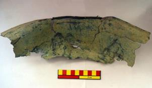
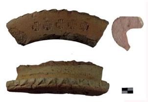
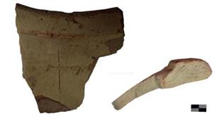
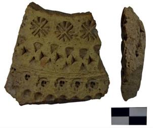
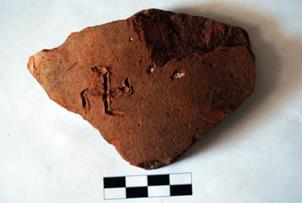
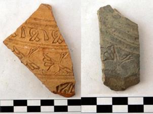
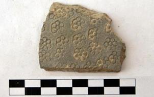
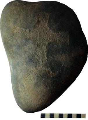
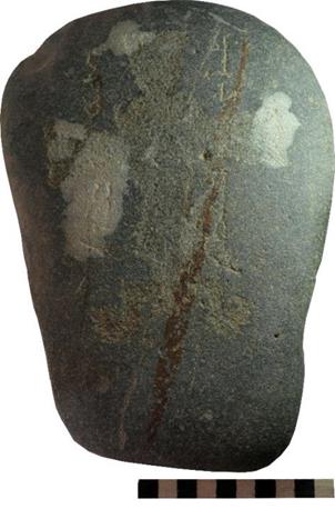
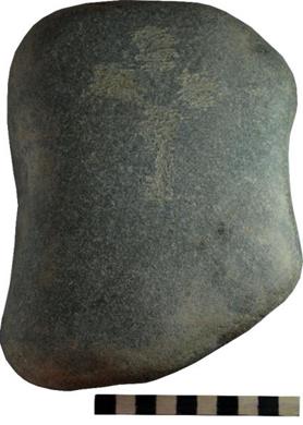
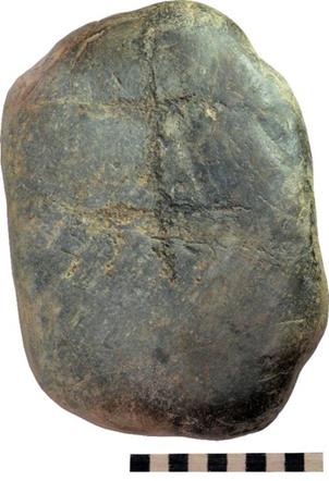
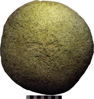
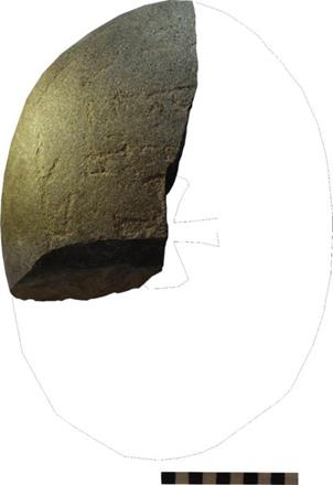
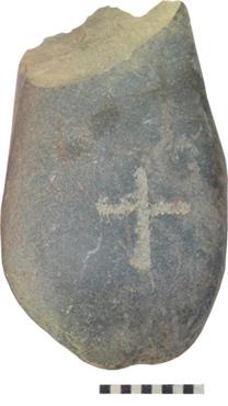
7.4. GRAVESTONES (KAYRAK) HAND DRAWINGS
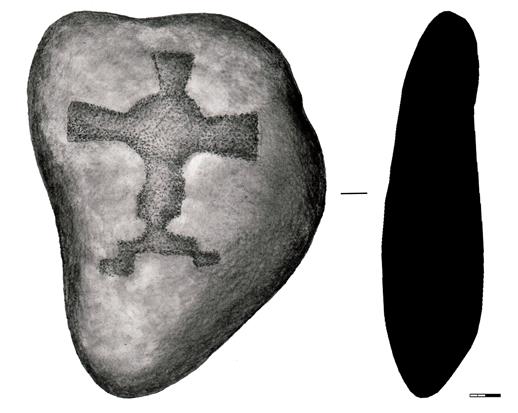
Picture 1. IB-16-3-1 Gravestone (kayrak) with an engraved cross, most likely Church of the East (Nestorian).
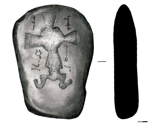
Picture 2. IB-16-3-2 Gravestone (kayrak) with an engraved cross and full inscription. Most likely, Church of the East (Nestorian).
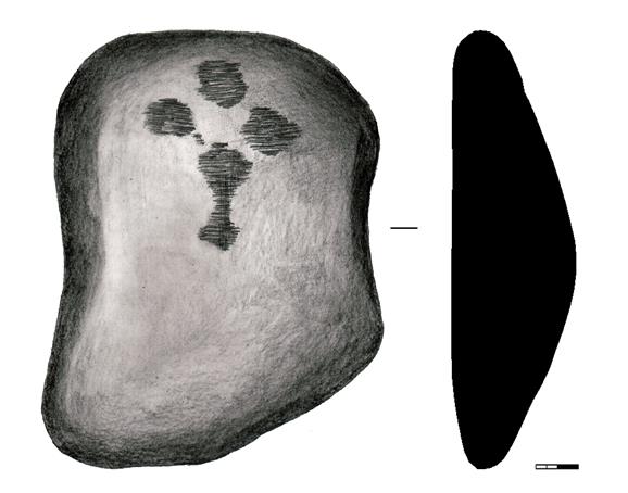
Picture 3. IB-16-3-3 Gravestone (kayrak) with an engraved cross and full inscription. Most likely, Church of the East (Nestorian).
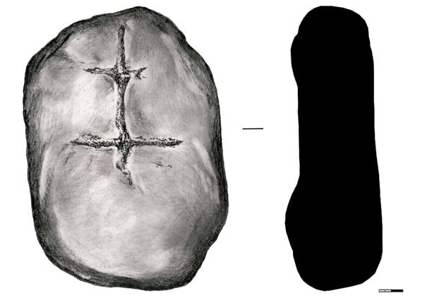
Picture 4. IB-16-3-4 Gravestone (kayrak) with an engraved cross, most likely Church of the East (Nestorian).
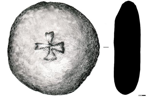
Picture 5. IB-16-3-5 Gravestone (kayrak) with an engraved cross, most likely Church of the East (Nestorian).
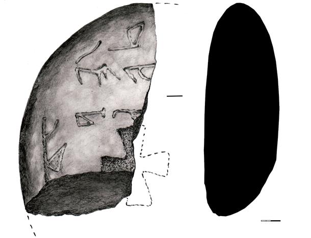
Picture 6. IB-16-3-6 Partial gravestone (kayrak) with an engraved cross and partial inscription, most likely Church of the East (Nestorian).
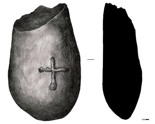
Picture 7. IB-16-3-7 Partial gravestone (kayrak) with an engraved cross, most likely Church of the East (Nestorian).
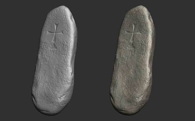
Grave stone 3D models.
CONCLUSION
Archaeological excavations and research took place on the ancient settlement of Ilibalyk (todays Usharal, Kazakhstan) in August of 2016. The first excavation site, which encompassed a total area of 342. 5 m2 was excavated in the western section of the citys shakhristan, (the area within the citys main wall, but outside the citadel wall). The second excavation site of 100 m2 occurred in the central part of the citadel area and the third excavation site (conducted by the specialists of the Tandy Institute for Archeology, USA) took place in the area of the city known as the rabad (that area of settlement outside the city walls). The team conducted a geophysical survey on the territory of the rabad with the use of a ground-penetrating radar, the GSSI SIR-3000 with an antenna frequency of 270 Mhz., which scans to a depth of up to 5 meters.
Participation by the archaeologists from the Tandy Institute for Archeology contributed to the experience of scientific and cultural exchange between local and foreign archeologists in the field of research methodology and the documentation process in the archeological project. Utilizing the aerial drone, the DJI Phantom IV, the research team identified the borders of the site; explored the topography; and developed the excavation site plans.
A systematic exploratory survey by foot of almost the entire area of the territory of the rabad (almost a full square kilometer) resulted in the significant identification of seven kayraks (gravestones) with engraved crosses, presumably from the adherents of the Church of East (Nestorian) with two stones containing inscriptions (one full, one partial) in the ancient Syriac or Old Turkic languages.
Archaeological excavations on the territory of excavation site No. 1 identified two construction horizons. The first horizon was almost totally dispersed with only some small midden pits yielding fragments of glazed ceramics. The second construction horizon also had few remains due to numerous rain channels and snowmelt that wrought its erosive destruction. Areas presented by compacted clay loam presumably correspond to the foundation of the walls of any structures that had previously existed.
Excavations at site No.1 did reveal an important collection of ceramic material. Most of the pottery sherds belong to large vessels such as storage jars and pots, the rims of which were often decorated by the potters using undulated lines and finger-made depressions. Another hand-carved cross was found on the side of the jar. A solar symbol was also found on another vessels wall. Some pottery sherds were decorated with stamps of flowers and waterfowl resembling geese. Other vessel lids contained geometric and floral patterns. Numerous pots had horizontal, protruding semicircular handles, while some pot fragments possessed cranked handles and necks.
Excavations of site No. 2, situated at the presumed citadel location, identified three construction horizons. Compared to the first excavation, this sites ceramic material demonstrated, with a few exceptions, an absence of glazed fragments. A few well-preserved walls made of mud bricks put in a stack of 9 ranges (size of mud bricks 27x16 cm) were identified in the southern part of the excavation unit. Excavation site No 2 also revealed some midden pits from the upper construction horizon in its southern and northern corners. One of the fragments of a jar rim was decorated with a stamp represented by a succession of crosses.
Five copper coins found on the territory of the shakhristan also occupy a significant place among the findings.
The excavation process identified three construction layers: an upper layer corresponding to the 13-14th century, while the second and third layers correspond to the 11-12th century.
It is important to emphasize
that the present site was not included on the list of cultural heritage sites
with UNESCO. Today, the major part of the old city is situated under the modern
village of Usharal (in the Panfilov District of the Almaty Region). This means
that much of the site is totally destroyed and requires further, careful study.
Members of Church of the East (Nestorian) probably inhabited this city. The
potential exists for further excavation of a possible necropolis and/or a
church building. Only a few similar sites verifying the presence of medieval
Christians exist on the on the territory of todays Kazakhstan and no
gravestones have ever been found in Kazakhstan prior to the find at the
Ilibalyk site in 2014, as recorded in this report. The additional 7 gravestones
discovered in the course of this project verify the need for further
investigation.
End Notes
[i] Гандзакеци Киракос. История Армении. Перевод с древнеармянского, предисловие и комментарий Л.А.Ханларян. Москва, 1976.
[ii] Байпаков К.М. Средневековая городская культура Южного Казахстана и Семиречья. Алма-Ата, 1986. С. 37.
[iii] Бартольд В.В. Отчет о поездке в Среднюю Азию с научной целью в 1893-1894 гг. Сочинения. Москва, 1966. Т. IV. С. 77-87.
[iv] Bretschneider E. Medieval Researches from Eastern Asiatic Sources. Fragment towards the knowledge of the geography and history of Central and Western Asia from the 13th to 17th century. London, 1888. Vol. I, II; 2-ded.:1910.
[v] Бартольд В.В. Отчет о поездке в Среднюю Азию с научной целью в 1893-1894 гг. // Сочинения. Москва, 1966. Т. IV. С. 79-81.
[vi] Пантусов Н.Н. Надгробные христианские памятники в Алмалыке // Историко-культурные памятники Казахстана / Протоколы заседаний и сообщений членов Туркестанского кружка любителей археологии. Год седьмой (11 декабря 1902 11 декабря 1903 г.). Туркестан: «Туран», 2011. С. 265-267.
[vii] Gandzaketsi Kirakos. History of Armenia. Translation from the ancient Armenian, preface and comments by L.A. Hanlaryan. Moscow, 1976, p.p. 222-224.
[viii] V.V. Bartold Report about the trip to Central Asia with a scientific purpose in the 1893-1894. Works. Moscow, 1966. Vol. IV. p.85.
[ix] C.C. Valikhanov Diary of a trip to Issyk-Kul, 1856, Selected Works. Alma-Ata, 1958. p. 281.
[x] A.N. Bernshtam Historic landmarks of the Alma-Ata region Proceedings of the Academy of Sciences of the Kazakh SSR. Archaeological series. Alma-Ata, 1948. Vol. 1 (no. 48). p.89, Fig. 1, map insert.
[xi] K.M. Baipakov Medieval city culture of the South Kazakhstan and Semirechie. Alma-Ata, 1986. p. 36.
[xii] For a history of these finds in English, see T.W. Thacker, A Nestorian Gravestone from Central Asia in the Gulbenkian Museum The Durham University Journal (vol. 59) 1967, 94-107. For recent publications on translations for several of these stones see Mark Dickens, Syriac Gravestones in the Tashkent History Museum, in Dietmar W. Winkler and Li Tang, eds., Hidden Treasures and Intercultural Encounters: Studies on East Syriac Christianity in China and Central Asia. (LIT Verlag Munster, 2009), 13-49, and Mark Dickens, More Gravestones in Syriac Script from Tashkent, Panjikent & Ashgabat, in Dietmar W. Winkler and Li Tang, eds., Winds of Jingjio: Studies on East Syriac Christianity in China and Central Asia. (LIT Verlag Munster, 2016)105-29.
[xiii]V.V. Bortold, p.79.
[xiv]V.V. Bortold, p.80-81.
[xv]N.N. Pantusov Christian headstone monuments in Almalyk, Minutes of meetings and reports of members of the Turkestan circle of archaeology admirers. Historical and archaeological sites of Kazakhstan. Turan, 2011. pp. 165-167.
_______________________________________________________________________________________
|
|
|
Archaeological |
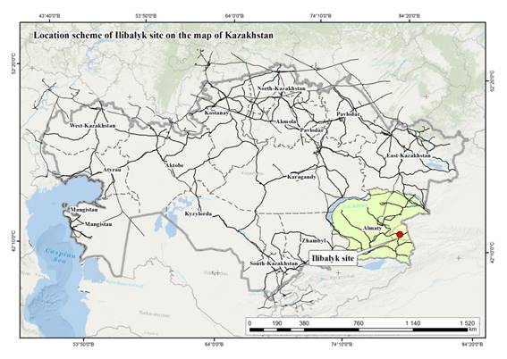


Eurasia Exploration Society, Switzerland
Archaeological Expertise LLP, Kazakhstan
Tandy Institute for Archaeology, Southwestern Baptist Theological Seminary, USA
Archaeological Society of Kazakhstan
2017 FIELD REPORT ON THE
ARCHAEOLOGICAL EXCAVATIONS
AT USHARAL-ILIBALYK,
KAZAKHSTAN
P A R T I A L R E P ORT 1

|
Christian gravestone (kayrak) with incised cross and inscription, |
![]() Almaty, 2017
Almaty, 2017
Under supervision of:
Dr. Christoph Baumer
and
Prof. Dr. Karl Baipakov
LIST OF EXCAVATION TEAM LEADERS
Dr. Dmitriy Voyakin |
|
Dr. Tom Davis |
|
Khabibullayev F.F. |
|
Dr. Steven Gilbert |
|
Lucas Grimsley |
|
Philip Webb |
|
Dólgushev A.S. |
|
Dr. Charles A. Stewart |
|
|
SUMMARY
The present report includes topographical and archaeological studies of the large medieval settlement on the north bank of the Ili River. Today the area lies under the village of Usharal, Kazakhstan, which was recorded in Armenian, Persian and Chinese sources of 12th to 14th centuries as Ilanbaliq, Ilibalyk, and Ilibali, respectively. The site, henceforth referred to as Usharal-Ilibalyk, should be considered the most important medieval settlement of the northern region of Zhetysu (Semirechiye), alongside Qayalyk (modern Koilyk), in Kazakhstan. Ilibalyk was part of the network of trade routes, connected to other medieval cities to the southwest, such as Suyab (Ak-Beshim), Navakent (Krasnaya Rechka), and Balasagun (Burana) in Kyrgyzstan, as well as cities to the east, Almalyk and Ghulja in China.
In 1986 Professor Karl Baipakov theorized that the historical site of Ilibalyk probably lay underneath the village of Usharal (1986:37). Then in 2014 a large gravestone (kayrak) was uncovered by a villager; this was the catalyst to test Dr. Baipakov’s theory for the first time. The gravestone not only verified the antiquity of the site, but also provided crucial early evidence for Christianity in Kazakhstan. The stone belonged to the “Church of the East” (also known as “Nestorian Church”), thus connecting the site to a global institution reaching beyond the current borders of Kazakhstan. So Dr. Dmitriy Voyakin (Director General, Archaeological Expertise, LLP—henceforth referred to as “AE”) and Dr. Baipakov (then the director of the Margulan Institute of Archaeology) surveyed the Usharal’s archaeological areas exposed by recent road and housing construction, tracing the outlines of a large mudbrick rampart that surrounded a shakristan (palace and administrative center). Around the shakristan, to the south, north, and west were vast amounts of ceramic sherds and other pre-modern artifacts, indicating that these were large rabads (residential, commercial, and work spaces). In the course of their research, villagers provided three hoards and individual coins, totaling 175 in number. As a collection, these coins formed a random sampling, providing an approximate age of the site and were published (Petrov et al. 2014).
The 2016 and current 2017 excavations support the conclusions drawn from the 2014 numismatic study. The first hoard consisted of 8 coins from the years 1258 to 1261; the second, 7 examples dated from 1271 to 1300; and the third hoard had 36 coins dating from 1318 to 1335. Together with the surface coins, there emerged four chronological and geographical categories: 1.6% of the coins were issued during the Northern Song Dynasty (1023-1106) from China; 9.4% were minted by the Karakhanid Empire (1052-1170); 76% were from the unified Mongol Empire (1232-1268); and 13% were from the Chagatai Khanate (1276-1341). Of these the earliest coin was issued by Emperor Shengzong of the Liao Dynasty dating between the years 1023 and 1032; the next oldest was minted at Tunket (near Taskent, Uzbekistan) in 444AH/1052-1053 under Kahn Muhammad bin Yusuph. As the authors of the study observed, the majority of coins (53%) were minted at Almalyk (or Almaliq); the earliest of these dates to 636AH/1238 and the latest to 742AH/1341 (Petrov et al. 2014). This was not a surprise given the fact that Almalyk (near Huoerguosi-shi, China) is located 52 km (33 miles) east, just a two-day march by foot, from Usharal village. Almalyk was the capital of the Chagatai Khanate.
During 2014 and 2015 reconnaissance surveys, archaeologists identified several factors that threatened the archaeological fabric at Usharal-Ilibalyk. Natural processes of wind and water erosion, vegetation and flooding has taken its toll on the mudbrick ramparts and architecture, which were exacerbated by licit and illicit human intervention. The village and its surrounding settlements has doubled in size over the past ten years (population currently around 6000) and modernization (piping, sewage lines, and electricity conduits, and new roads) has led to destruction and removal of ancient remains. Moreover, for decades looters have dismantled and plundered key areas of the site. These issues, along with its geographical location and historical significance, demanded that a thorough scientific investigation be performed.
In 2015 Dr. Voykin and his organization, AE, contacted governing authorities for permissions research and excavate the area. Because the area of Usharal-Ilibalyk was so large—504 hectares (1,245 acres or about 5 km2)—Dr. Voyakin invited the Tandy Institute of Archaeology to assist in exploring the site. Dr. Steven Gilbert, a historian and resident of Almaty, served as a liaison between the two organizations as well as organizing local volunteers. Joint-excavations on three areas commenced from 29 July to 26 August 2016; because this activity informed our 2017 research, it is summarized here:
Field I (342.5 m2) was excavated as a probe to provide information regarding the northern rabad. This area seems to have been a residential area, based on the mudbrick remains and the courseware; however, the mudbrick was deformed and did not provide clear dimensions of the building(s). Our field interpretation was as follows: We uncovered a residential space; at some point, prior to the 15th century, the area was abandoned and served as a landfill, indicated by the 12 rubbish pits (middens) cut into the area, both within and outside the mudbrick remains. These pits contained vast amounts of pottery sherds and animal bone; none contain whole vessels or any that could be reconstructed. Without more extensive excavation little more can be said about this area.
Field II (100 m2) was selected for excavation in order to reveal the nature of the shakristan; that is, the area within the mudbrick rampart, which corresponded to the citadel or palace. Three phases of construction were identified: the earliest remains dated to the 12th to 13th centuries; above this was a 12th to 13th century construction; and the most recent structure dated to the 13th-14th century. These phases were identifiable because of the fired-brick masonry that stood in situ, as well as the remains of a heating or drainage system. The only coins found in the 2016 season came from these contexts, providing chronological phases. This area seems to have been abandoned by the end of the 15th century, since 10 rubbish pits were deposited within the excavated area. This investigation confirmed that this was, indeed, a shakristan and served as a residence of an elite member of society, if not part of the citadel proper. Additional excavations could identify the culture and the rulers who lived in the shakristan, and their quality of life.
Field III covered 158 acres (639,403.3 m2). A variety of methods were used to survey this expansive area. First, a surface collection of ceramic sherds was gathered by volunteers over one section (10,000 m2) in order to assess the patterns of concentration. Second, a ground-penetrating radar (GPR) scan was conducted in an adjacent section where the Nestorian gravestone was recovered in 2014; three test trenches were excavated in the area of the scan which uncovered little material culture. An additional nine trenches were excavated to the east of the scanned field based on the ceramic survey. While these trenches revealed little regarding buildings or deep occupation areas, it did affirm that there were no cemeteries where the gravestone was found. In other words, the gravestone’s original location must have been elsewhere and it was later deposited here—by who and when is unknown. Seven additional test trenches were carried out northwest of the GPR-scanned area, which uncovered more substantial human occupation and a medieval mudbrick structure, perhaps remains of a wall or a courtyard. Many years of plowing erased much of the structure and our limited excavation could not draw any conclusions, besides affirming that this area served as a rabad or suburb northwest of the shakristan. The final method employed was “intensive surface reconnaissance” covering the entire northern half of the area (approximately 380,000 m2); team members followed transects laid out at 5-meter intervals on a bearing 90 degrees from the Zokenbaeva Road (Жокинбаева) which leads into the village from the A353 highway. Eventually seven additional gravestones were found. All the stones contained inscribed crosses and two have inscriptions in Syriac script. Preliminary examination reveals that one of the stones is in Syriac language, the other, a partial inscription due to damage, most likely from a plow, is still in need of further analysis. The location of these were recorded using the total station.
A vast amount of ceramics was recovered from the 2016 Excavation and these are still being processed. Because they were mostly gathered from the surface and top-soil layers, they are difficult to date and unsuitable for dating stratum. With that said, the large variety of designs (lamps, pithoi, cups, plates, jugs, bowls, etc.) and decorations (plain courseware, stamped-reliefs, slip, engobe, multi-color glazes, etc.) brought to mind the assemblages uncovered and documented at medieval Otrar and Taraz, dating between the 11th to 14th centuries (Baipakov and Erzakovich 1991; Baipakov and Voyakin 2013: 338-46). The ceramics together with the coin evidence formed a random sample, providing a reasonable chronology framework—including the fact that none of the fine-ware specimens dated after the 15th century.
Based the 2016 Excavations, we were able to support these hypotheses:
- the modern village of Usharal is built on the remains of the historical city of Ilibalyk;
- the shakristan is about 20.5 acres (82,960.56 m2) and is surrounded by extensive rabads;
- the citadel area is located at the southeast quadrant of the shakristan;
- the area served as a settlement as early as the eighth century and grew as a major center in the eleventh century during the Karakhanid dynasty; it reached its peak around 1300 (during the Chagatai Khanate) and began to decline by the year 1340; and by the year 1500 it seems to have been abandoned.
Furthermore, we were also able to conclusively prove:
- that the Christian gravestone discovered in 2014, indeed, came from a field north of the village Usharal;
- that there was a substantial Christian cemetery in the area, as supported by the additional seven gravestones found in situ;
- that these Christians belonged to the “Church of the East” (so-called Nestorian or Jacobite traditions), given the additional Syriac inscriptions; and hence,
- that there was a substantial Christian community in the medieval city of Ilibalyk.
Our 2017 project focused on a particular section of Field III, which we have redubbed “Field IV” for this season. We decided to ascertain the extent and quality of cemetery, presumably, underneath or in the vicinity where the gravestones were recorded in 2016. This report describes our approach, methods, resulting data, and interpretation. Some information from the 2016 report is provided again here because either that material: (1) is directly relevant to the 2017 project; (2) has been further processed; (3) is complemented by new information, leading to different interpretations; and/or (4) is presented in a different way by the current authors.
1. INTRODUCTION
Geographical and Geological Overview
Our understanding of Central Asian archaeology has advanced over the past century with the investigations of Russian-speaking scholars. Since the dissolution of the Soviet Union in 1991 diverse international scholars have been given more access to antiquities and can now contribute to the study of the region. Interest was prompted, in part, by the 1976 UNESCO conference in Nairobi which proposed a project called the History of Civilizations of Central Asia which would be published in five-volumes beginning in 1992; this led to the Silk Roads Project that began in 1988 and continues to the present. These collaborative efforts provide a glimpse into the temporally-deep and widespread archaeological remains, fine arts, and monumental architecture in the region, and conveyed the general impact that Central Asian cultures had on world history. It also revealed gaps in our knowledge.
One particular area that is clearly important, but has not been fully investigated archaeologically is the Zhetysu (or in Russian, Semirechye) that covers southeast Kazakhstan, northeast Kyrgyzstan, and northwest China today. The region is loosely framed by geological features: to the north are the Dzungarian Alatau mountains and Lake Balkash; to the east, the Ek-tagh range (Mongolian Altai); the southern limitf is drawn by the Kokshal-tagh mountains; and the Chuy, Suusamyr, and Naryn Valleys, down to the Fergana Range describe the western edge. In the Kazakh language Zhetysu can be translated as the land of “seven waters” which denotes its important fresh-water resources being surrounded by the Kyzylkum, Betpak-Dala, and Taklamakan deserts. Its waters are products of the massive Altai and Tian Shan mountains to the north and south, so that thearea can be considered a large basin into which many streams and rivers flow into large lakes, aquifers, and wells. Its major rivers are the Ili, Charyn, Shinzhaly, Chuy, Suusamyr, Naryn, Typup, and Shalkudysu; and the largest lakes are the Alakol, Balkash, Issyk, Song, Chatyr, and Sayram. While archaeological research has been conducted at the southern Zhetysu cities in Kyrgyzstan (Suyab, Balasagun, and Navakent), the northern settlements in Kazakhstan [Qayalyk (Koilyk), Talkhiza (Talgar), Shengaldy Fort, Equius (Taldykorgan), Ilibalyk (Usharal)] have been less studied by the international community.
Cities could develop in the Zhetysu because of the concentration of natural resources. Besides fresh water, the tall mountains contribute to the valley breezes that form a temperate climate zone. On average during the summer months, temperatures reach an average of 24 °C (76 °F) and the winter, about −5 °C (25 °F); such mild seasonal temperatures allow for the harvesting a variety of domesticated and wild crops. In terms of forests, there is a deep tradition of reaping native species of apple, apricot, pistachio, cherry-plum, buckthorn, currants, raspberry, barberry, honeysuckle, dog-rose, and almond trees (Dzhangaliev et al 2010). Hardwoods, such as oak and ash, and softwoods, such as spruce and pine, are abundant and can be used for architectural purposes as well as fuel for cooking, heating, and manufacturing (Kushlin et al. 2004). Regarding agriculture, an array of crops can thrive in its fertile valleys: millet, barely, wheat, sorghum, and peas. Evidence of early cereal domestication was discovered at three sites in Zhetysu (Tasbas, Begash, and Tuzusai) and date to the Bronze Age (c. 3300–1200 BC) (Spengler et al. 2014: 4). The steppe provided rich grasslands for maintaining herds of sheep, goats, horses, cows, and swine; moreover, husbandry allowed for the production of animal by-products such as milk, leather, bone implements, oil, an as deer and boar, would also be a vital source of providing food for urban populations. Other natural resources were mined in the mountains, such as tin and copper, and were used for manufacturing since the Bronze Age; and iron mining and smith was common by the early d textiles.
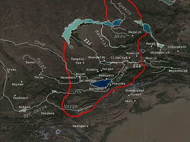
Figure 1.1. Map Illustrating the of the Ili and Chuy River Valley Civilizations. The area within the red line demarcates the traditional limit of the Zhetysu region (© C.A.Stewart).
Wild game, such Middle Ages (Frachetti 2002; Garner 2011; Park and Voyakin 2007). It is this ancient context that provides a deeper understanding regarding how a city, like Usharal-Ilibalyk, could be supported by the surrounding countryside in the area.
Usharal-Ilibalyk is located on a ridge north 16.15 miles (26 km) north of the Ili River, and is literally shaped by streams that run through this region. In Antiquity and the Middle Ages, the Ili River was much wider and had a broader flood plane, which means that Ilibalyk was slightly closer [15 miles (24.5 km)] to the river. This also explains why its shakristan was situated so far from the river—by being on a high spur it would be protected from flash floods while being better defended from attack. Today China siphons much water from the Ili River, rendering the river much smaller than it would have been in the Middle Ages. At that time, the wide Ili valley was prime grazing ground for nomads as well as suitable for farming in the plains around the
city. A creek called the Kara-Su (Black water) flows through Usharal-Ilibalyk, while a slightly larger stream, the Dirgulyk, demarcates its eastern extent; both join with the larger Usek River to
the south of the village, and eventually into the Lake Usek; most likely the lake had an outlet that ran into the Ili River in the Middle Ages. Today these rivers have a robust flow throughout the summer, fed by plentiful rainfall and mountain springs; moreover, all along these waters are substantial forests.
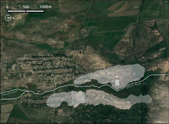
Fig. 1.2. Satellite Image: highlighted areas (in white) outline the archaeological areas of Usharal-Ilibalyk.
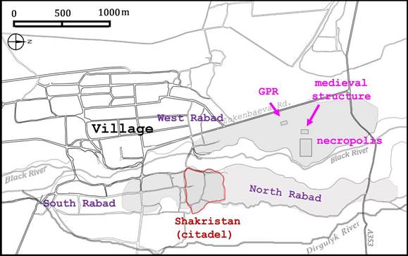
Fig. 1.3. Map Illustrating the archaeological areas of Usharal-Ilibalyk (© C.A.Stewart).
It should be mentioned that these forests would have been considered sacred by the followers of the pre-historic Scythian, Mongol, and Turkic tribesmen who practiced a type of folk religion (for the sake of convenience, the term “Tengrism” will be used henceforth to designate all nomadic religions that focus on shamanism and “heaven worship”). In both Uyghur and Turkic mythology, the forests of Ötüken (near the Orkhon River in Mongolia) were the birthplace of their tribes; so like many other cultures, the “Sacred Tree” is a common motif in their artworks and folklore (Mackerras 1990: 322). One tribe that lived on the Ili River—the Choros (also
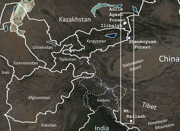
Fig. 1.4. Map Illustrating the of ancient pilgrimage centers (C.A.Stewart).
known as the Oirats)—claimed to have sprung from a Sacred Tree; similar to stories likewise found as far west as Hungary (in the form of the Világfa) and Bulgaria (as Svetovno Dŭrvo), analogous to, or perhaps derived from, the Kipchaks and Cuman Turkic tribes—of which the modern Khazak language is closely affiliated (Boldyreva 2014). The Aulie-Agash Forest (Святое дерево in Russian, which also means “Holy Wood” in Kazakh) lies only seven miles
(12 km) directly due north of Usharal-Ilibalyk and has preserved pre-Islamic religious connotations over the centuries; today modern pilgrims pray underneath a large tree in the center of the forest. Likewise180 miles directly south (288 km) of Usharal is the Shenmuyuan Forest (Numinous Wood), near Aksu (China), which has sacred trees, visited by pilgrims since the Middle Ages, as testified by a monumental cemetery beside it; several domed mausoleums and has a well-preserved medieval “lecture hall” (which may have served as either a mosque, Manichean school, or a church). As such, these sacred forests preserve primordial myths that are parallel to the Yggdrasil (World Tree) in Nordic mythology and analogous to the “origin trees” of the Garden of Eden in Genesis—hence why these Central Asian forests served as pilgrimage sites to Muslims, Tengrists, and perhaps other religious persons.
It is also important to note that two other global pilgrimage sites are known in Central Asia. Regarding the first example, in 1993 Chinese archaeologists discovered a large circular temple complex in the Tien Shan mountains foothills (340 km, 200 miles, southeast of Usharal), near the village of Korla, within the Bayanbulak Grassland park. Archaeologists excavated the remains in 2016 and dated the earliest phase to the Bronze Age (ca. 1000 BC); they also associate this complex with “heaven worship” concepts found in pre-Buddhist and Tengrist religion. Second, a major Hindu and Buddhist site is located at Mount Kailash, 720 miles (1180 km) almost directly south of the Shenmuyuan Forest, which has drawn pilgrims for over two thousand years. These sites transcend modern political borders, indicating that people came through Central Asia for reasons beyond trade and political conquest. Local customs and their mythologies shaped the identities of the tribes who moved in and out of the Ili Valley, and even with the spread of global religions, such as Buddhism and Islam, each region would develop idiosyncratic beliefs and practices.
1.2. Historical and Cultural Overview
The Ili River valley was occupied by many cultures that left a lasting influence. Several nomadic and sedentary Turkic, Iranian, and Mongol tribes lived in the area at various times: the Wusun, Xiongu (Huns), Yuezhi, Karluks, Yaghmas, Chuy, Chigils, Naimans, Oirats, Uighurs, Kirghiz, Keraites, etc. In terms of archaeology, it is difficult to distinguish these tribes from one another, which characterizes their similar and shared lifestyles. It is only with the advent of larger world empires that we can begin to archaeologically identify cultures through their coin and ceramic production, as well as monumental art and architecture. Though the excavations at Usharal-Ilibalyk has not revealed any artifacts earlier than the eighth century, there is no reason to think that this fertile area did not have any previous occupation. It is further hoped that with the discovery and excavation of burials, forensic science (such as DNA and isotope analysis) can contribute to identifying settlement and migration patterns in the Middle Ages.
1.2.1. Sogdians, Uyghurs, and Karluks
The Sogdians would have a lasting legacy along the Silk Roads. They were known for their ability to adapt to geography and cultures as they expanded their trade across the Asian continent, and to adjust to political changes (Naymark 2001; Vaissière and Ward 2005). While there is no evidence of Sogdian influence in northern Zhetysu, their use of a type of Aramaic-Syriac script would be the basis of Uyghur, early Turkic, and Mongolian writing, and would complement the longevity of the Syriac script used by the Church of the East. Sogdian city-planning would also influence the manner that the first cities were designed by nomadic cultures transitioning to sedentary rule; for example, in 757 the Uyghurs would build their first capital, Ordubalyk (also known as Mubalyk and Karabalghasun), on the Orkhon River (Mongolia) based on the Sogdian cities of the Chu River valley, with some Chinese influence (Mackerras 1972; 1990:321; Barfield 1986: 20-97; Arden-Wong 2012). Uyghurs appear to have built the first cities in the Zhetysu (Golden 2011: 44-46). In fact, many Uyghurs would become Christians and Manicheans through their contacts with the Sogdians. Even with the rise of the Muslim Arabs in the southwest and Turks in the northeast, some smaller Sogdian cities would continue to function into the 11th century (Golden 2011: 47, 61).
Sogdian and Uyghur city-states in the Zhetysu were conquered and assimilated by the Ashina clan, centered in the Ili Valley, who eventually created the Göktürk Khaganate in 552. The Göktürks employed Sogdian advisors, while assimilating and emulating Sogdian customs, including tolerance of many religions; in turn, the Turkish language began to spread and replace other languages in the region, such as Tocharian and Sogdian (Sinor 1990: 285-301). Turkic dominion stretched almost as far as the Pacific Ocean to the Black Sea, and so they depended on Sogdian merchants and scholars who provided their extensive intelligence regarding geography and trade routes. At first the Göktürks established friendly terms with Sassanid Persia, but later became their enemies. Conflict, between the Persians and the Byzantines and now the Turks, disrupted trade routes and endangered development in Central Asia. According to the historian Menander Protector, in 568 the Turks forged an alliance with the Byzantine Empire under Justin II; from this time forward, Turks served in the Byzantine army and many would convert to Christianity. These types of agreements indicate how fluid the northern-Asia trade routes (i.e. “Silk Roads”) could be, and how Turkic-controlled cities facilitated and encouraged exchanges between Jiankang (Nanjing) and Constantinople. Here it is important to note that between these two great imperial cities were the vast deserts of the Gobi and Taklamakan to the east and the Dasht-e Kavir and Karakum to the west—and exactly in between are the fresh waters and fertile valleys of the Zhetysu (about 3,650 km from Navakent to Constantinople and 3,650 from Usharal-Ilibalyk to Nanjing).
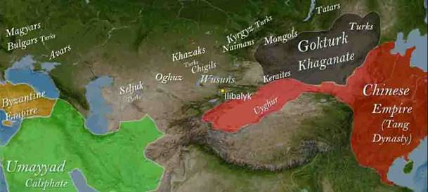
Fig. 1.5. Map Illustrating the Global Empires around the year 700 AD and Tribal Groups (© C.A.Stewart).
Chinese historical sources continue to describe nomadic Turkic-speaking tribes inhabiting
the north bank of the Ili Valley during the Tang dynasty (A. D. 618-907). These tribes were labeled as such based on their language rather than their politics or racial morphology. Tang armies conquered these tribesmen and dominated region in order to control the east-west trade routes; eventually the Chinese installed Turkic rulers as their allies extending their influence in the region. In the late eighth century, the Uyghurs conquered their Turkic overlords and ended Tang domination, forming their own empire; however, around the year 840 the Turkic-speaking Kyrgyz tribe rebelled and ended the Uyghur Empire’s control of the Ili Valley. And yet, before then, another Turkic-speaking tribe emerged in 745, the Karluks, who controlled the western part of the Ili River; they would fill the power vacuum when the Uyghur Empire later collapsed (Golden 2011: 63). Sometime in the 780s a “Turkic king” requested a CoE bishop to be installed and, thus, a cathedral constructed, somewhere along the Syr Darya river valley; this khan, most likely, was a Karluk (Dickens 2010: 127-128). According to the Persian writer Narshakhi, the later Karluk Emir, Ismail, conquered the city of Taraz (Kazakhstan) in the year 893 and “A large church was transformed into a grand mosque”—whether this church was the same cathedral constructed in the 780s cannot be determined (Frye 1954: 87).
The Karluks organized a confederacy of Turkish and Uyghur tribes in the Ili Valley, which would emerge as the Kara-Khanid Khanate by the end of the 9th century (Golden 1990:354-355). According to a much later source (16th c.):
In addition to these Uyghurs…living in the Eastern Tian Shan, there was a third section of the race dwelling farther west. They are called sometimes the ‘Karlughi’ [Karluks] and their seat of power was originally at Ili-balik and on the head waters of the Chu (Mirza Muhammad Haidar Dughlat Beg, The Tarikh-i-rashidi, transl. after Ross, pg. 93-94).
This description is confused. Why would “Ilibalyk” (i.e. “the city on the Ili River”) be located on the “head waters of the Chu” River? It seems that Mirza Muhammad Haidar conflated where the Karluks came from (the Ili) with where they settled (the Chuy) and, yet, all this is probably based on a historical tradition; therefore, we are reluctant to associate this account with Usharal-Ilibalyk, though it cannot be ignored.
The Karluks consolidated their dominance within Chuy Valley, which extended from modern Kazakhstan into Kyrgyzstan. They assimilated other Turkic-speaking tribes, such as the Chigils and Tukshi; and then they eventually conquered the Sogdian-founded cities of Suyab and Navekent, making the former their capital until they established Balasagun (Buruna) in the 10th century. The later description of al-Kashgari also reflects the language and demographic situation at the time:
The lightest of the dialects is that of the Oghuz. The most correct is that of Yaghma and Tukshi, and those who dwell on the rivers Ila (Ili), Artis (Irtish), Yamar, and Atil (Itil), as far as the country of Uyghur. The most elegant is that of the Khaqani kings and those who associate with them. The people of Balasagun speak both Soghdian and Turkic. The same is true of the people of Tiraz (Talas)…” (transl. Levi and Sela 2009: 72)
Being Turkic, the Karluk elite inherited the royal titles of the previous Göktürks and assimilated Sogdian culture, which still flourished in the region. According to the Persian historian Juzjani (b. 1193), by the year 1134 the Karluks had already established the northern Zhetysu cities, such as Kayalyk (Koylik, Kazakhstan) and Almalyk (China); we can assume that these settlements were based on the flourishing southern cities of Suyab and Balasagun (Biran 2005:106).
1.3. Karakhanid Khanate
The Karakhanids dominated the entire Zhetysu region for over three centuries. Most likely if there was an earlier settlement at Usharal-Ilibalyk, it would have been transformed by the Karluks, modeled after the cities they conquered in the Chuy Valley. As mentioned above, the numismatic studies at Usharal-Ilibalyk indicate a substantial 11th century presence; moreover, some of the earliest identifiable ceramics discovered during excavations belong to the late 9th century, similar to styles found at Karakhanid sites in Kyrgyzstan. Monumental architecture of the citadel would have signified Karakhanid civilization in the Ili Valley, though no religious buildings have been positively identified at Usharal-Ilibalyk. At present, the only evidence of religion is Christianity.
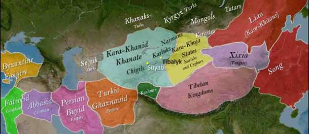
Fig. 1.6. Map Illustrating the Karakhanid Khanate and Tribes ca. 1000 AD (C.A.Stewart).
Muslims. These narratives seem contradictory. For example, Jamal Qarshi in the 13th century described how the first Karakhanid ruler to convert to Islam was Satuq Ughra Khan in 934; at the beginning, Satuq had to hide his conversion from his Karluk family, who were, it seems,
Buddhists; by the end of the story Satuq conquers Kashgar forcing all its citizens to convert (Levi and Sela 2009: 73-76). Marco Polo’s testimony casts doubt on this account when he described Kashgar in the 13th century as having “many” Christians, and that they worshiped publicly in monumental churches (I.33). Another example is Ibn al-Athir’s reported that “200,000 tents of the Turks converted” to Islam in the year 960 within the Karakhanid domain. Scholars often cite these numbers as evidence Islamic dominance in Central Asia; however, we must remember that Ibn al-Athir was providing second-hand information, three centuries later, and was deliberately omitting any reference to religious traditions other than Islam (Golden 1990: 357-358; 2011:70). In contrast, around the year 1010, the Bishop Abdisho of Merv stated that about 200,000 Turks and Mongols converted to Christianity (Mingana 1925: 308) and —unlike Ibn al-Athir—he was a contemporary eye-witness.
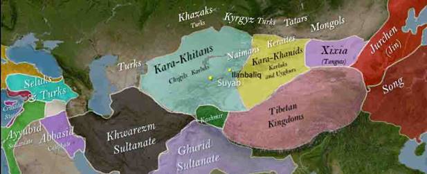
1.3.1. Kara-Khitan Khanate
Around the year 1030 the Jurchens and Song Dynasty combined forces and exiled the leaders of the Liao dynasty of China. Their prince, Yelü Dashi, fled westward while assembling an army among the Khitan tribes of inner Mongolia; the majority were linguistically diverse (Mongolian, Turkic, Uyghur), while the court favored Chinese (Biran 2005:93-101). According to Juzjani, around the year 1031 they founded their capital at the town of Emil (modern Emin, China) on the Emil River forming the Kara-Khitan Khanate; from there they conquered Karluks cities of Qayalyk and Almalyk and, presumably, Usharal-Ilibalyk, 400 km (250 mi) to the southwest (Biran 2005:104-115). Eventually the Khitans expanded to the Taraz and Chuy Valleys, making Balasagun their new capital—following the pattern of conquest of the Karluks and conforming to their administrative system—including the adoption of their Turkic title “Gurkhan” (universal Khan).
1.3.2. Mongols, the Chagatai Khanate, and Almalyk
The Mongols adopted the Kara-Khitan policy of toleration towards religion. For fifty years Christianity had a place within their camps among Buddhists, Tengrists, and Confucians. Muslims were also present, but did not have the same influence, given the fact that many of the khans were married to Naiman Christians and/or were the sons of Naiman mothers (Ryan 1998a). Giovanni da Pian del Carpine and Guillaume de Rubruck provided skeptical accounts regarding Mongol piety; no doubt their Latin high-standards were not similar to Nestorian expectations or, more likely, they simply did not understand their different customs. One devout Mongol leader was Khan Nayan (1257-1287) nephew of Genghis Khan, whose domain included parts of modern Korea. He rebelled against his uncle Kublai Khan and in his last battle, Nayan had his banners decorated with Christian crosses, but in the end, he was unsuccessful and executed. According to Marco Polo, when Buddhists and Muslims mocked that a Christian was so defeated, Kublai Khan silenced them by stating Nayan lost, not because of his faith, but rather because he was a rebel (ed. Rugoff II.1.5).
To his eldest son Joci [Tushi] he gave [the territory] from the regions of Qayaliq and Khwarazm to the far reaches of Saqsin and Bulghar [on the Volga] and from those parts to whatever places the hooves of the Tatar horses could reach. To Chaghadai [he gave the territory extending] from the country of the Uyghurs to Samarkand and Bukhara and his place of residence was at Quyas in the vicinity of Almaliq (after Boyle 1958 I: 42-43).
In other words, the Ili Valley—the domain of the Karluks, Keraites, and Naiman tribes—became the stronghold of the Chagatai Khanate: the fertile plains supplied its bread, the steppes its meat, and the mountains were its ramparts.
The Chagatai capital of Almalyk was close to the city of Usharal-Ilibalyk (52 km, 33 miles). Our archaeological excavations, so far, demonstrate that this settlement thrived between the years 1225 and 1350, when Almalyk developed into a cosmopolis. The majority, if not all, the Syriac-inscribed gravestones that were uncovered here belong to this period. Unfortunately, we do not have primary sources that describe the people, institutions, or society of Usharal-Ilibalyk; however, we do have contemporary accounts of the city of Almalyk, which hint at the general culture of the area. In other words, the development of Usharal-Ilibalyk was inextricably connected to the fortunes of Almalyk. As the city of Rome assists archaeologists in understanding the ancient port of Ostia, or how Athens is studied in relation to the port of Pireaus, so Almalyk can give us some insight regarding the river town of Usharal-Ilibalyk. Moreover, the Christian kayraks discovered in Almalyk bear a striking correspondence—in terms of form, style and scale—to those discovered in Usharal-Ilibalyk (Ruji 2006; Pantusov 1903).
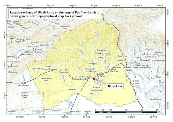
Fig. 1.8. Map Illustrating the Four Divisions of the Mongol Empire ca. 1250 (© C.A.Stewart).
The date of Almalyk’s foundation is unknown. Its name is derived from the Old Turkic alma meaning “apple” and lik meaning “place”, hence “apple orchard”—like the modern city of Almaty (Golden 1992b: 45; Boyle 1964: 183 n. 57). According to historical sources the Karluks had settlements in this vicinity in the 11th century, but Almalyk really enters onto the “global stage” in 1211 when it was seized by the Karluk outlaw named Buzar (or Ozar). He soon crowned himself Khan, making Almalyk his capital; in effect, he was declaring open rebellion against the Kara-Khitai and their Naiman allies who were ruling the Ili Valley. The Naiman forces, led by Küchlüg, besieged Almalyk several times, forcing Buzar to turn to the Mongols for assistance (Juvaini, ed. Boyle 1958 I: 75-77). The Naimans were ultimately unsuccessful and Buzar’s son, Siqnaq Tegin, continued to control Almalyk, as a puppet ruler of the Mongols. This episode highlights the capability of Almalyk as a strategic stronghold.
Several travelers described passing through Almalyk in the early 13th century. For example, Li-Chi-Ch'ang, wrote about the Confucian monk, K'iu-Ch'ang-Ch'un’s journey around 1219:
We passed the night in a mountain passage…then we entered a broad valley which stretched from east to west, well-watered, with abundant grass, and here and there some mulberry trees and jujubes. Our next stop was the city of Almalyk. The Muslim (Pu-su-man) ruler of the realm came out of the city, together with the Mongol governor, to meet the master [K'iu-Ch'ang-Ch'un]. We stopped at a fruit orchard west (of the city). The people here call this fruit an “apple” (a-li-ma); and as the place is famed for its fruits, the city received the above name. There is a kind of cloth called the tu-lu-ma. The people say that it is woven from vegetable wool [i.e. cotton]. We got seven pieces of it for winter clothes. This hair resembles the down (enclosing the seeds) of our willows. It is very clean, fine, and soft; and they use it for making thread, ropes, cloth, and wadding. In cultivating the fields, the people use also artificial irrigation by means of aqueducts. For drawing water, they use a jar which they carry on their heads” (transl. after Bretschneider 1888 I:69-70)
Here the author is highlighting agriculture, commercial production, and water management—all characteristics of urban society. Clearly there was both a Muslim and Mongol presence in the city. Likewise, around the year 1220, Si-Yu-Lu recorded how the Khitan statesman, Yelü Chucai (1190-1244), traveled through the area:
After leaving the Yin Mountains one arrives at the city of Almalyk. The Western people [Turks] call the crabapple “a-li-ma”, and since all the orchards all around the city abound in apple trees, the city received this name from them. Eight or nine other cities and towns are subject to Almalyk: in that country grapes and pears abound. The people cultivate five kinds of grain, as we do in China. West of Almalyk there is a large river which is called the Ili (Yelü Chucai’s Embassy to the West, after transl. by Bretschneider 1888 I:17)
Emphasis is placed on the fertility of the land and the agriculture, which contributed to the development of a cluster of cities—which can be labeled the “Ili River Civilization”. Certainly Usharal-Ilibalyk was one of these satellite “cities” dependent on Almalyk.
The rise of the Mongol Empire caused on the “Ili River Civilization” to flourish between the years 1200 and 1340. It was the “gateway” or “bottleneck” where several routes converged, connecting the Mongol capital of Karakorum to its wealthy southern cities of Fergana and Kashgar and those to the west, Samarkand and Bukhara. In other words, the Illi River formed a long passage between the Yin-Dzungarian Mountains and the Tian Shan, becoming the shortest, safest, and most comfortable (with access to fresh water, food, level roads, and temperate climate) route between these cities. Even when Karakorum was eclipsed by Khanbalyk (Beijing), the main trade route continued to cross the Ili Valley, hence why Kublai Khan fought so hard to maintain a presence in the area between 1260 and 1290.
In the year 1226, Genghis Khan’ son Chagatai (1183–1242), inherited this realm and eventually assimilated all the Karluk domains. Juvaini stated:
In spring and summer, he [Chagatai] had his quarters in Almalyk and Quyas, which in those seasons resembled the Garden of Iram [poetic garden of paradise]. He constructed large pools, which they call kol, in that region for the flocking of the waterfowl. He also built a town called Qutlugh [“Happy Place”]. The autumn and winter he spent in Marauzyk on the Ili River (transl. after Boyle 1958 I: 271-272).
This rather bucolic account depicts the how Chagatai could escape the court intrigue, wars, and bustle of the larger cities—such as Bukhara and Samarkand—in his domain. Like the mythical Xanadu, the The mountain views, fresh water, hunting grounds, fresh fruit and meats, flower gardens, and moderate temperatures. As described below, our site has been identified as “Ilibalyk” which is a generic descriptor; it may have been known locally by the more specific name either “Qutlugh” or “Marauzyk” mentioned here.
When Chagatai died in 1242, Almalyk passed down to his grandson Kara-Hülegü which he maintained as the capital until he died ten years later. His main palace was known as Ulugh-Ef (“Grand House”) which was either within or just outside Almalyk (Juvaini Boyle 1958 II:563, 612). According to Jamal Qarshi, the region area around Almalyk became known as “Il-Aragu” based on the name “Ulugh-Ef” (Barthold 1956-1962 I: 115). Kara-Hülegü was married to an Oirat princess named Organa—“possessing much beauty, wisdom, and influence”—and she ruled as the Khatun and regent when he died in 1252 (Ross 1895: 34).
It is important to note that the Mongol guides of both Carpine and Rubruck consciously avoid the area of Almalyk. In same year that Kara-Hülegü died, it seems that Carpine traveled through the western half of Ili Valley since he provides this description:
This country has an abundance of rivers, though they are not large; on both banks of the rivers there are woods, but they do not stretch far in depth. Ordu [Kara-Hülegü] lives in this country; he is older than Batu, in fact he is the oldest of all the Tatar chiefs. The orda or court of his father is there and it is ruled by one of his wives [Organa], for it is a custom among the Tartars that the courts of princes or nobles are not destroyed but women are always appointed to control them and they are given their share of the offerings… (transl. after Dawson 1980:60]
Likewise, in 1254 Rubruck crosses the Ili River at Shengaldy, but his guides are careful not to travel closer to Almalyk. He called this area the “Land of Organum”; apparently, he mistook the name of the Khatun with the name of the country (Bretschneider 1876: 217). Their Mongol guides, from the Golden Horde, were deliberately avoiding Organa—either because they did not accept her rule or they were keeping the Latins’ “gifts” to their own lieges. In fact, at that time, the throne of the Chagatai Khanate was being contested, since Alghu Khan (the grandson of Chagatai) claimed to be the appropriate successor, opposing Organa and her infant son Mubarak Shah.
Though these Latin monks do not travel through Almalyk in this period, other merchants and dignitaries continue to visit the Chagatai court. One significant account was written in 1259 describing the journey of Ch’ang Te westward:
There are mills (on the river), which are put in motion by the running water. Proceeding westward, Chang-Te arrived at the city called Ye-man. Further to the south-west a city Bolo [Pulad] was reached. In this country wheat and rice are cultivated. On the mountains, many cypresses are found…the dwelling houses and bazaars stand interspersed among the gardens. The houses are built of clay, and the windows furnished with glass….[the way\ was guarded by Chinese… leading through the defile Chang-Te arrived at Almalik.
There the reservoirs in the market-places were connected by running water. As regards fruits there were melons, grapes, and pomegranates of excellent quality. The Hui-ho [Muslims] in Almalik lived among the Chinese, and gradually their customs had got changed into the customs of the middle kingdom. South [of Almalik] there was a city called Chimur [Talgar?]. Amongst the inhabitants were a great many Chinese from Ping and Fen…Chang-Te passed Yitu situated between two mountains. The ground there was level and the population numerous. The country was intersected in all directions by canals, which irrigated fields. Numerous ancient walls and other ruins were seen. The people said, that in former times the Khitan dwelt there… [he passed the Talas] and…arrived at Sailan (Sayram). There is a tower in which the Hui-ho (Muslims) worship (Bretschneider 1876: 74-75).
Here a wealth of information: water technologies (mills, aqueducts, and canals); mining, metal working, and minting; surplus agricultural production; market stalls; architecture (mud-brick and glass). Note that grapes were grown which could be turned into wine—perhaps for service in the Christian liturgy.
The peaceful garden atmosphere of Almalyk was marred between the years 1260 to 1290 due to internecine warfare among the Mongols. In 1266 Barak (son of Alghu Khan) usurped his cousin Mubarak Shah and assume the khanate with the help of Kublai Khan’s Yuan armies. Then Barak rebuffed Kublai’s authority; as a result, Nomukhan (Kublai's son) and his generals occupied Almalyk from 1266 to 1276 and garrisoned forts within the Ili Valley. They did not remove Barak from power, but forced him to fight their enemy Kaidu Khan of the Ögedei dynasty. In 1270 Kaidu defeated and killed Barak, effectively, reducing the Chagatai dynasty to vassals; eventually and he move his palace court to Almalyk, driving the Yuan from the Ili Valley (Bretschneider 1888: 216). These battles effectively closed the “Silk Roads” in the region, causing much economic and social hardship; for example, in 1291 the missionary John of Montecorvino (1247–1328) tried to travel to China from Italy on this route but was prevented, because it “was not safe on account of the wars” (ed. Dawson 1980:226). When Kaidu died in 1301, the remnants of the Chagatai dynasty reasserted their authority and it became an independent state again, so that between the years 1301 to 1338 Almalyk and its environs returned to their peaceful garden-like state. Writing in the year 1305, from Khanbalyk (Beijing), John of Montecorvino encouraged missionaries: “As to the road: I report that the way by the land of the Khitai, the emperor of the Northern Tatars, is safer and more secure so that travelling with envoys, they might be able to arrive within five or six months” (ed. Dawson 1980:226). Likewise, the Italian merchant Francesco Balducci Pegolotti (fl. 1310 - 1347) stated: “the road you travel from Tana [Tanais, Russia] to Cathay is perfectly safe, whether by day or night, according to what merchants say who have used it” (Yule 1915 II: 292).
At this point, the history of Almalyk becomes closely intertwined with the history of European missionaries to the Far East. Already in the 5th century, when the Huns invaded Europe, Latin Christianity was promulgated among the Turkic-speakers in their ranks; and by the year 1217 there was a Catholic “Bishop to the Turks” centered in what is modern-day Hungary (Golden 1992b: 45). Books, like the 13th-century Codex Cumanicus (a Latin-Turkic dictionary), were written to facilitate preaching the gospel to Turkic tribes; incidentally, the riddles recorded in that book are still told in Kazakhstan today, using strikingly similar terms and catch-phrases (Golden 1992b). While the missions of Carpine and Rubruck are well-known, one wonders how many Latin merchants and missionaries traveled through or settled in the Ili Valley but were never recorded.
By the year 1314 there was a Latin bishop in Almalyk—but the historical sources are silent regarding the circumstances of his establishment (Wadding and Fonseca 1733: 227). We know that a Bishop of Almalyk, friar Carlinus de Grassis, died in the “new castle” near Pavia in 1328, whether he was returning to or outgoing from Almalyk is unknown. Afterwards the friar Richardus de Burgundia was installed (Eubel 1898 I: 108). In the year 1333 the Spaniard friar Pascale de Vittoria arrived and joined the Franciscan community in Almalyk. In a letter, he described how he learned the Turkic language and Uyghur script to facilitate his mission (Yule 1915 I: 85). Apparently, these monks constructed a “magnifica” Gothic cathedral and four Franciscan monasteries: one in Almalyk and, presumably, three others in surrounding towns—perhaps, Usharal-Ilibalyk (Civezza 1859 III:658). In the letter by Pope John XXII, he mentioned that: in 1333 Nicholas of Paris (soon-to-be archbishop of China), together with six laymen and 20 friars, traveled through Almalyk and was treated well by Changshi Khan (r. 1335-1338) (Yule 1915 III: 11-13, App. 79). At this point in history, Latin Christianity seemed to have a bright future in Central Asia: King George of the Onguts had converted to Catholicism by the year 1305 and Friar John of Montecorvino reported that he alone baptized thousands of Mongols and Chinese, and established fifty monasteries (ed. Dawson 1980: 225-227). Such was the calm before the storm.
A militant form of Islam had infiltrated Central Asia since the Karakhanid Khanate. This trend subsided in the Kara-Khitan and early Mongol Empire, where Islam was active but in decline, while Syriac and Latin Christianity was expanding. The sentiment of Bar Hebraeus is telling:
And having seen genuine modesty and other virtues among the Christian people, certainly the Mongols loved them greatly at the beginning of their kingdom; though that was some time ago, and [unfortunately] somewhat short-lived (Chronography X.6.ii, after Wallis Budge).
The change took place around the year 1257 when Berke Khan assumed the rule of the Golden Horde, being the first Muslim Mongol ruler—however, the Chagatai and Yuan domains were not affected by Islam the same way. In fact, most Yuan and Chagatai khans were predisposed to Christianity, having Nestorian advisors and scribes (not unlike how the Göktürks and Uyghurs employed Sogdians) and wives. It was only with Ali Khalil Khan (or Ali-Sultan) who reigned briefly in 1339 that Christians were first brutally persecuted at Almalyk. The background story is unknown; but it was recorded that the Latin architecture was destroyed and the entire European community was massacred. A year later Giovanni de Marignolli—with a mandate from the Pope Benedict XII to rebuild—traveled through Almalyk and provided this testimony:
[At Almalyk] we built a church, bought a piece of ground, dug well, sung masses, and baptized several persons; preaching freely and openly, notwithstanding the fact that only the year before the bishop and six other minor friars had undergone for Christ’s sake a glorious martyrdom, illustrated by brilliant miracles. The names of these martyrs were friar Richard the Bishop; friar Francis of Alexandria, friar Pascal of Spain (this one was a prophet and saw the heavens open, and foretold the martyrdom, and many other glorious things); friar Laurence of Ancona; friar Peter, an Indian friar (who acted as their interpreter), and Gillottus, a [Genoese] merchant” (Yule 1915 III: 212).
For the next two decades Giovanni de Marignolli’s church at Almalyk continued to serve the area—then, all of a sudden, the Latin clergy stopped corresponding with other churches. The bishopric disappears from history.
1.3.3. The Decline of the “Ili Valley Civilization”
Latin and Nestorian Christianity vanished from historical sources in the Ili Valley (as well as the rest of Central Asia) in the second half of the fourteenth century. Christianity’s collapse coincided with the general decline of urban life and international trade, as well as the rise of radical Islam. Our excavation has not revealed any positive data regarding how and why Usharal-Ilibalyk declined; at this point, there is an absence of burning (of buildings), corporeal remains due to homicide, or military projectiles. Historical sources described continuous tribal warfare in the area, and so, future excavation may provide more information. Tentatively, the data can be explained by current historical models, that is: starting in the 1330s diseases, especially, the Black Death (which seems to have included a variety of ailments including the bubonic plague, leprosy, and parasitical worms) were spread along the Silk Roads. This led to population decline, and this, in turn, led to economic deterioration. Economic problems were the basis for political instability in Central Asia.
By 1370 Tamerlane’s armies (i.e. Amir Timur, 1336-1405) conquered much of the Eastern Chagatai Khanate, enforcing strict Islamic practice among his subjects. Nonconformists were persecuted and murdered. Several scholars have calculated that Timur’s campaigns and policies led to the death of around 17 million people (Marozzi 2004). In the cities, Christians of any sect, but especially the Nestorians, lost their standing in society, stripped of their property and livelihoods; eventually the church went “underground” leaving its bishoprics unfilled (Winkler 2003; Bostom 2010: 460). Tamerlane’s radical islamization practices coincided with Tughlugh Timur Khan’s conversion to Islam around 1360, which led to the transformation of the Chagatai Khanate, and its capital Almalyk, into an Islamic state. Eventually the Islamic sharia would replace the Mongol yassa as the system of law. Incidentally, since the year 1360 Christianity is no longer mentioned in Ili Valley until Russian reintroduction in the 1840s. Scholars today refer to the islamized Eastern Chagatai Khanate as “Moghulistan” to mark the change in society and historical circumstances (Kim 2000).
The rulers of the Chagatai Khanate lost support among the majority of its Mongol subjects who resisted conversion to Islam. By the year 1415, it seems that the city of Almalyk was abandoned as a capital, eclipsed by Ghulja and, later Beshbalyk. The fate of Zhetysu towns and cities were unrecorded in the histories that were written at the time. According to Sultan Baber, who wrote in the 16th century, he said Almalyk was a once-important city:
Farghana is situated…at the limit of settled habitation…to the north, though in former times there must have been towns such as Almaliq, Almati, and Yangi (which in books they write Taraz), but at the present time all is desolate, no settled populations whatever remaining, because of the Mughuls and the Uzbeks (Babur in 1494, transl. Levi and Selah 2010: 210)
From about 1400 to 1425 various tribes (Uzbeks, Oirats, Kazakhs, Kyrgyz, etc.) came through the Ili Valley devastating settlements. Usharal-Ilibalyk is one of these sites that was abandoned by then.
2017 Field Report on the Archaeological Excavations
at Usharal-Ilibalyk, Kazakhstan
1.4. 2017 PROJECT OBJECTIVES.
We planned to:
- continue exploring the large medieval city Usharal-Ilibalyk (ca. 10th to the beginning of 14th centuries) on the Great Silk Road;
- carryout further geo-archaeological exploration to identify and recover the Christian monuments of the site, such as the known cemetery and, perhaps, any related architecture;
- further identify and define the borders, topography, and layout of the ancient settlement;
- analyze the stratigraphy and chronology of the ancient settlement;
- excavate the area where the gravestones were discovered last year (2016);
- study the artifacts, faunal, and flora remains in the stratigraphy and prepare a ceramic typology while assessing the coins as they are uncovered; and
- prepare a scientific report of the findings and two publications in the Russian and English languages.
Time Frame:
Total period of project implementation – 2016-2017;
2016 – 1 month (June 29 to August 29);
2017 – 1 month (June 1 to July 1);
Expected results:
Our investigations will provide new data for understanding the nature of the medieval site of Usharal-Ilibalyk. Our field surveys, topographical studies, geo-archaeological analysis, and excavation work are expected to provide materials (ceramics, coins, metal objects, bones, etc.), which will allow for the identification of the ancient settlement of Usharal as corresponding to the city of Ilibalyk mentioned in written sources of the 13th and 14th centuries. Our focus in 2017 is to recover the remains of Christian heritage, such as architecture and additional gravestones (kayraks) with Syriac and Christian symbols, and identify and excavate the actual burials that are commemorated. These studies will provide new information regarding the spread of Christianity along the Great Silk Roads together with its role in the cultural life of the Karakhanid Empire through the Chagatai Khanate of the Mongolian Empire as well as its relationship with other religions.
1.5. APPROACH TO SETTLER-TYPE SITES
As discussed in the 2016 report (§1.3) Usharal-Ilibalyk is classified as a “Settler-type” site. Our project was designed around this identification and applies techniques developed by archaeologists in the region, while incorporating international standards. In order to determine the precise location and features of the hidden archaeological objects, we applied non-invasive remote sensing methods. In the case of the 2017 project, a geophysical scan of individual unites were conducted prior to excavation. Analysis of the soil layer was carried out with careful observation of the ground for finds, with special consideration of bare structural loci and layouts. After removing each layer, the surface was swept clean, and a visual survey conducted of the unit for architectural and other loci. Each layer of soil was removed based on either stratification or the nature of the loci within each unit, until we reached a surface.
We recorded the cultural remains using photography and drafting diagrams. When substantial monumental remains survived, we planned to preserve them for further study. Ephemeral constructions were identified and photographed, and eventually backfilled for the purpose of later study. Those constructions in a poor state of preservation were often excavated for the purpose of revealing more features. After proper recording, each feature was eliminated and the plot was leveled and excavation continued until the required cultural layer was reached.
For each excavated unit, we kept a daily record regarding the structural features, artifacts, and observations of the stratigraphy. Field records served as the basis for the drafting of this scientific report and future publications. This year’s project (2017) did not reveal any features that required conservation for tourists or necessitated further research by us, according to our research objectives; if architecture, civic structures, or public monuments had been uncovered, we would have designed a plan for conservation and restoration. Moreover, if substantial remains were uncovered, we were prepared to compare the material with other citadels and cities of the Zhetysu and southern Kazakhstan.
Our record keeping and site management reflects “best practice” processes. The finds of all recovered artifacts were recorded, described, and logged into an official inventory of the collection kept by Archaeological Expertise, LLP (AE). All photographs of features included the use of a scale ruler and/or surveying rod indicating which direction the camera lens was set. During the investigation, we identified and described artifact context, stratigraphy, midden (rubbish pits), and other structural features. The finds were fully cleaned and restored (when possible or necessary), drawn and/or photographed with a scale ruler. Materials were stored in packets with labels indicating their context. The label was placed in a separate small package to prevent damage. Artifacts obtained during the excavation were taken for museum storage and further scientific processing.
1.6. Excavation Methodology
This section explains the methods and procedures utilized while conducting the scientific and research work of each phase of the site. As much as possible standardized and systematic research methods and procedures were applied to all excavation areas. Due to the context and circumstances, some methods were not used while others were expanded. In such cases various individual excavation methods and procedures were used as appropriate to the context and situation.
The choice of the location, size, and layout of the excavation site was determined by the results of a detailed survey of the site and the surrounding region conducted in 2016. The survey produced areas of interest due to the presence of grave markers (kayraks) on the surface. One particular area contained a concentration of such markers (this location was labeled Field IV).
The methodology envisioned the discovery and complete excavation of burials, the original cultural surface, and any related features or structures in their context. The excavation area covered a portion of land on the supposed necropolis. The necropolis is positioned along near the stream known as the Kara-Su, which is a tributary of the Ili River, which experienced annual flooding prior to the 1900s. This produced multiple geomorphological layers intermixed with cultural layers stretching across the entire area of excavation. Therefore, to reach the undisturbed cultural layers associated with the necropolis, systematic and detailed stratigraphic recordation was conducted to sequence the excavated cultural layers.
A systematic recording method was utilized to record the context and provenience of all archaeological material. Following the convention of the previous season (2016), the 2017 excavation was organized to continue the field numbering sequence. The field of excavation for 2017 was labeled Field IV and all excavation was conducted in this sector. The field was further sub-divided into areas (broadest sub-division category) labeled with capital letters (A, B, C), and then organized into units (narrower sub-division category) labeled with Arabic numerals (1, 2, 3 etc.). Unit extensions were labeled with the corresponding Arabic numeral that was followed by a letter (1A, 1B, 1C, etc.). All areas and units were aligned along the north axis grid of Field IV.
The most basic sub-division category was the locus, which is the smallest unit of provenience. A locus is a three-dimensional point in space (that is, its physical location) that contains archaeological material [whether i.e. soil, feature(s), architecture, objects, etc.]; there is a relationship between the archaeological material in the locus and the larger geographical context. The limits of the locus are determined by the professional archaeologist based on soil (i.e. type, color, density, “feel,” etc.), artifacts (i.e. cluster, entire object, etc.), features (i.e. pit, burial, surface, etc.), and architecture (i.e. wall, structure, etc.). Each locus is assigned a “locus number” that can be related to a specific stratigraphic layer. To track stratigraphic layers across the excavation site all units began with locus 000 for the surface. 001 for the topsoil (removed by bulldozer), and 002 as the opening locus for each unit.
Prior to the 2017 excavation season, photographic images of the terrain were taken using an unmanned aerial vehicle (drone) and a topographical plan was conducted using a total station. The surface was inspected and documented before excavation began. The excavation areas were cleared of topsoil, using heavy equipment (bulldozer), to a depth of approximately 20-30cm and then carefully cleaned to detect traces of cultural material (see § 3.1.2 below). Following topsoil removal, non-invasive remote sensing was used to determine anomalies at the working level beneath the plough zone. Ground-penetrating radar was used specifically to help locate features and their depth. All excavation units were placed based on visual evidence following the removal of topsoil or on the results from the GPR. Each unit was aligned with the north axis of the grid in Field IV. The size of each unit was based on the circumstances of the visual evidence and/or GPR data. Prior to excavation the outline of each unit was recorded using a total station.
Apart from topsoil removal, field excavation was completely done by hand with the help of hand tools (shovels, trowels, hand picks, mattocks, brushes, scoops, etc.). Photographic recordation was utilized in the field excavation process to catalogue the overall appearance of the excavation area and various layers of stratigraphy, as well as objects, features, and architecture. All photographs were numbered and cross-referenced with loci numbers and included the use of a scale ruler and an arrow/trowel to indicate the northern direction. Additionally, loci in which additional information could be attained through the collecting of material (i.e. soil, organic, geological) for further study by specialists (i.e. geologists, geomorphologists, paleobotanists) of the natural sciences was done by taking appropriate samples of the material for further analysis.
Each excavation unit was monitored and recorded by a professional archaeologist. Each archaeologist kept a record of the daily excavation process from the field that reflected all features, objects, and architecture along with its cultural strata, loci numbers, and other various observations. Significant finds were photographed and recorded with the total station. Top-plans and profiles were recorded for each unit. These field records serve as the basis for the drafting of this scientific report.
Excavation of each unit began at the base of the area excavated by heavy equipment and was given the designation Locus 002. At the opening of a locus, elevations were taken and visual observations noted. Depth of excavation passes were 10-15cm unless the context dictated another approach. All excavated soil was sampled by sifting. In most circumstances one-hundred percent sifting was done, but in certain situations only a portion of the soil was sifted. Soil chroma was noted for each locus and feature with the use of Munsell charts. All excavated soil was removed from the excavation unit and dumped in designated piles.
Upon each excavation pass or articulation of feature, the unit (or feature) was swept clean and a visual survey was conducted. Each excavation pass was accompanied by photography and observational analysis, which was then recorded in field notebooks. Identified material and features were subject to detailed excavation by professional archaeologists and were swept, recorded, and photographed, before removal and/or further excavation. At the close of a locus, depths were taken and all relevant notation was completed.
The excavation of the Ilibalyk necropolis required careful identification and systematic provenience of all significant cultural material to properly place it within each stratum. Since the original topography of the site is unknown, soil composition was carefully analyzed to better understand the sequencing of deposits over time. In each unit excavation ceased when the occupational surface was reached. The preservation of the surface was important to understanding the stratigraphic sequencing of the site.
In each locus, all material culture was collected and material fragments were counted in the field at end of each day before being processed in lab. Fineware ceramics and notable material culture were placed in separate bags, while being properly labeled to their corresponding locus. During the excavation season, identification and cataloging of material culture was conducted and significant finds were drawn and/or photographed with a scale ruler. All collected ceramics were washed, scrubbed, and restored if possible. Materials were stored in packets with a label indicating raw data. Each label was placed within a separate small package to prevent damage. Artifacts obtained during the excavation were taken for museum storage and further scientific analysis.
This season’s project (2017) did not uncover any burials, features, or architecture that required conservation for further research or tourism. Had such burials, features, or architecture been uncovered, conservation and restoration work would have been conducted. At the end of the season all excavated material was recorded, documented, described, and logged in official unit summaries. The entire process of excavation was fully documented from start to finish and the results are presented in the form of this written report. The study of the ceramics and artifacts are ongoing.
The legislative basis of the work:
All work is carried out on the basis of:
-the law of the Republic of Kazakhstan no. 1488-XII dated July 2, 1992
“On the protection and use of object of historical and cultural heritage”;
-Order MCS no. 156;
-Order MCS no. 157;
-Order MCS no. 376;
-Other normative and legal documents of the Republic of Kazakhstan.
1.7. RESEARCH PHASES AND GROUPS
Work at the site was divided into a number of phases, with various research groups contributing to the success of the project. The first phase includes preliminary investigations and obtaining permissions from local authorities. Since 2014, Archaeological Expertise, LLP, (AE) has been conducting studies on the Usharal-Ilibalyk, including: numismatic analysis; local physical and geographical characteristics; examination of the historical documents of the village; and cross-referencing the site with other the archaeological sites in the region. As a result, AE has created an archive and a database with cartographic data, aerial photography, up-to-date topographic maps, and satellite imagery. By understanding the geography, AE has been able to identify the local authorities who are responsible for maintaining and preserving the archaeological site, from the äkim of the village to the Ministry of Agriculture. The second phase includes the onsite investigation and the archaeological excavation, which is explained by this report. The third phase includes post-excavation processing of information, such as publication, reporting at conferences, and continual analysis of the finds. The research teams were organized into specialized groups with specific tasks, including:
- Field Archaeologists, Technicians, and Surveyors. This group is engaged in surveying the site, recording topographic and geological features (using scientific equipment, including drone photogrammetry and filming), and drafting plans, maps, and diagrams.
- Finds Specialists. This group preserves, organizes, records, and manages the storage of the material culture obtained by the excavation.
- Geophysical surveyors and data analyzers. This group conducted field collection of geophysical data by means of geomagnetic surveying using a GSSI SIR 3000 geo-scanner. Geodetic and geophysical data were processed by analyzing the data using the GPR Slice software, as well as vector and bitmap graphic applications.
- Cartographers. This group performed the geodetic data processing in the CAD and ArcGIS software.
- Academicians (Historians, Archaeologists, and Art Historians). The task of this group includes the study of: archival data, historical sources, and archaeological reports. Ultimately thy will compare Usharal-Ilibalyk with other contemporary sites, identifying similarities and differences regarding their arrangement of monuments, such as religious buildings and fortification, as well as topographical and civic structures, such as roads and water management. They are responsible for publishing and lecturing.
- Managers and Directors. Administrators support all the teams by: obtaining permissions, grant-writing, budgeting, reporting (publishing and lecturing), ordering equipment and software, managing inventories, facilitating storage, tracking logistics, organizing field trips, hiring employees, delegating assignments, networking personnel, and tracking quality of work, etc.
2. REMOTE SENSING
2.1. Geodesy
At this time, as a result of the integration of modern technologies in the area of scientific investigation, various pieces of modern engineering equipment were utilized. One such example is the use of Total Stations, 3-D scanners, high precision GPS and geo-radars to document archaeological sites. The use of this equipment enables extra precise measurements over a short period of time.
In turn, Archaeological Expertise LLP has adopted the latest equipment for documenting and studying both surface and buried objects applying non-invasive methods. The investigations for this project involved the company using the following equipment: Leica TCR 307, 407, TC 407 laser total stations, HDS3000 3D scanner, Trimble R3 ultra-precise GPS tracker, GSSI SIR-3000 geo-radar with a 270 MHz frequency antenna.
The main tool for documenting the sites during the archaeological dig was the total station. This apparatus provided high-precision topographic survey plans of hills and cross sections. Data acquisition was accelerated and convenient due to the fact that the data acquired from a total station is digital.
The Trimble R3 GPS tracker enabled high-precision documentation over large areas. The advantage of this method is this technology’s high speed and accuracy of plane surveys and topography. In addition, only one operator was required to carry out the survey because the device is not attached to fixed positions, thus, one can use it on sites with complex terrain as well as over very large areas which exceeds the range of any Total Station.
A surface survey was conducted of the terrain layout, including the roads, communications, the surrounding infrastructure, hydrology, etc. With the help of the high-precision Trimble R3 GPS receiver a triangulated polygon for project planning and surveying was created. As a result of the research the following data collection and processing method was used:
- An arrangement scheme
This represents a set of information containing communication data related to roads of all types (central/main, dirt), the water resources (rivers, streams, lakes, etc.) and the power lines. All information is overlaid on the basis of topography.
- Surveying
This methodology involves a 3-D survey of the area based on the following:
Surveying technique: Topographic surveying of the object occured in two stages. The first stage involved surveying the micro-topography of each object individually. The advantage of micro-topography lies in its detail, allowing a researcher to determine the layout and features of the object under investigation based on a predetermined model with the ability to select a plot to conduct excavations using the received data. Micro-topography is run with a frequency of 1 m, which provides the possibility to construct a topographic model with horizontal increments equal to 0.2 m.
The second stage of the research involved a general topographical survey of the area and the surrounding landscape. This step facilitated the tracing of the overall arrangement and the relationship between the objects themselves as well as tracing the features of the cultural landscape. Surveying the general topography was made in increments of 10 m with horizontal increments of 0.6 - 2 m.
The peculiarity of the archaeological survey is that the information needed for this study was generated by applying different scales, that is, objects of interest are documented using micro-topography and the buffer area by applying common topography. In this regard, the work was carried out by a trained professional with an expertise in the field of archaeology.
The scale of the arrangement scheme was selected depending upon the area of the research objective. The maximum scale is 1:500 and then proceeds to 1:1000, 1:2000, 1:5000, etc. These limits do not apply to topographic surveying due to the archaeological specifics listed above. It is recommended that one use the following scale grid with a maximum scale of 1:50, then 1:100, 1:200, 1:500, etc., if applying intermediate scales a linear scale was required.
- Planned surveys
This method of collecting information can be both an independent method when conducting documentation and a complementary method to all other types associated with the use of a laser total station. Plan drawing carries the maximum amount of information. It is generated by object section with a plane at the level of 1 m or at the required height with an indication of the information in the drawing. The plan provided all the structural parts with feedback of the related information that included height-marking, explanations of the drawing and dimension lines. The composition of the plan drawings included drawings of individual parts, constructive units and other items requiring more detailed elaboration and carried out on a larger scale. Drawings were done in a linear scale ranging from a scale of 1:10 and less.
2.2. Using GIS technologies
Modern computer technologies have already proven their superiority when processing data. Combining computer technologies (especially data processing and analysis) and traditional maps has opened new horizons for cartography and resulted in the first Geographic Information System (GIS). Geo-information systems now combine precision and high quality digital maps; a tremendous amount of background information; a powerful set of tools for the processing and analysis of data; and also, the ability of specialized information exchange through the Internet. GIS - Geographic Information Systems are new technology that, despite its recent appearance, has spread widely across many scientific disciplines. GIS is successfully applied, for example, in such areas as forestry, water management, geology, economics, criminology etc. The very name itself does not provide the full gamut of a GIS system, below are some definitions that characterize GIS:
- a powerful system for collection, storage, processing, retrieval, and display of spatial data extracted from certain objects for specific practical purposes.
- an information system that generates data relating to spatial or geographic coordinates.
In other words, GIS is a system of databases with specific operational features applicable to spatial data.
- GIS is a computer system whose main purpose is the manipulation, storage, processing and generating of data about geographic space.
- GIS is not a single computer program, but a combination of several different computer technologies.
- GIS is an overlay of all kinds of data to its spatial environment (territory).
GIS for archaeologists is recognized as the best system with the ability to use the latter in the most extensive of studies. This is because the system allows for the analysis, management, and expression of the full range of collected data that is both spatial and having certain characteristics. This is absolutely necessary to maintain up-to-date with the constantly changing human environment. The program allows one to work on the restoration of an ancient landscape and provide further analysis of individual excavation structures, etc.
Despite their appeal, geographic information systems are criticized for its pronounced environmental determinism. Data related to the concept of "environment", such as types of soils, rivers and land usage can be measured, mapped and transformed into a digital format, while the cultural and social aspects are complex and therefore, problematic.
So, GIS technology is used to examine and process sets of various geographically related information. GIS is often used as a tool for mapping and analysis. There are a variety of methods whose use facilitates solving set tasks, and each method has its advantages and disadvantages. They are as follows:
Manual survey via a hand-carried map. -- very low accuracy, extremely time-consuming, low cost.
Instrumental survey (theodolite/total station) - high accuracy, extremely time-consuming, high cost.
Utilizing GPS - accuracy within 5-15 m, extremely time-consuming, low cost, problematic display on a map.
Topographic bases (100,000, 25,000) – Objects and features are not displayed due to their small size.
Geo-referenced satellite imagery -- extremely costly, yet high-resolution imagery.
Aero-photography -- no geo-referencing, distortion, not time-consuming, high cost.
GPS Rover survey (GPS measurement with high accuracy) -- extremely high accuracy, extremely time-consuming, extremely high cost.
The most appropriate way is a combination of these several methods mentioned above, combined into a GIS. This was applied during the excavation.
2.3. Satellite imagery
Working with satellite imagery that are geo-referenced and have a resolution of up to 1 m provides researchers with information about landscape arrangement, water sources, and topographical details. This information is then used in drawing maps and documenting the change of landscape through time, as well as monitoring the current excavation and its context. We used satellite imagery from a variety of sources including: Birdseye Satellite Imagery, Digital Globe, USGS, ESA Sentinel and EOLi, and JAXA ALOS, and Google Earth Pro.
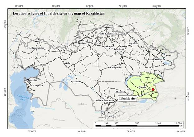 |
|
|
|
|
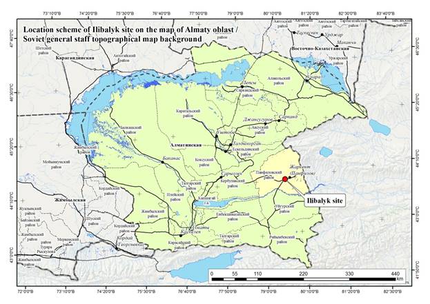
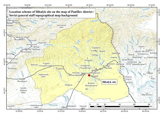

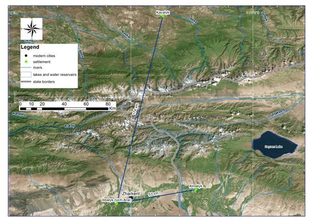
2.4. Aerial photography
In the process of the 2016 and 2017 excavation, aerial survey which included photogrammetry was employed for collecting and processing topographic information. A Phantom 4 quadrocopter (drone) was used to photograph, capture video, and take measurements. As a result we were able to gather much technical and visual information.
We developed a method that took into account the wind and weather conditions of this region of Kazakhstan. Numerous flights were performed at low altitudes (30-100 m) over specific locations, applying so-called “carpet coverage” that allows a production of a large number of pictures with each subsequent photo overlapping the previous one by no less than 80%. In this way, numerous photos cover all of the spatial area of the site.

Aerophoto. Oblique view to the north. Rabad and cemetery
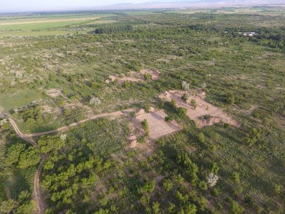
Aerophoto. Oblique view to the north-west. Research area 2017
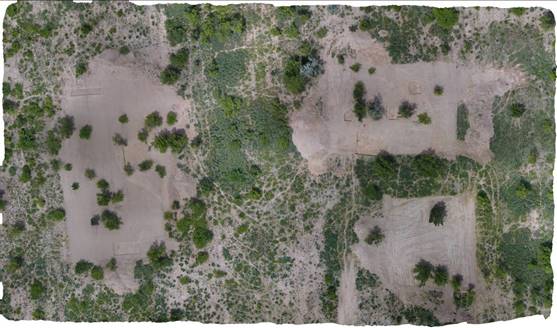
Ortho-photographic plan based on photogrammetry. Research area 2017
On the basis of the data collected a 3-D model was created utilizing the method of photogrammetry. This provides the following result-- a highly detailed ortho-photographic plan and a 3-dimensional digital model with the ability to construct a high precision topography.
2.5. Geophysical Survey
Introduction
Archeology as a humanitarian science has always attracted specialists of various profiles - natural and technical sciences. One of such manifestations was the use of achievements in the field of geophysics. As a result of the emergence of instruments that make it possible to conduct a research of the land structure (magnetometers, georadars), archaeologists have begun to apply this method to identify buried objects using non-contact methods.
Since 1978, Russian archaeologists have been conducting research on monuments with the help of magnetometers.
The principle of magnetic prospecting for searching buried historical monuments is to measure the Earth's natural magnetic field with a very small step and with a minimum height of the sensor location. Under such shooting conditions, an unusually sensitive mechanism starts to work, namely, the presence of various amounts of magnetic iron oxides in the buried objects is affected.
Since 2002, devices based on the method of geomagnetic scanning are beginning to be used.
In the world practice, for many years already the georadiolocation method together with other geophysical methods is included in the standard complex of field archaeological research. Traditional archaeological methods do not allow to guarantee the identification of an object on large areas due to considerable labor costs and time restrictions. The recognized advantages of the method of georadar sounding are the use of non-destructive, noncontact, methods of obtaining information, high adaptability and relatively low cost of work.
The main direction in world of archeology, now, has become the study of archaeological sites without disrupting their structure and integrity. Remote study of archaeological structures is very important, because During the excavation, some archaeological objects can be irretrievably lost. Georadars in archeology are used in various research - from the study of historical monuments, which will never be excavated before a quick and cheap exploration of the site for excavation planning. Georadar research can be conducted on any surfaces, whether it's black earth, concrete, ceramic tile and even the surface of water (the research of flooded objects).
Especially relevant is the use of georadar at archaeological sites that are located in the zone of expansion of construction sites or quarries. Unlike traditional methods of reconnaissance and dissection, archaeological research at such sites should be carried out in the shortest possible time. In such conditions, georadar surveying helps archeologists to quickly perform research and mapping of buried archaeological objects that do not appear on the surface of the earth (remains of foundations, plowed barrows, etc.).
Georadar is designed to detect subsurface structural-material inhomogeneities of various nature caused by uneven moisture of deposits, different composition of the rocks studied, features of rock structure and texture (porosity, stratification), heterogeneity of deposits or materials, fracture and deformation of the environment by inclusion of foreign objects.
The principle of the operation of the georadarocation method of shallow geophysics, also known as subsurface radar or radar sounding, is the reflection of a high-frequency electromagnetic signal from the interfaces in the upper part of the section-from stratigraphic boundaries, water saturation levels, contours of buried objects, foundations, etc.
Interpretation of georadar data is a rather complex creative task, since the theoretical basis of the method and the mathematical apparatus used at the interpretation stage are poorly developed. In addition, many objects of the application of the radar method - technologically processed sections of Quaternary sediments, cultural layers, underground engineering structures, archaeological and other objects, usually have a complex and heterogeneous structure, contain many different inclusions and irregularities, which are unevenly and intermittently moistened, which creates a complex wave the picture on the radarogram and makes it difficult to compare geophysical anomalies with real subsurface objects.
Like any geophysical material, radar data need to be correctly verified with detailed geological information on the structure of the upper part of the section of the work area (drilling materials, descriptions of pits, archaeological excavations). Reports of archaeological and restoration work, historical evidence, literary sources, etc. can be useful in the study of technogenic formations, as well as buried objects of historical and cultural heritage.
As a result, the purpose of interpreting radar data is to convert radargrams into stratified sections of sediments, to identify and separate natural and man-made buried inhomogeneities, to compare them with real objects and to determine the parameters of the latter (depth, size, degree of preservation, etc.).
Used equipment
To perform geomagnetic scanning, the GSSI SIR-3000 georadar with an antenna frequency of 270 MHz was used, which allows scanning to a depth of up to 5 meters.
Objectives of the research
The purpose of the research was to identify the earth graves belonging to the period of the monument's existence by conducting complex researches using the geomagnetic scanning method.Method of performing geomagnetic scanning at the site of the Ilibalyk site
The process of gathering information consists of the following stages:
- Territory preparation
The investigated areas must be cleaned of vegetation, stones, metal objects, etc., which impede movement over the surface and create a background for the antenna
- Landmarking
The landmarking is performed by an electronic total station
The boundaries of the investigated territories are determined - rectangular shape, if the surface of the object does not allow it to be entered into the correct form, then it is possible to make the boundaries with broken lines, but with parallel sides (in this case it is necessary to draw a scheme of the section with an exact designation of dimensions). The plot is divided into strips with 2 m wide.
- Passage of territory
The shooting is conducted from the left to the right, with "snake" method, the interval between the passages is 50 cm, the speed of the passage is medium and uniform. Do not let the wheels off the ground.
Description of the scanning area
The plots are located in the north-eastern part of the monument, related to the rabad. At present, this territory is used as a forestry and planted with trees. On the surface of the investigated territory there is a large number of ceramics, burnt bricks, metal products. This area was chosen because of the discovery of gravestones on it, indicating the presence of a cemetery in the territory. Local residents point to the existence in the area and other grave stones lost at a later time.
The area of geomagnetic scanning is occupied by bushes and trees, traces of plowing are traced on the surface, on the eastern and western sides, at a small distance from the site there are field roads.
For scanning, a depth of 100 ns (3.5 m) is selected. This depth can give us additional information about the possible contents of any elements (structures, burial holes, etc.), however, the main goal is to study the soil content up to 70cm deep.
The sizes of areas:
Area 1 - 36x36m
Area 2 - 38x52m, stretched in the direction of the West - East.
Area 3 - 40x68m, stretched in the direction of the North - South.
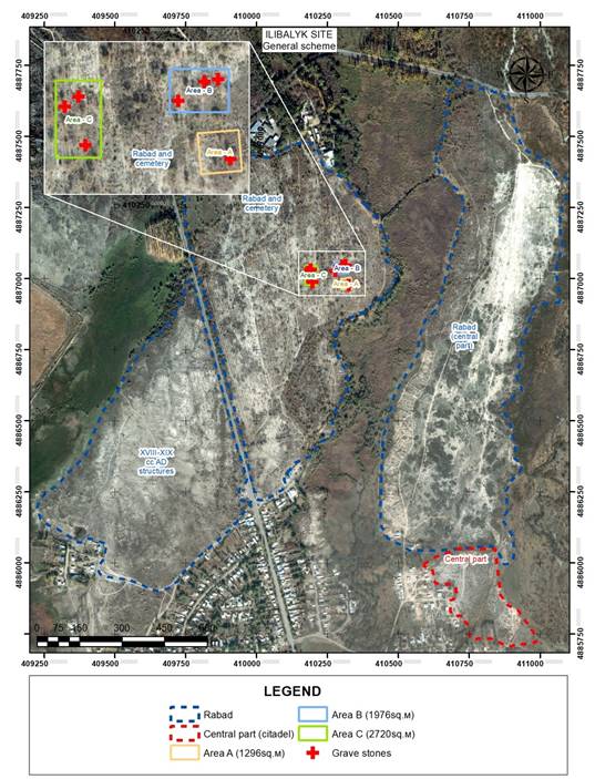
Research area localization
3. 2017 EXCAVATION
3.1. General description of Field IV
The goal of the 2017 field season at Usharal-Ilibalyk was to identify and sample the cemetery assumed to be associated with the inscribed grave markers found during the first field season at in 2016. This dictated the field strategy. Accordingly, field investigations in 2017 were confined to the newly-designated area “Field IV”; this is the location of the surface findspots of the stones and lies within the boundaries of the intensive surface-survey area investigated in 2016 (known as Field III). The stones were assumed to be close to their original medieval locations since plowing does not normally relocate objects, even large objects like the gravestones, more than 5-10 meters (Lewarch and O’Brian 1981: 7-50).
Field IV lies east of the north/south road linking the modern village of Usharal and the A353 highway. A low-lying floodplain and creek (known as the Karasu or “Black River”) delineates the landform to the east and south, separating the 2016 survey area from the main portion of the archaeological site to the east. The current vegetation reflects the land tenure history of the area, having been a collective farm from 1930s through 1990s. Crops were orchard fruits (primarily apples) and watermelon planted in open fields. The ordered rows of orchard trees form a pattern that are clearly visible on satellite imagery and, although many have been uprooted and removed, numerous stumps testify to their former presence. Derelict buildings of the collective farm occupy the northeastern area of the landform. The entire field has since gone out of agricultural use and is utilized by local residents as pasture. The undergrowth is relatively open; thistles, thorn and low trees permit adequate surface visibility across more than 90% of the survey area.
Three large investigation areas (Area A, B, and C) were laid out within Field IV encompassing the surface findspots of the inscribed stones that were recovered in 2016 (Figure 4.1.1). These blocks, totaling more than 6000 m2, were first mechanically stripped, then subjected to geophysical survey and intensive visual examination (see §3.1.2. below). Before the results of the geophysical survey were available, within Area C, we investigated two 10 x 10 m test units located where the findspots of two inscribed stones were uncovered during the mechanical stripping.
The geophysical data from the survey allowed the survey team to separate hard soil areas from soft soil areas to a depth of 80 cm below the stripped surface (reference). The field team postulated that any medieval grave shafts would reach at least that depth and would be filled with relatively soft soils all the way through the soil column. The shape of Nestorian graves in Kazakhstan is, of course, unknown; our postulation was based on Nestorian graves uncovered in the 19th century in neighboring Kyrgyzstan and China (Kyzlasov 1959; Pantusov 1886 and 1908). The Tandy excavation team assumed relatively straight-sided shafts, although the size could be larger than necessary for a single internment, since at least one of the Kyrgyz graves held more than one body.
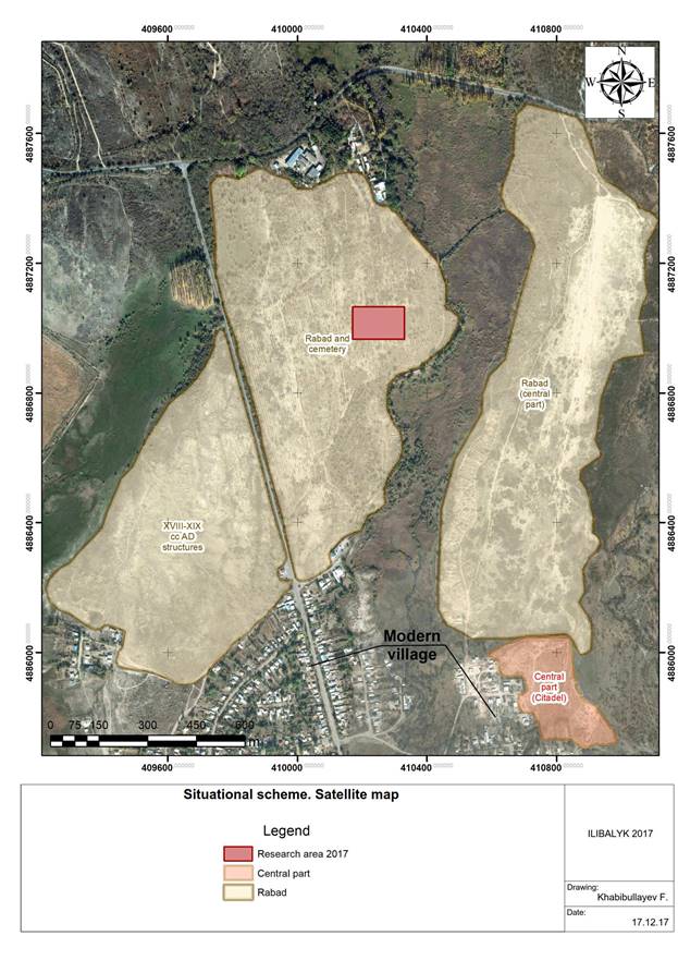 |
Situational scheme. Satellite map |
|
Situational scheme. Topographic map |
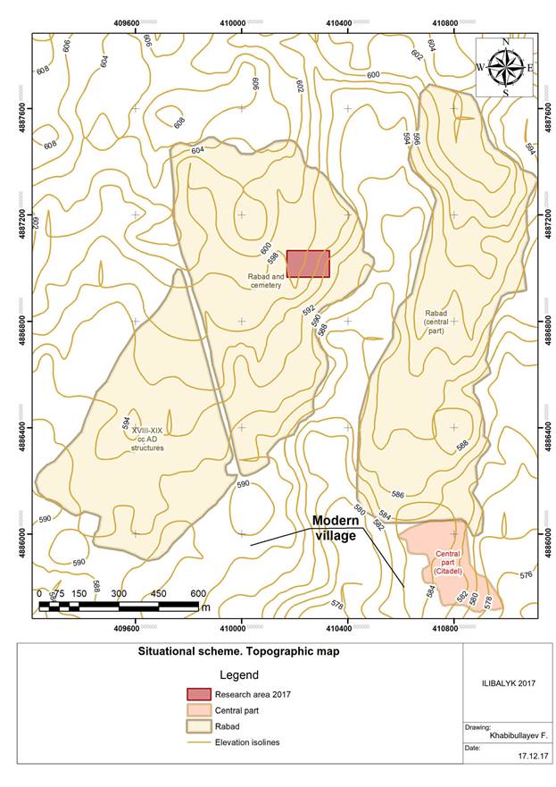
|
Fig. 3.1 . Field IV. Aerial photograph with photogrammetric measurements and site plan. |
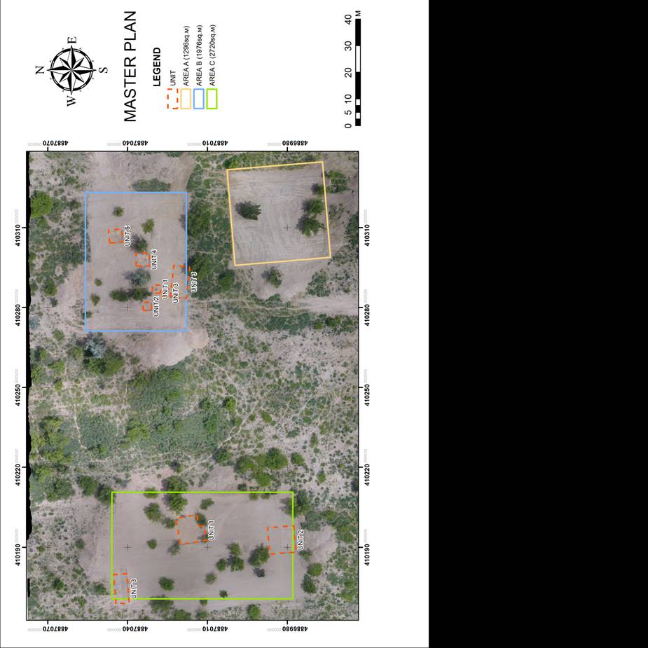
3.1.2. Preliminary Treatment
Mechanical stripping of the plow-zone soils in the three excavation areas of Field IV was the most efficient way to prepare the study area for geophysical survey. The heavy undergrowth and uneven surface of Field IV would have hindered the execution of the survey and biased the data. Using a large front-end loader (henceforth, will be referred to as the “bulldozer”) allowed quick removal of the soil and provided a sufficiently smooth surface for the GPR survey. Moreover, this vehicle provided good visibility (to see the field staff and the ground), variable speed, and quick response-time when cultural material was identified by ground staff and the driver. The excavation permit required that any trees be preserved within the stripped area, including a sufficient soil buffer to prevent major root damage. In consequence, each of the stripped areas included tree “islands” that were not stripped and not subject to geophysical survey. The bulldozer made at least two passes across each section of the survey area, removing topsoil on the first pass to the depth of approximately 30 cm below the original surface, and then a second pass of the machine smoothed the newly exposed surface. The stripping process had to be carefully monitored to prevent damage to any possible cultural features.
The monitoring team included observers placed both in front of and behind the machinery, allowing for a quick response from the operator to instructions. On occasion, the driver observed from the distance and physically felt possible obstructions and alerted the monitors even before the potential feature was exposed. The monitoring team also carefully examined the spoil piles during the excavation and recovered three kayraks which were not previously identified during the intensive pedestrian survey of the area in 2016. Following completion of the mechanical stripping, the team completed the preparation of the surface by hand-leveling the exposed soils using flat shovels. The field team collected and recorded all visible cultural artifacts from the surface of the survey areas. Diagnostic material was retained for further analysis. Visible surface anomalies were marked for later investigation.
3.2. Area A
3.2.1 General Overview
Area A measured 1296 m2 and was the last of the stripped blocks to be subject to geophysical survey (Figure 3.2.1). Once results were available, careful examination of the data yielded no reasonable locations for grave shafts (Figure 3.2.2) As a result, Area A was only surface-collected by our staff and volunteers. The surface collection consisted of low-density scatter of historic ceramics, a few fired brick fragments, and small disarticulated animal bones. Besides this no further archaeological investigations were undertaken during 2017. The lack of positive results from the geophysical survey suggested that the stones recovered from the surface of Area A were removed from their original locations, before the landform was plowed in the twentieth century.
Area A dimensions 36 x 36 m, is located 16 metres to south from the "B" area, which is located in the area covered by dense vegetation in the centre and the edges. In this territory, there grow shrubs, elm, apricots and thick grass. Prior to the excavation, the site was subjected to superficial material collections. Geophysical research of the entire area of the zone was carried out via geosсaner GSSISIR300. As a result, there were found a small number of fragments of red-clay and grey-clay ceramics: Fragments of khumcha and aquifer rims, as well as two glazed pieces of blue bowls (kese), fragments of burnt bricks. The rims of khumcha-like receptacles are decorated with ribbon stucco of alternating triangles around the edge. The walls of the aquifers are decorated with drawn lines.
Prior marking and excavating, this territory was used to feed cattle, which resulted in the territory being covered by cow excrement. Small modern fire and modern household litter (photograph 1-14) have also been spotted on the surface of the territory.
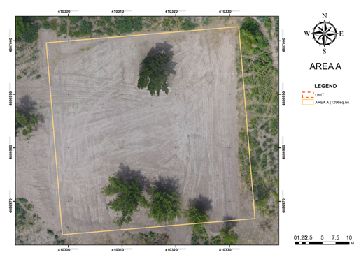
Fig. 3.2.1. Field IV. Area A. Plan after preliminary treatment prior to excavation.
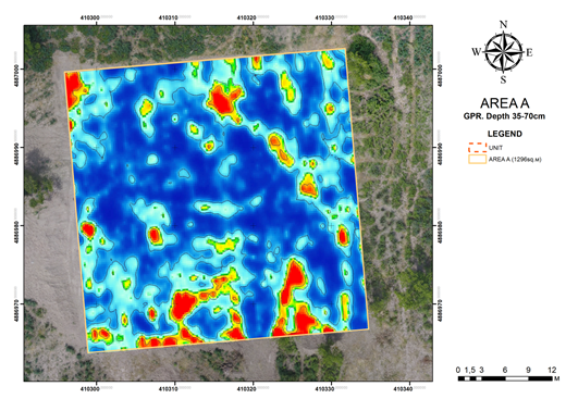
Fig. 3.2.2. Field IV. Area A. Plan after preliminary treatment prior to excavation.
3.2.2. Layered planigraphy
1. Before the beginning of the stripping work, the excavation area was an uneven surface. In the central part of the excavation there is a slight decrease in the landscape. In the southern and western parts, the elevation of the elongated form is fixed, which extends from east to west. In the northern half of the excavation is also read a small hill. The eastern and western parts of the excavation are relatively flat. It is also more likely that this site was used as arable land in the 19th and 20th centuries.
2. After removing the first layer of 20 cm. The planning situation in the excavation area did not change much. At first glance, when evaluating the surface, no structures were found. The first layer being removed is dense shrub, grass, elm.
In the loamy layer being removed, there was found a small number of fragments of red-clay and grey-clay ceramics: fragments of rims of khumcha and aquifers, fragments of ceramic boilers with smoked walls, pitcher handles and also glazed fragment of a blue bowl, fragments of burnt bricks. The layer contains bones of cows and sheep.
In order to find and determine the alleged Christian burials of the fortress of Ili Balyk in the southeast corner of Area A, a square excavation of the size of 4 meters has been made along the cardinal points.
The excavated layer is grey loam. At the 20 cm depth of the uncovered layer, there is a thick root system of plants (photograph 25-26). The layer is loose, with the inclusion of the residue of the organic matter (photograph 19-22).
In the western part of the excavation, at a depth of 8 cm, there is a red-brown burnt spot, the size of which is 2.20x1.50 m. There is soot and grey ashes around the burnt spot. On top of the spot there was found a piece of burnt brick, the dimensions of which are 25x20x5 cm. A piece of thick-wall vessel was lying near the brick. The layer of calcined clay is observed throughout the depth of the uncovered layer (Photograph 23, 24, 27-30).
3.2.4 Drawings documentation
|
|
|
|
|
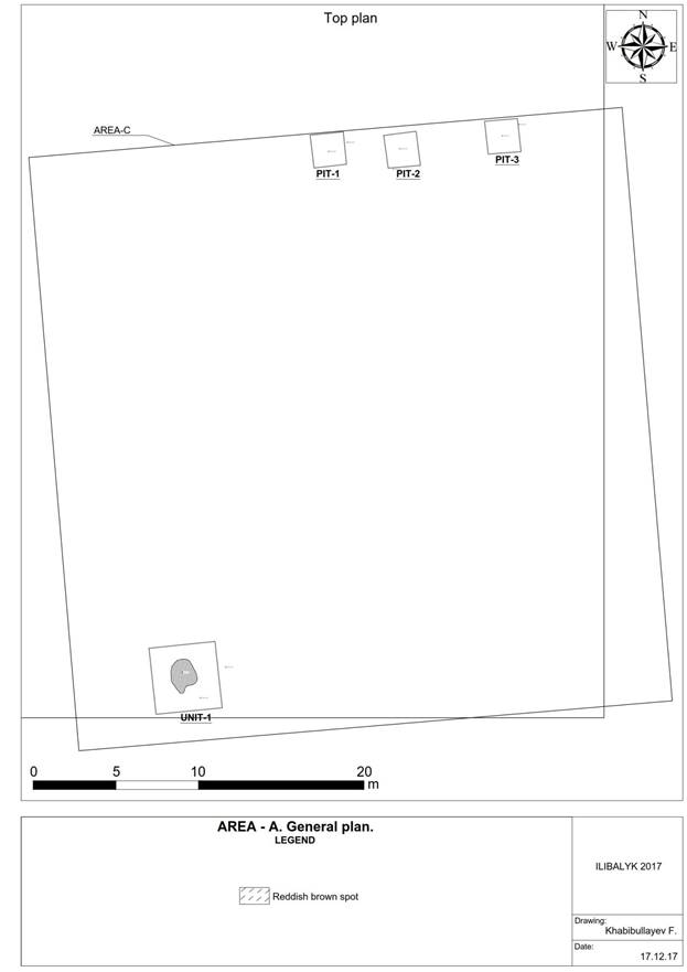
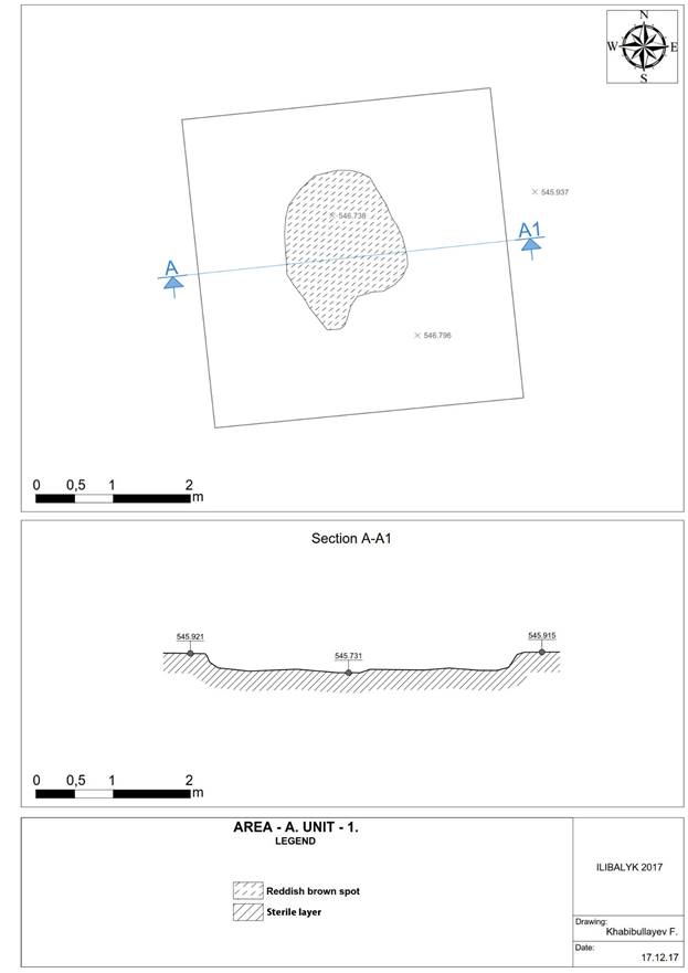
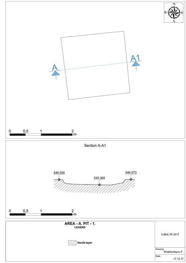
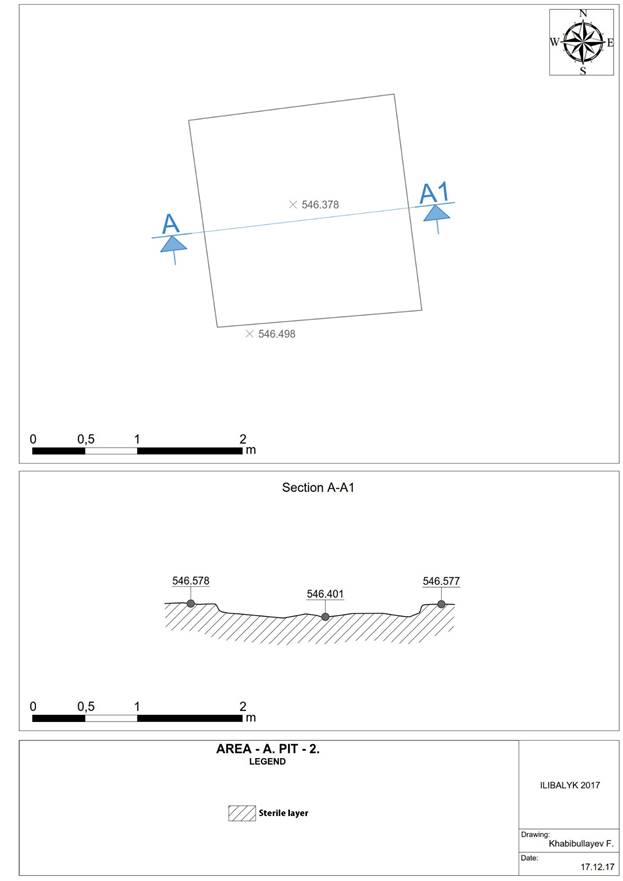
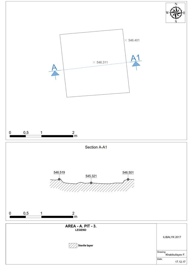
3.2.5 Photo Gallery
|
|
Photo 1. View of the excavation site IV before excavation works |
Photo 2. View of the excavation site IV before the excavation works |
|
|
Photo 3. View of the excavation site IV- "A" before the excavation works |
Photo 4. View of the excavation site IV- "A" before excavation works |
|
|
Photo 5. View of the excavation site IV before the excavation works |
Photo 6. View of the excavation site IV before the excavation works |
|
|
Photo 7. View of the excavation site IV before the excavation works |
Photo 8. Geoscanning of the excavation site IV- "A" before excavation works. |
|
|
Photo 9. Geoscanning of the excavation site IV- "A" before excavation works. |
Photo 10. Geoscanning of the excavation site IV- "A" before excavation works. |
|
|
Photo 11. View of the excavation site IV- "A" before excavation works. View to the west. |
Photo 12. View of the excavation site IV- "A" before excavation works. View to the north |
|
|
Photo 13. View of the excavation site IV- "A" before excavation works. View to the west |
Photo 14. View of the excavation site IV- "A" before excavation works. View to the south |
|
|
Photo 15. Excavation site 1 IV-«А» after clearing the soil and marking in the form of a square in the central. View to the north. |
Photo 16. Excavation site 1 IV-«А» after clearing the soil and marking in the form of a square in the central. View to the east |
|
|
Photo 17. Excavation site 1 IV-«А» after clearing the soil and marking in the form of a square in the central. View to the north. |
Photo 18. Excavation site 1 IV-«А» after clearing the soil and marking in the form of a square in the central. View to the east. |
|
|
Photo 19. Excavation site 1 IV-«А». Beginning of excavation works in the southwestern part after clearing the turf and removing the topsoil. View to the north-east. |
Photo 20. Excavation site 1 IV-«А». Beginning of excavation works in the southwestern part after clearing the turf and removing the topsoil. View to the west. |
|
|
Photo 21. Excavation site 1 IV-«А». Beginning of excavation works in the southwestern part after clearing the turf and removing the topsoil. View to the east. |
Photo 22. Excavation site 1 IV-«А». Beginning of excavation works in the southwestern part after clearing the turf and removing the topsoil. View to the west. |
|
|
Photo 23. Excavation site 1 IV-«А». Beginning of excavation works in the southwestern part. Clearing the layer of burnt, burnt bricks and ceramics. View to the west. |
Photo 24. Excavation site 1 IV-«А». Beginning of excavation works in the southwestern part. Clearing the layer of burnt, burnt bricks and ceramics. View to the east. |
|
|
Photo 25. Excavation site 1 IV-«А». Loamy layer with plant roots. View to the west. |
Photo 26. Excavation site 1 IV-«А». Loamy layer with plant roots. View to the east. |
|
|
Photo 27. Excavation site 1 IV-«А». Beginning of excavation works in the southwestern part. Clearing the layer of burnt, burnt bricks and ceramics. View to the west. |
Photo 28. Excavation site 1 IV-«А». Beginning of excavation works in the southwestern part. Spot of calcareous fossil and ceramics. View to the east. |
|
|
Photo 29. Excavation site 1 IV-«А». Beginning of excavation works in the southwestern part. Clearing the layer of burnt, burnt bricks and ceramics. View to the west. |
Photo 30. Excavation site 1 IV-«А». Beginning of excavation works in the southwestern part. Clearing the layer of burnt, burnt bricks and ceramics. View to the east. |
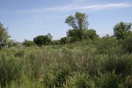
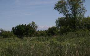
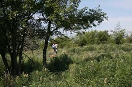

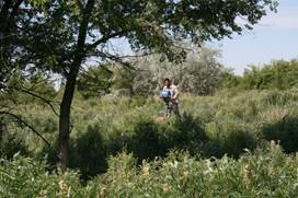
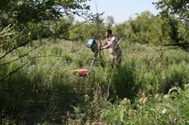
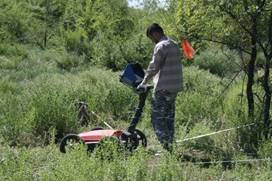
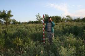
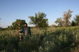
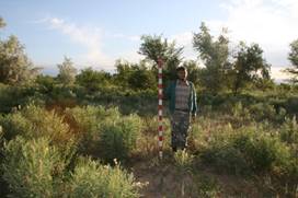
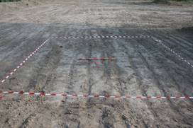
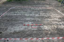
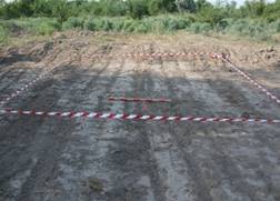
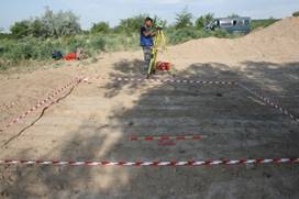
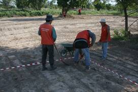
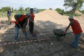
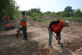
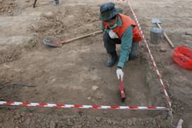
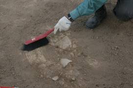
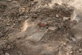

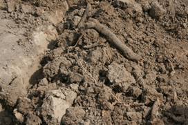
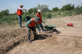
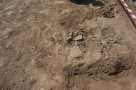
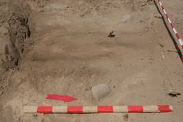
3.3. Area B
3.3.1 General Overview
Area B measured 1976 m2. Surface collection recovered in excess of 150 ceramics including fine wares consisting of blue-glazed and incised ware, brick fragments, and scattered small animal bones. In Area B, the field team excavated two 3x3 m test units (Area B, TU 1 and 2) to examine surface finds (fig. 3.1). Test Unit 1 examined a surface feature consisting of coarse reddish sand, suggestive of subsurface disturbance. Test Unit 2 surrounded a partially restorable pot on the surface of the stripped area. After receiving GPR results, the field team formulated an excavation strategy to explore anomalies (fig. 3.2). The subsurface shape of five soft soil anomalies within Area B met the criteria, outlined above, for possible grave-shafts. Accordingly, three major test units were opened to encompass the anomalies: Test Unit 3 measured 6 x 12 m and included three subsurface anomalies; Test Unit 4 measured 5 x 5 and encompassed a cross-shaped soil anomaly; and Test Unit 5 initially was a 3 x 3 m test unit but was expanded to measure 5 x 5 m upon the discovery of a substantive mudbrick feature.
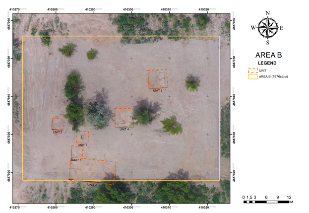
Fig. 3.3.1. Field IV. Area B. Plan during excavation.
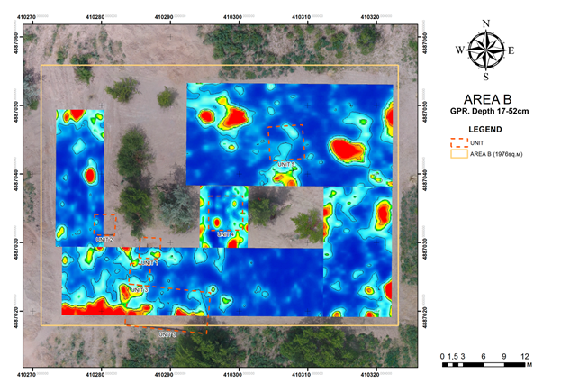
Fig. 3.3.2. Field IV. Area B. Ground penetrating radar results in relation to site plan.
3.3.2 Layered planigraphy
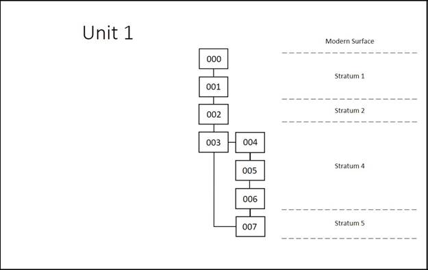
3.3.3
Description of the loci
Loci 000 & 001 were the same across the entire Area B as these were excavated together by heavy equipment. To keep uniformity, we began each Unit with Locus 000 as surface and Locus 001 as the topsoil, which consisted of the plough zone. This resulted in all Units beginning with a working level Locus 002.
Unit 001 - Unit 001 was opened as a 3m x 3m square situated around a visible partial ceramic
vessel uncovered by the heavy equipment. The unit was aligned along the North axis of the gird.
List of Loci. Unit 001
000 – Modern Surface
001 – Topsoil (plough zone) layer excavated by heavy equipment (bulldozer) 20-30cm
002 – Arbitrary locus for first soil layer 3m x 50cm against northern baulk
003 – North, east and southwestern section of the unit. Surface
004 – Refuse pit. Encompasses ceramic vessel
005 – Ceramic vessel in the center of unit
006 – Melted surface in pit
007 – 1m x 1m test trench within the pit.
Locus 000
This locus consists of surface material including modern dumped debris, foliage, and miscellaneous surface finds. These were observed and noted but nothing significant was discovered.
Locus 001
Topsoil removed by heavy equipment approximately 20-30cm in depth at the beginning of the excavation season. The removal of the topsoil was observed and recorded by archaeologists. The clearing of Locus 001 revealed a partial ceramic vessel in situ and showed signs of both ancient and modern damage. The modern damage was due to initial removal of topsoil by heavy equipment.
Locus 002
Located in the northern section of the Unit against the north baulk. Measuring 3 meters east to west and approx. 50cm from north to south. The locus was opened and excavated to remove the layer of soil left by the heavy equipment and to tabletop the unit. The soil in the locus was a silty clay (10YR 5.2) and is the same soil in the topsoil layer removed by the bulldozer. The locus was excavated approx. 10-20cm in depth with the use of hand picks, trowels and brushes to level the unit. The locus produced seventeen ceramic sherds, fourteen pieces of bone (animal) and three mudbrick fragments. Once the unit was table-toped, the locus was closed following the recordation of closing elevations.
Locus 003
Though irregular in shape, this locus was situated below Locus 002 and was partially exposed by excavation of heavy equipment., The locus extended to the southwest section of the unit and encompassed what later was identified as a refuse pit (Locus 004) containing a reconstructable ceramic vessel (Locus 005). Initially, the edges of the locus were delineated from the refuse pit (Locus 004) with the use of trowels. Locus 003 is similar to the silty clay (10YR 5.2) found in Locus 002 with the exception of being more densely compacted. This compacted soil was initially thought to contain deteriorated mudbrick; however, upon further excavation was determined to be the occupational surface that spans the entire site. This soil layer was sterile and no material culture was found in this locus. Upon the locus becoming sterile a section was cut into the western side to better establish the extent of the sterile soil. The result confirmed the entirety of Locus 003 was a sterile soil layer. Once this was completed closing elevations were recorded and the locus was closed.
Locus 004
Comprised of looser soil than that of Locus 003, the locus extended to the southeastern section of the unit and up to 50cm from the north baulk that contained Locus 005 (ceramic vessel). The locus contained a mix of soils including dung ash (2.5Y 4.1), orange clay (5YR) and traces of the silty clay (10YR 5.2) found in both Locus 002 and 003, with the exception of Locus 004 being both loose and containing a sandy mixture. Excavation traced the edges of Locus 004 to delineate its boundaries from Locus 003. Traces of plaster were found along the eastern portion of the locus (a refuse pit). Locus 004 was bisected from east to west and the northern portion was excavated to establish a section to gain a sequencing of the refuse pit. Once the sequencing was established the remainder of Locus 004 was excavated. Locus 004 yielded ceramic fragments, animal bone, and charred animal bone. Once the ceramic vessel was removed the area beneath it was excavated. Directly beneath the ceramic vessel was a sandy soil layer followed by a concentration of animal bones (some charred) as well as a layer of dung ash. Upon tracing the dung ash, a melted surface was discovered within the pit which was approx. 60cm in length and 20cm in width. This melted surface became Locus 006. Once Locus 006 was removed, the ash layer continued another 3-5cm before disappearing. There were additional layers of dung ash dispersed throughout the pit with varying degrees of thickness and size. Below the dung ash the soil became more compacted and sterile. The layers of dung ash were followed using trowels and brushes to reveal a pit which had once encompassed the ceramic vessel, bone, ash, shaped stone, and ceramic sherds. Locus was closed once the loose sandy soil was completely excavated and became sterile.
Locus 005
The ceramic vessel located in the center of the unit and exposed by the heavy equipment during the excavations of loci 000 and 001. The base measured 10cm, the body height 30cm and the width of the vessel was 20cm. The vessel was broken into 17 pieces as a result of excavations conducted by the heavy equipment. The vessel was situated within Locus 004 a loose sandy soil matrix. Once the vessel was removed, a thin layer of sand was directly beneath followed by bone fragments (some charred) with dung ash below the bone fragments. The locus was closed once the vessel was removed.
Locus 006
Melted surface layer approx. a millimeter thick within the pit in Locus 004. The surface measured approx. 20cm in width and 60cm in length. Six ceramic sherds and two pieces of bone were found directly beneath this surface once it was excavated. The locus was closed following the excavation of the melted surface.
Locus 007
A 1m x 1m probe was conducted at the bottom of the pit in Locus 004. The probe was excavated with shovels down to a depth of 2m for a clear visual of Locus 004 in its stratigraphic sequencing and for comparison of sequencing in adjacent units. This probe yielded a piece of fired brick, iron slag, glass slag, ceramic sherds, bone fragments, and a decorative mother of pearl below a sterile layer of compacted soil at the bottom of Locus 004. Locus was closed after reaching a depth of 2m and no significant features were discovered.
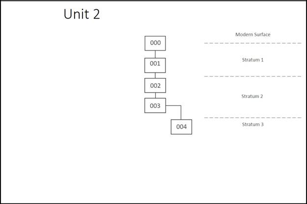
Unit 002-unit 002 was opened as a 3m x 3m square encompassing a sandy lens which
manifested after the removal of topsoil by heavy equipment.
List of Loci. Unit 002
000 – Modern Surface
001 – Topsoil (plough zone) layer excavated with heavy equipment (bulldozer) 20-30cm
002 – Arbitrary locus for first soil layer at bottom of plough zone
003 – Compact soil layer with cultural inclusions
004 – Geologically formed sand layer
Locus 000
Surface material consisting of modern debris, foliage, surface finds.
Locus 001
Extends across all of Area B, including in Unit 1. This was the soil cleared to an approximate depth of 20-30 cm by heavy equipment.
Locus 002
Locus was opened to investigate a sandy lens visible after removal of topsoil. The locus covered all of Unit 2 and was a mixture of sand, loamy sand, and silty clay loam. The sandy lens was not coherent enough to distinguish it from the surrounding matrix. There was no consistent chroma or density delineation around the sand to justify a separate locus designation. The entire locus was excavated arbitrarily approximately 15-20 cm. Within the excavated soil matrix were rounded cobbles, pebbles, and granules as well as ceramics, mudbrick, and animal bones. Most of the ceramic material consisted of undistinguished body sherds though in the southwest corner fragments of a base and part of a body of a single vessel were recovered. The bones were primarily bovine. This locus is understood as the bottom of the plough zone which was not removed by the heavy equipment. After the removal of 15-20 cm across the unit there was a noticeable distinction in both color and compaction between the sandy lens and the soil around it so the locus was closed allowing for new loci to be opened which accounted for the soil change.
Locus 003
Locus 003 was assigned to the silty clay loam which surrounded the sand in Unit 2. The sand was designated Locus 004. The dimensions of Locus 003 shifted as the excavation continued and Locus 004 expanded underneath Locus 003. At opening Locus 003 surrounded the sand in Locus 004 on three sides. The locus was 105 cm south of the north balk, 105 cm east of the west baulk, and 85 cm north of the south balk with Locus 004 in a rough oval shape extending westward from the east balk. The soil matrix was 7.5 YR 7/3 very pale brown. It had angular cobble and pebble inclusions at a random distribution. There were ceramics, animal bone, plant debris, mudbrick, and glass slag found within the soil matrix. The ceramics were mostly undistinguished body sherds, though two Iranian blue glaze fine ware sherds were collected. The bones were mostly from a large mammal, and were concentrated on the north side of the unit. Additionally, there was a lens of dung ash near the transition from Locus 003 to Locus 004 on the north side of Locus 004 though within Locus 003. There were mudbrick fragments, both fired and unfired examples. Several fragments of glass slag were recovered, including one piece which appears to be a bead in a partial stage of construction. The locus was excavated according to soil color and density. As it was excavated its dimensions shrank as it gave way to the sterile sand of Locus 004. The locus was closed once it was determined the unit was exposing a geological feature in Locus 004.
Locus 004
After Locus 002 was closed the sandy matrix which was distinguishable in both density and color was designated Locus 004. This soil was excavated based on its consistent color and density. It was 7.5 YR 4/4 brown in color and a very loose sand. Careful excavation proved difficult because the soil was extremely loose and a soft brush was all that was necessary to excavate. As excavation in the unit continued the dimensions shifted from a roughly oval shaped protrusion out of the east balk to covering most of Unit 2. The matrix was sterile of all cultural material. The sand was so fine only the smallest of rounded stone granules were noted within the matrix. Geophysical survey of the unit revealed the loose material of Locus 004 continued to expand beneath Locus 003 and director T. Davis determined, confirming the opinion of the excavators, Locus 004 was formed geologically. As the locus was understood through both remote sensing and actual excavation the locus, and whole unit, were closed.
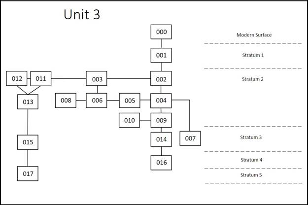
Unit 003-unit 003 was opened as a 12m x 6m rectangle in the southwestern corner of Area B. Its
placement was established from the results of the GPR data. The GPR data detected three anomalies along this section of Area B which appeared to extend south, beyond the area excavated by heavy equipment. This trench was placed to encompass all three anomalies and therefore had to extend south beyond the excavated area an additional 75cm.
List of Loci. Unit 003
000 – Modern Surface
001 – Topsoil (plough zone) layer excavated with heavy equipment (bulldozer) 20-30cm
002 – Arbitrary locus for first soil layer across unit
003 – Stone Feature
004 – Arbitrary locus for second layer across unit
005 – Ceramic feature
006 – Ash lens
007 – Channel Lag
008 – Stone Feature
009 – Arbitrary locus for third layer across unit
010 – Ash lens
011 – Layer for 3A
012 – Layer for 3A and 3 baulk
013 – Mudbrick feature
014 – Channel Lag
015 – Channel Lag
016 – Occupational Surface
017 – Foundation Trench
Locus 000
This locus consists of surface material including modern dumped debris, foliage, and miscellaneous surface finds. Unit 003 extended south 75cm beyond the area excavated by heavy equipment. Prior to excavation of the extension the surface was observed and noted but nothing significant was discovered so in the extension Locus 000 was excavated with Locus 001 in Unit 3.
Locus 001
This material was identical with that which was removed with heavy equipment. This locus was in the southern limit of the unit and extended the full 12 meters from east to west though only extended approximately 2 meters northward into the unit. This was excavated together with L. 000. Both loci 000 and 001 were removed to the bottom working level of the rest of Unit 3 which was established by the heavy equipment. Once that level had been reached across the unit, the locus was closed. The collected material totaled approximately 150 ceramic sherds, including a blue glazed rim sherd identified as Iranian and dated to the 14th century, though the majority are undistinguished body sherds. Dozens of bone fragments were recovered, though some with fresh breaks from the excavation process so an accurate count proved unfeasible. A total of 51 mud brick fragments were collected though no date was possible.
Locus 002
This locus was opened arbitrarily as the first excavation pass was made across the entire unit from east to west using pick axes and shovels. All soil collected was hand sifted. The locus extended across the entire unit and included rounded cobbles and pebbles. Other inclusions within the silty clay loam matrix included approximately 100 ceramic sherds, 18 mudbrick fragments, bone fragments, glass slag and a single coin. The coin was too corroded for a field reading. The diagnostic ceramic sherds included a blue glazed Iranian sherd, a storage jar rim, the rim of a whole mouth jar, and a jar handle which were variously dated in the field to the 14th century, 10th-14th centuries, post Tamerlane, and the 13th-14th centuries respectively. The soil color was nearly uniform across the entire unit at 7.5 YR 5/4 brown. As excavation progressed from east to west an inscribed kayrak was found in situ. The stone was given a separate locus number but may be considered to be within Locus 002. After the entire unit was excavated to roughly the same working level the locus was closed arbitrarily. No texture or color change within the soil suggested a necessary locus change, but in order to best control the material over such a large unit the locus was changed to Locus 004 which is immediately below Locus 002.
Locus 003
Locus 003 is the first kayrak found in situ at Ilibalyk and the first found in Unit 3. The base of the stone was measured at an elevation of 547.09.6 meters above sea level. The stone itself measures 27cm x 26 cm and has a cross inscribed into it. No other inscription or carving is apparent in the stone. The inscription is on one side only and the opposite side is devoid of any cultural marking. The soil around Locus 003 is comparable to that of Locus 002 in which Locus 003 is contained: 7.5 YR 5/4 Brown. The kayrak was found 184 cm south of the north balk and 145 cm east of the west baulk. This is in close proximity to one of the anomalies found during the geophysical survey, the center of which was located 174 cm south of the north balk and 178 cm east of the west baulk. The kayrak sat approximately 65 cm west of the center of the anomaly.
Locus 004
Locus 004 represents the second excavation pass across the entirety of Unit 3. Pick axes and shovels were used across the entire 12x6m unit with the same sifting strategy used in Locus 002: hand sifting done out of a wheelbarrow. The locus was opened arbitrarily when a new excavation pass commenced, again on the east side and worked westward. Loci 005 and 006 are both contained within Locus 004. The soil is the same color as the locus overlaying it: 7.5 YR 5/4 brown. The soil matrix was silty clay loam with some loamy sand on the western limit of the unit. Rounded cobble and pebbles stones were included in the matrix, with more cobbles at the lower limit of Locus 004 on the western side of the unit. Also within the soil matrix were ceramic, bone, and mudbrick inclusions. The bone fragments ranged in size from large bovine leg fragment to the skull of a rodent. The ceramic material included 188 undistinguished body sherds and 30 diagnostic pieces. A single piece of worked stone, possibly a game piece, was collected though laborers in the unit noted several similar stones were found in proximity to the one collected but were discarded. The locus was closed after the entire unit had been excavated to the same working level. In the western side of the unit the soil began to change to a loamy sand with several water-smoothed cobbles suggesting a possible drainage or wash beneath Locus 004.
Locus 005
While excavating Locus 004 a cluster of smashed ceramic sherds was found. They were assigned locus 005 and excavated as one feature. The soil associated with the ceramic splatter was identical with that of Locus 004 in which Locus 005 is contained: 7.5 YR 5/4 brown. The locus was located 80 cm south of the north balk and 790 cm west of the east balk with a bottom elevation of 546.99m above sea level. The area around the splatter was excavated and the ceramics themselves were articulated so the full extent of the splatter was discerned. The ceramics were determined to be floating so they were removed. At least two vessels are represented; the first is a large bowl or krater with a simple rim and a herring bone handle while the second is large storage jar with a flanged rim. Several body sherds are present but not all can be definitively associated with the diagnostic sherds so it is possible more than 2 vessels are represented in Locus 005. The locus was closed once the ceramics were removed.
Locus 006
While excavating Locus 004 an ash lens was uncovered and designated Locus 006. It was approximately circular with a diameter of 30 cm. It was designated as its own locus because Locus 006 is partially beneath, and sealed by, Locus 003. The locus was beneath a kayrak in situ and the ash lens was excavated separately. The ash lens was articulated with trowels and it was revealed the ash was surrounded by a compact clay soil. The lens was bisected and shown to be shallow; approximately 3 cm deep. A carbon sample was taken for testing as it was a sealed context and the locus was closed.
Locus 007
Locus 007 was opened for the loamy sand and cobbles which were revealed in the west of Unit 3. Work in the unit proceeded from west to the east, as much of the material culture was revealed in the western portion of the unit. The soil matrix in Locus 007 was a loamy sand to sand colored 7.5 YR 5/4 brown. It included water smoothed cobbles, pebbles, and granules as well as cultural inclusions such as 11 ceramic sherds, and 10 bone fragments. Two of the ceramic sherds were diagnostic and datable; one is a striped blue glazed Chagatai fine ware sherd while the other is Iranian in origin but imitating Chinese porcelain and is a hallmark of the 14th century. The locus was called channel lag because of the soil matrix and stone inclusions are indicative that the locus was deposited by water channeling through the area. The locus was closed arbitrarily after the whole unit had been excavated to the same working level.
Locus 008
Locus 008 is the second kayrak found in situ at Ilibalyk and the second found in Unit 3. The stone feature was found while excavating Locus 009. It is roughly oval in shape and in the field was measured 22 cm long, 16 cm wide, and 4-5 cm thick. It was found at an elevation of 546.89.5 m above sea level and 175 cm south of the north balk and 145 cm east of the west baulk. The soil associated with the stone was 7.5 YR 4/3 brown in color. The stone had a cross inscribed into it but no other inscription was found on front or back. After the stone was removed the locus was closed.
Locus 009
Locus 009 represents the third excavation pass across the unit. Work commenced moving from west to the east so as to explore the western portion of the unit earlier in the day with better light. The soil matrix was a silty clay loam and colored 7.5 YR 4/3 brown. Inclusions in the matrix include rounded cobbles, pebbles, and granules as well as ceramic, bone, mudbrick, and glass slag. There were approximately 100 ceramic sherds found in Locus 009 with a few diagnostic pieces including a 14th century decanter with thin walls and incised decoration as well as a locally manufactured green glazed cup fragment dated to the 14th century. The locus was excavated with picks and shovels in a shallower pass than loci 002 and 004 because a hard-packed surface was encountered. The entire unit was excavated down to the top of the hard-packed surface and flat shovels were used to scrape the surface of loose soil. The unit was brushed clean so the surface could be seen. Once the surface was cleaned work ceased and the locus was closed.
Locus 010
While excavating Locus 009 a thick ash lens was found. It was excavated with trowels and excavated as a separate locus. The ash was thick, over 10 cm, and filled with dung ash and butchered bone. The soil around the ash lens was hard and compact. The ash varied in color with the dark charcoal colored ash and the lighter dung ash represented. A representative sample was taken and was colored 10 YR 5/1 gray. The ash lens, interpreted as a fire pit on the hard-packed surface of Locus 016, was located 375 cm south of the north balk and 700 cm west of the east balk and is a roughly 60 cm by 40 cm oval. No ceramics were found in the ash lens. The bone was from livestock animals such as caprids and bovine. A soil sample was taken out of the field for flotation.
Locus 011
Locus 011 represents the first excavation pass in the northern extension of Unit 3 designated 3A. Extension 3A is a 3x3m extension along the north balk of Unit 3 in the northwest corner. Shovels and pick axes were used to excavate the locus down to the depth of the hard-packed surface of Locus 016. A balk was left in the south between Unit 3A and Unit 3 so Locus 011 measures 3x2m and is immediately below Locus 002. Ceramic, bone and mudbrick fragments were included within the soil matrix of Locus 011.
Locus 012
Locus 012 represents the balk removal between Units 3 and 3A. The soil is the same as Locus 011 with no distinction in color or compaction between the two. The dimensions of the locus are 1x3m.
Locus 013
Locus 013 is a mudbrick feature inside Unit 3 in the northwest corner of the unit. This mudbrick feature was first noticed going into the northern balk of Unit 3 and was fully revealed with the excavation of Locus 012. The mudbrick feature included several unfired constructional mudbricks. The feature is roughly rectangular, extending out of the west baulk and measures 50x40 cm. The top of the feature was measured at 546.97 cm above sea level and the bottom of the feature in the north section was measured at 546.77 cm. The bricks are over a foundation trench, Locus 017, which is cut into surface Locus 016. Work in Unit 3 ceased so Locus 013 was closed for season.
Locus 014
This locus represents more of the channel lag noticed in Locus 007. After the excavation of Locus 009 a color and compaction distinction was noticed in the southwest corner. This semi-circular anomaly was excavated as Locus 014. The soil matrix was sand with rounded cobbles, pebbles and granules. This was determined to be connected to the channel lag of Locus 007 though this was not apparent when excavation began. Once the connection between the two was understood work ceased in Locus 014 and it was closed. The soil was 7.5 YR 5/4 brown and had no cultural material in it.
Locus 015
Locus 015 is the continuation of the channel lag found in Locus 007 but excavated to a greater depth in Unit 3B. The soil is 7.5 YR 5/4 brown and had multiple rounded pebble, cobble, and granule inclusions as well as some ceramic and bone; 12 and 2 fragments respectively. The material in Locus 015 is the same as that in Loci 007 and 014 but was given separate designation as it was in the sub unit 3B; the 3x3m probe opened within the original Unit 3 in the northwest corner. Work ceased in Unit 3B so Locus 015 was closed for the season.
Locus 016
Locus 016 represents the hard-compact surface found across most of Unit 3. Locus 016 was uncovered under Locus 009 and covers the entire unit except for where it is interrupted by the channel lag of Loci 007, 014 and 015. It is not an even surface and undulates across the unit. The soil is incredibly dense and compact making excavating through it laborious and difficult. When it was excavated into in Unit 3B, sections of the surface were examined and subtle horizontal striations were visible. These are interpreted as annual or semi-annual depositions and suggest the surface was laid down naturally. The presence of objects on, or just above, Locus 016 suggest this surface was used culturally even if it was deposited naturally. Excavation in 3B and 3C show Locus 016 is quite deep with the existing working level on the surface top at 546.96m above sea level and the lowest attained level in 3C measured at 546.47m above sea level. The bottom level in Unit 3C, a small 1x2m probe in the northwest corner of the original Unit 3, is not the bottom of Locus 016 and it ostensibly continues deeper. The surface is light in color, with it manifesting in the north section as both 2.5 YR 7/3 and 7/4 pale yellow. This surface is currently understood as the 14th century occupation level based on the ceramic and numismatic evidence from above it. While excavating through Locus 016 very little material culture was found within the soil matrix; only 1 partial mudbrick fragment, 4 undistinguished ceramic body sherds, and 7 bone fragments were found in all of the excavated areas of Locus 016.
Locus 017
Locus 017 represents the soil in Unit 3C below the mudbrick feature of Locus 013 and cut into Locus 016. The soil is 10 YR 6/3 light brown. The soil is ostensibly cut into Locus 016 but had little cultural material. A coin, which was too corroded for a field reading, a small fragment of iron, and only assorted small bone fragments were found. Work continued 20 cm below the last cultural object and work ceased as the locus had become sterile.
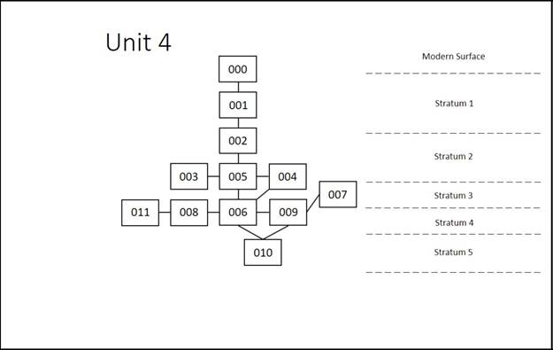
Unit 004A - unit 4 measured 5m x 5m and was opened to explore a ‘cross-shaped’ anomaly
represented in the GPR data. Unit 4A was opened within Unit 4, running 3m from north-south and 1.5m from east to west. This was to determine the depth of occupation in this Unit (particularly to investigate the ‘cross-shaped’ anomaly that had shown up on the GPR) and excavate until basal sub level. Unit 4B was opened on the eastern and southern sides of Unit 4, 1m east-west and 2m north-south. This was to determine the depth of occupation in this Unit, investigate possible mud-brick evident in locus 006 in Unit 4 and investigate a possible headstone in the SE baulk corner of Unit 4. This Unit was further extended as Unit 4C, 1/2m north-south and 1.5m east-west. This was to enable excavation of the possible headstone in the baulk.
List of Loci. Unit 004
000-Modern Surface
001- Topsoil (plough zone) layer excavated with heavy equipment (bulldozer) 20-30cm
003-Firepit Feature
004-Mud-brick Feature
005-Arbitrary locus for first soil layer in unit
006-Occupational Surface
007-Channel lag (gravelly composition)
008-Kiln/furnace feature
009- Structure melt and occupational surface
010-Basal sub-layer
011-Ceramic pottery fragment scatter
Locus 000
This locus consists of surface material including modern dumped debris, foliage, and miscellaneous surface finds. These were observed and noted but nothing significant was discovered.
Locus 001
Topsoil removed by heavy equipment approximately 20-30cm in depth at the beginning of the excavation season. The removal of plough zone was observed and recorded by archaeologists.
Locus 002
Locus 002 was an arbitrary layer opened to begin excavation in Unit 4 and was present across the whole Unit (5m x 5m). This locus is below the topsoil (001) and above the arbitrary locus 005. Fire pit (003) cuts into it. A big pick, spades and shovels were used to excavate in 10-15 cm passes. Soil collected was removed via buckets and screened for material culture. 100% of material culture was collected for analysis. Soil is a silty clay loam, compact, with some cobble and boulder size stone inclusions. Material Culture consisted of common ware pottery (531 fragments), glazed fine ware pottery (13), animal bone (700+), fired red-brick (24), plaster (1), kiln pieces (2), knife blade (3 fragments), a tile-possibly soapstone (1), carved bone (1), glass sherds (9), fine wear spindle whorl (1), whetstone (1) and copper pendant (1). There was also a large stone (possible grave marker) located in the baulk in the south-eastern corner. After table-topping the Unit at an arbitrary elevation this locus was closed.
Locus 003
Locus 003 was identified as a fire pit (possibly crudely constructed furnace/kiln) cutting into locus 002 and locus 005. Directly below the topsoil (001) and above the occupational layer (006). It contained evidence of burning: bones turned white by burning, ash, mud-bricks and pottery. These finds were incorporated with locus 002 material. The oval shape of the locus also suggested its use as a fire pit. It measured 65 cm on the north-south axis and 80 cm on the east-west axis with a depth of approximately 16 cm. This locus was excavated with a trowel and dustpan, being initially sectioned on the east-west axis to determine its nature, after which it was fully excavated. Ash/soil collected was removed via bucket and screened for material culture. 100% of material culture was collected for analysis.
Locus 004
Locus 004 was the remains of a mud-brick structure/platform (possibly a bed) that had suffered from melt/erosion. It also contained evidence of fired red-brick. It was situated in the south west corner of the Unit, below locus 002 and cutting into loci 005 and 006. This locus could be seen clearly in the baulk on the western side of Unit 4 and more faintly in the southern baulk. This locus had been cut into by initial excavation and then an arbitrary right-angled section face cut was made through it on the north and east facing sides to determine its mud brick composition. After the later Unit 4A had been finished, an attempt was made to trace the mud brick down from the western baulk section into Unit 4, whereupon some plaster wash was found, which had probably washed off the platform.
Locus 005
Locus 005 was an arbitrary layer opened at the ending elevation of Locus 002, across the whole Unit. Locus 005 was opened to maintain control over the excavation of the Unit. Situated below locus 002, above 006 and cut by loci 003 and 004. A big pick, spades and shovels were used to excavate in 10-15 cm passes. Soil collected was removed via buckets and screened for material culture. 100% of material culture was collected for analysis. Soil is a silty clay, compact, with some boulder and cobble stone inclusions. Material Culture consisted of common ware (155 fragments), animal bone (197), necklace bead (1), fired red-brick (18), glass slag (1) and fine ware pottery (3) and charcoal. Finds were consistent with previous locus (002). Locus closed and elevations taken when we reached occupational layer below (locus 006), which existed across the whole Unit.
Locus 006
Locus 006 was an occupational layer below 005 across the entirety of the Unit. It is cut by loci 007, 008 and 011. This was not excavated but cleaned with brushes to gain the extent of the layer. This clean up produced a couple of common ware pottery fragments. Although a little patchy it spread across the whole Unit, albeit cut into/by 007 that ran across the Unit. Its soil is a hard, compact clay. Elevation levels were taken and this locus was not excavated further.
Locus 007
Locus 007 is some type of sandy channel below locus 005 and cuts into/by locus 006 and runs approximately from NW to SE through the center of Unit 4. This locus was clearly identified when the occupational layer (locus 006) was swept. Its edges with locus 006 were delineated by using a trowel. Soil collected was removed via buckets and screened for material culture. 100% of material culture was collected for analysis. Soil is of a sandy gravelly composition with pebble and granule inclusions. Material Culture consisted of common ware pottery (8 fragments) and animal bone (4). Elevation levels were taken and this was not excavated further.
Locus 008
Locus 8 is a kiln/furnace located towards the southwestern corner of Unit 4 and the southern end of Unit 4A. It is below locus 005 and cuts into 006. It contained several fired red-brick pieces in situ in an oval shape with one large slab sitting vertically in place. Much ash and charcoal was contained within this kiln/furnace. There was a large collapsed fired red-brick halfway down inside the pit, sitting in a horizontal position in the kiln/furnace. There appears to have been 2 phases of use, with ash both below and above this collapsed brick. It is quite possible that this collapsed brick was also vertical during the first phase along with the still standing one, providing a ‘back-board’ of 2 bricks for the kiln. Then at some point it collapsed sealing the ash from the first phase below but continued to be used, thus constituting a second phase. It is probably part of a heating system that connects with the channel (locus 007). This locus was carefully excavated with a trowel and wooden hand tools. Soil collected was removed via buckets and screened for material culture. 100% of material culture was collected for analysis. Soil is silty clay and loosely filled. Material Culture consisted of common ware pottery (12 fragments), animal bone (6), fired red-brick (22), metal (1) and 1 charcoal sample for C-14 analysis. This locus was completely removed and further revealed a piece of iron. Another C-14 samples was taken before elevations were taken and this locus closed.
Locus 009
Locus 009 was the opening arbitrary layer dug in Unit 4A (but which basically consists of the occupational layer/melt 006 down to the basal sub layer 010). A big pick, spades and shovels were used to excavate in 10-15 cm passes. Soil collected was removed via buckets and screened for material culture. 100% of material culture was collected for analysis. Soil is a silty clay, compact, with little presence of stones or pebbles. C-14 charcoal samples were collected for analysis (x2). This locus was excavated down to the basal sub layer (010) and is cut by loci 008 and 011. Material Culture consisted of common ware pottery (91 fragments), animal bone (43), fine ware pottery (2) and fired red-brick (19). Material Culture consisted of common ware pottery (49 fragments), animal bone (37), fired red-brick (4) and glass (7). Elevations were taken and locus closed once identification of basal sub layer (010) below had been identified.
Locus 010
Locus 010 is the basal sub layer directly below locus 009. The soil is sandy loam, gravelly, with pebble and granule stone inclusions. Some material culture was found that had probably worked its way down to this layer. This material consisted of common ware pottery (11 fragments), animal bone (5) and fired red-brick (1).
Locus 011
Locus 11 is a pottery deposit of 2 (maybe more) vessels situated to the west of the kiln/furnace (locus 008) possibly deposited in a sunken cavity in the occupational floor (006) or it may have collapsed through into a storage area dug into the occupational layer (006). It is also above locus 010 and cuts into 009. The spread of the pottery measures 85 cm on the north-south axis and 57 cm on the east-west axis. Material Culture consisted of common ware pottery (23 large fragments), bone (2), fired red-brick (1) and a copper coin. Below the pottery 2 stones were found that ran in a straight line from SW to NE to form a right angle with some fired brick that comes out from the kiln/furnace (008). Further stones (3) were found beneath this but not excavated.
Unit 004B/C
Locus 002
Locus 002 was an arbitrary layer opened to continue excavation in extension Unit 4B/C and was present across its entirety (1.5m X 2.5m). It is below locus 001 and above 005. A big pick, spades and shovels were used to excavate in 10-15 cm passes. Soil collected was removed via buckets and screened for material culture. 100% of material culture was collected for analysis. Soil is a silty clay loam, compact, with some cobble and boulder stone inclusions. Material Culture consisted of common ware (161 fragments), animal bone (130), fired red-brick (8) and fine ware pottery (2). The large stone presence in the SW corner of Unit 4B/C didn’t have any markings. It is now understood to possibly be a support for a wooden post that would have held up a structure. This locus was table-topped at the approximate level it had been table-topped in Unit 4.
Locus 005
Locus 005 was an arbitrary layer opened to continue excavation in extension Unit 4B/C and was present across its entirety. It is below locus 002 and above the occupation layer (006). A big pick, spades and shovels were used to excavate in 10-15 cm passes. Soil collected was removed via buckets and screened for material culture. 100% of material culture was collected for analysis. Soil is a silty clay, compact, with some boulder, cobble and pebble inclusions. Material Culture consisted of common ware pottery (3 fragments), animal bone (4) and wall plaster-decorated (1). This locus was closed when the occupational layer (006) below was reached.
Locus 006
Locus 006 was the occupational layer that was present in Unit 4, and now also present in Unit 4B/C. It is below 005 and cuts in/by 007. Soil is clay with no other inclusions. Material culture found included common ware pottery (42 fragments), animal bone (54), fine ware pottery (3) and fired red-brick (1) – some of this has probably worked its way down from locus 005.
Locus 007
Locus 007 was the sandy channel evident in Unit 4 that is also now present in Unit 4B/C. Here it continued to run towards the east into the baulk of Unit 4B/C. It is below locus 005 and cut by/into locus 006. Soil is of a sandy, gravelly, composition with pebble and granule inclusions. This locus was clearly identified when the occupational layer (006) evident in Unit 4 was also evident in Unit 4B/C after being swept and cleaned. Its edges with locus 006 were delineated by using a trowel. No material culture was found.
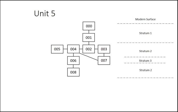
Unit 005 – This area was originally opened as a 3m x 3m square placed around an anomaly discovered by the GPR results. It was later expanded to a 5m x 5m square.
List of Loci. Unit 005
000 – Modern Surface
001 – Topsoil (plough zone) layer excavated by heavy equipment (bulldozer) 20-30cm
002 – Arbitrary locus for first soil layer consisting of entire 3m x 3m unit
003 – Soil layer against south and east baulk in 2m x 2m extension of unit
004 – Fired mud-brick feature and surrounding mud-brick melt and compact silty clay
005 – Ash layer near and inside fired brick feature
006 – Sand layer in northwest section of unit
007 – Ceramic pile in southwest corner of unit
008 – 1m x 2m trench beneath 006 and 004
Locus 000
This locus consists of surface material including modern dumped debris, foliage, and miscellaneous surface finds. These were observed and noted but nothing significant was discovered.
Locus 001
Topsoil removed by heavy equipment approximately 20-30cm in depth at the beginning of the excavation season. The removal of plough zone was observed and recorded by archaeologists.
Locus 002
This locus was opened around the entire 3m x 3m unit with an original target goal of a depth of 20-30cm in order to reveal the “anomaly” found in the GPR results. The locus (entire unit) was picked twice with mattocks and 20% of all material was collected in order to reach target depth more efficiently. Collection shifted to 100% on the third pass due to an increased number of brick and ceramic finds whilst picking the locus. A significant number of the bricks were found in the eastern and southeastern section of the unit. The soil in Locus 002 was a silty clay (10YR 5.2) that was found in adjacent units. However, on the third pass of picking the unit, the soil changed to a soft sand particularly in the western half of the unit. For this reason, the locus was closed.
Locus 003
This locus was opened on account of a soil change which had occurred in the previous locus (002). Initially, Locus 003 consisted of the entire 3m x 3m unit. However, a fired brick feature (Locus 004) was discovered following the first pass with the mattocks. This feature (kiln) was located in the southeast corner of the unit and extended into the eastern baulk. It was for this reason that the entire unit was extended to a 5m x5m from a 3m x 3m unit. From that time on, the entire unit became a 5m x 5m square. Locus 003 then encompassed Locus 004, the fired brick feature. As Locus 004 was traced, a melted mudbrick surface was exposed surrounding the fired brick feature. Thus, Locus 003 became restricted to a 50cm strip along the southern and eastern portions of the unit between Locus 004 and the southern and eastern baulks. Locus 003 consisted of a layer of silty clay (10YR 5.2) resting upon a very soft sand layer (7.5YR 6.6). This silty clay however was not present in the northwest section of the unit. The same sand which was discovered beneath the silty clay had existed in the northwest section since the closing of Locus 002 and continued below adjacent loci. For this reason, the northwest section of the unit became a separate locus from 003. Thus, Locus 003 became completely restricted to 50cm wide strip located along the entire southern and eastern baulks. This locus can be interpreted as part of the limits of the fired mud-brick feature (kiln). The locus produced a large quantity of fired mud-brick pieces, ceramic sherds, and animal bones. Occasional pieces of ceramic fineware were found along with a few pieces of glass. The locus was closed on the final day of the season.
Locus 004
This locus initially consisted only of the fired mud-brick feature which was discovered in the southeast corner of the original 3m x 3m square. The feature measured approx. 50cm x 50cm and was constructed of fired bricks atop a mudbrick surface atop sandy soil (7.5 YR 6.6). The locus was extended to include the hard-silty clay (10YR 5.2) surface of what came to be interpreted as mudbrick melt. The extension of this locus outside of the fired mud-brick feature was separated on two levels. The higher level consisted of the remnant of the south and east baulk of the 3m x 3m unit. This level followed the southern and eastern baulk lines (Locus 003). The southern section was excavated and determine to be a similar composition to that of Locus 003 with a layer of silty clay atop sand. The eastern side however, was excavated to reveal a circular shape of mudbrick and mudbrick melt around the eastern side of the fired mud-brick feature. This and the evidence of ash within the center of the circular shaped mudbrick feature were interpreted to be the central dome of the kiln or forge. The lower level consisted of mudbrick and melted surface on which the fired mud-brick feature rested. However, this level only extended from the fired mud-brick feature to the northern baulk and ended westward at the sand deposit in Locus 006. It was in this area that several pieces of iron slag and worked iron were found along with pieces of glass, charred bone and ash. It was this material that first led us to believe that this feature was a kiln or forge. A few mudbricks were outlined during excavations and on average they measure approx. 40cm x 20cm and were approx. .5cm thick. One brick that adjoined the sand which the fire mud-brick feature rested was excavated and examined. The base of this brick was burned and the soil beneath it contained traces of ash. This led the excavators to believe that the feature had multiple phases of use and construction during its lifetime. In order to better understand the construction and phasing of this feature, the kiln/forge was partially deconstructed toward the end of the season. The locus also produced ceramic sherds, pieces of fired brick and animal bone. 100% collection of material was practiced throughout the excavation of the locus. The locus was excavated with hand-picks, trowels and brushes. The locus was closed on the last day of the season after the profile of the feature and the upper layer were drawn and photographed.
Locus 005
This locus consisted of an ash layer which was contained within Locus 004. The ash ran from the center of the kiln/forge to approx. 30cm on the east and north side of the fired bricks. The ash was present above and below mudbricks which had been found below the fired brick on the same level as the sand surface. This was interpreted as multiple phase of use and construction of the kiln/forge. The evidence of ash on the east and north side of the fired bricks suggest that the kiln/forge was worked from the north and east side. Samples of charcoal and ash were collected from this locus for carbon dating. Though a few sherd and brick pieces were collected, the majority of the material cultural consisted of charred animal bone. The locus was excavated with trowels and brushes and 100% collection of material was practiced. Once the ash layered was excavated and the sandy soil was revealed, the locus was closed.
Locus 006
Located in the northwest section of the unit, Locus 006 opened due to a deposit of sandy soil (7.5YR 6.6). The soil was first identified whilst digging in Locus 002. However, due to the absence of an upper layer of silty clay, Locus 006 was separated from Locus 003. The deposit of sand was evident in the stratigraphy of the western profile. The locus was excavated using mattocks and shovels to a depth of 12-15cm and produced very little cultural material. The soil changed to a darker lumpy clay at a depth of approximately 15 cm and so the locus was closed.
Locus 007
A pile of ceramics located in the southwest corner of the unit. This locus intruded into both Locus 003 and Locus 004 and a pile of ceramics were found floating in both the silty clay (10YR 5.2) and the sandy soil (7.5YR 6.6). The locus was excavated with the use of trowels and brushes and the ceramics were removed. It is possible that this pile came from a single vessel.
Locus 008
This locus was opened on the last day of the season to determine if there were any occupational levels beneath the kiln. The locus was a 1m x 2m trench located on the western side of the kiln and is beneath Locus 006 and 004. Shovels and mattocks were used to take the trench down to a depth of approx. 23cm. The soil consisted of a dark hard lump clay which yielded absolutely no cultural material. It was determined that excavations had reached below the occupational levels and the locus was closed.
3.3.4 Stratigraphy
The stratigraphy of Area B is comprised of both geomorphological layering and occupational layers. There were five stratigraphic layers uncovered across Area B, all with varying degrees of depth and preservation.
Stratum 1-Topsoil
Stratum 1 is composed of topsoil layer that comprise the plough zone. Within the topsoil there are two plough zones, one shallow and one deep. The entire plough zone thickness measures approximately 20-30cm. This stratum is found across the entire area. Cultural material was present within this stratum, but nothing of significance was uncovered.
Stratum 2-Silty Clay Loam
Stratum 2 is an undisturbed soil layer composed of silty clay loam (7.5YR 5/4 brown) that rests between the plough zone and the occupational surface. This layer ranges in thickness from approximately 10cm-40cm. This stratum contained rounded cobbles and pebbles along with a high number of cultural material fragments (animal bones, ceramics, mud-brick, glass slag). Diagnostic ceramic sherds included a blue glazed Iranian sherd, rim of a whole mouth jar dating post Tamerlane, and 13-14th century jar handle. Other notable cultural artifacts were two kayraks found in situ, both with a cross inscribed on them. In unit 4 the remnants of a domestic structure were excavated in this stratum. Material culture in Unit 4 stratum 2 varied from other units due to being within this domestic structure. Cultural material excavated within Unit 4 were-plaster, knife blade fragments, carved bone, glass sherds, fine wear spindle whorl, whetstone, and a copper pendent. The upper layers of a melted kiln excavated in unit 5 also appear in this layer.
Stratum 3-Geomorphological Layer (Channel Lag)
Stratum 3 is a geomorphological layer matrix comprised of loamy sand and sand that is unevenly distributed/represented across the excavation units. This layer represents water deposits that had channeled through the area. In some units this stratum cuts through both Stratum 2 and 4 and in others it rests above Stratum 4. This stratum primarily includes water smoothed cobbles, pebbles and granules. Cultural material was present within this stratum and included ceramic sherds and animal bone fragments. In Unit 5 a kiln abuts the geomorphological layer along its eastern side.
Stratum 4-Occupational Surface
Stratum 4 is an extremely dense compacted surface found in all units, apart from unit 2. This stratum is a light color (2.5YR 7/3 and 7/4) and undulates across the units. This compacted surface was deposited naturally over time as subtle horizontal striations were visible in the profile where excavation was conducted into this stratum. The stratum is quite thick, measuring between 25-50cm. Excavation probes of this stratum did not attain the lowest working level of the surface, with the exception of unit 4 (thickness of stratum in unit 4 was approximately 25cm). Material culture was minimal in the areas that excavated into this stratum. Ceramic and numismatic evidence directly above this stratum provide an occupation surface of the 14th century.
Stratum 5-Sub Occupational Surface Layer
Stratum 5 is a sandy loam layer beneath stratum 4 with a soil matrix comprised of gravelly pebbles and granule stone inclusions. This layer was only found unit 4 and yielded minimal material culture.
3.3.5
Ceramic Analysis
The ceramic analysis and dates represented in this section are from field readings conducted during excavation. Lab results with more precise dates and analysis is still being processed.
Unit 1
Unit 1 primarily yielded undistinguished plain ware body sherds. Most of these ceramic sherds were excavated from the refuse pit (Locus 004). None of the ceramics from this unit had markings, were glazed, or were fine ware sherds. Located in the center of the refuse pit was an in situ partially-reconstructable vessel, which was broken into seventeen pieces. Some of the damage occurred during the excavation of the topsoil layer by the heavy equipment, evidenced by fresh break marks; however, the vessel was already partial broken in antiquity prior to excavation. Approximately three quarters of the vessel was revealed by our excavations. The vessel did contain a small symmetrical hole (approximately 2cm in diameter) near its base. This indicates that the vessel held oil or some form of liquid in which the hole would have served as a release point and then plugged when not in use. Alternatively, it could have served as a water clock.
Unit 2
In Unit 2 there was limited ceramic material. The vast majority of the recovered ceramics were undistinguished body sherds. The exceptions to this were two blue glazed fine ware sherds of Iranian origin, dated roughly to the 14th century. Additionally, in the southwest corner of the unit a fragmentary base and associated body sherds were found, but with no discernible context or associated cultural feature.
Unit 3
The observable trend within Unit 3 of the ceramic assemblage provided a roughly dating to the 14th century C.E. The vast majority of the ceramics recovered were undistinguished body sherds. While the diagnostic sherds revealed many forms that could be recognized from field readings, few of the utilitarian and plain wares proved diagnostic for chronological purposes. Of those which were recognized, such as the thin walled decanter from Locus 009, had only broad chronological ranges, though most incorporated all or part of the 14th century C.E. Locus 005 consists of a ceramic splatter with diagnostic sherds. At least two ceramic vessels are represented in Locus 005, one is a large storage jar with a flanged rim while the other is a large bowl or krater with a simple rim and herring bone handle. This type of handle was noted in units outside Unit 3, such as in Unit 4. Fine ware sherds proved more beneficial for chronological purposes. The most common, though always fragmentary, fineware sherd type represented is a blue glaze Iranian type dated to the 14th century. Other fine wares, which date to the 14th century, include a locally produced green glazed cup fragment (Locus 009), and Iranian ware imitating Chinese porcelain (Locus 007).
Unit 4
The common ware ceramics excavated from locus 002 in Unit 4 displayed a broad range of dating (up to a 1,000-year span), therefore the best means of dating was through the fine ware ceramics. There was a higher percentage of diagnostic fine ware ceramics in this unit. The fine ware ceramic assemblage represented in Unit 4 provided a rough dating between the 13th-14th century C.E. Examples of fine ware types include-blue porcelain Iranian ware dated to the 14th century, light-blue glaze Mongol era ware dated to the end of the 13th to the beginning of the 14th century, dark-blue Mongol ware dated to the 14th century, yellow-green Karakhanid ware (with fake Islamic Arabic script) dated to the 13th century, a black glaze Mongolian ware dated to the end of the 14th century, and a brown glaze Mongol ware dated to the 14th century.
Unit 5
Unit 5, in all, yielded a large quantity of ceramic finds of both plainware sherds and fineware sherds. Aside from Locus 008, ceramics were found in every locus within the unit. The majority of these were diagnostic sherds. Locus 007 consisted of a pile of floating ceramic sherds in the southwestern section of the unit. These sherds possibly formed a single vessel. Locus 002, 003, and 006 produced fineware sherds consistent to those found in other units.
3.3.6.Drawings documentation
|
|
|
|
|
|
|
|
|
|
|
|
|
|
|
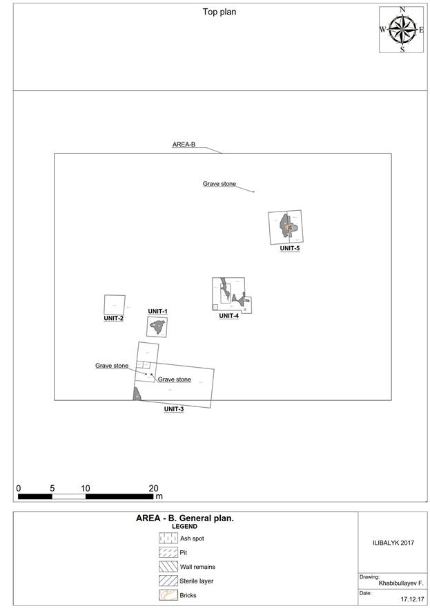
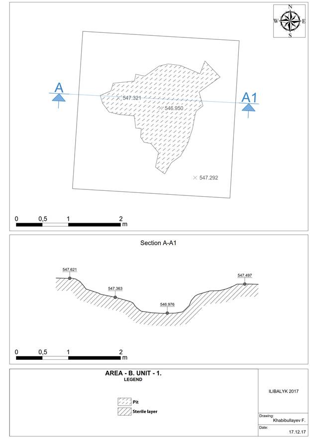
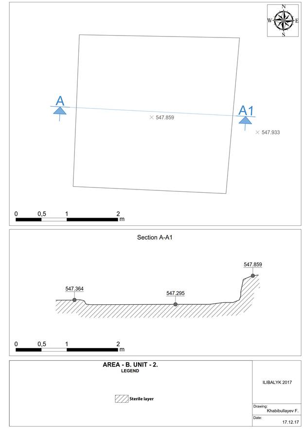
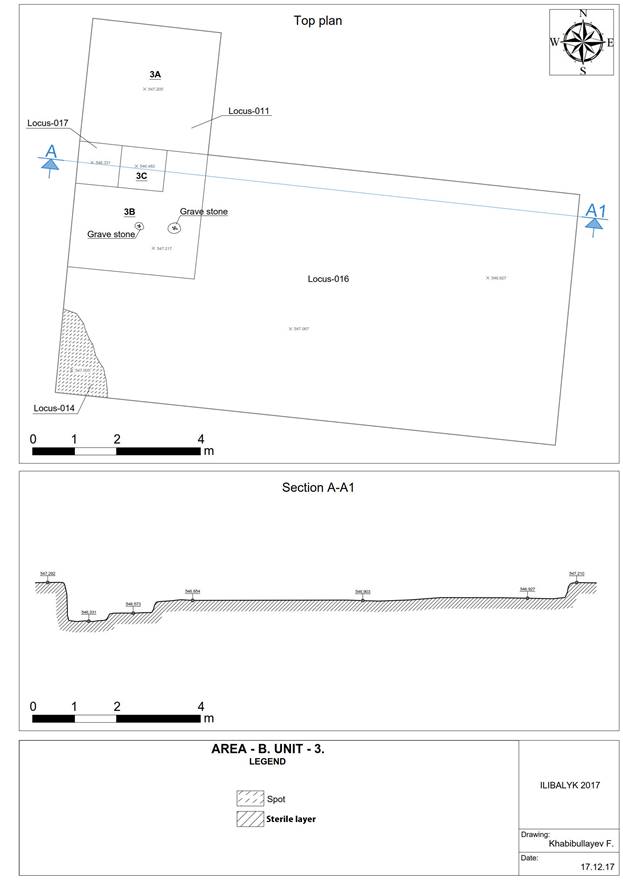
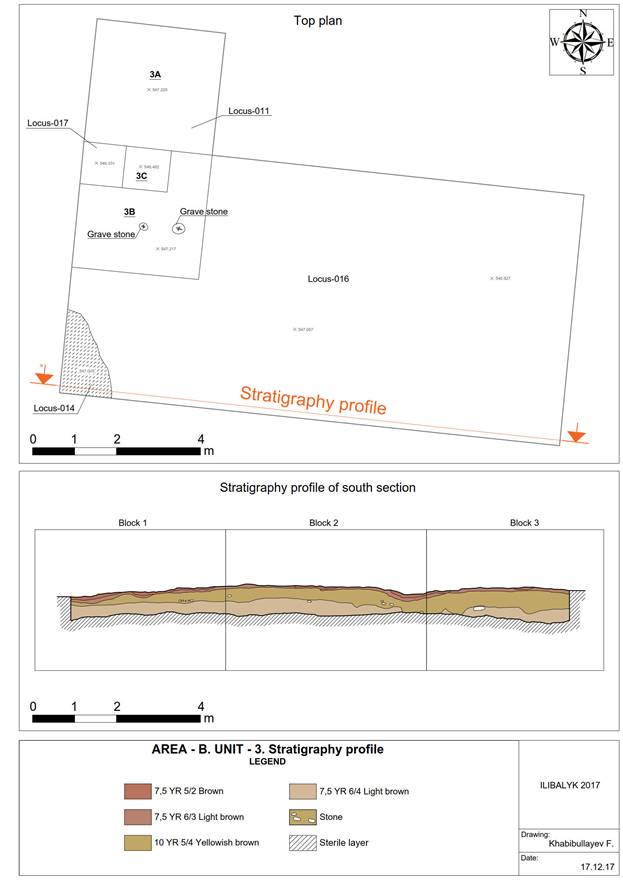
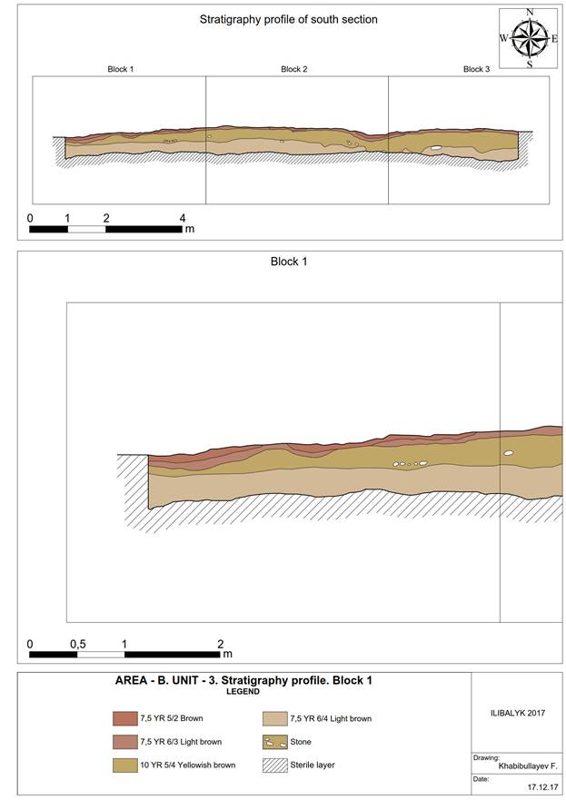
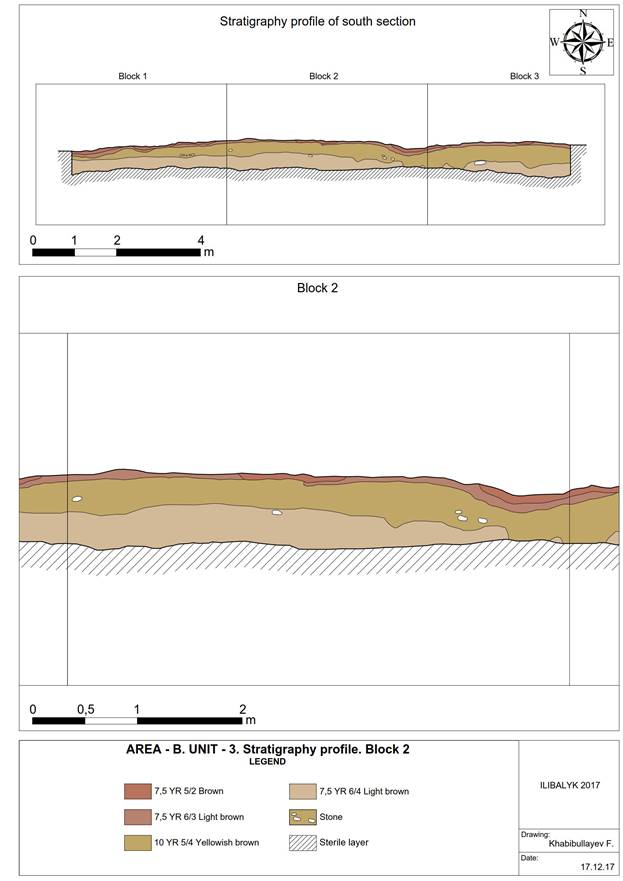
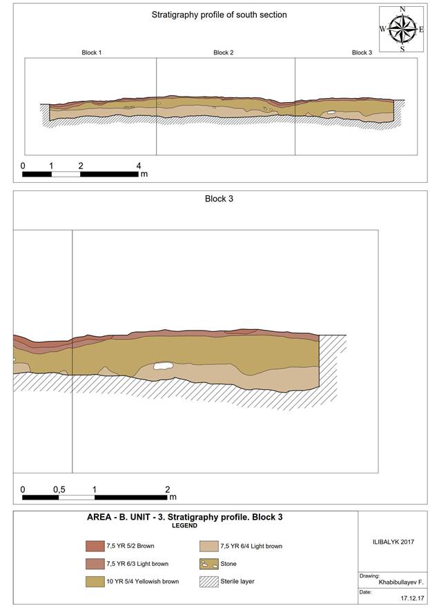
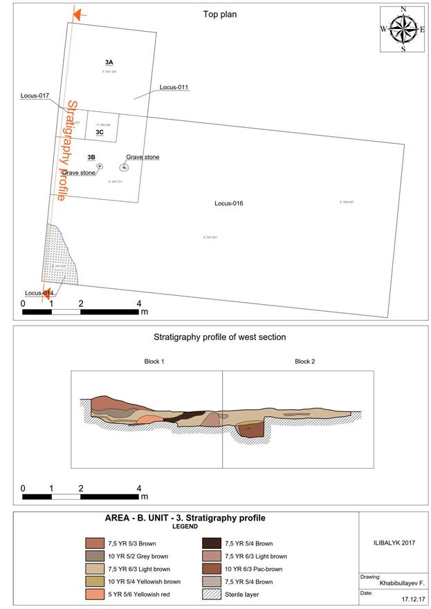
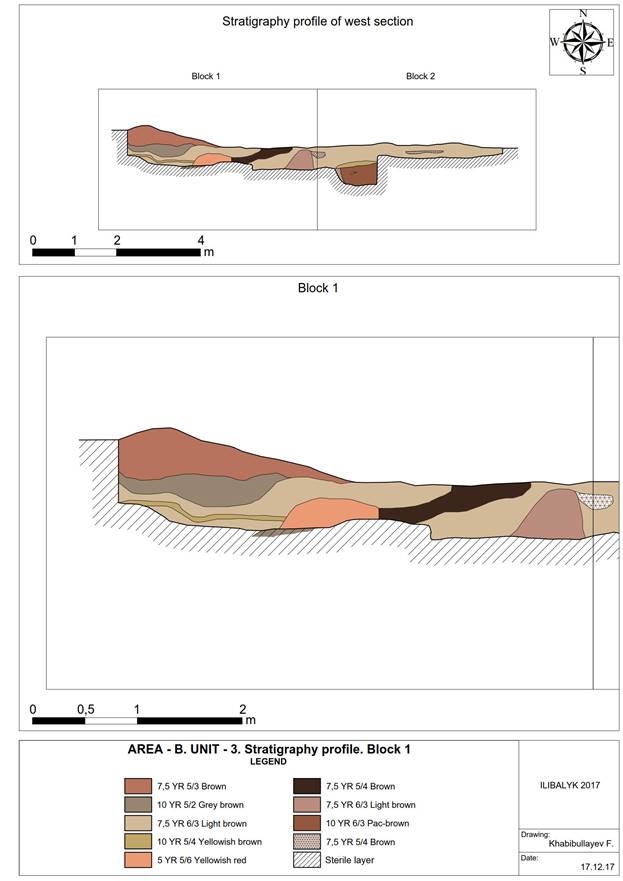
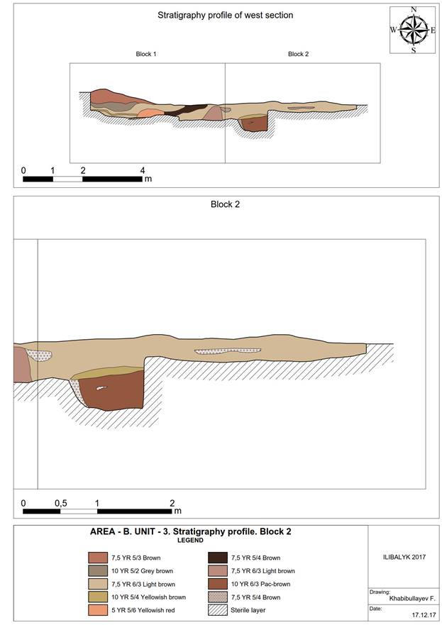
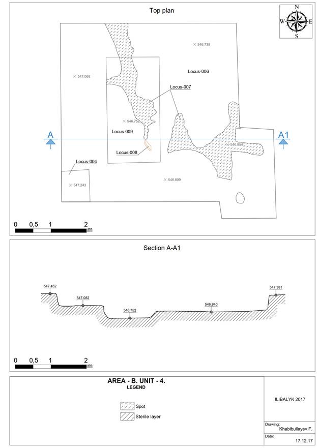
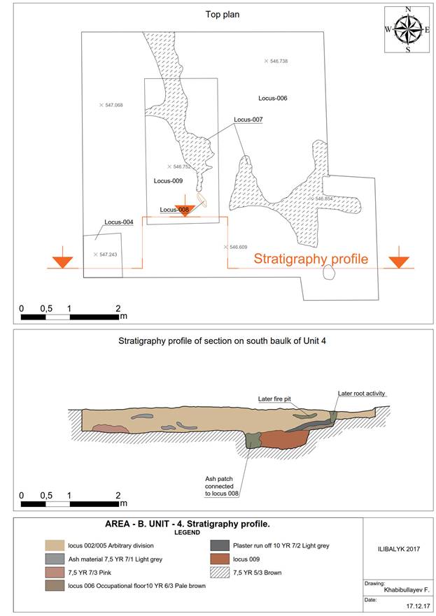
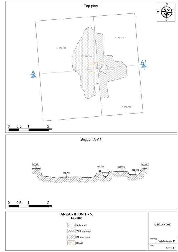
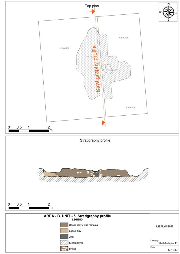
3.3.7 Photo Gallery
|
|
Fig. 1. Ilibalyk-2017. Area B Unit 1 refuse pit. |
Fig. 2. Ilibalyk-2017. Area B Unit 1 plaster material. |
|
|
Fig. 3. Ilibalyk-2017. Area B Unit 1 whole unit. |
Fig. 4. Ilibalyk-2017. Area B Unit 1 refuse pit. |
|
|
Fig. 5. Ilibalyk-2017. Area B Unit 1 ceramic in refuse pit. |
Fig. 6. Ilibalyk-2017. Area B Unit 1 ceramic in refuse pit. |
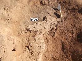
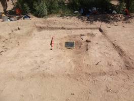
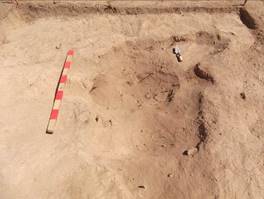
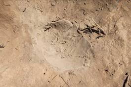
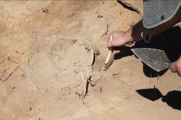
|
|
Fig. 7. Ilibalyk-2017. Area B Unit 1 |
Fig.8. Ilibalyk-2017. Area B Unit 1. |
|
|
Fig. 9. Ilibalyk-2017. Area B Unit 1 refuse pit. |
Fig.10. Ilibalyk-2017. Area B Unit 1 refuse pit. |
|
|
Fig. 11. Ilibalyk-2017. Area B Unit 1 plaster material. |
Fig. 12. Ilibalyk-2017. Area B Unit 1 plaster material. |
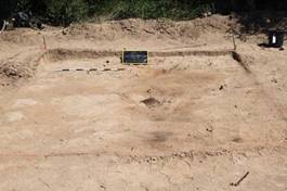
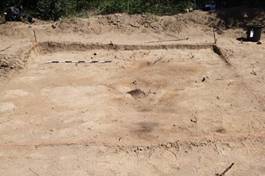
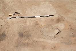
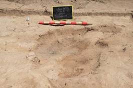
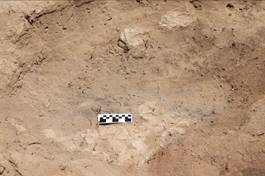
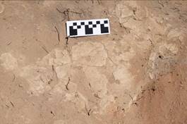
|
|
Fig. 13. Ilibalyk-2017. Area B Unit 1 excavating plaster material. |
Fig. 14. Ilibalyk-2017. Area B Unit 1 excavating plaster material. |
|
|
Fig. 15. Ilibalyk-2017. Area B Unit 1 western side of refuse pit. |
Fig. 16. Ilibalyk-2017. Area B Unit 1 western side of refuse pit. |
|
|
Fig. 17. Area B opening of Unit 2 with visible sandy patch. |
Fig. 18. Area B opening of Unit 2. |
|
|
Fig. 19. Area B Unit 2 ceramic splatter in southwest corner oriented north. |
Fig. 20. Area B Unit 2 ceramic splatter in southwest corner oriented east. |
|
|
Fig. 21. Area B Unit 3 excavated kayrak. |
Fig. 22. Area B Unit 3 taking measurements of recently uncovered kayrak. |
|
|
Fig. 23. Area B Unit 3 examining kayrak in situ. |
Fig. 24. Area B Unit 3 cleaning immediate surrounding of in situ kayrak. |
|
|
Fig. 25. Area B Unit 3 cleaning area around in situ kayrak. |
Fig. 26. Area B Unit 3 in situ kayrak. |
|
|
Fig. 27. Area B Unit 3 ceramic splatter. |
Fig. 28. Area B Unit 3 ceramic splatter detail. |
|
|
Fig. 29. Area B Unit 3 second in situ kayrak. |
Fig 30. Area B Unit 3 second kayrak detail. |
|
|
Fig. 31. Area B Unit 3 facing west. |
Fig. 32. Area B Unit 3 occupational surface. |
|
|
Fig. 33. Area B Unit 4. |
Fig. 34. Area B Unit 4. |
|
|
Fig 35. Area B. Unit 4. |
Fig. 35. Area B Unit 4 top of mudbrick furnace feature. |
|
|
Fig. 36. Area B Unit 4 mudbrick furnace feature. |
Fig. 37. Area B Unit 4 mudbrick feature. |
|
|
Fig. 38. Area B Unit 4 mudbrick furnace feature. |
Fig. 39. Area B Unit 4 mudbrick furnace feature. |
|
|
Fig. 40. Area B Unit 4 mudbrick furnace feature. |
Fig. 41. Area B Unit 4 mudbrick furnace feature. |
|
|
Fig. 42. Area B Unit 4 mudbrick furnace feature. |
Fig. 43. Area B Unit 4 |
|
|
Fig. 44. Area B Unit 4. |
Fig. 45. Area B Unit 5 mudbrick feature in south east corner of original unit. |
|
|
Fig. 46. Area B Unit 5 mudbrick feature. |
Fig. 47. Area B Unit 5 mudbrick feature detail. |
|
|
Fig. 48. Area B Unit 5 mudbrick feature overhead. |
Fig 49. Area B Unit 5 mudbrick feature after exposure. |
|
|
Fig. 50. Area B Unit 5 mudbrick feature. |
Fig. 51. Area B Unit 5 facing north after expansion. |
|
|
Fig. 52. Area B Unit 5 after excavation in expansion. |
Fig. 53. Area B Unit 5 after excavation in expansion. |
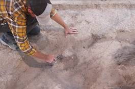
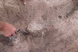
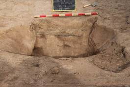
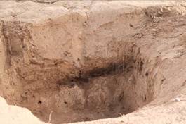
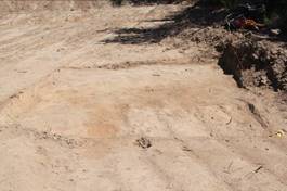
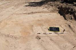
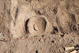
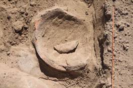
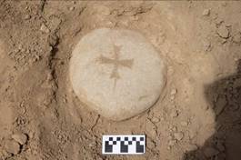
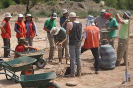
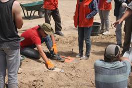
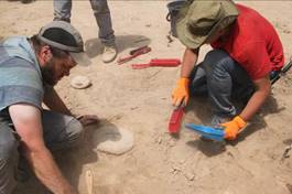
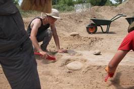
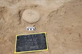
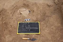
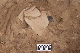
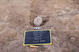
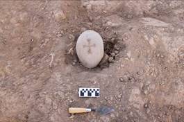
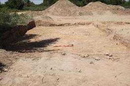
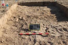
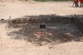
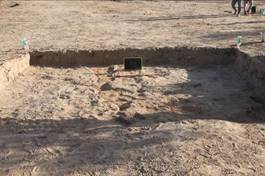
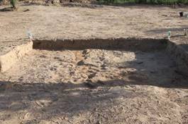
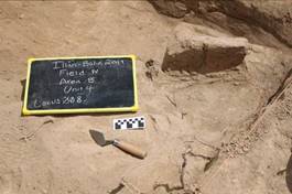
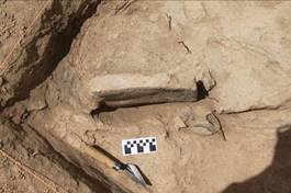
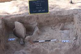
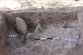
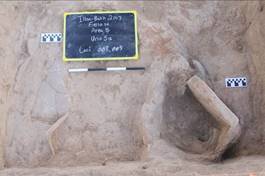
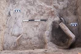
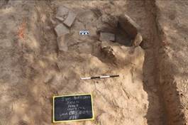
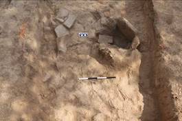
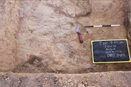
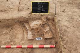
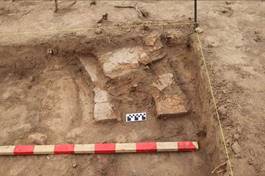
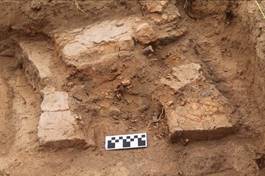
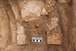
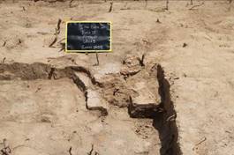
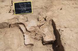
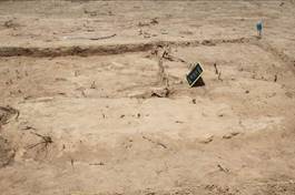
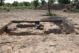
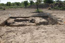
|
|
Fig. 54. Area B Unit 5 mud brick feature after excavation. |
Fig. 55. Area B Unit 5 mud brick feature after excavation. |
|
|
Fig. 56. Area B Unit 5 mud brick feature facing south. |
Fig. 57. Area B Unit 5 mud bruck feature facing south. |
|
|
Fig. 58. Area B Unit 5 mud brick feature after excavation. |
Fig. 59. Area B Unit 5 mud brick feature after excavation. |
|
|
Fig. 60. Area B Unit 5 inside mud brick feature. |
|
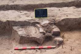
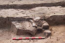
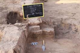
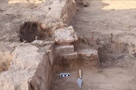
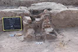
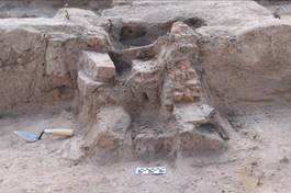
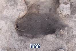
3.4. AREA C
3.4.1
General Overview
The "C" zone is located 60.5 metres west of the "A" and "B" zones, on a flat area covered with thick vegetation in the center and the edges. In the central part, elms growing make a square. Along its edges there are blackthorn, wild roses, elm and mulberry. The layout and breakdown of the excavation was done by electronic total station called "LEYKA". The breakdown was carried out following cardinal points. The total size of the zone is 38 x 52 m.
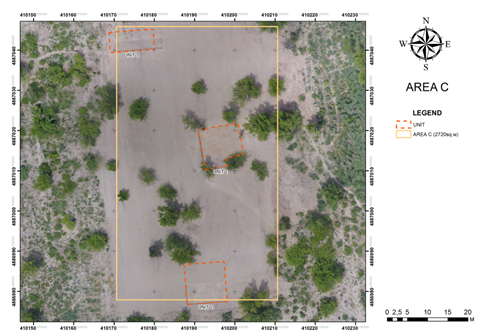
Fig. 3.4.1. Field IV. Area C. Plan after preliminary treatment prior to excavation.
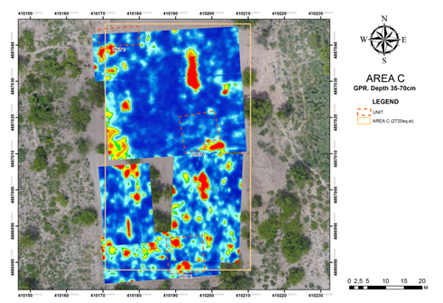
Fig. 3.4.2. Field IV. Area C. Ground-penetrating radar results.
3.4.2 Layered planigraphy
- The size of the Area C: 38x52 meters, stretched in the north-south direction. Before removing the top layer, the relief of Area A is relatively flat. In the south-east in the southern and south-western parts of the plot there is a slight increase in the landscape. In this area, there is a shrub, karagach, mulberry, thorn bushes and dense grass. Before the excavation works on this site, the surface was inspected. As a result, fragments of red clay and gray-clay ceramics were found in a small number: fragments of corollas of hummus and aquifers, as well as two glazed fragments of blue kese, fragments of burnt bricks. Also, on the surface of the excavation site, small modern fireplaces and household garbage are detected.
- After removing the first layer of 20 cm, the planning situation in the excavation area did not change much. When cleaning the surface of the territory, the remains of any structures were not found. It should be noted that during the process of removing the upper layer of the turf by using the technique, a kayrak with epigraphy was detected.
3.4.3.Description of the loci
Loci 000 & 001 were the same across the entire Area as these were excavated together by heavy equipment. To keep uniformity, we began each Unit with Locus 000 as surface and Locus 001 as the topsoil, which consisted of the plough zone. This resulted in all Units beginning with a working level Locus 002.
Locus 000
This locus consists of surface material including modern dumped debris, foliage, and miscellaneous surface finds. These were observed and noted but nothing significant was discovered.
Locus 001
Topsoil removed by heavy equipment approximately 20-30cm in depth at the beginning of the excavation season. The removal of plough zone was observed and recorded by archaeologists.
Unit 001– In the central part of the "C" zone, there was organized a square excavation №1, dimensions: 10x10 meters, which was oriented to the sides of the world (photograph 21-24). In turn, the excavation is divided into four sectors. The sectors were counted from the North and the East. Sectors 1 and 2 are located in the North-East and North-West parts of the excavation. Sectors 3 and 4 are located in the South-East and South-West ends of the excavation. Elms grow at the excavation edges. The surface of the excavation is flat, covered with sod, thickly covered with grass and small shrubs, and well manured by cows from a nearby village feeding in the fields.
Layer2.
Sector 1. While digging on the north side of Sector 3, in the loamy layer they found fragments of two bottoms from aquifers, walls, and a portion of a sidewall from a receptacle. In addition, there was found osteological material consisting of tubular bones and ribs of the small cattle.
The excavated second layer is represented by loose, loamy, lumpy soil, with the inclusion of humus plants. This sector has a dense root system of plants (photograph 25-33).
Towards the center of the excavation the change of soil by density and color can be observed. Loamy soil becomes dense. The soil is compacted from East to West (photograph 34-36).
In the sector described, there is a manure layer of up to 20 cm thick coming from the edge of the third sector towards the North. The soil in this layer is loose black and brown, including lump-dung, ash and humus plants. The area of this cluster is 1.50 m from North to South, 2.50 m from East to West.
The roots of the plant of trees in the vicinity are ingrained at this depth.
Pottery, which continues to be found in this sector, is mainly represented by a small number of fragments of bottoms from aquifers, as well as a rim of a ceramic boiler, sidewalls and a bottom from an aquifer. There's a loop-shaped handle on a boiler, and a handle with a part of a pitcher neck.
Sector 2. The soil of the third layer in Sector 2 of the excavation 1 is dense, loamy and lumpy. The soil is full of root systems of trees and plants. There is a concentration of nitrogen and white carbonate in the soil.
Twenty-two pieces of ceramics were found in the excavated layer. Of this number, there were 2 useful and informative fragments: lower bottom of an aquifer and one rim from a pitcher. The rest is 20 fragments of the sidewalls from a variety of receptacles.
Sector 3. The excavated second layer of the excavation 1, sector 3, is represented by loose, loamy, lumpy soil, with the inclusion of humus plants.
In the study layer, pottery is found in small quantities and is represented by a ceramic boiler, sidewalls,a bottom from an aquifer.
A total of 10 fragments were found. Of this number, there are 2 informative fragments - the bottom of a receptacle and the rim.
No osteological material was found in this sector.
Sector 4. The removed second layer of the excavation 1 has dense, loamy, lumpy soil, with inclusions of plant residues and nitrogen, as well as carbonates. A piece of ceramic boiler with a stucco moon-like handle, with seam in the center, a fragment of a Chagatay-period burnt brick, walls and bottom of humcha-like receptacles and aquifers were found in the surveyed layer. In the Eastern part of the sector, there was uncovered a cluster of cow bones (a calf?) ribs, anklebone (asyk, chuko bone), tubular bones. The cluster penetrates into the next layer.
Pottery in the sector is represented by 60 fragments of sidewalls of thick and thin walled receptacles, 10 fragments from the walls and khumcha rims, lower bottom of an aquifer, sides and rims from boilers.
Layer 3.
Sector 1. In the excavated sector, the soil is loamy, dense, grey, with a densely woven thick root system of trees.
During the soil extraction they found fragments of cow and sheep bones.
From the pottery fragments in this layer, we can note a khumcha rim, with its edge decorated with a stucco belt in the form of alternating triangles. From glazed ceramics, we note a fragment of a bowl with white glazing. In this same location there was found a rim from a wide-mouth pitcher, the opening of which was decorated with a traced strip, a handle from a khumcha-like receptacle, flat in section, and a portion of a pitcher wall with a corrugated surface. They also found a pitcher bottom, a wall of a receptacle with traces of handle fixation, a fragment of a receptacle rim and walls of a ceramic boiler and aquifers.
A total of 42 pottery fragments were found. Out of this number there are 10 informative fragments.
Clearing and sweeping the surface in the first sector of the excavation, at a depth of 40 cm in the loamy layer, they cleared a piece of a gravel from fine granite. The stone was once oval. At the time of the excavation, three quarters of the stone were chipped. The gravel was laid deeply buried into the loamy soil on its flat chipped surface. There is an engraved cross facing up on the surviving non-chipped surface of the gravel.
Sector 2. The soil of the third layer in Sector 2 of the excavation 1 is dense, loamy and lumpy. The soil is full of root systems of trees and plants. There is a concentration of nitrogen and white carbonate in the soil.
Twenty-two pieces of ceramics were found in the excavated layer. Of this number, there were 2 useful and informative fragments: lower bottom of an aquifer and one rim from a pitcher. The rest is 20 fragments of the sidewalls from a variety of receptacles.
Sector 3. One shovel down in the SE part of the excavation (sector 3) the excavated third layer is grey, loose, loamy, lumpy, with inclusions of humus organics, as well as the decomposing roots of trees and plants.
In the digging area of the sector, there were found a rim of a khumcha, a part of a rim with a sidewall from a ceramic cup, and fragments from a thin receptacle.
In addition to pottery, sheep bone fragments were found.
Down to 22-25 cm, in the centre of the sector they found a rim and walls of a ceramic boiler, as well as a edge of the thick-walled vessel and its lower bottom.
Sector 4. The removed second layer of the excavation 1 has dense, loamy, lumpy soil, with inclusions of plant residues and nitrogen, as well as carbonates. A piece of ceramic boiler with a stucco moon-like handle, with seam in the center, a fragment of a Chagatay-period burnt brick, walls and bottom of humcha-like receptacles and aquifers were found in the surveyed layer. In the Eastern part of the sector, there was uncovered a cluster of cow bones (a calf?) ribs, anklebone (asyk, chuko bone), tubular bones. The cluster penetrates into the next layer.
After clearing and cleaning the excavated surface, the loamy soil is dense. From the eastern wall of the excavation to the West there is a long loamy seal of up to 7 meters long (photograph 43-52).
Unit 002 – While the bulldozer removed the first layer of topsoil and vegetation, a round stone was made barely visible about 30 cm below from the starting surface. The stone appeared to be a gravestone (kayrak) in situ since it was similar in dimensions to inscribed stones found in that vicinity. Members of Archeological Expertise LLP excavated an area 2x2 m and 30 cm deep around the stone and lifted it to see the underside, which was carved in a similar fashion to the gravestones, but no specific symbol or inscription was made; it was simply smoothed to a flat surface in a squarish shape.The unit was expanded into 10x10m; however only the southern half was excavated 10x5m.
List of Loci. Area C. Unit 002
000 – Modern Surface
001 – Topsoil (plough zone) layer excavated by heavy equipment (bulldozer) 20-30cm
002 – Kayrak, which is a stone that has been selected, polished, and finely chiseled
003 – Soil deposit beneath and around 002
004 – Soil level beneath and surrounding 003
005 – Large ceramic vessel which was mostly intact
Locus 002
Locus 002 is the kayrak. The initial interpretation was that the stone that was carved and prepared, presumably for use as a gravestone (kayrak), but not completed. It is possible that the stone was still used as a grave marker given the context near the other gravestones found in the 2016 Excavation. Therefore, this stone was given special attention as a possible burial marker; moreover, it was found with a large ceramic sherd of a jar (Locus 5) and other remains (animal bone and brick) in Locus 3. The stone was removed; however, it could not be confirmed that it rested on a surface, medieval or otherwise. No evidence of soil change (color, texture, or composition) was found under the stone which indicates, at this point, that there was no associated burial. Another interpretation was formulated when a similar stone found in Area B within a house, which may have served a base for a wood pillar; this would explain the smoothing of Locus 002. Likewise similar flat round stones were found in Field 1 during the first excavation season (2016), just across the river, and these were interpreted as bases for wood pillars in houses.
Locus 003
Around Locus 002 was a cluster of ceramic sherds around the kayrak and the soil around this area, roughly 1 m in diameter, was looser (silty clay loam) than the surrounding soil, though it was the same color (10YR 5/2)—this feature was called Locus 003. After excavating a depth of 30 cm the Locus was removed, indicating it was a shallow pit deposit. It consisted of 17 ceramic sherds (including fragments of Locus 005), 14 animal bone fragments, and 3 fragments of fired brick.
Locus 004
Locus 004 represents the soil layer (sandy loam) around and beneath 003 which made up the majority of the excavated Unit. Throughout the layer was uniformly greyish (weak red), 10YR 5/2. 30 cm. Altogether we collected 704 courseware sherds, 5 fineware (glazed) sherds, 116 animal bones, 4 unpainted fragments of building plaster, 5 stones that were artificially fashioned, 3 shards of glass, and 6 fragments of molded brick (presumably for a bread oven, known locally as a tandir or tanur).
Locus 005
In Locus 003 a ceramic vessel was deposited and was mostly intact (estimated 75%), which was uncommon in this context and given special attention; 10 of the 17 sherds found in 003 belonged to this vessel. The form can be identified as a large courseware jar or pitcher.
Unit 003– In the north-western part of the zone "C", a rectangular excavation with dimensions: 11x5 meters which is oriented to the sides of the world. As in the first excavation, excavation 3 is divided into four sectors (photograph 55-66). The sectors were counted from the North and the East. Sectors 1 and 2 are located in the North-East and North-West parts of the excavation. Sectors 3 and 4 are located in the South-East and South-West ends of the excavation. In the North and West, there grow elm and mulberry. The surface of the excavation is flat, covered with sod, thickly covered with grass and small shrubs, and well manured by cows from a nearby village feeding in the fields. On the western side, there is a watering canal dug in the Soviet times to irrigate gardens.
Layer2.
Sector 1. In the removed layer, to the depth of 17-22 cm, as in the neighboring sectors, the soil is loose, loamy, with the inclusion of humus and the presence of thick tree roots (photograph 75-76).
Pottery found in this layer and sector is represented by 21 fragments of receptacles. Of these, 1 fragment is a pitcher rim, the rest come from aquifers.
Sector 2. The soil in the second layer in Sector 2 of excavation 3 is loose, loamy, with the inclusion of humus and the presence of thick tree roots (photograph 68-69).
Fifty-two pieces of ceramics were found in the excavated layer. Eight of the named fragments provide certain information: two lower bottoms from aquifers, one rim from a pot decorated with an ornament, five ornamented fragments from boilers and a pitcher. The rest is 44 fragments of sidewalls from a variety of receptacles.
A ceramic spinning wheel was found 22 cm deep in the layer. The spinning wheel is made from a watering bowl, the wheel is covered with turquoise glazing. The wheel diameter is 2.5 cm., thickness is 0.8-1 cm. The diameter of the drilled hole is 0.7 cm.
No architectures structures or grave pits were identified within the extracted layer and the cleared surface (photograph 77-80).
Layer 3.
Sector 1. Digging the third layer to a depth of 20 cm, the soil turned out as loose, loamy, with the presence of tree roots.
The pottery found in this layer and sector is not available. There were found no bones during excavation (photographs 84-92).
Sector 2. In Sector 2 of the excavation 3, the removed layer is loose, loamy, with the inclusion of humus and the presence of the roots of the trees.
In the excavated layer, there are single pieces of pottery, mainly walls of aquifers. The total is 12 fragments of the sidewalls from a variety of receptacles.
The osteological material is represented by fragments of cow bones: tubular bones, teeth, ribs.
Sector 3. Digging the third layer to a depth of 20 cm, the soil turned out as loose, loamy, with the presence of tree roots.
Pottery found in the third sector is represented by 5 fragments of receptacle walls made of red clay easel ceramics.
There were dug out sheep bones in this sector: ribs and tubular bones.
Sector 4. The soil of the second layer in the excavation 3 is loamy, lumpy, loose, with the inclusion of vegetation. The root system is thicker to the North. The reviewed layer of the sector contained 41 pieces of pottery. Of these, 30 sidewalls of thick and thin-walled receptacles, 11 pieces of ornamented pitcher walls, three pitcher rims, two aquifers' lower bottoms. There was also found a fragment of a brick, apparently from the late Karakhanid period, and small fragments of sheep bone.
The excavated layer and the stripped surface in the northern part of the excavation, as well as in the west and southwest corner, have traces of different configurations and sizes (photograph 93-104).
Layer 4.
Sector 1. In the removed layer, to the depth of 20 cm, as in the neighboring sectors, the soil is loose, loamy, with the inclusion of humus and tree roots and grass.
No pottery in this layer. No osteological material in the removed layer.
Clearing the soil along the Northern wall of the excavation, there is a long spot, its length being 1.18 m, width - 38 cm. There's a loose grey-coloured soil inside the spot. Part of the observed spot is located outside the excavation.
Sector 2. In Sector 2 of the excavation 3, the removed second layer is dense, loamy, with the inclusion of humus and the presence of the roots of the trees.
The excavated layer contained 6 pieces of ceramics from aquifers.
After cleaning the middle of the sector, there is an extended, oval spot, with length of 1.50 m, width of 70 cm. There is a loose grey soil in the spot (photograph 111, 112).
Sector 3. Digging the third layer to a depth of 20 cm, the soil turned out as loose, loamy, with the presence of tree roots.
No pottery in the removed layer of the excavation sector. No osteological material either.
Sector 4. The second removed layer of the excavation 3 has loamy, lumpy, dense soil. The root system of plants is rare. The humus roots of grass and shrub are found in the layer.
In the southwest corner of the excavation, between the western and southern walls, during clearing of the excavation, there is a round loamy light grey spot, dimensions of which are 1.43 x 1.60 m, which is interpreted as a garbage-filled pit. Inside the spot there is a loose grey soil, where pottery fragments and small bones of animals are found. A portion of the spot is observed outside the excavation, in the shoulder section (photograph 109, 110).
Pottery is rarely found in the layer being studied. There are only 6 minor fragments of sidewalls of thick- and the thin-walled receptacles. Osteological material is represented by small and fragmented cow and sheep bones.
3.4.4 Ceramic Analysis
Unit 002
All the ceramics in this context should be considered surface finds. The vast number of sherds belonging to many different sizes of courseware vessels, indicates breakage from decades of ploughing in the field. Besides the jar (pitcher) (locus 005) located near the kayrak (locus 002), none of the pieces can be reconstructed. In general, the courseware can date to a very broad range, from the 10th to 17th century. The fine wares could be dated with more specificity: one fragment of glazed “sgraffito” bowl is dated to the 12th and 13th century; other examples include a sherd of a light-blue glazed Mongol-era bowl dated to the end of the 13th to the beginning of the 14th century; and an interesting handle from a 12th-century Karakhanid oil lamp.
3.4.5 Drawings documentation
|
|
|
|
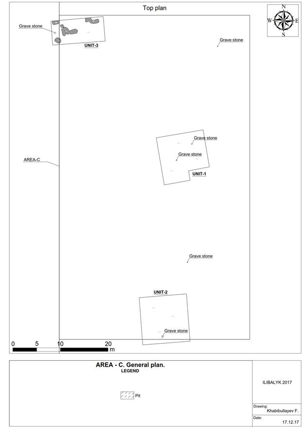
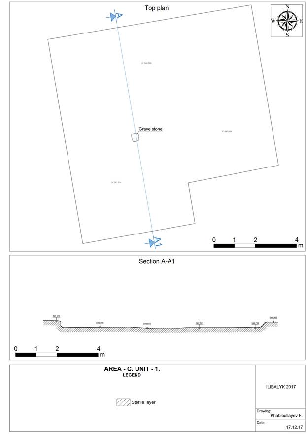
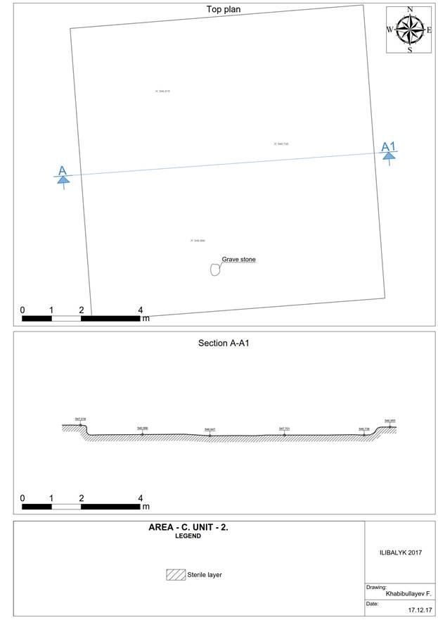
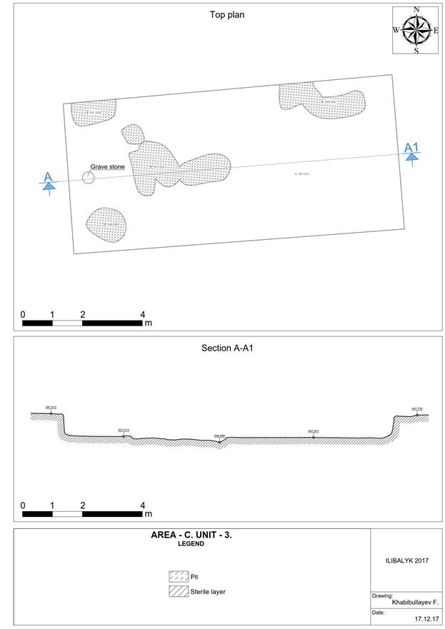
3.4.6 Photo Gallery
|
|
Photo 1. View of zone IV- "C" before the excavation works. View to the west. |
Photo 2. View of zone IV- "C" before the excavation works. View to the north. |
|
|
Photo 3. View of zone IV- "C" before the excavation works. View to the east. |
Photo 4. View of zone IV- "C" before the excavation works. View to the south. |
|
|
Photo 5. Kayrak after clearing the area after removing the first layer of turf and the soil of the eastern part of the excavation site. View to the east. |
Photo 6. Kayrak after clearing the area after removing the first layer of turf and the soil of the eastern part of the excavation site. View to the north |
|
|
Photo 7. Clearing the area after removing the first layer of turf and soil in zone IV-C in the central part of the excavation site. |
Photo 8. Clearing the area after removing the first layer of turf and soil in zone IV-C in the central part of the excavation site. |
|
|
Photo 9. Clearing the area after removing the first layer of turf and soil in zone IV-C in the central part of the excavation site. |
Photo 10. Clearing the area after removing the first layer of turf and soil in zone IV-C in the central part of the excavation site. |
|
|
Photo 11. Kayrak after clearing the area after removing the first layer of turf and the soil of the eastern part of the excavation site. View to the east. |
Photo 12. Kayrak after clearing the area after removing the first layer of turf and the soil of the eastern part of the excavation site. View to the north. |
|
|
Photo 13. Kayrak after clearing the area after removing the first layer of turf and the soil of the eastern part of the excavation site. View to the north. |
Photo 14. Kayrak after clearing the area after removing the first layer of turf and the soil of the eastern part of the excavation site. View to the east. |
|
|
Photo 15. Kayrak and ceramics after clearing the excavation area 2 in the southern part of the excavation IV- "C". View to the north. |
Photo 16. Kayrak and ceramics after clearing the excavation area 2 in the southern part of the excavation IV- "C". View to the east. |
|
|
Photo 17. Clearing and inspection of the kairak during the clearing of the future excavation area 2 in the southern part of the excavation "B". View to the east. |
Photo 18. Clearing and inspection of the kairak during the clearing of the future excavation area 2 in the southern part of the excavation "B". View to the north-east |
|
|
Photo 19. Zone 3 IV- "C". Fragment of a kairak with a cross in the loam of the second layer. View to the north. |
Photo 20. Zone 3 IV- "C". Fragment of a kairak with a cross in the loam of the second layer. View to the north. |
|
|
Photo 21. Excavation site 1 IV-«С» after clearing the soil and marking in the form of a square in the central part. View to the north. |
Photo 22. Excavation site 1 IV-«С» after clearing the soil and marking in the form of a square in the central part. View to the south. |
|
|
Photo 23. Excavation site 1 IV-«С» after clearing the soil and marking in the form of a square in the central part. View to the west |
Photo 24. Excavation site 1 IV-«С» after clearing the soil and marking in the form of a square in the central part. View to the east.. |
|
|
Photo 25. Excavation site 1 IV-«С». Beginning of excavation works in the eastern part after clearing the turf and removing the topsoil. View to the south-east. |
Photo 26. Excavation site 1 IV-«С». Beginning of excavation works in the eastern part after clearing the turf and removing the topsoil. View to the west |
|
|
Photo 27. Excavation site 1 IV-«С». Beginning of excavation works in the eastern part after clearing the turf and removing the topsoil. View to the south-east. |
Photo 28. Excavation site 1 IV-«С». Meeting of managers in the process of work to adjust further plans. View to the west. |
|
|
Photo 29. Excavation site 1 IV-«С». The beginning of excavation works. Removal of the second layer of soil. View to the south-west. |
Photo 30. Excavation site 1 IV-«С». The beginning of excavation works. Removal of the second layer of soil. View to the south |
|
|
Photo 31. Excavation site 1 IV-«С». The beginning of excavation works. Removal of the second layer of soil. View to the south |
Photo 32. Excavation site 1 IV-«С». The beginning of excavation works. Removal of the second layer of soil. View to the west. |
|
|
Photo 33. Excavation site 1 IV-«С». The beginning of excavation works. Removal of the second layer of soil. View to the south-west. |
Photo 34. Excavation site 1 IV-«С». Loamy layer in the excavation. Second layer of soil. View to the west. |
|
|
Photo 35. Excavation site 1 IV-«С». The loamy layer and the root system of plants in the excavation site. Second layer of soil. View to the north. |
Photo 36. Excavation site 1 IV-«С». The loamy layer and the root system of plants in the excavation site. Second layer of soil. View to the north |
|
|
Photo 37. Excavation site 1 IV-«С». The loamy layer and the root system of plants in the excavation site. Second layer of soil. View to the north |
Photo 38. Excavation site 1 IV-«С». The loamy layer and the root system of plants in the excavation site. Second layer of soil. View to the east |
|
|
Photo 39. Excavation site 1 IV-«С». The accumulation of cow bones in the layer of loam and roots of plants in the southeastern part of the excavation. Second layer of soil. View to the west. |
Photo 40. Excavation site 1 IV-«С». The accumulation of cow bones in the layer of loam and roots of plants in the southeastern part of the excavation. Second layer of soil. View to the north |
|
|
Photo 41. Excavation site 1 IV-«С». Removal of the second layer of soil in the northwestern part of the excavation site. View to the north. |
Photo 42. Excavation site 1 IV-«С». Removal of the second layer of soil in the northwestern part of the excavation site. View to the north |
|
|
Photo 43. Excavation site 1 IV-«С». Surface cleaning after removal of the second layer of soil in the northern part of the excavation site. View to the north. |
Photo 44. Excavation site 1 IV-«С». Surface cleaning after removal of the second layer of soil in the northern part of the excavation site. View to the west.. |
|
|
Photo 45. Excavation site 1 IV-«С». View after removing the second layer of soil and stripping the surface. View to the west. |
Photo 46. Excavation site 1 IV-«С». Вид View after removing the second layer of soil and stripping the surface. View to the west. |
|
|
Photo 47. Excavation site 1 IV-«С». View after removing the second layer of soil and stripping the surface. View to the north. |
Photo 48. Excavation site 1 IV-«С». View after removing the second layer of soil and stripping the surface. View to the north. |
|
|
Photo 49. Excavation site 1 IV-«С». View after removing the second layer of soil and stripping the surface. View to the east |
Photo 50. Excavation site 1 IV-«С». View after removing the second layer of soil and stripping the surface. View to the east. |
|
|
Photo 51. Excavation site 1 IV-«С». View after removing the second layer of soil and stripping the surface. View to the south. |
Photo 52. Excavation site 1 IV-«С». View after removing the second layer of soil and stripping the surface. View to the south. |
|
|
Photo 53. Excavation site 1 IV-«С». Fragment of a kairak with a cross after removing the second layer of soil and cleaning the surface. View to the south. |
Photo 54. Excavation site 1 IV-«С». View after removing the second layer of soil and stripping the surface. View from above. |
|
|
Photo 55. Excavation site 3 IV-«С». The process of marking the excavation with the help of an electronic total station "LEICA" View to the north .. |
Photo 56. Excavation site 3 IV-«С». The process of marking the excavation with the help of an electronic total station "LEICA" View to the north |
|
|
Photo 57. Excavation site 3 IV-«С». The process of marking the excavation with the help of an electronic total station "LEICA" View to the north |
Photo 58. Excavation site 3 IV-«С». The process of marking the excavation with the help of an electronic total station "LEICA" View to the north |
|
|
Photo 59. Excavation site 3 IV-«С». Area of the excavation site after marking. View to the north. |
Photo 60. Excavation site 3 IV-«С». Area of the excavation site after marking. View to the north. |
|
|
Photo 61. Excavation site 3 IV-«С». Area of the excavation site after marking. View to the east. |
Photo 62. Excavation site 3 IV-«С». Area of the excavation site after marking. View to the east. |
|
|
Photo 63. Excavation site 3 IV-«С». Area of the excavation site after marking. View to the south. |
Photo 64. Excavation site 3 IV-«С». Area of the excavation site after marking. View to the south. |
|
|
Photo 65. Excavation site 3 IV-«С». Area of the excavation site after marking. View to the west. |
Photo 66. Excavation site 3 IV-«С». Area of the excavation site after marking. View to the west. |
|
|
Photo 67. Excavation site 3 IV-«С». The beginning of excavation works. Removal of the second layer of soil. View to the south-west. |
Photo 68. Excavation site 3 IV-«С». Removal of the second layer of soil. View to the west. |
|
|
Photo 69. Excavation site 3 IV-«С». The loamy layer and the root system of plants in the excavation site. Second layer of soil. View to the north. |
Photo 70. Excavation site 3 IV-«С». Clearing the fragment of the kairak with the cross in the loam of the second layer. Work moment. View to the north .. |
|
|
Photo 71. Excavation site 3 IV-«С». Fragment of a kairak with a cross in the loam of the second layer. View to the north. |
Photo 72. Excavation site 3 IV-«С». Fragment of a kairak with a cross in the loam of the second layer. View to the north-east. |
|
|
Photo 73. Excavation site 3 IV-«С». Fragment of a kairak with a cross in the loam of the second layer. View to the north-east. |
Photo 74. Excavation site 3 IV-«С». The loamy layer and the root system of plants in the excavation site. Second layer of soil. View to the north. |
|
|
Photo 75. Excavation site 3 IV-«С». The beginning of excavation works. Removal of the second layer of soil. View to the north. |
Photo 76. Excavation site 3 IV-«С». The beginning of excavation works. Removal of the second layer of soil. View to the north. |
|
|
Photo 77. Excavation site 3 IV-«С». The area of excavation after removal of the second layer of soil. View to the north. |
Photo 78. Excavation site 3 IV-«С». The area of excavation after removal of the second layer of soil. View to the east. |
|
|
Photo 79. Excavation site 3 IV-«С». The area of excavation after removal of the second layer of soil. View to the south. |
Photo 80. Excavation site 3 IV-«С». The area of excavation after removal of the second layer of soil. View to the west. |
|
|
Photo 81. Excavation site 3 IV-«С». The beginning of excavation works. Removal of the third layer of soil. View to the north. |
Photo 82. Excavation site 3 IV-«С». The beginning of excavation works. Снятие Removal of the third layer of soil. View to the north-west. |
|
|
Photo 83. Excavation site 3 IV-«С». The beginning of excavation works. Removal of the third layer of soil. View to the north. |
Photo 84. Excavation site 3 IV-«С». The beginning of excavation works. Removal of the third layer of soil. View to the west. |
|
|
Photo 85. Excavation site 3 IV-«С». The beginning of excavation works. Removal of the third layer of soil. View to the north. |
Photo 86. Excavation site 3 IV-«С». The beginning of excavation works. Removal of the third layer of soil. View to the north. |
|
|
Photo 87. Excavation site 3 IV-«С». Removal of the third layer of soil. View to the north. |
Photo 88. Excavation site 3 IV-«С». Removal of the third layer of soil. View to the north. |
|
|
Photo 89. Excavation site 3 IV-«С». Removal of the third layer of soil. Surface cleaning. Work moment. View to the north. |
Photo 90. Excavation site 3 IV-«С». Removal of the third layer of soil. Surface cleaning. Work moment. View to the east. |
|
|
Photo 91. Excavation site 3 IV-«С». Removal of the third layer of soil. Surface cleaning. Work moment. View to the north. |
Photo 92. Excavation site 3 IV-«С». Removal of the third layer of soil. Surface cleaning. Work moment. View to the east. |
|
|
Photo 93. Excavation site 3 IV-«С». General view of the western part after removal of the third layer of soil. View to the north. |
Photo 94. Excavation site 3 IV-«С». General view of the central part after removal of the third layer of soil. View to the north. |
|
|
Photo 95. Excavation site 3 IV-«С». General view of the western part after removal of the third layer of soil. View to the north. |
Photo 96. Excavation site 3 IV-«С». General view of the excavation after removal of the third layer of soil. View to the west. |
|
|
Photo 97. Excavation site 3 IV-«С». General view of the excavation after removal of the third layer of soil. View to the west-south-west. |
Photo 98. Excavation site 3 IV-«С». General view of the eastern part after removal of the third layer of soil. View to the south. |
|
|
Photo 99. Excavation site 3 IV-«С». General view of the central part after removal of the third layer of soil. View to the south. |
Photo 100. Excavation site 3 IV-«С». General view of the western part after removal of the third layer of soil. View to the south. |
|
|
Photo 101. Excavation site 3 IV-«С». General view of the excavation after removal of the third layer of soil. View to the east. |
Photo 102. Excavation site 3 IV-«С». General view of the excavation diagonally after removal of the third layer of soil. View to the north-east. |
|
|
Photo 103. Excavation site 3 IV-«С». Loose loamy filling in the northern part of the excavation after removal of the third layer of soil. View to the north. |
Photo 104. Excavation site 3 IV-«С». Dark brown loamy filling in the western part of the excavation after removal of the third layer of soil. View to the north-east. |
|
|
Photo 105. Excavation site 3 IV-«С». Removal of the fourth layer of soil. View to the east. |
Photo 106. Excavation site 3 IV-«С». Removal of the fourth layer of soil. View to the south-east. |
|
|
Photo 107. Excavation site 3 IV-«С». Removal of the fourth layer of soil. View to the north. |
Photo 108. Excavation site 3 IV-«С». Removal of the fourth layer of soil. View to the north-west. |
|
|
Photo 109. Excavation site 3 IV-«С». Garbage pit? in the form of an elongated loamy filling in the northern part of the excavation after removal of the third layer of soil. View to the north. |
Photo 110. Excavation site 3 IV-«С». Dark brown loamy filling in the western part of the excavation after removal of the third layer of soil. View to the north-east. |
|
|
Photo 111. Excavation site 3 IV-«С». Grave spot? in the western part of the excavation after removal of the third layer of soil. View to the east. |
Photo 112. Excavation site 3 IV-«С». Grave spot? in the western part of the excavation after removal of the third layer of soil. View to the north. |
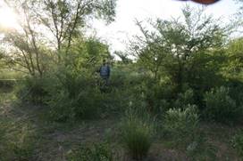
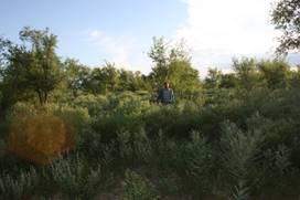
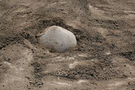
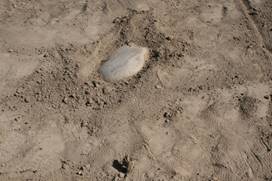
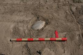
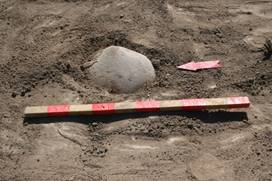
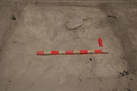
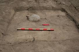
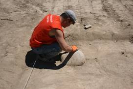

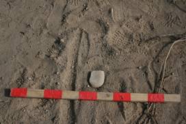
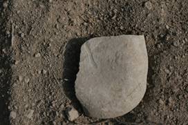
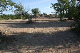
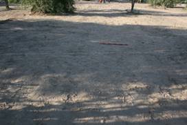
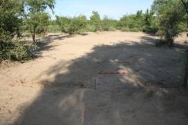
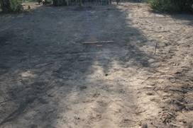
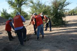
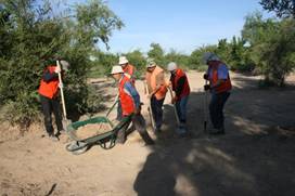
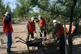
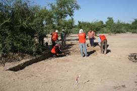
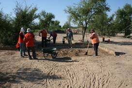
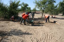
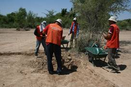
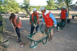
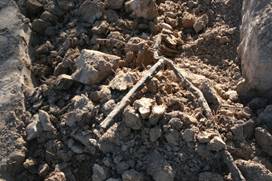
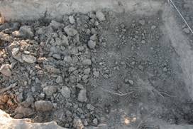
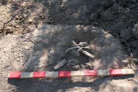
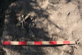
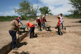
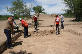
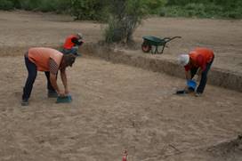
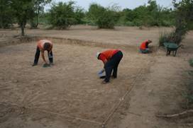
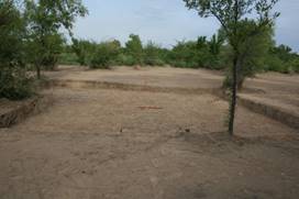
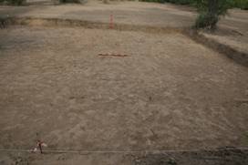
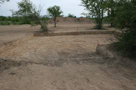
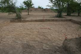
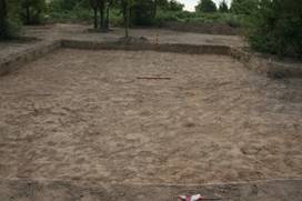
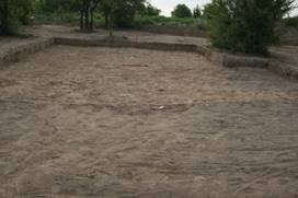
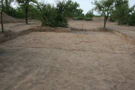
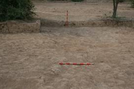
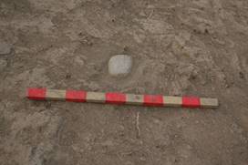
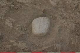
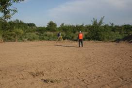
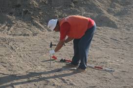
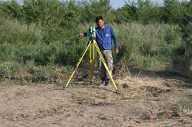
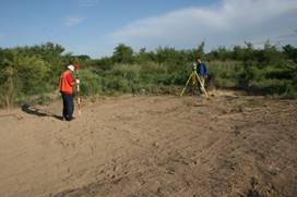
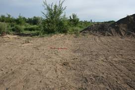
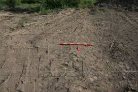
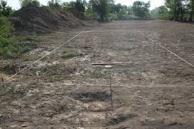
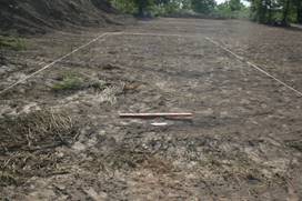
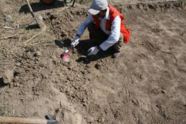
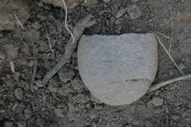
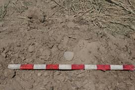
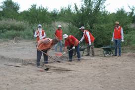
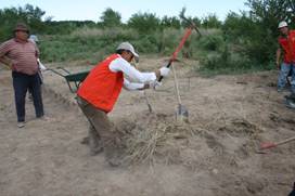
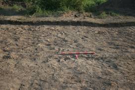
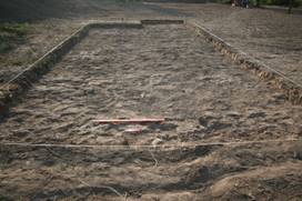
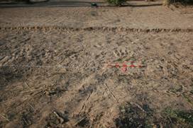
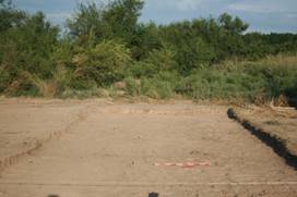
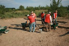
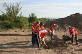
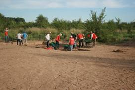
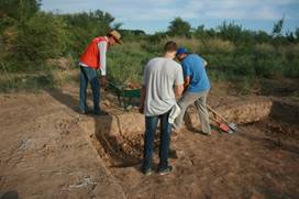
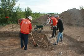
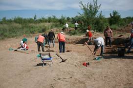
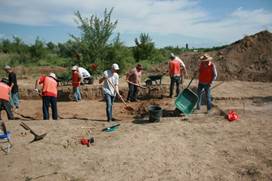
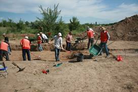
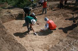
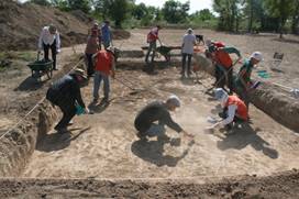
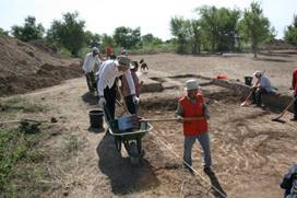
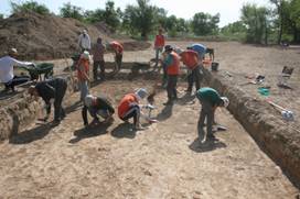
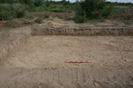
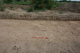
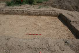
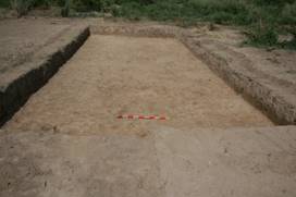
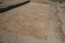
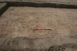
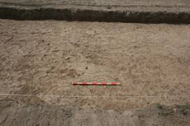
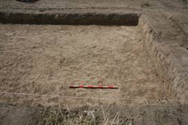
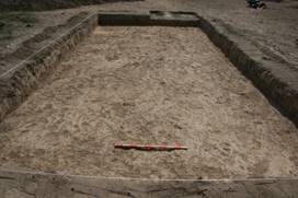
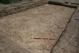
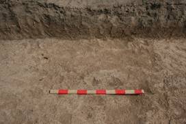
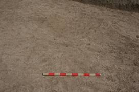
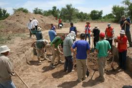
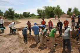
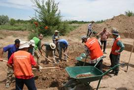
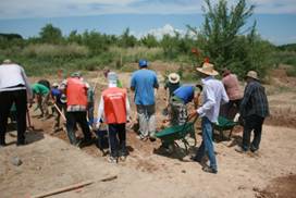
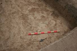
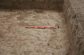
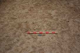
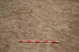
4. Grave Stone (Kayrak) Analysis (Tandy Institute)
Over one-hundred years have passed since the publication of Daniel Chwolson’s pioneering work Syrische Grabschriften aus Semirjetschie (1890) which demonstrably proved that there was a thriving Christian population in the cities of the Chuy Valley in modern Kyrgyzstan. Likewise, the short publication by Nikolai Pantusov “Надгробные христианские памятники в Алмалыке” (1903) gave evidence for a Christian community in city of Almalyk within the Ili Valley, in modern China. Since then, few Christian sites have been identified, and historians assumed—and published—that Christianity was limited to small populations within cities; moreover, evidence for Christianity in between Suyab and Almalyk was missing—that is, no similar archaeological monuments were known in modern Kazakhstan. Then in 2014, a villager discovered of an inscribed Christian gravestone near Usharal, Kazakhstan. In effect, the Usharal monument, bridged two historical centers, thereby signifying that Christianity was widely disseminated, not just in urban centers, but also in smaller rural settlements. Our 2016 and 2017 has uncovered an additional 14 kayraks, most are inscribed with a cross relief, while three have inscriptions. Other smaller stones have been found that may have served as grave markers, but we cannot be certain.
This section provides a preliminary art historical assessment of the Usharal-Ilibalyk kayraks. These should be considered “field notes” based on our first impression of the stones as they have been discovered in context. As we process the archaeological context, epigraphy, and iconography, comparing our objects with other examples our interpretation is subject to change. Our analysis here has three parts: first, we will discuss the distribution pattern and context of the kayraks; second, we will discuss the iconography; and third, we will provide a tentative translation of the inscriptions.
4.1. Distribution
All the Usharal-Ilibalyk kayraks were located in “Field III”. The area covers approximately 240 acres (located around 44° 7'39.98"N, 79°52'36.18"E) framed by: the highway A353 to the north, the village’s main thoroughfare (Zokenbaeva Road) to the west, the village to the south, and a stream to the east (named by the locals as “Қара-Cy”, or the “Black River”). The kayraks were concentrated in the north-eastern section within Field III, and that area was dubbed “Field IV” during the 2017 season. In general, Field IV is at a higher elevation than the rest of the field, even though it is near the stream’s floodplain. Our preliminary interpretation is this: During the Middle Ages, Field III served as a segregated suburb, being across the river and outside the walls of the main shakristan of Ilibalyk; however, we assume that the main ancient and medieval road occupied the same area as the current highway (A353) and so the area would have been conspicuous to travelers entering the city from the west and north.
The stones are classified as “kayraks” because that is the common term used for grave-markers in Central Asia, such as those discovered in Suyab (Ak-Beshim), Navakent (Krasnaya Rechka), Tashkent, and Almalyk. The Usharal-Ilibalyk kayraks share these basic characteristics, they are: (1) naturally polished or smoothed; (2) sandstone or granite; (3) mostly spherical or lozenge-shaped and; (4) none are larger than 40 cm, in any dimension. These kinds of stones are common in stream and river valleys in the area, but they are not naturally-occurring in Field III; in other words, they were brought here by human agency. It is also important to point out that none of the kayraks were found in an architectural foundation or wall; though one seems to have been reused in a later domestic context (but this could not be determined with certainty). The script and ornamentation of the kayraks strongly suggests they originally served as tomb markers. The distribution diagram (fig. 4.1) presents these two facts: (1) each kayrak was at least 5 m from the closest kayrak and; (2) there was a concentration, but not an identifiable pattern. While we assumed that there was (and is) a cemetery in Field IV, we could not be certain given the fact that this field was cultivated with heavy machinery throughout the twentieth century and, more recently, the field was landscaped when electricity poles and underground irrigation pipes were installed (see §3.1). These modern activities, not to mention earlier human interventions, disrupted the original layout of the land and may have led to the shifting of the kayraks.
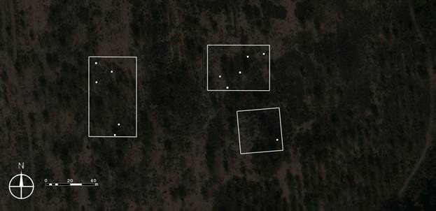
Fig. 4.1. Field IV Distribution Diagram. showing approximate kayrak distribution (superimposed on satellite image): solid white circles indicate 2016 finds; solid white squares indicate 2017 finds; white lines indicate boundaries of the 2017 excavation.
When the cemetery is identified and the burials excavated, our analysis of the kayraks will be more substantial. At the moment, we do not know: the scale of the cemetery (and hence, the population of the Christian community); the ethnicity (local or foreign); and their burial practices; whether the site was monastic or if it was mainly lay persons, etc. The 2017 Excavation confirmed that Field IV (that is, where the kayraks were found) was not part of a cemetery. Our best explanation is that the kayraks “drifted there” from another area of Field III—the catalyst for that movement remains unknown. The next course of action is to continue excavations around the periphery of Field IV in a systematic manner, so that the cemetery can be located. Until then any analysis made regarding the kayraks remains tentative.
4.2. Iconography
4.2.1 The Cross in Central Asia
The cross is a common design in many cultures around the world, formed by the intersection of one bar or line over another in a perpendicular fashion. As a graphic design, its success is due to its simplicity, but which can also lead to the cross’ ambiguity in archaeological contexts. In other words, cruciform shapes can be made inadvertently by children doodling or accidently by stone masons sharpening a chisel and, in these situations, it has no meaning. That is why scholars should be cautious in attributing religious identity to crosses found in Central Asia apart from taking into account the entire archaeological setting and, naturally, the associated epigraphy.
In tribal cultures, from the Mongols to the Vikings, crosses within circles symbolized the sun. Commonly this is depicted as a four-spoke chariot-wheel that rolls across the sky (Kaul 2003). The same form served as a tamgha for coinage throughout Central Asia and, incidentally, the cruciform surrounded by the rays of the sun is the current Emblem of Kazakhstan (shanyrak), signifying the roof-opening of a yurt (Naymark 2001:232-204). When Christianity was introduced to these cultures, it is quite possible that these sun symbols were reinterpreted with new significance. To Christians there was no theological problem with this appropriation since Sun-Day (“the Lord’s Day”) came to distinguish the faith from the Jewish Sabbath; moreover, there is a prophecy metaphorically describing the messiah as the sun (Malachi 4:2), leading to the orientation of churches towards the rising sun (Constitutiones Apostolorum II.7).
As Christianity expanded into Central and Eastern Asia, the cross became exclusively Christian and it was avoided by Muslims, Jews, and, presumably, Buddhists, who no longer used the four-arm Dharma-wheel by the 3rd century (Heilo 2015:55; Price 2013: 178). With that said, there is some exceptions where Buddhists and Manicheans used the cross to convey similar ideas to Christianity, perhaps influenced by Sogdian and/or Syriac Christians who used it as their chief identity markers (Klimkeit 1979). For example, there is a Chinese painting that, at first glance, seems to be Buddha, dated to the 12th or 13th century (Fig. 4.2.); however the figure holds a cross commonly found on Christian tombstones (Fig. 4.3.), so it has been interpreted as a Nestorian image of Jesus (Izumi 2006); and because of its ambiguity, it has recently been reinterpreted as a “Manichean Buddha Jesus” (Gulácsi: 2009). Without further data, we must allow for both interpretations; however, note that the cross is springing from a blossom just the figure is sitting within a blossom—there is a strong association between the figure and the cross.
The Christian cross was (and is) a pictogram that has deep history and, thus, has accrued complex connotations as it has spread to different societies. To understand the meaning of the cross in medieval eastern Asia, we must understand how the cross emerged in ancient western Asia. Among scholars a consensus has emerged that the cross was used by Christians prior to the legalization of Christianity in 313 AD and, thus, independent of imperial Roman ideology (Daniélou 1964: 136-145; Hurtado 2006; Longnecker 2015). Its non-Roman elements are important factors in assessing the cross’ function in the art and rituals of the Syriac Church. With that said, the cross was a shared symbol, expressed in the earliest Christian traditions and, as such, in the Middle Ages, it was used as a symbol of solidarity during times of persecution. As elucidated by historian David Wilmhurst, by the late 13th century, the leaders of the Church of the East came to believe that: “…Latin, Armenian, Greek, Jacobite and Nestorian Christians must overcome their mutual jealousies and work together” (2016: xi). These traditions sprang from the same root and, therefore, the cross represented a shared symbol, maintaining ideas that first coalesced in the first century.
Fig. 4.2. Chinese Hanging Scroll. Tempera and Gold on Silk. 153.5 x 58.7 cm. 12th or 13th century. Now at the Temple of Seiun-ji, Kõfu (Japan) (from Gulácsi 2009).
Fig. 4.3. Detail of Fig. 4.2. (from Gulácsi 2009).
The earliest connotations of the Christian cross were maintained throughout the centuries—including within the community at Usharal-Ilibalyk—so it is necessary to provide a summary of these connotations. The cross represented four main things: (1) the monogram of Christ’s name (thus, Christ himself); (2) the implement of Christ’s sacrificial death (crucifixion); (3) the sign of victory over death (Eternal Life, salvation) and; (4) divine auspices. These representations are clearly related to each other, but emphasize different aspects of Christian theology and was stressed at different points in history by different teachers. The explanations of these ideas will be published in our forthcoming publication.
From 2014 to 2017 our project has uncovered 14 Christian kayraks at Usharal-Ilibalyk. Possibly three other stones may have served similar purposes, though they are smaller, and their incisions are ambiguous, so we cannot be certain. Of all these, the most finely-carved example is the kayrak discovered in 2014, which has two crosses inscribed on it (fig. 4.4). It is also the largest such kayrak ever discovered in Central Asia—or at least, that has been published. Its unique location, decoration, and form indicates that the monument was meant to be placed in a conspicuous area of the settlement. For the sake of convenience, it has been titled the Usharal-Ilibalyk Stele (here, it will be henceforth referred to as the Stele). The Stele measures (at its widest points) 17x28x95cm. The stone can be classified as an irregular elongated rounded-prism, made from sandstone which is not from the local area, but common in the Ili Valley. It may have originally been placed flat on a grave. Alternatively, it may have stood upright, given these two characteristics: first, it was carved deliberately with a rounded base (up to the 20cm mark from the bottom) that may indicate that this section was interred and supported by soil; second, it has a secondary cross on the top, meant to be viewed from above.
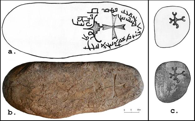
Fig. 4.4. Kayrak with Turkic Inscription in Syriac characters, from Usharal-Ilibalyk: a. drawing; b. photograph: c. drawings of the top incision [photo and drawings: Archaeological Expertise LLP].
The crosses adorning the Usharal-Ilibalyk’s kayraks are similar to types found at other Middle Eastern and Central Asian sites. This is the general typology:
6 Calvary Crosses
2 simple crosses
2 flared (pattée)
1 flared with a prong
1 forked (croix fourchée)
1 knobed (croix pommée)
1 patriarchal cross
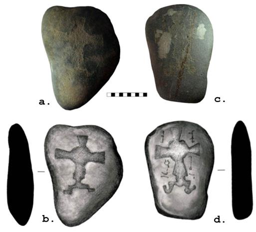
Fig. 4.5. Calvary Crosses on two kayraks discovered at Usharal-Ilibalyk in 2016: a. Kayrak, inventory number IB-16-3-1, b. 3-D digital scan and profile; c. Kayrak, inv. no. IB-16-3-2, d. 3-D digital scan and profile.
************
A kayrak discovered near Almalyk, China, appears to be rather large, which was just rediscovered” in the Hermitage Museum, in St. Petersburg; however, we have not been able to obtain its measurements. A photograph of it appeared online from which we obtain the drawing (fig. 4.5.4) however, it has since disappeared from the web.
Each of these types provides a variety of clues regarding the visual culture and the possible influences that shaped the Christian community at Usharal-Ilibalyk. For example, the quantity
of the examples of Calvary Cross confirms the overall affinity that the CoE had with other throughout Asia (Figs.4.4, 4.5). With that said, the “flowering cross” motif so common in the artworks from Syria to China, especially on the kayraks at Almalyk and Suyab, has not been found at Usharal-Ilibalyk. It is possible that they exist but have not been found yet by our limited excavation.
The Usharal-Ilibalyk example of a flared cross with a prong (or tang) at the bottom (found in 2017) is certainly an image of a processional cross that was commonly used during the liturgy in Early Christian and medieval churches—both in the east and west (Gignoux 2001; Cotsonis 1994). The prong at the bottom would be inserted into a wooden pole; alternatively, the pole would slip into a processional cross with a socketed base. The Usharal-Ilibalyk example can be compared other “pronged” or “socketed” examples found on kayraks at Almalyk and Suyab.
The use of the “patriarchal” type at Usharal-Ilibalyk (Cat no. IB-16-3-4) has no parallels in other CoE contexts in Asia. Just like the Calvary cross, the patriarchal cross was associated with the reliquaries of the True Cross. The most famous example is the 9th-century reliquary known as the Limburg Staurotheke which was made somewhere in the Byzantine Empire, most likely Constantinople (measuring 48x35x6 cm). The extra arms indicated that it contained a relic—unlike ordinary, non-reliquary, crosses. Later bishops added extra arms to the crosses on their heraldry or emblems to indicate their higher authority—this is commonly employed by bishops in both Greek Orthodox and Russian Orthodox Churches today (in the similar way that the papal crown actually consists of three tiaras, indicating the pope’s rank above secular kings). That is why the “extra-armed cross” is called a “patriarchal cross”, indicating top-ranking eastern bishops. In the west, the patriarchal cross is associated with the Duchy of Lorraine and is often called the “Cross of Lorraine”; however, the Duke of Lorraine were not first to use it in their heraldry, but rather the Hungarian King Béla III. It as depicted on the much-restored Gothic tomb within St.Matthias, Budapest, which was originally destroyed by the Mongols in 1241. The Hungarians, who aligned themselves with Roman Catholic, were highly influenced by their southern neighbors, the Byzantines who, as mentioned above, had reliquaries of the True Cross in this form.
The forked and knobbed crosses found at Usharal-Ilibalyk also have no parallels in CoE contexts in Asia. These are uniquely western types that developed on heraldry and were introduced to western Asia during the Crusades and the Latin Empire between 1095 and 1261. One wonders if the Latin church, with its cathedral established at Almalyk by the year 1314, had introduced these forms into Central Asia and accomplished ecumenical rapprochement with the Christian community at Usharal-Ilibalyk.
4.3.Inscriptions
At the conclusion of the 2016 Excavations, hopes were high that the two kayraks with written inscriptions discovered during the field survey of Field III would be quickly translated (see appendix 1; stones IB-16-3-2 and IB-16-3-6). However, the rather rudimentary nature of the inscriptions accompanied by the wear on the stone, made translation quite a challenge.
Compounding this difficulty is the lack of specialists who are fluent in Old Turkic. Fortunately, Dr. Mark Dickens, a scholar on the Church of the East and Assistant Professor at St. Joseph’s College at the University of Alberta and fluent in Old Turkic agreed to assist the team with the finds. However, all photographs sent to Dr. Dickens of the stones proved insufficient. Even 3-D scans of the stones failed to yield enough clarify for him to translate the kayraks.
Dr. Dickens had been able to translate the large meter-long stone found in 2014. It was even published in Dr. Christoph Baumer’s excellent publication on Assyrian Christianity (Baumer 2016). That translation will also be included in this brief survey due to the contextual nature of the find in relation to the newest stone with an inscription found in 2017.
So, as the international team began its 2017 excavations, neither of the two stones from 2016 had been translated. However, on June 6, during the clearing of topsoil by the bulldozer unearthed on the second day of the expedition a 30x27x16 cm stone with a chiseled cross in the center and surrounded by very clear written inscription. Photos were immediately taken and sent via email to Dr. Dickens. He produced a translation within three hours. The following translations and comments are those of Dr. Dickens concerning this stone, followed by the large meter-long kayrak found in 2014 as well as of a partial translation of stone IB 16-3-2. This latter stone was photographed more closely during the 2017 excavations and Dr. Dickens was able to decipher part of that one and its translation is below. IB-16-3-2 is of particular significance because according to Dr. Dickens it is totally in Syriac language as opposed to Old Turkic.
4.3.1 Translations for three of the stones from Usharal-Ilibalyk
4.3.1.1 The 2014 meter-long stone
This is the large gravestone found in 2014. It can be read and translated as follows:
Teginning öγli Petros
Baršabbā Quchaning öγli…
Tegin’s son Petros
Baršabbā Qucha’s son [name illegible]
The cross is one of the styles fairly common in the Semirechye corpus. The first line is written to the left of the cross, the second to the right. The first word Teginning is written underneath the second word, öγli, almost as if the stonemason did not plan in advance where to put the words making up the inscription. There is no writing underneath the cross; rather there is a curved base resembling a dish.
The language is Turkic, which is less common in the Semirechye corpus, but more common in the Almalyk corpus. There is no trace of a date in the legible text, but this is not uncommon in the Semirechye corpus. It appears to be the gravestone for two males, but there is no indication whether they are young or old. They are not described as youths, so possibly they are adults. Reference to each as the son of someone else is relatively common with the Syriac language gravestones, so it is not surprising with this one in Turkic. The absence of a date and the fact that the stone is apparently for two individuals suggests that it might possibly be dated to the years 1649 or 1650 SE (1337/38 or 1338/39 CE), when plague swept through this part of Central Asia, as shown all too clearly by the large number of gravestones in the Semirechye corpus dating from these two years. When many burials were required in a short space of time, there was less time to prepare the gravestones.
Also of interest and very typical of the Semirechye corpus of gravestones is the ethnic mixture of names. Thus, Petros (from Greek πέτρος) represents the biblical name Peter. By contrast, Baršabbā (Syriac for “son of the Sabbath”) is a name with a long pedigree in Central Asian Christianity, dating back to Baršabbā, the bishop of Merv who was present at the 424 Synod of the Church of the East and who seems to have inspired a legendary namesake whose name is recalled in various Syriac and Christian Arabic texts, including texts from Turfan found nowhere else. The name also occurs in the corpus of Syriac gravestones from Semirechye and amongst the Syriac inscriptions located near Urgut, Uzbekistan.
It is interesting that the father of Petros has the Turkic name, Tegin, originating in the Turkic title “prince” – this phenomenon of Syriac names and Turkic names in different generations of the same family is very common in the Semirechye corpus. Also common is the situation of a double name – one Syriac, one Turkic – like that of, Baršabbā Qucha; the latter is a variant on the Turkic word for “strength.” As noted below, there may well be a connection between this gravestone and the gravestone found in 2017.
4.3.1.2 The 2017 “priest” stone
This is the gravestone found in 2017. Again, it is in Turkic and again it appears to be the grave of two individuals. Are we also dealing here with victims of the plague?
Baršabbā Qučning qabrāsi
Yošmid kāhnāning qabrāsi
The grave of Baršabbā Quč
The grave of Yošmid the priest
Is it a coincidence that this gravestone and the first both contain the double name, Baršabbā Quč(a)? It seems unlikely that two people in the community would have the same combination of these two names. Of the two variants of the second component – Quč and Quča – the former better transliterates Turkic quč, "strength." Also of interest is the Turkic grammatical structure (found twice on the stone) containing the genitive case ending -ning and the possessive ending -si on the end of the word qabrāsi. Incidentally, the only other known occurrence of this form with, qabrāsi is found in an Öngüt Turkic Christian gravestone from Inner Mongolia.
Regarding the name Yoshmid, the consensus is that it comes from the Sogdian word for "Sunday" (lit. first day) and is therefore cognate with Persian "yakshanbe" (یکشنبه ), still used in much of Central Asia as the word for Sunday (e.g. Tajik Якшанбе; Uzbek yakshanba; Kazakh Жексенбі). It parallels Christian traditions elsewhere, including in Syriac, where one finds the name Bar hadbshaba, "son of Sunday." Interestingly, the word used for “priest” (kāhnā) is Syriac, but it is not the usual word (qašišā) found on these gravestones.
4.3.1.3 Stone IB 16-3-2
As mentioned above, this stone has a complete inscription but has yet to be fully translated. Plans for 2018 include having Dr. Dickens come to Kazakhstan so he may look at the kayraks directly. For this kayrak, he has been able to translate the following:
This is the grave
(of?) Shirin the believer
Unlike the other two graves in the corpus, this grave is entirely in Syriac. Most of the inscription (apart from the name) is hard to make out on the images, but based on the visible letters and the standard formulas found in these stones, the proposed reading is reasonable. The name Shirin is of Persian origin, meaning “sweet” (still a popular female name in Central Asia to this day). It had special resonance in Christian circles, since the Christian queen of the Sassanian shah Khosrow (Chosroes) II (r. 590-628) was named Shirin. It is unclear if the particle for the English “of” is present at the beginning of the second line. Since it is unlikely that there were many if any Syriac speakers in these Central Asian Christian communities, it is unclear whether those writing out the gravestone inscription or those carving it in the stone were aware of this grammatical error.
4.3.2 Future analysis
The following translations provide fascinating insights to the Christian community of Ilibalyk. First, and perhaps quite obvious, Ilibalyk contained a significant Christian community with clergy and Christians spanning more than one generation. Second, the presence of clergy begs the question as to where the church building might be located. Third, Turkic language on two of the three stones translated to date demonstrate once again that Christians were indigenous to the region. These people were not foreigners bringing a “foreign religion” and if Baršabbā Quč(a) referenced on the 2014 kayrak and the 2017 kayrak are the same person, this may demonstrate entire families of Christians spanning generations.
Further detailed analysis on these gravestones will certainly follow in upcoming publications. Such findings also emphasize the need for further investigations in the field of Usharal-Ilibalyk. Of particular importance is the hope of finding the graves that accompany these stones. Human remains with their accompanying analysis could provide many answers to exactly who and when this community thrived in Ilibalyk.
5. ARTEFACTS ANALYSIS
Pottery, stone, metal, glass and bone artifacts were found during research within the different units (Areas A, B, & C), during the excavations at the medieval site of Ilibalyk.
Glass and stone jewelry.
Pearly bead. Pearly bead, white, consists of three links. One side is decorated with two circles of 0.4 cm in diameter. Contains two drilled holes. Dimensions: diameter 0.2 cm, length 1.2 cm, width 0.8 cm, thickness 0.4 cm. (IB 17-IV-B-1-29).
Stone faceted bead. Stone faceted white bead. Irregular-shaped bead with six facets. Has one drilled hole with a diameter of 0.2 cm. Dimensions: diameter 0.8 cm, width 0.7 cm, thickness 0.4 cm. (IB 17-IV-B-1-19).
Pearly bead. Pearly flat white bead. Square with rounded corners. Has a drilled hole, with a diameter of 0.2 cm. Dimensions: length 1.1 cm, width 0.7 cm, thickness 0.3 cm. (IB 17-IV-B-5-27).
Glass ring fragment. The ring fragment is made of turquoise-colored glass. Part of the circle has survived. There is a notch at the top in the center. Dimensions: diameter 2 cm, internal - 1.4 cm, width - 0.4 cm, thickness - 0.4 cm. (IB 17-IV-B-5-28).
Metal jewelry.
Copper alloy from a necklace. The copper necklace was found in the excavation IV-B-4. The necklace is a disc-like, round shaped medallion and covered with oxidized copper. At the top, there is a round punch hole 0.2 cm in diameter. No imagery is detected on the necklace. Small chips along the edges. Mintage casting. Dimensions: diameter 3 cm, height 0.2 cm. (IB 17-IV-В-4-22).
Iron and non-ferrous metal items.
Bronze ring. Found in the first layer of the excavation Area B. The product has a perfectly round shape, and is oxidized with green copper. Dimensions: diameter 3.8 cm. Rim width 0.7 cm. Inside diameter 2.4 cm. (IB 17-IV-B-2-1).
The lid is from a copper receptacle. Found in the SE sector of the excavation Area B. The lid is covered with oxidized copper. The upper part of the lid is hemisphere-shaped. At the top there is a loop-shaped handle with a diameter of 0.7 cm, the diameter of the hole is 0.3 cm. A flange is placed on the edge of the lid. Lid dimensions: diameter 2.4-2.8 cm, height 1.3 cm. (IB 17-IV-В-1-5).
An iron object. An iron object, possibly theshaft of an arrow, found in excavation IV-B-3. The shaft around the section is extremely corroded. The site of the possible attachment of the arrowhead to the arrow indicates scrapping. The length of the shaft is 3.1 cm, diameter is 0.4-0.7 cm. (IB 17-IV-B-3-30).
Coins.
Silver coin. Found in the first layer of the excavation Area B in the SE sector. The coin is slightly warped. Dimensions: diameter 2.2 cm, height 0.2 cm. (IB 17-IV-В-1-2).
Copper coin. A copper coin of the Chagataid state was found in Locus 11 of the excavation IV-B-4A, in the layers of the second construction horizon. The coin is covered with oxidized copper. The legend and the image are unreadable. Dimensions: diameter 3 cm, thickness 0.2 cm. (IB 17-IV-В-4A-17).
Copper coin. A copper coin found in locus 11 of excavation IV-B-3. A round-shaped coin and covered with oxidized copper. The legend and the image are almost unreadable. Mintage casting. Dimensions: diameter 3.4 cm, height 0.2 cm. (IB 17-IV-В-3-20).
A piece of copper coin. A piece of copper coin was found in locus 1 of excavation IV-B-3. Part of the coin is broken and covered with oxidized copper. The legend and the image are unreadable. Mintage casting. Dimensions the surviving fragment of the coin: diameter 3.4 cm, thickness 0.2 cm. (IB 17-IV-B-3-21).
Terra-cotta.
Ceramic spindle whorl. The spindle whorl is made froma pottery sherd. The spinning wheel has a drilled hole closer to the edge. The edges of the spinning wheel are uneven. The wheel’s diameter is 2.6 cm., thickness is 1.1 cm. Inside diameter is 0.7 cm. (IB 17-IV-B-1-3).
A pottery fragment with letters. Thispottery sherd was found in the eastern part of the excavation B. On the outside, there is a possible Syriac (?) letter carved on the raw clay. The letter B or “Beth”is possible. The other letters depicted on the break are not readable. Dimensions of the fragment are 6.5x0.8 cm (IB 17-IV-B-1-4).
Ceramic spindle whorl. The spindle whorl is made from a watering bowl, the wheel is covered with a turquoise glaze. The wheel’s diameter is 2.5 cm., thickness is 0.8-1 cm. The diameter of the drilled hole 0.7 cm. (IB 17-IV-C-3-15).
Ceramic spindle whorl. The spindle whorl is made of a pottery sherd. It is an oval disc, made from a piece of an easel red-clay thin-walled vessel. The spinning wheel has a drilled hole closer to the edge. The edges of the spindle whorl are uneven. Its diameter is 3.4x3.1 cm., thickness is 1.4 cm. Inside diameter is 0.8 cm. (IB 17-IV-В-4-23).
A piece of ceramic spindle whorl. This spindle whorl is disc-shaped and made from a glazed bowl, covered with a blue glaze. A portion of the disk is broken along the center of the drilled hole. Its diameter is 3.4 cm., thickness is 0.7 cm. The diameter of the drilled hole is 0.7 cm. (IB 17-IV-В-4-24).
Procurement of ceramic spun. This spindle whorl is made of a grey clay easel ceramics. It is a disc-shaped and constructed from a thin-walled vessel. In the center, there is a drilled depression. Its edges are uneven. Its diameter is 4 cm., thickness is 1.4 cm. Diameter of the hole is 0.7 cm. (IB 17-IV-В-3-25).
Archaeologically intact pottery.
No archaeologically intact pottery remains were found during excavations.
Bone artifacts.
Bone item. A carved bone, presumably from a loom, was found in the excavation IV-B-4. The item is long, round and flattened, with the traces of seams, slices and chips and made from the rib of a large animal. One end of the product is rounded with traces of grooving for the threads forming the rounded head. The other edge is squared and has a carved groove for holding thread in place. Its length is 6.3 cm, the diameter of the rounded part is 1 cm, its thickness is 0.8-1.2 cm. (IB 17-IV-B-4-26).
Stone products.
Headstone Kayrak 1. After investigating the surface of the marked excavation Area B, in the north-eastern section on the surface, near the elm trees and grass, there was discovered a large, diamond-shaped grey stone. Thisstone was lying near the marked edge on the eastern side of the excavation, partially hidden in the 10 cm-deep sod and ground. The stone was lying with its flat side partially on its side, and partly with its edge submerged into the loamy soil. The stone’s surface on one side is flat, with the natural cracks. The other side is elevated with beveled outward edges, full of cracks and small chips. The edges of the stone are uneven, rounded or turned and beveled edges. Inside the hollow surface, there is a cross engraved via deep chiseling method to a depth of 0.4-0.5 cm. The cross has four uneven crossings. The cross has a crack in the left part, coming down to the right side. The dimensions of the cross are 10.5x6.8 cm. (IB 17-IV-C-6).
Headstone Kayrak 2 with an epitaph inscription. While clearing the surface and digging the first layer of soil in the central part of excavation C, between four live elm treeswhich formed a rectangular area, at the site of the excavation at a depth of 10 cm, a massive square stone was found with a flat surface on two of its opposing sides. When thoroughly inspected, the stone was found to be flat, have a slightly chiseled surface and carved cross, with the rays going outwards. The stone can be identified as a headstone for a grave or a kayrak. The kayrak was laying with its flat surface on the loamy soil. The kayrak's shape resembles a rounded square. The top edge is in the shape of an arc. The surface of the stone from one edge has been leveled, on the other edge it has a slight naturally flattened area. The surface of this uneven leveling forms a jagged square the size 15 cm. It containes 34 characters, or letters engraved with a sharp, solid object. The center of this peculiar square has an engraved cross. The cross has an intersection of four cross-hairs going outwards that connect at the center of the main ones and endwith aflared split, resembling a Maltese Cross. Inside the cross there is a circular, raised shape. The size of the cross is 15x15 cm, the diameter of the circle is 1.3 cm. The kayrak's dimensions are 26x29x15 cm. (IB 17-IV-С-7).
Headstone Kayrak 3. This kayrak is a granite stone. The shape of the kayrak is circular with smooth, rounded edges on either side. The surface of the kayrak is flat on each side. The edges of the kayrak are smooth and rounded. The surface of the stone from one edge is flattened level, on the other edge it has been hollowed as a result of the engraved cross. The cross, engraved with a sharp and solid instrument, is reminiscent of a Maltese Cross, known from different images and publications. The cross has four rays whose ends split in different directions. Inside the cross there is a circular, raised shape. The size of the cross is 13x10.5 cm, the diameter of the circle is 2 cm. The kayrak's dimensions are 21x24x4 cm. (IB 17-IV-C-8).
Headstone Kayrak 4. The kayrak is made from a large, flat, gray stone. The surface of the kayrak is flat and level on each side. The edges of the kayrak are uneven, but rounded, flowing into its broken edges. Its flat surface contains an engraved chiseled, square performed with a sharp instrument. This square image on the stone can be interpreted as an image of the Scripture - the Bible or the Gospel (Dolgushev A.S.). The size of the engraving is 26.5 x 20.5 cm. This kayrak's dimensions are 41x32x7 cm. (IB 17-IV-C-2-9).
Headstone Kayrak 5. This kayrak was made from a granite stone. It is round, with smooth rounded edges on both sides. The bottom the stone's edges are somewhat sharpened. The surface of the kayrak is flat and level on both sides. The edges of the kayrak are smooth and rounded.One of the stone’s edges contains a small chip, which likely occurred during the process of engraving the cross.
The surface of the stone has been flattened and is level on both edges. One of them has a groove resulting from the cross. The cross was engraved with a sharp, solid instrument and is reminiscent of a Maltese Cross, known from different images and publications. The cross has four rays, the ends of which split in different directions. At the bottom of the cross there is an extension in the shape of an engraved “staff.”At the top of the staff there is a 14.5 cm long curvy engraved ribbon. The size of the cross is 9.8x8.8 cm, the length of the staff is 4 cm. The kayrak's dimensions are 29x28x7.2 cm. (IB 17-IV-B-3-10).
Headstone Kayrak 6. This kayrak was made from a granite stone. The shape of the kayrak is smoothed oval, rounded in an outwards directions the edges on both sides. One edge of the stone, like the opposite side of it, has been chipped off. The surface of the kayrak is weathered and even. It has a groove resulting from the engraved cross. The cross is executed in a simple manner and engraved with a sharp, solid instrument. The manner of cross depicted is known by different images and publications. The size of the cross is 5.2x3 cm. The kayrak's dimensions are 16x14.5x5.2 cm. The size of the cross is 3.7x4 cm. The kayrak's dimensions are 10,3х8,7х3 cm. (IB 17-IV-С-1-11).
Headstone Kayrak 7. This kayrak was made from a granite stone. The kayrak is tear-drop-shaped, with smooth rounded edges on both sides. The bottom of one of the stone's edges is chipped. The surface of the kayrak is curved in one direction. One edge of the kayrak is smooth, and the end of it curves in different directions. The other edge is curved inwardand has a small chip, as well as some naturally created depressions.
On the upper flattened, level edge, there is a depression resulting from the engraved cross. The cross, engraved with a sharp and solid instrument is reminiscent of the Maltese Cross. The cross has four rays whose ends split in different sides. At the bottom, the cross stands on a raised mountain-shaped engraved image. Thismountain may be interpreted as depicting Golgotha, the site of Jesus’ crucifixion. The top of the “Golgotha” is high, and the bottom of the depicted “mountain” descends smoothly in opposite directions. To the left of the cross from top to bottom there is a curvedengraved ribbon 10 cm long. The size of the cross is 8x8cm, the length of the "Golgotha" is 6.2 cm, the height in the middle is 2.2 cm, at the edges it is 1 cm. The kayrak's dimensions are 23x17x4 cm. (IB 17-IV-B-3-12).
Headstone Kayrak 8. The kayrak is made ofa granite stone. Oval in shape, the kayrak is smooth and rounded in an outwards direction with the edgescontaining chips on both sides. The surface of the kayrak used to be even and flat from two edges, with its edges being flat and rounded. At the time of the excavation it has chips on the right and bottom edges.
The surface of the stone from one edge has a slight slope. The other edge is flattened and has been hollowed out resulting from the engraved cross. The cross engraved with a sharp, solid instrument is cross-shaped and resembles a St. Andrew's cross, which is the shape of the cross on which tradition says the Apostle Andrew was crucified. This cross is known by various images and publications, and is also the symbol of the flag of Scotland and the Russian Navy. Part of the cross-hairs is chipped off. The size of the cross is 3.7x4 cm. Kayrak's dimensions are 10.3х8.7х3 cm. (IB 17-IV-С-13)
Fragment of a granite cross. In the south-eastern part of the marked excavation Area C, following removal of the topsoil layer on the loamy surface, a rectangular-shaped flattened stone made from fine black granite with traces of chips at one end. The stone was located on the surface of the soil near the edge of the excavation. After a thorough examination of the stone there were found traces of abatement and polishing with a sharp, solid and abrasive instruments. This finding could possibly be identified as the upper head beam to a cross.
The possible cross was made of granite stone. Oval in shape, the stone fragment appears to be smoothed and rounded. It widens at the base on either side. The surface of the stoneon both sides is smooth and flatwith rounded edges, narrowing from the center towards the edges. At the time of the excavation, if this interpretation is correct, three-fourths of the cross have been lost.
In a partially remaining central part of the cross, there is an arched groove, which once was round, and appeared to have a diameter of approximately 4 cm. This stone’s dimensions are 12x7x3-4.5 cm. (IB 17-IV-C-14).
Headstone Kayrak 9. The kayrak is made of a granite stone. The shape of the kayrak is an oval, rounded into an outwards directions with the edges on both sides. The surface of the kayrak used to be even and flat on both sides, with its edges being flat and rounded. At the time of the excavation it was found to have chips on the upper and bottom edges.
The surface of the stone from one edge is slightly sloping, on the other edge it is flattened and has been hollowed out as a result of the engraved cross. The cross, engraved with a sharp and solid instrucment, has two crosshairs. At the bottom, the cross rises on a peculiar platform with a partial additional notch in the form of what may be a mountain, which could be interpreted as a Golgotha, a depiction of the site of Christ’s crucifixion. The top of the “Golgotha” is high, and the bottom of the depicted “mountain” descends smoothly to the left. (See above for a possible differing interpretation). The size of the cross is 4.5x4.7 cm, the length of the "Golgotha" is 6.2 cm, the height in the middle is 2.2 cm, at the edges it is 1 cm. The kayrak's dimensions are 7х8х3,5 cm. (IB 17-IV-С-3-15).
Whetstone. This sharpener is made of a solid stone andhas an elongated, cylindrical shape, with three smoothed faces, and smoothed edges. One side between the faces is deeper and bears traces of abrasion. The length of the whetstone is 13.4 cm, diameter - 4.2 cm. (IB 17-IV-B-4-18).
A fragment of a whetstone. This sharpener is made of a brownish sandstone, is an oval and elongated in shape. The working side is hollowed out and bears traces of abrasion. The unworked surface, like the edges, is slightly rounded. There is a chip in the middle of the stone. The non-worked side has traces of denting and chipping. The length of the whetstone is 8 cm and its width is 8-9.8 cm with a thickness of 3.6 cm. (IB 17-IV-B-4-31).
6. CONCLUSIONS
The 2017 excavations at Usharal-Ilibalyk provided significant additional discoveries of inscribed gravestones (karayks) without finding actual graves and remains which the stones commemorate. As mentioned above on volume-1.pg. 24, the expeditions goals are summarized as follows:
Our focus in 2017 is to recover the remains of Christian heritage, such as architecture and additional gravestones (kayraks) with Syriac and Christian symbols, and identify and excavate the actual burials that are commemorated. These studies will provide new information regarding the spread of Christianity along the Great Silk Roads together with its role in the cultural life of the Karakhanid Empire through the Chagatai Khanate of the Mongolian Empire as well as its relationship with other religions.
Our international team found new gravestones starting from the first days in the field, with the significant discovery of what we are dubbing the “Priest stone.” By the second day, we had a clear translation of what this stone records (see volume-1, pg. 151). Naturally, the idea we might soon discover actual graves seemed a logical reality. Yet, despite finding a total of ten new stones (see volume 2, pgs. 253-258), five of which are undoubtedly gravestones (kayraks), the discovery of human remains, or even burial chambers proved elusive.
As the report details, the team utilized an extensive ground penetrating radar (GPR) analysis on the site of the previous year’s kayrak discoveries to determine the best suited locations to excavate for potential graves. Certain anomalies seemed to reveal man-made disturbances, and the most promising indicators were examined up until the final day of the dig. The team also thoroughly examined certain changes in the soil discovered during the process of topsoil and plow zone removal.
Most certainly, significant artifacts revealing human activity on the site were discovered. Area B (see volume-1, pgs. 69 - 112) in particular revealed evidence of a possible structure as well as a possible metallurgical installation. Yet, preliminary indications infer that this activity occurred during later stages of occupation (14th century), after the anticipated use of the area as a cemetery. Possible reasons for finding no direct evidence for the graves themselves will be suggested below.
What the kayraks tell us
We can unequivocally state that a Christian community connected to the Church of the East lived in Ilibalyk. This community was organized-- with clergy present-- as the “Priest Stone” testifies: “…this is the grave of Yomshid, the priest.” In addition, of the three kayraks that have been at least partially translated, all of them have Turkic names listed: BashabbaQu’cha (Kush), Tegin, and Shirin. The other two names given have ecclesiastical connotations: Petros, (Greek for “Peter,” the first of the apostles of Christ) and Yomshid (possibly a Sogdian-derived name for “Sunday” the primary day of worship for Christians as it commemorates the day of Christ’s resurrection).
We also know that two of these stones are in Old Turkic and the other is in Syriac. This, combined with the Turkic names, confirms two things: First, it demonstrates the indigeneity of the community there, whose primary language was that of the local population—Old Turkic. Second, the Syriac confirms the Church of the East connections and its continued use as a liturgical language.
Other inferences can be drawn from the evidence at hand. If BarshabbaQu’cha and Barshabba Kush are one and the same person (see volume-1, pgs. 150-151 above), then we see familial connections in the community and possible multi-generations of Christians at Ilibalyk. One stone, the large one-meter stele, mentions the burial of BashabbaQu’cha’s son. The “Priest Stone” commemorates Barshabba Kush himself. The decorative appearance of these stones combined with the fact that they contain written inscriptions indicates a type of elite status, either from an educational, clerical, or economic standpoint.
Of the twelve possible kayraks discovered to date, seventy-five percent appear with only an incised cross. In our report, Dr. Charles Stewart has shown some of the connections that the artwork of the crosses, varying from simple, rough-hewn crosses, to more elaborate, decorative pieces (see volume-1, pgs. 144 - 149). It is possible to infer from this, that some in the Christian community at Ilibalyk were simple, ordinary people of modest means. Many could have been illiterate.
Most intriguing, however, is the appearance of the “calvary cross” designs and others of the so called “Maltese crosses” or “Crusader crosses.” The diffusion of these cross designs and patterns which appear in the Middle East and even western Christendom during this same time period should not be overlooked. While certainly not unique in the overall gravestone corpus throughout Semireche, it once again demonstrates the interconnectedness of Christianity spanning the length of the Silk Road. This is not to deny certain doctrinal and theological differences that divided the various confessions of the period, however, shared artwork and symbolism also implies connections to a similar faith, particularly around the concept of the atonement of Christ as the sacrifice for human sin.
While much has been written concerning the Christological controversy of the 5th century which led to the first major rift in Christianity, often overlooked, or even unknown, are times when members of the Church of the East, Jacobite (Monophysite) Christians, and Roman Catholics interacted, worshipped together and acknowledged the others’ faith.
Illusiveness of dating
While examination of the kayrak written inscriptions is ongoing, pinpointing exact dates for the Christian community at Ilibalyk remains elusive. Original examination of the meter-long stele discovered in 2014 led our team to initially believe they detected and deciphered a date of 1162 A.D. This date was widely reported through the first press releases following the 2016 excavations. However, subsequent examination revealed that the word originally thought to be a date-- attributing Syriac numerals which utilize letters for numerical designations-- was actually the Turkic word for “son of.” This confusion is understandable given the fact that both Syriac and ecclesiastical Old Turkic utilize the same script. While many gravestones found in modern Kyrgyzstan during the Russian imperial era have inscribed dates, so far, none of the kayraks from Ilibalyk are found to contain dates. This leaves us with only being able to supply a range of dates spanning from the 11th through 14th century.
We do have a few clues that can help us narrow down the time period in question. C-14 dating from the 2016 excavations of a midden pit just a few hundred meters from the location of the kayraks provided a date squarely within the 13th century (1217 – 1270). Ceramic typology and numismatic finds, while far from specific, puts most of our 2017 excavations within the later 13th to early 14th century. Unfortunately, ceramic typology in the region is still too underdeveloped to allow us to pinpoint dating with further accuracy. Also, the coins found in 2017 have proven too corroded to yield dates. In addition, carbon samples taken during the 2017 excavations still await analysis.
Why no graves?
Evidence for occupation with both industrial and domestic usage in the same location as the kayraks raises the question as to why these activities were taking place in the vicinity of a necropolis. Discoveries of stones below the plow zoneseem to imply that the stones were moved sometime in the 14thor 15th century previous to modern agricultural disturbance.
While certainly speculation, it is worthwhile to consider some potential causes for the mystery of grave stones with no graves. First, Soviet industrial plowing could have moved the stones a significant distance from their original provenience. The village of Usharal was established in the 1930s at the height of agricultural collectivization in Kazakhstan. Plowing utilizing heavy tractors might have moved the gravestones a considerable distance from the graves they commemorated. This could certainly have been true of those stones uncovered during the initial clearing of the presumed plow zone by the excavation team’s bulldozer. In addition, the installation of new electrical lines in the area near the excavations within the past decade may also have resulted in further disturbance of the areas in question. However, this accounts for less than half of the stones found in 2017. The remaining kayraks, particularly stones in Area B, unit 3 (see volume-1, pgs. 75 – 79, and volume-2, appendix 2, pg. 253) were found under the plow zone and described by the excavation team to be in situ. Additionally, as previously indicated, an American study on the impact of plowing on cultural remains demonstrates that most plows cause relatively minimal horizontal displacement of heavy objects.
Second, the kayraks might have moved due to natural causes, most probably flooding. The site of Ilibalyk is bracketed east and west by two small streams that are tributaries of the Ili River. As mentioned above (see volume-1, pg. 11), the Ili itself probably contained significantly more water in the medieval period due to the lack of modern irrigation which siphons off water in both China and Kazakhstan today. It would seem logical that the streams, the Karasu and Dirgulyk, probably contained a larger amount of water as well. Heavy snow melt or spring rains over the course of time could certainly have washed the kayraks from their original locations. However, due to the sparsity of historical records or any such incident and no strong evidence of flooding, such as heavy silt beds, this is less than an ideal explanation.
Third, perhaps the gravestones were moved in the centuries following Christian occupation. Anecdotal stories from villagers at Usharal tell of residents utilizing large stones in the area to include in the foundations of their new homes they built during modern times. The gravestones are an optimal size for such purposes. Other stones of similar size as the kayraks were used as foundations for wooden pillar supports in at least one structure in Ilibalyk, as appears to be the case from a structure excavated in the 2016 dig in Field I. (see 2016 Ilibalyk field report, volume-1, pg. 40, description of element [locus] 16).While the thought of moving stones commemorating the dead might go against religious convention and the worldview of adherents to a variety of religions; a new people, ignorant to the kayraks’ purposes or even those unsympathetic or possessing animosity to Christianity, could have recycled them for their own purposes.
Fourth, excavations and GPR scans possibly failed to go to a sufficient depth. With the exception of one study from the 19th century (Pantusov, N. 1886) and one study in Uzbekistan in the 1990’s (Zhukova, 1994), we have almost no record of Christian burials in the region. Ground penetrating radar scans of Field IV went to a depth of 348 cm. While the team certainly did due diligence in determining when they thought they had reached below the layer of cultural material, it is possible that the graves lay deeper than anticipated or that our current scans indicated. This seems unlikely, however, as grave shafts from Pantusov’s investigations in today’s Kyrgyzstan of the 1880s showed a depth of no more than 350 cm.
Finally, we simply may still be digging in the wrong place. Despite our best efforts and even advanced technology, an excavation unit placed in a different location could have yielded the grave shaft(s) we were hoping to find. Just prior to finding the kayraks in 2016, a shepherd of 30 years who fed his flocks in the exact location of the survey told our team that he had never seen anything like what we were seeking to find. He expressed great skepticism of any success. Yet, within two hours of expressing his sentiment, pictures of the first stone were being taken. The evidence of more than a dozen gravestones speaks to the fact that we just have not looked in the right place, yet.
The significance of the project for the Republic of Kazakhstan
This project demonstrates certain unique qualities that rarely characterizes most excavations in Central Asia. The team is comprised of international partners and sponsors spanning three continents, which is certainly nothing new for archaeological exploration in the region. However, it has also involved the inclusion of a major team of highly motivated local volunteers. In the course of two seasons, more than 20 Kazakhs from around Kazakhstan participated as unskilled dig assistants, pottery washers, etc. They came because of their desire to learn about the heritage and religion of the people from this time period. They worked together with laborers from the local village of Usharal. This created a growing sense of appreciation on the part of the local villagers for the history that resides under their feet. Most of the locals’ initial perception of the archaeological expedition’s purpose viewed us simply as “gold diggers” seeking hidden treasure. However, this false perception is beginning to change. At a celebratory meal following the 2017 season’s excavations, a local resident who is a respected member of the community and who assisted us during our stay, thanked the team for coming on behalf of the entire village. He stated that prior to the Ilibalyk excavations, most of them had no idea that an ancient city along the Old Silk Road existed in and around the territory of Usharal. Our project is helping them appreciate their cultural heritage.
The knowledge of the discoveries of the past two seasons has expanded to the major organs of government and is beginning to reach the general public. Kazakhstan’s embassy in Washington, D.C. posted the news release from the 2016 findings. A local television film crew produced a documentary of 2017 expedition crew that was later put on YouTube in Kazakh, Russian and English.
In June 2017, the findings directly led to the establishment of the Center for Nestorian Studies, a department of the archaeological section for the Academy of Sciences for the Republic of Kazakhstan. This Center, led by Mr. Kevin White, has already enlisted the assistance of most of the major Church of the East scholars around the world. A conference for scholarshosted by the Center is scheduled for 2019.
We were invited to present our initial findings in June 2017, during the course of this year’s excavations at a seminar conducted by Prof. Karl Baipakov’s Centre for Cultural Rapprochement at the Academy of Sciences in Almaty. Presentations by Dr. Charles Stewart, Dr. Tom Davis, and Dr. Steven Gilbert provided an explanation of the project to date and they provided some initial resultsto leading archaeologists from several countries of the region.
The Usharal-Ilibalyk excavation has also sparked a fresh emphasis on further investigations of the Church of East in Kazakhstan and other Central Asian countries. The Nestorian Study Center has already identified three additional locations within Kazakhstan as possible sites for further investigation. Potential partnerships with educational and archaeological institutes appear on the horizon. Opportunities and interest most certainly are growing.
Rationale for further investigations at Usharal-Ilibalyk
The fact that stones were found clustered in relative proximity to one another and even below the plow zone-- including inscriptions naming particular individuals-- warrant continued investigation. Finding human remains from the early medieval Christian community could potentially answer many questions concerning the identity of the community at Ilibalyk including more precise dating, possible ethnicity, dietary and environmental information, as well as providing potential causes for their disappearance from the area.
The “Priest Stone” provides significant new information regarding Kazahkstan’ssuilk road communities. Granted, Guillaume de Rubrouckreported that some Church of the East priests during this period were actually appointed to the priesthood while children (Jackson, 1990), but most likely the presence of clergy possibly points to an entire ecclesiastical complex. The inscriptions also point to at least a small number of elites who were literate in Old Turkic and or Syriac. This hints at religious education as well as the possibility of ecclesiastical architecture in the city.
Only five Church of the East church buildings have actually been discovered in Central Asia proper, two of which are found in the same city, Sayub (AkBeshim), in today’s Kyrgyzstan. The discovery of a church structure in Ilibalyk would not only expand our understanding of Church of the East architecture during the Middle Ages, but also “fill in the missing puzzle piece” connecting this section of the Silk Road(s) with the finds in China. Simply put, it would expand the emerging picture of exactly how thoroughly multi-cultural communities during this period were scattered along the trade routes of the era.
Further excavations could also provide a possible clue about the potential relationship between the residents of Ilibalyk and the nomadic populations that inhabited the area. Textual evidence tells of Naiman and KeireitTurko-mongolian tribes in this zone, particularly to the east of Ilibalyk, becoming Christians in the 11th century. (Moffett, 1998) Many of the Mongol Khans’ wives and mothers wereKerait and identified as Christian and in some cases strongly supported the religion. All of this is based purely on textual evidence as excavations have never confirmed these facts archaeologically. The significance of such information is compounded by the fact that Kazakhs still have tribes who claim direct linage to Keraits and Naiman. Any discoveries related to the nomadic population of today’s Kazakhstan would obviously contribute to society at large. For these reasons, it is our hope that excavations at Usharal-Ilibalyk will continue into the foreseeable future.
SE here stands for the Seleucid Era used traditionally to render dates in Syriac literature.
See Sims-Williams 1988 [1989]; Hunter & Dickens 2014, 470; Sims-Williams 2012, 232; Chabot 1906, 288; Dickens forthcoming.
The English version of the documentary is in three parts, the link can be found at https://www.youtube.com/watch?v=nzpEPBWEH_E
These include buildings in Merv (Turkmenistan), Qocho (near Tufan, China), Urgut (Uzbekistan) and the two in Ak-Beshim, one of which may be a monestary.
1.1. APPENDIX 2: Catalogue of Finds
Kayraks
№ |
Description |
Figure |
1. |
|
|
2. |
Name: Gravestone (kayrak) with an engraved cross and inscription, most likely Church of the East (Nestorian). Description: The stone is oval stone greenish-gray in color. The cross is the “Maltese” type with a circular intersection. |
|
3. |
Description: The stone is oval and gray in color. Found during excavation on June 6, 2017. |
|
4. |
Description: The stone is oval and pinkish, multicolored. The cross is the “Maltese” type with a circular intersection and is shallow. |
|
5. |
Description: The stone is oval and pinkish gray in color. The cross is the “Maltese” type with a tang at the bottom. |
|
6. |
Description: The stone is oval and brown-gray in color. The cross is the “Maltese” type with a steped base at the bottom. |
|
7. |
Name: Partial Gravestone (kayrak) with an engraved cross, most likely Church of the East (Nestorian). Description: The stone is oval and pinkish-gray in color. The cross is two simple lines. |
|
8. |
Name: Incised stone with an engraved “X” perhaps a cross. It may have been used as a grave marker, because it was found in the context of the other kayraks, however, its small size and fragmentary nature warrants caution. Description: The stone is oval and brownish-gray in color. The “X” is two simple lines. Found during excavation on June 13, 2017, in Field IV, Area C, Unit 1. Index: IB 17-IV-С-13 |
|
Name: Incised stone with an engraved “+” perhaps a cross. It may have been used as a grave marker, because it was found in the context of the other kayraks, however, its small size and fragmentary nature warrants caution. Description: The stone is oval and brownish-gray in color. The “+” is two simple lines. Found during excavation on June 13, 2017, in Field IV, Area C, Unit 3. |
|
|
10. |
Name: Fragmentary Carved Stone Description: The stone is “cylindrical” and mottled grey and dark grey. Material: Granite. Dimensions 12 х 9.5 х 5 cm. Found during excavation on June 17, 2017, in Field IV, Area C, Unit 1. Index: IB 17-IV-С-14
Reconstruction: Because the carved-stone fragment flares outward symmetrically, and since there is a predominance of cross symbolism in the context where this stone was found, this reconstruction is possible. However, because of the fragmentary nature, we cannot be certain (drawn by C.A. Stewart). |
|
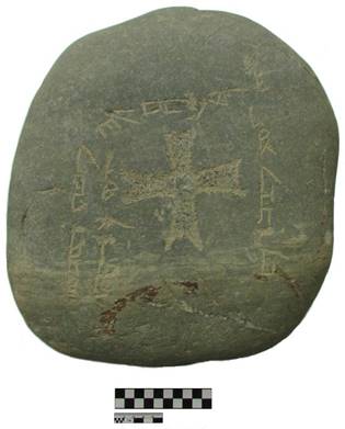
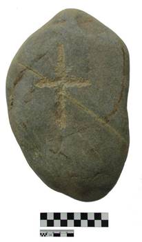
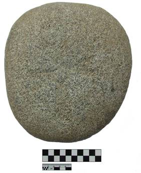
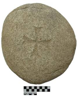
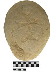
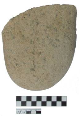
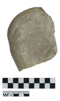
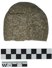
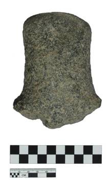
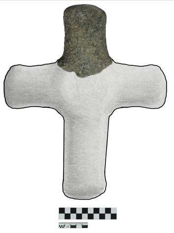
Other
№ |
Name |
Description |
Dimensions |
Photo |
Metal |
||||
1 |
Bronze ring. |
This bronze ring was found in the first layer of the excavation Area B. Covered with oxidized copper. Produced by casting and polishing (IB 17-IV-B-1-1). |
Dimensions: diameter 3.8 cm, rim width 0.7 cm. Inside diameter is 2.4 cm |
|
2 |
Silver coin.. |
This silver coin was found in the first layer of the excavation Area B in the SE sector. The coin is slightly warped. Produced by the method by minting (IB 17-IV-B-1-2). |
Dimensions: diameter 2.2 cm, thickness 0.2 cm. |
|
3 |
Lid from a copper receptacle . |
The lid from the copper receptacle was found in the SE sector of the excavation Area B. The lid is covered with oxidized copper. The upper part of the lid is semi-circular. There is a loop-shaped handle located on the top. A flange is placed on the edge of the lid. Produced by the method of casting and drilling (IB 17-IV-B-1-5). |
A loop-shaped handle with a diameter of 0.7 cm, a hole diameter of 0.3 cm. Dimensions of the lid: diameter 2.4-2.8 cm, height 1.3 cm. |
|
4 |
Copper coin. |
A copper coin of the Chagataid state was found in Locus 11 of excavation IV-B-4A, in the layers of the second construction horizon. The coin is covered with oxidized copper. The legend and the image are unreadable. (IB 17-IV-В-4A-17). |
Size: diameter 3 cm, thickness 0.2 cm. |
|
5 |
Copper coin. |
A copper coin found in locus 11 of excavation IV-B-3 and covered with oxidized copper. The legend and the image are almost unreadable. Mintage casting. (IB 17-IV-В-3-20). |
Size: diameter 3.4 cm, thickness 0.2 cm. |
|
6 |
A piece of copper coin. |
A piece of copper coin was found in locus 1 of excavation IV-B-3. Part of the coin is broken and covered with oxidized copper. The legend and the image are unreadable. Mintage casting. (IB 17-IV-B-3-21). |
The size of the preserved part of the coin: diameter 3.4 cm, thickness 0.2 cm. |
|
7 |
Copper suspension from a necklace. |
The copper necklace was found in the excavation IV-B-4. The necklace is a disc-like, round shaped medallion and covered with oxidized copper. At the top, there is a round punch hole 0.2 cm in diameter. No imagery is detected on the necklace. Small chips along the edges. Mintage casting. (IB 17-IV-В-4-22). |
Size: diameter 3 cm, thickness 0.2 cm. |
|
8 |
An iron object. |
An iron object. An iron object, possibly theshaft of an arrow, found in excavation IV-B-3. The shaft around the section is extremely corroded. The site of the possible attachment of the arrowhead to the arrow indicates scrapping. (IB 17-IV-B-3-30). |
The length of the petiole is 3.1 cm, diameter 0.4-0.7 cm. |
|
Pottery |
||||
9 |
Ceramic pindle whorl. |
This ceramic spindle whorl is made from a potsherd. The spinning wheel has a drilled hole close to the edge . The edges of the spindle whorl are uneven. Produced by the method of modelling and drilling (IB 17-IV-В-1-3). |
The diameter of the whorl: 2.6 cm, the thickness: 1.1 cm. The hole diameter: 0.7 cm. |
|
10 |
A pottery fragment with letters. |
A pottery fragment with letters. This pottery sherd was found in the eastern part of the excavation B. On the outside, there is a possible Syriac (?) letter carved on the raw clay. The letter B or “Beth”is possible. The other letters depicted on the break are not readable. Dimensions of the fragment are 6.5x0.8 cm (IB 17-IV-B-1-4). |
Fragment dimensions are 5x6.5x0.8 cm |
|
11 |
Ceramic pindle whorl. |
The spindle whorl is made from a watering bowl, the wheel is covered with a turquoise glaze. (IB 17-IV-C-3-15) |
The diameter of the spinner is 2.5 cm, the thickness is 0.8-1 cm. The diameter of the drilled hole is 0.7 cm. |
|
12 |
Ceramic spindle whorl. |
The spindle whorl is made of a pottery sherd. It is an oval disc, made from a piece of an easel red-clay thin-walled vessel. The spinning wheel has a drilled hole closer to the edge. The edges of the spindle whorl are uneven. (IB 17-IV-В-4-23). |
The diameter of the spinner is 3.4x3.1 cm, thickness 1.4 cm. The hole diameter is 0.8 cm. |
|
13 |
A piece of ceramic spinning wheel. |
A piece of ceramic spindle whorl. This spindle whorl is disc-shaped and made from a glazed bowl, covered with a blue glaze. A portion of the disk is broken along the center of the drilled hole. (IB 17-IV-В-4-24). |
The diameter of the drilled hole is 0.7 cm. The diameter of the wire was 3.4 cm, and the thickness was 0.7 cm. |
|
14 |
Procurement of ceramic spun. |
This spindle whorl is made of a grey clay easel ceramics. It is a disc-shaped and constructed from a thin-walled vessel. In the center, there is a drilled depression. Its edges are uneven. (IB 17-IV-В-3-25). |
The diameter of the spinner is 4 cm, the thickness is 1.4 cm. The hole diameter is 0.7 cm. |
|
Bone |
||||
15 |
Bone item. |
A carved bone, presumably from a loom, was found in the excavation IV-B-4. The item is long, round and flattened, with the traces of seams, slices and chips and made from the rib of a large animal. One end of the product is rounded with traces of grooving for the threads forming the rounded head. The other edge is squared and has a carved groove for holding thread in place. (IB 17-IV-B-4-26). |
The length is 6.3 cm, the diameter of the round part is 1 cm, the thickness is 0.8-1.2 cm. |
|
Glass |
||||
16 |
Glass ring fragment. |
The ring fragment is made of turquoise-colored glass. Part of the circle has survived. There is a notch at the top in the center. (IB 17-IV-B-5-28). |
Outer diameter 2 cm, inner - 1.4 cm width 0.4 cm, thickness 0.4 cm. |
|
Stone |
||||
17 |
A fragment of a whetstone. |
This sharpener is made of a brownish sandstone, is an oval and elongated in shape. The working side is hollowed out and bears traces of abrasion. The unworked surface, like the edges, is slightly rounded. There is a chip in the middle of the stone. The non-worked side has traces of denting and chipping.(IB 17-IV-B-4-31). |
The length of the grindstone is 8 cm, the width is 8-9.8 cm, the thickness is 3.6 cm. |
|
18 |
Whetstone. |
This sharpener is made of a solid stone andhas an elongated, cylindrical shape, with three smoothed faces, and smoothed edges. One side between the faces is deeper and bears traces of abrasion. (IB 17-IV-B-4-18). |
The length of the grindstone is 13.4 cm, diameter 4.2 cm. |
|
19 |
Stone faceted bead. |
Stone faceted bead. Stone faceted white bead. Irregular-shaped bead with six facets. Has one drilled hole with a diameter of 0.2 cm.(IB 17-IV-В-1-19). |
Diameter 0.8 cm, width 0.7 cm, thickness 0.4 cm. |
|
20 |
Pearly bead. |
Pearly flat white bead. Square with rounded corners. Has a drilled hole, with a diameter of 0.2 cm. (IB 17-IV-B-5-27). |
Length 1.1 cm, width 0.7 cm, thickness 0.3 cm. |
|
21 |
Pearly bead. |
Pearly bead, white, consists of three links. One side is decorated with two circles of 0.4 cm in diameter. Contains two drilled holes. (IB 17-IV-B-1-29). |
Length 1.2 cm, width 0.8 cm, thickness 0.4 cm. |
|
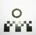
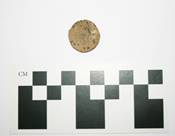
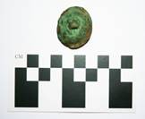
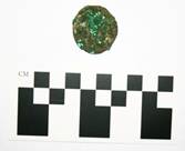
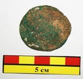
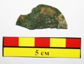
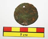
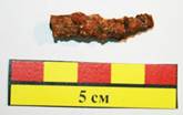
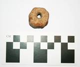
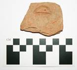
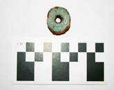
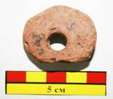
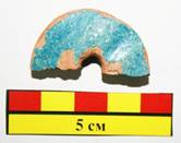
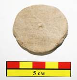
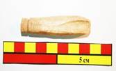
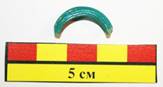
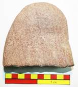
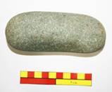
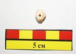
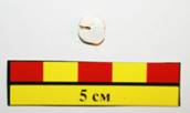
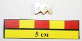
1.2 APPENDIX 3. List of Carbon Samples
Sample 1
Field 4
Area B
Unit 4
Locus: 005
Date: 16/6/2017
Supervisor: Alistair
Sample 2
Field 4
Area B
Unit 4
Locus: 005
Date: 17/6/2017
Supervisor: Alistair
Sample 3
Field 4
Area B
Unit 4
Locus: 009
Date: 17/6/2017
Supervisor: Alistair
Sample 4
Field 4
Area B
Unit 5
Locus: 005
Basket: 021
Date: 17/6/2017
Supervisor: Carpenter
Sample 5
Field 4
Area B
Unit 5
Locus: 004
Basket: 030
Elevation: 39 cmbd
Date: 19/6/2017
Supervisor: Carpenter
Sample 6
Field 4
Area B
Unit 4-A
Locus: 008
Date: 20/6/2017
Supervisor: Alistair
2. Bibliography
Primary Sources
Abū Saʻīd ʻAbd al-Ḥayy Gardīzī, The ornament of histories. Engl. Transl. by C.E. Bosworth, The ornament of
histories: a history of the Eastern Islamic lands AD 650-1041 (London: I.B. Tauris, 2011)
Akhsikandi, Sayf al-Din. “Majmu al-tawarikh”. MSPb B667.
Anonymous. Chronicon Brevis. Engl. Transl. by Nasir al-Ka'bi, A Short Chronicle on the End of the Sasanian
Empire and Early Islam 590-660 A.D. (Piscataway, NJ: Gorgias Press, 2016)
Anonymous. Ḥudūd al-ʿĀlam [Boundaries of the World]. V. Minorsky and C. Bosworth, Hudud al-'Alam 'The
Regions of the World' - A Persian Geography 372 A.H. (982 AD) (Cambridge: Gibb Memorial, 2015)]
Anonymous. Life of Mar Jab-Alaha. Engl. Transl. by J. Montgomery, The History of Yaballaha III (New York:
Columbia University, 1927)
Anonymous. Mongγol-un niγuca tobčiyan. Engl. Transl. by I. de Rachewiltz, The Secret History of the
Mongols (Leiden: Brill, 2013)
Anonymous. Chronicon (de Arbela). German Transl. by E. Sachau, Die Chronik Von Arbela: Ein Beitrag Zur
Kenntnis Des Ältesten Christentums Im Orient (Berlin: Verl. der Königl. Akad. der Wiss., 1915)
Anonymous (or Joshua the Stylite). Engl. Transl. by Amir Harrak The Chronicle of Zuqnīn (Piscataway:
Gorgias Press, 2017)
Bar Hebraeus, Chronicon ecclesiasticum [Latin Transl. from Syriac by J.-B. Abbeloos and T. Lamy (Louvain:
Peeters, 1872); Engl. Transl. D. Wilmshurst, Bar Hebraeus: the Ecclesiastical Chronicle (Piscataway: Gorgias Press, 2015);
Bar Hebraeus. Chonographia. E. Wallis Budge, Bar Hebraeus' Chronography (London: 1932)
Besse, B. di (1897) Analecta Franciscana: sive Chronica aliaque varia documenta ad historiam Fratrum minorum
Spectantia III(Florence: Collegium S. Bonaventurae)
Bretschneider, E. (1876) “Notices of the Medieval Geography and History of Central and Western Asia”, Journal of
the North-China Branch of the Royal Asiatic Society [Series 2] 10: 75-308.
Bretschneider, E. (1888) Medieval Researches from Eastern Asiatic Sources. Fragment towards the knowledge of
the geography and history of Central and Western Asia from the 13th to 17th century (London: Paul
Kegan)
Brewer, K. (2015) Prester John: The Legend and its Sources (Farnham, UK: Ashgate Publishing)
Chavannes, É. (1900) Documents sur les Tou-kiue (Turcs) occidentaux (Paris: Librairie d’Amérique et d’Orient ;
Reprint, Taipei: Cheng Wen Publishing Co. 1969)
Constantine Porphyrogenitus. De Administrando Imperio. Ed. G. Moravcsik with Eng. Tranls. R. Jenkins,
(Washington D. C.: Dumbarton Oaks, 1993)
Eubel, K. Hierarchia Catholica Medii Aevi (Regensberg: Monastery, 1898)
Ephrem the Syrian. Collected Works. Latin transl. Sancti Patris Nostri Ephraem Syri Opera omnia quæ exstant:
graece, syriace, latine… (Rome: Vatican, 1732-1746); Partial Engl. Transl. P. Schaff. Nicene and Post-Nicene Fathers XIII: Gregory the Great, Ephraim Syrus, Aphrahat (London: T. & T. Clark, 1900);
Spelunca Thesaurorum . Eng. transl. E. Budge, The Book of the Cave of Treasures (London: The Religious Tract Society, 1927); Hymns on Paradise, Transl. S. Brock (Crestwood, NY: St. Vladimir's Seminary Press, 1990)
Frodsham, D. (1974) The First Chinese Embassy to the West: Journals of Kuo Sung-tao, Liu Hsi-hung and Chang
Te-yi (Oxford: Clarendon)
Giovanni da Pian del Carpine, Ystoria Mongalorum [English translation in C. Dawson’s Mission to Asia
(MART 8) (Toronto: University of Toronto Press, 1980); originally published as The Mongol Mission: Narratives and letters of the Franciscan missionaries in Mongolia and China in the thirteenth and fourteenth centuries (New York, 1955)]
Giovanni da Montecorvino. Epistola. Eng. transl. C. Dawson’s Mission to Asia [MART 8] (Toronto:
University of Toronto Press, 1980): 224-228.
Guillaume de Rubrouck (or William of Rubruck), Itinerarium [Engl. translation and commentary by P.
Jackson and D. Morgan, The mission of Friar William of Rubruck: his journey to the court of the Great Khan Möngke 1253-1255 (London: Hakluyt Society, 1990)]
Huc, E. Le christianisme en Chine, en Tararie et au Thibet (Paris, 1857)
Ibn al-Athir, Ali ‘Izz al-Din. Al-Kāmil fī al-tārīkh: (The Complete History); [Partial Engl. translation by D. S.
Richards, The Chronicle of Ibn al-Athir (London: Ashgate Publishing)
Juvaini, Ata-Malik, Tarīkh-i Jahān-gushā [Engl. translation and commentaryby J. Boyle, History of
the World Conqueror (Cambridge: Harvard University Press, 1958)]
Juzjani, Minhaj Siraj, Tabakat-i-Nasiri [Engl. translation and commentaryby H. Raverty, Tabakat-i-Nasiri: A
general history of the Muhammadan dynasties of Asia (London: Gilbert & Rivington, 1881)]
Kashgari, Muhammad. Dīwān Lughāt al-Turk [Compendium of the languages of the Turks]; Engl.
translation R. Dankoff and J. Kelly, Compendium of the Turkic dialects (Duxbury, MA: Harvard University Print, 1982); B. Atalay, Divanü Lügati't – Türk (Ankara: Türk Tarih Kurumu Basımevi, 2006)
Khass Hajib Yusuf. Kutadgu Bilig [Engl. Transl. by R. Dankoff. Wisdom of Royal Glory: A Turko-Islamic
Mirror for Princes (Chicago: University of Chicago Press, 1983)
Kirakos of Gandzak, History of Armenia [French Transl. by M. Brosst, Deux historiens arméniens : Kiracos de
Gantzac et Oukhtanès d'Ourha (St. Petersburg : Eggers, 1870)]
Levi, S. and R. Sela (2010) Islamic Central Asia: An Anthology of Historical Sources (Bloomington: Indiana
University Press)
Marco Polo and Rustichello da Pisa, Il Milione (or De Mirabilibus Mundi) [Engl. Transls. H. Cordier (1920) Ser
Marco Polo (London: John Murray); M. Rugoff, The Travels of Marco Polo. (New York: Signet Classics,
2004)]
Matthew Paris, Chronica Majora [Engl. Transl. by H. Luard, Chronica Majora (Cambridge: Cambridge
University Press, 1872, 2012 reprint)]
Mauro, Fra. Mappamundi [P. Falchetta, Fra Mauro's World Map (Turnhout: Brepols, 2006)]
Menander Protector. Historia [J. P. Migne, Patrologia Graeca, 113; Engl. Transl. by R. Blockley, The History
of Menander the Guardsman (Liverpool: University of Liverpool, 1985)]
Mirza Muhammad Haidar Dughlat Beg, The History of Rashid [Engl. Transl. by E. D. Ross, The Tarikh-i-
Rashidi (London: Low, Marston and co., 1895)]
Narshakhi, Abu Bakr Muhammad ibn Jafar. History of Bukhara [French transcription by C. Schefer, Description
topographique et historique de Boukhara (Paris: E. Leroux, 1892); Engl. transl. R. Frye, The History of Bukhara (Cambridge, MA: Medieval Academy of America, 1954)
Pashcalis de Vittoria. Epistolae. Engl. transl. H. Yule and H. Cordier, Cathay and the way thither (London, 1914)
and Chronica XXIV Generalium ordinis Minorum, in Analecta franciscana 3 (Florence, 1897): 532-35.
Philoxenus of Mabbūg. Epistle to Abi Afr. Engl. transl. A. Mingana (1925) “The Early Spread of Christianity in
Central Asia and the Far East”, Bulletin of the John Rylands Library 9.2: 297-371; French transl. P. Harb, “Lettre de Philoxène de Mabbûg au Phylarque Abu Ya'fûr de Hirtâ de Bëtna'mân”, Melto 3.1-2 [Mélanges Mgr. Pierre Dib] (Kaslik, Lebanon: Université Saint-Esprit, 1967): 183-212.
Priscus Panita. Excerpta et fragmenta, ed. P. Carolla (Berlin: W. De Gruyter, 2008) ; Engl. Transl. R.
Blockley, The Fragmentary Classicising Historians of the Later Roman Empire. II. Liverpool: Francis Cairns.
Rabban Bar Sauma, History [Engl. Transl. by E. Wallis Budge, The Monks of Kublai Khan Emperor of China
(London: Religious Tract Society, 1928)
Rashid-al-Din Hamadani. Jāmiʿal-Tawārīkh [Compendium of Chronicles]; S. Blair, A compendium of
chronicles: Rashid al-Din’s illustrated history of the world (London: Nour Foundation, 2006); J. Boyle. The Successors of Genghis Khan (New York: Columbia University, 1971)
W. Thackston, Compendium of Chronicles [Sources of Oriental languages and literatures 45]
(Harvard University, Department of Near Eastern Languages and Civilizations, 1998
Shimon Shanqlawaya. Chronicon. Ed. and German Transl. by F. Müller, Die Chronologie Des Simeon Šanqlâwâjâ
(Piscataway, NJ: Gorgias Press, 2012)
Various. Babylonian Talmud (Soncino Talmud), Engl. Transl. I. Epstein (London: Soncino LTD., 1935 - 1948)
Waddingo, L. and J. Fonseca. Annales Minorum 6 (Florence, 1625–54, Rome reprint 1733 )
Wyngaert, A. van den (1929) Sinica franciscana I: Itinera et relationes Fratrum minorum saeculi XIII et XIV
(Florence: Collegium S. Bonaventurae)
Yule, H. (1863) Mirabilia descripta: the wonders of the East (London: Hakuyt Society)
Yule, H. and H. Cordier (1915). Cathay and the way thither: being a collection of medieval notices of China
(London: Hakluyr Society)
Zacharias Rhetor. Historia Miscellanea.Engl. Transl. by F. Hamilton and E. Brooks, The Syriac Chronicle known
as that of Zachariah of Mitylene (London: Methuen & Co., 1899)
Secondary Sources
A
Abazov, Rafis (2008) The Palgrave concise historical atlas of Central Asia (New York: Palgrave Macmillan)
Akhinzhanov, S. (1975) “Вопросу О Знаках На Керамике Позднесредневеко-Вого Отрара” [Regarding the
Problem of Signs on the Pottery of the Late Medieval Otrar], in K. Akishe ed. ДревностиКазахстана (Almaty: Nauka)
Allan. J. (1979) Persian Metal Technology, 700-1300 AD (Oxford)
Allsen, T. (1994) “Two Cultural Brokers of Mediaeval Eurasia: Bolad Aqa and Marco Polo,” in M. Gervers
and W. Schlepp, ed., Nomad Diplomacy, Destruction and Religion from the Pacific to the Adriatic (Toronto): 63-78.
Allsen, T. (1998) Commodity and Exchange in the Mongol Empire (Cambridge)
Allsen, T. (2001) Culture and Conquest in Mongol Eurasia (Cambridge)
Arden-Wong, L. (2012) “The architectural relationship between Tang and Eastern Uighur Imperial
Cities”, Frontiers and Boundaries: Encounters on China's Margins, ed. R. Zsombor and I. Bellér-Hann [Asiatische Forschungen 156] (Wiesbaden: Harrassowitz Verlag): 11-47.
Arslanova, A. (2005) “Russian Research on the Interrelations of the Golden Horde with the Ilkhans of
Iran and the Chaghatayids”, Acta Orientalia Academiae Scientiarum Hungaricae 58. 3 [Proceedings of the First International Conference on the Mediaeval History of the Eurasian Steppe: Szeged, Hungary May 11—16, 2004: Part III]: 277-293.
Asimov, M. and C. Bosworth ()
Asmussen, J. (1982) “The Sogdian and Uighur-Turkish Christian Literature in Central Asia before the
Real Rise of Islam. A Survey”, L. A. Hercus et al. (eds.), Indological and Buddhist studies…in Honour of Professor J. W. de Jonġ (Canberra: Faculty of Asian Studies): 11-29.
B
Baipakov, K (1986) Средневековая городская культура Южного Казахстана и Семиречья (Medieval city
culture of South Kazakhstan and Semirechiye) (Almaty: Hayka)
Baipakov, K. (1998a). Medieval Cities of Kazakhstan on the Great Silk Road, transl. by Roza Bektoureyeva
(Almaty: Ministry of Culture, Kazakhstan)
Baipakov, K. (1998b) “Medieval Towns in South Kazakhstan and Semireč'e”, Rivista degli studi orientali
72. 1/4: 245-261.
Baipakov, K. (2012) Исламская Археологическая Архитектура И Археология Казахстана [Islamic
Archaeology Architecture and Archaeology of Kazakhstan] (Almaty: Archaeological Expertise LLP)
Baipakov, K. and L. Erzakovich (1991) Ceramics of Medieval Otrar (Kazakhstan: Ministry of Culture)
Baipakov, K., G. Kapekova, D. Voyakin, and A. Maryashev (2011) Treasures of Ancient and Medieval Taraz
and Zhambyl Region (Taraz: Archaeological Expertise LLP)
Baipakov, K. and P. Petrov (2006) “Кайалык – город Великой Монгольской империи.
Нумизматический и археологический аспекты” [Kayalyk—the city of the Great Mongol Empire], Денежное обращение и торговля средневекового Казахстана [The Money Currency and Trade of Medieval Kazakhstan] (Turkestan: Turan Publishing): 14-21
Baipakov, K., D. Voyakin, et al. (2008) Monuments of Otrar Oasis in Their Settings: Investigation of Irrigation
System and Cultural Landscape (Almaty: UNESCO Institute of Archaeology MES RK)
Baipakov, K. and D. Voyakin (2012). “The Towns of Huwara and Yangikent, the Old and New Capitals of
the Oguz State,” in The Bulletin of the International Institute for Central Asian Studies 16: 22-44.
Baipakov, K. and D. Voyakin (2013). Treasures of the Ancient and Medieval Taraz and Zhambyl Region
(Almaty: Archaeological Expertise LLP)
Baipakov, K. and D. Voyakin (2014a). Kazakhstan Section of the Great Silk Road in the Serial World Heritage
Nomination (Almaty: Archaeological Expertise, LLC)
Baipakov, K. and D. Voyakin (2014b). ВыдающиесяархеологическиепамятникиКазахстана (Notable
Archaeological Sites in Kazakhstan) (Almaty: Archaeological Expertise, LLC)
Bedutova, L.M. (2015) “Третий Буддийский Храм На Городище Ак-Бешим” (The Third Buddhist
temple on the site of Ak-Beshim), ИзвестияНациональнойАкадемииНаукКыргызскойРеспублики (Proceedings of Sciences of the Kyrgyz Republic National Academy) 947.1 (575.2).4: 125-133.
Barfield, T. (1989) The Perilous Frontier (London: Blackwell)
Barthold. V.V. (1956-1962) Four Studies On the History of Central Asia (Leiden: Brill)
Barthold. V.V. (1966) Отчет о поездке в Среднюю Азию с научной целью в 1893-1894 [Report about
the trip to Central Asia with a scientific purpose in the years 1893-1894] (St. Petersburg: Imperial Academy of Sciences)
Barthold. V. (1964) “О христианстве в Туркестане в домонгольский период”, Сочинения 2.2: 265-302.
Baum, Wilhelm (2006) "Shirin - Christian Queen of Persia. History and Myth," Jingjiao: The Church of the East in
China and Central Asia (Collectanea Serica), ed. by Roman Malek & Peter Hofrichter. Sankt Augustin: Institut Monumenta Serica, 475-483.
Baum, Wilhelm, and D. Winkler (2003) The Church of the East: a concise history (London: Routledge)
Baumer, Christoph (2008) Traces in the Desert: journeys of discovery across Central Asia (London: I.B. Tauris)
Baumer, Christoph (2014) History of Central Asia 2: The Age of the Silk Roads (London: I.B. Tauris)
Baumer, Christoph (2015) “Archäologie schreibt Geschichte“, in Neue Zürcher Zeitung (11 April) 83: 59-60.
Baumer, Christoph (2016) History of Central Asia 3: The Age of Islam and the Mongols (London: I.B. Tauris)
Baumer, Christoph (2016) The Church of the East: An Illustrated History of Assyrian Christianity (London: I.B.
Tauris)
Bearman, P. et al. (eds.) (2003) The Encyclopaedia of Islam (Leiden: Brill, 2nd edition)
Beckwith, C. (2009) Empires of the Silk Road: A History of Central Eurasia from the Bronze Age to the Present
(Princeton: Princeton University Press)
Biran, M. (2001) “Qarakhanid Studies: A View from the Qara Khitai Edge”, Cahiers d’Asie centrale 9:
77–89.
Biran, M. (2005) The Empire of the Qara Khitai in Eurasian History: Between China and the Islamic World.
(Cambridge: Cambridge University Press)
Biran, M. (2007-08) "Culture and Cross-Cultural Contacts in the Chaghadaid Realm", Chronika, 7-8: 26-43.
Biran, M. (2008) “Diplomacy and Chancellery Practices in the Chagataid Khanate: Some Preliminary Remarks”,
Oriente Moderno, Nuova serie 88. 2: 369-393.
Biran, M. (2009) "Central Asia from the Conquest of Chinggis Khan to the Rise of Tamerlane" The Cambridge
History of Inner Asia 2, ed. P. Golden et al., (Cambridge: Cambridge University Press): 46-66.
Biran, M. (2013) Qaidu and the Rise of the Independent Mongol State in Central Asia (London: Routledge)
Boldyreva, Indzhir (2014) “On Kalmyk Folk Beliefs”, Anthropology & Archeology of Eurasia 53: 62-70.
Boeschoten, H. and M. Vandamme (1998) “Chaghatay”, The Turkic Languages, ed. L. Johanson and É. Csató-
Johanson (London: Routledge): 166-178.
Borbone, P. and P. Marsone (2015) Le christianisme syriaque en Asie centrale et en Chine [Études syriaques
12] (Paris: Geuthner)
Bostom, A. (2010) The Legacy of Jihad: Islamic Holy War and the Fate of Non-Muslims (Amherst, NY:
Prometheus)
Boyle, J. (1964) “The Journey of Hetum I, King of Little Armenia, to the Court of the Great Khan Mongke",
Central Asiatic Journal 9: 175-89.
Boyle, J. (1973) “The Summer and Winter Camping Grounds of the Kereit”, Central Asiatic Journal 17: 108-110.
Bregel, Yuri (1995) Bibliography of Islamic Central Asia (Bloomington, IN: Research Institute for Inner Asian
Studies, Indiana University)
Bregel, Yuri (2000) Historical maps of Central Asia, 9th-19th centuries A.D. (Bloomington, IN: Research
Institute for Inner Asian Studies, Indiana University)
Bregel, Yuri (2003) An historical atlas of Central Asia (Leiden: Brill)
Bretschneider, E. (1875) Notes on Chinese Medieval Travellers to the West (Shanghai)
Bretschneider, E. (1876) “Notices of the Medieval Geography and History of central and western Asia”,
Journal of the North-China Branch of the Royal Asiatic Society. New Series 10 (Shanghai): 75-308
Brock, S. (1967) “Alphonse Mingana and the Letter of Philoxenus to Abu 'Afr'”, Bulletin of the John Rylands
Library 50.1: 199-206.
Buriakov, I. (1999) The cities and routes of the great silk road: on central Asia documents (Tashkent:
International Institute for Central Asian Studies)
Bussagli, Mario (1963) Painting of Central Asia (Geneva: Skira)
C
Chang, C. and K. Guroff (2007) Of gold and grass: nomads of Kazakhstan (Bethesda: Foundation for
International Arts and Education)
Chang, C. and R. Beardmore (2015) “The tale of a mud-brick: lessons from Tuzusai and de-assembling an
Iron Age site on the Talgar alluvial fan in south-eastern Kazakhstan”, Incomplete Archaeologies (Oxford: Oxbow): 84-97.
Chabot, Jean-Baptiste (1906) "Éclaircissements sur quelques points de la littérature syriaque: Contribution à
à l’onomastique syriaque," in Journal Asiatique, Vol. X (Ser.), No. VIII (Tom.), 259-293.
Chwolson, D. (1890) Syrisch-nestorianische Grabinschriften aus Semirjetschie (St. Petersburg: Commissionnaires
de l'Académie impériale des Sciences)
Chwolson, D. (1897) Syrisch-nestorianische Grabinschriften aus Semirjetschie, neue Folge (St. Petersburg:
Commissionnaires de l'Académie impériale des Sciences)
Clauson, G. (1972) An Etymological Dictionary of Pre-Thirteenth Century Turkish. Oxford: Clarendon Press.
Civezza, M. da (1859) Storia universale delle missioni francescane 3 (Rome: Tipografia Tiberina)
Conyers, L. and D. Goodman (1997) Ground Penetrating Radar: An Introduction for Archaeologists (Oxford: Alti-
Mira Press)
Cotsonis, J. (1994) Byzantine Figural Processional Crosses (Washington DC: Dumbarton Oaks)
D
Danielou, J. (1964) Primitive Christian Symbols. Transl. D. Attwater (Baltimore: Helicon)
Dauvillier, Jean (1948) “ "Les Provinces Chaldéennes 'de l'Extérieur au Moyen Age,” Mélanges offerts au
R.P. Ferdinand Cavallera, doyen de la faculté́ de théologie de Toulouse á l'occasion de la quarantième année de son professorat á l'Institut Catholique (Toulouse : Bibliothèque de l'Institute Catholique)
Davidovich, E. A. (1998), "The Karakhanids", History of Civilisations of Central Asia 4. I (New York:
UNESCO Publishing): 118-149.
Deeg, Max (2006) “Towards a New Translation of the Chinese Nestorian Documents from the Tang
Dynasty”, in R. Malek (ed) Jingjiao: The Church of the East in China and Central Asia (Sankt Augustin: Institut Monumenta Serica): 115-132.
Devéria, M. (1895) “Notes d’épigraphie Mongole-Chinoise”, Journal asiatique (9e s.) 8:2, 94–128, 395–443.
Dickens, M. (2010) “Patriarch Timothy I and the Metropolitan of the Turks”, Journal of the Royal Asiatic Society,
3rd Ser.,20, 2: 117-139.
Dickens, M. (forthcoming) "Syriac Inscriptions near Urgut, Uzbekistan," in Studia Iranica.
Dinkler, E. (1962) “Kreuzzeichen und Kreuz”, Jahrbuch für Antike und Christentum 5: 93-112.
Dinkler, E. (1964) “Bemerkungen zum Kreuz als Tropaion“, Jahrbuch für Antike und Christentum 1:71-78.
Dinkler, E. (1965) “Das Kreuz als Siegeszeichen“, Zeitschrift für Theologie und Kirche 62: 1-20.
Dinkler, E. (1967) Signum Crucis (Tübingen: Mohr Siebeck)
Drake, F. S. (1962) “Nestorian Crosses and Nestorian Christians in China under the Mongols,” Journal of the Hong
Kong Branch of the Royal Asiatic Society 2: 11-25.
Dayre de Mayol, P. (1896) Dictionnaire historique et héraldique… (Paris : Direction et Rédaction)
Dunlop, D. (1944) “The Karaits of Eastern Asia”, Bulletin of the School of Oriental and African Studies, University
of London 11.2: 276-289.
Dzhangaliev, A. T. Salova, and P. Turekhanova. 2010. “The Wild Fruit and Nut Plants of Kazakhstan”,
Horticultural Reviews 29: 305-371.
E
Ebrey, P. (1999) The Cambridge Illustrated History of China (Cambridge: Cambridge University Press)
Ebrey, P. A. Walthall, and J. Palais (2006) East Asia: A Cultural, Social, and Political History (Boston: Houghton
Mifflin)
4.5.j
Eddé, A.-M. (2011) Saladin (Cambridge, MA: Belknap Press)
Elisseeff, V. (2000) The Silk Roads: Highways of Culture and Commerce (New York: Unesco/Berghan)
Elders, J. (2001) “The lost churches of the Gulf: New discoveries on the islands of Sir Bani Yas and
Marawah, Abu Dhabi Emirate”, Proceedings of the Seminar for Arabian Studies 31: 47–57.
Elders, J. (2003) “The Nestorians in the Gulf: Just Passing Through? Recent Discoveries on the Island of
Sir Bani Yas, Abu Dhabi Emirate, in D. Potts et al. (eds), Archaeology of the United Arab Emirates. (London: Trident Press): 230–236.
Esbroeck, M. Van (2005) “Caucasian Parallels to Chinese Cross Representations”, in R. Malek (ed) Jingjiao: The
Church of the East in China and Central Asia (Sankt Augustin: Institut Monumenta Serica): 425-444.
F
Farge, B. de la (2000) Petit Précis de la Croix Occitane (Toulouse: Loubatières)
Franke, H. (1925)
Francke, A. (1925) “Felseninschriften in Ladakh”, Sitzungsberichte der Preußischen Akademie der Wissenschaften. Philosophisch-Historische Klasse 31: 366-371.
Fiey, J. (1967) “Auteur et date de la Chronique d'Arbèle”, L’orient Syrien 12: 265-302.
Fiey, J. (1993) Pour un Oriens Christianus novus; répertoire des diocèses Syriaques orientaux et
occidentaux (Beirut)
Finegan, J. (1992) The Archeology of the New Testament: The Life of Jesus and the Beginning of the Early Church
(Princeton: Princeton University Press)
Finster, B. and J. Schmidt (1976) “Sassanidische und frühislamische Ruinen im Iraq”, Baghdader
Mitteilungen 8.
Foster, John (1954) “Crosses from the Walls of Zaitun”, Journal of the Royal Asiatic Society 86.1-2: 1-25.
Fox-Davies, A. (1904) The Art of Heraldry: An Encyclopædia of Armory (London: T.C. and E.C. Jack)
Frachetti, M. (2002) “Bronze Age Exploitation and Political Dynamics of the Eastern Eurasian Steppe
Zone”, Ancient interactions: east and west in Eurasia, ed. bу K. Boyle et al. (Cambridge: McDonald Institute): 161-170.
Francke, A.H. (1925) “Felseninschriften in Ladakh“, Sitzungsberichte der Preußischen Akademie der
Wissenschaften. Philosophisch-Historische Klasse: 366-371.
Frumkin, G. (1970) Archaeology in Soviet Central Asia (Leiden: E. J. Brill)
Fuller, M. and N. (1989-1990) “Tell Tuneinir 1986 and 1987“, Archäologische Forschungen in Syrien 36-37:270-
290.
Fuller,M. and N. Fuller (1994) “A Medieval Church in Mesopotamia”, Biblical Archaeologist 57:38-45.
Fuller, M. and N. Fuller (1998) “Archaeological Discoveries at Tell Tuneinir, Syria”, Journal of Assyrian Academic
Society 12.2: 69-82.
G
Golden, P. (1990) “The Karakhanids and Early Islam” and “The peoples of the south Russian Steppes”, The
Cambridge History of Early Inner Asia, ed. D. Sinor (Cambridge: Cambridge University Press): 229-284.
Golden, P. (2000) “’I Will Give the People unto Thee’: The Činggisid Conquests and Their Aftermath in the Turkic
World”, Journal of the Royal Asiatic Society, Third Series 10.1: 21-41.
Golden, P. (2011) Central Asia in World History (Oxford: Oxford University)
Gan, Fuxi and R. Brill (2009) Ancient glass research along the Silk Road (New Jersey: World Scientific, 2009)
Garner, J. (2011) “Bronze Age tin mines in central Asia”, Archaeometallurgy in Europe III, ed. by E.
Hauptmann and D. Modarressi-Tehrani (Bochum: Montanhistorische Zeitschrif): 135-144
Gaulier, Simone et al. (1997) Buddhism in Afghanistan and Central Asia (Leiden: Brill)
Gignoux, P. (2001) “Une Croix de procession de Herat inscrite en pehlevi”, Le Museon 114.3: 291-304.
Gignoux, P. and B. Litvinsky (1996) “Religions and Religious Movements I”, History of Civilizations of
Central Asia III (Paris: UNESCO): 403-420.
Gilman, Ian and H.-J. Klimkeit (1999) Christians in Asia before 1500 (London: Routledge)
Griffith, S. (2012) Syriac Writers on Muslims and the Religious Challenge of Islam (Piscataway, NJ: Gorgias Press)
Grousset, René (1970) The Empire of the Steppes: A History of Central Asia (New Brunswick: Rutgers
University Press)
Gulácsi, Zsuzsanna (2005) Mediaeval Manichaean Book Art: a codicological study of Iranian and Turkic
illuminated book fragments from 8th-11th century east Central Asia (Leiden: Brill)
Gumilev, L. (1987) Searches for an Imaginary Kingdom: The Legend of the Kingdom of Prester John (Cambridge:
Cambridge University Press)
Gignoux, P. (2001) “Une Croix de procession de Herat inscrite en pehlevi”, Le Museon, 114.3: 291-304.
H
Hage, W. (1970) “ “Das orientalische Christentum in Asien bis zum 14. Jh.,” and “Das römisch-
katholische Christentum im Machtbereich der Mongolen (13.-14. Jh.)“, Atlas zur Kirchengeschichte:
die christlichen Kirchen in Geschichte und Gegenwart, ed by H. Jedin et al. (Kartographische Bearbeitung: Hans E.F. Quast]: 23, 27, 47, 63.
Hage, W. (1973) “Die oströmische Staatskirche und die Christenheit des Perserreiches”, Zeitschrift für
Kirchengeschichte 84: 174-87.
Hage, W. (1978) “Einheimische Volkssprachen und syrische Kirchensprache in der nestorianischen Asienmission”,
Erkenntnisse und Meinungen 2 [Göttinger Orientforschung 17]: 131-60.
Hage, W. (1987) “Das Christentum in der Turfan-Oase,” W. Heissig and H.-J. Klimkeit (eds.) Synkretismus
in den Religionen Zentralasiens (Wiesbaden): 46-57.
Halbertsma, T. (2008) Early Christian Remains of Inner Mongolia (Leiden: Brill, revised 2015)
Hansen, O. (1968) “Die christliche Literatur der Sogdier,” Iranistik [Handbuch de Orientalistik I.IV.2.1
(Leiden: Brill): 91-99.
Harris, David (ed) (2010) Origins of agriculture in Western Central Asia an environmental-archaeological study
(Philadelphia: University of Pennsylvania Museum)
Heilo, Olof (2015) Eastern Rome and the Rise of Islam: History and Prophecy (London: Routledge)
Herrman, G. and H. Kennedy (1999) Monuments of Merv: traditional buildings of the Karakum (London:
Society of Antiquaries of London)
Hunter, E. (1989-91), “The Conversion of the Kerait to Christianity in A.D. 1007", Zentralasiatische Studien 22:
142–163.
Hunter, E. (2009) The Christian Heritage of Iraq [Gorgias Eastern Christian Studies 13] (Piscataway, NJ:
Gorias Press)
Hunter, E. (2012) “Syriac, Sogdian and Old Uyghur Manuscripts from Bulayïq”, The History behind the
Languages. Essays of the Turfan Forum on Old Languages of the Silk Road (Shanghai: Shanghai guji chubanshe): 79-93.
Hunter, Erica C. D. & Mark Dickens, (2014) Syrische Handschriften. Teil 2. Syriac Manuscripts from the Berlin
Turfan Collection (Verzeichnis der Orientalischen Handschriften in Deutschland 5,2). Stuttgart: FranzSteiner
Hurtado, L. (2006) “The staurogram in early Christian manuscripts: the earliest visual reference to the crucified
Jesus?” New Testament Manuscripts, ed. T. Kraus (Leiden: Brill): 207–26.
I
Izumi, T. “A Possible Nestorian Christian Image: Regarding the Figure Preserved as a Kokuzõ Bosatsu Image at
Seiun-ji”, Kokka 1330 (2006):
J
Jedin, H., K. Latourette, and J. Martin (1970) Atlas zur Kirchengeschichte: die christlichen Kirchen in Geschichte
und Gegenwart (Freiburg: Herder)
Jeni, G. (1995) “The Figurative Arts and the Khatchk’ar”, The Armenians, ed. A. Novello et al. (Paris: Bookking):
227-264.
K
Ka’bi, N. al- (2014) “A New Repertoire of Crosses from the Ancient Site of Ḥira, Iraq”, The Journal of the
Canadian Society for Syriac Studies 14: 90-102.
Kaul, F. (2003) “Der Mythos von der Reise der Sonne. Darstellungen auf Bronzegegenständen der späten
Bronzezeit”, Gold und Kult der Bronzezeit (Nürnberg: Germanisches Nationalmuseum), 37-51.
Khalid, Adeeb (2007) Islam after Communism: religion and politics in Central Asia (Berkeley: University of
California Press)
King, G. (1997) “A Nestorian Monastic Settlement on the Island of Sir Bani Yas, Abu Dhabi: a Preliminary
Report”, Bulletin of the School of Oriental and African Studies 60: 221–235.
Kim, Hodong (1998) “The Early History of the Moghul Nomads: The Legacy of the Chaghatai Khanate”,
The Mongol Empire and Its Legacy, ed. R. Amitai-Preiss and D. Morgan (Leiden: Brill)
Klein, W. Wassilios (2000) Das nestorianische Christentum an den Handelswegen durch Kyrgyzstan bis zum 14.
Jh (Turnhout: Brepols)
Klein, W. and C. Reck(2004)“Ein Kreuz mit sogdischer Inschrift aus Ak-Besim Kyrgyzstan”, Zeitschrift
der Deutschen Morgenländischen Gesellschaft 154: 147-156.
Klein, W. and P. Rott (2005) “Einige Problematische Funde Von Der Seidenstraße: Novopokrovka IV und V, Issyk-
Kul'-Gebiet, Chotan“, in R. Malek (ed) Jingjiao: The Church of the East in China and Central Asia (Sankt
Augustin: Institut Monumenta Serica): 403-424.
Klimkeit, H.J. (1979) “Das Kreuzessymbol in der zentralasiatischen Religionsbegegnung“, Zeitschrift für
Religions-und Geistesgeschichte 31.1: 99-116.
Kljaštornyj, Sergej andV. Livšic (1972) “The Sogdian Inscription of Bugut Revised”, Acta Orientalia
(Hungaricae) 26.1:69-102
Kolchenko, Valery (2002) “Заметки О Христианстве В Чуйской Долине В Средние Века,” (Notes about
Christianity in the Chui Valley in the Middle Ages)”, Коомдукилимдержурналга(Bishkek: Kyrgyz-Turkish University "Manas”): 163-182.
Kolchenko, Valery (2003) “Периодизация распространения христианства в Средней Азии по
данным археологии” (The periods when Christianity Spread into Central Asia according to Archeology), Буддизм и христианство в культурном наследии Центральной Азии (BuddhismandChristianityintheculturalheritageofCentralAsia) (Bishkek): 53-73.
Kolchenko, Valery (2013) “Кара-Джигачское (При-Пишпекское) средневековое кладбище
(археологический аспект)” [Kara-Dzhigachskoe (Pre-Pishpek) medieval cemetery (the archaeological aspect)], An International Paschal Reader: Collection of Materials (Bishkek): 81-83.
Kochnev, B. (1995 and 1997) “Svod nadpisej na karakhanidskikh monetakh: Antroponimy i titulatura”, Vostochnoe
istoricheskoe istochnikovedenie i spetsial’nye istoricheskie distsipliny 4: 201-278; 5: 245-314.
Kochnev , B. (2006) Нумизматическая история Караханидского каганата (991-1209 гг.) (Moscow: Sophia)
Kokovcov , P. [Kokowzoff](1904-1905)“Христианско-сирийские надгробные надписи из Алмалыка",[Syro-
Christian Tombstones Inscriptions from Almalyk], Записки Восточного отделения Российского археологического общества 16.2: 190-200.
Knobloch, Edgar (2001) Monuments of Central Asia: A Guide to the Archaeology, Art and Architecture of
Turkestan (London: I.B.Tauris)
Kushlin, A., T. Schillborn van Veen, and W. Sutton. 2004. Kazakhstan - Forest sector in transition (New York:
Worldbank)
Kyzlasov, L.R. (1959) “Arkheologicheskie issledovaniya na gorodishche Ak-Beshim v 1953-54 gg.
[Archaeological Exploration of Ak-Beshim in the years 1953-54.], in Proceedings of the Kama Archaeological Expedition (Moscow): 231-233.
L
Lakier, A. (1855) Русскаягеральдика (St. Petersburg)
Lala Comneno, M. 1995. “Cristianesimo nestoriano in Asia Centrale nel primo millennio”, Orientalia
Christiana Periodica 61: 495-535.
Lala Comneno, M. 1996. “Archeologia cristiana in Asia Centrale: nuove possibilità”, Symposium Syriacum
7 (Rome: Orientalia christiana analecta): 705-716.
Lala Comneno, M. 1997. “Nestorianism in Central Asia during the First Millennium: Archaeological
Evidence,” Journal of the Assyrian Academic Society 11.1: 20-67.
Langfeldt, J.A. (1994) “Recently Discovered Early Christian Monuments in Northeastern Arabia”, Arabian
Archaeology and Epigraphy 5: 32-60.
Lattimore, Owen (1934) “A Ruined Nestorian City in Inner Mongolia”, The Geographical Journal 84.6
(December): 481-497.
La Vaissière, É. (2005) Sogdian traders: a history (Boston: Brill)
Leslie, D. (1995) “The Mongol attitude to Jews in China”, Central Asiatic Journal 39. 2: 234-245.
Lewarch, D. and M. O'Brien (1981) “Effect of Short Term Tillage on Aggregate Provenience Surface Pattern”,
Plowzone Archaeology: Contributions to Theory and Technique, ed. D. Lewarch and M. O'Brien (Nashville: Vanderbilt University)
Ligeti, Louis. (1981): "Prolegomena to the Codex Cumanicus", Acta Orientalia Academiae Scientiarum
Hungaricae 35.1: 1-54.
Liu, Xinru (2012) The Silk Roads: A Brief History with Documents (London: St. Martin’s Press)
Litvinsky, B. and M. Vorobyova-Desyatovskaya (1996) “Religions and Religious Movements II”, History of
Civilizations of Central Asia III (Paris: UNESCO): 421-448.
Longenecker, B. (2015) The Cross Before Constantine: The Early Life of a Christian Symbol (Mineapolis:
Augsburg Fortress Publishers)
Love, Serena (2013) “The performance of building and technological choice made visible in mudbrick
architecture”, Cambridge archaeological journal 23.2: 263-282.
Lubo-Lesnichenko, Ye. (2002) Svedeniya kitaiskikh pismennykh istochnikov o Suyabe (Gorodishche Ak-Beshim).
[Information of Chinese Written Sources about Suyab (Ak-Beshim)] (St. Petersburg).
Lubo-Lesnichenko, E. and G.L. Semyonov (1998) “Новая китайская надпись VII в. из Киргизии
(городище Ак-Бешим)”, ЭрмитажныечтенияпамятиБ.Б. Пиотровского: (St. Petersburg: Hermitage Museum): 48-51.
M
Mackerras, C. (1973) The Uighur Empire according to the Tang dynastic histories (Canberra: Australian
National University Press)
Mackerras, C. (1990) “The Uighers”, The Cambridge History of Early Inner Asia (Cambridge University
Press): in 317-342.
Mair, Victor (2010) Secrets of the Silk Road (Santa Ana: Bowers Museum)
Malek R. (ed.) (2005) Jingjiao, The Church of the East in China and Central Asia (Sankt Augustin: Institut
Monumenta Serica)
Margulan, A. (1950) Из истории городов строительного искусства древнего Казахстана (Almaty)
Marozzi, J. (2004) Tamerlane: sword of Islam, conqueror of the world (London: Harper-Collins)
Marschak, B. (1971) KeramikaSogdaV-VIIvekovkakistoriko-kulturnyjpamyatnik (St. Petersburg)
Marschak, B. (1986) Silberschatze des Orient (Leipzig)
Marsone, P. (2013) “Two Portraits for One Man: George, King of the Önggüt”, From the Oxus River to the
Chinease Shores (Zurich: Lit Verlag): 205-224.
Millward, James (2007) Eurasian Crossroads: a history of Xinjiang (New York: Columbia University Press)
Moffett, S. (1998) A History of Christianity in Asia (New York: Orbis)
Moldakynov, T. (2010). The Monuments of Ancient Taraz (Taraz: The National Historical Cultural Reserve
Museum of Taraz)
Moravcsik, G. (1967) Studia Byzantina (Amsterdam: A.M. Hakker)
Motuzaite Matuzeviciutea, G. and D. Voyakin, et al. (2015) “The extent of cereal cultivation among the
Bronze Age to Turkic period societies of Kazakhstan determined using stable isotope analysis of bone collagen,” Journal of Archaeological Science 59: 23-34.
N
Narain, A. (1990) “Indo-Europeans in Inner Asia”, The Cambridge History of Early Inner Asia (Cambridge
University Press): 151-176.
Nau, F. (1913) “Les pierres tombales nestoriennes du musée Guimet”, ROC 18: 3–35.
Naymark, Aleksandr (2001) Sogdiana, its Christians and Byzantium: A study of artistic and cultural connections
in late antiquity and early Middle Ages, unpublished Ph.D. Dissertation, Indiana University.
Németh, G. (1930) A Hongfoglaló Magyarság Kialakulása (Budapest: Kiadja Magyar Tudományos)
Niu Ruji (2006) “Nestorian Inscriptions from China (13th - 14th Centuries)”, in R. Malek (ed.), Jingjiao,
The Church of the East in China and Central Asia (Sankt Augustin: Institut Monumenta Serica).
Niu Ruji (2006) “Nestorian Inscriptions
O
Oates, David (1990) “Innovations in Mud-Brick: Decorative and Structural Techniques in Ancient
Mesopotamia”, World Archaeology 21.3 (Feb., 1990): 388-406.
Okada, Y. and H. Numoto (1989) “Excavations at Ain Sha’ia ruins and Dukanin caves, Pt. III: Fortified
building, Site F”, Al-Rafidan 10: 35–61.
Okada, Y. (1992) “Ain Sha’ia and the early Gulf churches: An architectural analogy”, Al-Rafidan 13: 87–93.
Omaechevarria, I. 1960. A la sombra de Gengis-khan (Madrid: Editorial Cisneros) (in Basque) [English
transl. by R. Conard, In the Shadow of Genghiz-Khan (Zharkent, 2004)]
P
Paksoy, H., K. Krisciunas K. et al. Central Asian Monuments (Istanbul: Isis Press)
Palmer, Martin (2001) The Jesus Sutras: Rediscovering the Lost Scrolls of Taoist Christianity (New York:
Ballantine)
Pantusov, N. (1886) “Христианское кладбище близ г. Пишпека (Семиреченской области) в Чуйской долине”,
[A Christian Cemetery near Pishpek (Region of Semirechiye) in the Chu Valley], in Zapiski Vostochnogo otdeleniya Rossiĭskogo arkheologicheskogo obshchestva [Transactions of the Oriental Department of the Russian Archaeological Society] 1 (St. Petersburg): 74-83.
Pantusov, N. (1903) “Надгробные христианские памятники в Алмалыке” [Christian Grave
monuments in Almalyk], Протоколы заседаний и сообщений членов Туркестанского кружка любителей археологии. Годседьмой [Historical and cultural monuments of Kazakhstan / Minutes of meetings and reports of members of the Turkestan circle of archeologists. Seventh year (11 December 1902). (Turkestan: Turan): 265-267.
Pantusov, N. (1908) “Христианское кладбище у ущелья Зауке” [A Christian Cemetery at Saryg Ravine],
ПротоколыисообщениячленовТуркестанскогокружкалюбителейархеологии / Meeting and reports of members of the Turkestan Society of Archeology 13: 14-15.
Pantusov, N. (1910) “Город Алмалык и Мазар Туглук Тимур хана”, Кауфманскийсборник (Moscow):
161—188.
Park, J. and D. Voyakin (2007) “Cast Iron Technology at Medieval Talgar in Kazakhstan”, Серия
общественныхнаук1: 223-236.
Parry, K. (2006) “The Art of the Church of the East”, in R. Malek (ed) Jingjiao: The Church of the East in China
and Central Asia (Sankt Augustin: Institut Monumenta Serica): 321-339.
Payne, Richard (2015) A State of Mixture: Christians, Zoroastrians, and Iranian Political Culture (Berkeley:
University of California)
Petrov, P., K. Baipakov, D. Voyakin, D. Eresenov (2014) “The Medieval Town Found in the Valley of the
Ili River (Numismatic Aspect),” НумизматикаЗолотойОрды/Golden Horde Numismatics (Kazan) 4: 61-76.
Poppe, Nicholas (1955) “Renat's Kalmuck Maps”, Imago Mundi 12: 157-159.
Price, M. (2013) “Medieval Antisemitism and Excremental Libel”, Jews in Medieval Christendom (Leiden:
Brill), 177–187.
R
Rashid, Ahmed (2002) Jihad: the rise of militant Islam in Central Asia (New Haven: Yale University)
Ratchnevsky, P. Genghis Khan: his life and legacy, transl. T. Haining (Oxford: Blackwell, 1992)
Rhie, Marylin (2007) Early Buddhist Art of China and Central Asia (Leiden: Brill)
Rice, T. (1965) Ancient Arts of Central Asia (New York: Praeger)
Richard, J. (1977) La Papauté et les missions d'Orient au Moyen Age (XIII-XV siècles) (Rome : Ecole Française de
Rome)
Ross, E. (1895) The Tarikh-i-Rashidi (London: Low, Marston and co.)
Rossi, G. B. de (1864-1877) La Roma sotterranea cristiana (Roma: Cromo-litografia pontificia)
Rott, P. (2005) “Christian Crosses from Central Asia”, in R. Malek (ed) Jingjiao: The Church of the East in China
and Central Asia (Sankt Augustin: Institut Monumenta Serica): 395-402.
Ryan, J. (1998a) “Christian Wives of Mongol Khans: Tartar Queens and Missionary Expectations in Asia”,
Journal of the Royal Asiatic Society 8.3: 411-421.
Ryan, J. (1998b) “Preaching Christianity along the Silk Road: Missionary Outposts in the Tartar ‘Middle Kingdom’
in the Fourteenth Century”, Journal of Early Modern History 2: 350-73.
S
Sachau, Eduard (1919) “ Zur Ausbreitung des Christentums in Asien“, Abhandlungen der Preussischen
Akademie der Wissenschaften, Philosophisch-Historische Klasse 1:1-80.
Sala R. (2010) “The Medieval urbanization of Semirechie”, Reconceptualizing Cultural and Environmental
Change in Central Asia, ed. by M. Watanabe and J. Kubota (Kyoto: Research Institute for Humanity and Nature): 117-150.
Saunders, J. J. 1971. The history of the Mongol conquests (London: Routledge & K. Paul)
Savchenko, Alexei (1996) “Urgut Revisited”, ARAM.The Journal of the Society for Syro-Mesopotamian
Studies 8. 1-2: 333-54.
Savchenko, Alexei (2005) “По поводу кхристианского селения Ургут” (On the Christian settlement
of Urgut), Zapiski Vostochnogo otdeleniya Rossiĭskogo arkheologicheskogo obshchestva 2. 27 (St. Petersburg)
Savchenko, Alexei (2010) “Östliche Urkirche in Usbekistan“, Antike Welt 2.10: 73-82.
Semyonov, G.L. (1999) “Монастырское вино Семиречья [The Wine of Semirechye Monastery]”,
ЭрмитажныечтенияпамятиБ.Б. Пиотровского[Hermitage Readings in Memory of Boris Piotrovsky] (St. Petersburg: Hermitage Museum): 70-74.
Semyonov , G.L. and K. Tashbaeva (1997) “Раскопки в Ак–Бешиме в 1996 году”, Отчетная
археологическая сессия за 1996 год: Тез. докл.-СПб (St. Petersburg: Hermitage Museum): 48-49.
Shishkina, G. (1979) Glazurovannai︠akeramikaSogda : vtorai︠apolovinaVIII-nachaloXIIIv.(Tashkent: Fan)
Sims-Williams, Nicholas, (1988 [1989]) "Baršabbā," in Encyclopaedia Iranica, Vol. 3, 823.
Sims-Williams, Nicholas (2012) Mitteliranische Handschriften: Teil 4. Iranian Manuscripts in
Syriac Script in the Berlin Turfan Collection (Verzeichnis der Orientalischen Handschriften in Deutschland 18,4). Stuttgart: Franz Steiner.
Sinor, Denis (1990) The Cambridge History of Early Inner Asia (Cambridge University Press)
Sinor, Denis and S. Klyashtorny (1996) "The Türk Empire", History of Civilizations of Central Asia: The
crossroads of civilizations, A.D. 250 to 750, ed. B. Litvinsky (New York: UNESCO): 327–346.
Skaff, J. (2012) Sui-Tang China and its Turko-Mongol Neighbors: Culture, Power, and Connections, 580-800
(Oxford: Oxford University Press)
Spengler, R. et al. 2014. “Late Bronze Age agriculture at Tasbas in the Dzhungar Mountains of eastern
Kazakhstan“, Quaternary International 1-11.
Stark, Sören et al. (2012) Nomads and networks: the ancient art and culture of Kazakhstan (Princeton: Princeton
University Press)
Stephanenko, V. P. and A. Urchenko (eds.) (2013) От Онона к Темзе. Чингисиды и их западные соседи
[From the river Onon to Thames: Chingizids and their western neighbors] (Moscow: Izdatelʹskiĭ
dom Mardzhan)
Stewart, Charles A. (forthcoming 2018) “Churches,” The Oxford Handbook of Early Christian Archaeology, eds. T.
Davis, W. Caraher and D. Pettegrew (Oxford/New York: Oxford University Press)
Sultanova, Razia (2011) From shamanism to Sufism: women, Islam and culture in Central Asia (London: I. B.
Tauris)
Sundermann, Werner (1994) “Byzanz und Bulayïq,” Peter Yavroušek (ed.), Iranian and Indo-European
Studies: Memorial Volume of Otakar Klíma (Praha: Enigma Corporation): 255 – 264.
T
Tang, Li and D. Winkler (2013) From the Oxus River to the Chinese Shores: Studies on East Syriac Christianity
in China and Central Asia (Berlin: Lit Verlag)
Tang, Li (2013) “Rediscovering the Ongut King George: Remarks on a Newly Excavated Archaeological Site”,
From the Oxus River to the Chinese Shores (Berlin: Lit Verlag): 255-266.
Thapar, Romila (2004) Early India: From the Origins to A.D. 1300 (Berkeley: University of California)
Thomas, Charles (1994) And Shall These Mute Stones Speak? (Cardiff: University of Wales Press)
Togan, İ. (1998) Flexibility and Limitation in Steppe Formations: The Kerait Khanate and Chinggis Khan
(Leiden: Brill)
Trofimov, I. (1975) “The Catholic Church in Kazakhstan”, Central Asia and the Caucasus 3.15:
U
Uebel, M. (2005) Ecstatic transformation: on the uses of alterity in the Middle Ages (New York: Palgrave
Macmillan)
Uray, Géza (1983) "Tibet’s Connections with Nestorianism and Manicheism in the 8th–10th Centuries”, T.
Steinkellner and C. Tauscher (eds), Contributions on Tibetan Language, History and Culture (Vienna: Arbeitskries für Tibetische und Buddhistische studien Universität Wien)
V
Vaissière, É. de la and J. Ward (2005) Sogdian Traders: A History (Leiden: Brill)
Voyakin, D. (2012) Scientific and Research Organization: Archaeological Expertise (pamphlet) (Almaty:
Archaeological Expertise, LLP)
Voyakin, D. (2014) “Another Revisit of the Question of Restitution or Return of Cultural Property to
Counties of Origin,” Diplomatic Herald (Kazakhstan) 2.45: 30-33.
Voyakin, D. and K. Baipokov (2014)“Case Study of Akyrtas and Otrar Archaeological Projects” (paper),
15th ICOMOS General Assembly and International Symposium: ‘Monuments and sites in their setting - conserving cultural heritage in changing townscapes and landscapes’ (17 – 21 October 2005, Xi'an, China) (Almaty: Archaeological Expertise, LLP)
Voyakin, D. and M. Massanov (2014) Results of the UNESCO/Japanese Funds-in-Trust project: “Support for
documentation standards and procedures of the Silk Roads World Heritage serial and transnational nomination in Central Asia” (Almaty: Archaeological Expertise, LLP)
W
Wiesehöfer, J. (1996) Ancient Persia from 550 BC to 650 AD (London: I.B. Tauris)
Wilmshurst, D. (2000) The Ecclesiastical Organisation of the Church of the East, 1318-1913 (Louvain: Peeters
Publishers)
Wilmshurst, D. (2016) Bar Hebraeus The Ecclesiastical Chronicle (Piscataway, NJ: Gorgias Press)
Winkler, D. (2003) The Church of the East: A Concise History (London: Routledge)
Y
Yan, Xiaojing (2009) “The confluence of East and West in Nestorian Arts in China”, in W. Dietmar et al.
(eds.), Hidden Treasures and Intercultural Encounters: Studies on East Syriac Christianity in China and Central Asia (Münster: LIT Verlag)
Z
Zakeri, M. (1995) Sasanid Soldiers in Early Muslim Society: The Origins of 'Ayyārān and Futuwwa (Wiesbaden:
Otto Harrassowitz Verlag)
Zalesskaya, V. (2009) “The Nestorian Discos in the Light of Apocryphal Texts and Artefacts”, Wonderful Things:
Byzantium through its Art, ed. L. James and A. Eastmond (London: Routledge)
Zholdasbaev, Saiden and M. Aldabergenova1 (2013) “A Medieval Town of Kazakhstan (Syganak)”, Asian Social
Science 9. 5: 73-82.
Zhukova, L. I. (1994) Из истории древних культов Средней Азии. Христианство (The history of ancient
religions of Central Asia. Christianity) (Taskkent: Glav. red. ėnt︠s︡iklopediĭ)
Zieme, P. (1974) “Zu den nestorianisch-türkischen Turfantexten”, G. Hazai and P. Zieme (eds), Sprache,
Geschichte und Kultur der altaischen Völker (Berlin): 661-68.
Zieme, Peter, 2015. Altuigurische Texte der Kirche des Ostens aus Zentralasien (Gorgias Eastern Christian Studies
41). Piscataway, NJ: Gorgias Press.
Zuanni, C. (2009) “The Earliest Archaeological Evidence of Christianity in Kazakhstan”, Kazakhstan: Religions and
Society in the History of Central Eurasia, ed. G. Bonora et al. (Turin: Umberto Allemandi & Co.): 67-89.
Zuckerman, C. (1995) “On the Date of the Khazars' Conversion to Judaism…”, Revue des études byzantines 53.1 :
237-270
Zuev, Yu (2002) Early Türks: Essays on history and ideology (Almaty: Daik-Press)
Zuev, Yu (2004) The Strongest Tribe—the Esgil (Almaty: Suleymenov Institute of Oriental Studies)
_______________________________________________________________________________________
Eurasia Exploration Society, Switzerland
Archaeological Expertise LLP, Kazakhstan
Tandy Institute for Archaeology,
Southwestern Baptist Theological Seminary, USA
2018 FIELD REPORT
ON THE
ARCHAEOLOGICAL EXCAVATIONS
AT THE CEMETERY OF USHARAL-ILIBALYK,
KAZAKHSTAN
VOLUME 1
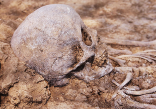
Almaty 2018
Under supervision of:
Dr. Christoph Baumer
Usharal-Ilibalyk 2018 Archaeological Report.
The joint archaeological project at the site of Usharal-Ilibalyk completed its third season in the summer of 2018. This expedition is truly an international effort with participants this year from the Republic of Kazakhstan, the United States of America, Switzerland, Australia, and Malaysia along with technical diggers from the community of Usharal itself. The expedition, for the first time, excavated human remains dating to the late medieval period from a necropolis of adherents of the Church of the East (Nestorian). While previous individual and scattered burials with Christian artifacts have been found over the past several decades, this marks the first time in more than 130 years that a necropolis of Christians in Central Asia has been identified and excavated. 2018 marks the first season that actual remains were found in conjunction with gravestones with Christian inscriptions containing Old Turkic and Syriac along with pottery fragments with cross inscriptions that were located in the previous two seasons.
The Usharal-Ilibalyk project’s main participants include Archaeological Expertise, LLC., under the direction of Dr. Dmitry Voyakin; the Tandy Institute for Archaeology (Ft. Worth, Texas, USA) led by Dr. Stephen Ortiz; and sponsored by the Society for the Exploration of Eurasia, Dr. Christoph Baumer, director. Additional sponsorship was supplied by the A. K. Margulan Institute of Archaeology of Kazakhstan directed by Dr. Baurzhan Baitenaev.
Fig. 1. Ilibalyk (shaded in white) with location of necropolis
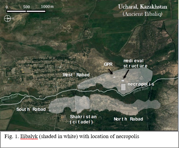
1) Archaeological Expertise, LLC.et. al., 2016 Field Report on the Archaeological Excavation at Usharal-Ilibalyk (posted on http://www.exploration eurasia.com/inhalt_english/frameset_projekt_aC.html). See also Archaeological Expertise, LLC. et. al, 2017 Field Report on the Archaeological Excavation at Usharal-Ilibalyk (posted on http://www.exploration-eurasia.com/inhalt_english/frameset_projekt_aC.html),
The necropolis with Christian burials was located outside the walls (shakristan) to the north of the city and identified in the 2016 season.
Subsequent excavations in 2017 at the hypothesized site of the necropolis yielded further gravestones, including one with a significant inscription. However, no human remains were found. Rather, in a portion of the site of the gravestone find spots (Field IV, Area B), occupation including a possible structure and kiln were excavated and recorded. While additional gravestones were located in the same Area B as well as Area C during the 2017 season, the failure to located human remains or the evidence of grave pits, even while utilizing Ground Penetrating Radar puzzled the archaeologists. Possible explanations included the idea that the stones had been moved significantly either due to industrial plowing during the Soviet Era (1933 – 1991) since the location was in the fields of a collective farm; or reused secondarily in antiquity by a population who later had no connection to previous inhabitants of the site. A final hypothesis included the idea that perhaps excavation had not penetrated deeply enough.
Because of the continued number of gravestone finds from 2017 which testified to a significant community of people who associated themselves with Christianity, the team considered this enough rationale to continue to examine the area for evidence of graves despite the fact that both the soil and the GPR results provided no convincing proof of grave chambers. Simply, the goal was to dig deeper.
In addition, several research questions remain unanswered, particularly the identity of the Christian inhabitants. Since so few graves of Central Asian Christians have been excavated, particularly during the modern era, no modern identification techniques involving ancient DNA analysis or modern forensic techniques have ever been applied to this particular context. Such information could prove invaluable in simply answering the question: Who were these people? Therefore, the best way to answer this question is to continue to dig where they might most reasonably be found, the location of the gravestones found in the previous two seasons.
The Usharal-Ilibalyk expedition of 2018 sought to implement the following research objectives:
- Conduct further geo-archaeological exploration to identify and recover the Christian monuments of the site of Usharal-Ilibalyk through continued examination of the necropolis and, perhaps related architecture.
- Further identify and define the borders, topography, and layout of the necropolis with the goal to excavate human remains.
- Take forensic, chronology (C-14) and DNA samples under controlled conditions for the purpose of identifying the environmental, cultural, and ethnological context of those remains found in the necropolis.
- Analyze the stratigraphy and chronology of the necropolis and any surrounding features
- Prepare a scientific report of the findings and two publications in Russian and English languages, with the eventual goal of a report also in Kazakh.
As this report will detail, several of the expedition team’s goals were met including the location of some 33 intact graves in various states of preservation. Interestingly, almost all of the remains (excluding two) were children ranging from infants to teenagers. Based on the analysis of the burial practices from these graves, it can be clearly demonstrated that those interred in this necropolis appeared to be part of a homogeneous culture. These remains—even on the smallest of infants and possible still borns—demonstrated a consistent burial practice and orientation of the body. Several of the graves included simple grave goods, mostly jewelry or other small items. In many cases head and hand positioning reveal a significant burial tradition. One fired brick in situ grave marker, as well as strong evidence of a gravestone found in 2016 with an excavated grave in the vicinity of the same location provides conclusive proof that the bodies discovered in the necropolis are directly associated with the gravestones and their inscriptions Some of the research is still pending. This pending research includes all the forensic, C-14, soil and DNA samples taken. During the course of excavations, 34 soil samples, most of the surrounding area of the grave pits, were submitted for analysis. All of the human remains, following careful excavation and recordation, were wrapped and boxed for analysis. Five C-14 samples were taken of burned wood that were found in some of the significant number of burn pits and ash lenses found at the grave sites.
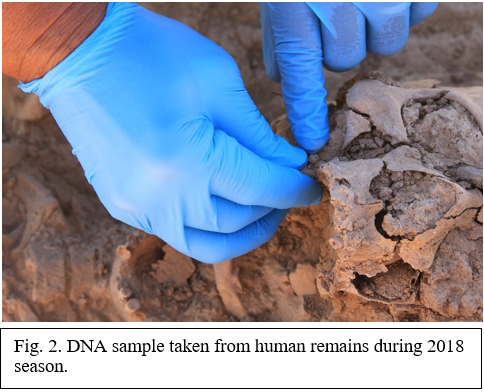
Four human DNA samples were taken from the molars of 3 skeletons of various ages along with a sheep’s tooth. It is regrettable that these samples have run into various obstacles either during the submission process or problems with the necessary specialists agreeing to do the work. Such are some of the problems of conducting these analyses in locations where proper equipment, resources and expertise is at a minimum. It is our hope that these problems will be solved within the next few weeks so that an addendum report can be submitted which can shed a fuller light on ethnic identity, diet and perhaps even cause of death in a few cases.
Chronology and the exact period in question is still somewhat nebulous. While most are in agreement that we are uncovering remains from the 13th- 14th century, this season failed to yield any numismatic material (coins) which is the first time since our excavations began. In addition, delayed C-14 results and other samples for comparison are lacking to help us determine the chronology. A better ceramic typology; further C-14 samples sent to reliable labs; and other methods of chronological dating may eventually enable us to more accurately date the remains discovered to date. Such accuracy could also help answer the question of when and why these Christians eventually disappeared, not only from Ilibalyk but also from Zhetisu/Semireche as a whole. While historical theories abound ranging from the plague to the conquests and genocide of Timur (i.e. Tamerlane), no archaeological evidence to confirm or discredit these theories exists.
So far, no evidence of ecclesiastical structures has been discovered at Ilibalyk. While one of our objectives is to try and find evidence for a church and/or monastery which have been discovered in Kyrgyzstan and Uzbekistan dated to our period of research, nothing has emerged. The long tradition of burying Christians near a church building is firmly established. Burials at Ak Bashim (medieval Suyab) were found even under the walls of the church excavated there.2 Further exploration of the site is needed for the future in terms of where such a structure might exist. Since two of the gravestones from Ilibalyk refer to clergy, it is logical to assume that a church might be found on the site. If, however, such a structure was located inside the walls of the city, then chances diminish of locating the structure. In addition, if the people associated with this necropolis came from a nomadic community that conducted trade or had a symbiotic relationship with the inhabitants of the city, then the ecclesiastical structure could have been a moveable one.
2) For a survey of the few Church of the East structures found in Central Asia, see Mark Dickens and Alexi Savchenko, “Prester John's Realm: New Light on Christianity Between Merv and Turfan,” in, The Christian Heritage of Iraq, Collected papers from the Christianity of Iraq I-V Seminar Days (Gorgias Eastern Christian Studies), ed. Erica C. D. Hunter, 2009, 121-135.
This preliminary report seeks to delineate the methodological procedures undertaken at the necropolis of Ilibalyk. It will allow the reader to examine the cultural and analytical data and to compare the grave sites of the human remains. The findings of the 2018 season bring these medieval inhabitants a bit closer to our own time and reality and also provide us with a better picture of the Christian communities that existed in northern part of the Zhetisu region of modern Kazakhstan and contributes to the overall, rich history of the area.
1. REMOTE RESEARCH METHODS
1.1. Geodesy
At this time, as a result of the integration of modern technologies in the area of scientific investigation, various pieces of modern engineering equipment were utilized. One such example is the use of Total Stations, 3-D scanners, high precision GPS and geo-radars to document archaeological sites. The use of this equipment enables extra precise measurements over a short period of time.
In turn, Archaeological Expertise LLP has adopted the latest equipment for documenting and studying both surface and buried objects applying non-invasive methods. The investigations for this project involved the company using the following equipment: Leica TCR 307, 407, TC 407 laser total stations, HDS3000 3D scanner, Trimble R3 ultra-precise GPS tracker, GSSI SIR-3000 geo-radar with a 270 MHz frequency antenna.
The main tool for documenting the sites during the archaeological dig was the total station. This apparatus provided high-precision topographic survey plans of hills and cross sections. Data acquisition was accelerated and convenient due to the fact that the data acquired from a total station is digital.
The Trimble R3 GPS tracker enabled high-precision documentation over large areas. The advantage of this method is this technology’s high speed and accuracy of plane surveys and topography. In addition, only one operator was required to carry out the survey because the device is not attached to fixed positions, thus, one can use it on sites with complex terrain as well as over very large areas which exceeds the range of any Total Station.
A surface survey was conducted of the terrain layout, including the roads, communications, the surrounding infrastructure, hydrology, etc. With the help of the high-precision Trimble R3 GPS receiver a triangulated polygon for project planning and surveying was created. As a result of the research the following data collection and processing method was used:
- An arrangement scheme
This represents a set of information containing communication data related to roads of all types (central/main, dirt), the water resources (rivers, streams, lakes, etc.) and the power lines. All information is overlaid on the basis of topography.
- Surveying
This methodology involves a 3-D survey of the area based on the following:
Surveying technique: Topographic surveying of the object occured in two stages. The first stage involved surveying the micro-topography of each object individually. The advantage of micro-topography lies in its detail, allowing a researcher to determine the layout and features of the object under investigation based on a predetermined model with the ability to select a plot to conduct excavations using the received data. Micro-topography is run with a frequency of 1 m, which provides the possibility to construct a topographic model with horizontal increments equal to 0.2 m.
The second stage of the research involved a general topographical survey of the area and the surrounding landscape. This step facilitated the tracing of the overall arrangement and the relationship between the objects themselves as well as tracing the features of the cultural landscape. Surveying the general topography was made in increments of 10 m with horizontal increments of 0.6 - 2 m.
The peculiarity of the archaeological survey is that the information needed for this study was generated by applying different scales, that is, objects of interest are documented using micro-topography and the buffer area by applying common topography. In this regard, the work was carried out by a trained professional with an expertise in the field of archaeology.
The scale of the arrangement scheme was selected depending upon the area of the research objective. The maximum scale is 1:500 and then proceeds to 1:1000, 1:2000, 1:5000, etc. These limits do not apply to topographic surveying due to the archaeological specifics listed above. It is recommended that one use the following scale grid with a maximum scale of 1:50, then 1:100, 1:200, 1:500, etc., if applying intermediate scales a linear scale was required.
- Planned surveys
This method of collecting information can be both an independent method when conducting documentation and a complementary method to all other types associated with the use of a laser total station. Plan drawing carries the maximum amount of information. It is generated by object section with a plane at the level of 1 m or at the required height with an indication of the information in the drawing. The plan provided all the structural parts with feedback of the related information that included height-marking, explanations of the drawing and dimension lines. The composition of the plan drawings included drawings of individual parts, constructive units and other items requiring more detailed elaboration and carried out on a larger scale. Drawings were done in a linear scale ranging from a scale of 1:10 and less.
1.2. Using GIS technologies
Modern computer technologies have already proven their superiority when processing data. Combining computer technologies (especially data processing and analysis) and traditional maps has opened new horizons for cartography and resulted in the first Geographic Information System (GIS). Geo-information systems now combine precision and high quality digital maps; a tremendous amount of background information; a powerful set of tools for the processing and analysis of data; and also, the ability of specialized information exchange through the Internet. GIS - Geographic Information Systems are new technology that, despite its recent appearance, has spread widely across many scientific disciplines. GIS is successfully applied, for example, in such areas as forestry, water management, geology, economics, criminology etc. The very name itself does not provide the full gamut of a GIS system, below are some definitions that characterize GIS:
- a powerful system for collection, storage, processing, retrieval, and display of spatial data extracted from certain objects for specific practical purposes.
- an information system that generates data relating to spatial or geographic coordinates.
In other words, GIS is a system of databases with specific operational features applicable to spatial data.
-
GIS is a computer system whose main purpose is the manipulation, storage, processing and generating of data about geographic space.
- GIS is not a single computer program, but a combination of several different computer technologies.
- GIS is an overlay of all kinds of data to its spatial environment (territory).
GIS for archaeologists is recognized as the best system with the ability to use the latter in the most extensive of studies. This is because the system allows for the analysis, management, and expression of the full range of collected data that is both spatial and having certain characteristics. This is absolutely necessary to maintain up-to-date with the constantly changing human environment. The program allows one to work on the restoration of an ancient landscape and provide further analysis of individual excavation structures, etc.
Despite their appeal, geographic information systems are criticized for its pronounced environmental determinism. Data related to the concept of "environment", such as types of soils, rivers and land usage can be measured, mapped and transformed into a digital format, while the cultural and social aspects are complex and therefore, problematic.
So, GIS technology is used to examine and process sets of various geographically related information. GIS is often used as a tool for mapping and analysis. There are a variety of methods whose use facilitates solving set tasks, and each method has its advantages and disadvantages. They are as follows:
- Manual survey via a hand-carried map. -- very low accuracy, extremely time-consuming, low cost.
- Instrumental survey (theodolite/total station) - high accuracy, extremely time-consuming, high cost.
- Utilizing GPS - accuracy within 5-15 m, extremely time-consuming, low cost, problematic display on a map.
- Topographic bases (100,000, 25,000) – Objects and features are not displayed due to their small size.
- Geo-referenced satellite imagery -- extremely costly, yet high-resolution imagery.
- Aero-photography -- no geo-referencing, distortion, not time-consuming, high cost.
GPS Rover survey (GPS measurement with high accuracy) -- extremely high accuracy, extremely time-consuming, extremely high cost.
The most appropriate way is a combination of these several methods mentioned above, combined into a GIS. This was applied during the excavation.
1.3 Satellite imagery
Working with satellite imagery that are geo-referenced and have a resolution of up to 1 m provides researchers with information about landscape arrangement, water sources, and topographical details. This information is then used in drawing maps and documenting the change of landscape through time, as well as monitoring the current excavation and its context. We used satellite imagery from a variety of sources including: Birdseye Satellite Imagery, Digital Globe, USGS, ESA Sentinel and EOLi, and JAXA ALOS, and Google Earth Pro.
|
|
|
|
1.4 Aerial photographyIn the process of the 2016 and 2017 excavation, aerial survey which included photogrammetry was employed for collecting and processing topographic information. A Phantom 4 quadrocopter (drone) was used to photograph, capture video, and take measurements. As a result we were able to gather much technical and visual information. We developed a method that took into account the wind and weather conditions of this region of Kazakhstan. Numerous flights were performed at low altitudes (30-100 m) over specific locations, applying so-called “carpet coverage” that allows a production of a large number of pictures with each subsequent photo overlapping the previous one by no less than 80%. In this way, numerous photos cover all of the spatial area of the site. 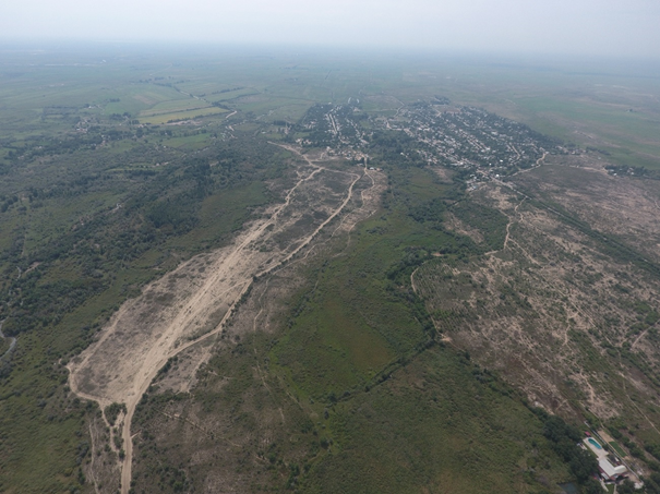 Fig. 8 - Aerophoto. Oblique view to the north. Rabad and cemetery 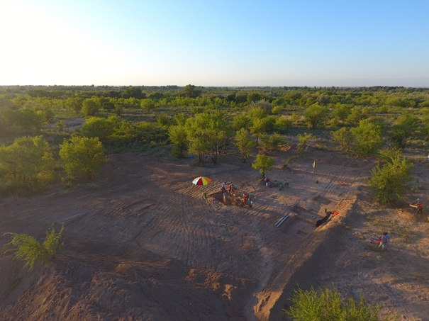 Fig. 9 - Aerophoto. Oblique view to the north-west. Research area 2018 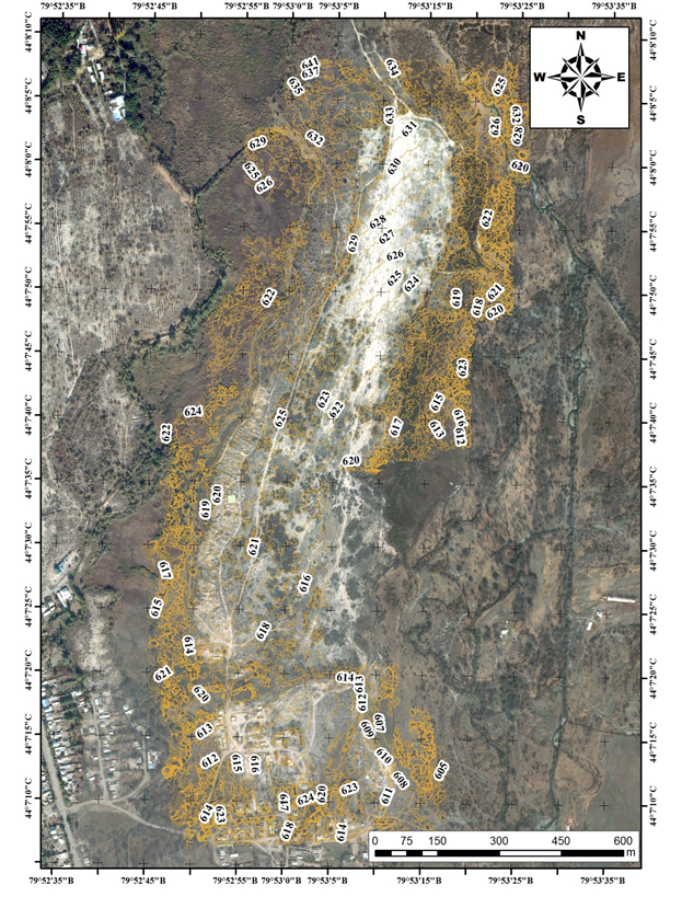
|

Fig. 10 - Topographical map.
On the basis of the data collected a 3-D model was created utilizing the method of photogrammetry. This provides the following result-- a highly detailed ortho-photographic plan and a 3-dimensional digital model with the ability to construct a high precision topography.
2. EXCAVATION RESULTS 2018
2.1 Excavation Unit Summaries for Field IV, Area С
The previous season’s (2017) excavation involved the initial mechanized clearance of the topsoil in three areas of the possible necropolis in what has been designated “Field IV (previously Field III, in 2016). Following backfill procedures based on environmental regulations in this state forest, excavations in 2018 involved a re-exposure of topsoil in Area C (See Appendix C, Fig. 1). The exposed area was 890 m2 which represents a reduction in exposure from the previous season by 1830 m2. The team believed that a research design for this season (2018) warranted further examination of Area C due to the significant number of gravestones (kairaks) found in this location and the possibility that the previous season’s excavations had not penetrated deeply enough to yield human remains. Such a hypothesis proved accurate as by the first day of excavations further grave markers—and for the first time, human remains—were located.
Initial mechanized clearing to a depth of between 50 to 80 centimeters below the surface (cmbs) was conducted with the archaeological team carefully observing any artifacts or features that might manifest during the process. Any features and/remains were carefully marked and loci identified. Subsequently, excavation units were delineated and measured based upon findings.
Further clearing using hand shovels and towels occurred across the entirety of Area C following initial mechanized clearing. This resulted in further exposure of artifacts, features, and human remains. In each case these were marked and loci identified and recorded utilizing a total station.
(See appendix C, Fig. 48)
Unit 1
This unit was measured as a 2 x 2 meter unit laid out to incorporate the human skull (juvenile) identified as Locus 012. It was situated 1.41 m to the south of the northern baulk of the unit and 1.44 m to the west of the eastern baulk. The levels for each corner of the unit is as follows: NW: 597.118; NE: 597.289; SW: 597.123; SE: 597.212; Center: 597.123 (See Appendix C, Fig. 3-4).
Locus 015 was opened as the initial level of the unit surrounding the human remains. The soil was excavated using shovels starting in the NE corner to a level of approximately 15 cmbs. Soil was collected in buckets and 100% of the soil was sifted.
The cranium in situ was measured at 12 cm X 11 cm and appeared to be extensively fractured, probably due to clearing and leveling operations. The color and small size of the cranium made identification in the soil quite difficult, thus the damage incurred. No grave chamber was visible in the soil.
A Munsell reading of the soil in Unit 1: 7.5 YR 4/4 Brown. The soil typology was a sandy loam. There were white flecks of what appear to be a type of calcite with pebble inclusions. As excavations proceeded at about the 4 cm level in the NW sector of the unit, the soil appeared darker with more inclusions and crumbly pieces. (Munsell 7.5 YR 5/3 Brown). The soil appeared slightly lighter and with a more clay-type consistency as excavations proceeded southward in the unit, closer to the cranium.
The soil approximately 6 – 12 cmbs became more compact or “chunky.” The soil was left undisturbed around the skull in a 20 – 30 cm diameter to help delineate other possible remains and to begin creating a pedestal around the remains.
Bone fragments were found during the sifting process which were li human. It was determined to carefully delineate which sector of the unit the remains were found in the sift were coming from. Excavations continued in a clockwise manner from northwest to southwest in 6 – 8 cm levels. Small bone fragments were found in southeast corner of the unit as well as the northeastern baulk and in the northwestern corner. A piece of glazed pottery was also found in the southeastern corner.
North of cranium at approximately 16 cmbs a reddish color manifested in the soil. The area was cleared and photographed (Photos: 0806 – 0809). The soil appeared to have a bit moister consistency almost like clay, but it was neither consistent nor deep.
Bone fragments were found in southern half of the unit, south of the cranium. Also, calcite deposits, similar in texture to the north of the cranium were found. After digging to a level of approximately 21 cmbs on the north side of skull and leveling the area; it was decided to begin to slice into the unexcavated terrace that had been created around the location with the skull. It was further delineated into a pedestal and determined to create a cross-section, in the event that the body was interred vertically. Thus, initially excavations of the cranium itself were in the direction of north to south in a vertical cross-section. Later, it was proven that these bodies are not buried in a vertical fashion but oriented in a supine fashion with faces oriented toward the east. As more of the skull was exposed and fragments flaked off, the excavation was then approached from the top down, revealing that the body was laid from west-to-east with the face and body oriented to the east.
Meticulous exposure of the remains (designated Locus 014) with dental tools revealed the cranium and thoracic areas. One of the femurs (probably left) became dislodged during initial excavations and was bagged. The condition of the skeletal remains was fair, particularly of the thoracic area (Ribs and chest). The left humerus was relatively intact as were the left radius and ulna. The forearm (radius and ulna) were bent toward the pelvic area. The lumbar vertebrae were visible, but the pelvic area appeared to be missing or had decayed beyond recognition. The right leg was never found, nor were bones from either feet, although some small toe bones may have been located in the sift and were bagged. Hand and finger bones were visible but difficult to distinguish between right and left hand. The right humerus was also intact but the left radius and ulna were either missing or decayed. Despite this, the arm orientation on the right side also appeared to be directed downward toward the pelvic area. The skull was highly fractured and due to the multiple pieces, soil that encased the area was left in place for as long as possible to prevent total collapse of the cranium in upon itself. Eventually, the soil in the facial region was carefully removed and it was determined that the face was in an east/southeasterly direction. Cleaning continued throughout the course of excavations.
Drawings of the skeleton began. During this drawing process it was further determined that the skeleton was definitely supine and had both hands directed toward the pelvic region. It was impossible to determine if hands were overlapped on top of the abdominal area. This orientation appeared to be consistent with remains in other units as well, as a pattern of burial (See burial comparison worksheet, Appendix E).
Measurements of the juvenile skeleton were made:
Cranium: S to N: 14 cm; W to E: 10.2 cm. The skull was highly fragmented, almost crushed, (possibly excavational damage from the tractor)
Right Ulna: 7 cm
Right radius: 7 cm
Eye sockets: Right: 2.5 cm; Left: 2.5 cm
Measurement of final levels of Unit 1 (L-015) were as follows:
SW 596.904 m
NW 596.872 m
NE 596.964 m
SE 596.950 m
Measurements of level of human skeleton (juvenile) L-014:
597.055 m
(See appendix D, Fig. 36)
All skeletal remains were then removed, wrapped, bagged and boxed for analysis.
Baulk drawings at the conclusion of the excavation are found in (See appendix C, Fig. 52-53)
(Numbers in parentheses in the descriptions correspond to the drawing in the appendix)
East baulk description
The east baulk (cross-section), 2 meters from north to south, indicated a soft layer (1& 3) as found throughout Area C. A difference in the soil can be detected that stretches from top-to-bottom in the center of the baulk (2). On the eastern side a shaded area of soil with a bone fragment is indicated (4). It is hard to determine if this is any sort of detritus or hardened structure related to the necropolis. To the south of this shaded area a soft pit layer seems visible. If this is a grave shaft, it is indeterminate.
North baulk description
The 2 m northern baulk has a soft soil layer that extends from the east almost reaching to the western border (1). A harder layer (2) of soil melt (detritus) can be seen below the softer upper layer but does not appear to be part of any feature. Sandy soil (3) is visible about 25 cm above the unit floor that stretches west-to-east until it comes in contact with a very hard soil (taipa?)(4). This tamped or hardened soil could be characteristic of other covered graves found in other sections of the necropolis, but this is still indeterminate.
West baulk description
The 2 m western baulk reveals three significant cuts into the soil (2), possible evidence of pits. One begins 60 cm to the north of the southern baulk and extends northward 50. The other begins 70 cm to the south of the northern edge and connects with the third cut 20 cm from the northern edge. Each of these may indicate grave pits given the context, but this is indeterminate. The southern end of the baulk (3) is a softer soil and the northern end under one of the possible pits is a shaded area (1).
South baulk description
In the 2 m southern baulk, ashy soil (1) can be seen in the western corner extending to the east for 30 cm. Harder soil melt (2) (detritus) extends across the baulk to the west all the way from the western edge below the ashy soil for 90 cm. A cut in the soil which may be a possible grave pit (3) can be seen at the 90 cm mark and proceeds vertically and horizontally across the baulk until 30 cm before the western edge. Soft soil (4) is extends 30 – 50 from west to east in a patch that goes to a depth of 25 cm.
Summary of Unit 1
The remains found in Unit 1 (L-014) were the first excavated during the 2018 season at Ilibalyk. Thus, the initial challenge of determining the layout of the body combined with the fact that the infant remains created a unique challenge. This initial excavation helped the archaeologists to determine what to expect in the subsequent excavations of burials in the steadily expanding necropolis. From these remains we learn the following:
- This body did not have an easily discernable grave pit. Like most of the later grave discoveries, only once the bones themselves were found did excavators know that they had located a grave. The challenging soil conditions explain some of the difficulties from the previous seasons in finding and locating graves, even with the assistance of Ground Penetrating Radar that was used the previous two seasons.
- This burial (597.055 m ABS) is lower in comparison to some of the other infant burials (i.e Unit 3, Unit 4, Unit 5), however the natural topography may be an explanation as the ground appears to slope downward from east to west in Area C.
- Excavators later found possible evidence of ash deposits in the southern baulk and a possible grave pit. Ash deposits in the vicinity of Unit 1 correlates with the other burials discovered later with ash pits and lenses connected with burials.
- No grave goods of any type were found with the remains in L-014.
- No further remains were found in Unit 1, however, the unit was not lowered to deeper levels as some of the other unit (i.e. Units 3 and 5). It could be that other graves exist at lower levels but this option was not explored with this unit.
Unit 2
During the process of cleaning and leveling the western section of Area C, it was determined to investigate a zone north of Unit 1 (Loci 014 and 015) which was identified as a human burial (see Unit 1). During the cleaning phase a human skull was revealed and was assigned as Locus 016 with the surrounding unit as Locus 017. A 4 x 2 meter unit was opened against the western edge of Area C, with the burial roughly in the center.
The center of Locus 16 (the skull) was approximately 1.74 m from the western baulk and 2.25 m from the eastern edge of the unit; 0.9 m from the southern and 1.1 m from the northern edge, respectively. A depth using a total station was taken revealing the skull at 597.068 meters above sea level.
The skull was covered in a white fungus or mold, and thread-like branches (hyphae) all along the surface, which gave it a greyish white appearance, not unlike a stone (and that is why it was initially interpreted the skull as a stone).
Excavations began in the unit at 4 cm intervals, steadily “shaving” the surface and cleaning, in order to find the limits of the burial. Very few bones and ceramic sherds were found. Visually the soil color (Munsell: 7.5 YR 7/2) was indistinguishable with the soil color around Locus 16 (skull) and the rest of the unit. However, there did appear to be a difference between the soil consistency and texture, that is, the soil to the west and east of Locus 16 was harder and more compact than the area around the skull. As depths gradually increased, it was noted that the area to the west had more organic material (roots and a whitish mold or fungus) and this was designated as “detritus,” whereas the area around the soil was a silty loam, and to the east the soil seemed to have more clay—but it was difficult to see any color changes overall.
Fragments of bone and human remains were discovered when cleaning the southeast corner, and eventually the outlines of another skull were identified (which was subsequently labeled Locus 019).
In the NE-SE section of the unit, a patch of soil with distinct color changes measuring about 11.2 cm x 10.7 cm. The center area was dark brown (7.5 YR 3/1) and seemed to contain trace amounts of burnt material (carbon), but insufficient to collect for testing. Around this was a ring of sandy orange soil (7.5 YR 6/8).
During excavations a second juvenile cranium was found in the SE corner of the unit. It, too, had the upper part of the cranium shaved off during excavations due to the fact that no grave pit was apparent. A new locus (019) was opened. These remains were left unexposed and a section measuring 0.74 m by 0.62 m around it was left for later investigation in order to concentrate on the initial finds (L-016). Level of cranium in L-019 was measured using a total station as a level of 597.035 m (See Appendix C, Fig. 5-9).
The rest of the unit was “shaved” in 1 – 2 cm intervals using a shovel to distinguish the changes of the soil and the burial, as well as to determine the extent of the skeleton in L-016. As we did so, it became apparent that the skull was propped vertically and its occipital lobes (eye sockets) were orientated towards the east and at approximately 5 degrees slightly to the north, exactly pointed to the rising sun on this day. Slow and steady excavation continued around the skull, carefully cleaning after every pass. After about descending a further 4 cm the level of the upper mouth (maxilla) was reached, and approximately 6 cm of soil was left around the back of the head to keep it upright (i.e. to prevent it from falling over or becoming loose). Clearing around the skull a further 2 cm downward continued until reaching the level below the mandible. The mouth was tightly closed, and teeth were preserved in situ. At a further 1 cm down the clavicle and shoulder (acromion) were traced, gently delineating the arms (humerus), ribs and spine, at about 5 cm east of the skull.
To support the skeleton and maintain the bones’ positioning, it was determined to form a “pedestal” of earth measuring approximately 0.73 m by 1.55 m oriented with the same angle as the head and spine. Excavations occurred around this pedestal so that the area in the unit was roughly 5 cm lower than the pedestal. At this point additional bone fragments were found in the SW corner and bones and sherds embedded in the north baulk, not associated with L-016 were discovered.
Excavations continued around the rest of the skeleton (L-016) by removing soil along the bones. It was apparent that the head was at a higher level than the feet, so that the burial was sloping rather than entirely horizontal. The outline of the body was traced from the head and gradually down the arms (humerus, ulna, and radius), to the iliac plate, to the femur, tibia and fibula, and foot. The skeleton was remarkably well preserved, even the left knee cap (patella) remained.
A large bone was found lying above the left ulna, which seemed out of place. It has been suggested that this was the talus of the foot (if so, it was obviously misplaced). Nevertheless, the skeleton appears to have been well-preserved and undisturbed.
Soil samples were collected from within the chest cavity and around the skeleton for analysis, with care taken not to touch the soil, but using metal implements to transfer them into their receptacles. With the body fully exposed, measurement of the entire body of the individual ensued measuring approximately 1.05 m by 0.32 m. The right side appeared slightly lower in the soil. Locus 016 is a well-preserved burial of a child with initial estimates that the child was between six and nine years of age. Sex could not be determined prior to forensic analysis.
In terms of funerary practice, clearly the head was propped up by soil in the burial pit so that skull was vertical and oriented literally to “look” eastward. The left and right arms were positioned so that the hands came together at the pelvis. The left hand’s bones (carpus, metacarpus, and phalanges) were clearly lying over the pelvis. The right hand appeared to be lying behind the spine; however, it may have clasped the left hand in front and distorted when the body decayed.
As excavations progressed, rectangular greenish stone was uncovered at the right side of the skeleton, between the lower rib and the pelvis. This stone seemed to have been placed underneath the body before burial; or, alternatively, it was placed above the body during burial and settled down after the body decomposed. Both hands were placed in front of the body during burial and may have been clasped together.
The north baulk was cleaned, and a section was drawn, illustrating the baulk’s stratigraphy. Photos, both 3-D and drone, were taken of Locus 016 at sunrise from the western side confirming the orientation is eastward (i.e. head to the west, feet to the east, and skull tilted so that eyes are looking eastward).
Then the dismantling of the skeleton (Locus 016) began, starting at feet and moving up the body. In general, the preservation level of the skeleton is excellent, even pristine, with some minor decayed areas. Compacted soil was carefully removed around the bones with dental tools, assisted by continual brushing. Bones were placed in aluminium foil as follows: right foot, left foot, right fibula and tibia, left fibula and tibia, right femur, left femur, right side ribs, left side ribs, right hand, left hand, right radius and ulna, left radius and ulna, right humerus, left humerus, right clavicle, left clavicle. The small rock which was located in the lower right rib/abdomen area was bagged for closer examination. The soil gathered from around the bones was placed in a large plastic bag to be analysed later. Then, the left pubic bone and ilium; right pubic bone and ilium; sacrum; lumber spine L1-L5; thoracic and cervical spine T1-T2 and C2-C7; Skull and C1. The skull was removed with rubber gloves in order to lower risk of contamination for further tests. During removal of the skull 3 loose teeth were found on left hand side of skull, recorded and bagged. Some photos were taken of the final removal of Locus 016.
The head rest area was removed and bagged separately for possible further tests and preliminary assessment suggests that the head was tilted east at burial using in-situ silty soil. Photos were then taken of the head rest area. The skull dimension estimate is: circumference 47cm, back to front 16cm and side to side 14cm. The eye sockets were approximately 3.5cm in height and width.
The area beneath the skeletal remains were removed to look for any further artefacts. A dense, worked stone approximately 5 cm x 5 cm x 1.5 cm was located 5-10 cm below the body level (245 cm from east baulk, 96 cm from north baulk), and the area was ‘shaved’ at this level to see if there were any more fragments, but none were located.
Following the conclusion of excavations of L-016, the remains of a baby skeleton found in the southeast corner of Unit 2 (Locus 019) was cleaned and prepared for excavation. The condition of the skull was very poor. Several small white beads measuring 2 - 3mm in diameter were located in rib cavity area, possibly from a bracelet or necklace. The location of the center of the skull was 0.5 meters from the east baulk and 155 cm from the north baulk.
Working eastwards from the head, to the ribs, then towards the leg bones, the skeleton was uncovered. Some of the ribs were intact, but below this the bones were fragmented and barely recognizable. No hands or feet bones were found. Loose soil from digging around the skeleton was screened and several bone fragments located. The area around skeleton was scraped in order to make a level area, then excavations continued around the skeleton. While brushing lightly, a further two loose beads were located in abdomen area but it was unclear exactly where they came from. While digging near the east baulk, some leg fragments were located, indicating that the skeleton’s legs/feet may extend eastwards, therefore, it was decided to extend the baulk a further 0.5m to the east with a further 1 meter.
The extension of Unit 2 in the southeast corner was named Unit 2A. Once the small extension of Unit 2 designated Unit 2A into the southeast corner was completed the three baulks were shaved, and a brown detrital layer was clearly seen on all three cross-sections. This demonstrates that the end of the grave pit for this infant skeleton lay between the original eastern baulk of Unit 2 and the eastern baulk of Unit 2A, which was predicted. This was confirmed when the horizontal surface was scaped around the skeleton showing a clear change in soil from fragmentary, loose brownish soil to yellow-light brown homogenous silty mud to the east.
The excavation of the skull continued which had been shaved to eye socket level previously when unit was being levelled. A small rock was placed at the side of the skull to prevent it from flaking off the soil-filled interior of the skull. Cleaning continued around the badly disintegrated bone fragments and the absence of pubic bone, ilium, sacrum and spine was noted. The lower leg bones were fragmented, and no hands or feet bones were located. Several more beads were found around the skull during brushing indicating they were likely associated with a necklace. Though the skeletal bones were found in the Unit 2A, this process proved useful in order to delineate the grave pit.
The skeleton in L-019 was then measured and a level obtained with the theodolite. The approximate skull size was as follows: circumference 40cm, diameter side to side 12.5, diameter front to back 11cm though this may be inaccurate due to crushing and rotation of the skull with time and pressure. The skeleton was then photographed on four sides designated with a north arrow and measuring stick. Then the bones and skull were carefully removed. The bones were placed in aluminium foil wrappings and packed for transport and analysis.
Following photographs and measurements of U-2, it was determined to lower the northern baulk which was located south of Test Pit #1 because of the discovery of a possible human bone found in the baulk for the purpose of investigating possible human remains. During this process, a feature was located in the northern baulk which may have corresponded with the bones in the baulk and/or the skeletal remains in L-016. This former baulk area containing the supposed burial pit was given Locus 033 and the area was photographed. It was eventually determined that this was an ash pit.
Locus 033 (expanded into extension Unit 2B) was located on north side of Unit 2 and extended 3 m from the west baulk and a baulk separating Unit 2 and an adjacent test pit, with a width of 0.65m wide and height ranging from 0.4m in the west to 0.53m in the east. As mentioned above, excavators determined to investigate this section due to bone fragments located in the northern baulk and the notable stratigraphic layers with truncations suggesting an ash pit/grave pit structure. The area was cleaned and brushed, measured with a total station (theodolite) and photographed.
Following levelling to a depth of 30 cm near the west end of the northern baulk, a brown detrital soil layer which was truncated by a light gray color of soil It was then interpreted to be an ash pit. Artefacts were collected from the ash pit during excavations including fragments of black charcoal which was placed carefully in aluminium foil for possible future C-14 analysis. In addition, some pottery, brick and stone fragments were found in the pit.
As the levelling of Unit 2B continued to bring it level with the floor of Unit 2, a poorly preserved infant skeleton at eastern end of Unit 2B was exposed. This was unexpected since the fill represented an ash pit, but in fact seems to have been an ash pit directly alongside a small grave pit. The newly discovered infant skeleton was given Locus 035. Bone fragments were removed from around the badly damaged skull and the soil in the immediate vicinity was screened.
At the western end of Unit 2B, extending slightly into the adjacent test pit, a possible fibula and tibia were uncovered slightly, in the area where bone fragments were previously noted. This appeared to be another intact skeleton extending west but outside the Area C boundary by 0 - 0.5m. It was decided to leave this for possible future excavations due to the lateness of the season. No locus was assigned.
In order to excavate the human remains in L-035, a unit extension was prepared Started to level the area with spade and shovel. Marked out the area of Unit 2B with nails and string 3m long from West to east, and it was 1 m x1 m square at east end, and 0.65m wide for the rest, as shown in the Unit 2/2A/2B/2C plan drawing.
This 1m x 1m block located in the baulk east of the skeletal remains was lowered to the skull’s level, and revealed an oval section of the grave pit defined by a brown detrital layer truncated by a homogenous light brown silty mud which was the grave fill.
The excavation of the 1m x 1m square at the west end of the skeleton found in what became Unit 2C proceeded. Some artefacts were found in the soil approximately 10 – 30 cm above the remains including animal bones in a possible ash pit and a turquoise blue glazed pottery fragment.
The area around the infant skeletal remains of L-035 was cleaned and photographed, including excavating the grave pit area at the posterior end (east end) of the skeleton. The skeleton was poorly preserved and notably one part of the skull appeared to be resting on another part of the skull which indicates major disturbance for example possibly due to agricultural activities in this area during modern times. The soil around the skeleton was screened for any bone and other artefacts, and some bone fragments were recovered. No beads or other jewellery was found. The skeleton was then measured at the total station (theodolite). The skeleton was then extracted with body bones and skull fragments wrapped separately in aluminium foil. Also, a bag of soil from around the skeleton was collected and labelled for analysis. The area around the grave pit was then dug 5 cm deeper to check for any additional artefacts and none were found.
Unexpectedly, another juvenile infant skeleton was found while a ramp was being made for the wheelbarrow exposing human bone fragments. This new area was named Unit 2C and delineated 3 meters long and 1.5 meters wide. These skeletal remains were designated Locus 036. The area was lowered to the level of the skull and an outline of the potential grave pit was delineated adjacent to an ash pit.
Excavations of juvenile remains (Locus 036) continued to expose bones as much as possible. The area was then measured using theodolite and photographed. The remaining parts of the skeleton, which were in poor condition which included parts of the back of skull, part of the left and right ilium, both femurs, both fibula and tibias, one heel and metatarsal and toe tip. These bone fragments were then extracted and placed in two aluminium foil packets – one with body bone fragments and the other with the skull fragments (including soil fill). The packets were labelled and bagged for shipping and analysis.
The only additional artefact in L-036 was a fired brick fragment, but further levelling on the ash pit west of the skeleton possibly contained bone fragments. Also, west of the skeletal remains, in an apparent ash pit area, a very hard surface feature may represent some kind of mud brick structure. Locus 036 was then cleaned and levelled further and the soil was screened to ensure all bone fragments were removed. The edge of the grave pit was indicated by a curved shaped fissure/crack around the pit The dimensions of the grave pit were 130 cm long, 80 cm wide. The length of the skeleton was approximately 66 cm.
The final measurements for the loci in Unit 2 are as follows:
L-017 (Unit 2 closing level): 596.933 m
L-16 (grave): 596.936 m
L-019 (grave): 596.971 m
L-033 (Unit 2-B closing level): 597.199 m
L-035: (grave): 596.910 m
L-036: (grave): 596.877 m
Baulk drawings at the conclusion of the excavation are found in Appendix C, Fig. 50-51
(Numbers in parentheses in the descriptions correspond to the drawing in the appendix)
East baulk description
A brown-colored detrital layer (2) with white flakes or fragments approximately 15 cm wide is truncated at two points, indicating a potential 0.5 m grave pit (3) related to the unexcavated skeletal remains in the southeast corner of unit (Locus 019). An 8 cm x 8 cm wide brick-like object (4) with dark grey core and orange rim in the middle of this potential fill area was noted and investigated. This turned out to be a burned root structure rather than a brick, and only extended approximately 7cm into the baulk.
North baulk description
Another potential grave pit is noted (3), as indicated by truncation of the same detrital layer (2) present on the east baulk. The size of the potential grave pit fill area is 1.7m long and corresponds to the location of small bone fragments (6) present in the face and has mostly light-gray and light-brown colors. The bone fragments are at the same level as the skeletal remains in Locus 016.
West baulk description
This face contains the least features. Towards the right side, the detrital layer (2) is present in the bottom 15 cm and the layer appears to transition to homogenous texture (1) towards the south. There is a greyish coloured brick-like feature in upper half of cross-section present which may indicate grave fill (7).
South baulk description
On this cross-section, bone fragments at two locations were noted (6), and appears to correspond to a potential grave pit (1) which extends 1.35m eastwards from the west baulk and marked by a light brown homogenous texture with some grey patches (5). The bone fragments are at the same level as Locus 016 and are likely to represent as yet unexcavated skeletal remains.
Summary on Unit 2
Unit 2 (4m x 2m) was opened on discovery of Locus 016 which turned out to be a well-preserved child’s skeleton 1.05m in length. On further cleaning of the unit, an infant skull was located in the southeast corner (Locus 019), followed by a further infant in the north baulk (Locus 035), and another in the south baulk (Locus 036). This led to the unit being extended three times to include Unit 2A, 2B and 2C. The infant remains were poorly preserved compared to those in L-016 probably due to their deaths occurring at a younger age, thus having a more fragile bone structure. All of these skeletal remains were located at a similar level (approximately 597.1 m above sea level) indicating burial during a similar time period. As with other units, where skeletons were located at different depths, it may be possible to find further remains and cultural materials if the unit was excavated to a deeper level, however, time was a limiting factor.
Notable features from the unit included:
1) All skeletal remains had a similar orientation (feet pointing East, and head tilted looking east)
2) Grave pits of 3 infant remains (Locus 019, 035, 036) were delineated and interpreted as oval shaped surface structures which appear to indicate a simply dug out hole in the ground for a grave. Evidence of brick structures were not found at this level.
3) Ash pits were noted adjacent to Locus 035 and 036, with charcoal, animal bones and occasional pottery fragments which may indicate a burial ceremony of some kind.
4) Close proximity of the burials is notable (approximately 1 m apart). Further skeletal remains (tibia and fibula bones) were located in the southwest corner of the adjacent test pit but time did not allow excavation.
5) Radius, ulna and hand bone locations on Locus 016 appear to indicate both hands were placed on abdominal area, with the right hand possibly in a slightly higher position.
6) A small stone was found in the right lower abdominal area, perhaps originally placed in the right hand or both hands of the child at burial.
7) Small white beads as grave goods were found only from Locus 019. The other Loci – 016, 035 and 036 contained no jewellery.
Unit 3
During cleaning and leveling with shovels following the mechanized cleaning of the previous day across Area C, a juvenile (infant) human skull was found in the SE spur of Locus 001 (see Appendix C, Fig. 2). A new locus was opened—008. The cranium’s cap was slightly damaged prior to noticing its presence in the soil. It was encapsulated in an area with hardened soil, whose consistency was similar to mudbrick. A brief period of excavation around the scull for identification purposes revealed the presence of baby teeth, some of which were loose. These were bagged. A sifting of the dirt around the skull revealed more teeth as well. A level of the skull was taken of 597.500 ABS using a total station. Other small animal bone fragments were found to the NE of the cranium.
The juvenal cranium appeared to be either within the hardened soil or immediately next to it. Following further examination, it was seen to be significantly fractured which probably occurred during the clearing of the soil. Apart from the hardened soil, no grave chamber or change in soil was apparent. Also, it was noted that near this L-008 location in the spur of the southeast sector of Area C, there were fired and mud brick features which emerged to the west of the location of the infant’s skull.
Due to the presence of human remains at L-008 and the nearby brick features, a unit measuring 4 x 6 meters (Unit 3) was opened which incorporated the human skull together with the first set of brick features to the west. Interestingly, this “spur” of Area C was a section of the necropolis that had not been exposed during the 2017 season.
Once the unit was delineated, it opened with initial measurements as follows: Datum (SE corner of U-3): 597.757 m abs; SE: (-.21) 597.547 m; SW: (-.39) 597.367 m; NW: (-.49) 597.267 m; NE: (-.26) 597.497 m; Center: (-.52) 597.237 m. The initial level was opened as Locus 018.
During initial leveling, a very small skeleton, possibly a still-born child was uncovered, and Locus 021 was opened. The brick feature containing both unfired mud brick and fired brick was opened as Locus 022. Excavations at this feature initially revealed one fired brick, one cut stone, and two mud bricks. Eventually, excavations would reveal approximately 10 brick-like objects which were a combination of fired and unfired brick with the single cut stone. Eventually, a second course of brick was found beneath the northeastern edge of the initial course. The unfired portion was removed to facilitate investigation. This feature was measured with the dimensions of 69 cm x 14 cm x 48 cm. The individual fired bricks were measured and were all approximately 28 cm x 28 cm square. Schist and bone (animal?) were found in the soil around the brick. Mortar was found along one side of the fired bricks indicating they were likely of secondary usage.
Further examination of the cranium of the infant in L-008 revealed that the child’s head was facing east. Two small river stones were also included with the burial, these stones were bagged as grave goods. As excavations proceeded, a bead to a possible necklace and a small stone were found with the body whose condition was rather deteriorated. As a result, only small fragments of one femur were found and no further articulation of the body was present. The remains were removed, wrapped and boxed for further examination. Soil samples around the skull were taken.
The excavation of the very small infant (stillborn) in L-021 revealed the left side rib cage, shoulder blade, hip, upper and lower left arm and skull fragments. The size indicated likely a premature or stillborn infant. Almost immediately to the east and slightly below this set of remains, another set of infant remains were found, these a bit larger than those in L-021. These remains were designated Locus 025 (597.127 m). Bits of glass slag were also found in the vicinity. Prior to further examination of the remains in L-025, those of L-021 were removed, wrapped and boxed for forensic investigation. Levels were taken of L-025 and recorded at 597.127 meters above sea level. Photographs were taken and the remains were removed, wrapped, and boxed for forensic examination.
The second course of fired bricks from L-022 were removed revealing another infant skeleton with a west-to-east orientation, with the head propped up. The skull measured approximately 40 cm in circumference. The remainder of the skeleton was poorly preserved. The arms of the remains in L-022 were badly preserved and broken off at the humerus. The rib cage, spine, and hips were intact, but the legs were fragmented. No grave goods were present. 3-D photographs were taken. The grave shaft was clearly evident due to the soil density. A shallow shaft was cut into bottom of the tomb at a depth of no more than 10 cm. Very little could be discerned concerning the arms although they did appear angled toward pelvic region.
The skull fragments found in L-025 were more than 5 cm higher in elevation than the pelvic material originally exposed. This seemed to indicate that the body was purposely positioned, and the head propped with eyes facing east, but at a slightly different degree angle than those of the remains in L-008 and L-021. This may be explained by the possibility that the bodies were buried facing the sun at different times of the year. The remains of L-025 appeared slightly disturbed which was likely due to later internment of the stillborn (L-021) which is approximately 10 cm away. The remains of L-025 were too deteriorated to discern a positioning of hands.
During excavations in the northeast corner of Unit 3, an ash pit extending 120 cm north to south and also quite discernable in the eastern baulk was discovered. As a result, Locus 028 was opened. The soil was looser in the ash pit. It was nearly parallel with the small chambered tomb of L-022 but appeared to be at a bit lower level. Bone and antler fragments found within the ash pit. A charcoal sample was taken for C-14 analysis. The ash was at the same elevation as the tomb of L-022 (596.887 m). The ash color had a Munsel reading of 7.5 YR 7/4 Light Gray and the surrounding soil was 10 YR 5/2 Brown.
A rough plaster surface manifested in the southwest corner. A soil color reading was taken yielding a Munsell reading of 10 YR 8/1 and 7/1 light gray. The surface was also evident in every baulk of Unit 3. The question remains as to whether this “detrital layer” is some sort of mineral deposit. It seemed to have a significantly straight line in the baulk which supports the idea that it may have been the occupational surface at a level of 596.825 m.
At this point in the excavations of Unit 3, it was determined to create a unit extension since the brick-covered chamber (L-022) proceeded further to the east and into the existing baulk. This inadvertently led to the discovery of another grave. During clearing of the unit in prep to take down the northeast section of the eastern baulk, a pick was accidentally put through an apparent adult-aged skull during the excavation process resulting in the discovery. The skull appeared to be that of an adult. The use of the pick was due to the very hard soil found just under the ash pit of L-028 which eventually revealed several courses of mudbrick around the skull and eventually extending to the edge of the eastern baulk.
Prior to finding the mudbrick connected with the adult skull (designated L-040) a different course of mudbrick, which eventually was also identified as a mudbrick tomb covering was found to the west of L-040. This was opened as Locus 039. The bricks (approximately 20) were made of dense clay and had a light gray appearance and had an irregular shape but were very smooth. A bone fragment and bead were also found. A level was taken of this section of mudbrick at 596.827 m (.93 m below datum). Pure clay was found in a second course of bricks. This clay was well levigated and possessed a grayish color with a pure, mailable quality. Bits of it were on top of the tomb structure of L-039. The bricks were positioned in geometric pattern and appeared angled and staggered off each other going from north to south. The way the bricks were angled they appeared to go down into the ground.
The level of the adult skull in L-040 was measured as 596.797 m ABS. The large ash pit seemed to have been above the location of the grave in L-040. It is indeterminate whether this pit was associated with this grave or associated with one of the other burials. The bottom of pit yielded more animal bones with charring and the packed clay/mud brick grave cover which was associated with the tomb in L-040 continued into the extension (Unit 3A) and ended 20 cm prior to the eastern baulk of the extension unit. Small oxidized metal fragments were found in the ash pit itself.
The lateness of the season and the need to clearly delineate both mudbrick tomb coverings meant that both L-039 and L-040 remained unexcavated and will be left until next season. If further excavations could have occurred, the rest of the body would have been found probably in a west-to-east orientation. The head did not appear to have been artificially propped up.
The eastern baulk extension, labeled as Locus 041, was opened (1.33 m x 2.5 m) to follow the tomb of L-022 and L-040. The tomb of L-022 extended an additional 25 cm into the eastern baulk of U-3, thus the need to create the extension was justified. Ash material was found on southern half of the extension (597.277 m). This was likely associated with L-008. Grayish mud brick was found at -66 cmbd (597.097m) in the same area. The bricks appeared to be of a similar fabric as L-039 and top layer of L-022. Animal bones were found at the bottom of the ash pit on south side of Unit 3-A. The edge of the burial construction of L-022 was marked by low heat-fired brick similar to the defined southern edge found originally at the opening of Unit 3. These bricks were re-purposed, low-fired brick approximately 32 cm2. The total estimated size of the tomb construction for L-022 was 160 cm X 65 cm.
This ash pit, found in the extension (Unit 3-A, L-041), was located above the body of an infant that was eventually found at -.80 cmbd (596.957 m). The infant’s body orientation was west-to-east, however, the head appeared to be askance and facing north. The skeleton was in very poor condition and quite deteriorated. The grave was left unexcavated in the southern baulk of the extension. Excavations ceased due to time constraints and the body was not removed. Pictures were taken. Brick found in the original baulk (the eastern baulk of Unit 3 but on the opposite (west) side of the baulk) may have been some sort of grave marker for this internment, however, due to the lack of time, this remained indeterminate.
Profile drawings were made of each of the baulks of Unit 3. Profile drawings of the extension were not taken because the baulks could not be cleaned without further exposing the skeletal remains in L-053 which time prohibited from fully excavating. Geotech fabric was placed over the unit prior to backfilling in order to preserve the unexcavated remains for next season.
Baulk drawings at the conclusion of the excavation found in Appendix C, Fig 54-55. (Numbers in parentheses in the descriptions correspond to the drawing in the appendix).
North baulk description
This 3 m cross-section is characterized by three major sections. The soft upper layers of homogenous soil (1); a potential grave pit (2) which cuts into the detrital layer and has association of L-040; and (3) which is appears to be found throughout the necropolis. All three sections extend across the width of the baulk.
West baulk description
This 4 m wide western cross-section contains an upper layer of softer homogeneous soil (1). The baulk was cut to allow a ramp for the removal of soil near the center (unlabeled). What appears to be an unidentified grave pit (2) proceeds the depth of the baulk on the northern half of the cross-section and begins 270 cm and concludes 340 cm south-to-north may have an association with the mudbrick feature (L-039) (4) which is likely a grave covering. The detrital layer (3) runs the length of the baulk and a calcium line (5) appears to run through the center of this layer.
South baulk description
This 3 m southern cross-section has what appears to be a possible grave pit (1) on the eastern side that extends westward for approximately 50 cm with a depth of 50 cm. This pit may have an association with the grave in L-008, although this is uncertain. A sandy inclusion (2) runs 1.2 m to the west from the 50 cm mark to the 170 cm mark. A thin, red, sunbaked (?) line (3) appears to run east-to-west for 190 cm at a depth of approximately 60 cm below the surface. The detrital layer (4) that contains the chalk or plaster line can also be seen.
East baulk description
This eastern cross-section shows 2.5 m of the baulk whereas the grave chamber of L-022 to the north is not included, nor Unit 3-A extension. The upper layer extending from south-to-north for 230 cm contains homogeneous soil (1) with the surface revealing stamped earth on the surface in possible association with the grave in L-008. It then connects to a softer layer (2) that appears to abut the grave chamber of L-022 to a depth of the detrital layer (5). A deep cut containing a large ash pit (4) extends into the detrital layer proceeding below the unit floor. Calcium “spots” (3) can be seen in the cross section just above the southern side of the ash pit.
Summary of Unit 3
- Remains of 5 humans (4 juvenile, 1 adult)
- Constructive material is definitely associated with a grave in at least one (L-022, with almost certainly two others (L-039, L-040)
- All graves were oriented west-to-east and in almost every instance there were simple grave goods (river stones) and in one case, small, white beads.
- Almost the same number of ash pits (4) were found as graves (5) which, while uncertain as to exact association is significant enough to demonstrate some form of ritual meal occurring at time of burial.
- It is hard to determine if the “plaster line” (designated in Area C as “detritus”) is natural or manmade. There was never a point in the excavation of Unit 3 in which a “sterile layer” was reached.
- Carbon dates may be able to yield a relationship between the graves.
Unit 4 (Locus 009)
During the initial clearing phase of Area C, an infant skeleton was discovered at 597.764 m ABS. Locus 009 was opened and the area marked off and initial photos taken for later examination. The remains were located 6.5 m from the eastern border of Area C and 16.3 m from the northern border. The remains in comparison to some of the later burials proved to be at a rather shallow depth, as many of the finds were often 50 to 80 cm lower. Later analysis of drone photographs confirmed that this location was identical to a stone find spot from the 2016 season. (See Appendix C, Fig. 49.)
The area around L-009 was swept and the residual soil sifted. Small human bone fragments were found. The sift also yielded a silver loop, a possible pendant or earring, along with a small, white bead. The artifacts were bagged as special finds. One small pottery fragment was also found.
Subsequently, a 3 x 4 m unit was delineated along cardinal compass points incorporating the human infant remains. The initial level of the unit was designated as Locus 020.
Since the remains were so close to the surface and revealed during initial clearing, excavation on the body commenced immediately. During this process, many micro-sized, white beads were found with the body in L-009. Also, a reddish, probably carnelian bead, a bit larger in size (5 mm) was found, as were a dark, blue bead of unknown material, as well as an elongated, white bead. Photos were taken, and the contents bagged (See Appendix A, Fig. 17).
The skeletal remains were in poor condition, although most of the bones did appear to be intact, the cranium was completely crushed. The mandible was intact with some teeth present. The body was oriented west-to-east. The beads were located in the thoracic area. All lower arm bones were missing with the exception of the left radius, which was angled toward the abdominal/pelvic area. The thoracic vertebrae were present as was part of the pelvis (ilium bones) and both femurs. The right tibia bone appeared to be intact. The length of the body, excluding the missing feet was 62 cm and its shoulder width was 13 cm. Other loose bones were removed prior to the excavation process since they were loose in the soil. The body was delineated, sketched and photographed. The remains were then removed and placed in foil, and boxed for further analysis.
Summary of Unit 4
After removal of remains, the unit was closed following photographs. Since the unit was not lowered any further there were no baulk profiles and no cross sections drawn.
This infant’s grave, as one of the first excavated during the 2018 season, proved significant in relation to its location—as probably having a direct correlation with a gravestone find spot (see above)—as well as the grave goods. The white beads found (made probably of glass paste) were exceptional for their very small size and the carnelian stone could be examined further to help with determination as to whether this stone is indigenous to the region or the product of trade (See Appendix C, Fig. 16-17).
Unit 5
During initial mechanical clearing operations, a partial human adult-sized skull was uncovered and appeared in the dirt pile in the northern border of Area C (L-001). Initially, observers believed this skull came from a location where a large fired brick along with other human remains were found. This partial cranium was placed together along with the other human remains (initially believed to be from the same skeleton) and were left at the supposed find spot and covered to protect them during the rest of the topsoil clearing operations An elevation was taken yielding a reading of 597.899 m ABS. This reading is the highest elevation of any of the remains found in Area C during the excavation season. Locus 006 was opened.
In the same location as the bone fragments and cranium, a small white stone was found. It had been initially overlooked due to its small size and because the stone had been cut previously on two sides. As a result, only one cross-bar, possibly the top section of an inscribed cross could be seen. Due to the location, it was determined to include the small stone with the human remains at the location. The stone is dull white with black flecked inclusions. The stone’s dimensions are 8.5 cm X 5 cm X 3 cm. It is rounded on one side and is roughly cut, yet flattened, on the other. The chisel mark, which appears to be one-fourth of a cross, is 2.5 cm X 1.5 cm.
Further investigation of the location revealed small juvenile bones including ribs, skull fragments, and what appeared to be leg bones. A soil sweep around the area also found a human tooth during sifting. This closer examination of the area caused excavators to realize that the adult human skull found earlier was not associated with the human remains uncovered at L-006.
It was determined, however, to further investigate the remains of both the gravestone and the child and Unit 5 was opened with Locus 024 as the initial level of the unit. A 3x4 m unit was delineated along cardinal compass points. The adult cranium fragment was bagged and labeled, and the other loose infant bones were bagged separately as well and associated with L-006. (See top plan in Appendix C, Fig. 18-20).
Opening measurements for Unit 5 were as follows:
SW 597.679 m
NW 597.676 m
NE 597.679 m
SE 597.699 m
Center 597.650 m
Excavations in U-5 began by lowering the unit with shovels by approximately 10 cm. Soil in and around L-006 was sifted separately from that of the remainder of the unit (L-024). Excavation in the small area around 006, using a trowel, revealed several small skull fragments and other human bones (very small). The posterior side of what appeared to be a juvenile skull (infant) was found in situ. The level of these remains, as noted above, was 597.899 m. Further investigation revealed more skull fragments and spinal vertebrae (very small). The body seems oriented to face east, yet still uncertain if the head was raised in part due to the severe destruction of the cranium possibly due to the opening day’s excavations. Most of the bones in the upper part of the body were loose and not imbedded in the soil. Two or three animal (feral) bones were found near L-006. Two human teeth (juvenile) were also found. In the southeast corner of the unit more bone was found of an indeterminate nature.
The skeletal remains could be classified as very poor. The cranium was completely fragmented with the only part in situ being a few fragments of the back of the skull. The only other bones in situ were a few left ribs, a small portion of the pelvis and the left femur.
It was determined to pedestal the remains of the child’s skeleton to assist with excavation purposes by clearing the soil of U-5 to a deeper level. During this process, two stone fragments were found that seemed similar to gravestone (kairak) 6, thus they were collected for analysis, but later determined not to be of the same stone. The soil in L-006 was sifted and further remains were found and bagged. No grave goods, such as jewelry were found with the remains. The locus was photographed, and bones were removed from the soil. (See photos 1186 – 1193). All bones were wrapped in foil and bagged for analysis.
The pedestal following removal was examined and it did not appear that hardened soil was placed behind the head for the purpose of raising the head. One final pass of the pedestal was made to see if any cultural material remained. The pedestal was then removed and lowered to the current level of the entire unit.
In the northwest corner of Unit-5 a small rock, rectangular in shape (5cm x 2.5cm x 2cm) was found. This may be significant due to other finds at Units 2 and 3 in which a small river stone was included with an interned body.
In southern part of unit 5 during further lowering (approx. 10 cm) of unit bone fragments (probably feral) were found including an animal tooth (sheep), along with some charcoal was found. Contamination prohibited taking a carbon sample. Eventually in the location a rather large ash pit emerged. This ash pit contained some charcoal fragments with some bone inclusions (feral). It stretched 60 cm to north of southern baulk and approximately 1 meter east-to-west.
Throughout the unit during the lowering process both feral and possible human (juvenile) bone fragments were found. Eventually, significant skull fragments were found at 597.342 m, justifying the opening of a new locus, designated Locus 026.Also, in the vicinity of these remains, ash was detected in the soil. These skull fragments were found 1.77 m from the northern baulk and 2.70 m from the eastern baulk of Unit 5.
Another small ash lens (5 cm diameter) was also found in the southeast corner of the unit. This may have been associated with bones of a very small infant that kept coming from the soil in this section of the unit, but which seemed very fragmentary with no real apparent grave pit and very arbitrary in nature.
The area around the skull and bone fragments found at L-026 was further exposed and delineated. Two Carbon 14 samples were taken from burned wood fragments (packed carefully and wrapped in foil and labeled). These samples included several small pieces of charred wood due south of the skull. Ash was found to the east-southeast of the skull. During sweeping of the unit a couple of small pottery fragments were found.
The location of skeletal remains (L-026) in Unit 5 was 2.50 m from the northern baulk and 1.44 m from the eastern baulk at 597.326 m which is 57.3 cm lower than the remains in L-006. As the skeletal remains were exposed, it was noticed that a tibia (lower leg bone) was parallel with the left humerus. The displaced tibia was north of the skeleton, stretching from the 4th rib on the left side down to the pelvis. The length of the skeleton, excluding the missing feet 80 cm, the width at the shoulders was 20 cm. The remains appeared to be that of a 3 -5 year-old child. The condition of the skull was quite poor and highly fragmented probably due to excavation damage since no apparent grave chamber could be detected during initial clearing. The remainder of the skeleton was in good condition, however, the lower legs were missing with the exception of one of the tibias which was, as noted, next to the left humerus.
The displacement of the tibia possibly occurred prior to excavation, but this was the cause of the confusion. Work continued to expose the skeleton, with the main mystery as to why a tibia bone was next to the child’s humerus bone which was about 4 cm higher in the unit in relation to the rest of the body. After further exposure, it appeared that the body may have experienced trauma in the pelvic area. Still, uncertainty remained as to whether the break occurred prior to internment (most certainly causing death) or is was a post internment disturbance. During pursuant discussions, it appears that the ilium and ischium (bones of the pelvis) seem to have been rotated outward detaching it from the pubic bone. The tibia bone also appeared to have had some charring or residual ash, possibly from the nearby ash pit.
The left hand of the skeleton (L-026) was also mangled, this was near the location of the hip fracture. However, while uncertainty remains, it is more likely that these ostial breaks occurred post internment by either rootage or grave disturbance.
During the course of skeletal exposure of L-026, a ring was found on the right index finger (phlange). In the field and during initial examination in the field lab, most considered the ring to be bronze due to its green-colored oxidation. Subsequent cleaning by the conservator revealed a finely cast silver ring (See Appendix A, Fig 21). Photos were taken. The ring, 1 cm in diameter, could have possibly fit on the finger of the child, or it could have been included during internment. It definitely was on the child’s finger at the time of burial. After continued exposure of the skeletal remains, small bits of wood charcoal were found close by but were too small to be submitted for C-14 analysis. Eventually, during exhumation of the remains in L-026, two small river stones were found with the body. One was possibly located in its left hand, the other under the body’s left humerus. Following removal of the remains, a small, bronze piece of jewelry (possible an earring) was found in the soil.
Field measurements of the body in L-026 were as follows: Length: 74 cm (Tibia and feet missing); Right femur: 24 cm; right Humerus: 16 cm; Right radius: 13 cm; Right ulna: 13 cm. The cranium was too fragmented to measure in situ. Following complete exposure of these remains, photos (including 3-D photos were taken), the remains were eventually exhumed, wrapped and boxed for forensic analysis.
Lowering of Unit 5 continued. Near the southern baulk in the area of a rather substantial ash pit, a decorative handle to a ceramic bowl lid was found. (See Appendix A, Fig. 27) In addition, two to three bone fragments—some with charring and possible butchering— were exposed near the same location. Signs of ash were also found in the southern baulk itself.
In the southeast quadrant of Unit 5, several bone fragments were found. These appeared to be possible human juvenile remains and mixed with animal bone. All soil in this sector was sifted with small bone fragments also found in the soil. These remains were found in this part of the unit during its reduction for 20 – 30 centimeters. However, there never appeared to be a discernable grave pit or any other features and the skeletal remains were never found to be intact. Eventually, a child’s mandible was discovered which was probably associated with these fragments, but a definite determination could not be made. All remains were bagged and submitted for analysis.
Pottery sherds continued to be found near and within the southern baulk along with feral (animal) bones. Approximately 75 cm to the east of the western baulk, soil during clearing became very hard. Excavators found a fragment of plaster and animal bone. Eventually, in this southwestern corner of the unit a cranium was exposed. The crown of the head was undamaged and appeared to be larger than any previous remains up to that point. A new locus, Locus 034, was opened. A level was taken using a total station that yielded a measurement of 597.268 m which was approximately 6 cm lower than the remains in L-026.
Around cranium in L-034, the soil was quite hard and there was a very slight pinkish coloration to the soil which could possibly meant the area around the skull contained very corroded, fired brick. just 20 cm north/northeast of the skull. However, this may have been a possible hardening of the soil due to some sort of heating of the soil. Subsequently, while reading the cross-section of the southern baulk at this location, mudbrick was found within the baulk, so while still inconclusive, this might have been brick or taipa (packed soil) around the tomb in L-034 which was hardened due to the burning the ash pit which could possibly been on top of the mudbrick tomb. This is, however, speculative.
An effort was made to try and trace the apparent fired brick or hardened soil to the north of the skeleton. A large root, which went behind the cranium was also exposed. The skull was in excellent, pristine condition. The head was oriented to the east/north east and appeared to be artificially propped up. The spine appeared to be oriented due east. Field measurements of the cranium were as follows: Ear-to-ear, 14 cm; anterior to posterior of skull, 15 cm; eye sockets, 3cm diameter, circumference, 48 cm.
The soil just above the remains but below the cranium was a thin, brown, “detrital” layer which was found throughout Area C. This clayish, chunky soil layer with calcium flecks as inclusions was found about level with the head with the remainder of the body below this thin layer. Eventually, during examination of the southern baulk for cross-sectional drawings, a course of mudbrick (whose individual bricks measure 30 x 30 cm) are the same size as those bricks located in Unit 3. These bricks in Unit 5 were seen within the baulk but based on measurements this Unit 5 burial is 40 cm higher in elevation.
As exposure of the remains in L-034 continued, the radius of the skeleton appeared displaced and beside the left humerus. The hands were crossed across the abdomen and chest, with the right hand above the left. In the vicinity of the body an infant-sized rib was found which raised the question as to whether this bone is connected with the other infant remains in the southeast sector of Unit 5. Then, surprisingly, at the base of the legs of the body of in L-034 a child’s cranium was found where the feet of L-034 were expected. This skull was then designated Locus 051.
The remains of L-034 are very well-preserved, almost pristine and completely intact with the exception of the aforementioned displaced radius and missing feet. The skeleton’s length was approximately 118 cm and the width at the shoulder was 27 cm. Field analysis suggested that the body was that of a female (based on the shape of the pelvis) and probably a teenager due to the fact that the growth plates on the body were not yet fused, as would be expected with adult remains.
The juvenile skull (L-051) was severely fractured, and this was not due to disturbance by excavation. No other bones were found in association with the skull, although most of the remains from the scattered bones found in the southeast corner of the unit could possibly be connected, although this is speculative. This skull (L-051) was found at 597.046 m. While difficult to determine, it seems possible that the child burial (L-051) represented a later burial since the feet of the larger skeleton were missing. Thus, one explanation is that during the process of digging the grave shaft for the child, the feet of L-034 were found and discarded. Why and what disturbed the grave of the infant, or why no other bones were found with the skull is indeterminate. Part of a skull fragment was found 20 cm to the east of the skull of L-051. It could not be determined in the field if this fragment was connected with the existing skull or came from a totally different body.
Thus, there was a 22 cm descent from the head of the body in L-034 to the skull of the infant (L-051), which shows that the entire body of L-034 was likely laid at a slight incline from west-to-east. Also, during final clearing of L-034, an animal bone was found of the skeleton’s left side.
The entirety of Unit 5 was then leveled to the same elevation as the juvenile cranium of L-051 with the exception of the pedestaled remains of L-026. During this process, a cranial fragment, part of an eye socket (orbit), was found. Its size suggests it may have come from an adult. Due to lateness in the season, excavators determined not to expose those remains. A new locus was opened for recordation purposes (Locus 055) and a level was taken—596.926 m. This fragment was 12 cm lower than the juvenile skull at L-051; 34 cm below the skull of the skeletal remains of L-034; 42 cm below the skull in L-026; and 84 cm below the juvenile (baby) remains in L-006.
During the final leveling process, in the northeast corner the soil became quite hard. Two small river stones were discovered in this sector unassociated with any remains. The final measurements of Unit 5 were as follows: SW: 597.244 m; NW:597.222 m; NE: 597.060 m; SE: 597.159 m. Photographs of all the loci and the unit were taken, including 3-D photos. All the remains were then exhumed, wrapped in foil, and boxed for further forensic analysis.
Baulk drawings at the conclusion of the excavation are found in Appendix C, Fig. 56-57. (Numbers in parentheses in the descriptions correspond to the drawing in the appendix)
East baulk description
The 3 m eastern baulk contained a layer of homogeneous, brownish soil stretching from south to north for approximately 170 cm (4). A very clear cut then interrupts this soil as it slightly darkens. This soil can be seen to descend downward approximately 35 cm until it encounters what has been described as the detrital layer (2) which contains soil of a chunkier texture and consistency with thickness of about 10 cm. The soil layer underneath the detrital layer then becomes a darker shade of brown for another 10 cm. On the lower half of the southern side of this eastern cross-section, an approximate 150 cm long feature of a harder, grayish soil intermixed with what appear to be small, fired brick fragments is visible. This feature contains 2 main sections. The center section (5) creates a semi-circular “mound” that raises 30 cm and descends rapidly midway in the baulk. It extends to the south for approximately 40 cm. The second section is characterized as a more oblong mound (6) that extends south of the first mound for approximately 70 cm and a height of 20 – 25 cm. It then appears to intersect with the so-called detrital layer (7) which extends to the end of the baulk for 10 cm. These two “mound features” could possibly be evidence of a mudbrick tomb enclose, similar to those found and exposed in Unit 3.
North baulk description
The northern 4 m long cross-section is characterized by a homogeneous soil layer (1) that extends from the western side of the north face for almost 300 cm until it intersects with soil of a slightly lighter and softer texture (4). This layer descends from the surface on the east side westward and contains a 10 cm diameter hole (possibly rodent) about 10 cm from the top of the baulk. It is difficult to determine if this soil differs significantly from the of the west side, however, in the center section, which is a significant darker soil contains four obvious grayish-colored mudbricks (3) which appear to be “floating” approximately 170 – 180 cm from the western corner. At the base of area with mudbrick, fired brick detritus appears quite visibly in the soil. This appears to be in contact with the so-called “detrital layer” (5) which is found 12 cm from the surface. On the western side of the cross-section, a hardened layer of more grayish color is visible (2) which could possibly be mudbrick. This feature appears to be rectangular in shape and extends from the lower half of the western corner for approximately 160 cm and a height of 20 – 25 cm. This feature may correspond to the human skull fragment found in the northwest corner of Unit 5 (L-055) and remained unexcavated due to time limitations. Thus, this possible mudbrick feature is likely a tomb covering.
South baulk description
The southern 4 m cross-section contains homogeneous soil (1) on the western side that extends for approximately 100 cm until it intersects with a sharp cut (3) in the soil which is a bit darker shade and contains hints of a reddish tint (possible fired brick detritus?). Below the soil on the western side about 10 – 15 cm from the unit floor is the so-called “detrital layer” (2) which extends to the sharp cut as well about 90 cm to the west. Two very distinct rows of mud bricks can be seen in the baulk (4). One row, a course of 6 bricks, extends along the base of the baulk for approximately 25 cm. The second row is a course of 3, possibly 4 bricks, which are at a higher level than the first row. These bricks measure 30 cm long and 4 cm wide, which are almost identical in shape and dimension of the mudbrick connected to the tomb coverings found in Unit 3. These bricks in the Unit 5 southern baulk may be in association with the human remains found in L-034.
The western side of the baulk appears to have a possible cut in the far western corner (6). A hardened layer of lighter soil (5) is seen approximately 10 cm from the surface, which descends 10 – 15 cm and then contacts the so-called “detrital layer” (7) seen in this half of the cross-section and corresponds to the layer on the eastern side (2). Below this is darker soil that reaches the unit floor. (8)
West baulk description
The 3 m western cross-section is characterized by homogeneous soil (1) across the expanse of the baulk from south-to-north. The so-called “detrital layer” (3) is the most distinctive layer in this cross section that begins almost 40 cm below the current surface and extends approximately 200 cm to the north before it is interrupted by soil that appears cut into this “detrital layer” which may or may not be part of the more compact soil found in the center of the baulk (2) which has an almost oval shape extending for almost 100 cm south-to-north. A charred root (identified as “coal” in the appendix) can be seen at the top of this soil layer. More compact, darker soil with a reddish tint (4) can be seen in the lower northern corner which is probably associated with the possible remains of a human skull found in L-055. This may also be associated with the possible mudbrick tomb covering found in the north baulk.
Summary of Unit 5
Unit 5 was opened following the initial exposure of an adult-sized cranium fragment uncovered during mechanical excavations of the topsoil, which was later determined not to be connected with other juvenile remains at L-006. The 3 x 4 meter unit incorporated these remains which were later shown to be an infant whose remains were in poor condition and with no apparent grave goods. Continued reduction of the unit revealed two other sets of intact remains, several bone fragments of an infant and an infant skull possibly interred on top of the feet of the remains of a female teenager. Another piece of a skull fragment was found in the northwest corner of the unit at the lowest level reached during the season and left to be examined next season. The unit was covered with Geotech fabric and backfilled for preservation.
Notable characteristics of Unit 5 are as follows:
- All intact and excavated remains were laid in a west-to-east fashion with the head propped and facing the east
- The grave goods in L-026 contained jewelry and river stones. The jewelry, specifically the ring on this child’s finger being of silver indicates the likelihood of wealth and prestige. More investigation is needed to determine if this ring is indigenous to Ilibalyk or would be a traded import.
- Similar grave construction was found in baulks of this unit as that of Unit 3 and at only a slight variation of depth (40 cm difference). Some of the bricks, particularly those found in the southern baulk profile were of the same size and layout of those from Unit 3 as well.
- At least two ash pits were found in association with the graves. It even appears that the burning occurred directly on top of the grave containing either tamped soil or mudbrick. The presence of charred and possibly butchered bone together with cookware potsherds suggests a ritual meal at the time or close to the time of internment.
- A sterile layer of soil was never reached in the unit. Thus, further investigation is warranted to try and determine at what level the graves reach and if there is evidence of earlier cultural occupation.
Unit 6
During initial clearing by mechanical means followed by leveling with hand shovels, skull fragments were found in the southwestern sector of Area C (L-001). These were found in a pile of swept dirt, thus not in situ. The dirt was sifted and bone fragments bagged and labeled. Another bone fragment in the same area was found, approximately 12 cm in length. Because this bone was associated with skull fragments the assumption was that this fragment was also human remains from a juvenile. The find spot was marked and measured using a total station. The level was 597.267 m ABS. Locus 012 was then opened. Excavators also worked on clearing and identifying additional materials around this area and further remains were found, possibly from a second skeleton, thus the decision was made to open Unit 6.
This excavation unit (originally 2 x 3 m) was placed in the southwest part of the Area C near its western border. The shape of the excavation site was eventually expanded to include human remains that were found outside the orginal baulks of the excavation unit. The unit’s size was 4x4.5 meters in its widest parts.
The opening measurements of Unit 6:
SW 597.433 m
NW 597.371 m
NE 597.335 m
SE 597.342 m
Center: 597.257
L-012 (Human remains): 597.283 m
The initial grave contained the skeleton of a child, presumably female, due to the significant necklace found on the skeleton (see below). In the process of excavation and in the adjacent area, no outlines of the grave pit or any other elements of the burial structure were revealed. This could be related to the fact that the entire area was actively used for agricultural purposes during the 20th century and the modern equipment strongly affected the level of preservation of the shallower burials.
The skeleton was laid on its back (supine), its head was oriented at the west and feet to the east. The measurements of this infant skeleton were as follows: body length 0.59 meters; width across the shoulders 0.16 meters. The remains were poorly preserved. The skull was severely crushed as a result of the pressure from the soil and/or agricultural equipment. The pelvic bones, hands and feet were missing, possibly also destroyed due to agricultural activity. The skeleton’s face was propped up and oriented to the east; the left arm was located along the body; the right one was bent at the elbow by 30º with the hand likely on the pelvic bone; most of the ribs were absent; the vertebrae retained their natural easterly direction; the legs are sloughed apart and bent at the knees so that the shinbone bones converged toward the center.
During the process of excavation, a necklace of 24 bird bones, 14 beads and a bronze pendant with a bead was found around the neck. (See Appendix A, Fig. 31). The bird's bones have small pin holes at both ends, the beads are spherical and of light blue or turquoise color. The pendant is ring-shaped and a top with a white (possibly freshwater) pearl; the top is decorated with a bronze thread twisted around the pendant to keep the pearl in place.
Three brick fragments all from the same fired brick containing a roughly hewn cross inscription was found near this juvenile skeleton in L-012. This fragment was labeled, bagged and recorded (See Appendix A, Fig. 7). This in situ find is rather significant since it clearly demonstrates that the fired brick with post-firing cross inscriptions (4 in total) found during this season’s excavations are very likely grave markers themselves.
In the course of further excavations around Unit 6, an additional four graves were unearthed. All of these burials were at almost identical levels and consisted of 4 children (infants; Loci 012, 030, 031,032) and 1 adult (Locus 049).
The Unit 6, L-030 burial was located 0.38 meters to the north of the grave in L-012. The preservation of this skeleton was very poor with only fragments of the skull preserved along with the entire backbone. Judging by its size, this burial belonged to a child. No grave good were found. The width of the skull was 10 cm. Fragments of the collarbone were preserved to the east of the skull, indicating a similar west-east body orientation.
The burial in Unit 6, Locus 031 was located 0.5 meters to the east of the grave in Locus 012. The burial is that of a child whose head was oriented to the west and feet to the east. The face was artificially propped toward the east due to soil placed under the neck and head. The preservation of the skeleton was fair and the skull was crushed due to the pressure of the soil. The lower part of the right femur was crushed and the lower half of the spine was curved which seemed to indicate a physical impact on the skeleton following internment. The right tibia and fibula bones were missing as well as the feet on both legs. However, a tibia bone appeared to be located near the right side of the body. The length of the preserved portion of the body was 0.78 meters.
The arms were bent at the elbows and folded over the chest with the right one slightly below the left one. At the left elbow there was a pyramidal-shaped stone whose face measured 7 cm in diameter. No other grave goods were found.
The Unit 6, Locus 032 burial was located in the northwestern part of the excavation of Unit 6, and also, like the previous ones, belonged to an infant. The body was laid supine with a west-to-east orientation (head to the west, feet to the east). The face was turned to the east with the head slightly raised and positioned on a small pedestal of soil. The preservation of the skeleton was fair. Its hands and feet were missing, and the skull was severely crushed, but retained its shape. The skeleton maintained its in anatomical order, however, the chest was crushed. The humerus bones were parallel to the body, the right forearm was slightly bent at the elbow by 15-20º, while its legs were extended and parallel to each other. This burial contained no apparent grave goods. The length of the preserved body was 0.65 meters.
The Unit 6, Locus 049 burial was located in the eastern part of the excavation site at a level of 596.977 m ABS. This burial contained the body of an adult—one of only two adults found and the only one fully excavated (see Unit 3). It should be noted that during clearing of this burial, it was possible determine the contours of the burial chamber, which was an oval-shaped pit with shallow edges. The dimensions of the pit corresponded to the dimensions of the buried body.
The head of the body was oriented to the west, with the feet toward the east; the body was laid supine and stretched in one straight line. The skeleton was in good condition. The body dimensions were as follows: 1.68 meters long, 0.33 m wide in the shoulder girdle, 0.31 m at the pelvis. The arms were bent at the elbows and folded over the body: the right arm was across the chest, left was at the waist. The skull was rather fragmented, and the jaw was agape, revealing only two remaining molars in the upper palate. The lower mandible had a few front teeth remaining and they appeared quite worn. The head did not appear to be artificially propped up and the skull as a whole was slightly fractured. This was probably due to rootage, since a large root was seen growing through the right eye socket. This seemed to create a hole in the right temple as well, thus, the hole did not appear to be the result of trauma.
An amorphous pebble stone with a size of 6 x 4 cm was located between the femoral bones. Also, a small, blue glazed potsherd was found with the body. The unit was slightly expanded to the west by 50 cm to incorporate the feet bones of the adult skeleton of L-049. DNA samples of the upper molars were taken for this adult skeleton. Baulk drawings and cross-section measurements were not taken of this unit.
Summary of Unit 6
Like the other units in Area C, Unit 5 yielded the remains of several juvenile bodies within a relatively close proximity to one another. In the case of Unit 5, all of these bodies (5) were at similar depths. The unit was characterized by:
- The first body excavated (L-012) had a very interesting piece of jewelry with the avian (bird) bone and bead necklace with attached pendant. This, along with the cowrie shell necklace found in Unit 14, L-048 show an interesting, and possibly unique, use of design in jewelry.
- This unit also yielded two bodies containing small river stones with the body. This practice appears to be rather consistent for many of the burials. The adult grave, however had the stone placed between the femoral bones and not in the hand or under the humerus/elbow as all the others with such finds.
- The in situ fired brick with a cross inscription provided sufficient proof that the other fired bricks with roughly hewn crosses found in the necropolis are actually grave markers much like the gravestones (kairaks) found in the course of excavations of the past three seasons.
(See Appendix C, Fig. 21-25)
Unit 7
This excavation was situated to incorporate the entire northern part of the exposed portion of the necropolis of Area C. The relief of the terrain had a smooth shape with a slight increase to the north. The large excavation area was a total 310 m2.
Like the other sections of Area C, the topsoil and turf was scrapped away by the earth-moving equipment to a depth of 0.15-0.2 m below the surface. In this section, as in the others, no apparent grave pits or chambers became evident following the initial leveling with the exception of the gravestone finds. Therefore, the boundaries and outlines of the graves could not be fixed at any level of the relatively homogeneous soil. The only possible indicators were two areas in the northeast sector of Unit 7 of very hard soil which could possibly have been taipa (tamped soil) or mudbrick detritus. In both of these locations, gravestones were found on the surface although not particular grave could be associated with either the stones or the hardened soil itself. In one case, however, remains were found underneath this hardened soil.
The first pass in clearing the soil of Unit 7, like that of the entire necropolis, is a light gray loam with splashes of yellow clay and black hummified sandy loam with traces of a plow furrow. The soils was rather dense and lumpy. Over the entire excavation area, the layer was permeated with the roots of fruit trees.
The second pass in clearing the soil was very similar in consistency as the previous one and cleared to a depth of 0.15 - 0.25 m below the surface. The soil was loose and loamy, with the presence of tree roots. In the northeastern edge, the layer changed into a yellow sandstone, and 2 m from the southern edge in the center the ground is very dense, compressed making it was necessary to work with a pick. An ash lens with a thickness of up to 0.01 m the bones of small and large cattle were found.
The soil of the western part of the excavation was represented by lumpy, loose brown clay loam. During leveling in the western sector two gray ash lenses were exposed 4 meters to the east of the western edge and 3 meters north of the southern edge. The diameter was 0.6 m, the first one had a depth of 0.01 m, and the second one was 0.3 x 0.5 m. The fragments of charcoal were located in the ashy gray soil in several places.
The excavations were carried out manually, on conditional horizons to a depth of 0.1 - 0.15 m below the surface. As mentioned above, it was impossible to fix the contours of possible burial chambers or pits after removing the first layer (- 0.15 m) and cleaning the area using hand tools.
In the southeast corner of the excavation, at a depth of 0.05 m below the current surface, the bones of the child's skull were revealed (this eventually was labeled Unit 16, Locus 054). This location was marked off with signal tape into a 1 c 1.5 m box. Similar juvenile skeletons with varying degrees of bone preservation were uncovered in the central and western parts of the excavation site (Units 9-14 and Unit 16)
Thus, the purpose of designating Unit 7 was to conduct a broad sweep to find the bodies potentially located at the upper levels of Area C. As each set of remains was found via the leveling process with shovels and towels, the locations were marked and assigned a separate locus and unit. These units were kept intentionally small and not excavated below the depth of the bodies. As will be explained below, all of these remains (7 in total) in Unit 7 and then re-designated their own unit numbers, were those of juveniles, one that included the remains of a teenager.
The skeletons were excavated in a systematic manner by moving from the west to the east to reveal the skull, then shoulders, then torso, and finally, the legs. Since the bottom of the grave could not be determined by the composition of the soil, it was excavated to just below the level on which the skull lay. Special care was taken to determine the position of the backbone.
Following photographs, descriptions and measurements, the bones were carefully removed and packed into foil for forensic analysis and, in one instance, DNA sampling. After the skeletons were exhumed, the soil samples were taken for paleo-botanical analysis and the place was obligatorily dug another shovel’s depth in order insure that no double burial had occurred.
In the initial sweep of Unit 7, the largest category of finds were pottery fragments. Virtually all the sherds came from common ware. Due to their long stay in the ground and under the influence of moisture, the ceramics were covered with a thin patina. The fabric of the sherds was from either red or gray clay.
Other finds included a significant amount of bones of domestic animals (tubular bones and the fragments of ribs) located throughout the unit as well as a fragment of the iron. The material culture in the second pass included the same type as the previous. Of special note was finding the lower jaw of a ram.
Unit 8, Locus 042
This excavation unit was laid in the northwestern edge of Unit 7 with dimensions, 2.8 m to the east of the western edge and 1.2 m to the south of the northern edge as a 2 x 2 m square.
An infant's skeleton (597.510 m) was found in the northern sector of the excavation unit. It was oriented along a west-to-east axis (head to the at the west, feet at the east). The deceased lay in an almost crouched position on his right side, with its legs possibly tucked at the knees. Only 2 fragments of the cranium remained and was displaced from the body to the south. The ribs overlapped the spine, the left radius was placed on the chest is the radius. The pelvic bones took a horizontal position, as if the corpse originally was placed on its back. Probably due to the natural processes, the large and small peroneal bones of the legs were removed from their original position. These remains appeared to be that of a very small infant or possibly even a stillborn. No apparent grave goods were found with these remains.
(See Appendix C, Fig. 26-27)
Unit 9, Locus 043
This excavation unit was placed in the southwestern section of Unit 7, 2 meters to the east of the western edge, and 0.2 m to the north of the southern edge. It was delineated along cardinal points, 2 x 2 meters square. The excavation of the skeleton was conducted using trowels, brushes and fine dental tools.
This unit incorporated the skeleton of a teenager (597.434 m), known due to the fact that the growth plates of the skeleton remained unfused. The field measurements of the remains were 1.23 m long and 0.27 m wide at the shoulders. The skeleton was laid in a supine position along a west-to-east orientation. The cranium was significantly damaged, probably due to the initial excavation and the weight of the tractor. Only the crushed lower jaw indicated the upwards direction of the face. It is indeterminate if this skull was artificially raised but most likely it was not. The right arm was bent at an acute angle and lay on the chest, while the left arm was bent at the elbow almost at a right angle, with the hand located at the waist (on the navel). The legs were straight, and the feet appeared to almost touch one another, although many of the smaller bones of the feet were missing. The skeleton had no appearance of grave disturbance and with the exception of the skull, the remains were in good condition.
An examination of the soil under the skeleton, in the area of the lower cervical vertebrae, a bronze pendant 3.5 cm long and 1.7 cm wide was found (Ib_18_C_IV_043_I01). The loop has an oval shape opening up from below. The pendant is decorated with a scrim of wire and ends with a bronze nob of a multi-faceted shape.
(See Appendix C, Fig. 28-29)
Unit 10, Locus 044
At the northern edge in the central part of Unit 7, a child’s skeleton (597.410 m) was found during leveling operations 0.5 m to the south of the northern edge, and 9.6 m to the east-northeast of the western edge. The remains were in poor condition. The cranium was damaged during the surface clearance, again due to the fact that locating a grave chamber proved impossible.
This small child was buried in a supine position with his head to the west and feet to the east. The upper part of the body was not preserved with only the contours of the crushed skull visible. It seems reasonable to assume that it was facing up and shifted to the left. The torso of the skeleton was in good condition, however, the tibia and fibulas of both legs along with the feet were missing.
The both are were bent at the elbow almost at a right angle, the hands folded at the waist over the abdomen. The cervical vertebrae appear to have shifted to the left with the bones of the vertebral column forming a slightly curved S-shaped line to the right. No grave goods were found with these remains.
The length of the remaining backbone was 0.58 m and the shoulder width was 0.13 m.
(See Appendix C, Fig. 30-31)
Unit 11, Locus 045
This 2 x 2 meter excavation unit was placed 2.7 m to the northeast of the skeleton in Unit 9, L 043 and 6.7 m from the western edge Unit 7. The remains of this skeleton (597.417 m) were quite sparse and an error was made in excavating the unit. The pedestal that the skull fragments of this infant’s skull were the likely level of what little remained of the entire body, which was only part of the left clavicle and humerus bones. The bones were in very poor condition with no other remnants of the body left. If the shoulder joint bones were in the correct position, then this allows one to surmise the direction of the body position during the burial as being in the same west-to-east orientation as the other burials. In the probable area of the torso, 11 beads of a necklace were found (See Appendix A, Fig. 18).
(See Appendix C, Fig. 32-33)
Unit 12, Locus 046
This 2 x 2 m excavation unit was laid similarly to the previous unit and was located 6 m from the east and 2 m from the southern edge of Unit 7. The remains of this child’s skeleton (597.370 m) who, although speculative, appears to be 2 - 4 years of age in this unit was 0.74 m long and 0.14 m wide at the shoulders. The skeleton was placed in a supine position with a west-to-east orientation. Both hands of the juvenile are straight along the sides of the body and not placed on the abdominal and/or thoracic area. The skull was 70 – 80% intact and the head does not appear to be raised and its view is askance to the north, as opposed to the east. The lower jaw (mandible) is slightly detached from the upper mandile.
The lower jaw is slightly moved away from the upper one. The spine forms a practically straight line along the west-east axis. The thorax is "closed" meaning that the rib cage is collapsed. The arms (shoulder, elbow and radius) were tightly pressed against the ribs and formed a parallel line along the body’s long axis. The femurs of the legs form lines that connect in the lower leg region and the tibial bones lie parallel to each other. The bones of the feet were not preserved. While there is no evidence within the burial pit, the body almost appears to have been bound at least at the feet. This burial seems uncharacteristic of most of the others, particularly considering hand and leg placement. The remains were in fair condition.
(See Appendix C, Fig. 34-35)
Unit 13, Locus 047
This 2 x 2 m excavation unit was 4 m west of the eastern edge of Unit 7 and 6 m south of its the northern edge.
The infant’s skeleton (597.532 m) in this unit was in a supine position with a west-to-east orientation. The condition of these remains were very poor, but it is likely that the skull was placed on a small mound of soil, similarly to several other burials in the necropolis. The extremely deteriorated condition of the remains— in which the arms, hands, spine and pelvis are all missing—makes further description mostly speculative. That which remained was 51 cm in length with no shoulders to measure. The bones of the lower limbs are parallel to each other. The foot bones are also missing. No grave goods were found.
(See Appendix C, Fig. 36-37)
Unit 14, Locus 048
This 2 x 2 m excavation site was placed 2.4 m east of the remains in Unit 12, locus 46 and 1.2 m west of the eastern edge of the excavation Unit 7.
This infant skeleton (597.399 m) was placed in a supine position, oriented west-to-east. It was 0.75 m long (with the lower legs intact) and had a width of 0.18 m at the shoulders. The skull is artificially propped up with apparent soil placed behind the head to that the face is directed to the east (toward the legs). The lower jaw is firmly attached to the upper and the lower teeth are all intact. The upper body of the deceased appears to also be slightly raised. The thorax was "open" due to the young age of the skeleton due to the deterioration of all the thoracic cartilage in the sternum area. The left arm was parallel to the long axis of the body and the hand was neatly laid with its palm down at the side of iliac bone of the pelvis. The right arm was bent at the elbow at a right angle, the ulna and radius bones are located on the chest near the heart. A very small stone was placed under the humerus. The long limbs of the legs are elongated, and both tibias and fibulas are present. The feet bones are missing.
The condition of this skeleton is excellent, including the skull, which was fractured in the center due to either excavation damage at the time of first discovery or due to soil pressure or shifting.
(See Appendix C, Fig. 38-39)
Unit 16, Locus 054
This 2 x 2 m excavation unit was placed in the southeastern edge of Unit 7, 1 m north of the southeastern edge of the excavation. Because the remains extended beyond the boundary of eastern boundary of Field C, a 0.8 x 2 x 1.2 x 2.1 m rectangular extension was created to incorporate the remainder of the body.
The skeleton (597.550 m) was laid in an supine position with a west-to-east orientation. The remains were 0.9 m long and had a shoulder width of 0.18 m. The occipital and parietal bones of skull lay on artificially raised soil and the face looked to the east. The lower jaw (mandible) had been separated from the upper one and lay on the ground. The spine forms a straight line along the west-east axis. The chest was "closed" meaning the ribs had collapsed. The arms (humerus and radius bones) were bent almost at a right angle and lay on the abdomen, where a small square-shaped stone was placed. Under the right humerus, another small stone was in the crux of the elbow. The cranium, while intact, was highly fragmented. The upper torso was in fair to good condition. The lower half of the body was in poor condition with the vertebra and pelvis mostly missing. Portions of the upper and lower legs were still intact, but the feet were missing.
(See Appendix C, Fig. 40-41)
Unit 15
The excavation unit was laid in the form of a rectangular trapezoid with sides of 15.5 x 5 x 17 x 6.7 m oriented along the cardinal points containing an area of of 90 m2. The purpose—similar to that of Unit 7—was to further expose the upper burials in Area C. The soil was lowered an additional 10 cm from the original removal of the topsoil layer at the beginning of the excavation. As expected, the cultural remains found in this immediate level included potsherds and bones of domestic animals (mostly small cattle). After clearing the area, 3 skeletons were identified, and the same type of 2 x 2 m units were placed at these locations within Unit 15, for the purpose of grave excavation.
Unit 17, Locus 056
This 2 x 2 m excavation unit was placed 1.5 m north of the southern edge of U-15 and 0.7 m west of the eastern edge.
The skeletal remains (597.371 m) were placed in a supine position with a west-to-east orientation. The skull was completely missing. The spine formed a practically straight line along the west-east axis. Only fragments of the left side of the torso’s ribs were preserved. The left arm (fragments of the humerus and radius) was bent almost at a right angle and rested on the left side. A small stone was located between the humerus and the ribs. The right arm was represented by a small fragment of the humerus. Fragments of the femur formed parallel lines along the long axis of the body. Twelve elaborately crafted beads from a necklace (Ib_18_C_IV_056_I01) were found on the body in the grave which were of a similar nature to those found in Unit 11, L-045. The remains were in average to poor condition.
(See Appendix C, Fig. 42-43)
Unit 18, Locus 057
While clearing the upper loamy loose layer in excavation Unit 15, a gray ash-lens (0.3 x 0.15 m) of a rectangular shape was found in the central section. To investigate the cultural material in this section of U-15, a new unit and locus were delineated. Small fragments of sheep/goat bones, charcoal, glass fragments of fired ceramics, a highly eroded iron ball, slag pieces, and a highly oxidized bronze triangular shaped object (Ib_18_C_IV_057_I04) were found inside this location. No human remains were present as originally surmised. A fired brick fragment was found in the southwestern part of Unit 15, south of this unit.
Unit 19, Locus 058
During the leveling of Unit 15, another infant’s skeleton (597.522 m) was found in the northwestern section of the unit. The remains were in very poor condition. A new 2 x 2 m unit and locus were opened and was positioned to excavate the remains. It was located 1 m east of the southern edge, and 2.8 m of the northern edge of Unit 15.
The skeleton was quite disheveled and positioned a bit diagonally with spine and legs directed toward the northeast from the usual west-to-east orientation. The child’s head was placed on west side. The upper part was not preserved, only along the contours of the crushed skull, it is surmised that it is facing up and shifted to the left (to the south). The spine, chest and ribs represented a jumbled collection of bone fragments concentrated at the level of the chest and shoulder joint. Only the bones of the left arm and the bones of the lower limbs remained in situ. The humerus lay at a small angle to the skeleton's long axis. Elements of the forearm continue the line of the humerus and were located in the abdominal area. Only a fragment of the ilium was preserved from the pelvis. The femurs of the legs were parallel to each other and the long axis of the skeleton. No grave goods were found in the grave or around the unit.
(See Appendix C, Fig. 44-45)
Unit 20, Locus 059
During leveling operation in the northwestern corner of Unit 15, skeletal remains of an infant (597.379 m) were found. This unit was located directly to the east of Unit 5. The bones were in very poor condition. A 2 x 2 m excavation unit was opened with the Locus 059. In the center of the excavation unit, a child's skeleton (0.66 m long and 0.14 m wide at the shoulders) was excavated. The skeleton lay a supine position and was oriented along the southwesterly-to-northeastly orientation with the head to the west. The skull was crushed with only the fragments of parietal and occipital parts preserved. The thorax is was “open" meaning the ribs still were connected to the vertebrae. Several fragments of the spinal column were fused. The right arm was bent at a right angle and located at the thoracic cavity. Only the ulna is anchored from the left hand. The bones of the lower limbs were parallel to each other and the long axis of the skeleton. The feet bones were missing. The remains were in poor condition. No grave goods were found in the vicinity. This skeleton, while in close proximity to the remains in Unit 5, Locus 006 (597.899 m), it is actually 52 cm lower.
(See Appendix C, Fig. 46-47)
Unit 15, Locus 50.
In the central part of Unit 15, following removal of the soil from the area of the 1st horizon, very hard, compact soil with dimensions of 2.5 x 1.4 m was exposed. On the borders of this compaction, the soil was soft and crumbly. It was determined that this hard soil, possibly taipa (tamped soil) or mud brick detritus could indicate the presence of human remains. However, following removal of the soil nothing was found.
Summary of Units 7 and 15 and the Sub-units/loci Within
In the course of archaeological investigations of a total area of approximately 400 m2 which were initially designated Units 7 and 15 respectively where the remains of 11 children's skeletons of infants and adolescents were discovered. These units allowed the archaeological team to see the extent of burials across the upper levels of Area C. It testifies to the practice of inhumation in this cemetery of the children. In general, the major consistency of the burials, even monotony in terms of the tradition of skeleton’s orientation— they were situated along the west-east line with the head to the west and in an supine position. The skull was often placed on a “head rest” of soil (5 cases), so that the deceased was facing east in the direction of the legs. The hands were mainly located on the chest or on the abdomen. This fact provides a continuity concerning the ethnic uniformity and homogeneity of this culture and/or clan.
The practice of placing small stones under the humerus of the deceased (in 3 cases (U-14 L 048; U-16, L 054; U-17, L 056) is quite interesting and is also consistent throughout the necropolis excavations of Area C.
2.2 Field Survey of Field IV, Area D
During the initial season of excavations at Ilibalyk (2016), a field survey yielded several gravestones in three specific areas in what was eventually designated “Field IV.” These three areas were subsequently labeled A, B, and C. This incorporated an area of over 4800 m2. The following season (2017), excavations were undertaken in all three areas. Additional stones were found in Area C and Area B. While cultural material such as pottery and architectural features were found, no human remains were located. One unit was excavated in Area A which also yielded ceramic material, but nothing further, including no grave markers. In fact, during the initial field survey in 2016 in what became Area A (which lies to the south of Areas B and C), only one partial gravestone which contained an inscription was found.
The full extent of the size and limits of the necropolis located outside the walls of Ilibalyk has yet to be determined. In fact, a significant gap (approximately 80 m east/west x 60 m north/south) existed between Areas A and B which are parallel to one another. The reason for this gap is due to the fact that gravestones were found in the locations that became Areas B and C. There is significant undergrowth in between these two areas, including bushes with large thorns which made traversing that location quite challenging. Thus, it was possible that further gravestones might exist in this gap preventing close examination by the foliage.
In an effort to determine if there might be evidence to connect the two areas of the necropolis, a field survey was conducted of what became designated “Area D.” (See appendix B, Fig. 4, 5, 11-14) This Area was measured along cardinal points to dimensions: W- 81 m; N – 65 m; E – 81 m; S- 43 m. A survey team of twenty people conducted a systematic canvass of the area, including braving several thorny patches. All surface pottery and any other cultural remains were collected. All surface stones 5 cm or larger were carefully examined.
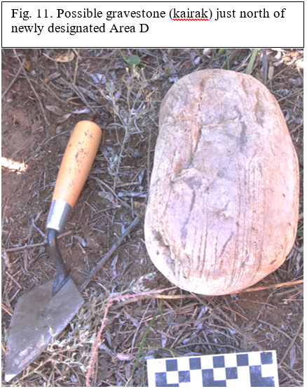
One possible stone with what appears to be an anthropomorphically-carved cross shape was found and photographed. (Ib_18_D_IV_001_I01)
The find spot for the possible gravestone was actually 14 meters north of the designated “Area D” because the surveyors inadvertently strayed outside the field’s perimeters. The find spot, unfortunately, was not measured for elevation. While indeterminate and very crudely carved, given the context of previous finds, this increases the likelihood that this is a gravestone.
Other cultural material included a large amount of pottery sherds (266), 8 fired brick fragments and 8 feral (animal) bones. Also, a metal fitting to a plow (Soviet era 1933-1991) was found testifying to the extensive industrial agricultural activity in this location.
One potsherd of special significance (Ib_18_D_IV_001_I02) from Area D was classified as a special find and was of particular note. This sherd was a rim fragment (dimensions 9.5 cm x 11 cm x 2.5 cm, see fig. 1 a-b), containing a crudely scratched cross in which the entire image no longer remains due to the break in the sherd (dimension 3 cm x 3.5 cm is still visible). Such sherds found in previous seasons have been rather indeterminate as to whether the cross symbol has any sort of significance or meaning, especially since—like this cross on this particular sherd—was etched following firing of the vessel.3 However, based on other finds of in situ brick fragments mentioned below and given the known context, the probability increases that this crudely carved inscription has religious, specifically Christian, significance.
3)For example, see the photograph on the cover of the 2016 Usharal-Ilibalyk report. Archaeological Expertise, LLC. and Tandy Institute for Archaeology, 2016 Field Report on the Archaeological Excavation at Usharal-Ilibalyk (posted on http://www.exploration-eurasia.com/inhalt_english/frameset_projekt_aC.html).
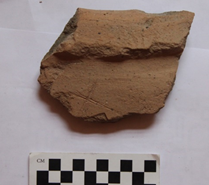
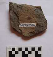
Fig. 12 a-b
The rim on the sherd appears to be folded and fired at a relatively low temperature due to its grayish fabric revealed in the cross-section. However, this may be indicative of the color of the unfired clay. The vessel contains no apparent slip and appears to come from a rather large storage jar or pot. The paste has a few small inclusions of what appear to be quartz and feldspar. The interior side of the sherd is quite worn, revealing much of the fabric. The vessel was thrown on a wheel. The sherd’s provenance is unknown since it was found on the surface yet located in the area of the necropolis.
This one-day field survey of Area D demonstrated that the surface contained cultural material of the same variety as the other locations of the necropolis. It also provided strong rationale that the zone between Areas C and B are probably part of one greater connected area, thus, a part of the necropolis. However, the exact dimensions in any direction has yet to be determined.
CONCLUSION
Summary Conclusions for Ilibalyk 2018
Perhaps is goes without saying, yet the artifact and cultural material of the 2018 Usharal-Ilibalyk expedition provides a historical record; possible evidence of commercial exchange; and, most certainly evidence of religious and cultural exchange. As already mentioned, forensic, C-14, and DNA analysis have yet to be provided from this past season’s efforts. This would certainly enhance and expand our current understanding related to chronology and genetic affiliation of the people buried in the necropolis so far uncovered and meet some significant objectives for our investigations. Until that time, we are dependent upon the pottery analysis; the observable osteological data; the burial practices and traditions as observed through grave excavations; and the simple grave goods so far discovered.
This section will provide a brief analysis and comparison with the other known possible Christian burials in the Zhetisu (Semireche) region and parts of southern Kazakhstan. While this previous evidence is dated (one study from 1886) and sparse (only a few burials in southern Kazakhstan with possible Nestorian Christian connections), it does begin to provide a baseline, however faint, of comparison.
Pottery and Ceramics Analysis
Certain generalities can be provided concerning the pottery finds from the 2018 season. Unique and certain diagnostic potsherds were classified as “special finds,” photographed, and described. Special attention was also given to fired brick samples that were retained because of their direct association with excavated graves or because they contained an inscription, in this case, of crudely etched crosses.
All excavated sherds were collected, washed, and cataloged. Common sidewalls were given serial numbers based merely on field, unit, and/or locus. Those classified as special finds were provided with an additional identification number.
As mentioned in the content of the report, the first day’s excavation involved conducting a surface survey by the team’s personnel of a newly classified area in Field IV—Area D. Area D consisted of an approximate 4000 m2 area located between Areas C and B from the previous season. This year’s team of more than 20 personnel struggled to navigate through this overgrowth yet located a significant amount of surface pottery. In fact, the total number of sherds made up 40 % of the total potsherds found over the course of the whole season.

Fig.13. Cross-inscribed sherd.
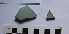
Fig. 14. Porcelain fragments
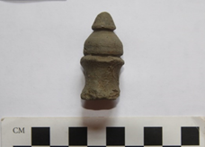
Fig. 15. Vessel lid handle
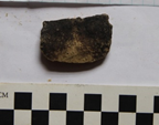
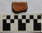
Fig. 16-a-b, Cook ware
This brief summary of the pottery finds from the 2018 season can allow for the following provisional interpretations:
- Potsherds found with cross inscriptions on the territory of Ilibalyk probably are a symbol of religio-cultural identity. The crudely etched sherd referred to above is, as stated previously, not the only sherd found at Ilybalyk with this type of etching on pottery. In addition, the area designated as the possible citadel region also yielded a sherd from a large storage jar with a series of five stamped crosses. Given the context of the gravestones with inscriptions in both Old Turkic as well as one stone with Syriac, identity with Syriac Christianity is firmly established.
- Cook ware sherds associated with ash pits and ash lenses near burials (as noted below in the report) indicate possible ritual meals or feasting in association with the deceased. Such sherds were found in almost every location where ash and animal bones could be found.
- Fine ware, particularly porcelain indicate possible imports and or trade connections. Much more analysis is necessary in the realm of pottery typology and what wares may be indigenous to the region. However, anecdotally, most porcelain pieces are considered to have connections with China, which given Ilibalyk’s proximity to that region could make that quite possible.
4) For example, see the photograph on the cover of the 2016 Usharal-Ilibalyk report. Archaeological Expertise, LLC. and Tandy Institute for Archaeology, 2016 Field Report on the Archaeological Excavation at Usharal-Ilibalyk (posted on http://www.exploration-eurasia.com/inhalt_english/frameset_projekt_aC.html).
APPENDIX A
SPECIAL FINDS
№ |
ID number |
DESCRIPTION |
PHOTO REF. |
1 |
Ib_18_C_IV_004_I03
|
This stone with a partially visible cross inscription was found during excavations using a front-loading tractor which was scraping the previous season’s backfill and topsoil layer. The stone has a pinkish hue with black and white flecks (possibly granite). Its dimensions are 14 cm x 8 cm x 7 cm and appears to be cut in half. The rock has a semi-circular shape; is perfectly rounded; and was probably entirely circular. The inscription on the stone appears to be half of a cross-beam chiseled into what would have been the center of the stone. The cross-beam inscription is 4 cm in length. The stone was located 8.4 m from the eastern border of Area C and 26.8 m from the northern border. The rock was removed for analysis and the find spot was marked and its elevation (597.736 m ABS) was measured using a total station.
|
Fig. 1 |
2 |
Ib_18_C_IV_002_I01
|
This stone was found during initial removal of topsoil by mechanical means. It is dark gray with a greenish hue. Its dimensions are 13 cm x 11 cm x 8 cm. The rock is triangular in shape with a chip on its right side in relation to the cross inscription. The cross inscription is 6 cm x 6 cm. It has a crudely carved fleur-de-lis pattern, or also known as a “tree of life” design with a small two-sided peaked base. The stone was located 8.4 m from the eastern border of Area C and 26.8 m from the northern border. The rock was removed for analysis and the find spot was marked and its elevation (598.130 m ABS) was measured using a total station.
|
Fig. 2 |
3 |
Ib_18_C_IV_007_I05
|
|
Fig. 3 |
4 |
Ib_18_C_IV_013_I07
|
During clearing and cleaning operations using shovels in Area C, a gravestone with a cross inscription was found in the northwest sector of Area C. The stone has a reddish color, almost like that of fired brick. It is smooth with pock marks throughout. Its dimensions are 10.5 cm x 6.5 cm x 2 cm. The stone has a rectangular, wedge-like shape that tapers in thickness from left to right in relation to the cross inscription. The cross inscription is 5 cm x 4 cm. The chiseled design contains a flared end at the top and less defined ends on the horizonal cross-bar. The stone was located 17.2 m from the eastern border of Area C and 4.45 m from the northern border. The rock was removed for analysis and the find spot was marked and its elevation (597.565 m ABS) was measured using a total station.
|
Fig. 4 |
5 |
Ib_18_C_IV_006_I06
|
This small white grave stone was found on the same location as various bone fragments and a partial cranium of an adult found during the initial removal of backfill and topsoil from the previous season by mechanical means. It had been initially overlooked due to its small size and because the stone had been previously cut on two sides. As a result, only one cross-bar, possibly the top section of an inscribed cross could be seen. Due to the location, it was determined to include the small stone with the human remains at the location. The stone is dull white with black flecked inclusions (possible granite). The stone’s dimensions are 8.5 cm X 5 cm X 3 cm. It is rounded on one side and is roughly cut, yet flattened, on the other. The chisel mark appears to be one-fourth of a cross and measure at 2.5 cm X 1.5 cm. It was found at a level of 597.906 m ABS.
|
Fig. 5 |
6 |
Ib_18_D_IV_001_I02 |
This sherd was a rim fragment (dimensions 9.5 cm x 11 cm x 2.5 cm, see fig. 1 a-b), containing a crudely scratched cross in which the entire image no longer remains due to the break in the sherd (dimension 3 cm x 3.5 cm is still visible). Such sherds found in previous seasons have been rather indeterminate as to whether the cross symbol has any sort of significance or meaning, especially since—like this cross on this particular sherd—it was etched following firing of the vessel. However, based on other finds of in situ brick fragments mentioned below and given the known context, the probability increases that this crudely carved inscription has religious, specifically Christian, significance. The rim on the sherd appears to be folded and fired at a relatively low temperature due to its grayish fabric revealed in the cross-section. However, this may be indicative of the color of the unfired clay. The vessel contains no apparent slip and appears to come from a rather large storage jar or pot. The paste has a few small inclusions of what appear to be quartz and feldspar. The interior side of the sherd is quite worn, revealing much of the fabric. The vessel was thrown on a wheel. The sherd’s provenance is unknown since it was found on the surface yet located in the area of the necropolis.
|
Fig. 6 |
7 |
Ib_18_C_IV_024_I02-a-c
|
Fired brick fragments (Dimensions: a: 8.2 cm x 8 cm x 4.5 cm; b: 4.5 cm x 5.5 cm x 3.5 cm; c: 6.2 cm x 5 cm x 3.8 cm Part a. contains cross inscription, parts c & b contain scratch marks, the bricks were found together and were part of one whole brick located next to a juvenile grave in Unit 6, in situ. Partial cross inscription dimensions: 6.5 cm x 5.5 cm (Fig. 7 shows only fragment “a.”)
|
Fig. 7 |
8 |
Ib_18_C_IV_003_I02
|
|
Fig. 8 |
9 |
Ib_18_C_IV_001_I01
|
Fired brick (Dimensions: 15cm x 14cm x 4.5cm); Cross inscription measurement: 6cm x 7cm. This brick was found during initial clearing of Area C, L-001. It contains plaster with finger swipe marks running vertically. The cross inscription was scratched in post-firing and the brick was likely of secondary usage at the time it was utilized as a grave marker.
|
Fig. 9 |
10 |
Ib_18_C_IV_001_I02
|
Fired brick (Dimensions: 18cm x 12.5cm x 4cm); Cross inscription measurement: 6cm x 5cm. This fired brick is thicker in size than most of the fired bricks found on the site at Ilibalyk (see also Fig.12). It was found during excavations of Area C, L-001 possibly in relation to the graves found near Unit 3 although the exact provenance is unknown. The chiseled cross inscription is post-firing and the brick’s function as a grave marker was likely its secondary usage.
|
Fig. 10 |
11 |
Ib_18_C_IV_005_I04
|
This is a large stone with a cross inscription found during excavations using a front-loading tractor which was scraping the previous season’s backfill and topsoil layer. The stone is dark green with several large, quartz inclusions. Its dimensions are 30 cm x 20 cm x 10 cm, making it the largest stone of the 2018 finds. The rock has an irregular oval-shape with a bulge on its right side in relation to the inscribed cross. The cross inscription on the stone is 14 cm X 9 cm and is chiseled with crude fleur-de-lis-type flares—or also known as a “tree of life” design— at the end of each cross bar. It also has a triangular-shaped base. The stone was located 15.2 m from the eastern border of Area C and 13.2 m from the northern border (see top plan). The rock was removed for analysis and the find spot was marked and its elevation (597.627 ABS) was measured using a total station.
|
Fig. 11 |
12 |
Ib_18_C_IV_001_I03
|
Fired brick (Dimensions: 23cm x 18cm x 7.5cm); Cross inscription measurement: 12cm x 10cm. This fired brick has the thickest dimensions of any of the fired brick grave markers found during the 2018 season. It was found near and possibly associated with graves identified in Unit 5, L-006 although its exact provenance is unknown. The cross was inscribed post-firing and it has finger marks running horizontally in the plaster. The brick’s function as a grave marker was probably a secondary usage.
|
Fig. 12 |
13 |
Ib_18_D_IV_001_I01
|
|
Fig. 13 |
14 |
Ib_18_C_IV_001_I11
|
A glass paste bead (2.1 cm in diameter) found during clearing excavations in Area C, L-001. The bead has several “zig-zag” lines running through it with two basic colors—brownish read and a creamy white with perhaps traces of mother of pearl. Further analysis is needed to determine exact content. The bead had no exact associations with any remains in the necropolis.
|
Fig. 14 |
15 |
Ib_18_C_IV_009_I04 |
This is a small loop, possibly from jewelry such as a necklace, found in connection with the human remains (infant) in Unit 4, L-009. The loop is made of silver and was found during the initial sweep of the area around the grave. It may be related to the beads found with the body of the infant in L-009 (see Fig.17 and Fig. 25 below).
|
Fig. 15 |
16 |
Ib_18_C_IV_026_I01
|
|
Fig. 16 |
17 |
Ib_18_C_IV_009_I02
|
These four beads are part of a larger 15 beads collection found along with a bronze loop which could indicate an attachment for a pendant necklace that were found in Unit 4, L-009. These beads are of various shapes and colors including one dark red bead (1 cm diameter) composed of a semi-precious stone, most likely carnelian. Further analysis is needed to determine the composition of the other beads. Two of the beads are cream-colored, one is dark blue. One cream colored bead (1.2 cm x .5 cm) is cylindrical in shape. The other contains a rounded section which narrows into a point 1.5 cm in length.
|
Fig. 17 |
18 |
Ib_18_C_IV_045_I01
|
These 8 beads come from a collection of 13 beads found in the grave of a very small infant in (Unit 11, L-045) whose remains were almost entirely decomposed. These beads of intricate design belonged to what appear to be an elaborate necklace. They are similar to form and design with those found in Unit 17, L-056. The smaller, white beads with a diameter of 2 mm are quite fragile suggesting they were made from glass paste. Two of the beads, approximate 5 mm in diameter have a grayish-blue series of circular dashes in full circumference of each bead. Two beads, 5 mm x 4 mm have an hour-glass shape with a dark gray color. One bead, which subsequently disintegrated following excavation, was a white rosette with five petals and approximately 7 mm in diameter. Another bead (5 mm) had four alternating horizontal lines encircling the bead and another (5 mm) with a light brown or beige color has a middle circular white line and swirling white lines running horizontally along the bead. Finally, one bead (6 mm x 7 mm) appears to be a possible freshwater pearl that is flattened on two sides and on each end. The material of the other beads is indeterminate and will need to be submitted for analysis.
|
Fig. 18 |
19 |
Ib_18_C_IV_056_I01
|
This collection of 12 beads was found in an infant’s grave in Unit 17, Locus 56. These bead range in size from 10 – 3 mm in diameter. The largest bead has a hexagonal, pyramidal shape and may be from a semi-precious stone or be a shaped pearl. The smallest bead is a light blue, turquoise color. Four others have a cylindrical shape with light brown or a beige color with swirling white lines and are seemingly identical to the beads found in Unit 11, L-045 (see description of Fig. 18 above). The remaining beads appear to be made from glass past and have a cream or dark gray color; one is of a twisted, triangular nature, almost in the shape of a bullet.
|
Fig. 19 |
20 |
Ib_18_C_IV_019_I01-I02 |
These beads were found in conjunction with a small infant skeleton in Unit 2. The beads are all 2 mm to 3 mm in diameter and are probably made of glass paste. They were located in the rib area and may be part of a small bracelet.
|
Fig. 20 |
21 |
Ib_18_C_IV_026_I02 |
A silver ring was found on the finger of a child buried in Unit 5, L-026. The ring is 1 cm in diameter. It has a small, raised platform, but with no apparent setting for a bezel. Initial examination revealed a possible series of raised bumps on the platform, however, following further cleaning and conservation showed no such design. There was, however a design of six small indentations on each side of the raised platform of the ring in a star-shaped pattern. It was found in the same grave as the earring pictured in Fig. 16.
|
Fig. 21 |
22 |
Ib_18_C_IV_012_I04
|
This silver loop was found in the grave in Unit 6, L-012. It is 2 cm in diameter. It was found in the same grave as the bird bone and bead necklace (see Fig. 31) but it is unknown if it a part of the necklace or part of a different piece of jewelry. |
Fig. 22 |
23 |
Ib_18_C_IV_048_I01 |
This unique find of a cowrie shell and a worked pearl bead came from the grave of an infant. Both were turned into beads possibly for a necklace. The seashell (2 cm x 1.5 cm) appears to be a type of cowrie shell and has been severely bleached of its color. It is obviously an import as no bodies of saltwater can be found for thousands of kilometers of Ilibalyk. The shell has holes drilled on each end so that it might be included on the string of a necklace. The other bead (8 mm x 5 mm) appears to be a worked pearl or mother of pearl and has been flattened with a tool.
|
Fig. 23 |
24 |
Ib_18_C_IV_043_I01 |
This bronze earring or pendant was found in the grave of what is likely a teenager (Unit 9, L-043). It is 2.5 cm long and the ring’s diameter is 1 cm. The nob on the end is 5 mm in diameter. It has an alternating pattern of diamond and triangle facets with line indentations separating the facets. There is a total of 12 facets. It appears to be attached to the earring by finely wound bronze wire.
|
Fig. 24 |
25 |
Ib_18_C_IV_009_I03
|
This single bead also comes from Unit 4, L-009 which associates it with the remains where a silver loop and 15 other beads were found. While this bead was found separately, it probably is associated with the other grave goods. (See Fig. 15 and 17 above.) The bead is cream-colored and is 5 mm in diameter. |
Fig. 25 |
26 |
Ib_18_C_IV_019_I02
|
Ranging between 1 mm and 5 mm in diameter, these glass paste beads were found with an infant’s remains in Unit 2, L-019. Most of the beads are white or cream-colored. Two have evidence of light blue or turquoise glazing. Some are brown in color. |
Fig. 26 |
27 |
Ib_18_C_IV_023_I03
|
This potsherd appears to be the handle for the lid of a vessel. Containing neither glaze nor slip, the dark gray lid handle has a double layer creating a conical or dome shape. It was created on a potter’s wheel and the lower half was probably below the lid from which it came. Its dimensions were 2 cm x 4 cm x 1 cm and it was found in Unit 5, L-023 very near an ash pit probably associated with the burial in Unit 5, L-034. |
Fig. 27 |
28 |
Ib_18_C_IV_045_I02
|
These beads are from the other half of the collection in Fig. 18 found in Unit11, L-045. They came from the grave of a very small infant whose remains were almost entirely decomposed. The small, white beads with a diameter of 2 mm are quite fragile suggesting they were made from glass paste. One bead, which subsequently disintegrated following excavation but pictured here, was a white rosette with five petals and approximately 7 mm in diameter |
Fig. 28 |
29 |
Ib_18_C_IV_019_I01
|
These beads (4) come from the same collection found in Fig. 20, Unit 2, L-019 and are similar in composition, size, and appearance. |
Fig. 29 |
30 |
Ib_18_C_IV_039_I01 |
This bead is 7 mm in diameter and is made from glass paste. It was found in on top of a mudbrick-covered tomb (Unit 3, L-039) and not within the tomb itself. It is cream-colored and has in irregular shape. It is indeterminate as to whether it is associated with the grave itself.
|
Fig. 30 |
31 |
Ib_18_C_IV_012_I04 |
The grave goods in L-012 were some of the most unique of the season. Around the neck of an infant a complete necklace was found comprised of avian (bird) bones with hole-piercings and alternating with turquoise-colored beads most likely composed of glass paste. The bones varied in size, some were broken or partially decomposed, however, those bones which were intact were usually 3 - 4 cm in length. Further analysis might enable us to determine the species of bird to see if it is indigenous to the region. |
Fig. 31 |
|
Fig. 1 |
|
Fig. 2 |
|
Fig. 3 |
|
Fig. 4 |
|
Fig. 5 |
|
Fig. 6 |
|
Fig. 7 |
|
Fig. 8 |
|
Fig. 9 |
|
Fig. 10 |
|
Fig. 11 |
|
Fig. 12 |
|
Fig. 13 |
|
Fig. 14 |
|
Fig. 15. Unit 4, Locus 009. |
|
Fig. 16. Unit 5, Locus 026 |
|
Fig. 17. Unit 4, Locus 009 |
|
Fig. 18. Unit 11, Locus 045 |
|
Fig. 19. Unit 17, Locus 056. |
|
Fig. 20. Unit 2, locus 019 |
|
Fig. 21. Unit 5, locus 026 |
|
Fig. 22. Unit 6, locus 012 |
|
Fig. 23. Unit 14, locus 048 |
|
Fig. 24. Unit 9, locus 043 |
|
Fig. 25. Unit 4, locus 009 |
|
Fig. 26. Unit 2, locus 019 |
|
Fig. 27. Unit 5, locus 023 |
|
Fig. 28. Unit 11, Locus 045 |
|
Fig. 29. Unit 2, Locus 019 |
|
Fig. 30. Unit 3, Locus 039 |
|
Fig. 31. Unit 6, locus 012 |
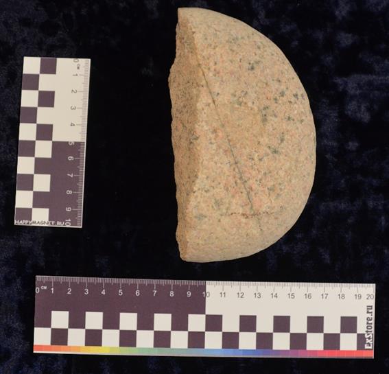
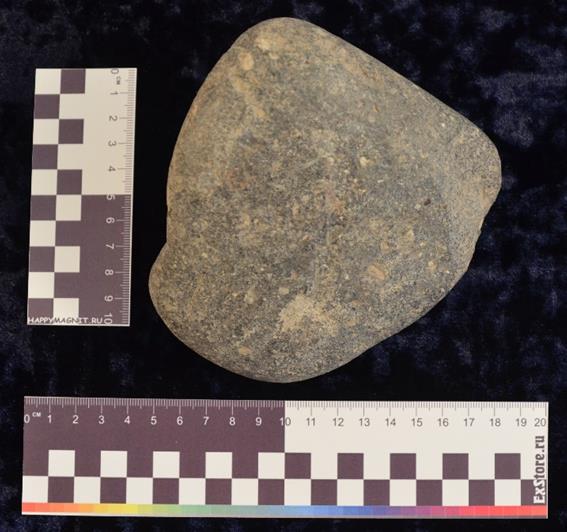
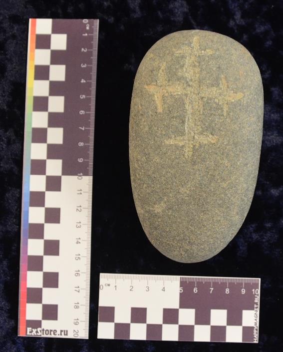
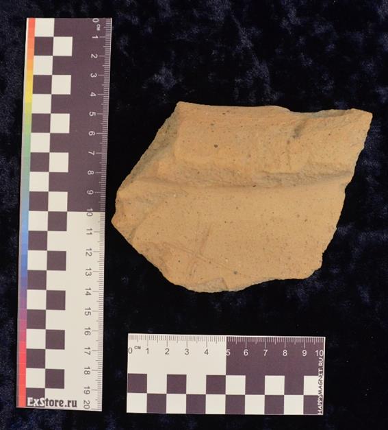
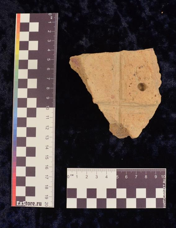
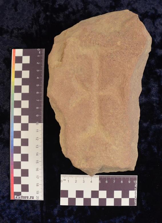
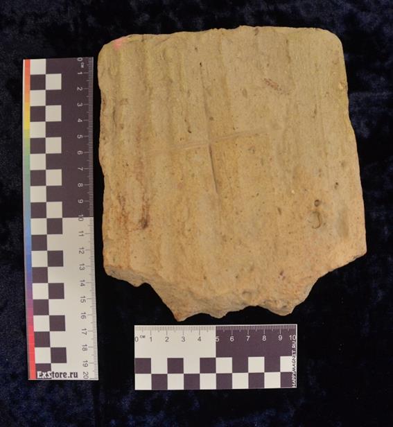
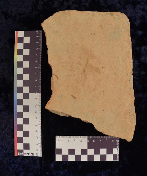
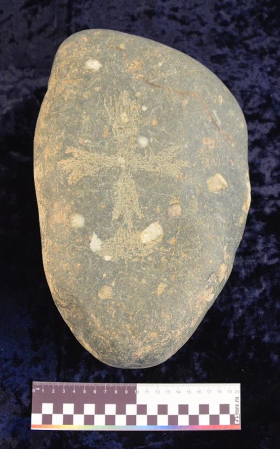
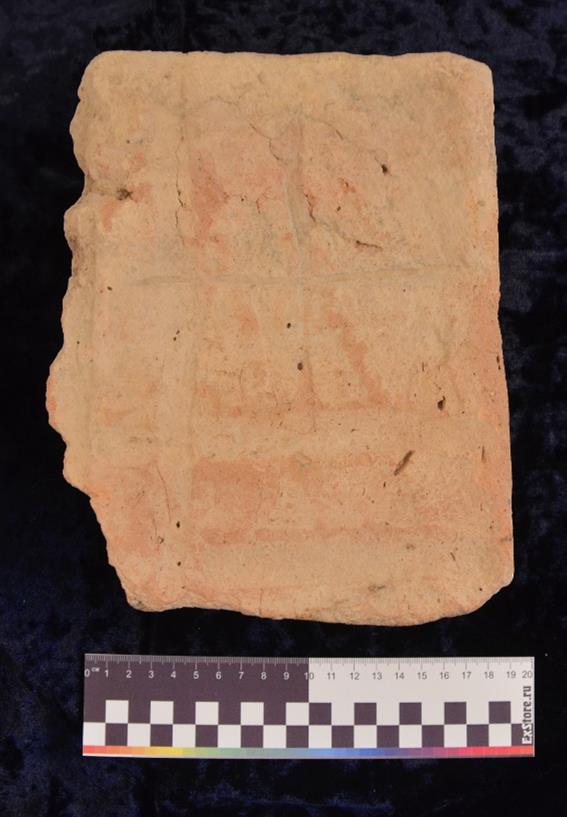
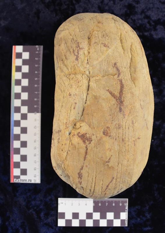
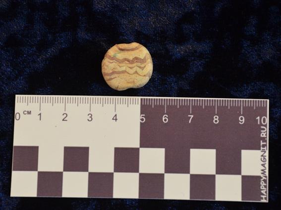
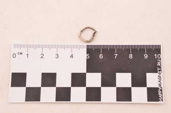
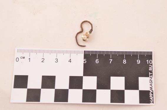
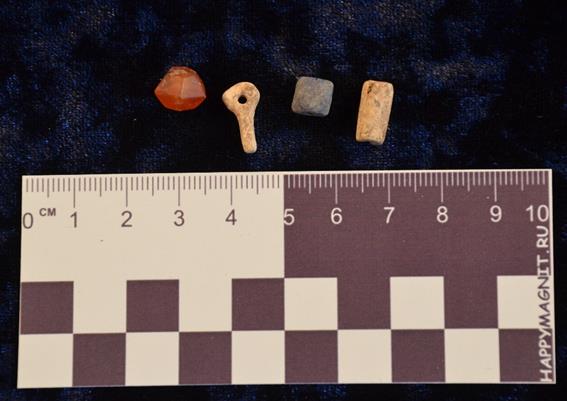

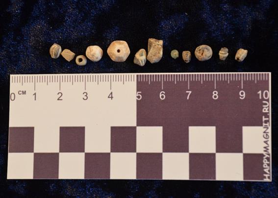
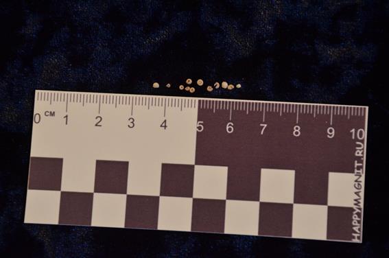
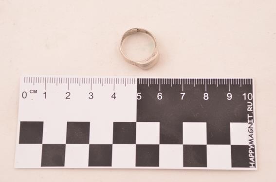
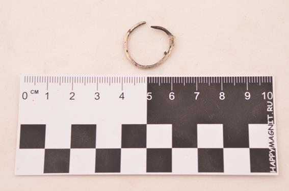
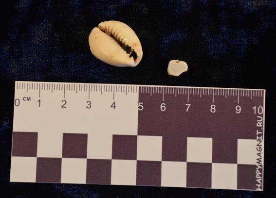
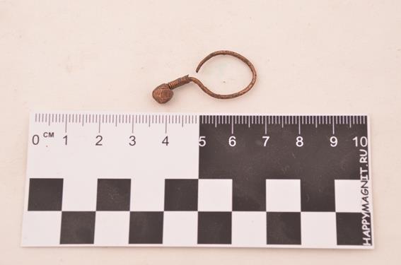
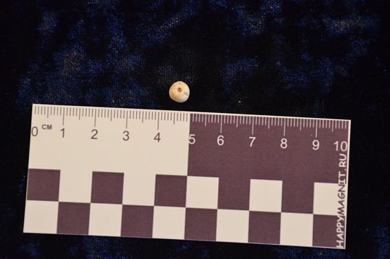
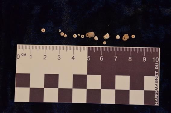
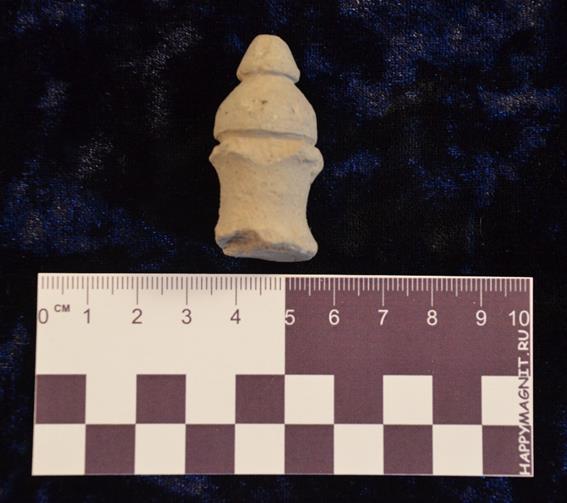
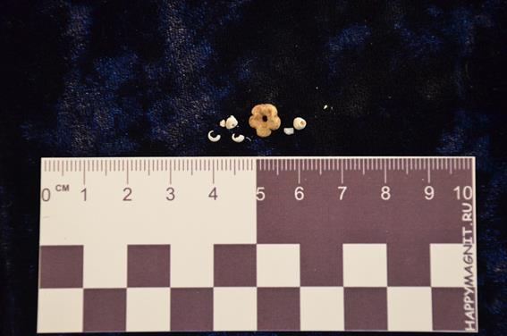
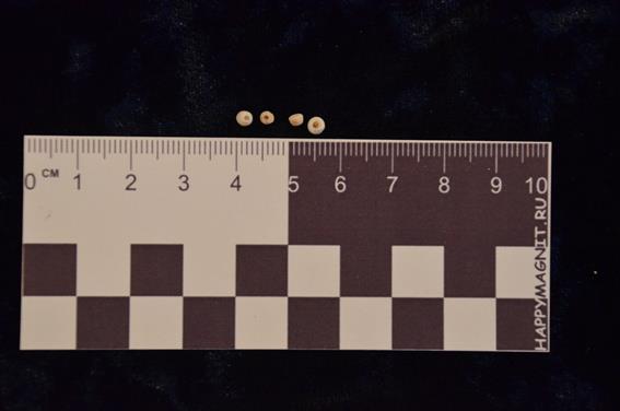
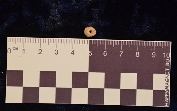
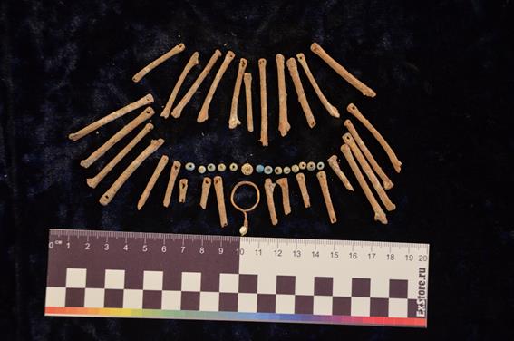
APPENDIX B
PHOTOS
|
Fig. 1 – General view. North direction |
|
Fig. 2 – General view. West direction |
|
Fig. 3 – General view. South direction |
|
Fig. 4 – General view. North-East direction |
|
Fig. 5 – General view. North-West direction |
|
Fig. 6 – General view. North-West direction |
|
Fig. 7 – General view. South direction |
|
Fig. 8 – General view. North-West direction |
|
Fig. 9 – General view. North-West direction |
|
Fig. 10 – General view. South direction |
|
Fig. 11 – Walk over survey |
|
Fig. 12 – Walk over survey |
|
Fig. 13 – Walk over survey |
|
Fig. 14 – Walk over survey |
|
Fig. 15 – Walk over survey. Grave stone. |
|
Fig. 16 – Work moment. Skeleton cleaning. Unit 2. |
|
Fig. 17 – Work moment. Skeleton cleaning. Unit 4. |
|
Fig. 18 – Work moment. Sifting process. |
|
Fig. 19 – Work moment. Unit 3. |
|
Fig. 20 – Work moment. Unit 3. |
|
Fig. 21 – Work moment. Cleaning process. |
|
Fig. 22 – Work moment. |
|
Fig. 23 – Work moment. Skeleton cleaning. Unit 2. |
|
Fig. 24 – Work moment. Skeleton cleaning. Unit 2. |
|
Fig. 25 – Work moment. Skeleton packing. Unit 6, Locus 12. |
|
Fig. 26 – Work moment. Skeleton packing. Unit 2, Locus 16. |
|
Fig. 27 – Work moment. |
|
Fig. 28 – Work moment. Brush cleaning. |
|
Fig. 29 – Work moment. Skeleton cleaning. Unit 5. |
|
Fig. 30 – Work moment. Skeleton cleaning. |
|
Fig. 31 – Work moment. Skeleton cleaning. |
|
Fig. 32 – Work moment. Skeleton cleaning. |
|
Fig. 33 – Work moment. Shoveling. |
|
Fig. 34 – Work moment. Skeleton packing. |
|
Fig. 35 – Work moment. Cleaning. |
|
Fig. 36 – Unit 1, Locus 14. |
|
Fig. 37 – Unit 2, Locus 16. |
|
Fig. 38 – Unit 3, Locus 21. |
|
Fig. 39 – Unit 1, Locus 14. |
|
Fig. 40 – Unit 3, Locus 22. |
|
Fig. 41 – Unit 5, Locus 6. |
|
Fig. 42 – Unit 5, Locus 26. |
|
Fig. 43 – Unit 5, Locus 26. |
|
Fig. 44 – Unit 5, Locus 23. |
|
Fig. 45 – Unit 5, Locus 23. |
|
Fig. 46 – Unit 2, Locus 19. |
|
Fig. 47 – Unit 2, Locus 19. |
|
Fig. 48 – Unit 6, Locus 30. |
|
Fig. 49 – Unit 3, Locus 22. |
|
Fig. 50 – Unit 5, Locus 26. |
|
Fig. 51 – Unit 5, Locus 26. |
|
Fig. 52 – Unit 5, Locus 26. |
|
Fig. 53 – Unit 6, Locus 31. |
|
Fig. 54 – Unit 6, Locus 31. |
|
Fig. 55 – Unit 6, Locus 31. |
|
Fig. 56 – Unit 6, Locus 31. |
|
Fig. 57 – Unit 2, Locus 36. |
|
Fig. 58 – Unit 3, Locus 39. |
|
Fig. 59 – Unit 2, Locus 36. |
|
Fig. 60 – Unit 2, Locus 36. |
|
Fig. 61 – Unit 2, Locus 35. |
|
Fig. 62 – Unit 2, Locus 35. |
|
Fig. 63 – Unit 2, Locus 35. |
|
Fig. 64 – Unit 2, Locus 35. |
|
Fig. 65 – Unit 5, Locus 34, 51. |
|
Fig. 66 – Unit 5, Locus 34, 51. |
|
Fig. 67 – Unit 6, Locus 49. |
|
Fig. 68 – Unit 6, Locus 49. |
|
Fig. 69 – Unit 5, Locus 26. |
|
Fig. 70 – Unit 5, Locus 26, 34. |
|
Fig. 71 – Unit 5, Locus 26, 34. |
|
Fig. 72 – Unit 5, Locus 26, 34. |
|
Fig. 73 – Unit 5, Locus 51, 34. |
|
Fig. 74 – Unit 5, Locus 51, 34. |
|
Fig. 75 – Unit 6, Locus 32. |
|
Fig. 76 – Unit 6, Locus 32. |
|
Fig. 77 – Unit 6, Locus 32. |
|
Fig. 78 – Unit 3. |
|
Fig. 79 – Unit 3. |
|
Fig. 80 – Unit 3. Locus |
|
Fig. 81 – Unit 3. |
|
Fig. 82 – Unit 3. |
|
Fig. 83 – Unit 3. Locus 22. |
|
Fig. 84 – Unit 6. Locus 12. |
|
Fig. 85 – Unit 6. Locus 12. |
|
Fig. 86 – Unit 2. Locus 16. |
|
Fig. 87 – Unit 2. Locus 16. |
|
Fig. 88 – Unit 2. Locus 16. |
|
Fig. 89 – Unit 2. Locus 16. |
|
Fig. 90 – Unit 6. Locus 24. |
|
Fig. 91 – Unit 6. Locus 24. |
|
Fig. 92 – Unit 6. Locus 30. |
|
Fig. 93 – Unit 6. Locus 30. |
|
Fig. 94 – Unit 6. Locus 30. |
|
Fig. 95 – Unit 6. Locus 31. |
|
Fig. 96 – Unit 6. Locus 31. |
|
Fig. 97 – Unit 6. Locus 31. |
|
Fig. 98 – Unit 6. Locus 31. |
|
Fig. 99 – Unit 2. Locus 36. |
|
Fig. 100 – Unit 2. Locus 36. |
|
Fig. 101 – Unit 2. Locus 35. |
|
Fig. 102 – Unit 2. Locus 35. |
|
Fig. 103 – Unit 2. Locus 35. |
|
Fig. 104 – Unit 10. Locus 44. |
|
Fig. 105 – Unit 10. Locus 44. |
|
Fig. 106 – Unit 9. Locus 43. |
|
Fig. 107 – Unit 9. Locus 43. |
|
Fig. 108 – Unit 9. Locus 43. |
|
Fig. 109 – Unit 8. Locus 42. |
|
Fig. 110 – Unit 8. Locus 42. |
|
Fig. 111 – Unit 11. Locus 45. |
|
Fig. 112 – Unit 11. Locus 45. |
|
Fig. 113 – Unit 11. Locus 45. |
|
Fig. 114 – Unit 13. Locus 47. |
|
Fig. 115 – Unit 13. Locus 47. |
|
Fig. 116 – Unit 12. Locus 46. |
|
Fig. 117 – Unit 14. Locus 48. |
|
Fig. 118 – Unit 5. Locus 26, 34. |
|
Fig. 119 – Unit 5. Locus 26, 34. |
|
Fig. 120 – Unit 5. Locus 26, 34. |
|
Fig. 121 – Unit 5. Locus 26, 34. |
|
Fig. 122 – Unit 5. Locus 26, 34. |
|
Fig. 123 – Unit 5. Locus 26, 34. |
|
Fig. 124 – Unit 5. Locus 26, 34. |
|
Fig. 125 – Unit 5. Locus 51, 34. |
|
Fig. 126 – Unit 5. Locus 51, 34. |
|
Fig. 127 – Unit 5. Locus 51, 34. |
|
Fig. 128 – Unit 16. Locus 54. |
|
Fig. 129 – Unit 16. Locus 54. |
|
Fig. 130 – Unit 16. Locus 54. |
|
Fig. 131 – Unit 16. Locus 54. |
|
Fig. 132 – Unit 6. Locus 49. |
|
Fig. 133 – Unit 6. Locus 49. |
|
Fig. 134 – Unit 6. Locus 49. |
|
Fig. 135 – Unit 6. Locus 32. |
|
Fig. 136 – Unit 6. Locus 32. |
|
Fig. 137 – Unit 6. Locus 32. |
|
Fig. 138 – Unit 6. Locus 32. |
|
Fig. 139 – Unit 17. Locus 56. |
|
Fig. 140 – Unit 17. Locus 56. |
|
Fig. 141 – Unit 17. Locus 56. |
|
Fig. 142 – Unit 17. Locus 56. |
|
Fig. 143 – Unit 19. Locus 58. |
|
Fig. 144 – Unit 19. Locus 58. |
|
Fig. 145 – Unit 20. Locus 59. |
|
Fig. 146 – Unit 20. Locus 59. |
|
Fig. 147 – Unit 20. Locus 59. |
|
Fig. 148 – Unit 20. Locus 59. |
|
Fig. 149 – Unit 20. Locus 59. |
|
Fig. 150 – Conservation. Work moment. |
|
Fig. 151 – Conservation. Work moment. |
|
Fig. 152 – Conservation. Work moment. |
|
Fig. 153 – Conservation. Work moment. |
|
Fig. 154 – Conservation. Work moment. |
|
Fig. 155 – Conservation. Work moment. |
|
Fig. 156 – Conservation. Work moment. |
|
Fig. 157 – Conservation. Work moment. |
|
Fig. 158 – Conservation. Work moment. |
|
Fig. 159 – Conservation. Work moment. |
|
Fig. 160 – Conservation. General view. |
|
Fig. 161 – Conservation. General view. |
|
Fig. 162 – Conservation. General view. |
|
Fig. 163 – Conservation. General view. |
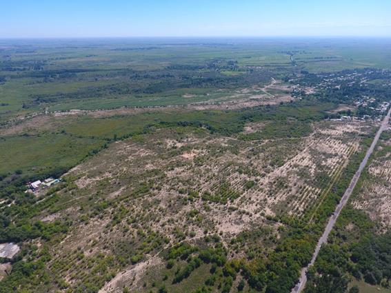
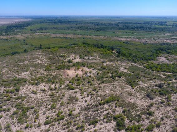
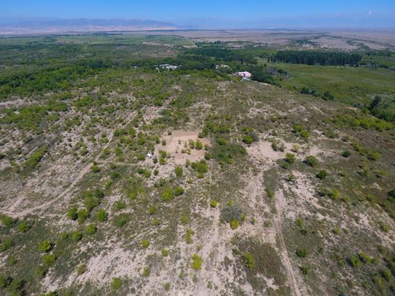
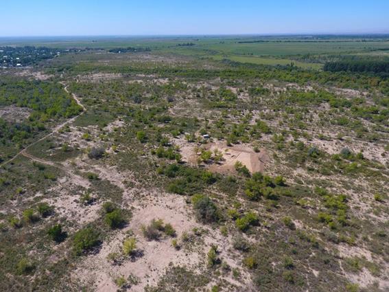
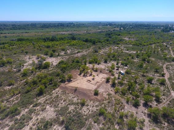
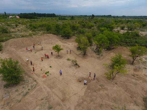
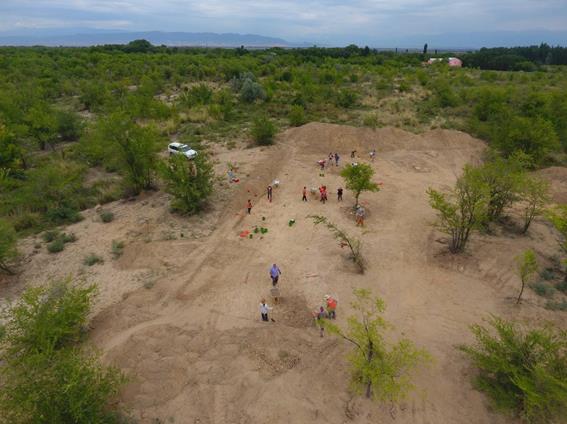
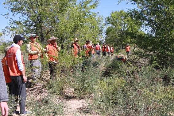
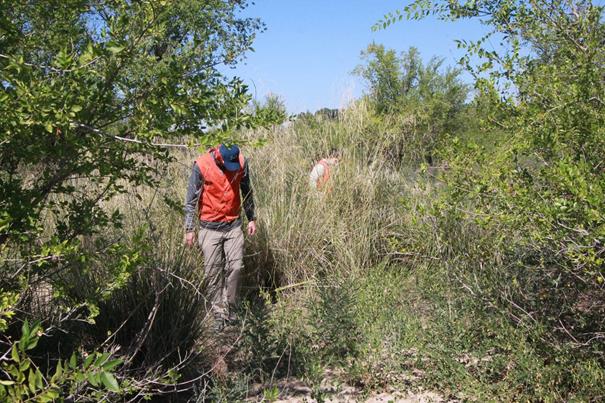
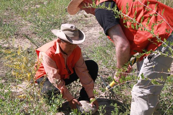
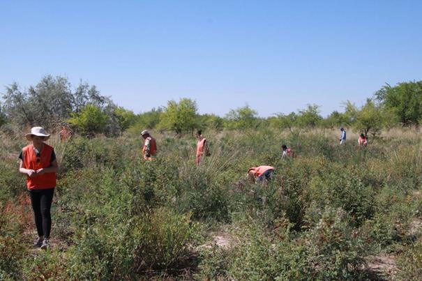
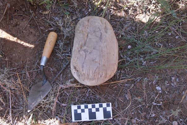
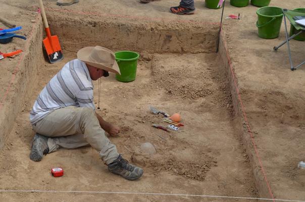
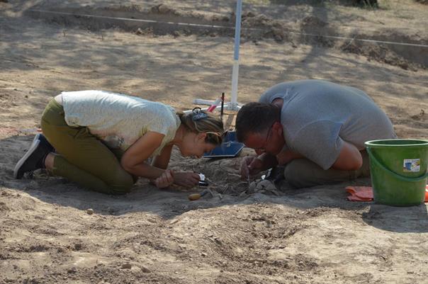
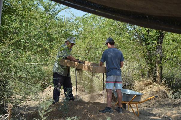
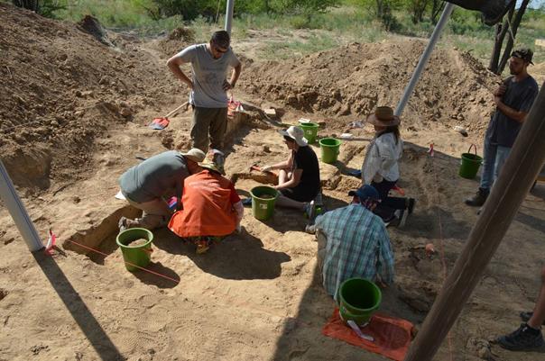
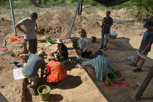
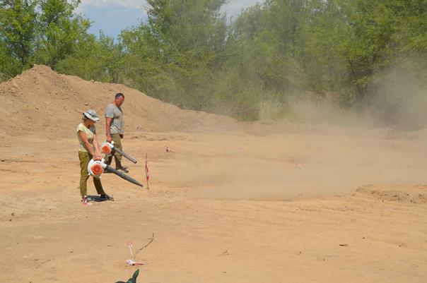
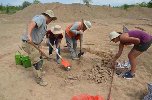
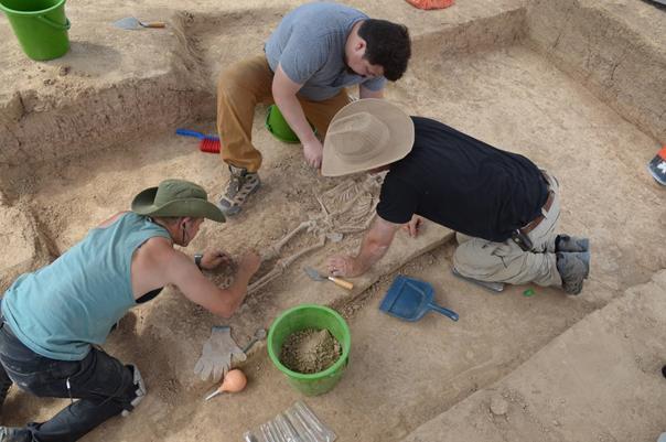
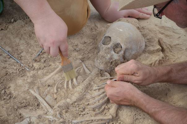
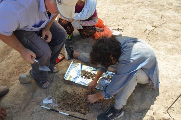
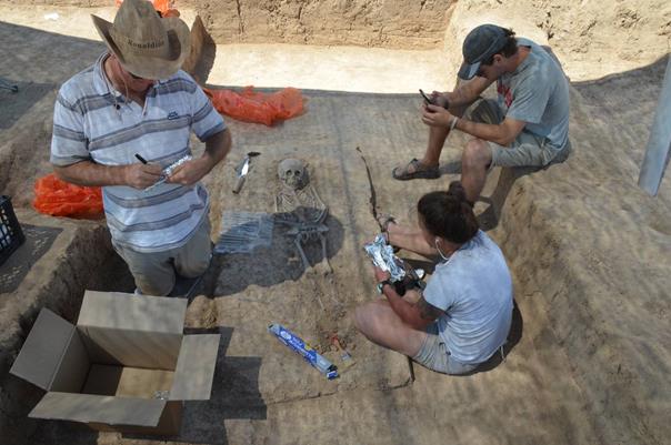
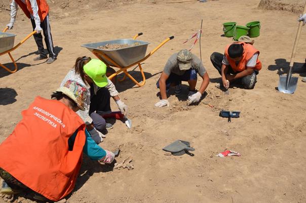
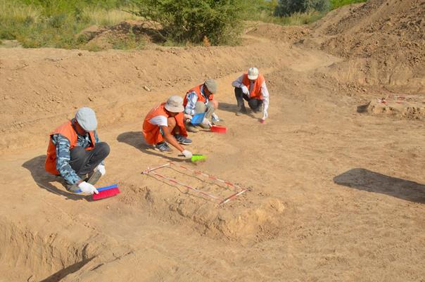
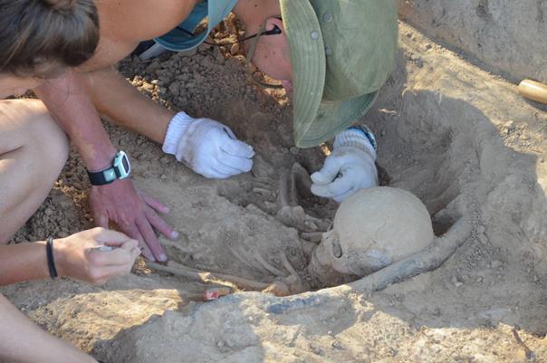
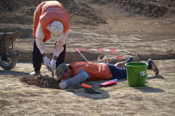
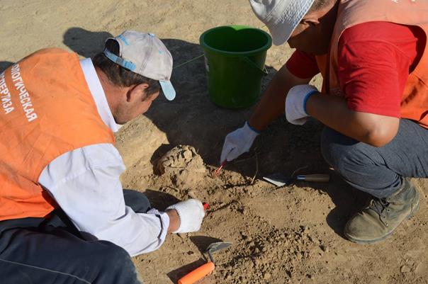
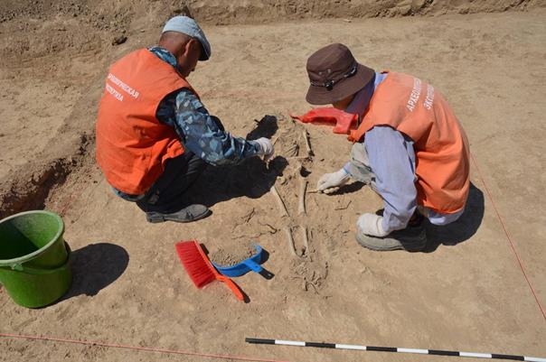
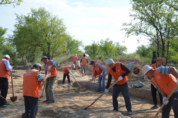
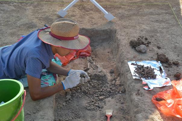
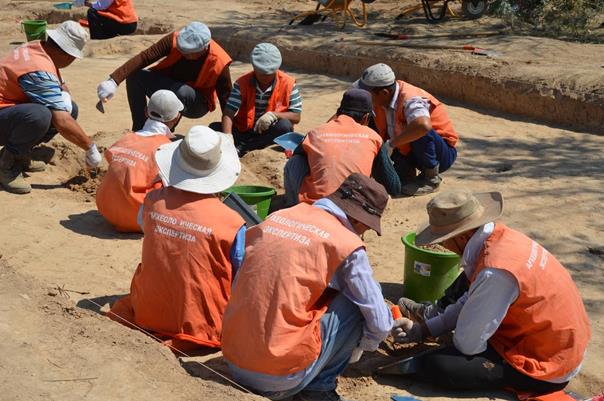
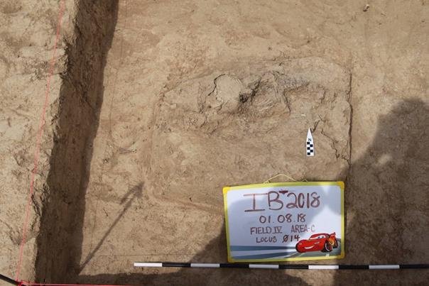
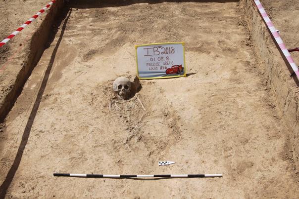
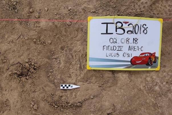
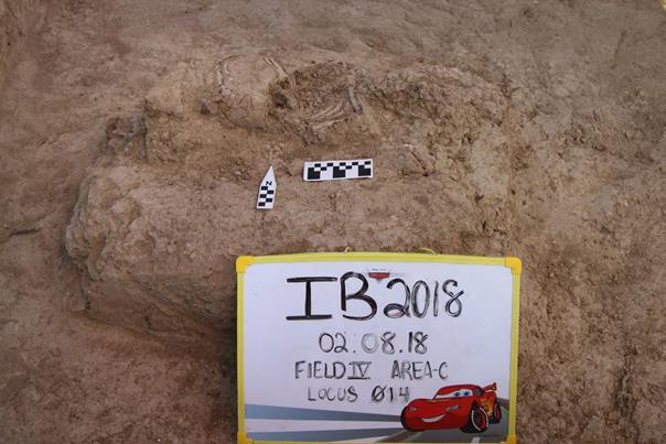
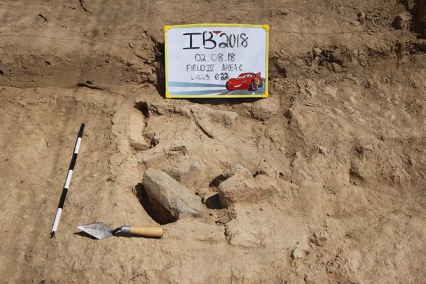
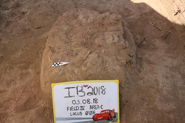
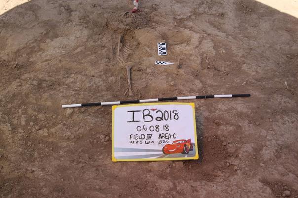
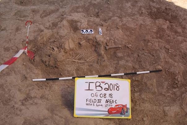
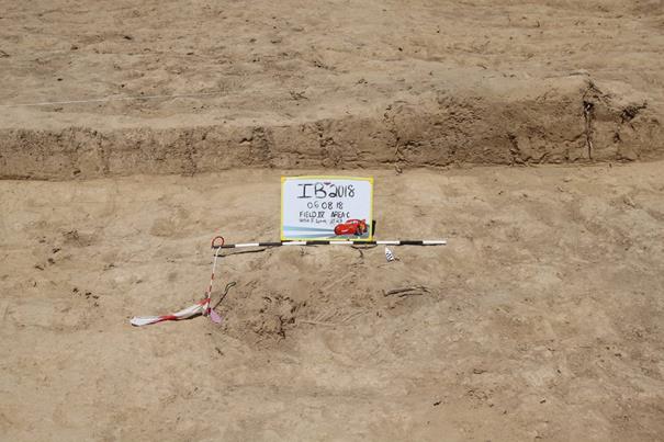
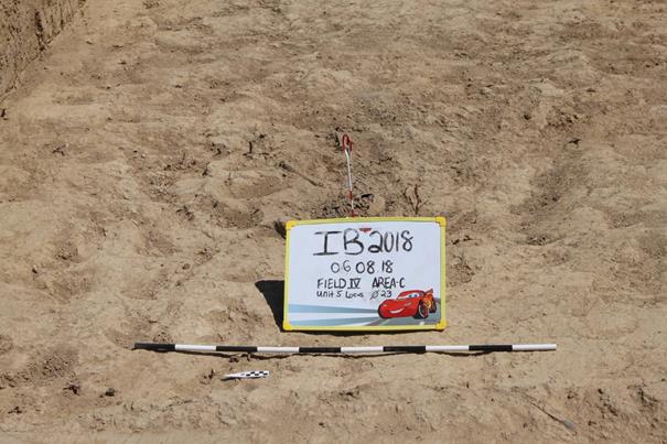
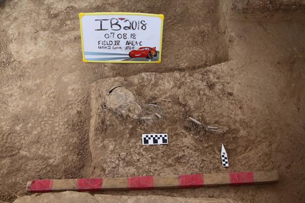
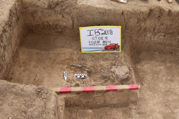
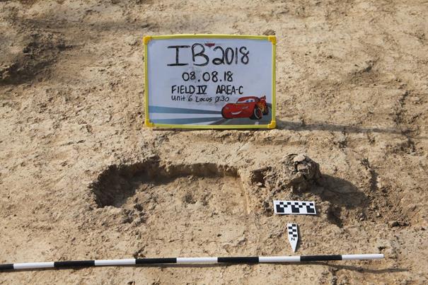
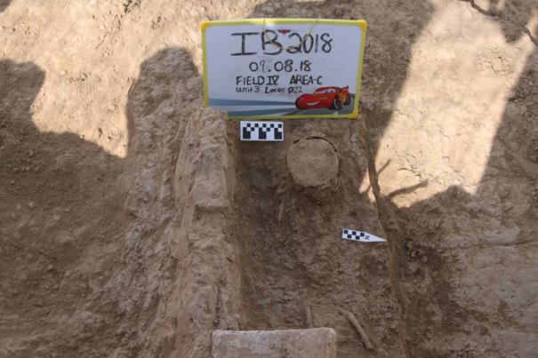
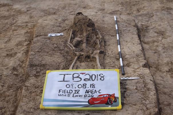
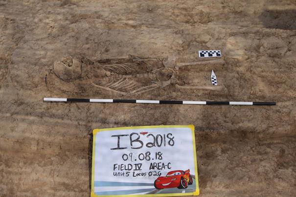
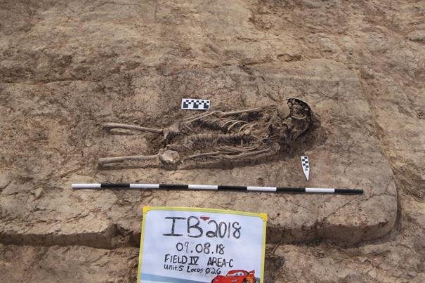
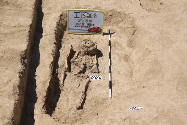
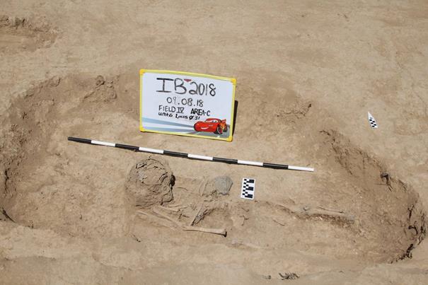
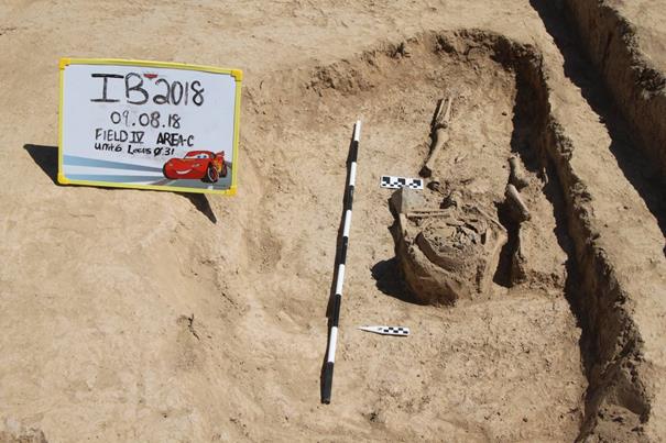
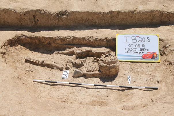
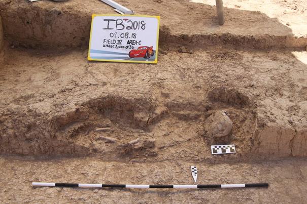
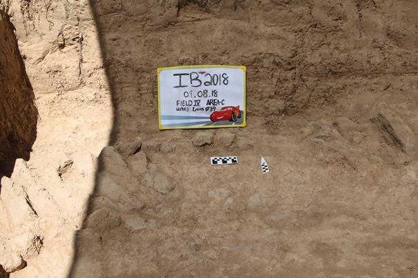

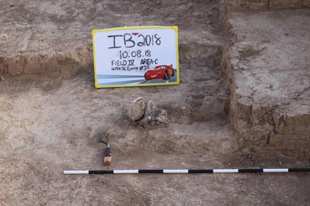
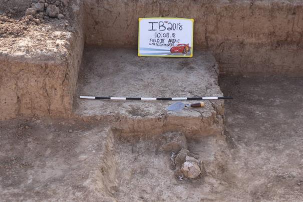
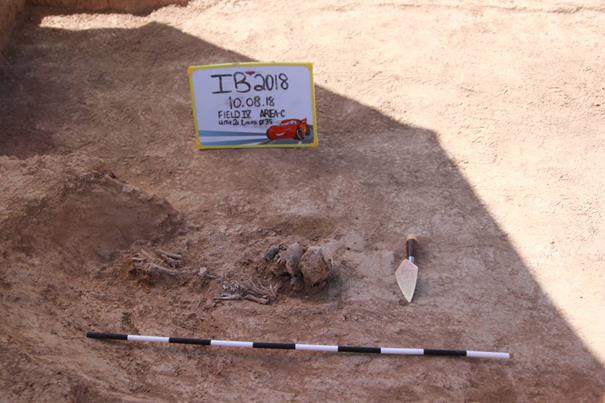
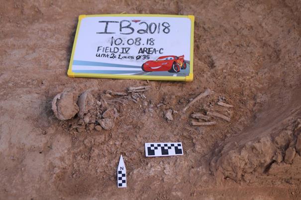
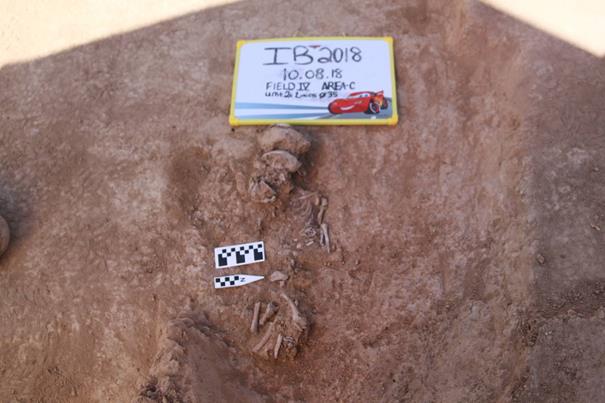
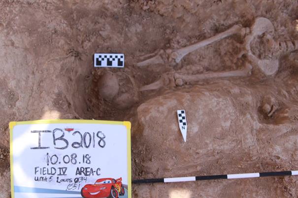
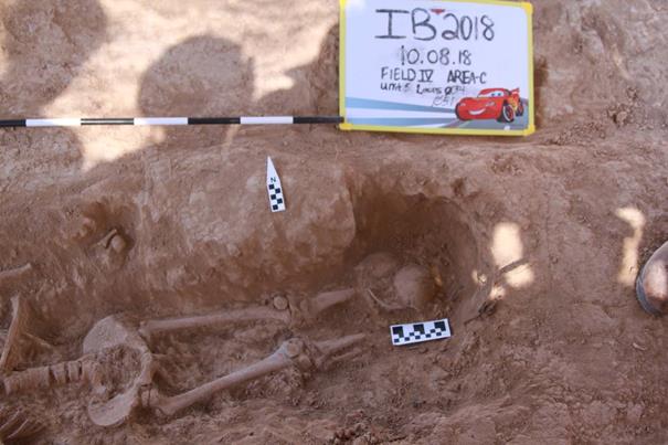
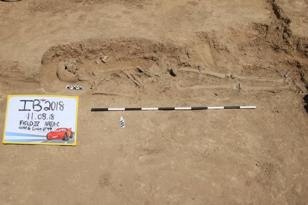

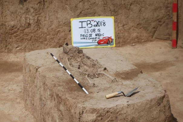
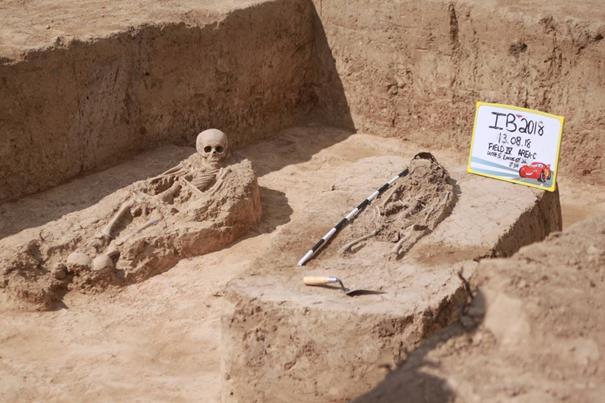
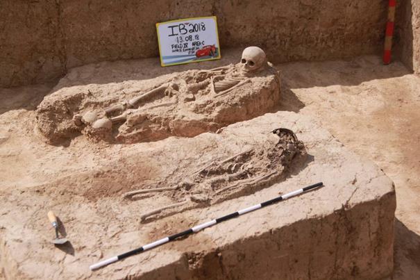
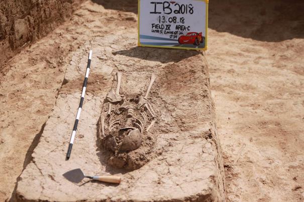
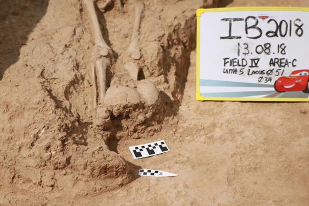
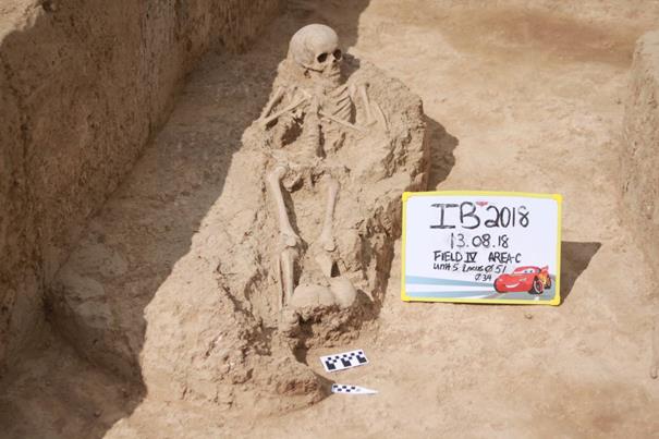
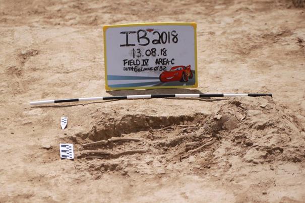
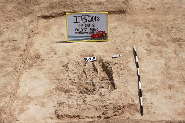
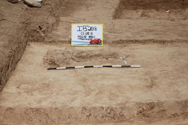
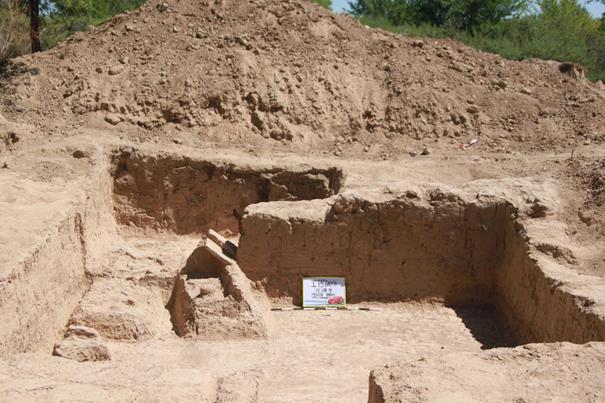
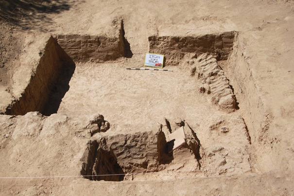
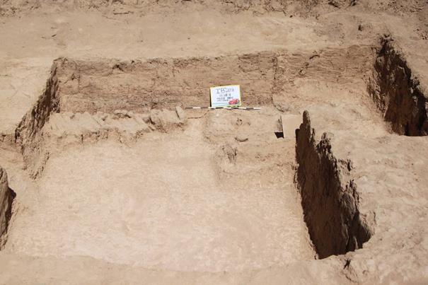
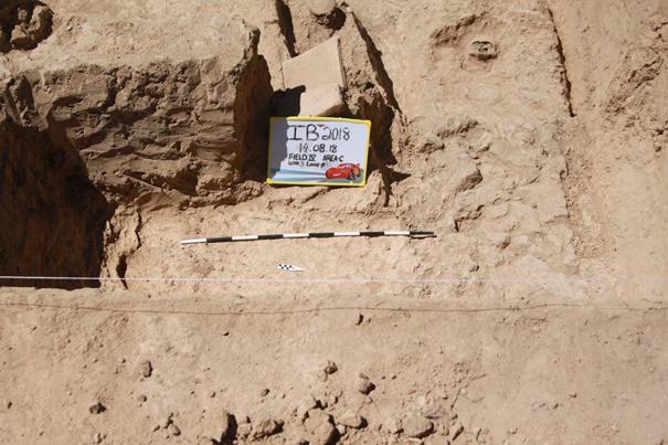
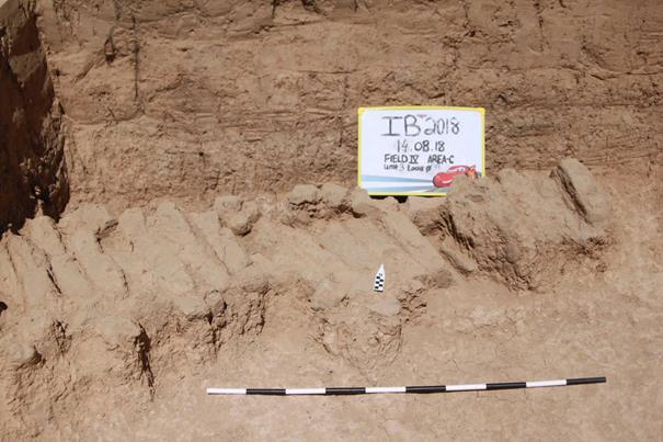
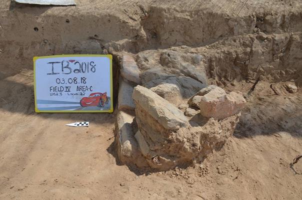
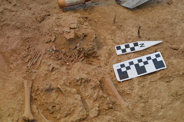
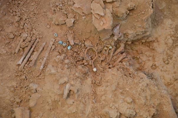
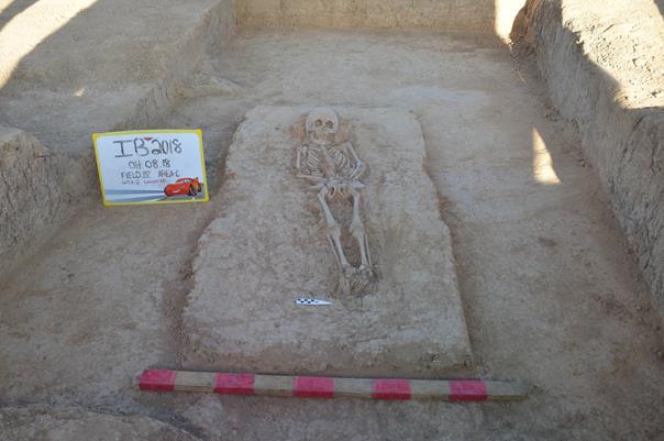
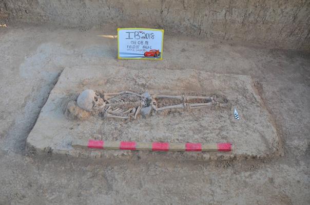
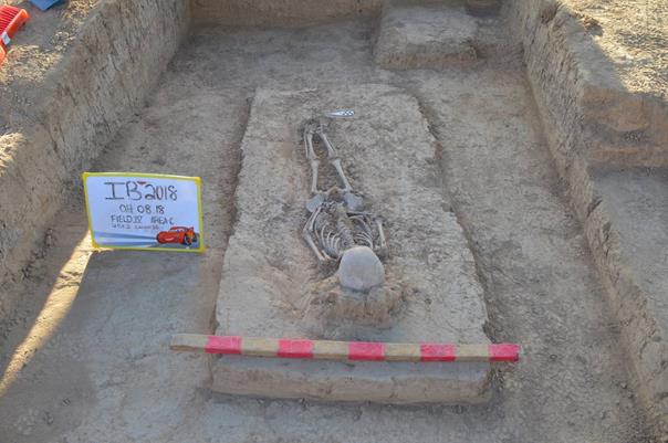
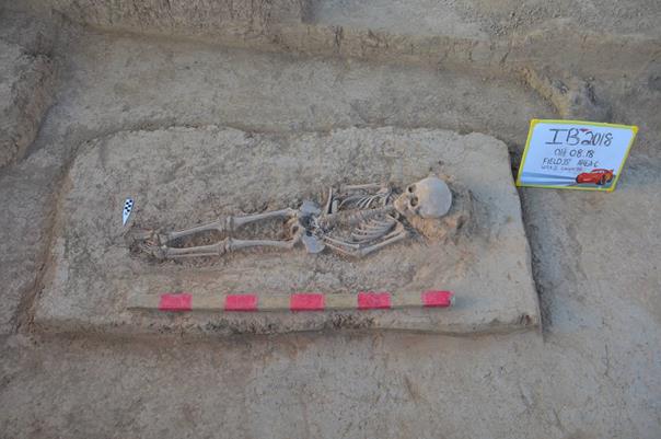
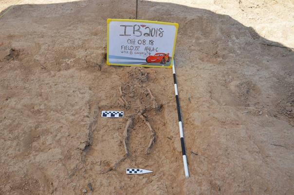
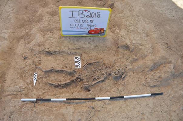
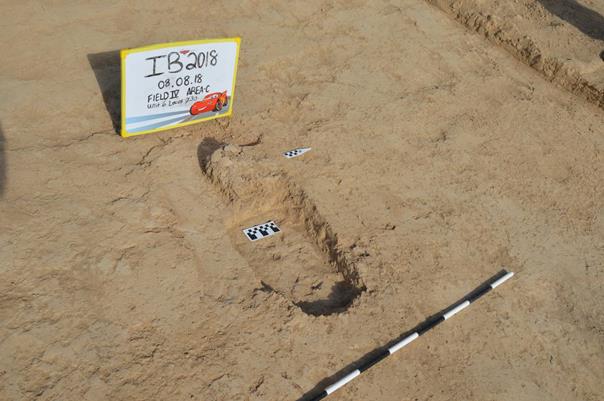
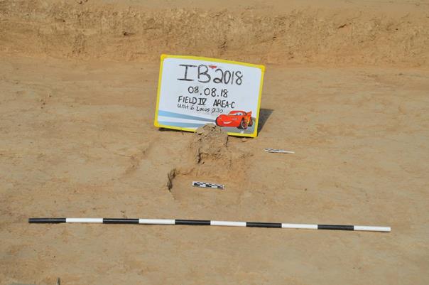
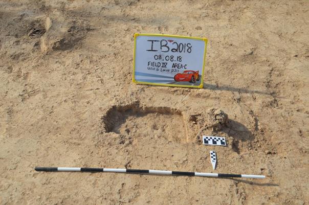
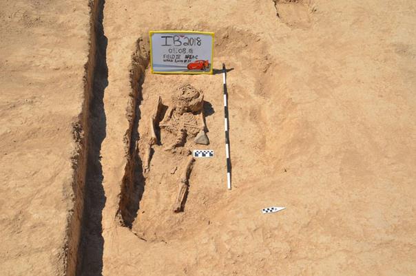
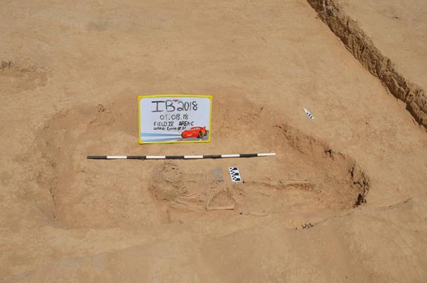
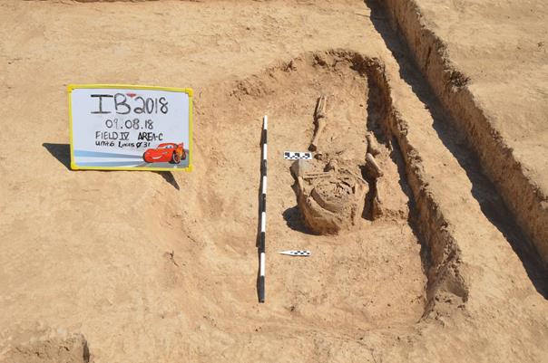
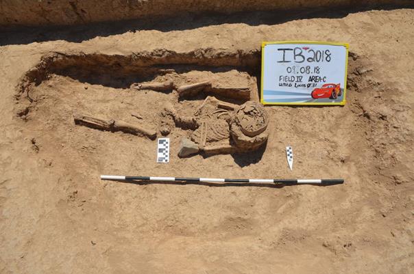
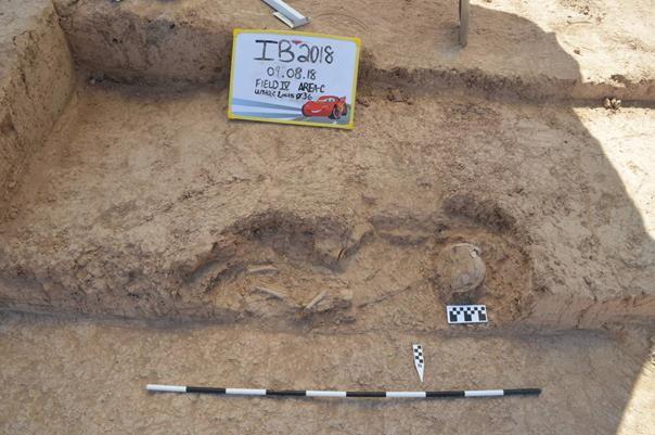
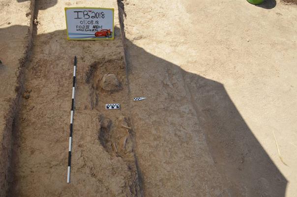
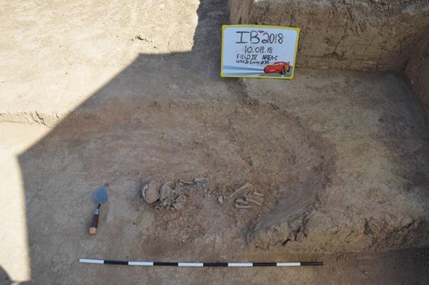
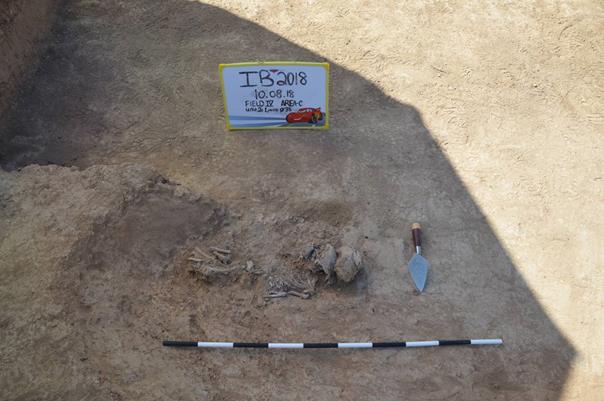
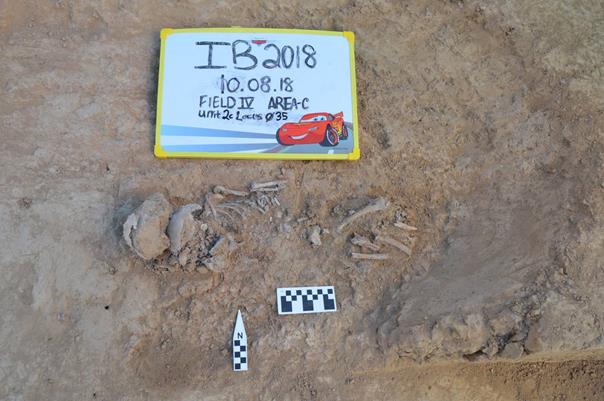
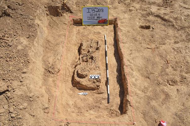
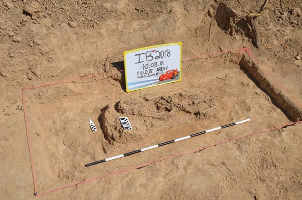
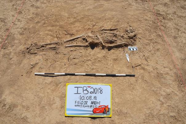
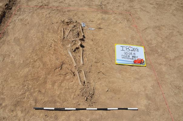
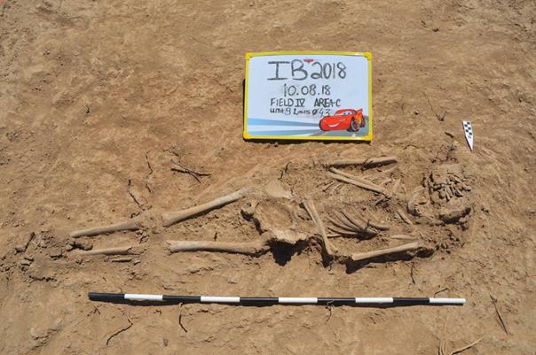
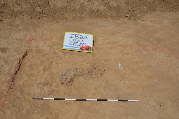
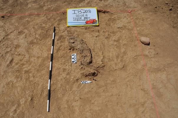
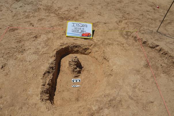
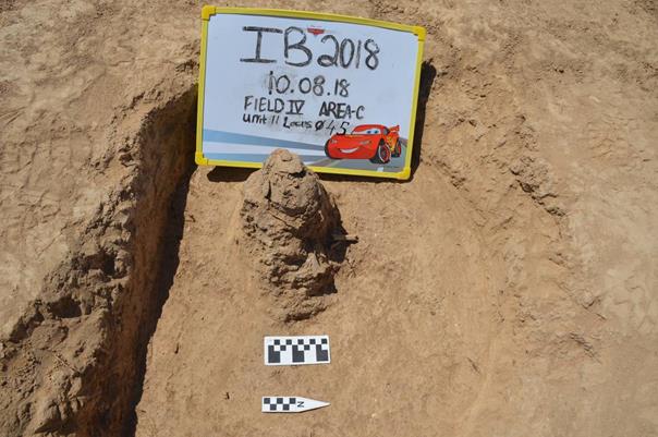
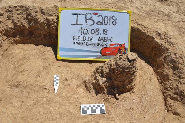
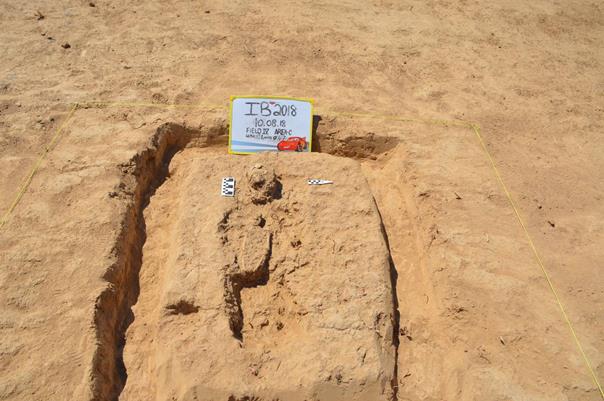
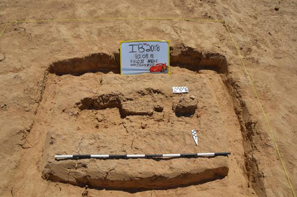
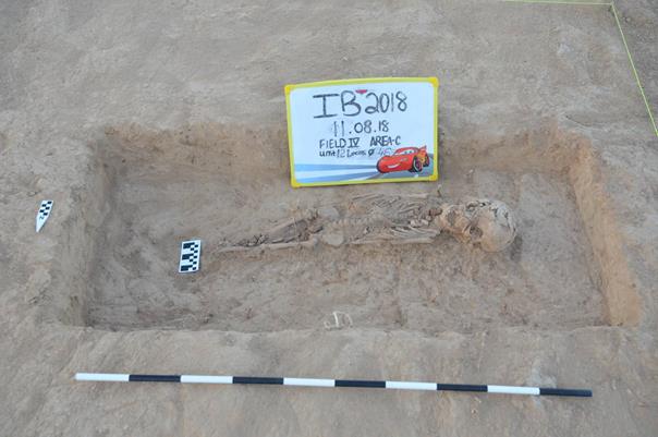
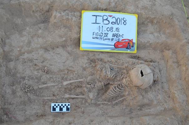
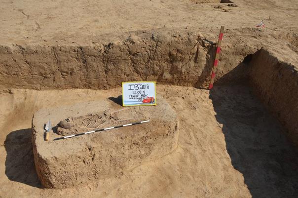
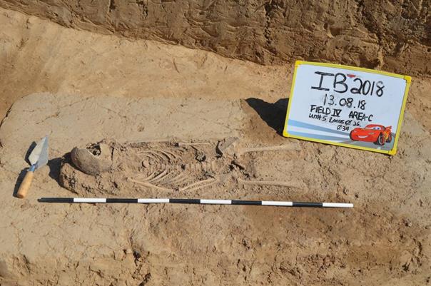
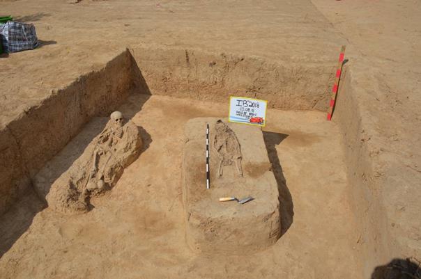
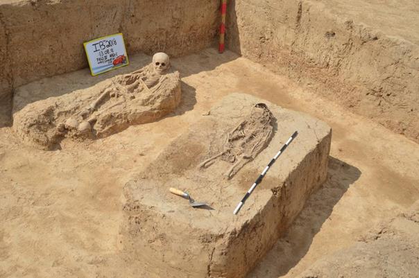
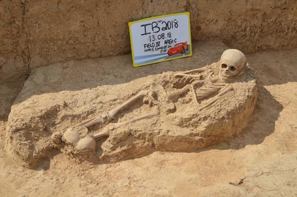
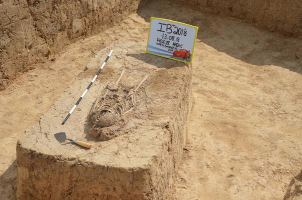
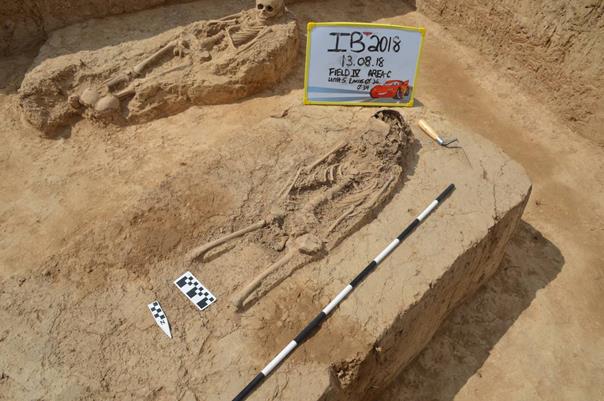
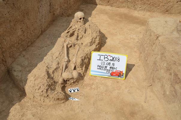
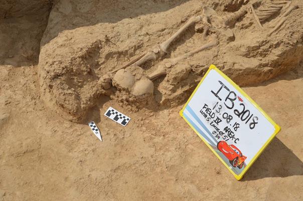
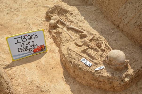
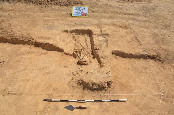
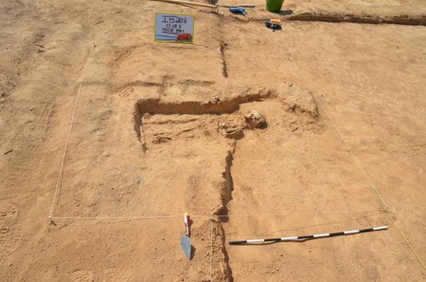
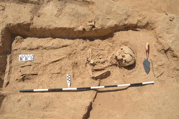
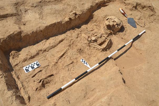
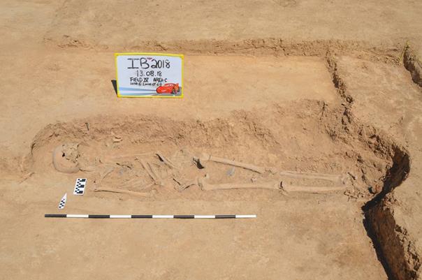
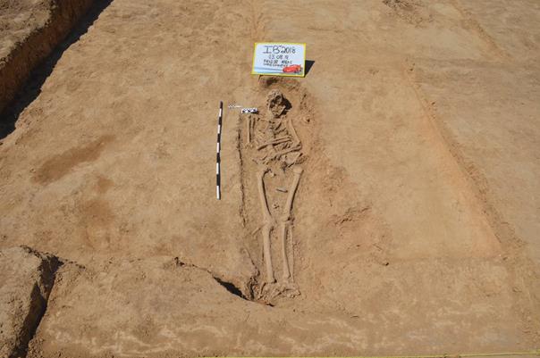
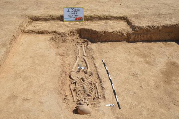
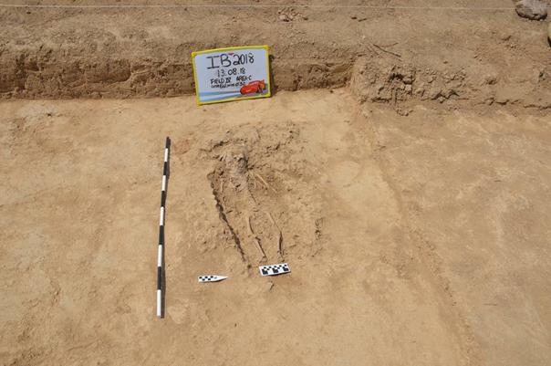
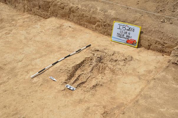
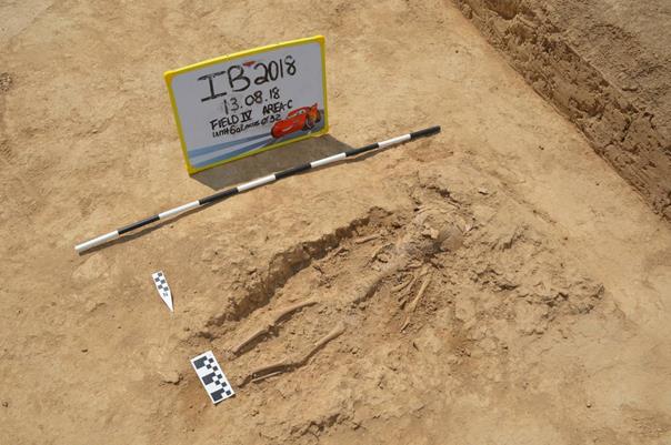
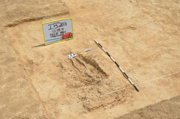
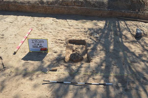
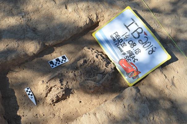

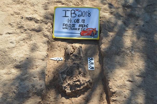
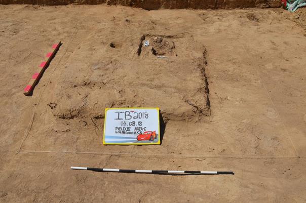
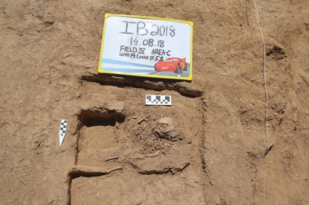
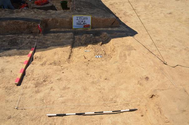
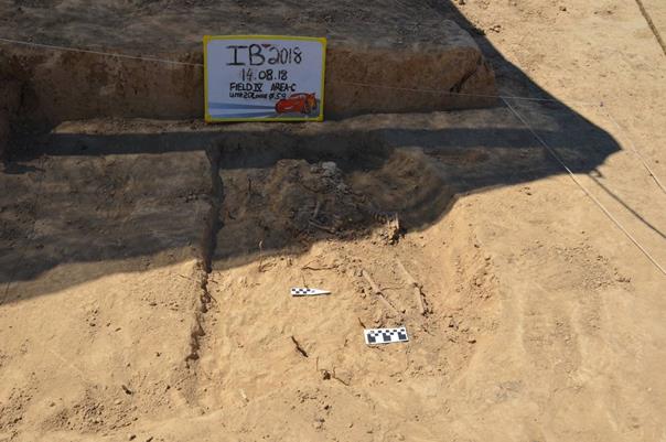
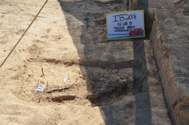
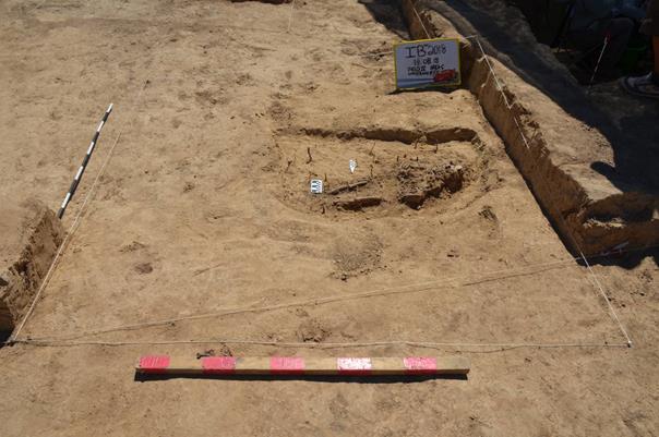
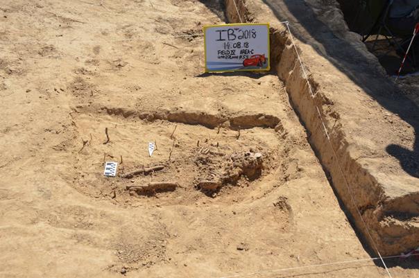
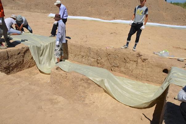
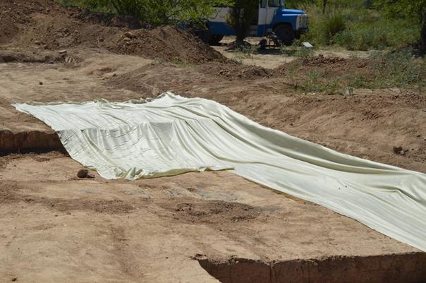
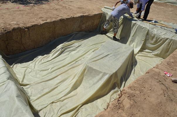
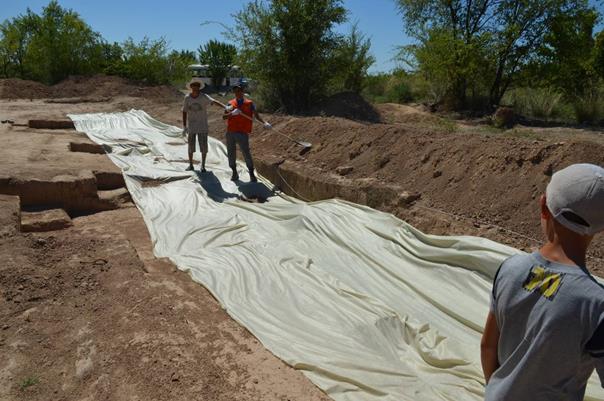
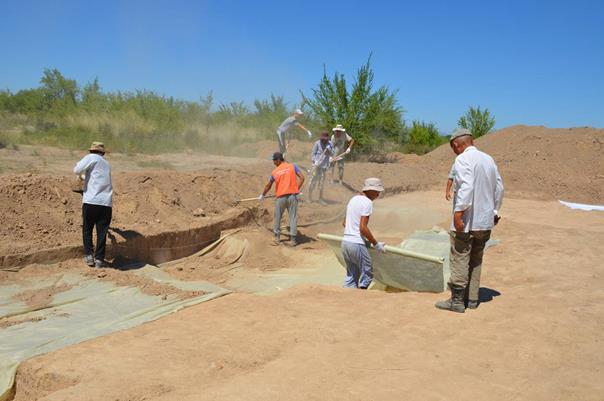
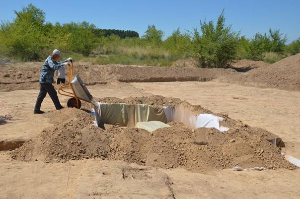
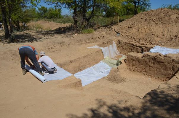
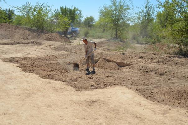
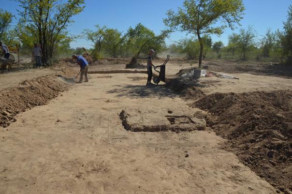
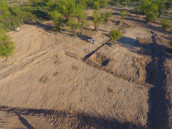
2018 FIELD REPORT
ARCHAEOLOGICAL EXCAVATIONS
AT THE CEMETERY OF USHARAL-ILIBALYK,
VOLUME 2
Almaty 2018
ANNOTATION
This
volume of the report contains next appendixes:
1.
APPENDIX
C – DRAWINGS which consist of general scheme of excavation area, detailed plan
of all grave pits, cross section of baulks;
2.
APPENDIX
D - SPECIAL FINDS DRAWINGS which consist of hand drawings of most interesting
artifacts: grave stones, jewelry and
other finds;
3.
APPENDIX
E - GRAVE COMPARISON which consist detail information about grave pits and
skeletons;
4.
APPENDIX
F - DESCRIPTION OF THE ILIBALYK CERAMIC MATERIAL which consist of detail
description of pottery fragment and tables with drawings.
APPENDIX C
DRAWINGS
|
Fig. 1 – General
scheme. Location of excavation.
|
|
Fig. 2 – General
scheme. Excavation area.
|
|
Fig. 3 – Plan.
Unit 1, Locus 14.
|
|
Fig. 4 – Plan.
Unit 1, Locus 14.
|
|
Fig. 5 – Plan.
Unit 2, Locus 16, 19, 35, 36.
|
|
Fig. 6 – Plan.
Unit 2, Locus 36.
|
|
Fig. 7 – Plan.
Unit 2, Locus 16.
|
|
Fig. 8 – Plan.
Unit 2, Locus 19.
|
|
Fig. 9 – Plan.
Unit 2, Locus 35.
|
|
Fig. 10 – Plan.
Unit 3, Locus 8, 21, 22, 25, 28, 39, 40, 53.
|
|
Fig. 11 – Plan.
Unit 3, Locus 8.
|
|
Fig. 12 – Plan.
Unit 3, Locus 22.
|
|
Fig. 13 – Plan.
Unit 3, Locus 22, 28, 40, 41, 53.
|
|
Fig. 14 – Plan.
Unit 3, Locus 21, 25, 39.
|
|
Fig. 15 – Plan.
Unit 3, Locus 25.
|
|
Fig. 16 – Plan.
Unit 4, Locus 9, 20.
|
|
Fig. 17 – Plan.
Unit 4, Locus 9.
|
|
Fig. 18 – Plan.
Unit 5, Locus 6, 23, 26, 34.
|
|
Fig. 19 – Plan.
Unit 5, Locus 34.
|
|
Fig. 20 – Plan.
Unit 5, Locus 26.
|
|
Fig. 21 – Plan.
Unit 6, Locus 12, 24, 31, 32, 49, 52.
|
|
Fig. 22 – Plan.
Unit 6, Locus 49.
|
|
Fig. 23 – Plan.
Unit 6, Locus 32, 52.
|
|
Fig. 24 – Plan.
Unit 6, Locus 12, 30.
|
|
Fig. 25 – Plan.
Unit 6, Locus 31.
|
|
Fig. 26 – Plan.
Unit 8, Locus 42.
|
|
Fig. 27 – Plan.
Unit 8, Locus 42.
|
|
Fig. 28 – Plan.
Unit 9, Locus 43.
|
|
Fig. 29 – Plan.
Unit 9, Locus 43.
|
|
Fig. 30 – Plan.
Unit 10, Locus 44.
|
|
Fig. 31 – Plan.
Unit 10, Locus 44.
|
|
Fig. 32 – Plan.
Unit 11, Locus 45.
|
|
Fig. 33 – Plan.
Unit 11, Locus 45.
|
|
Fig. 34 – Plan.
Unit 12, Locus 46.
|
|
Fig. 35 – Plan.
Unit 12, Locus 46.
|
|
Fig. 36 – Plan.
Unit 13, Locus 47.
|
|
Fig. 37 – Plan.
Unit 13, Locus 47.
|
|
Fig. 38 – Plan.
Unit 14, Locus 48.
|
|
Fig. 39 – Plan.
Unit 14, Locus 48.
|
|
Fig. 40 – Plan.
Unit 16, Locus 54(27).
|
|
Fig. 41 – Plan.
Unit 16, Locus 54(27).
|
|
Fig. 42 – Plan.
Unit 17, Locus 56.
|
|
Fig. 43 – Plan.
Unit 17, Locus 56.
|
|
Fig. 44 – Plan.
Unit 19, Locus 58.
|
|
Fig. 45 – Plan.
Unit 19, Locus 58.
|
|
Fig. 46 – Plan.
Unit 20, Locus 59.
|
|
Fig. 47 – Plan.
Unit 20, Locus 59.
|
|
Fig. 48 –
Comparing excavation area 2017-2018
|
|
Fig. 49 –
Comparing grave stones location with excavation area 2018
|
|
Fig. 50 –Cross
section. Unit 2. East, North.
|
|
Fig. 51 –Cross
section. Unit 2. South, West.
|
|
Fig. 52 –Cross
section. Unit 1. North, South.
|
|
Fig. 53 –Cross
section. Unit 1. East, West.
|
|
Fig. 54 –Cross
section. Unit 3. South, East.
|
|
Fig. 55 –Cross
section. Unit 3. North, West.
|
|
Fig. 56 –Cross
section. Unit 5. East, North.
|
|
Fig. 57 –Cross
section. Unit 5. West, South.
|
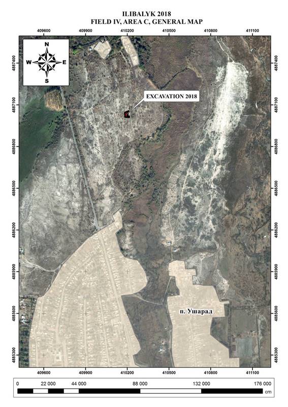
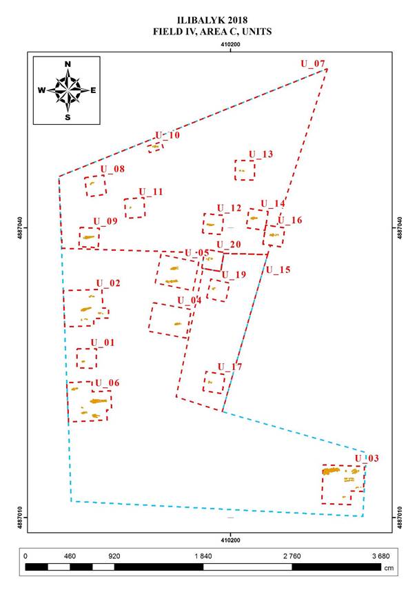
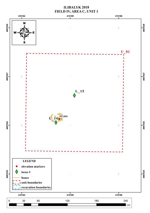
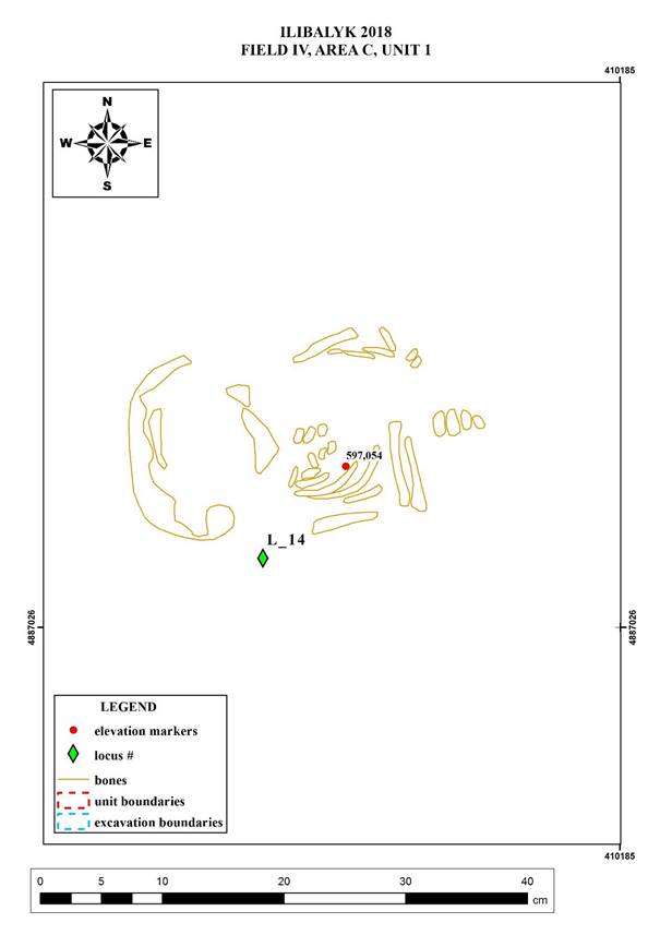
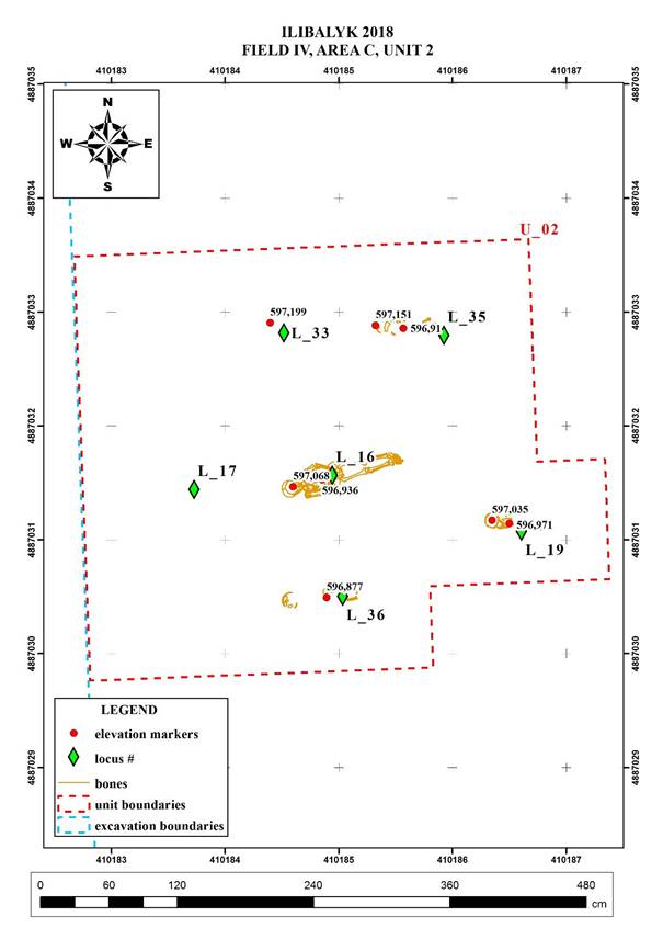
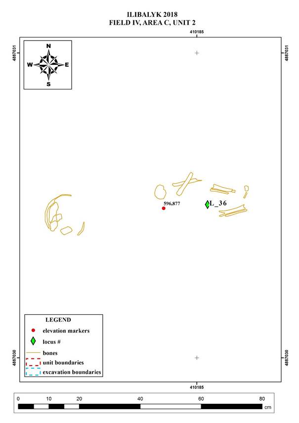
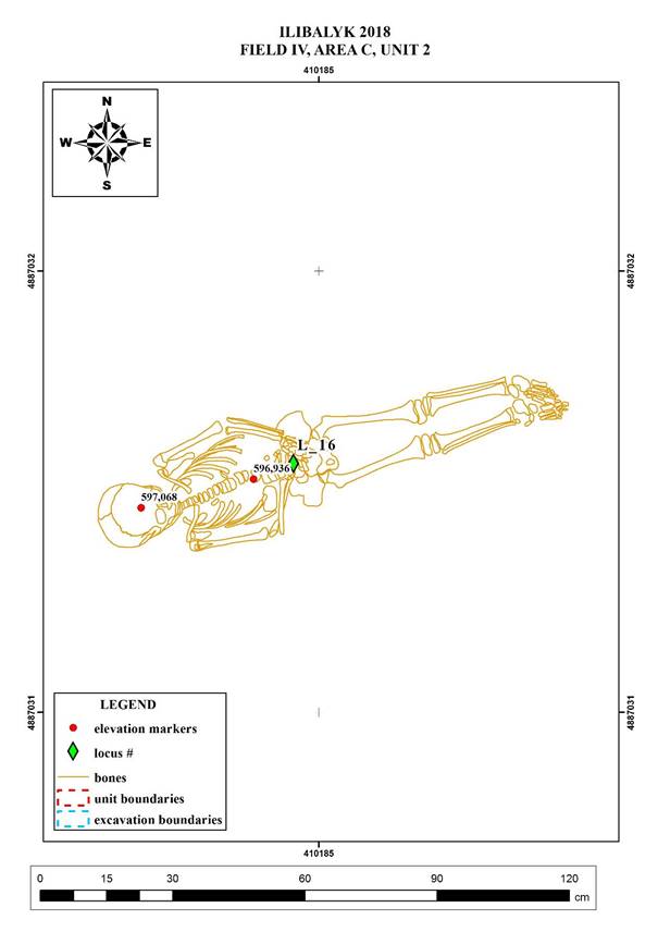
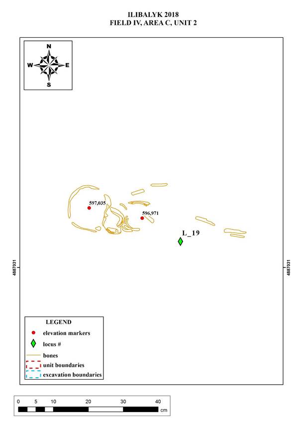
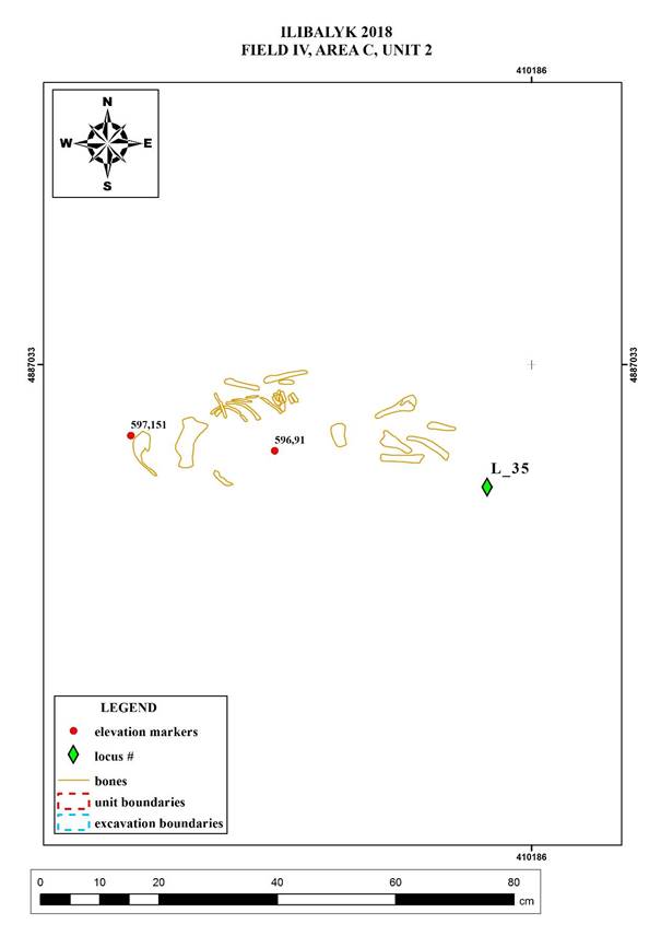
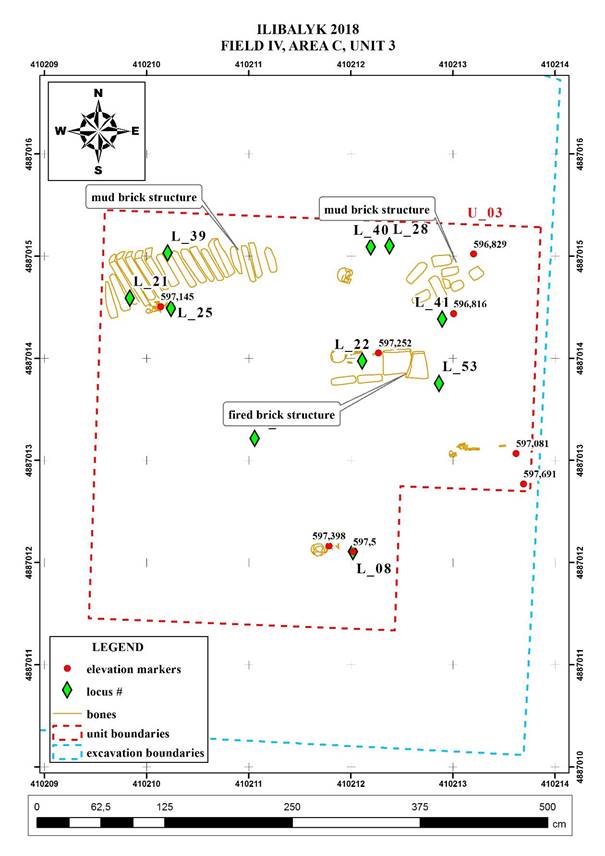
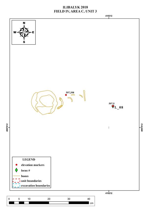
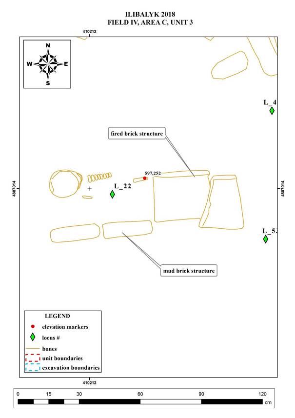
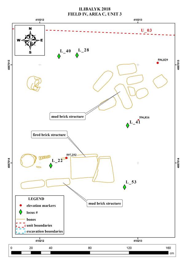
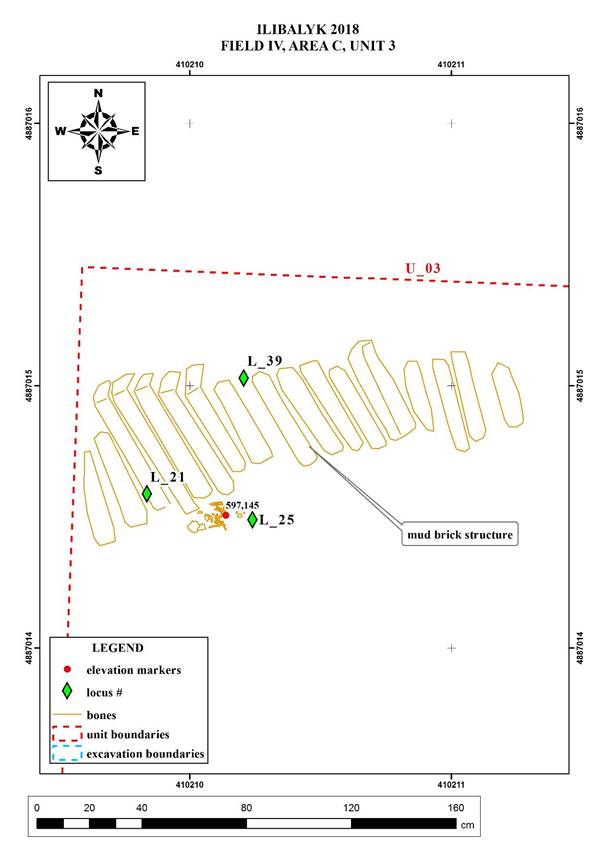
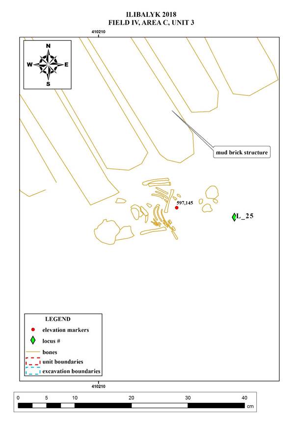
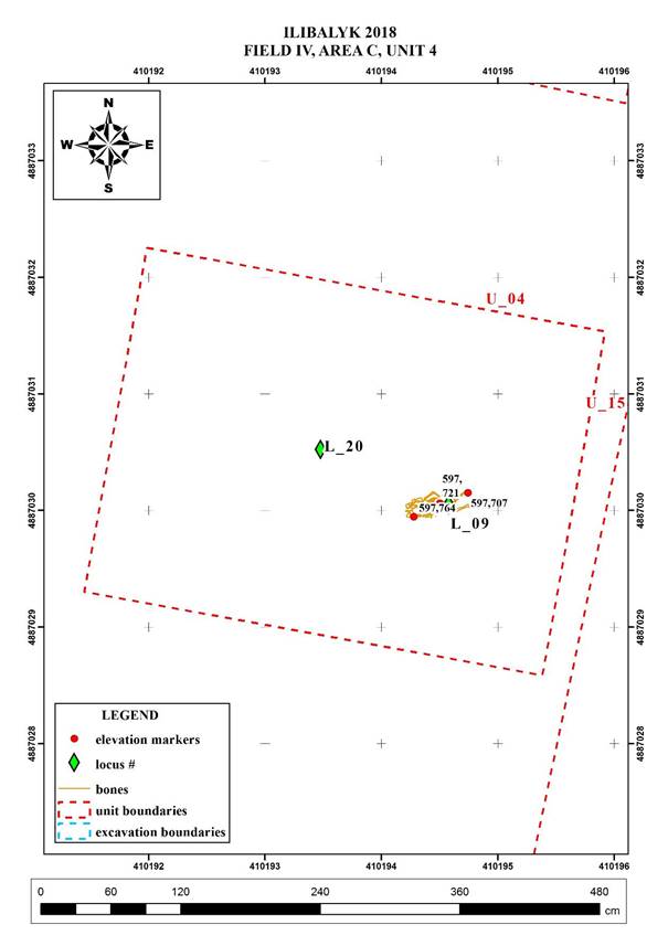
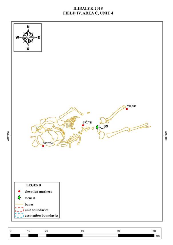
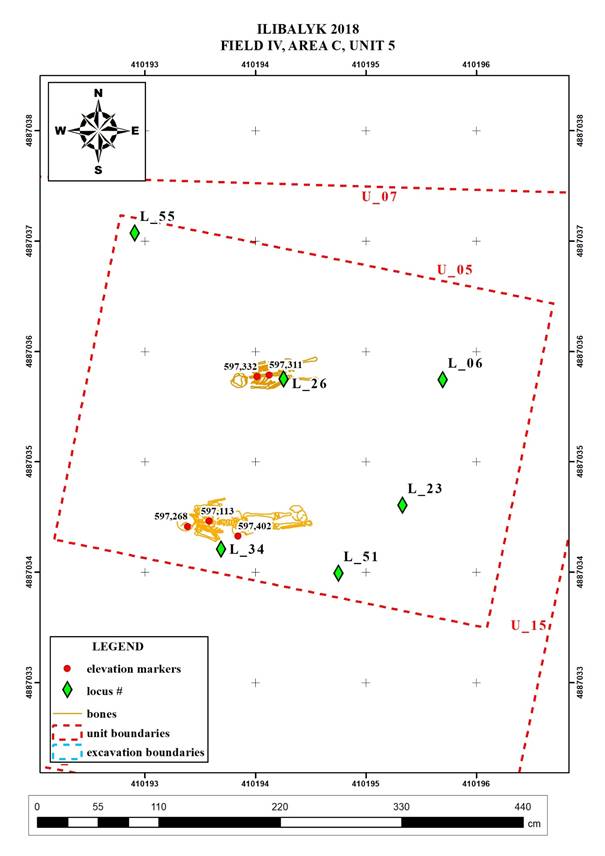
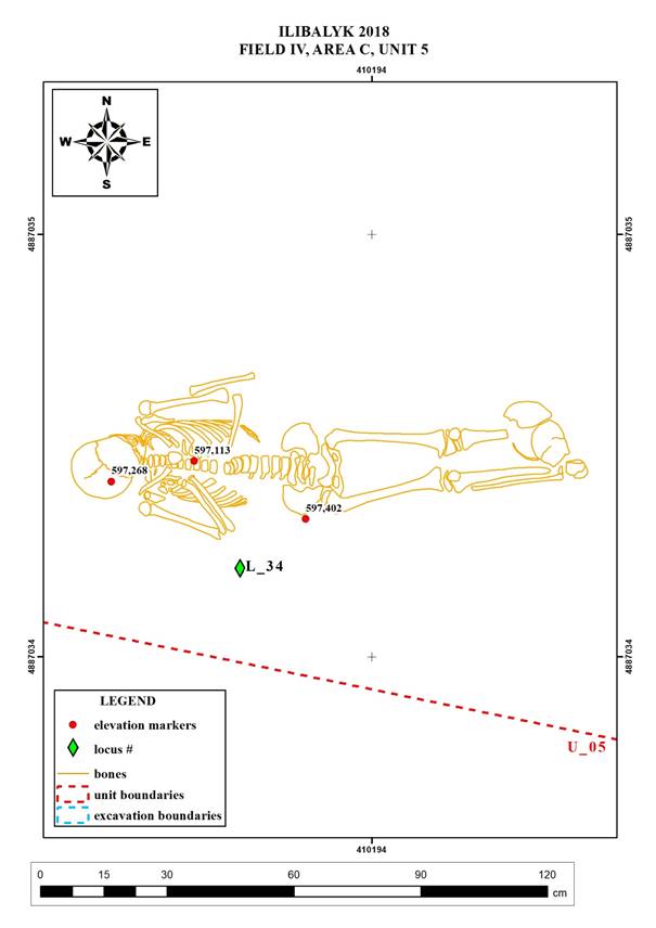
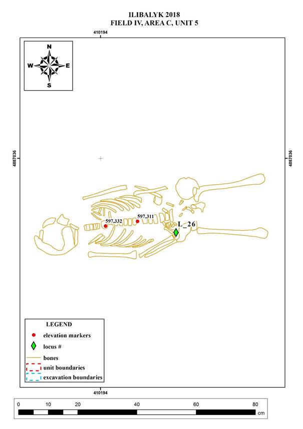
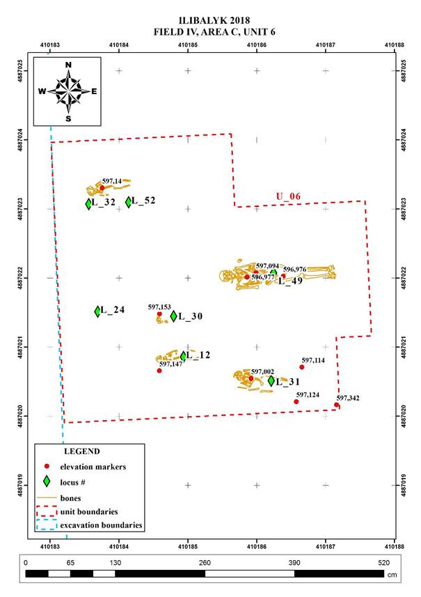
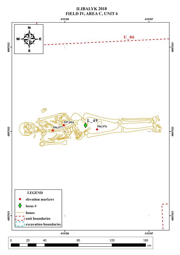
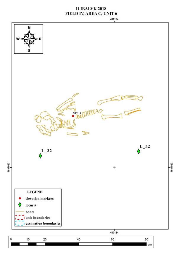
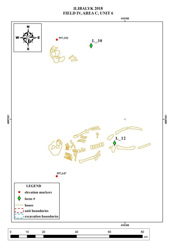
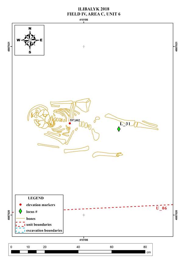
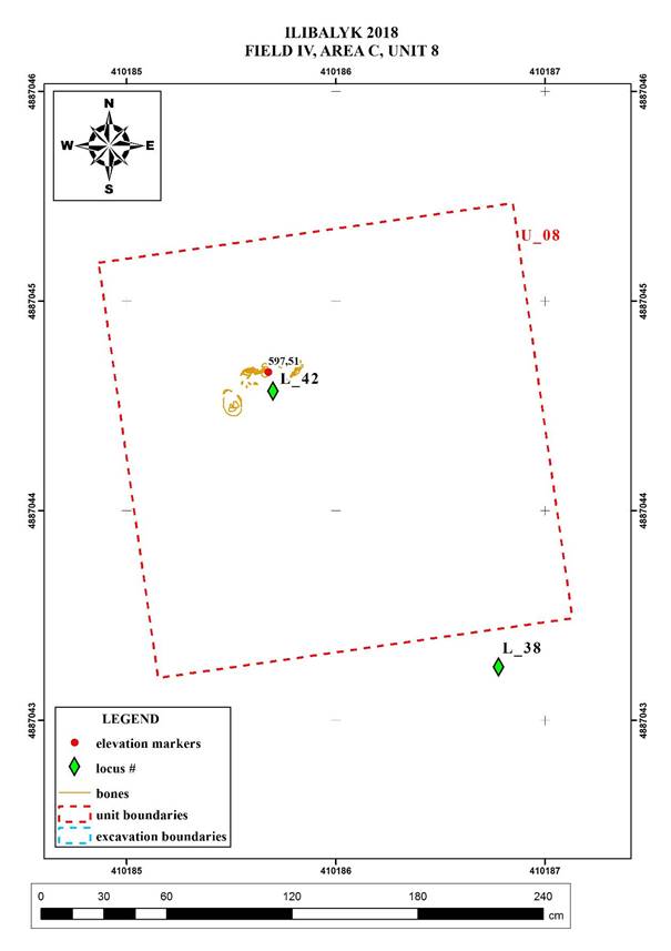
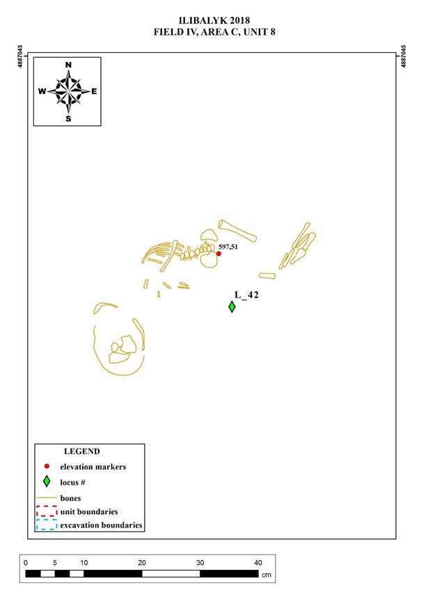
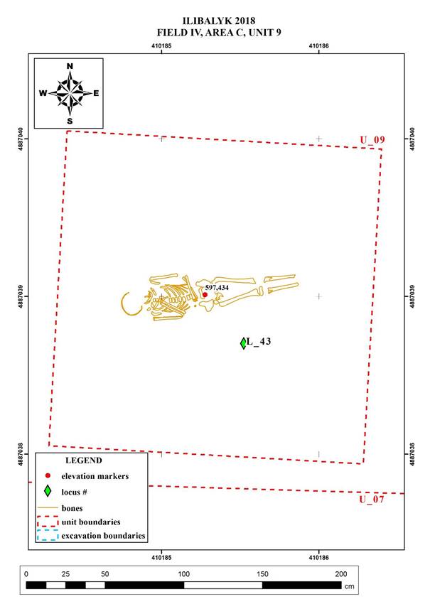
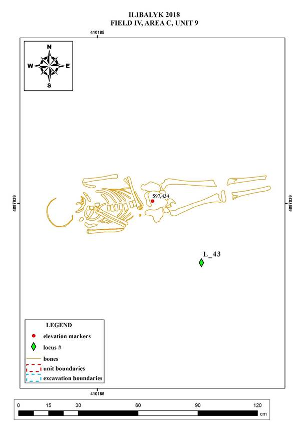
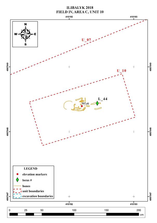
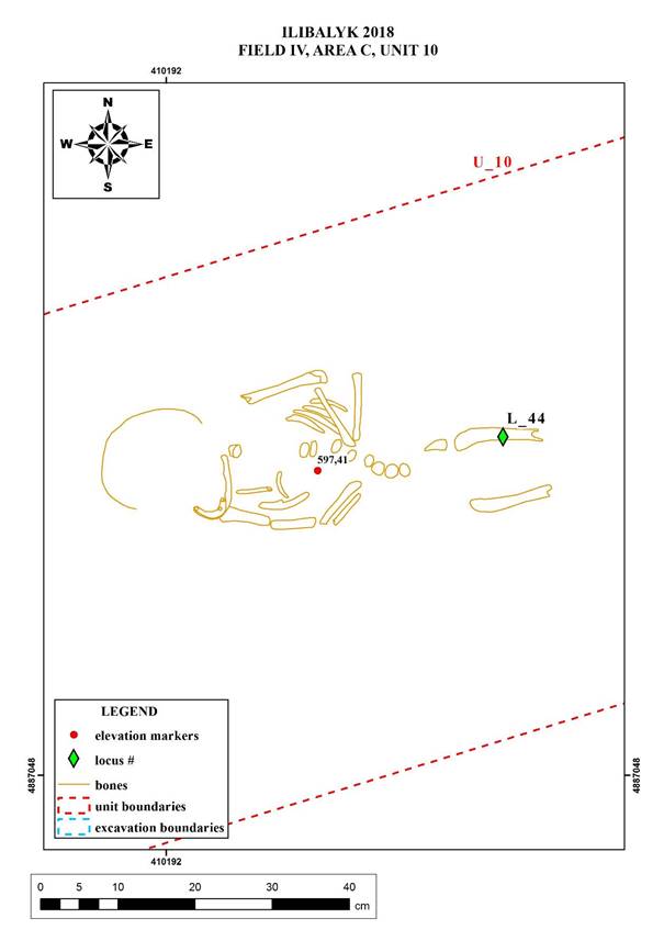
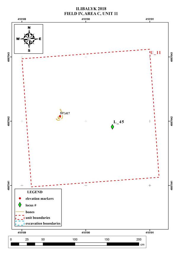
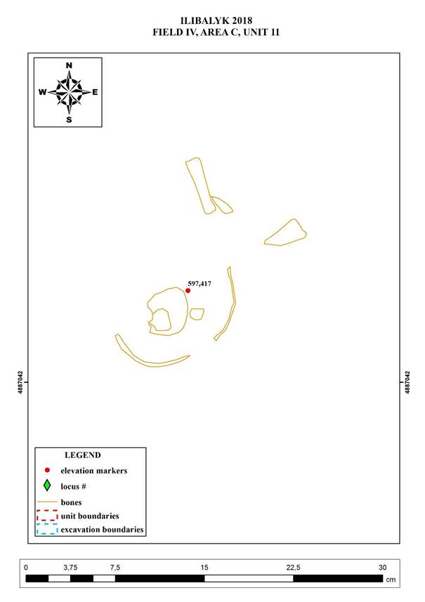
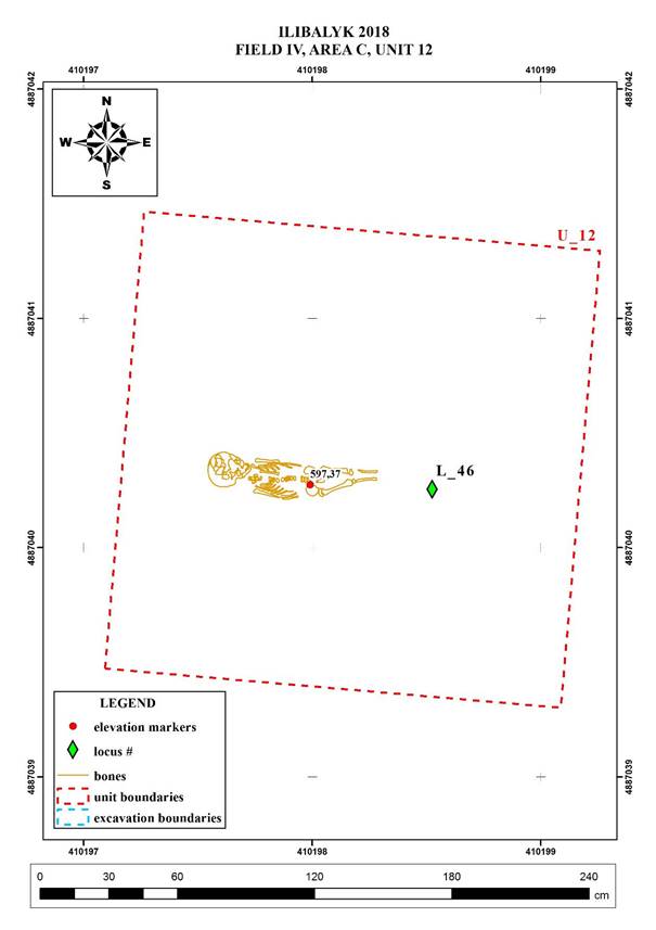
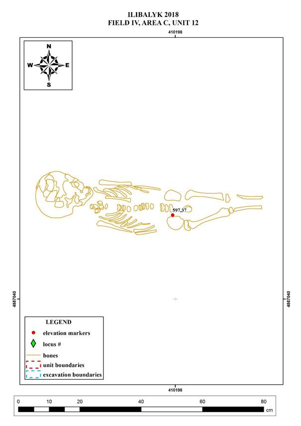
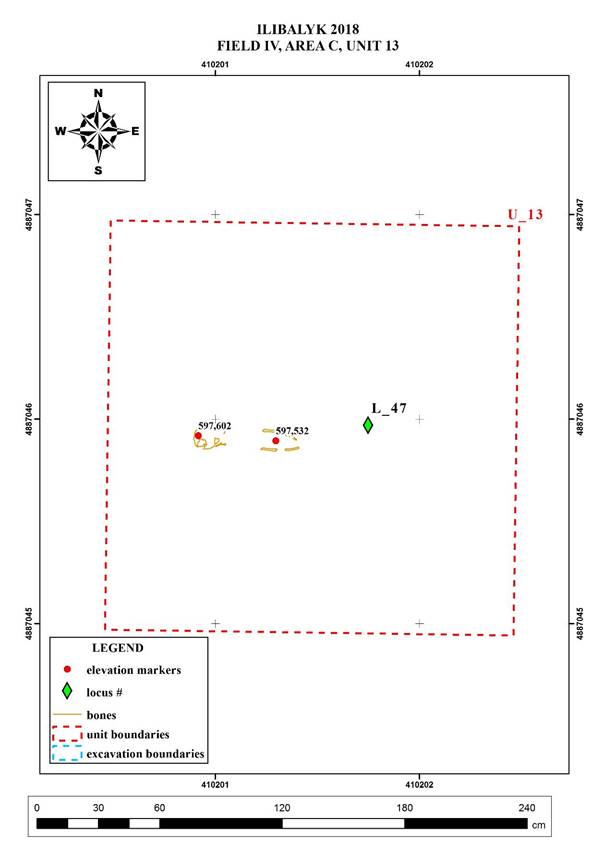
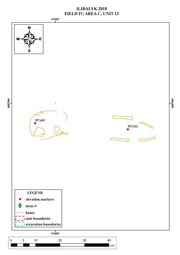
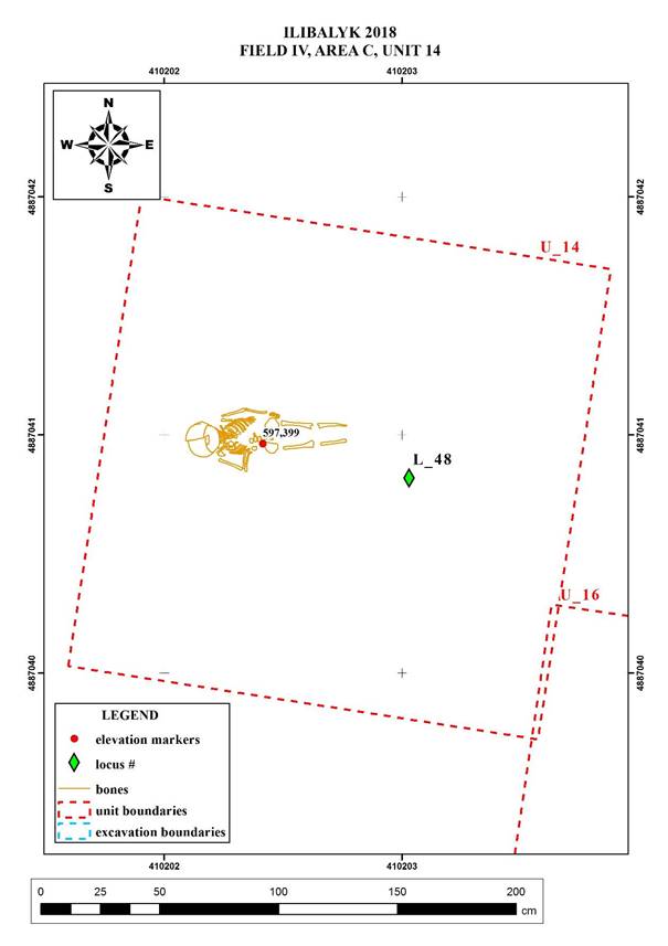
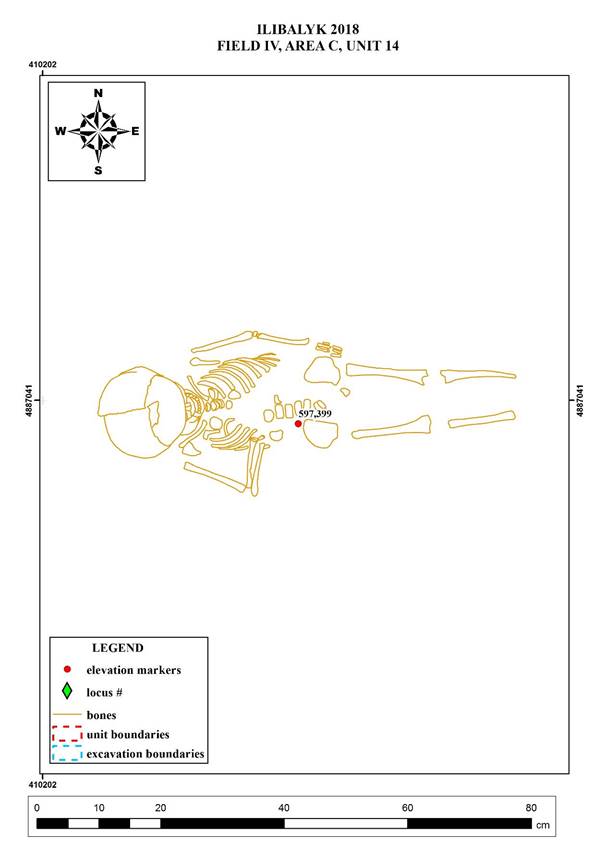
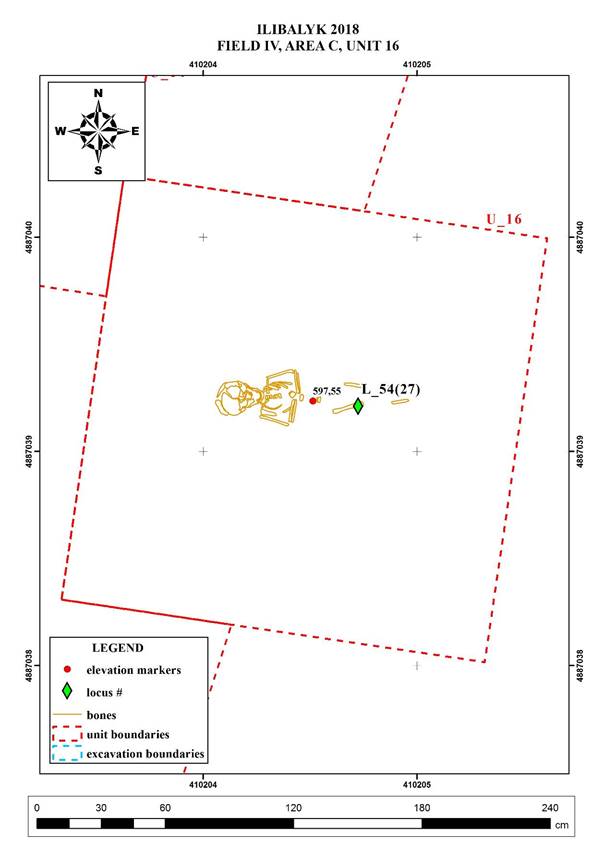
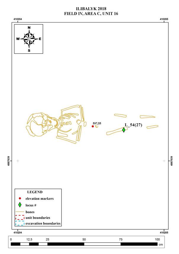
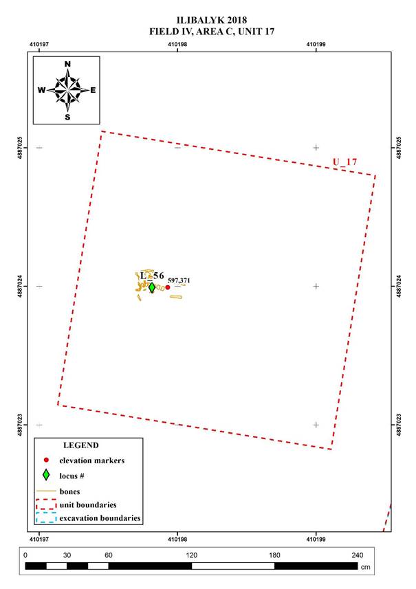
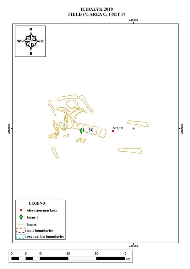
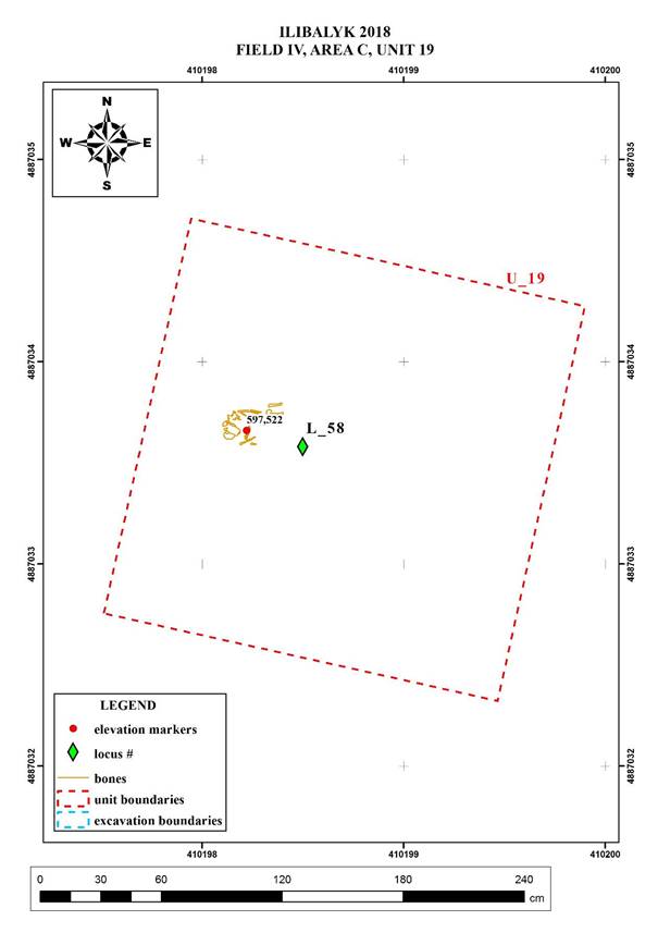
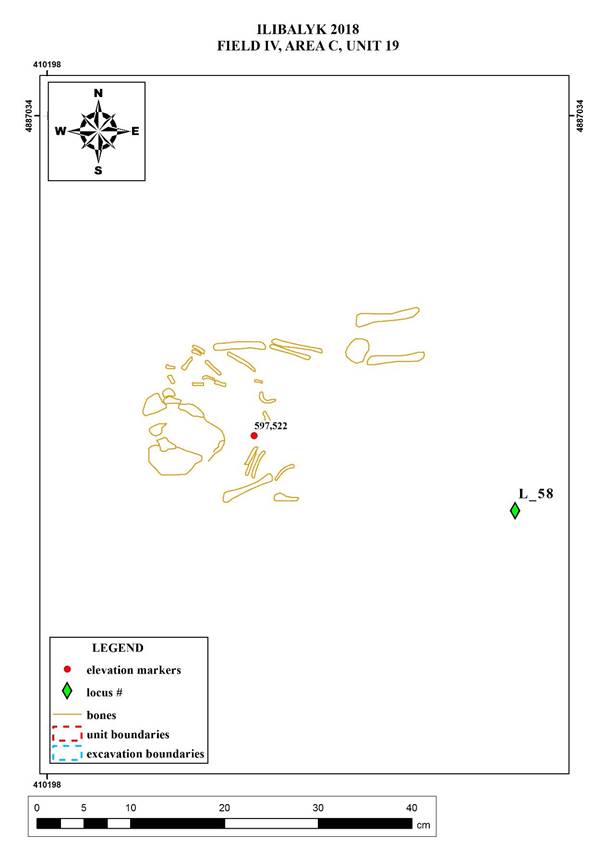
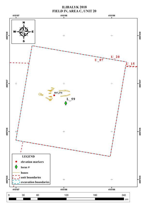
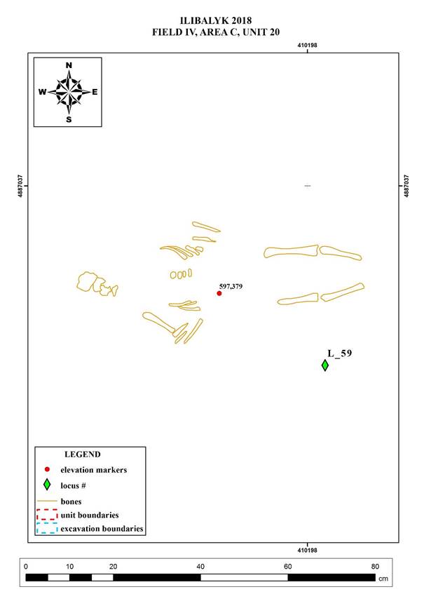
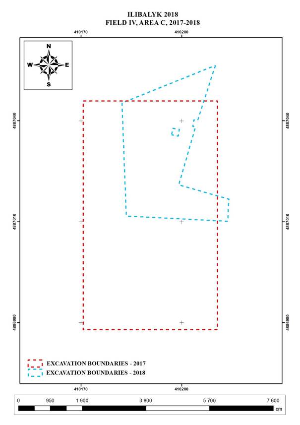
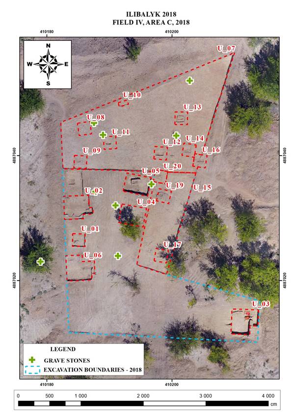
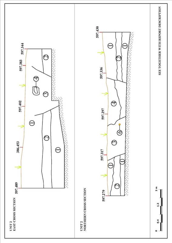
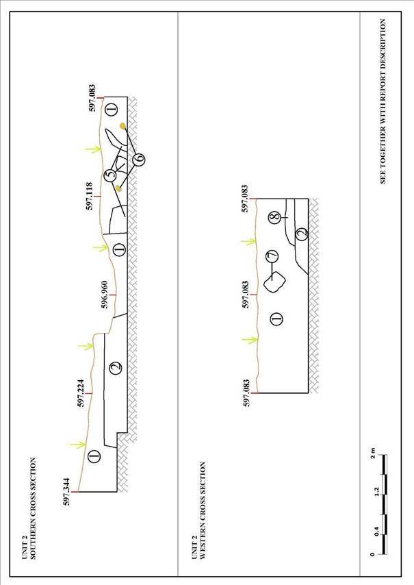
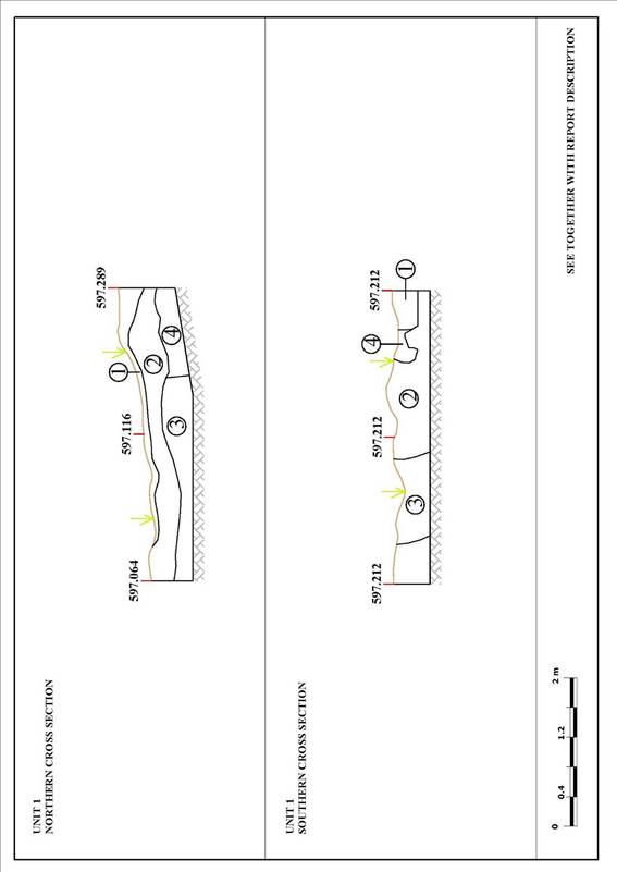
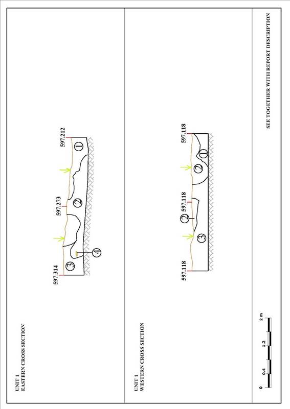
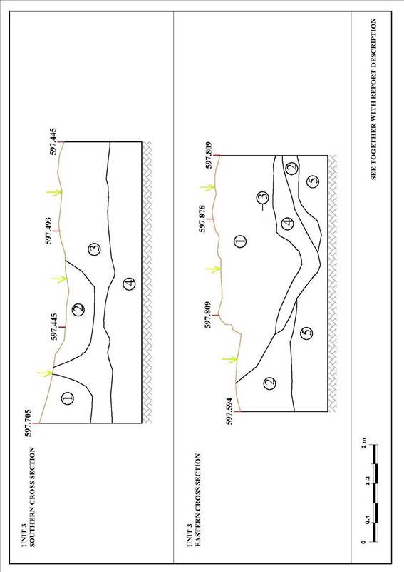
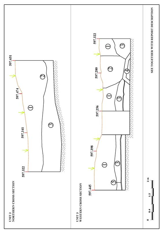
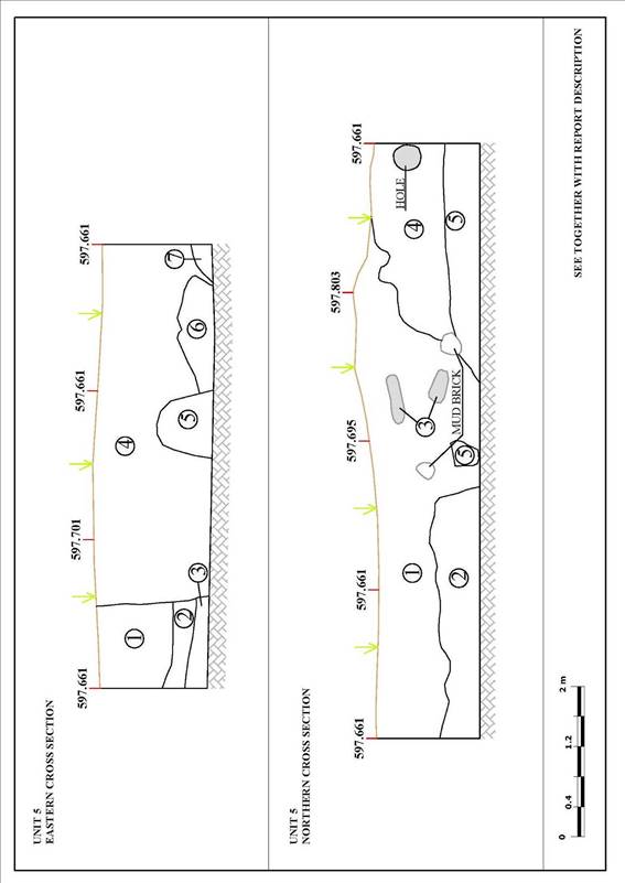
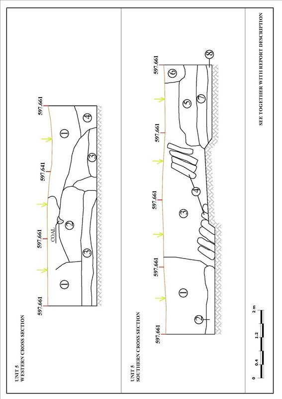
APPENDIX D
SPECIAL FINDS DRAWINGS
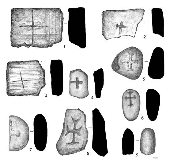
TABLE
№1.
GRAVE
MARKERS
1)Ib18_C_IV/001_I/03.
2)Ib18_C_IV/001_I/02.
3)Ib18_C_IV/001_I/01.
4)Ib18_C_IV/013_I/07.
5)Ib18_C_IV/002_I/01.
6)Ib18_C_IV/007_I/05.
7)Ib18_C_IV/004_I/03.
8)Ib18_C_IV/003_I/02.
9)Ib18_C_IV/006_I/06.
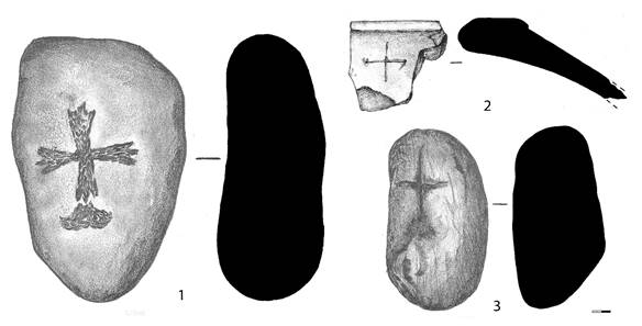
TABLE
№2. GRAVE MARKERS
1)Ib18_D_IV/005_I/04.
2)Ib18_D_IV/001_I/02.
3)Ib18_D_IV/001_I/01.
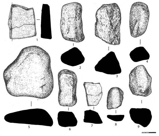
TABLE
№3. GRAVE MARKERS
1)Ib18_C_IV/016_I/02.
2)Ib18_C_IV/016_I/01.
3)Ib18_C_IV/023_I/01
(U5_L23).
4)Ib18_C_IV/008_I/01.
5)Ib18_C_III/032_I/01.
6)Ib18_C_IV/023_I/02.
7)Ib18_C_III/026_I/03
(U5_L26).
8)Ib18_C_IV/016_I/03
(U16_L54).
9)Ib18_C_IV/008_I/01.
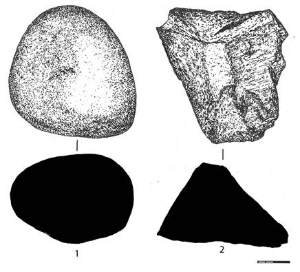
TABLE
№4.
1)
Ib18_C_III/034_I/01 (U5_L34).
2)
Ib18_C_IV/031_I/01.
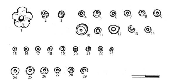
TABLE
№5.
1-3)
Ib18_C_IV/012_I/04 (U11_L45).
4-14)
Ib18_C_IV/019_I/02.
15-23)
Ib18_C_IV/009_I/01.
24-29)
Ib18_C_IV/019_I/01.
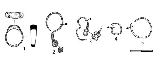
TABLE
№6.
1)Ib18_C_IV/009_I/04.
2)Ib18_C_IV/026_I/02
(U5_L26).
3)Ib18_C_IV/026_I/01
(U5_L26).
4)Ib18_C_IV/043_I/01
(U9_L43).
5)Ib18_C_IV/012_I/03.
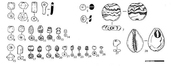
TABLE
№7.
1-4)Ib18_C_IV/009_I/02.
5)Ib18_C_IV/009_I/03.
6)Ib18_C_IV/039_I/01.
7)Ib18_C_IV/001_I/11
(U1_L11).
8-14)Ib18_C_IV/045_I/01
(U11_L45).
15-26)Ib18_C_IV/056
(U17_L56).
27-28)Ib18_C_IV/048_I/01
(U14_L48).
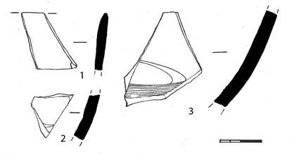
PORCELAIN. Ib18_C_IV/001_I/10.
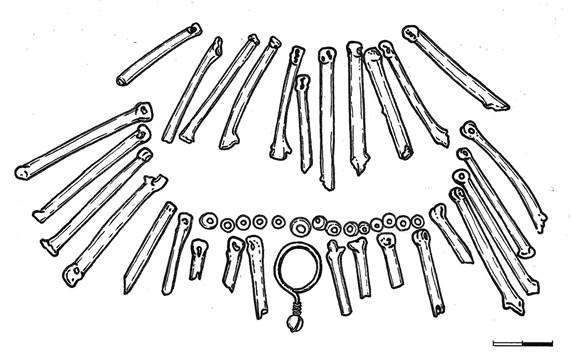
NECKLACE. Ib18_C_IV/012_I/04.
APPENDIX
E
USHARAL-ILIBALYK
2018 GRAVE COMPARISON


APPENDIX F
DESCRIPTION OF THE ILIBALYK CERAMIC MATERIAL 2018
Ib_18_C_IV (L01)
Unglazed Common Ware Potsherds
A total of 749 common ware fragments were found composed of the following: 29 rims; 29 bases; 645 sidewalls; 29 decorated sidewalls; 7 handles; and 10 other.
Rims
Ill. 1: This rim fragment from a pot-shaped vessel was made of a well-variegated, light-dense red fabric with a small number of inclusions of sand and mica particles. The outer and inner surface is covered with a layer of partially preserved light slip. The lip of the rim has a triangular shape in its cross-section and it is 20 cm in diameter. The sherd’s thickness is 0.8 cm. The rim has a straight high neck of 3.5 cm. In addition, a loop-shaped handle is attached to the side and is slightly below the edge. It has a standard oval shape in the cross-section and is 3.6 cm wide and 0.9 cm thick. There is a decoration of straight, concentric lines at the handle’s point of attachment to the body of the vessel.
Ill. 2: This rim fragment is from a vessel made of a well-variegated, dense light-red fabric, with minimal inclusions of small particles of sand and mica. The outer and inner surface is covered with a layer of partially preserved light slip. The edge of the rim is spindle-shaped and has an oval shape in its cross section. The diameter of the rim is 14 cm and the sherd’s thickness is 0.9 cm.
Ill. 3: This rim fragment is from a cooking pot and made of a a medium-variegated dense, gray fabric, with minimal inclusions of small sand particles. On the outside, a partially preserved layer of bright slip is visible. The edges of the rim are flattened and in the cross-section it has an oval shape. The diameter is 9 cm and the sherd’s thickness is 0.5 cm.
Ill. 4: This rim fragment was made of stucco and comes from a vessel with a high neck. It was made of a medium-variegated, dense red fabric with small inclusions of sand and mica particles. The inner and outer surface is covered with a partially preserved light slip layer. The edges of the rim are sub-rectangular in its cross section. The sherd’s diameter is 19 cm along the inner side and the sherd’s thickness is 0.9 cm. The vessel has a low straight neck which smoothly transitions into the vessel’s shoulder.
Ill. 5: This rim fragment is from a cooking pot made of a a medium-variegated light-red dense fabric with minimal inclusions of small sand and mica particles inclusions. The outer and inner surface is covered with a layer of light slip. The rim abruptly transitions into the vessel's shoulder. The edges of the rim are oval. Its diameter is 18 cm and the sherd’s thickness is 1 cm.
Ill. 6: This rim fragment from a small molded pot was made of a medium-variegated, light-red dense fabric. Inclusions of coarse and fine sand, mica and chamotte are visible in the cross-section. The outer surface and partially the inner surface is covered with a layer of light red slip. The edges of the rim are slightly turned outward and is oval in the cross-section. The rim’s diameter is 13 cm and the sherd’s thickness is 0.7 cm.
Ill. 7: This rim fragment is from a vessel with a low, straight neck which smoothly transitions into the shoulder. It was made of a well-variegated, light-red dense fabric. In the cross-section, inclusions of fine sand and mica are visible. The outer surface and partially the inner surface is covered with a layer of dense white slip. There are visible traces of soot on the edge of the rim. The rim is straight with a slightly thickened oval-shaped cross-section. Its diameter is 13 cm and sherd’s thickness is 0.7 cm.
Ill. 8: This rim fragment is from a cooking pot-type vessel made of a well-variegated dense red fabric with minimal inclusions of small sand and mica particles in the cross-section. The fragment’s surface is covered with a layer of light slip. The lip of the rim has a triangular shape in its cross section. There is also a concentric ridge on the rim’s neck. The rim’s diameter is 11 cm and the sherd’s thickness is 0.7 cm.
Ill. 9: This rim fragment is from a cauldron-shaped vessel made of well-variegated light-red dense fabric with minimal inclusions of small sand particles. The inner and outer surface of the fragment is covered with a light slip. The top of the sherd along the edge of the rim contains a painted brown slip line. The rim’s cross section has a triangular shape and narrows inwardly. On the outer side, just below the rim, there is a patterned decorative pattern of concentric lines applied by combing. The diameter of the rim is 16 cm and the sherd’s thickness is 0.7 cm.
Ill. 10: This rim fragment is from a large bowl made of a well-variegated light-red dense fabric with minimal inclusions of small sand and mica particles. The inner and outer surface is covered with a light slip. The rim’s edges are turned outward forming a slightly sloping platform of 1.5 cm wide. The inner diameter of the rim is 26 cm. The sherd’s thickness is 1.1 cm.
Ill. 11: This rim fragment is from a cooking pot made of a a medium-variegated, dense red fabric with multiple inclusions of small sand and mica particles as well as chamotte. The surface from the inner and outer side is covered with a red slip. The edges of the rim are spindle-shaped and have a triangular shape in their cross section. The diameter is 20 cm and the sherd’s thickness is 0.9 cm.
Ill. 12: This rim fragment from a small pot was made of a a medium-variegated, gray dense fabric with inclusions of small particles of sand. The surface either never contained a slip or it has not been preserved. The rim’s edges are rounded, bent outwards, and have an oval shape in cross- section. The diameter is 14 cm and the sherd’s thickness is 0.6 cm. This closed vessel had low, flat neck.
Ill. 13: This rim fragment from a small pot made from a a medium-variegated dense red fabric contained minimal small inclusions of sand and mica particles that are visible in the cross-section. The outer surface and partially on the inner surface is covered with a light-red slip. The rim has an everted rim and the lip of the rim is rounded with an oval shape in the cross-section. Its diameter is 14 cm and the sherd’s thickness is 0.5 cm. The rilling is pronounced which indicates it was thrown on a potter’s wheel.
Ill. 14: This rim fragment from a pot was made of a well-variegated gray, dense fabric with minor inclusions of small sand particles. The outer and inner surface is covered with a light slip. the lip of the rim is bent outwards forming a flat platform of 1.1 cm wide. The edge has a rectangular shape in its cross section. Its inner diameter is 17 cm and the sherd’s thickness is 0.6 cm. There is a protrusion across the surface of the vessel just under the rim.
Ill. 15: This stucco rim fragment is from a cauldron-shaped vessel made of a medium-variegated non-dense gray fabric with multiple inclusions of small and large sand and mica particles. The inner and outer surface of the vessel is covered with an additional layer of gray fabric or clay. The edges are strongly flared outwards which forms a T-shaped rim surface 2.2 cm wide. On this surface concentric lines etched in several rows. The cross-section of the rim has a rectangular shape and the inner diameter is 17 cm. The sherd’s thickness under the rim is 0.5 cm.
Ill. 16: This rim fragment from a large, presumably storage vessel was made of a a medium-variegated, dense red fabric with inclusions of small and large sand and mica particles which are visible in the cross-section. The outer and inner surface the vessel is covered with a light-red slip. The lip of the rim is massive and thickened and is oval-shaped in the cross-section. The edges are with a flat platform; the rim’s width is 3 cm and there is a wavy-rope-shaped design applique on its side that adorns the vessel. The inner side of the sherd’s diameter is 30 cm and its thickness is 1.7 cm.
Ill. 17: This rim fragment from a pot-type vessel was made from a a medium-variegated, dense red fabric with inclusions of small and large sand and mica particles. The outer surface and part of the inner surface is covered with a red slip. The rim is thickened, rounded and the lip is everted and partially flattened. It has an oval shape in its cross section. The rim’s outer diameter is 21 cm and the sherd’s thickness is 0.7 cm.
Ill. 18: This rim fragment is of the neck from small stucco, thin-walled vessel made of a medium-variegated gray dense fabric with multiple inclusions of small and large sand and mica particles. The outer surface and part of the inner surface is covered with a light slip. The lip is slightly thickened and everted. It has a flattened oval shape in its cross section. The sherd’s diameter is 13 cm and its thickness is 0.5 cm.
Decorated Sidewalls
Ill. 19: This sidewall fragment is presumably from a jug and was made of a medium-variegated, light-red dense fabric with inclusions of fine and coarse sand visible in the cross-section. The outer surface is covered with a partially preserved layer of light slip and decorated on the outer surface utilizing combing drawn in wavy lines in several rows. The sherd’s thickness is 0.8 cm.
Ill. 20: This sidewall fragment was made of a a medium-variegated reddish-gray dense fabric with inclusions of small and large sand and mica particles. The outer surface of the vessel is covered with a light-red slip and it is decorated utilizing combing with straight concentric and wavy lines across the entirety of the sherd. Its thickness is 0.8 cm.
Ill. 21: This sidewall fragment was made of a well-variegated dense, red fabric with minimal inclusions of small sand and mica particles seen in the cross-section of the sherd. The outer and inner surface is covered with a light slip and the vessel was decorated utilizing combing with straight concentric and wavy lines underneath one another across the entirety of the sherd. The sherd’s thickness is 0.7 cm.
Ill. 22: This sidewall fragment from a vessel, probably a jug, was made from a medium-variegated, red fabric with minimal inclusions of small sand and mica particles. The outer surface of the vessel is covered with a light slip. The sherd is decorated utilizing combing with two concentric bands, one above, the other below. Between them is band of wavy. The sherd’s thickness is 0.7 cm.
Ill. 23: This sidewall fragment was made of a medium-variegated dense, red fabric with inclusions of small sand and mica particles which are visible in the cross-section. The outer surface is covered with a partially preserved layer of light-red slip. The vessel was decorated utilizing combing in the form of straight, concentric lines and a stamp impression is slightly visible below the lines. The sherd’s thickness is 0.9 cm.
Ill. 24: This sidewall fragment from a molded cooking pot-type vessel was made of a medium-variegated thin, gray fabric with multiple inclusions of small and large sand and mica particles. The outer surface is covered with a layer of dark slip and it is decorated with a straight, wide concentric line. The sherd’s thickness is 0.8 cm.
Ill. 25: This small sidewall fragment is from a molded vessel made of a medium-variegated, loose red fabric with multiple inclusions of small and large sand particles. The outer surface of the vessel is covered with a light slip layer. The outer surface is decorated with two, double concentric lines. The sherd’s thickness is 0.8 cm.
Ill. 26: This sidewall fragment comes presumably from a pot made of well-variegated gray, dense fabric with minimal inclusions of small particles of sand. The outer surface is covered with a light gray slip or a layer of fabric that has a thinner consistency. The outer surface is decorated with a line with loop-like curls along the entire diameter of the vessel. The sherd’s thickness is 1 cm.
Ill. 27: This sidewall fragment is from a vessel made of a well-variegated dense, red fabric with minimal inclusions of small particles of sand and mica. The outer surface is covered with a light-red layer of slip. It is decorated with straight, concentric lines utilizing combing. The sherd’s thickness is 0.9 cm.
Ill. 28: This sidewall fragment was made of a medium-variegated gray, dense fabric with minimal inclusions of small particles of sand and mica. The outer surface is covered with a light slip which appears to have been smoothed and polished. The outer part of the vessel was decorated with an inscribed straight line with a wavy line drawn underneath. The sherd’s thickness is 0.9 cm.
Ill. 29: This sidewall fragment is from a vessel made of a well-variegated light-red, dense fabric with minimal inclusions of small sand particles which are visible in the cross-section of the sherd. The outer surface of the sherd is covered with a light, almost white, slip. It is decorated with vertical, punctated, alternating notches applied with a comb. The sherd’s thickness is 0.7 cm.
Ill. 30: This sidewall fragment is from a vessel made of a medium-variegated gray, dense fabric with minimal inclusions of fine sand and mica particles. The outer surface is covered with light slip layer. Its outer surface is decorated with straight and wavy lines utilizing a comb. The sherd’s thickness is 0.8 cm.
Ill. 31: This sidewall fragment is from a vessel made of a well-variegated gray, dense fabric with minimal inclusions of small sand particles visible in the cross-section. The outer surface is covered with a light-gray slip or a layer of fabric that had a more liquid consistency. It was decorated with a patterned, multi-rowed, wavy line. The sherd’s thickness is 0.9 cm.
Ill. 32: This sidewall fragment was made of well-variegated gray, dense fabric with minimal inclusions of small sand particles. The surface of the fragment either contains no slip or it is covered with a layer of gray fabric with a more liquid consistency. While it appears to have a stamped decorative pattern on the outside it is not fully discernable. Only small punctuation marks with alternating, round points and small lines are visible. The sherd’s thickness is 0.6 cm.
Handles
Ill. 33: This horizontally-positioned, ledge handle fragment is from a molded-cooking pot made of a medium-variegated gray, dense fabric with inclusions of small sand particles which are easily visible in the sherd’s cross-section. The surface contains no slip. The edges of the handle are decorated with alternating finger indentations. The thickness of the vessel wall is 0.7 cm.
Ill. 34: This fragment is a curved handle from a large storage vessel made of a well-variegated dense, red fabric with slightly visible inclusions of small sand particles in the cross-section. The fragment’s surface is covered with a light slip. The handle has an oval shape in its cross-section. It is 4.2 cm wide and 2 cm thick. It has a vertical groove on the back of the handle.
Ill. 35: This horizontally-positioned, ledge handle fragment is from a molded-cooking pot made of well-variegated dense, red fabric with minimal inclusions of small sand particles. The outer surface is covered with a light slip on top of which a wide gray-brown line or drip was applied. The thickness of the vessel wall is 0.8 cm. The edges of the handle are decorated with alternating finger indentations.
Bases
Ill. 36: This flat, concave base fragment is disk-shaped and made of well-variegated dense, gray fabric with minimal inclusions of small sand particles. The slip coating is either not visible on the surface or it has not been preserved. The diameter of the base is 7.5 cm and its height is 0.6 cm.
Ill. 37: This flat base fragment is from a vessel, presumably a jug, made of a medium-variegated dense, red fabric with inclusions of small and large sand particles. The outer surface is covered with a light slip. The edges of the pallet are smoothed and oval-shaped. Its diameter is 12 cm and its thickness is 1.2 cm, and the sidewall fragments remaining are 0.7 cm. There is a intentionally-placed hole of 1.4 cm in diameter just above the bottom edge.
Ill. 38: This very large disk base fragment, presumably a pot, was made of a medium-variegated light-red, dense fabric with multiple inclusions of small and large sand, mica and chamotte particles. The outer surface is covered with a red slip and the edges of the base are decorated with alternating finger indentations around outside of this oval-shaped base. The diameter is 12 cm and the base’s thickness is 2.3 cm. The remaining sidewall thickness is 1.1 cm. and the height of the disk of the base is 2.5 cm.
Ill. 30: This concave disk base fragment is from a vessel, presumably a pot, made of a medium-variegated light-red, dense fabric with multiple inclusions of small sand and mica particle inclusions. The outer surface is covered with a light slip. It is oval-shaped inside and the outer surface is slightly concaved. Its diameter is 12 cm and the base’s thickness is 1.3 cm. The remaining sidewalls 1.2 cm thick. The edges of the base are decorated with alternating finger indentations.
Ill. 40: This is a ring base fragment from a vessel made of a medium-variegated gray, dense fabric with inclusions of small and large sand and mica particles visible in the cross-section. The outer surface is covered with a light slip. Its diameter is 18 cm and the base’s thickness is 1 cm. The remaining sidewall is 1.1 cm.
Ill. 41: This ring base fragment as a flat disk shape. It is a small vessel made of a well-variegated dense, red fabric with minimal inclusions of small sand particles. The outer surface is covered with a partially preserved layer of red slip. The base is slightly concaved on the outside. The diameter of the base is 8 cm and its height is 0.6 cm.
Ill. 42: This is a flat disk base fragment from a vessel, presumably a pot, made of a medium-variegated dense, red fabric with multiple inclusions of small sand and mica particles. The outer surface is covered with a light-red slip. The edges of the base are decorated with alternating finger indentations. The diameter is 13 cm and its height is 1.5 cm. The sherd’s thickness is 1 cm. The inner side of the base is oval shaped.
Others
Ill. 43: (Ib18_C_IV_023_I03) This ceramic fragment is the knob to a vessel, possibly the handle to the top of a bowl, made of well-variegated gray dense fabric with minimal inclusions of small sand and mica particles. The surface contains no slip or is covered with a layer of gray fabric of a more liquid consistency. The dark gray lid handle has a double layer of a conical or dome shape. It was created on a potter’s wheel and the lower half was probably below the lid from which it came. The height of the handle is 4.5 cm and its width is 2.1 cm and the diameter of the base is 2 cm.
Glazed Fine Ware Potsherds
A total of 15 fragments were found composed of the following: 1 rim; 1 base; 12 sidewalls; and 1 other. [ID NUMBERS ARE INCORRECT]
Ill. 45: (Ib_18_C_IV_049_I01) This rim fragment from a bowl was made of a well-variegated light-red, dense fabric with minimal inclusions of small sand and mica particles. The outer and inner surface is covered with a blue glaze over a light-colored slip background. The edges of the rim have a flat oval shape and is inverted. The fragment is too small to determine the vessel’s diameter. The sherd’s thickness is 0.6 cm.
Illustration Tables
Rims
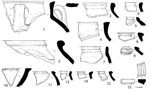
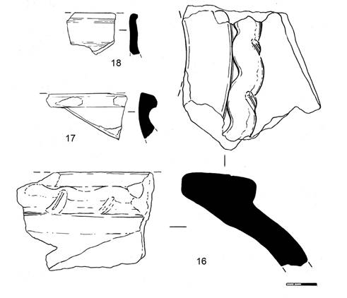
Ornamented sidewalls
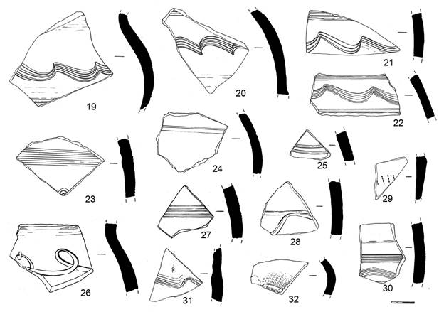
Handles
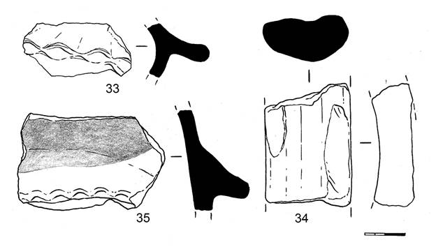
Bases
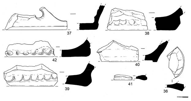
Others
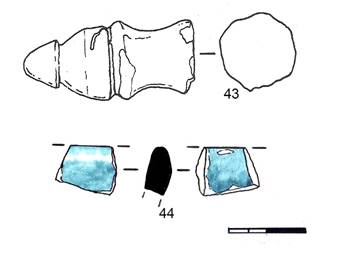
Description of the Ilibalyk Ceramic Material 2018.
Ib_18_D_IV (001)
Unglazed Common Ware Potsherds
A total of 264 fragments were found composed of the following: 17 rims; 17 bases; 207 undecorated sidewalls; 21 decorated sidewalls; and 2 handles. All of these sherds were found during a surface field survey of the newly designated Area D in Field IV.
Rims
Ill. 1: This cooking pot rim fragment was made of a well-variegated, dense red fabric with minor inclusions of small particles of sand and mica. The surface on the outside is covered with a layer of dark slip, the edges of the rim are everted, the diameter of the cross-section is 20 cm, while the wall’s thickness is 0.7 cm.
Ill. 2: This cooking pot rim fragment was made of a well-variegated dense red fabric, with minor inclusions of small particles of sand and mica. Both the outer and inner surfaces are covered with a red slip and traces of grime are seen on the outside. The rim narrows inwardly making it a closed vessel; the cross-section is flattened into an oval shape. An inscribed concentric line is on the outside of the rim. Its diameter is 22 cm, while the sherd’s thickness is 0.6 cm.
Ill. 3: This cooking pot rim fragment was made from a medium-variegated, dense red fabric with inclusions of large and small particles of sand. The outer surface of this closed vessel is covered with a light slip and it has a thick collar which in the cross section has a sub-triangular shape, slightly protruding outwards. The diameter is 12 cm, while the sherd’s thickness is 0.6 cm.
Ill. 4: This rim fragment from a vessel—presumably a cooking pot— was made of a medium-variegated, dense red fabric with small, minor inclusions of sand and mica visible in the cross-section of the sherd. Both the outer and inner surface of the vessel was covered with a light slip and the edges of the rim are everted, forming a 15-degree, low-pitched platform 1.6 cm wide. It has an oval shape in cross-section. The diameter of the rim is 15 cm, while the sherd’s thickness is 0.7 cm.
Ill. 5: This rim fragment from a thin-walled bowl was made of a well-variegated dense gray fabric containing minor inclusions of small sand particles. Both the inner and outer surface is covered with a light gray slip. The edges are straight, and the vessel was slightly open. It has a flat, oval shape in the cross section and a diameter of 22 cm. The sherd’s thickness is 0.5 cm. The outer surface has wide, concentric lines which are visible along the sherd.
Ill. 6: This rim fragment probably comes from a wash basin (Tagar) made of a well-variegated light-red dense fabric containing small, minor inclusions of sand. Both the outer and inner sides are covered with a light slip and the edges of the rim are straight with a slightly outward curvature. The cross section has a sub-rectangular shape with a 47 cm diameter. The sherd’s thickness is 1.1 cm. On the surface, slightly below the edge of the rim across its entire width, there is a wide, raised band.
Ill. 7: This rim is from a large, storage-type vessel (pithoid) made of a medium-variegated dense light-red fabric with multiple inclusions of small sand particles and chamotte. Both the outer and inner surface is covered with a layer of partially preserved light slip. The rim narrows inwardly and the edge of the rim was flattened, thus, forming a flat surface 3.5 cm wide. The diameter of the rim is 28 cm, while the sherd’s thickness is 1.6 cm.
Ill. 8: This is a rim fragment from a large storage-type (pithoid) vessel made of medium-variegated dense gray fabric with inclusions of sand, chamotte, and mica visible in the cross-section. The surface from both the outer and inner sides is covered with a partially preserved layer of light slip. The rim narrows inwardly, and the edges folded outwardly. It has an oval shape in cross section and forms a sloping 4 cm wide platform. The vessel is closed. The diameter of the rim is 18 cm and the sherd’s thickness is 1.7 cm.
Ill. 9: This rim fragment from a large vessel made of medium-variegated dense reddish-gray fabric contains multiple inclusions of small and large particles of sand and mica. Both the outer and inner surface is covered with a layer of light, almost white, slip. The rim is straight with flattened edges forming a low-pitched platform with a width of 2.9 cm. The diameter of the rim is 35 cm and the sherd’s thickness is 1.3 cm.
Ill. 10: This rim fragment from a pot-shaped vessel or bowl was made of well-variegated dense red fabric with minor inclusions of small sand particles. Both the outer and inner surface is covered with a light, almost white, slip. The edges of the rim are spindle-shaped and flattened in the cross section into a rectangular shape. The sherd’s diameter is 12 cm and its thickness is 0.9 cm.
Ill. 11: This rim fragment of a massive storage vessel (pithoid) made of well-variegated dense red fabric contains both small and large inclusions of sand and chamotte which are visible in the cross-section. The outer surface is smoothed and covered with a layer of light slip. The rim is narrowed inwardly from the rim forming a low-pitched platform 3.5 cm wide. The edges are decorated with an applique of an undulating rope-type design on the surface of which are alternating finger indentations. The inner diameter of the rim is 27 and the sherd’s thickness is 1.8 cm.
Decorated Sidewalls
Ill. 12: This sidewall fragment was made of a well-variegated, dense red fabric with minor inclusions of small sand particles. The outer surface is covered with a light slip and there is also a patterned decoration in the form of straight concentric lines applied by a comb on the outside of the vessel. The sherd is 0.8 cm thick.
Ill. 13: This sidewall fragment was made of a medium-variegated, dense red fabric with minor inclusions of sand and chamotte visible in the cross-section. The outer surface of the potsherd is covered with a layer of light slip. There is also an inscribed ornamentation in the form of several straight, concentric lines along the outer part of the sherd. The sherd’s thickness is 0.9 cm.
Ill. 14: This sidewall potsherd was made of well-variegated dense red fabric with minor inclusions of small sand particles. The outer surface is covered with a layer of light, almost white, slip. The sidewall is decorated with concentric straight lines in several rows with small triangular indentations arranged in small rows of two. They were possibly applied utilizing combing on the outer surface. The thickness of sherd is 0.9 cm.
Ill. 15: This sidewall potsherd was made from a medium-variegated dense, red fabric with inclusions of small particles of sand and mica. The outer surface is covered with a partially preserved light slip layer. It contains a wavy lined decorative pattern applied with a comb on the outside. The thickness of sherd is 1.1 cm.
Ill. 16: This small sidewall fragment was made of medium-variegated dense gray fabric with minor, sand particle inclusions which are clearly visible in the cross-section. The outer surface is covered with layer of light slip. The outside of the sherd was decorated with a band of wavy lines utilizing a comb. The sherd’s thickness is 0.8 cm.
Handles
Ill. 17: This handle fragment of a large curved jug was made of a medium-variegated dense, red dense fabric with small and large inclusions of sand. The surface is covered with a partially preserved layer of light slip. The handle has a flattened-oval shape. It is 6 cm wide and 2.6 cm thick.
Ill. 18: This handle fragment of the upper part of a curved jug was made of a well-variegated dense red fabric. The surface is covered with a light slip, and there are concaved vertical lines on the back of the handle. The handle has a flattened-oval shape. It is 4.4 cm wide and 1.2 cm thick.
Bases
Ill. 19: This base fragment is from a vessel made of a well-variegated dense gray fabric containing minor inclusions of small sand particles seen in the cross-section. The outer surface is covered with a light gray slip. Along the edge, there is a concaved, concentrically inscribed ridge. The diameter of the base is 15 cm and its thickness is 1 cm. The sherd’s thickness is 1.7 cm.
Ill. 20: This base fragment comes from a small, molded vessel made of medium-variegated dense gray fabric with minor inclusions of small sand and chamotte particles. The outer surface is covered with a light slip layer. The edges of the base are smoothed and have an oval-shaped cross section with a diameter of 14 cm. The base’s thickness is 0.7 cm and the sherd’s thickness is 1 cm.
Ill. 21: This flat disk-shaped base was made of a well-variegated dense gray fabric with no visible impurities in the cross-section. The outer surface is covered with a layer of light, partially preserved slip. The base is narrow and has straight edges that quickly widen. The base’s diameter is 12 cm and its thickness is 1.4 cm. The sherd’s thickness is 1.3 cm.
Ill. 22: This base fragment was made of well-variegated dense red fabric with minor inclusions of small sand particles in the cross-section. The surface on the outside is covered with a light, partially preserved layer of slip. The edges of the base are straight in cross section. On the inside rilling is quite visible, an indication it was thrown on a potter’s wheel. The base’s diameter is 13 cm and its thickness is 0.8 cm, while the sherd’s thickness is 1 cm.
Glazed Fine Ware Potsherds
A total of 2 fragments were found: 1 fragment of a sidewall and 1 base.
Ill. 23: This sidewall fragment of a thick-walled vessel was made of well-variegated dense, light-red fabric with no inclusions. The outer surface is covered with a layer of opaque, dark-blue glaze laid over a light-colored slip background. There is no decorative pattern. The inner walls have evidence of rilling, indicating it was thrown on a potter’s wheel. The sherd’s 1.2 cm thick.
Ill. 24: This flat base fragment comes from a large vessel made of a medium-variegated, dense fabric containing inclusions of small sand particles. The entire inner surface and part of the outer surface is covered with a layer of blue glaze on a white slip background. The edges of this concave base are oval in the cross-section and rounded. The diameter of the sherd is approximately 17 cm and the base’s thickness is 2 cm. The sherd’s thickness is 1.4 cm.
Illustration Tables
Rims
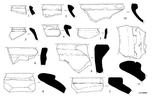
Ornamented Sidewalls
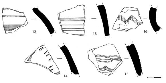
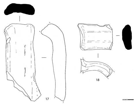
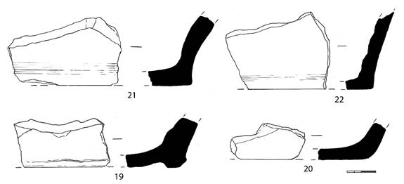
Glazed Ceramics
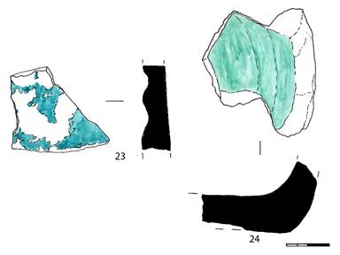
---------------------------------------------------------------------------------------------------------
PUBLIC FUND "ARCHAEOLOGICAL SOCIETY OF KAZAKHSTAN",
REPUBLIC OF KAZAKHSTAN
THE SOCIETY FOR THE EXPLORATION OF EURASIA,
SWITZERLAND
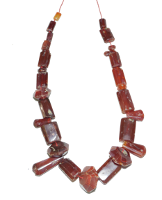
Excavations of the site of Usharal
the citadel of city of Ilanbalyk in 2018
| Scientific supervisor: | Prof. Dr. K. Baipakov, Academician NAS RK, |
| Dr. C. Baumer |
|
| Performers: | I. Kamaldinov, SNS, Master of Archeology |
Introduction
One of the major discoveries of Kazakhstani archeologists in 2014 was the discovery and localization of the city of Ilanbalyk in the Ili Valley, 7 km east of the modern city of Zharkent, located 250 km from Almaty.
A key find here was the Nestorian Kairak with a cross and a Syrian inscription in the Turkic language. It dates from the 12th century, as well as a collection of Karakhanid and Jagataid coins from the 11th-14th centuries.
In 2018, in the settlement of Usharal, in the city of Ilanbalyk, archaeological work under the direction of Academician K.M. Baipakov discovered and investigated a bath hamam from the XIII century. The excavations were carried out with funds from the EurAsia Society (Switzerland). The bathhouse consisted of 4 rooms: the first room in the central part of the excavation was “with warm floors and sufa-beds, the second room was for hot - “washing” was located in the western part of the complex, the third room was probably a dressing room (anteroom) and the fourth was for massage.
The remnants of the underfloor heating system were cleaned and included cans, a firebox, a water pipe made from clay pipes supplying clean water, as well as a drainage system from the bath of sewage. In the section of the part of the fortress wall that fell into the excavation, a treasure trove of jewelry was found hidden in a secret compartment in the inner wall face. It was in a wooden box covered in brown leather. The box fragments were wooden parts, nails and two pieces of leather. The treasure consisted of three silver twisted bracelets, three necklaces of silver beads; two copper earrings with pearls; a coral necklace; two necklaces of dark red carnelian; one string of turquoise beads; some made of agate beads; a set of pearl earrings(were they earrings??); individual lapis lazuli beads; rock crystal and jade pendants. The treasure dates from the 13th century. Analogies can be found in the jewelry collections of the cities of Otrar, Buduhkhet and Talkhir of the 13th century.
Keywords: town of Usharal, town of Ilanbalyk, Nestorian Kairak, hamam bath, treasure, jewelry, coin finds.
Site of ancient settlement Usharal – Ilanbalyk town
Topography of the settlement. The site of the ancient settlement of Usharal is geographically connected with the region in the foothills ??? of the Dzungarian-Alatau Mountains and between the Ili, Uzek and Borokhudzir rivers. The foothills of the Toksanbay, Itshoky, Altyn-Emel and Koyandytau ranges, located to the north and north-west of the settlement, form local watersheds with run-off zones dissected by modern valleys. From the south-east side there are natural boundaries - the desert sands of Muyunkum and Karakum, and to the south - marshlands formed by the waters of the Uzek. The modern village of Usharal is located 30 kilometers north of the Ili riverbed. The described area covers about 500 square kilometers, replete with water sources, which can be clearly seen in satellite images. The site of Usharal borders fertile lands, intensively saturated with river water. Groundwater is located close to the surface, so it is possible to use wells here.
The settlement structure is complex, which is primarily associated with the active diversified economic development of the territory. The settlement was formed on two terraces above the floodplain, stretching in the meridional direction. The terraces are cut out of the branches of the Usek hill ridgesdown to the floodplains. The eastern floodplain terrace rises above the river floodplains to a height of 9 meters, and has overall dimensions of 1800 m (in the latitudinal direction) x 400-250 m (in the meridional direction), the western terrace measures more than 4000 m (latitudinal direction) x 1000 m (meridional direction).
The eastern terrace stands out: it is divided into three main parts. The central part has a size of 380 x 350 m and dominates with its height. The absolute height of this territory is 620 m above sea level. The northern part is 1400 x 400-250 m in size and the southern part is 1300 x 350 m. The absolute height varies from 630 m in the northern to 620 m in the southern part of the terraces. The total length of the terrace in the meridional direction is 3,000 meters.
Taking into account the analysis of the topography of the described area, the location of the walls and channels, the commonality of the surface material, it can be determined that the central part of the medieval city (citadel and shahristan) was located in the center of the eastern terrace, using it as a natural platform. The size of the shahristan is 380 x 350 m. Currently, the analysis of external factors does not allow determining the exact space of the citadel in the outlines of the walls of the shakhristan, but taking into account the significant reduction in the relief of the shahristan in the western part, the citadel can be assumed to be located on the eastern, raised half of the area. The shahristan has an area of 10,500 square meters. The eastern side of the shkhristan is cut by the winding floodplain of one of the channels of the Usek, dominated by the Chulukai depression[MC5], which was also formed by the previous activity of this river. A topographic base scale of 1:100,000 was used to create a map. This map provides an opportunity to view the entire territory surrounding the object of study. This base also serves as a good reference for smaller scale maps. With the help of this map it was possible to perform a geographical adjustment of data collected by aerial and GPS means.
The use of a topographical basis scale of 1:25,000 allowed a more detailed examination of the object of study, the territory adjacent to it and the introduction of such elements as roads, rivers, canals, and settlements into the GI??PS. This allowed for more detailed corrections of the aerial photo, GPS and elevation isolation data; digitizing topographic contour lines and, accordingly, moving the documented area into three dimensions.
Research methodology. Using the integration into archeology of state-of-the-art research and development technologies, modern engineering equipment, such as laser total?? stations, 3D scanners, ultra-precise GPS, geo-radars, is used to document monuments. All this equipment allows performing highly accurate measurements in a short time.
Satellite images. Working with satellite images that are geo-referenced and having a resolution of up to 1 m provides researchers with information on a topographical scale used when producing the maps such as data relating to the landscape, water sources and all other sorts of details. At the same time, satellite images show the current situation in the desired area of research.
Localization of the city of Ilanbalik. The Mongol Empire was formed in the XIII century. The extremely complex historical situation created in Eurasia in the 13th – early 14th centuries contributed to the strengthening of diplomatic ties. The partners and allies were the papal curia; the Russian princes; the Ilkhans of Mongolian Iran; the kings of France; the Genoese merchants; the monks of the Franciscan and Dominican orders; the rulers of Cilician Armenia and the courtiers of the great Mongol khan in Karakorum. During this period, one traveler after another went to the Great Khan Horde in Mongolia.
Ancient explorers left us diaries or dictated their impressions to historians. Among the great travelers of this time are the famous Venetian Marco Polo; the ambassadors of Pope Innocent IV; the Franciscan monk Plano Carpini; the Frenchman Andre de Longjumeau; the Italian Ascellin; the ambassador of the French king Louis IX — the monk Guillaume de Rubruk; the great Arab Traveler ibn Battutа etc. Among these well-known names, it is impossible not to mention the name of the king of Minor Armenia, Hetum I.
When in the 1230s, the Mongols invaded Great Armenia, the rulers of Cilicia Armenia sat behind the high ridges of the Taurus. In the 1240s, King Hetum I, by recognizing vassal dependence on the Mongols, secured his small country from their invasions and acquired strong allies against the Mongols.
Hetum I, as the head of the embassy in 1253, went to Möngke-Kaan. He left secretly to ask for help against the oppression of Arghun, the deputy of the Mongols in Transcaucasia. Going on this journey, Hetum I, dressed as a driver of mules and with a small number of people traveled to Karakorum by a route about which very little is known. Only the Volga, the Yaik, the lands of the Naimans and Karakaits are mentioned. This embassy, well received at the court of Möngke, concluded an agreement with the Mongols and received a promise to reduce taxes. In 1254, Hetum I went home and “on the path that he (previously) walked in secret, returned, like a lion ...”. The reverse route, described in detail, is of great interest.
So, on November 1, 1254, Hetum I left Karakorum on the way back. “He arrived in Gumsgur, [from there] he went to Peralekh, [then] to Peshpalek ... From there they traveled through Arlek, Kulluk, Yenkah, Tchanpalekh, Khutaua and Ankipelekh. Then they entered Turkestan: from there to Ekopruk, Dinkapeleh and Pulat, passing through Sut-Gol and the Sea of Milk, arrived in Alauleh (Almalyk) and Ilanbaleh (Ilanbalyk), then crossed over the river called Ilansu, having crossed the spurs of the Taurus Mountains, arrived in Dalas (Taraz), and from there through Otrar, Dzhizak, Bukhara, Tabriz returned to the Motherland” [Gandzaketsi,1976, p. 222-224]. There are well-localized towns in this list - these are Almalyk and Taraz, which correspond to the towns of Alaulekh - Almalyk and Dalas - Taraz.
Thanks to this route, the location of the town of Ilanbaleh can be determined (Ili-Bali - according to Chinese or Ilanbalyk - according to Muslim sources of 1329-1331). However, for a long time, archaeologists could not find the site of the ancient settlement which could be confidently identified with this town.
At one time the orientalist V.V. Bartold, who made a scientific trip in 1893-1894 on the route Tashkent-Chimkent-Pishpek - Kegen-Zharkent-Verny identified a number of medieval towns with specific archaeological monuments. The scientist believed that Ilanbalyk corresponds to the town, which had the name Iki-Oguz, known from the reports of Makhmud of Kashgari (XII century), and Equvius Guillaume de Rubruk (XIII century). V.V. Bartold proposed to identify it with the settlement of Shingildy, which was located on the right bank of the Ili on the section of the road Verny - Zharkent, 35 kilometers east of the crossing of the river Ili [Barthold, 1966, p. 85].
Interestingly, the first to write about the settlement of Shingildy was Ch. Valikhanov in connection with the findings of water pipes there [Valikhanov, 1958, p. 281].
A.N. Bernshtam agreed with the identity of Ilanbalyk and Ikioguz/Equvius and placed it also at the site of the ancient settlement of Shingildy [Bernshtam, 1948, p. 89, fig. 1, map].
Later, archaeological research on the territory of the Ili Valley (Northeast Zhetysu) made it possible to discover dozens of new settlements here and convincingly prove that the town of Iki-Oguz and Equvius should be identified with the settlement of Dungene, located 20 km west of Taldykorgan in the village of Balpyk-bi [Baipakov, 1986. P. 37].
The identity of the town of Iki-Oguz - Equius and the settlement of Shingildy was questioned, since the latter, as it turned out later due to excavations, is the remains of a caravan-serai.
It was suggested that the city of Ilanbalyk was located between the villages of Kok-Tal and Panfilov (the present city of Zharkent) and, possibly, corresponds to the ancient settlement Usharal.
In 2014, new materials appeared that allow us to speak with confidence in favor of the identity of the settlement of Usharal and the town of Ilanbalyk.
Firstly, a rich collection of coins was collected at the site of this ancient settlement, which in itself testifies to the significance of the city that stood on this spot. It was possible to identify/place at this location?? three coin hoards/treasures??? and 123 single coin finds. All three hoards/clades??? consist mainly of dirhams of the period of the XIII-XIV centuries.
- Treasure 1. Silver-plated copper dirham Almalyk [656-660 / 1258-1262] consisting of 8 pieces. Concealment - first half of 660/1262;
- Treasure 2. Consists of 7 silver dirhams of the Chagataid state. The treasure was hidden at the turn of the XIII-XIV centuries.;
- Treasure 3. It consists of 40 silver dinars of the XIV century. The treasure was hidden no earlier than 740/1340. It was possible to identify 37 pieces, of which 36 were coins of the Chagataid state and one coin of Il-khan Abu Said.
The complex of single finds can be divided into three groups:
- the first - coins minted before the Mongol conquest;
- the second - coins of the Great Mongolian Empire;
- the third - coins of the Chagataid state. Not a single coin, minted later than the middle of the XIV century, has yet been discovered.
The coins of the first early group include seven dirhams of the Karakhanids of the 11th-12th centuries. One of them is the Bograkarakhan dirham, minted in Tunket, in 444 / 1052-1053. Two coins of the Chinese dynasty of the Northern Sung — Tian-Sheng yuan-bao (the issuer's motto was used in 1023-1032) were recorded, the oldest of which dates from the beginning of the 11th century. Coins of the early 13th century belong to this group. - one silver dinar and a fragment of a large copper silver-plated Karakhanid dirham or Khorezmshah Anushteginid. Analysis of numismatic data shows that the greatest activity of commodity-money relations in retail trade in this locality is observed precisely in the period from 630/1232 to 666/1268.
In the composition of the coins of the Mongolian empire there is a fragment of a gold dinar (perhaps the dinar itself was minted before the Mongol conquest) and 12 silver dirhams. Nevertheless, the bulk of the coins consist of silver-plated Almalyk dirhams and copper fels minted during the reign of Möngke Khan and soon after his death. It is impossible not to draw attention to the fact that the vast majority of the imperial coins found at the site of the ancient settlement Usharal were minted at the Almalyk mint. That is, the town of Ilanbalyk in the XIII century entered the sphere of economic influence of the town of Almalyk - the capital of the center of the Chagatay Ulus, located no more than two days' journey away (now in the territory of the PRC). Even the small amount of silver coin finds from the first half of the thirteenth century indicates the continuity of dirhams entering the markets of the town being studied from 630/1233 to 662/1264. It is the silver plated dirhams that made it possible to trace this chronological chain to 666/1268.
In addition to the Almalyk coins in the complex, there are products of the neighboring mint of the town of Kayalyk and the mints of Pulad and Imil, as well as the mint not yet established[MC6].
In the third group of silver coins there are Almalyk fels with a Uigur legend and the date of 742/1341-1342.
Both coin hoards/treasures?? and single finds from this monument point to the most active commodity-money relations in the town in the 13th and first half of the 14th centuries. [Baipakov, Savelyeva, Petrov, 2015, p. 94-97].
Thanks to these numismatic finds it can be argued that at the beginning of the XI century, this town already existed.
The first Kairak find in the settlement of Usharal, was a gravestone with a Nestorian cross and a Turkic inscription in the Syrian alphabet.
This is important because the Nestorian Kairaks were also found in Almalyk.
Almalyk in Muslim sources, according to V.V. Barthold, was mentioned shortly before Mongol rule. It was the capital of the ruler Ozar (Buzar), who went from being a robber and horse thief to the ruler of Almalyk and a number of neighboring cities. He later voluntarily submitted to Genghis Khan.
It is also known that it was 45 day-journey from Otrar to Almalyk along the Great Silk Road, and from Almalyk to Bishbalyk 2 weeks.
As the main city of the Chagatay possessions, Almalyk was one of the centers of activity of medieval European missionaries, who spread Catholicism in the Mongol possessions. In the 1330s, under Khan Jenkshy, the Catholics had a bishop and a church in Almalyk. The end of the activity of Catholics was due to the bloody persecution against Christians, begun in 1339 (or 1340) by Ali Sultan [Barthold, 1966, p.79].
Direct ties between the West and the East were interrupted in the 1340-1360s, when the Mongol Empire finally collapsed as a result of being a cumbersome and unstable political system which had developed during the conquests of Genghis Khan and his closest successors.
In due time V.V. Barthold most likely visited the ruins of Almalyk, where the mausoleum of Tukluk-Timur, who died in 1362-1363, the first of the lords of the eastern part of the Chagataid Ulus, who converted to Islam. V.V, was preserved. Barthold described the Almalyk mausoleum and noted that it repeats the style of similar structures in Central Asia. Nearby was another mausoleum, which apparently belonged to Shir-Ilkhan - the son of Tukluk-Timur [Barthold, 1966, p. 80-81].
In 1902, Almalyk was visited by an orientalist, a graduate of St.-Petersburg University N.N. Pantusov, who held high positions in the administration of the town of Verny. In Kuldzha, he was shown finds from Almalyk - two Kairak finds with crosses on them and inscriptions in Turkic language with the Syrian alphabet. N.N. Pantusov investigated and published them [Pantusov, 1902, p. 52-54].
These two time separated finds belonging to the Nestorians, made by N.N. Pantusov in 1902 and K.M. Baipakov in 2014 became another argument in favor of the identity of the ancient settlement of Usharal as the town of Ilanbalyk.
Thus, the finds of the Nestorian Kairaks both in the site of Usharal and in the site of the settlement of Almalyk are also an argument in favor of the fact that Usharal is the ruins of Ilanbalyk, named after the Hetum I after???? Almalyk.
Excavations of the site of Usharal - the city of Ilanbalyk
The town of Ilanbalyk is located in the Panfilov district on the territory of the modern village of Usharal, Almaty region. Most of the monument site is built on with residential buildings.
The town consists of a citadel, a shahristan and a rabad (Photo 1-2). The citadel is 800 x 800 m in size and occupies the southern part of the city (Photo 3), to the north of the citadel there is the shahristan measuring 2000 x 1000 m (stretching from north to south). To the west of the shakhristan is the rabad - the rural part of the suburb. To its northwest is the necropolis.
The walls of the citadel were partially preserved and in the southeastern part is a shaft 3-4 m high, 8 m thick at the base, 2 m in the upper part. The western half of the citadel is built up with residential houses of the modern village Usharal. In 2018, excavations were carried out in the south-eastern part of the citadel of the town of Ilanbalyk. The excavation was 13 x 16 m (416 sq. m) (Photo 4-5).
Description of excavation #1. Bath
Before the start of the excavation, the site was a flat area covered with vegetation, on the surface of which fragments of burnt bricks and several fragments of ceramics were found.
According to the method for excavation with large areas, the ground surface was removed to a depth of 20 cm over the entire area of the excavation, after which a thorough horizontal cleaning of the surface was carried out in order to identify building structures. During the removal of the layer, a small number of fragments of burnt bricks, ceramics and animal bones (kitchen debris) were encountered. The cultural layer consisted of black earth interspersed with organic matter, ash, ash spots and coal. The total depth of the excavation was 1.8-2 m.
After removing the top layer of earth with vegetation and leveling the surface over the entire area, in the northern part of the excavation an oval ash spot oval of 80 x 50 cm in size and 6-8 cm thick was dug out and at a depth of 20 cm. vessels – khums (large jars), boilers, jugs were found.
At a depth of 40 cm, pieces of white plaster with traces of burgundy-colored paint were encountered.
In the middle part of the excavation, closer to the northern border, a layer of ash with a thickness of 20 cm was noticed, an ash spot 1.2 m wide stretched along the north-west-south-east line and continues beyond the boundary of the excavation. After removing the ash layer with a depth of 100 cm from the current surface, a floor was found with a white coating remaining in some places, and a raw layer 3-4 cm thick made of a mixture of clay and sand with straw included was under it. Under the raw lies a layer of small gravel. In the course of clearing out the filling and on the surface of the floor, fragments of non-woven ceramics were found: jugs, pots, khum and khumchi,and a ceramic chirag-lamp with a broken handle. The lamp was covered with green glaze.
Along the perimeter of the floor, the remains of walls made of burnt brick were cleared. The walls were demolished by local residents as a building material, and only one row of six bricks was preserved at the northern wall. The brick size is 26 x 15 x 5 cm. The thickness of the northern (outer) wall of the room is 0.75 m, the remaining walls are 0.65 cm. The location of the walls was determined by tracks????, so the doorways are indicated based on their probable location.
To the south was another room, or rather, its southeast corner, and the floor in the room was paved with baked bricks. Most of the floor is made of brick-halves. The size of the whole brick is 40 x 40 x 5 cm, and the halves are 40 x 20 x 5 cm. In the eastern and southern parts of the paved floor there are the remains of a wall up to 10 cm high. The bricks of the floor were laid on ganch??? mortar. Since the pavement of the floor went beyond the boundary of the excavation, the excavation was extended an additional three meters in a southerly direction.
Room # 1 of 5.6 x 4.9 m in size, occupies a central position in the bath, with heated floors and sufa-beds, intended to warm the body. The floor of the room was paved with burnt bricks, heated by a special heating system with heat-conducting channels/canals???. These structures were found at a depth of 1.1 m from the surface. The system is partially destroyed.
Initially, three vertical wells (chimneys) were cleared, which, most likely, were built into the northern wall of the room underfloor heating system canoes??? (Photo 6-7). The wells are made of baked bricks with a size of 40 x 20 x 5 cm. The chimney wells have a size of 55 x 37 cm and the remaining height is 84 cm. The distance between the wells is 55 cm. The wells are the same size and are made up of 9 rows of brickwork. The inner walls of the wells are covered with a thick layer of black soot and gray ash. When clearing the chimney wells fragments of ceramics — bowls, plates and pots, were found. To the south of the wells, a chimney wall was revealed, oriented along the east-west line with a slight displacement. The bottom and walls of the canals??? are made of burnt bricks. The length of the canal is 190 cm and width is 16 cm. A 50 cm wide opening (chimney) was located in the middle of the canal wall. The eastern side of the canal wall was preserved to a height of 6 rows of masonry and the western side to 4 rows of masonry. Smoke was led through this wall to three vertical wells, which were then passed outside.
The second canal, parallel to the first, is located 23 cm to the south. Its length is 3.1 m; the middle part is partially destroyed. The walls of the canal are made with two rows of brick and the distance between two adjacent rows of bricks is 8 cm and it is filled with construction debris and mortar. In the southern direction, 7 dividing walls were found parallel to each other - a total of 5 cans???. The width of the air ducts between the walls is 25–35 cm. In the middle there is a central air duct with a width of 31–55 cm. The canals were under the floor of room # 3.
Room # 2, size 4.2 x 3.7 m (Photo 8). A functional area has a floor paved with burnt bricks (brick size 25 x 25 x 5 cm). A sufa 0.4 m wide and 0.4 m high was attached to the western wall. On the wall and on the sufa there was a covering with chip, a waterproof solution. Outside the wall was a curbstone built of rectangular baked bricks.
To the western wall of room # 2 was attached a pebble-shaped structure (Photo 11), moulded from a burnt brick. The size of the curbstone is 2.4 x 2.8 m and its height is 1.1 m. This functional area is presumably a stand for a large boiler.
In the southeast corner of the room was a drain for used water, which is a ceramic vessel in the shape of a pot dug into the floor of the room up to the level of its neck (Photo 9). Vessel size: corolla diameter – 25 cm, height – 35 cm. On the south side, a drain consisting of ceramic pipes adjoins the vessel. The overflow pipe extends from the room outwards and southwards beyond the excavation site (Photo 10). The length of the drain within the excavation is 4.1 m and the number of pipes is 9 with a length of 50 cm and a diameter of 18 cm each.
On the south-west side, a small 100 x 80 cm brick extension adjoins the room, most likely a water tank, and its top was rounded. The size of the neck of the tank is 40 x 50 cm. During the clearing of the filling in the tank, fragments of non-irrigated vessels were found. An interesting find is fragments of thin ceramic water pipes with a diameter of 8-10 cm however their length is not definable due to the small size of the fragments. Clean water was most likely supplied to the reservoir through this thin water pipe.
The foundation (base) is preserved in the southern, western and northern walls of the room.
Unlike the others, in room 2, the walls of the north-western corner are preserved up to a height of 0.7 m. There are two rows of brickwork at the north wall and five at the west one.
Room # 3 is located in the northwestern part of the complex. This is a room measuring 2.2 x 2.4 m, and judging by the location, served as a “dressing room or a waiting room”. The floor of the room was smeared with waterproof chip. The walls of the room are fixed??in the tracks[MC8]???.
Room # 4 is 2.3 x 3.3 m in size and adjoins the bathhouse on the southeast side. The floor was paved with small pebbles and a brown coating of clay was partially preserved on top of the stones. The floor is on the same level as the floors of rooms # 1 and # 2.
The functional purpose of the interior is not clearly defined however it may have been for massage.
It can be noted that the bat, located below the level of the current surface, is of a traditional rectangular shape with a size of 7.7 x 14.5 m which is typical of hammam-type oriental baths.. In the bath there are rooms which are characteristic of the baths of this time: one of them is “hot”, the other is “wash”, a waiting room or dressing room and “massage”. In the bath a convenient heating system was placed under the floor; smoke and heat were brought out of the burnt brick through a system of wells into the horizontal distribution channels of the cans???. The bath was built entirely of baked bricks.
The closest analogy to the Ilanbalyk bath is the palace bath, excavated in the settlement of Antonovskoe – the town of Kayalyk which dates to the XIII c.
Ceramics. The bulk of the finds during the excavations and cleaning of the bath complex is represented by thick-walled non-woven vessels - khums and khumchi, which were most often decorated with drips of engobe. Among the ceramics, fragments of large aquifer-jugs with crank?? handles were found and a small number of fragments of unpowered??? bowls and pots, the upper part of which were decorated with stamped ornaments.
Two ceramic lamp-chirags, covered with green glaze, were found among the glazed ceramics.
An interesting find is the zoomorphic neck on the handle of a jug in the form of an animal's head (Fig. 1).
According to the ceramic material obtained from the excavations of the bathhouse of the town of Ilanbalyk the layer dates from the 13th century. This is correlated with information from written sources.
Description of excavation # 2 (section of the fortress wall).
The purpose of the excavations at this site was to identify the parameters of the fortress wall; to establish the technology of erection and building materials and to identify the thickness of the fortress wall and its preserved height. For this, an excavation was made of 5 x 20 m in size in the southeastern part of the citadel on the highest and well-preserved section of the ramparts wall (Photo 12-14).
First, the fortress wall was cleared. During the clearing of the external face of the fortress wall, an oil stain was detected (Photo 15), which was most likely formed during the storming of the fortress walls and the defenses of the city. When clearing the outer face of the wall, in addition to the oil stain, there were often found spherical pebble stones with a diameter of 0.15 to 0.25 m.
The plastering of the fortress wall has been preserved only on the inner face of the wall and consists of a clay mortar of yellow color with the inclusion of straw.
The fortress wall was erected on a foundation 1.7 m high from the current surface and at its the base it is 14 m thick and in the upper part 5-6 m. The foundation is a densely rammed reddish soil.
The wall was preserved to a height of 1.8 m (from the top of the basement/foundations?? And its thickness at the base was 5 m. The wall was erected by the method of pouring monolith, in the section??? three parallel layers (0.6 m thick tape) were traced from the clay solution. This technology provides for the complete drying of the layer, before the next bay???.
The angle of the fortress walls of the outer facade are 65° and the inner walls are 75°.
The preserved height of the fortress walls from the outside together with its foundation is 3.5 m from the level of the current surface and the height from the inner side from the level of the current surface is 1.8 m.
When clearing the wall from the inner side, at the depth of 1 m, the mouths of three garbage pits were discovered (Photo 16, 18). The pits were rounded in plan and were filled with loose soil mixed with ashes containing fragments of ceramics and animal bones (Photo 19). Pit #1 has a diameter of 0.7 m and depth of 0.3 m,; pit # 2 has a diameter of 0.85 m and depth of 0.1 m and pit # 3 has a diameter of 1 m and depth of 0.8 m. The filling of the pits is with loose soil and heated organic matter containing bones of domestic animals and small fragments of ceramics.
The technique of construction and use of building material used for the fortress walls of the town of Ilanbalyk are analogous to other towns of the Zhetysu region (Semirechie) - Talkhir and Kayalyk.
Ceramic material obtained during the excavation of the section of the fortress wall of the town of Ilanbalyk allows dating of this site to the second half of the 12th - 13th centuries.
Treasure jewelry
On the inner side of the fortress wall, at a level of 1.6 m from the floor, a niche measuring 20 x 25 cm was found (Photo 20). In the niche was a treasure in a wooden box, covered with brown leather, covered with an ornament of red paint. Two pieces of leather, remnants of wooden parts and iron studs are preserved from the box. In the box was jewelry (Photo 21).
The treasure consists of three silver bracelets, two copper earrings, three necklaces of hollow silver beads; a pink coral necklace; two necklaces of many-sided cornelian beads and rectangular plates; a necklace made of turquoise beads; an agate rosary; a freshwater pearl; individual beads of lapis lazuli and rock crystal and several jade pendants.
Twisted bracelets are one of the types of jewelry. And 3 items are present in the hoard (Photo 22-23). The bracelets of this type are massive, open-ended, thickening towards the middle and tapering towards the ends, and made of a semicircular cross section of a silver drot. They are made out of smooth wire and filigree thread and contain a string of retinues?? of one or more jerks/turns/twists??. Such bracelets are known from the excavations of the settlement Talgar, the treasure of silver items from Otrar, and the settlement of the Red River in Kyrgyzstan.
A clear image of the head of a snake can be traced in the design of the open ends of the bracelets., The craftsmen in this case used only silver for the manufacture of the bracelets and showed exquisite workmanship of monochrome solutions.
1. The bracelet is twisted, semicircular in cross section and made of of silver wire, 3 mm thick. The maximum thickness of the bracelet is 5 mm, the minimum at the ends is 1 mm, and in the end hemispheres it is 4 mm. The bracelet dimensions are: length 72 mm, width 52 mm. The ends of the bracelet and hemisphere are tightened with a dart.
2. The twisted bracelet is made of a semicircular silver droplet 3 mm wide. The maximum width is 8 mm and the minimum at the ends is 4 mm. The bracelet dimensions are: length 63 mm, width 56 mm. The ends of the bracelet are tightened with flat rectangular plates 5 x 6 mm.
3. The bracelet is made of two twisted parts of a semicircular silver wire. Draft??? thickness is 2 mm. One part of the bracelet is retinue?? from right to left, the other mirror. These two parts are folded together and soldered. On the front side, the joint is decorated with a flat filigree ribbon of two twisted and one straight fine thread. The maximum thickness of the bracelet is 14 mm (5 mm each - the twisted part of the wire, 4 mm - flat tape). Its dimensions are: length 68 mm, width 53 mm. The ends are pulled together by three rows of 3 mm thick twisted filigree.
All silver bracelets of the northern and northeastern regions of Central Asia, Kazakhstan and the Volga region have a close resemblance [Varkhotova, 1963, p. 116-119; Kozhemyako, 1959, p. 58; Baypakov, Nastich, 1981, p. 20-62; Baypakov, Savelieva, Chang, 2005, tab. XIII, fig. 169; Smirnov, 1951, tab. 5, fig. 78].
The original form of bracelets is presented in the form of a composition of a pair of stylized coiled serpents with heads. A pair of snakes, like other creatures in art, was determined not only by the principle of decorative symmetry, but also had its own meaning. A pair of snakes expressed the presence of male and female and the idea of life and fertility.
The cult of the snake is known since ancient times in Central Asia. Here the totem of the snake appeared in two guises, personifying the good and evil beginning. As Mahmud Kashgari wrote in the XI century “t??? he day and year of the snake existed “???[Ancient Turkic Dictionary, 1969, p. 266]. For many nations, the snake was a symbol of health, intelligence, knowledge and wisdom. It is not by chance that the image of a snake these days has become the emblem of medicine — the emblem of the protection of people's health. In Kazakhstan and Central Asia, the snake was assigned many positive functions.
Silver necklaces, there are three of them (Photo 24).
The first necklace is made of rounded, slightly elongated beads measuring 18 x 30 mm. Along the poles are holes with a diameter of 3 mm with a protrusion. A body with convex wavy lines 3–4 mm thick divides the surface into strips 8–9 mm wide. The total of 115 beads in the necklace are 27 x 20 mm in size. There are many-sided beads (12 faces) as well as ones that are hexagonal and tetrahedral with convex poles.
The second necklace consists of 115 round hollow silver beads of elongated shape. Their sizes vary: 13 x 8; 10 x 8; 8 x 3 mm. Some beads are well preserved but some have dents and corrosion.
The third necklace consists of 536 spherical hollow silver beads with a diameter of 5 mm. Some of the beads are well preserved but some have dents and are corroded. In the holes there are remains of white cotton thread.
Silverware is mentioned in the Quran, specifically in such words of the Most High as "Silver Necklaces". Abu Rayhan Biruni wrote about silver: “Said Abu-l-Fadl al-Arudi al-Saffar:
"Because of the value of silver, the beneficent
Allah placed it in the heart of the rocks ...” [Biruni, 1963, p. 228].
The most common technique in the manufacture of silver jewelry is Basma with blackening. Basma is the embossing of the thinnest sheet of silver in a special form with a particular plot??. For blackening, the deepened ornament is filled with sulfurous silver. The product is then heated so that there is a fusion of the silver with the filler and becomes beautiful.
Copper earrings (Photo 25).
Another interesting piece of female jewelry from the treasure were copper earrings with pearls. They are made of a curved copper rounded wire with a thickness of 3 mm, decorated on both sides with pearl threads. The pearls are of a round shape with a diameter of 3.2-5 mm.
The ethnic?? preference of the Kazakhs for silver coincided with the religious ethics/beliefs??? of Islam as copper was also endowed with magical properties.
The pearls with through holes were fastened together by a thread and fastened onto a copper wire with cotton threads, the remains of which are preserved on a copper base. The total size of the whole earring is 40 x 20 mm.
The second earring is identical. In general, their safety??? allows you to reconstruct the original appearance of the product.
Coral necklace (Photo 26).
Coral jewelry has been widely used since ancient times. Rings, bracelets, beads, pendants for earrings and other jewelry were made from them, and for example, the surfaces of valuable things were encrusted with them. The color range of corals is wide - from rich red to pink and white. They made from it pendants for earrings, bracelets, inserts of rings and necklaces.
The treasure has a beautiful necklace made of coral stumps of twigs and twigs processed and having drilled holes for the thread. The pieces are different: from large ones 5-6 cm long and 2 cm thick, to very small ones 1.5-2 cm long.
Products made from corals were highly valued, since corals were attributed with various qualities and possibilities for influencing a person’s fate.
Corals spread along the Silk Road from the west and southeast from the Mediterranean regions and from the islands of the Pacific Ocean.
Chinese sources describe the “Roman” method of extracting precious coral: “There is a coral island in the middle of the sea. People of the sea sit on large ships; from which they descend iron nets into the depths of the waters. When the coral begins to grow on the tops of the stone slabs, it is white as a mushroom; but a year later it is already yellow, and after three years it is an entangled interweaving of red branches three or four times tall. Now its shoots themselves cling to the net, from where the iron sticks out; and people from the ship choose a network.
And if they miss the right time and do not collect it, then it will rot” [Mets, 1966, p. 373]. Here we are talking about the precious red coral of the Mediterranean Sea, famous throughout the world. Coral, as the inhabitants of China knew about it, also grows in the South Seas, brought from Persia and from Ceylon.
Treelike specimens of coral had the strongest effect on the imagination of the Chinese, as they looked like real thickets from a magical fairyland and trees of treasures from the abode of immortal gods. Penglai - the island of immortal celestials in the Eastern Seas, whose vain searches were conducted by the Chinese in antiquity, in the times of Qin and Han; in the Tang era, this island was already a dream. But the coral tree in the garden pool could cause vivid ideas about the vegetation of this imaginary world [Schaefer, 1971, p. 325].
Siyuji's essay "Notes on the Western Territory of the Taoist Monk Chan-Chun," which describes his trip in 1221-1224, includes noteworthy places and cities for an episode about the meeting of Ch'an Chun with "men" (Mongols) returning from the war. They brought with them a lot of coral. Some of the officers who accompanied us bought up to fifty coral branches, paying two silver ???and merchants from China at Genghis Khan’s headquarters in Badakhshan. The largest tree was over a foot tall. Traveling on horseback, it was impossible to take them without breaking them” [Akishev, 2008, p. 25].
Necklaces of carnelian (chalcedony). There are two cherry-colored carnelian necklaces in the hoard. They differ from each other in the size of beads and plates, which alternate in a necklace. Most often, beads of a flattened and elongated shape of a six or octahedral prism were made from carnelian.
The first necklace consists of 41 beads, of which 19 are multi-faceted disc-shaped. The bead sizes are: 30 x 20 mm; 30 x 14 mm; 26 x 15 mm; 22 x 7 mm; 20 x 10 mm. All of them have through holes with a diameter of 2 mm. 22 beads were flattened in the form of multifaceted prisms and their sizes vary: 37 x 17 x 10 mm; 34 x 14 x 7 mm; 27 x 12 x 6 mm; 22 x 7 x 5 mm. Many beads are chipped (Photo 27).
The second necklace consists of 28 beads: 7 of them are multi-faceted disc-shaped with dimensions of 38 x 23 mm; 37 x 15 mm; 34 x 14 mm; 30 x 15 mm; 14 x 4 mm; 16 x 8 mm. Through holes with a diameter of 2 mm are located at the poles of the disk.In this necklace, 16 beads have a multifaceted flat elongated shape of different sizes: 35 x 20 x 10 mm; 39 x 20 x 13 mm; 35 x 22 x 10 mm; 33 x 25 x 16 mm; 20 x 10 x 7 mm; 29 x 19 x 10 mm. Through round holes with a ????diameter of 2 mm are located on the long side. Five beads in a necklace have flattened rounded pendants with dimensions of: 50 x 20 x 12 x 13 mm; 35 x 20 x 10 x 10 mm; 28 x 20 x 10 x 8 mm. Through holes for piercing thread with a diameter of 2 mm are located in the narrow part. Many beads are chipped (Photo 28).
The popularity of carnelian was contributed to by its wide distribution in nature. Even Abu Rayhan Biruni in the XI century reported that carnelian mines exist in India and Yemen [Biruni, 1963, p. 160]. Cornelian is a form of chalcedony. From ancient antiquity it attracted people's attention with its bright color with a multitude of shades. Cornelian was the most common semi-precious stone used for making jewelry.
Carnelian has always been attributed with various healing properties - it was believed that it helps to cure tumors and wounds from the sword. To do this, the Georgian source of the 10th century, containing a translation of the treatise of Epiphanius of Cyprus, advises rubbing carnelian in water and rubbing the area it with this water. Cornelian, like other stones, was also given magical properties. According to legend, Muhammad uttered the words: "Who wears a carnelian in a ring; he is constantly in prosperity" and "Wear a ring with a carnelian, because, truly, he expels poverty" [Papus Enkoss, 1912, p. 83-84].
Turquoise necklace This has 7 beads: 2 blue and 5 greenish-blue. All beads are natural forms from rounded pebbles. There are traces of grinding. The beads are of different sizes: 13 x 7 x 5 mm; 10 x 8 x 3 mm; 5 x 5 x 2 mm; 5 x 7 x 3 mm (Photo 29). Abu Rayhan Biruni at one time noticed that noble people like to wear turquoise [Biruni, 1963, p. 162]. According to Armenian sources, turquoise has other properties: “Whoever wears turquoise on his finger, he does not feel a lack of money, his words are met with attention. But he should not rely too much on the fact that he has turquoise and should not utter indecent speeches” [Biruni, 1963, p. 158]. Biruni also reports on the favorite forms of turquoise inserts (for rings): the people of Iraq prefer flat stones, and the people of India love round, “grape-like” cabochon. Biruni also conveys the author's opinion about the talismans that turquoise is a stone of victory, and a stone against the evil eye [Biruni, 1963, p. 158].
Rosary agate This has 17 beads made of dark brown banded agate: there are 14 beads with a diameter of 13 mm, 2 beads with a diameter of 10 mm and one round bead is broken. The multi-faceted bead has 14 faces, each 14 ??? and 14 mm in size. Through holes with a diameter of 2-3 mm are located along the poles. Processing the beads of agate used grinding and turning. Presumably the functional purpose was to use as a rosary. (Photo 30).
This stone has is widely distributed and is easy to process. Al-Biruni argued that a man struck by the "evil eye" would get rid of it if he had an agate in his possession. Therefore, necklaces for children were made of it [Biruni, 1963, p. 158].
Agate was ground to a powder and added to pure water, from which healing extracts were obtained for wound healing. Stones were considered to have an excellent antiseptic effect and help cure inflammations, cuts and burns. Beads or pendant from agate would help get rid of diseases of the throat, bronchi and lungs, toothache and a ring, put on the ring finger of the left hand, will calm heartache. It is considered necessary to wear a ring on the middle finger of the right hand for people suffering from insomnia, unreasonable fears, bouts of anger, hysterics.
Agate is a symbol of health, long life and harmony. The talisman is considered to have a beneficial effect on the state of its owner, protects him from the dangers and negative influences of the surrounding world, and gives confidence.
A set of pearls. In the hoard there are 439 pieces. and their size varies from 3 to 6 mm. The pearls are of different shapes: regular round, slightly oval or oval-elongated. The color of the pearl beads have a cool grayish tint. All beads are drilled through holes, possibly designed for use in a necklace, either for weaving into braids or for “pearl sewing” of clothing (Photo 31).
Pearls were one of the most beloved jewelry. All poetic literature of the Middle Ages is permeated with metaphorical references to them. Comparison with a pearl is the highest praise for a man, his mind, thoughts, words, beauty. It is synonymous with excellence.
Medicinal properties were also attributed to pearls and they made a “heart-strengthening mixture” out of them [Biruni, 1963, p. 113]. Sources confirm that it was often decided to make a necklace from pearls. Mahmud Kashgari has a mention: "tizig" - "pearl necklace"; "Tizim" - "string of pearls" [Ancient Turkic Dictionary, 1969, p. 288]. But it was also often decided to combine pearls with colored stones, metal. Biruni writes about this: “He was stringing, alternating between pearls and turquoise. Also, small beads separating pearls in a necklace can be from jet, turquoise or lapis lazuli, although in most cases they come from gold, and then a reflection of gold gives a yellow tint to the pearls” [Biruni, 1963, p. 114]. Thus, it was often decided to make necklaces not only from one pearl, but also to find subtle, refined and catchy combinations with bright stones and gold, creating alternating different color rhythms and shades which were colorful and picturesque.
Jade pendants They are present in two pieces (Photo 32-33).
Pendant №1 - pendant made of gray jade (jadeite). Naturally shaped pebbles were ground. The size of the prismatic suspension is 33 x 20 x 16 mm. The through-hole for hanging is drilled in the upper part with a diameter of 2 mm.
Pendant number 2 - pendant made of gray jade (jadeite). The nugget of a prismatic natural form is a pebble which wsa ground, 50 x 27 x 22 mm in size. The through-hole for hanging is drilled in the upper part with a diameter of 2 mm. On one of the sides there are bore mark traces of incomplete drilling of 4 holes of 2 mm each.
Jade is of particular interest: it is one of the most beloved stones of the peoples of Central Asia, which has been a subject of worship since ancient times. It has exceptional strength and toughness with relatively low hardness, the ability to take polishing and, finally, the peculiarity of stone coloring with soft calm tones — all this provided jade with a special place in the history of the material culture of many peoples [Vakhrushev, 1988, p. 59-62]. “Jade is a stone of eternity” - aptly identified the outstanding expert on colored stone A.E. Fersman. He cites the characteristics of jade, made by the ancient Chinese philosopher Confucius: “Five colors he has are white, like lamb fat or cream; yellow like chestnuts boiled in boiling water; black as wax or lacquer; red, like a rooster's comb or lipstick; but the most diverse is green, and the most expensive is gray” [Fersman, 1957, p. 108].
An important role was played by jade in the representations??? of the Turks, who called it “jada”, “jed”, “tash”, “poison”, “suu-tash”, which meant “rain stone”. In addition to jade, jasper, jade???, serpentine were credited/included?? in this category. With the help of this stone, the Turkic shamans could allegedly cause rain [Akishev, 1980, p. 203-209].
Ibn al-Faqih cites in his essay Kitab Akhbar Al-Buldan the story of the “rain stone” on behalf of the Oguz prince Balkik. An ancestor of Balkik?? with a group of comrades was sent to the east of the country. He reached the area where the magic mountain stood. When the sun came out because of it, it burned everything alive with scorching rays. Local inhabitants and all living things were hiding in caves and dungeons. In the mountains, however, there were "rain stones", with the help of which wild animals escaped from the burning rays. They took these stones into their mouths and lifted their heads to the sky — rain clouds immediately appeared and covered the sun. The grandfather of Balkik managed to get this stone and return to his homeland.
Certainly, jewelry made of silver, copper, colored stones, found during excavations of the city of Ilanbalyk (Usharal site) near the modern Zharkent and dated from the XIII century, is one of the links in the development of jewelry from the Kazakhs.
CONCLUSION
In the field season of 2018, a bathhouse consisting of 4 rooms was excavated in the central part of the citadel of the medieval city of Ilanbalyk with an area of 416 m2: a dressing room (hot locker room), a hot room, a washing room, and possibly a massage room. The bath was heated by the characteristic canal type of hamam type bath. In the bath there was a water supply and a system for waste-water. The bath was built with burnt bricks, the floors in the bath were paved with square burnt bricks. The bath complex is dated to the XIII century. The closest analogies of the bath is with the one in the town of Antonovskoe (Kayalyk town).
Another excavation was dug on the fortress wall. As a result of this research, the parameters and structure, building materials from which the wall was erected and the erection technology were identified.
During the study of the wall, a treasure of jewelry was discovered.
The studies of Ilanbalyk characterize it as a sacred city, and a space of two world religions coexist - Islam and Christianity.
The finds and objects studied of the medieval city of Ilanbalyk indicate that the culture of the city was Islamic - these are remnants of a bath-hamam, ceramics with Arabic inscriptions,and coins with inscriptions in Arabic. At the same time, the presence of Kayrak - tombstones with Turkic inscriptions in the Syrian alphabet, confirms the presence of residents of another religion - Christian Nestorian. Today, most of the old city is under the constructions of the modern village of Usharal. This means that most of the monument is already destroyed and the rest requires further careful study.
SPISOK ISPOL'ZOVANNOY LITERATURY
1. Agadzhanov S.G. Ocherk istorii oguzov i turkmen Sredney Azii IX-XIII v. Ashkhabad, 1969. S.122-125.
2. Akishev A.K. O kul'ture dozhdevogo kamnya (dzhada, yada) na Otrare // Problemy izucheniya i okhrany pamyatnikov kul'tury Kazakhstana: Tezisy dokladov nauchno-teoreticheskoy konferentsii. Alma-Ata, 1980. S. 203-209.
3. Akishev A.K. «Siyuyztsi» – zapiski o zapadnom kraye daosskogo uchitelya Chan'-Chunya // Tugan Olke – Rodnoy kray. Istoriko-krayevedcheskiy i arkhivnyy zhurnal. Almaty, 2008. №1-2 (10-11). S. 25.
4. Baypakov K.M. Srednevekovaya gorodskaya kul'tura Yuzhnogo Kazakhstana i Semirech'ya (VI – nach. XIII v.). Alma-Ata: Nauka, 1986. S. 37.
5. Baypakov K.M. Srednevekovyye goroda Kazakhstana na Velikom Sholkovom puti. Almaty, 1998. C.186-190.
6. Baypakov K.M., Nastich V.N. Klad serebryanykh veshchey i monet XIII v. iz Otrara // Kazakhstan v epokhu feodalizma. Alma-Ata, 1981. S. 20-62.
7. Baypakov K., Savel'yeva T., Yespolova E. Yuvelirnyy klad iz srednevekovogo goroda Ilanbalyk v Zhetysu // Promyshlennost' Kazakhstana. Almaty, 2018. №2 (103). S. 94-97.
8. Baypakov K.M., Savel'yeva T.V., Petrov P.N. Lokalizatsiya goroda Ilanbalyk (Ilanbali) v Iliyskoy doline // Promyshlennost' Kazakhstana. Almaty, 2015. №4. S. 95-97.
9. Baypakov K.M., Savel'yeva T.V., Chang K. Srednevekovyye goroda i poseleniya Severo-Vostochnogo Zhetysu. Almaty, 2005. Tabl. XII, ris. 169.
10. Bartol'd V.V. Otchet o poyezdke v Srednyuyu Aziyu s nauchnoy tsel'yu v 1893-1894 // Soch. Moskva: Nauka, 1966. T. IV. S. 85.
11. Biruni Abu Raykhan. Sobraniye svedeniy dlya poznaniya dragotsennostey // Izbrannyye proizvedeniya. Tashkent, 1963. T. II. S. 105, 113, 123, 160, 162, 158, 170, 182, 228, 505.
12. Bernshtam A.N. Pamyatniki stariny Alma-Atinskoy oblasti (po materialam ekspeditsii 1939 goda) // Izvestiya AN KazSSR. Seriya arkheologicheskaya. Alma-Ata, 1948. Vyp. 1 (№48). S. 79-91.
13. Valikhanov Ch.Ch. Izbrannyye proizvedeniya. Alma-Ata: Kazgosizdat, 1958. S. 281.
14. Varkhotova D.P. Dva serebryanykh brasleta X-XI vv. iz Chinaza // Izvestiya material'noy kul'tury Uzbekistana. Tashkent, 1963. Vyp. 4. S. 116-119.
15. Vakhrushev V.A. Arkhitektura i iskusstvo glazami minerologa. Novosibirsk, 1988. S. 59-62.
16. Vseobshchaya istoriya iskusstv. Moskva, 1956. T.1. S. 320-321.
17. Gandzaketsi K. Istoriya Armenii. Perevod s drevnearmyanskogo, predisloviye i kommentarii L.A. Khanlaryan. Moskva, 1976. S. 222-224.
18. Zdorik T.B. Kamen', rozhdayushchiy metall. Moskva, 1984. S. 49.
19. Kazakhskiy epos. Alma-Ata, 1958. S. 559.
20. Kashgari M. Drevnetyurkskiy slovar'. Leningrad, 1969. S. 49, 266, 288, 438, 564. 565.
21. Kozhemyako P.N. Rannesrednevekovyye goroda i poseleniya Chuyskoy doliny. Frunze: Izdatel'stvo AN KirgSSR, 1959. S. 58.
22. Lubo-Lesnichenko Ye.I. Velikiy Shelkovyy put' // Vostochnyy Turkestan v drevnosti i rannem srednevekov'ye. Moskva, 1989. S. 352-353.
23. Margulan A.KH. Kazakhskoye prikladnoye iskusstvo. Almaty, 1994. S.174-192.
24. Mets A. Musul'manskiy renessans. Moskva, 1966. S. 373.
25. Pantusov N.N. Nadgrobnyye khristianskiye pamyatniki v Almalyke // Protokoly Turkestanskogo kruzhka lyubiteley arkheologii. God sed'moy (11 dekabrya 1901 – 11 dekabrya 1902 g.). Tashkent, 1902. T. 7. S. 52-54.
26. Papyus Enkoss. Prakticheskaya magiya. Sankt-Peterburg, 1912. CH. III. S. 83, 84.
27. Peshchereva Ye.M. Goncharnoye proizvodstvo v Sredney Azii // Trudy Instituta
etnografii.: Izdatel'stvo AN SSSR, 1959. T. XLII. S. 107.
28. Sarianidi V.I. O velikom lazuritovom puti na Drevnem Vostoke // Kratkiye soobshcheniya o dokladakh i polevykh issledovaniyakh Instituta arkheologii AN SSSR. Moskva, 1968. Vyp. 114. S. 3-9.
29. Smirnov A.P. Volzhskiye Bulgary. Moskva: Izdaniye GIM, 1951. Tabl. 5. Ris. 78.
30. Spitsyn A. Iz kollektsii imperatorskogo Ermitazha (Chimkentskiy klad) // Zapiski Russkogo arkheologicheskogo obshchestva. Sankt-Peterburg, 1906. T. 8. Vyp. 1. S. 249-258.
31. Fakhretdinova D.A. Yuvelirnoye iskusstvo Maverannakhra // Khudozhestvennaya kul'tura Sredney Azii IX-XIII vv. Tashkent, 1983. S.64.
32. Fersman A.Ye. Rasskazy o samotsvetakh. Leningrad, 1957. S. 108.
33. Khozhdeniye za tri morya Afanasiya Nikitina. Moskva-Leningrad, 1958. S.68.
34. Recent Archeological discoveries in the People’s Republic of China // The Centre for East Asia Cultural Steadies UNESKO. Paris-Tokyo, 1984. P. 76-77. Fig. 17.
35. Shefer E. Zolotyye persiki Samarkanda: Kniga o chuzhezemnykh dikovinakh v imperii Tan. Moskva, 1981. S. 299, 325.
36. Aforizmy pro serebro [Elektronnyy resurs]. – Rezhim dostupa: http://aphorizmy.ru/pro-serebro (data obrashcheniya:15.08.2016).
APPENDIX A
Photo illustrations
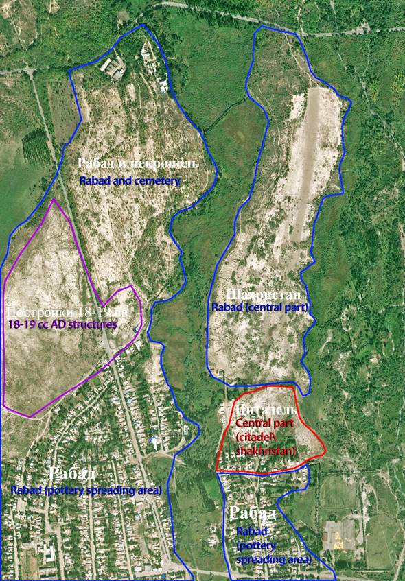
Photo
1. The settlement of Usharal the town of
Ilanbalyk. Aero photo.
|
|
|
Photo 2. The settlement of Usharal - the town of Ilanbalyk. Aero photo. North view
|
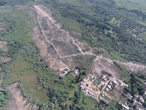
|
|
|
Photo 3. Town Ilanbalyk. The eastern half of the citadel. Aero photo. South view
|
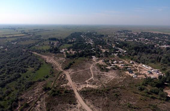
|
|
|
Photo 4. The settlement of Usharal - the town of Ilanbalyk. Excavation # 2. After rain. |
|
|
|
|
|
Photo 5. The settlement of Usharal. Excavation # 2 - bath.
View from above |
|
Photo 6. The settlement of Usharal. Excavation #2. The remains of chimneys. Northeast view
|
|
|
Photo 7. The settlement of Usharal. Excavation # 2. Remains of the heating system. Northwest view |
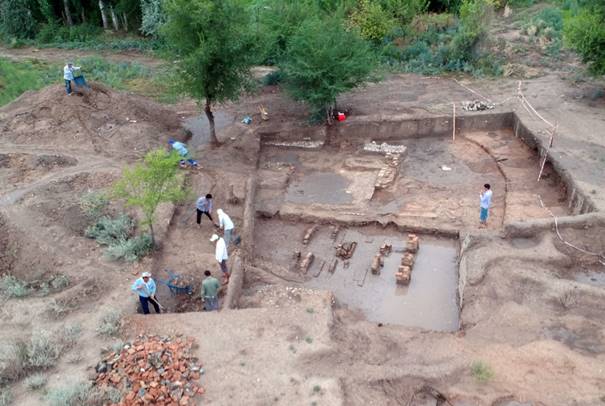
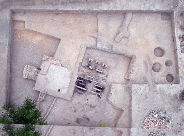
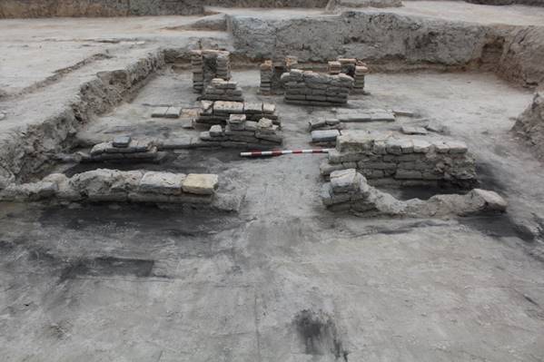
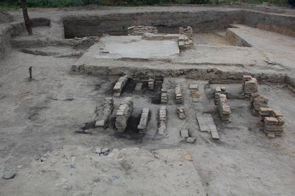
|
|
|
Photo 8. The settlement of Usharal. Excavation # 2. Room 2. Tiled floor
|
|
Photo 9. The settlement of Usharal. Excavation # 2. Room 2.
Drainage of waste water
|
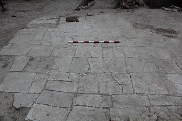
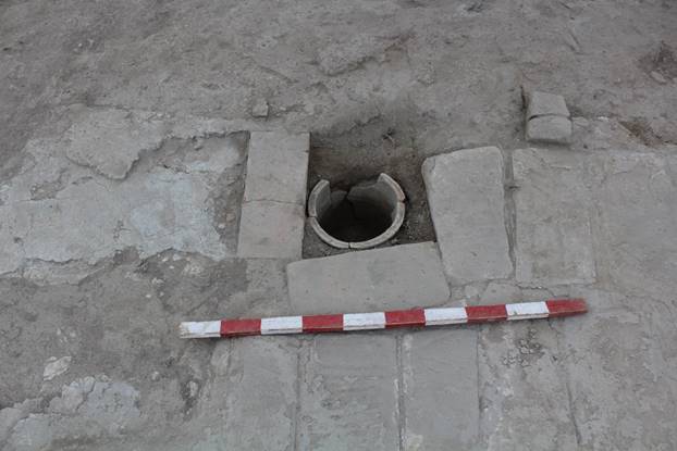
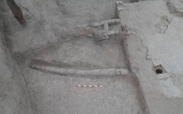
Photo 10. The settlement of Usharal. Excavation # 2. Sewage system
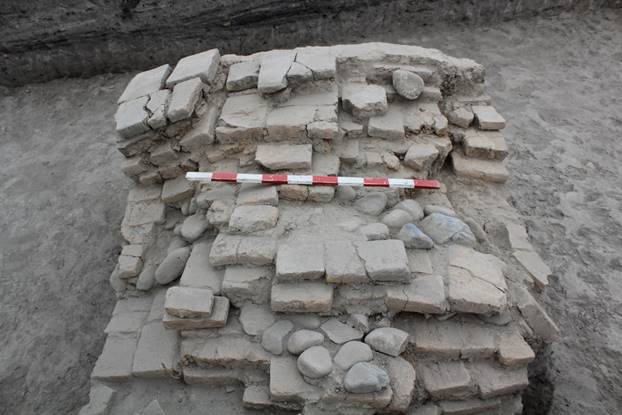
Photo 11. The settlement of Usharal. The construction of baked bricks in a cold room
|
|
|
Photo 12. Site of Usharal. The fortress walls in the south-eastern part of the citadel. Aero photo. West View
|
|
|
Photo 13. Site of Usharal. The fortress walls in the south-eastern part of the citadel. |
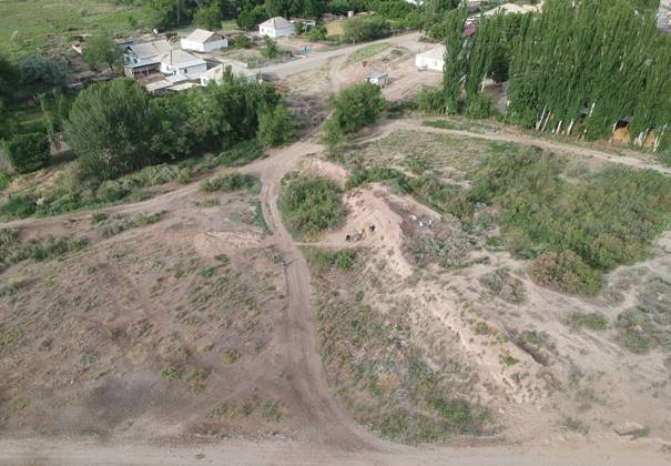
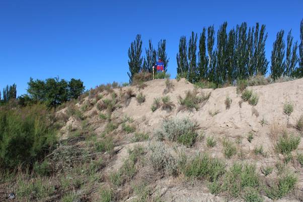
|
|
Photo 14. Site of Usharal. The fortress wall. Excavation # 3. Work moment
|
|
|
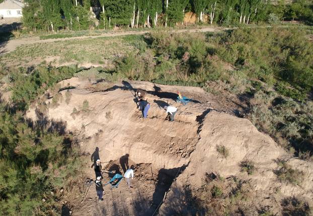
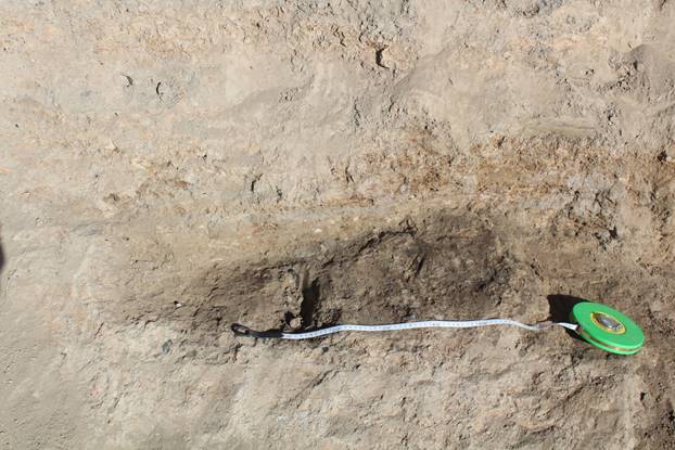
Photo 15. Site of Usharal. Oily stain on the outside of the fortress wall
|
|
|
Photo 16. The settlement of Usharal. Excavation # 2. The fortress wall. Aerophoto. South view
|
|
Aerophoto. View from above. |
|
|
|
Photo 18. The settlement of Usharal. Excavation # 2. The fortress wall. Garbage pit
|
|
|
|
Photo 19. The settlement of Usharal. Excavation # 2. The fortress wall. Garbage pit. Fragments of ceramics and animal bones from filling the pit
|
|
|
|
Photo 20. The settlement of Usharal. Excavation # 2. The fortress wall. The niche where the treasure was found
|
|
|
Photo 21. The settlement of Usharal. Excavation # 2. The fortress wall. Silver beads
|
|
|
|
Photo 22. The settlement of Usharal. Excavation # 2. Wooden details of silver jewelry and bracelets
|
|
|
Photo 23. The settlement of Usharal. Excavation # 2. The fortress wall. Silver bracelets
|
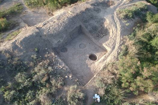
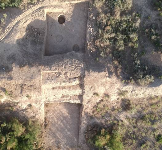
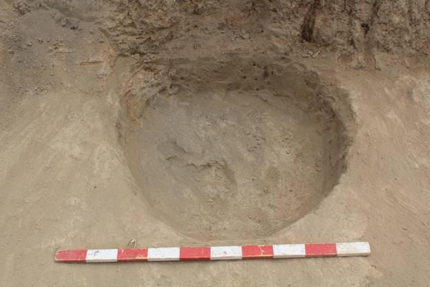
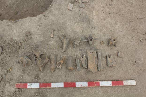
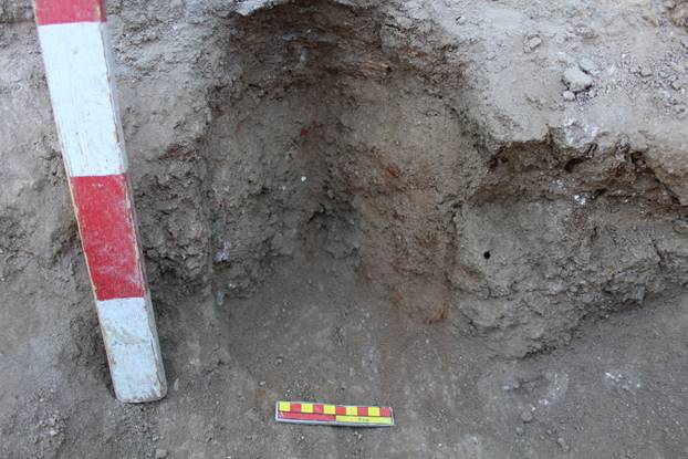
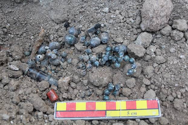
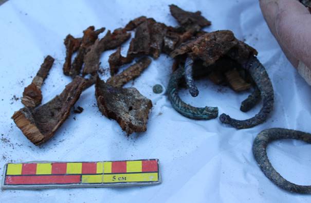
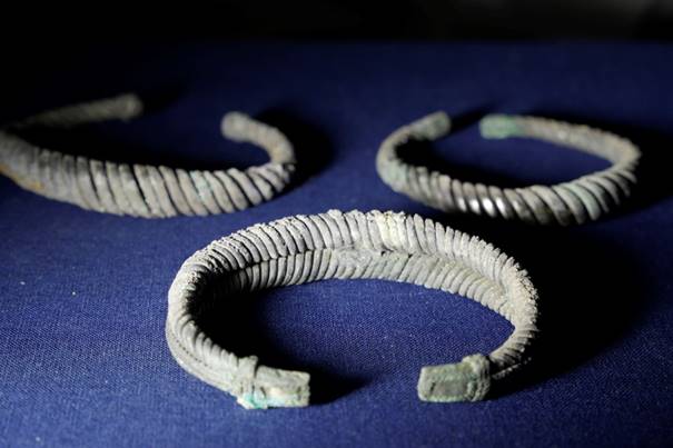
|
|
Photo 24. The settlement of Usharal. Excavation # 2. Silver beads
|
|
|
|
|
|
|
Photo 26. The settlement of Usharal. Excavation # 2. Large coral necklace
|
|
|
|
Photo 27. The settlement of Usharal. Excavation # 2. Carnelian Beads |
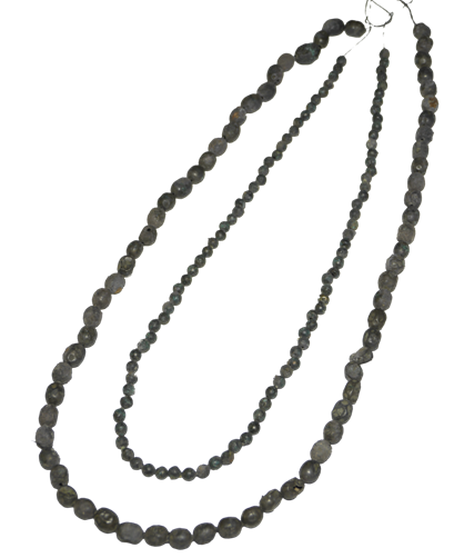
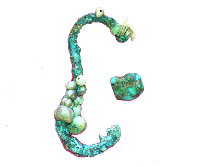
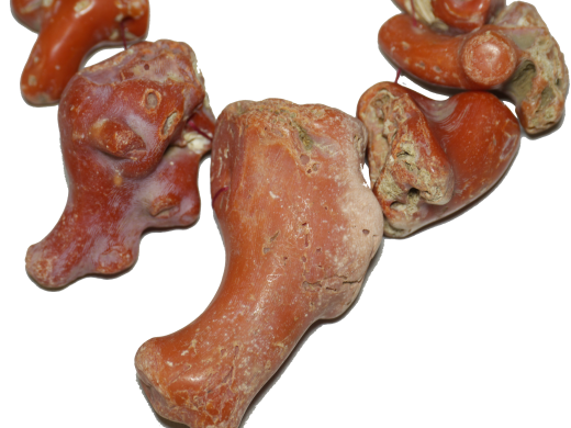
|
|
|
|
|
|
|
|
|
|
|
|
|
|
|
|
Photo 31. The settlement of Usharal. Excavation # 2. Pearls
|
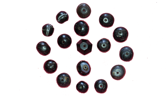
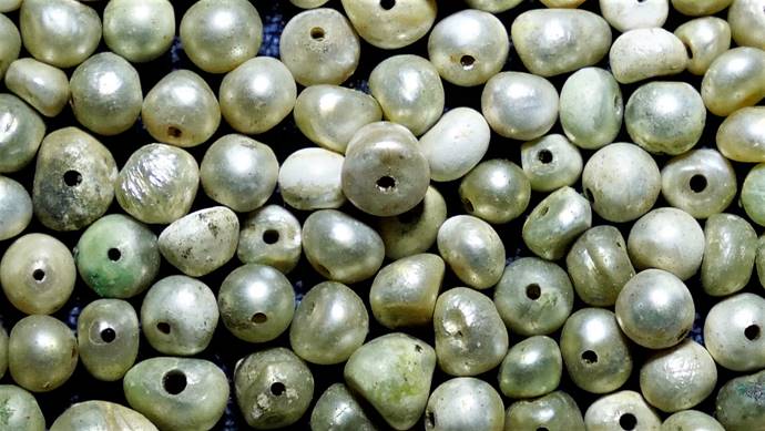
|
|
|
Photo 32. The settlement of Usharal. Excavation # 2. Pendant # 1 of jade
|
|
|
|
Blank for pendant #2 of jade |
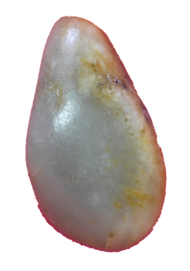
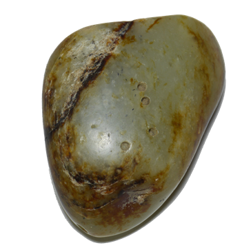
|
|
|
Figure 1. The settlement of Usharal. Excavation # 2. Zoomorphic design nozzle-drain jug in the form of an animal's head
|
|
|
|
|
|
Figure 3. The settlement of Usharal. Excavation # 2. Ceramic lamp-chirag
|
|
|
|
Figure 4. The settlement of Usharal. Fragment of a vessel sidewall with a handle. The body is decorated with a drawn geometric pattern.
|
|
|
|
Figure 5. The settlement of Usharal. Excavation # 2. Undersized kitchenware with horizontal arcuate handles
|
|
|
|
Figure 6. The settlement of Usharal. Excavation # 2. Fragments of non-glazed kitchen and household utensils
|
|
|
Figure 7. The settlement of Usharal. Excavation # 2.Fragments of non-glazed household utensils
|
|
|
|
Figure 8. The settlement of Usharal. Excavation # 2. Unpainted fragments of dish for food storage
|
|
|
Figure 9. The settlement of Usharal. Excavation # 2. Fragment of a ceramic vessel
|
|
|
|
Figure 10. The settlement of Usharal. Excavation # 2. Fragments of the cranks??? of the water-bearing jugs
|
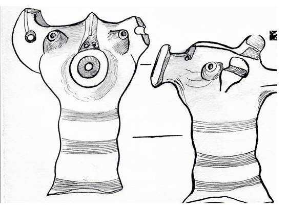
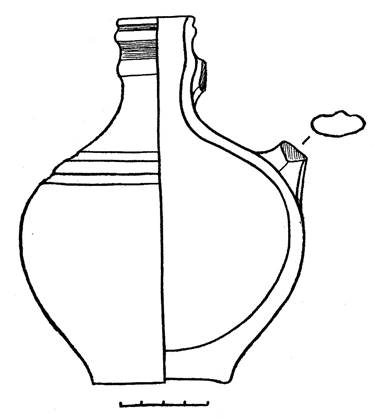
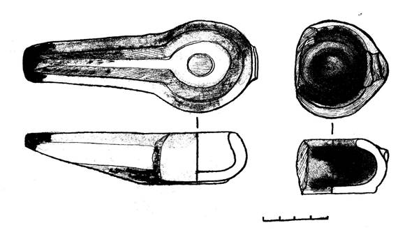
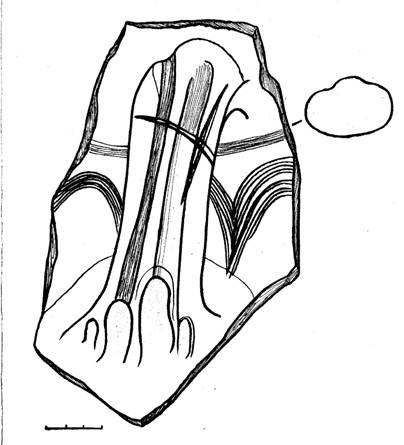
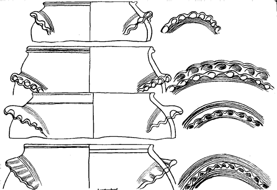
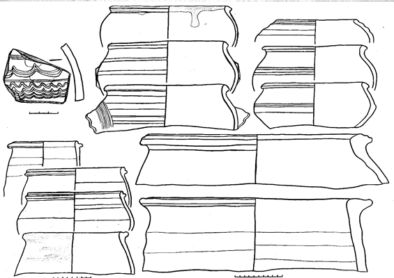
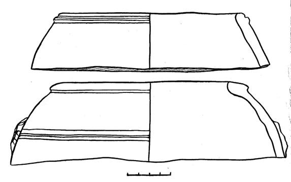
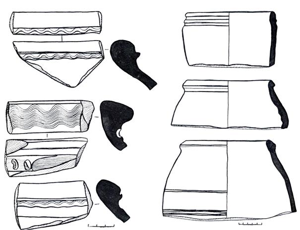
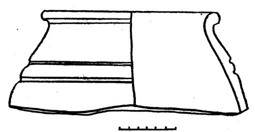
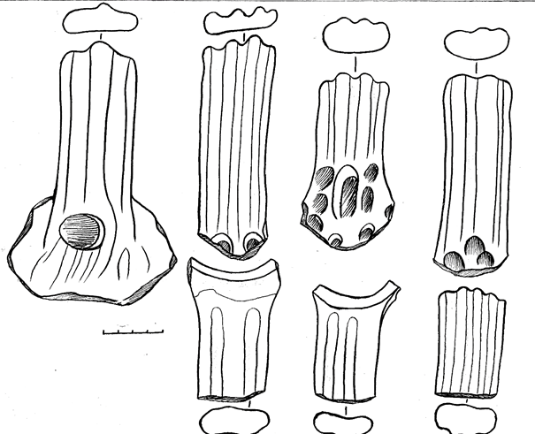
|
|
|
|
|
Bottoms of large non-glazed ceramic vessels
|
|
|
|
Figure 13. The settlement of Usharal. Excavation # 2. Bottom of ceramic vessels
|
|
|
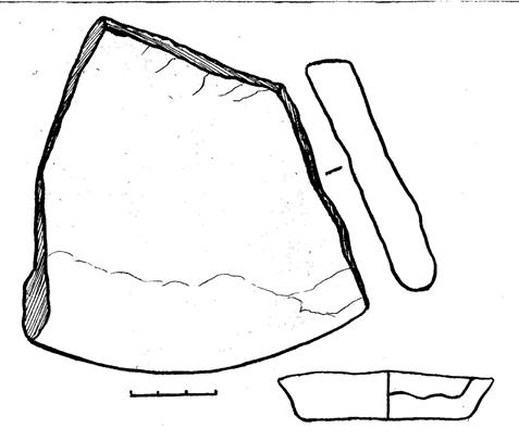
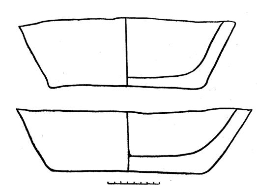
Figure 14. The settlement of Usharal.
Excavation # 2.
Fragments of the bottom of non-glazed ceramic tableware
APPENDIX C
Drawing documentation
|
|
|
Drawing 1. The settlement of Usharal. Excavation #.
|
|
|
|
|
|
Drawing 2. The settlement of Usharal. Excavation #
1. |
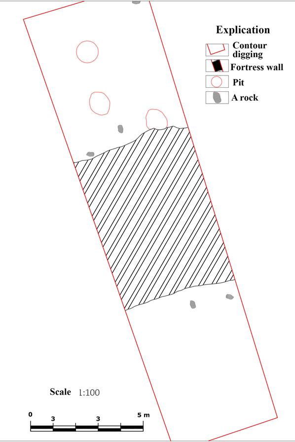
Drawing 3. The settlement of Usharal. Excavation # 2. Section of the fortress wall. Plan