Archaeological excavation of a likely Christian Nestorian graveyard
| 2022 | 2023 | 2024 | 2025 |
The site of Urgut was declared a World Heritage Site by the UNESCO World Heritage Commission as part of the transnational project "Silk Roads: Zarafshan-Karakum Corridor" on 17 September 2023.
Starting point
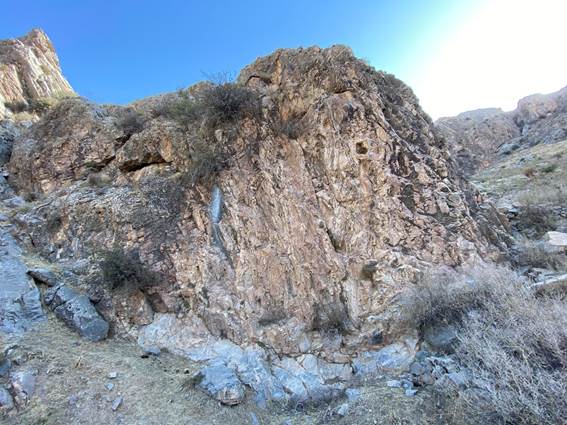
From 2004 to 2008, the Society for the Exploration of EurAsia conducted archaeological work at the site of Suleiman-tepa located south of Samarkand in Uzbekistan. (See here under Completed Projects/Urgut Monastery).
It resulted in the discovery of a monastery dated between the 9th and 12th centuries.
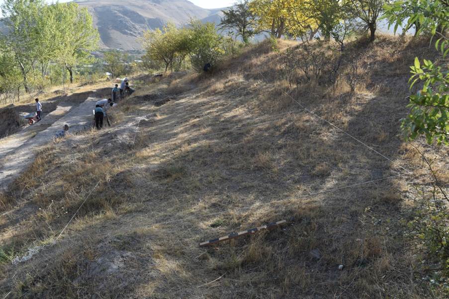
Following chance indications by local people, in was decided in spring 2022 to resume work at Suleiman-tepa/Urgut in order to identify and excavate the presumed graveyard attached to the monastery.
.
FIELD REPORT
ON THE
ARCHAEOLOGICAL EXCAVATIONS
AT URGUT- SULEIMAN-TEPA,
UZBEKISTAN IN 2022
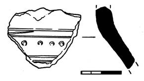
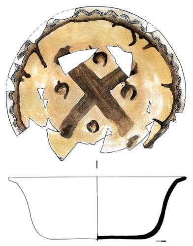
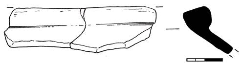
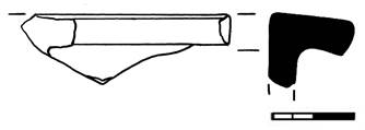
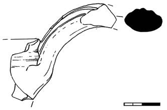
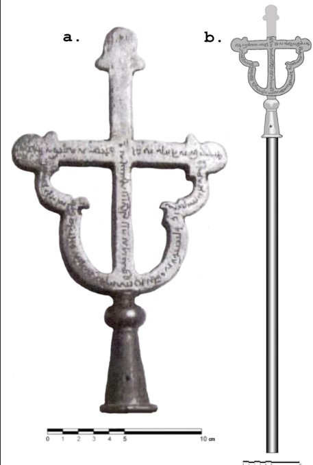
"Tagara" ceramic vessel from
the monastery
with a depiction of a cross
Samarkand 2022
LIST OF EXCAVATORS
CONTENTS
Introduction
Sponsor: Society for the Exploration of EurAsia (Switzerland).
Performers: International Institute for Central Asian
Studies (IICAS) in cooperation with the Samarkand Archaeological Institute
named after Ya. Gulyamov.
In 2022, research work was carried out on the territory
of the Suleiman-tepa monument (a medieval Christian monastery).
Earlier, from 2004 to 2008, archaeological work was
already carried out on this territory, which resulted in the opening of a
monastery dated between the 9th and 12th centuries.
The purpose of the research in 2022 was to search for a
necropolis dating back to the time of the existence of this monastery, as well
as to continue work on the territory of the monastery.
Given that the monastery was quite large and had existed
for more than one century, there were solid grounds for searching for a
necropolis in which the monks buried their dead.
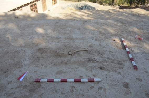
In the course of the research work, fragments of human
bones were found on the territory adjacent to the monastery.
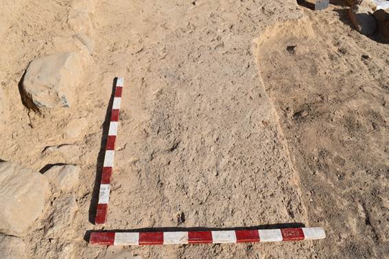
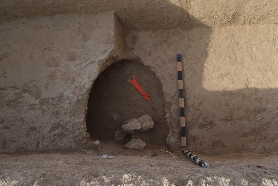
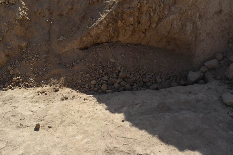
The human remains were dug up as a result of construction activities using an excavator. This
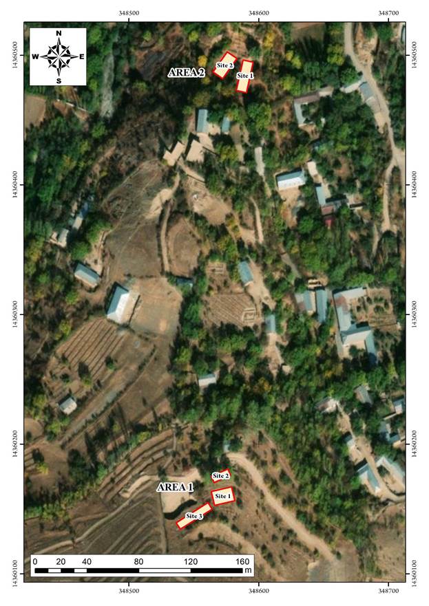
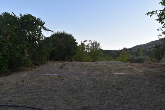
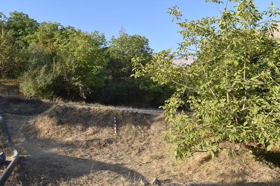
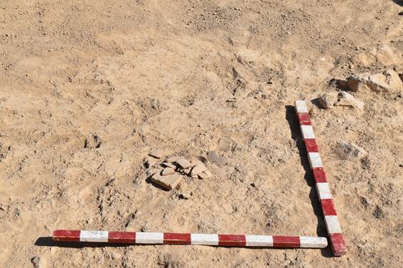
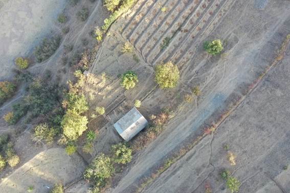
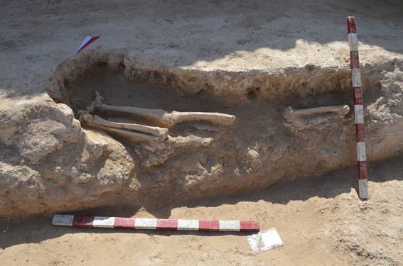
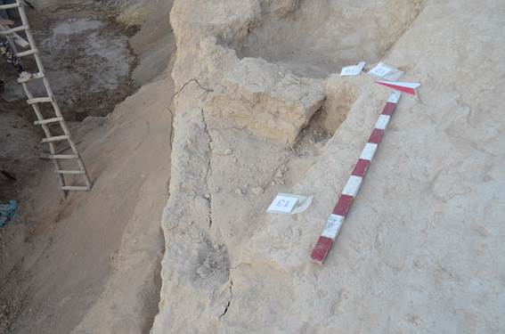
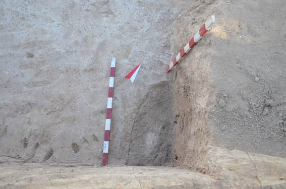
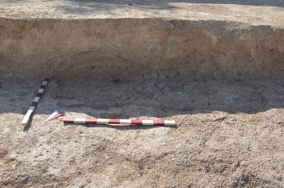
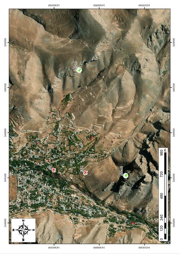
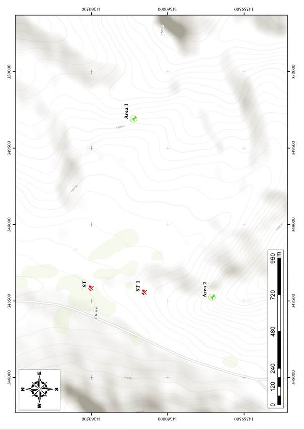
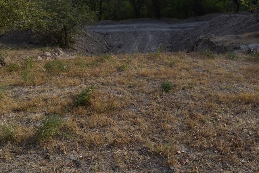
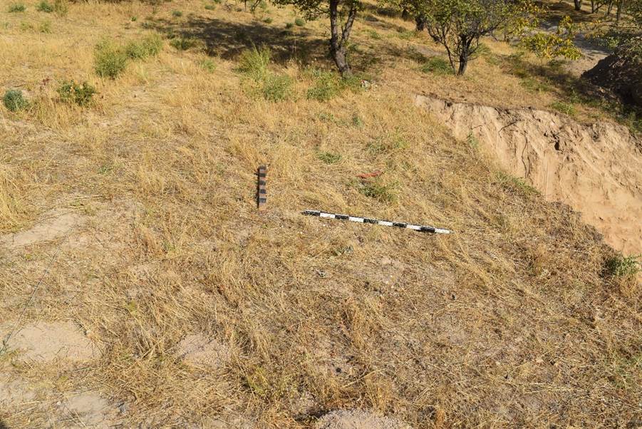
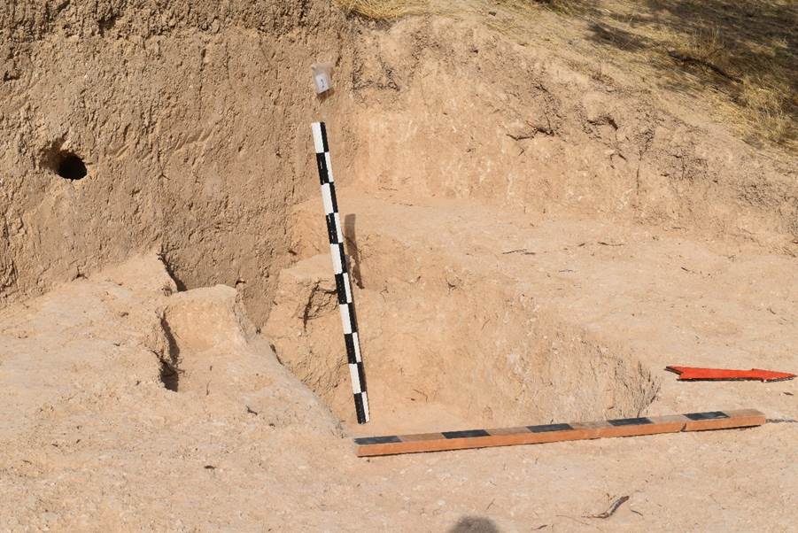
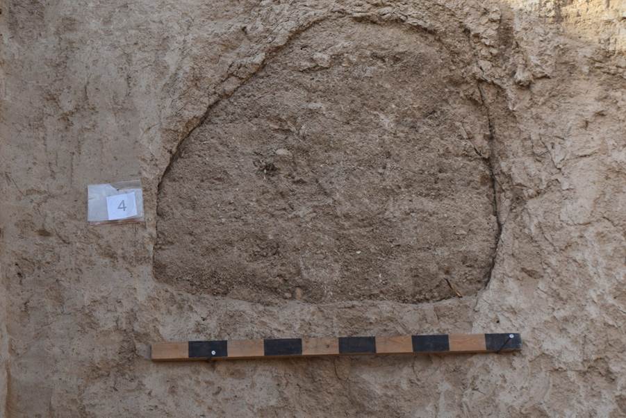
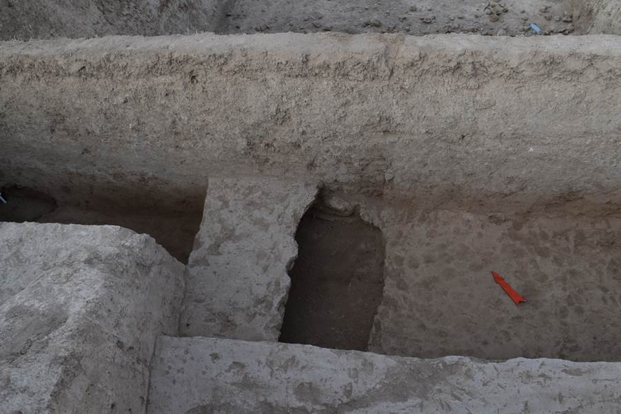
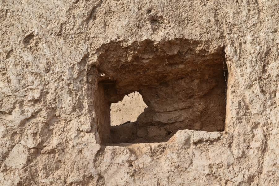
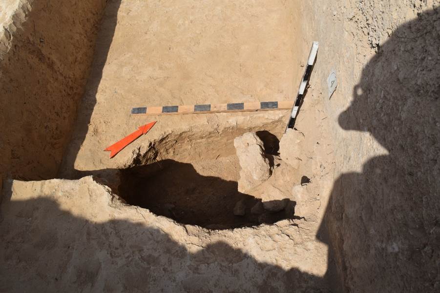
site is located 240 metres south of the monastery on the territory of a garden (see Appendix “Drawings”, fig. 4-5). The
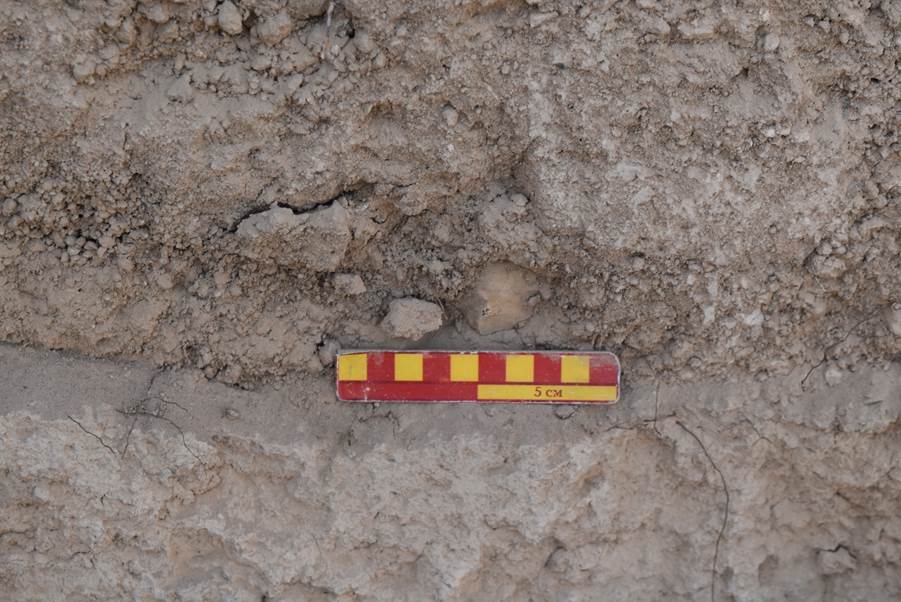
discovered remains were sent to a laboratory for radiocarbon dating. On 5 September 2022, the results of analyses were ready – 8th-10th centuries, with the 9th century determined as most probable after correlation.
Goals:
1. Archaeological work at the Suleiman-tepa monastery;
2. Exploration and archaeological work on the Suleiman-tepa 1 necropolis;
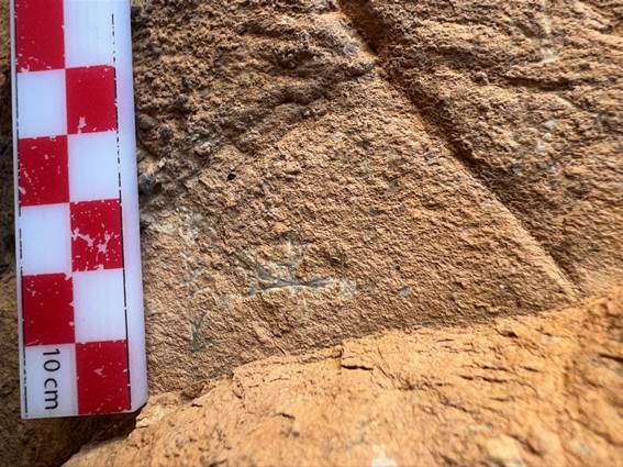
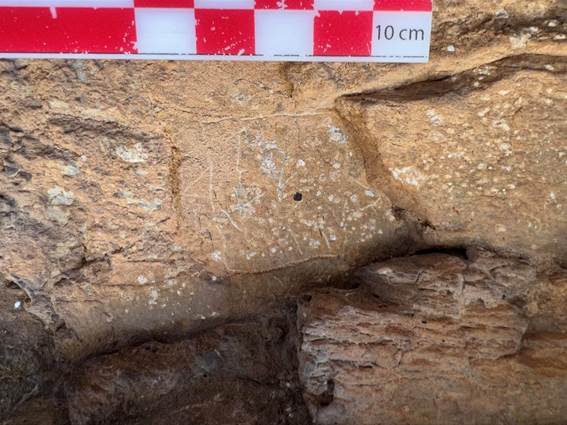
3. Exploration work in the foothills near the monastery in order to search for caves and rock inscriptions;
4. Preparation of an academic report on the results of the conducted research.
Work description:
In 2022, research work was carried out to study the
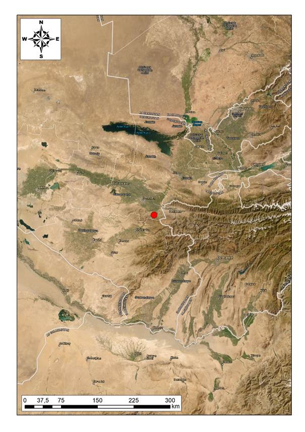
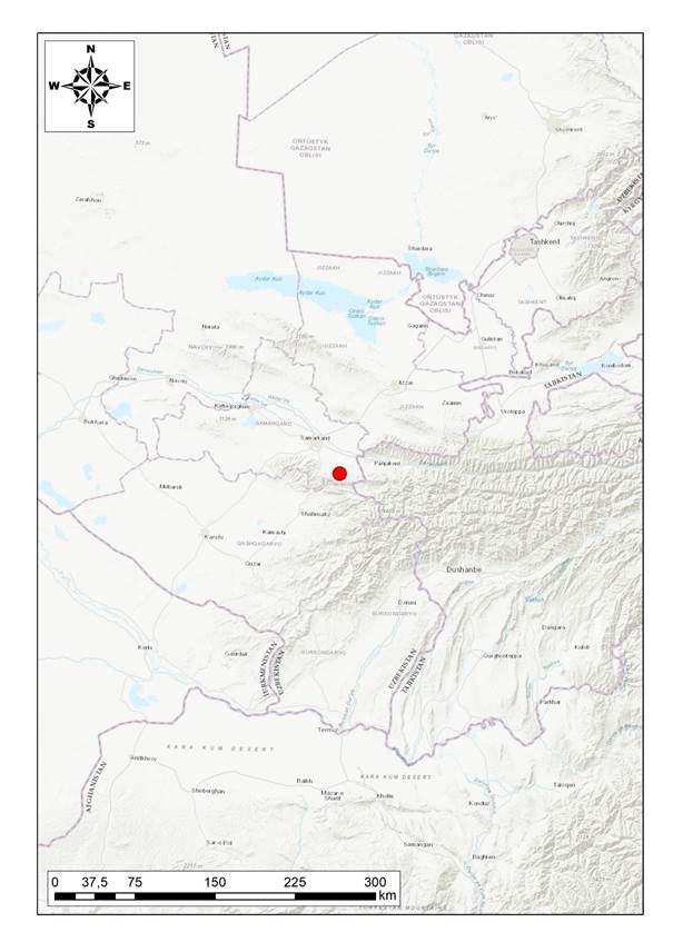
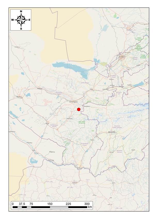
early Christian monument of Suleiman-tepa. This object is located in the
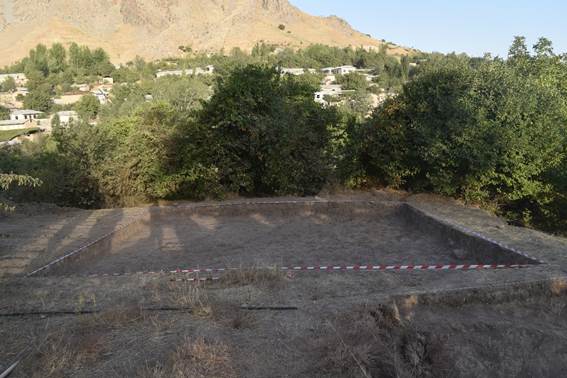
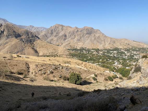
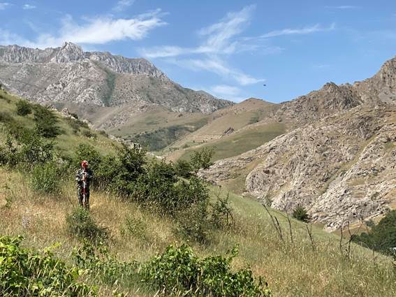
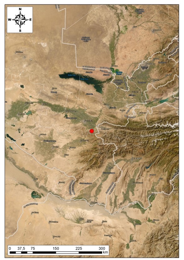
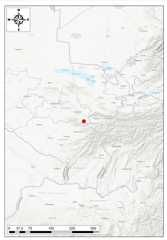
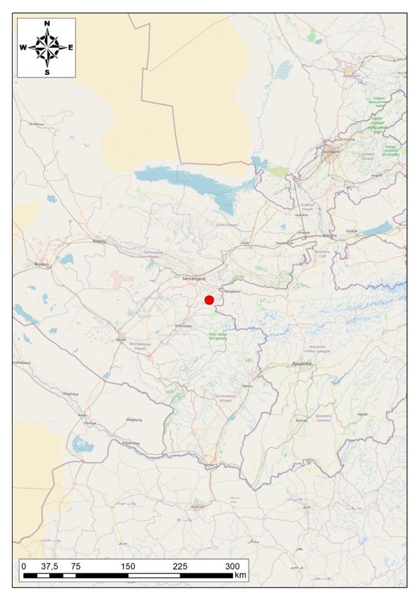
Republic of Uzbekistan, Samarkand region, Urgut district, in a mountainous area
on the southern outskirts of the city of Urgut (see
Appendix “Drawings”, fig. 1-3). Experts from
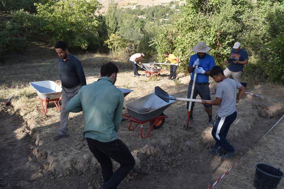
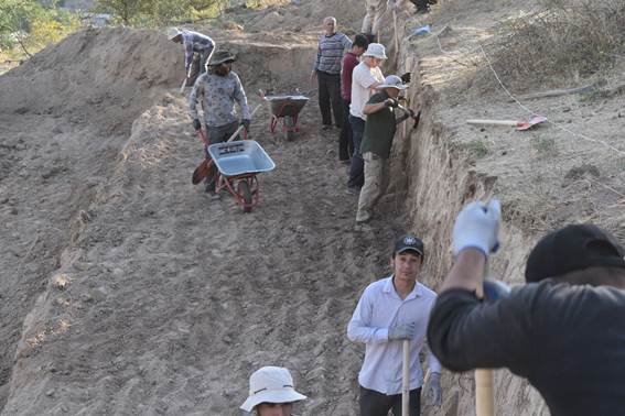
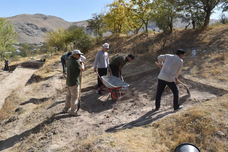
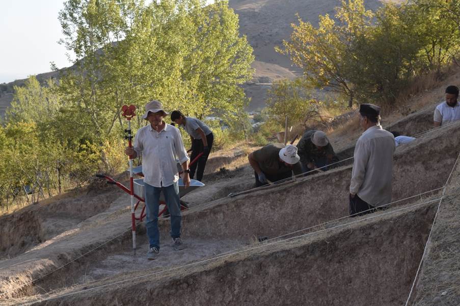
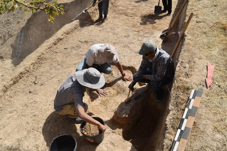
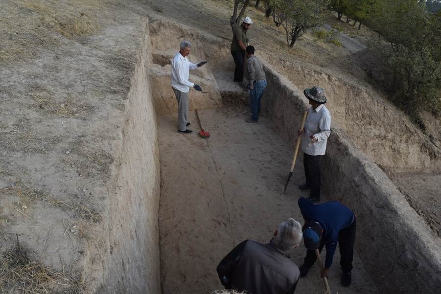
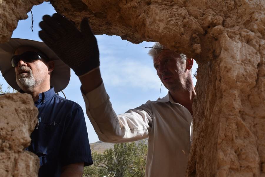
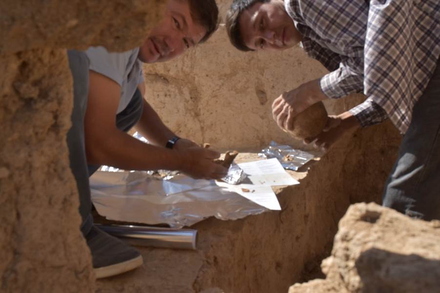
Uzbekistan, Kazakhstan, and the USA took part in the expedition. In total, the
expedition team consisted of more than 10 researchers.
The project's research curator was a representative of
the Samarkand Archaeological Institute named after Ya. Gulyamov, its acting
director Muminkhon Saidov, the expedition was headed by the IICAS director
Dmitry Voyakin.
The research work on the monument consisted of several stages:
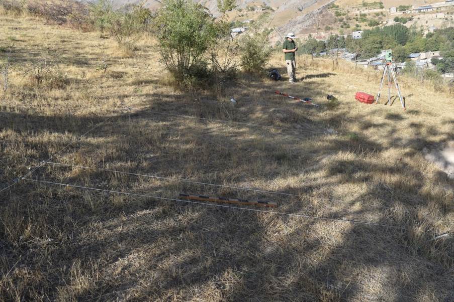
1. A preparatory stage, consisting of geodetic and geophysical work on future work sites;
2. Archaeological work on two sites: the monastery, the necropolis;
3. Processing of discovered materials and writing a report.
As a result of the work, the following results were
obtained:
1.
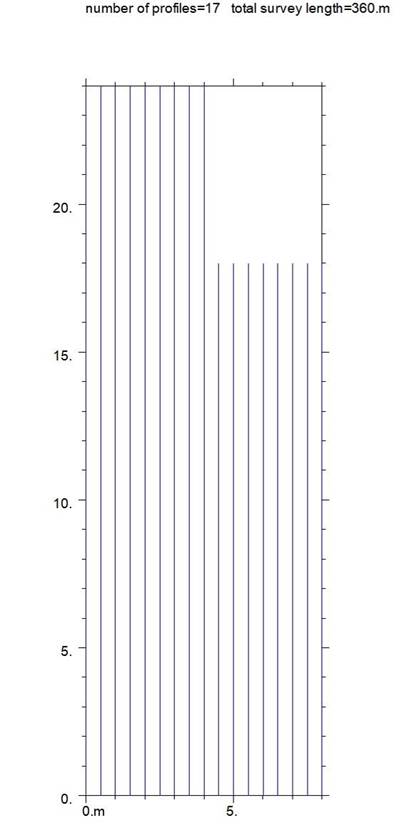
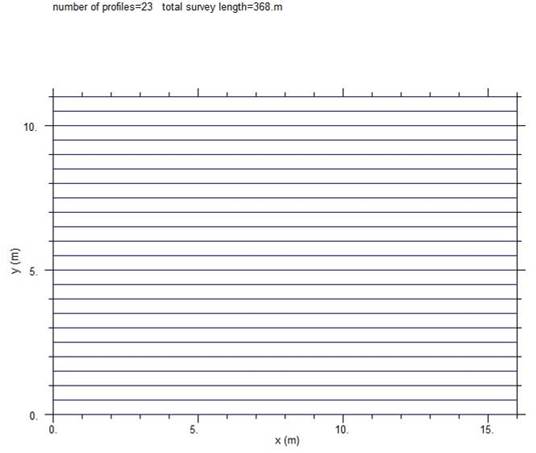
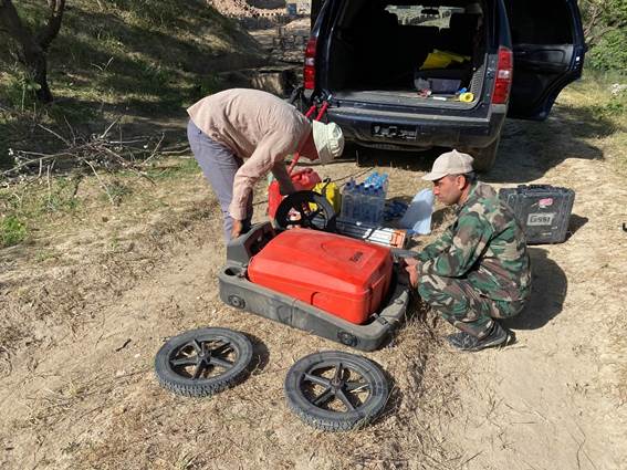
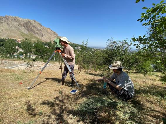
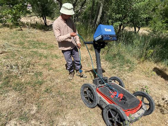
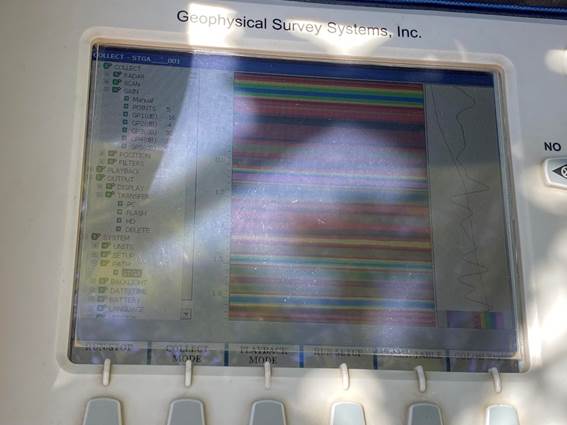
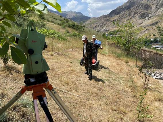
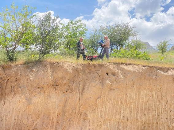
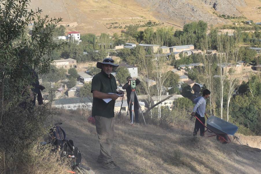
In the course of geodetic works using the Trimble R3 GNSS receiver and the
Leica TCR 407 laser total station, a topographic plan of the monastery and the
adjacent territory was prepared, a three-dimensional model of the topography
was created, geomagnetic scanning of future archaeological sites was carried
out using the GSSI SIR 300 geomagnetic scanner with a 270 MHz antenna;
2.
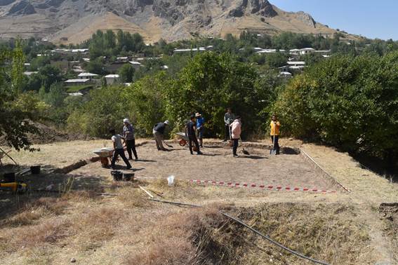
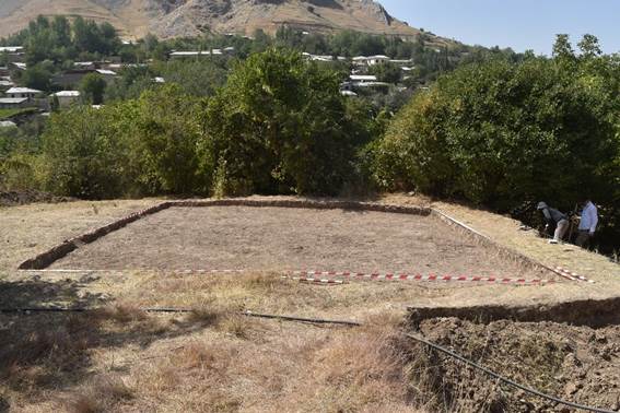
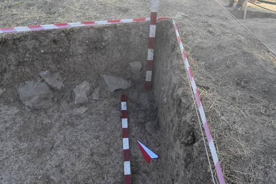
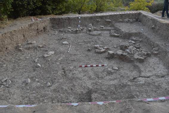
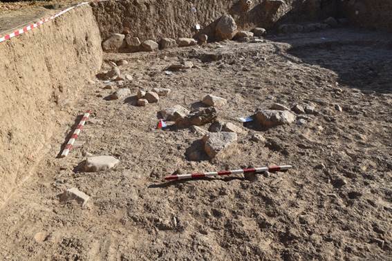
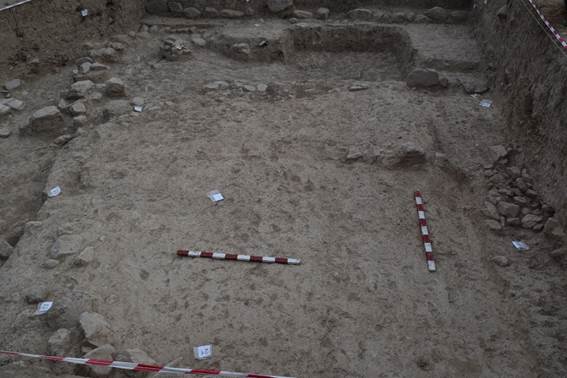
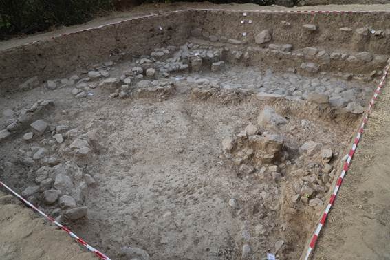
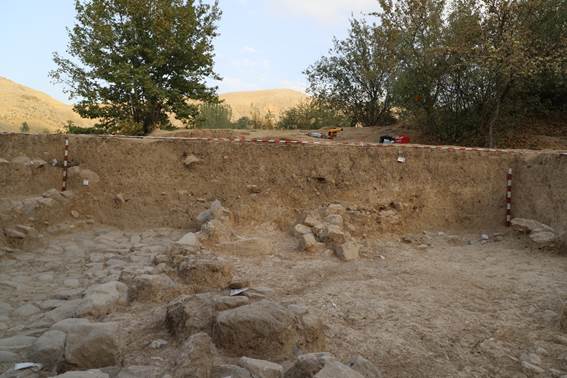
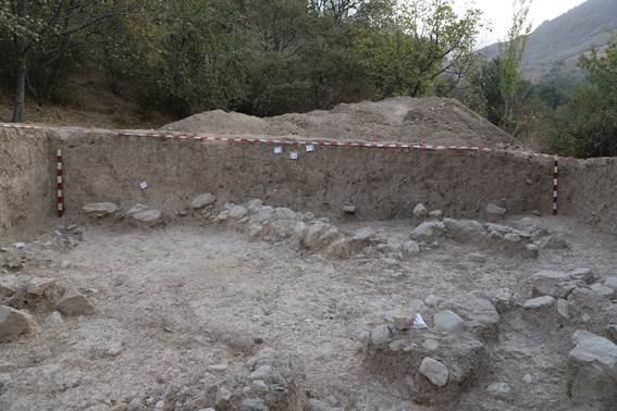
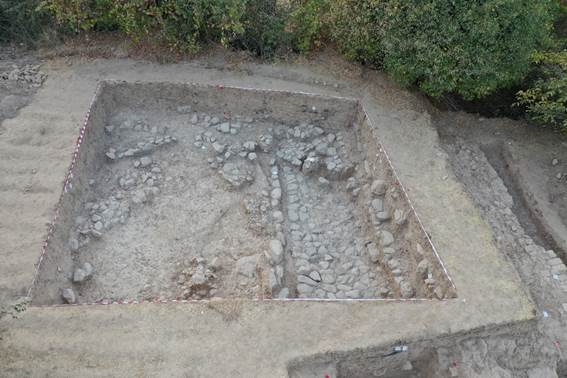
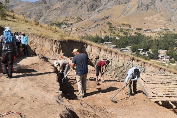
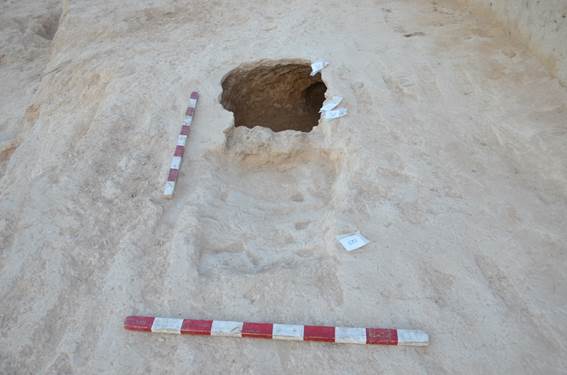
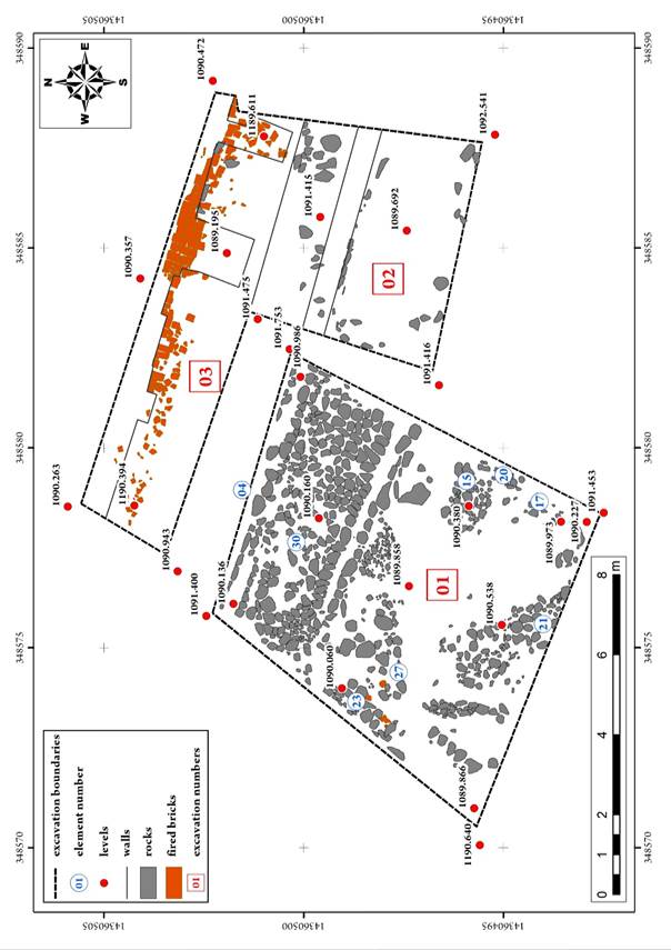
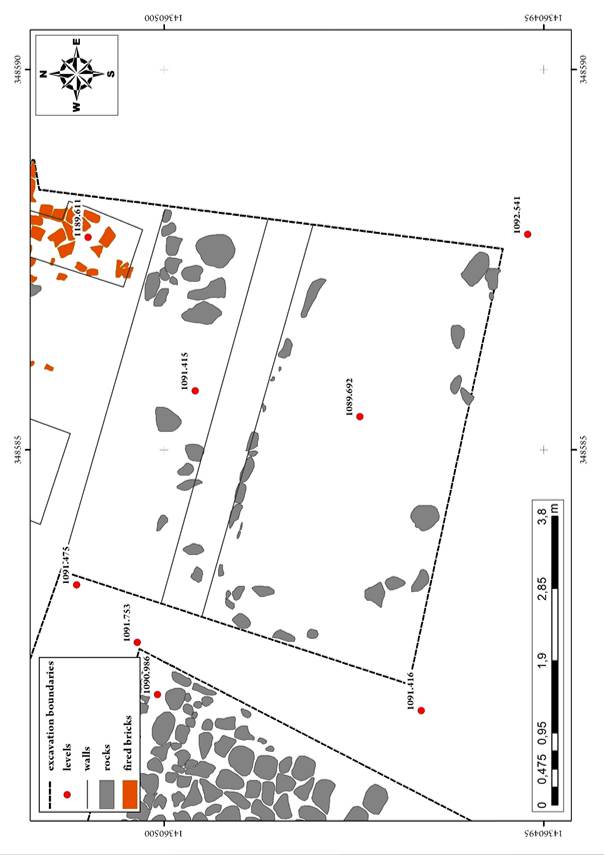
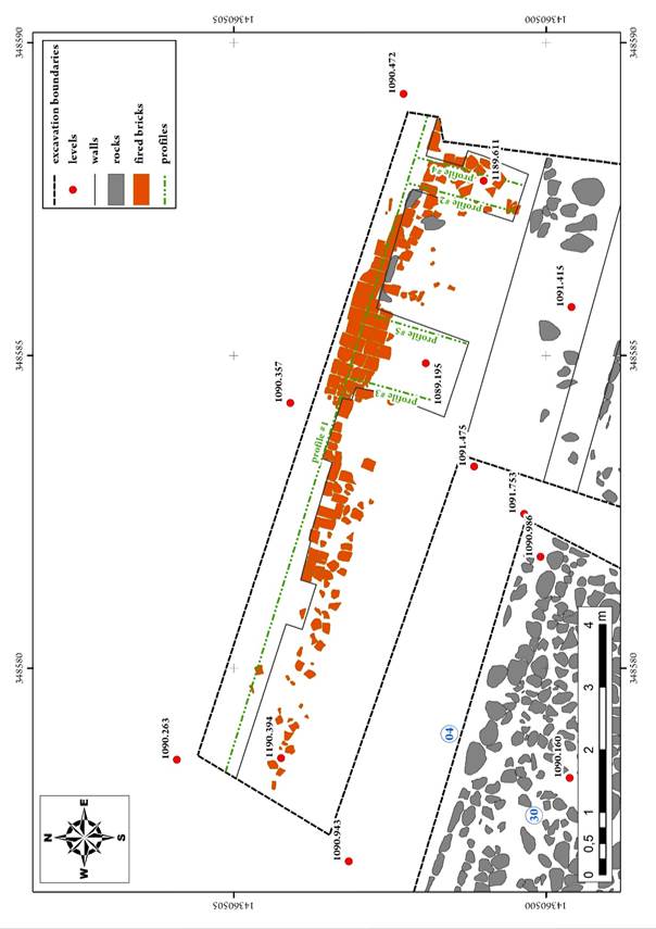
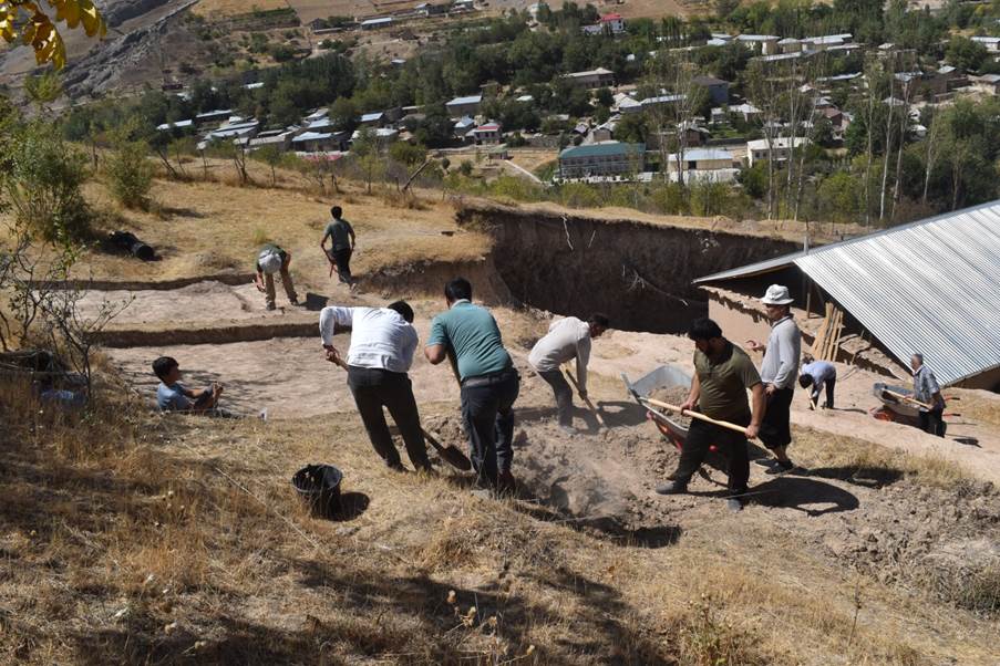
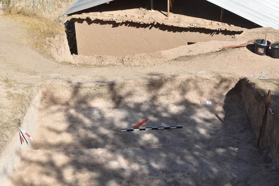
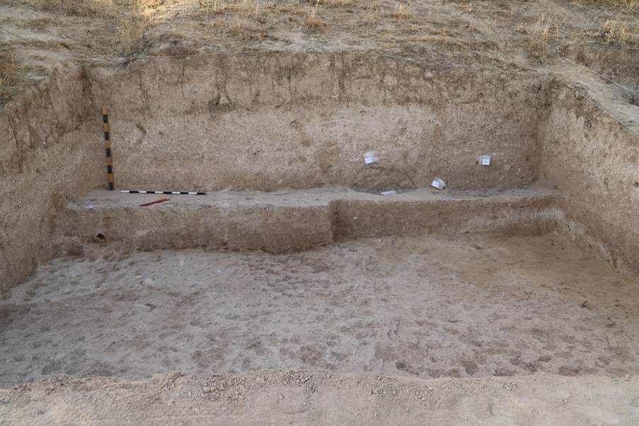
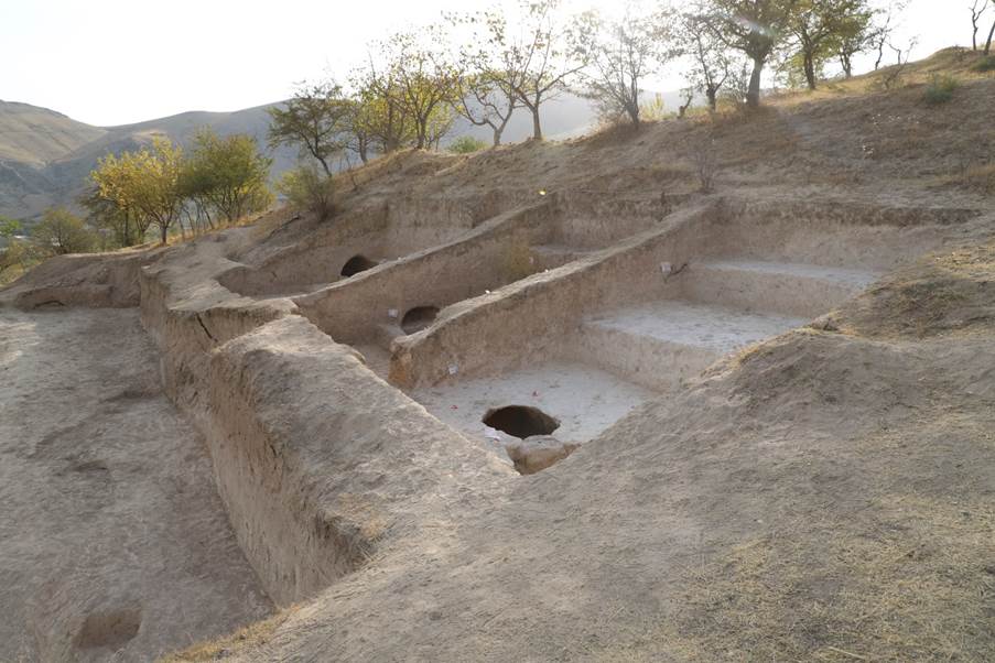
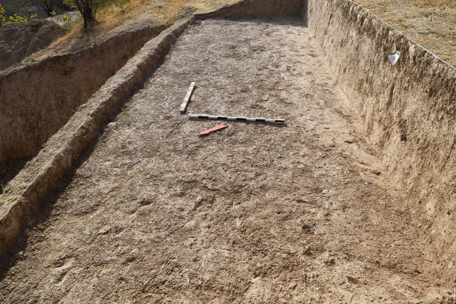
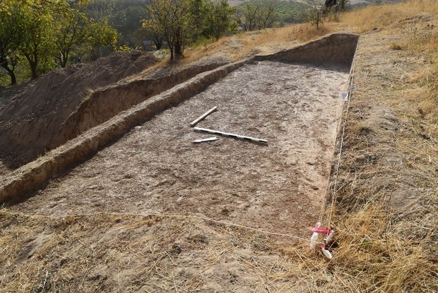
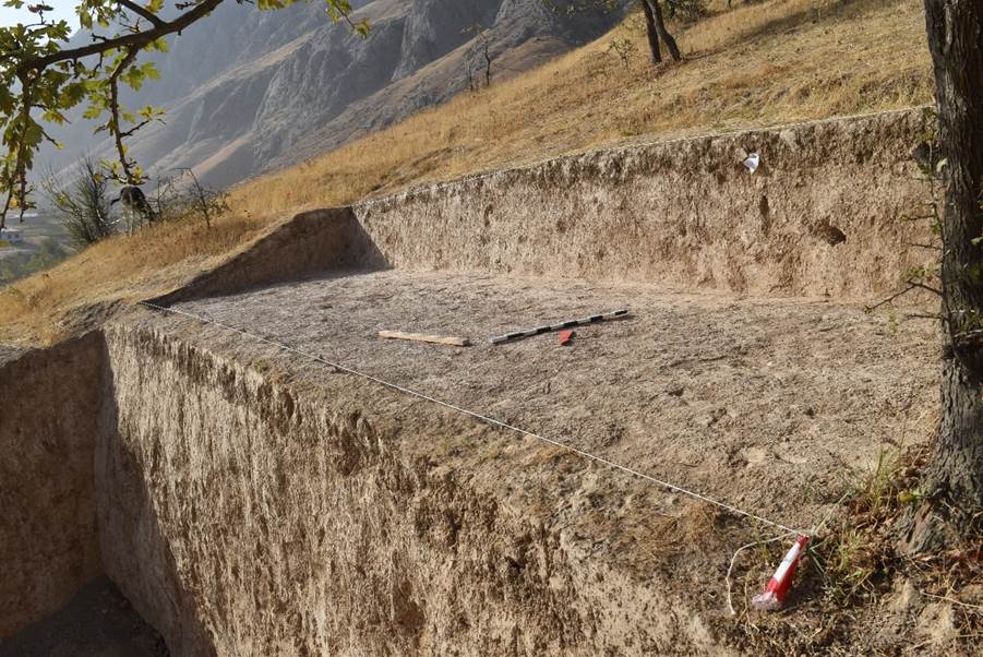
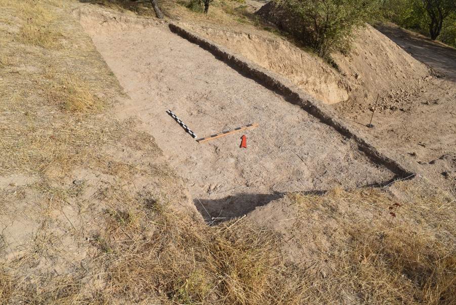
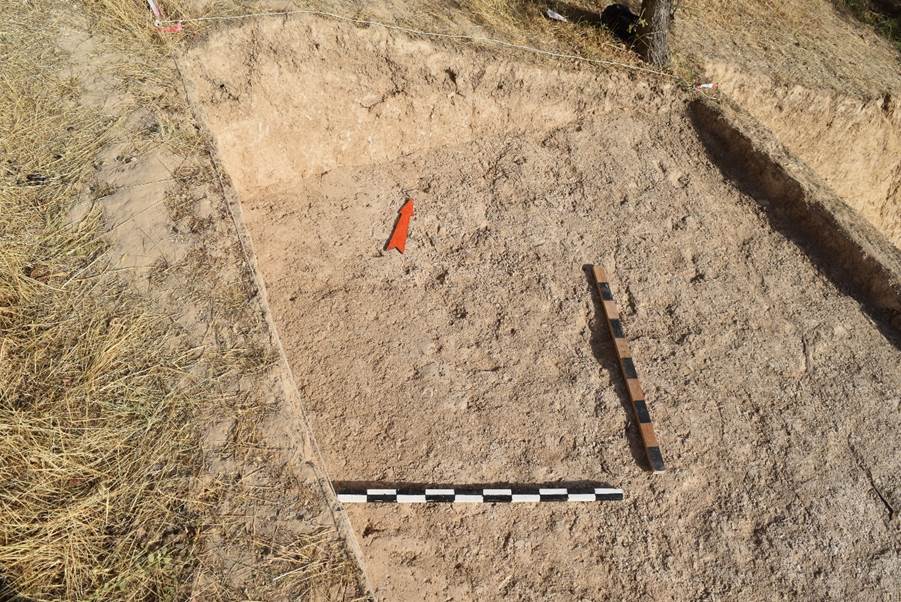
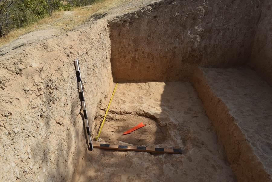
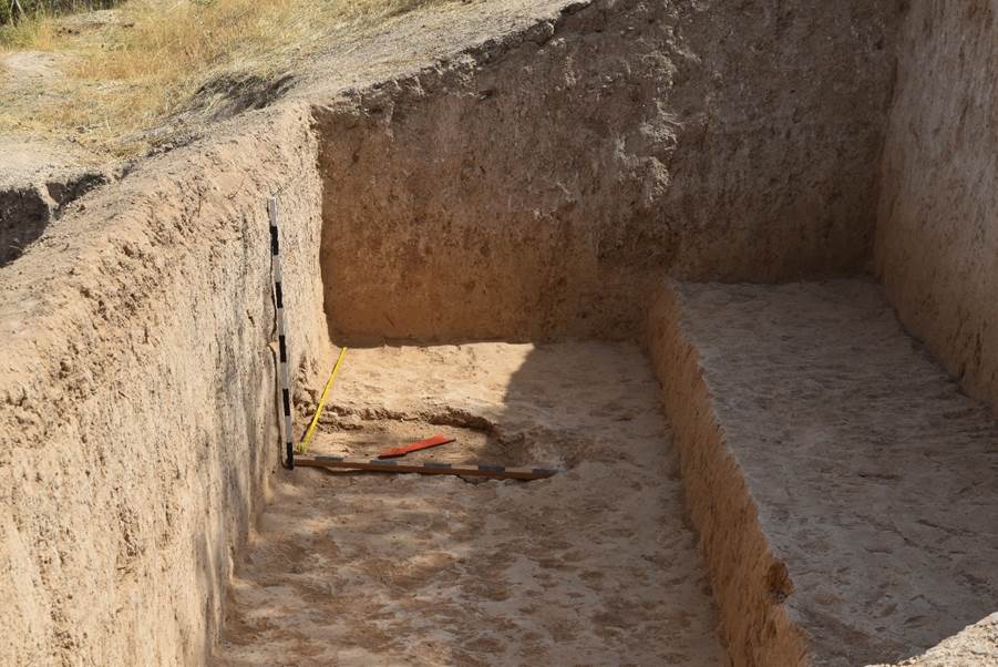
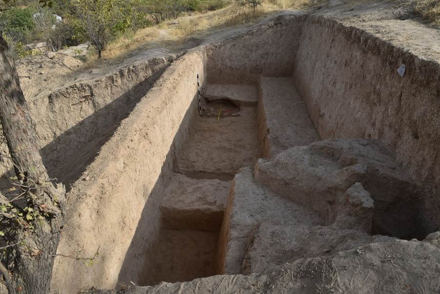
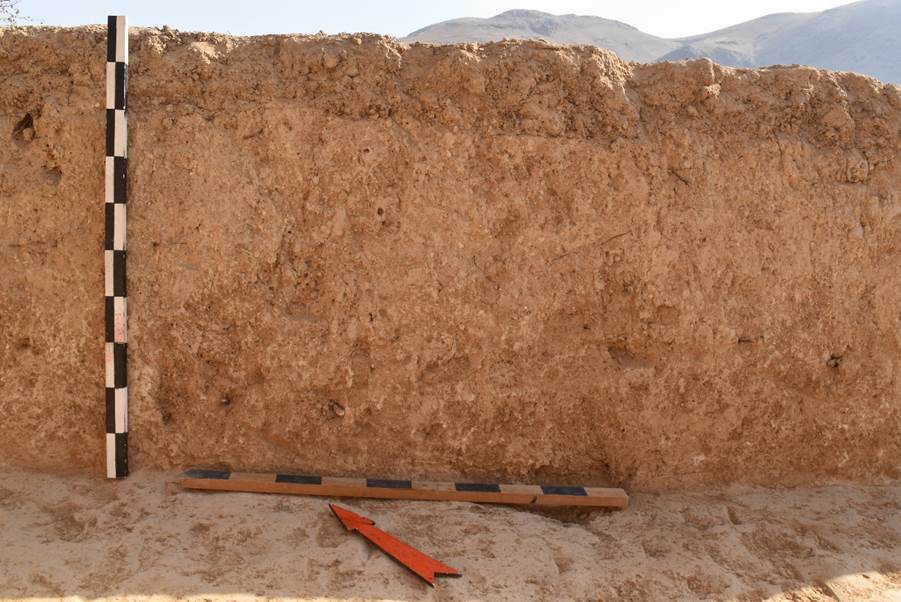
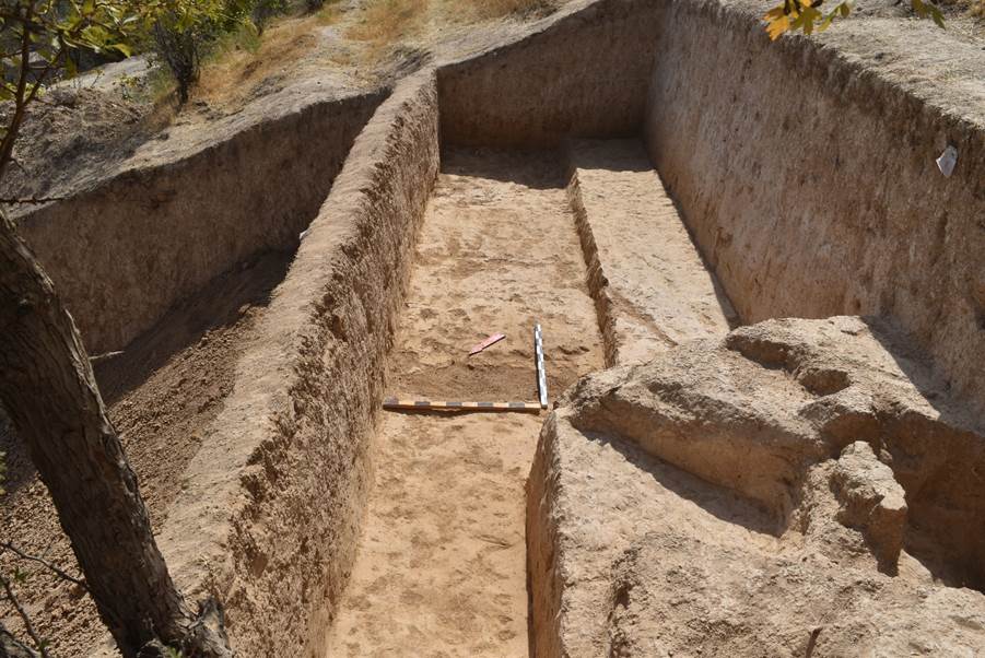
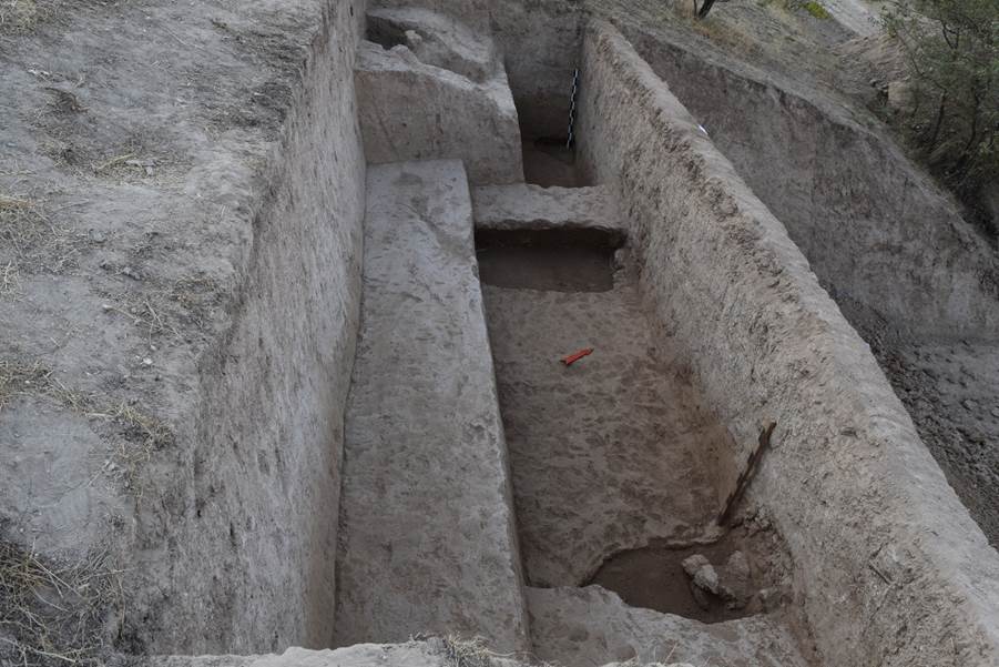
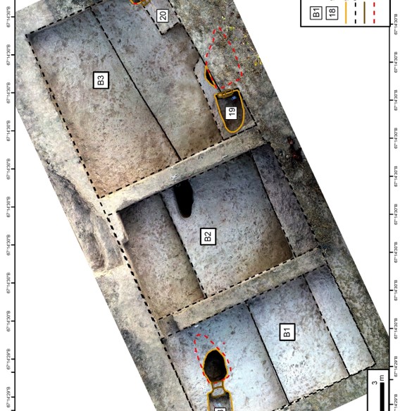
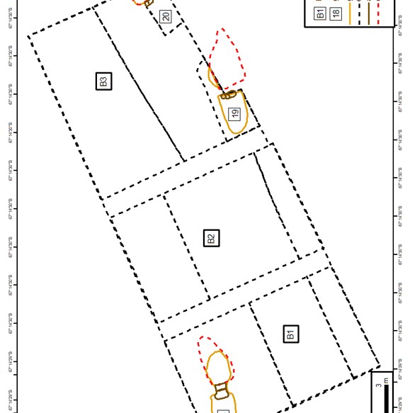
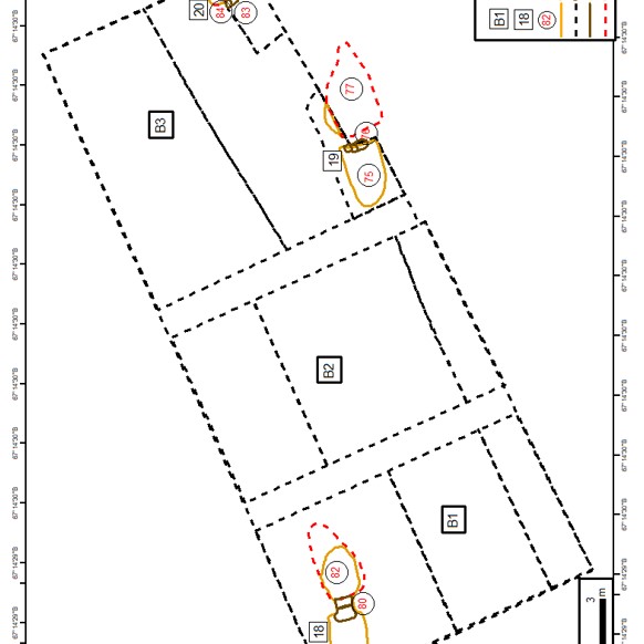
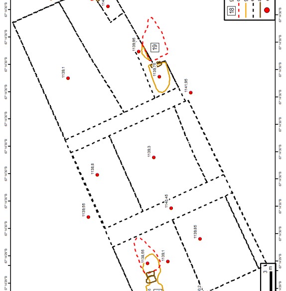
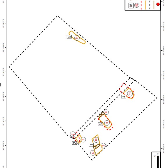
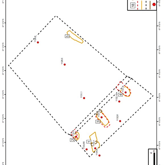
Three excavations were made on the territory of the monastery: excavation No. 1
was outside the monastery in its south-western part, the excavation has a
trapezoidal shape, stretching from north to south, dimensions 8x7 m: excavation
No. 2 is located east of excavation No. 1, also outside the monastery; it was
made on the site of an old test trench, which was expanded to the size of
4.7x2.8 metres and stretched along the WE line; excavation No. 3 is located
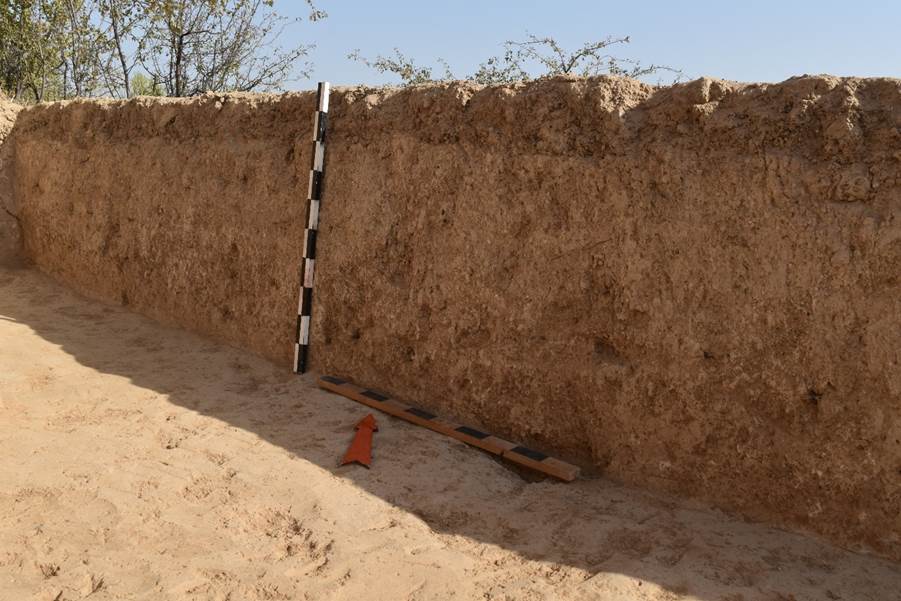
inside the monastery along the southern wall (dimensions 10.5x0.5 m).
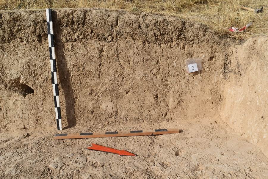
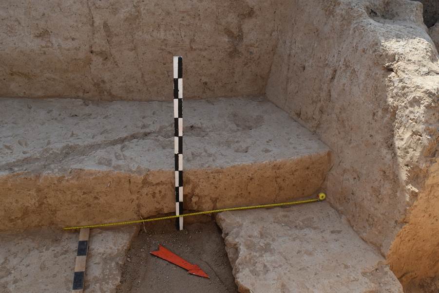
During
the work carried out at excavation No. 1 at a depth of 1.3 metres a pavement
running from west to east along the southern wall was discovered; the width of
the pavement is 2.4 metres, the revealed length is 6.5 metres, in the western
part of the pavement has an elevation in the form of a step going all across
the pavement, the height of the step reaches 40 cm. On the territory of
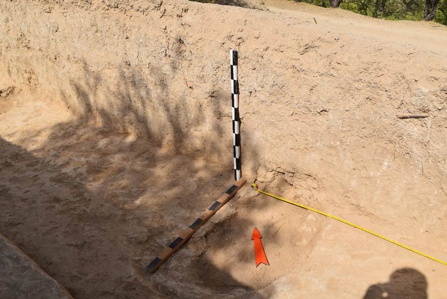
excavation No. 2, a continental layer was reached at a depth of 205 cm, in the
northern profile of the excavation a masonry of large pebbles is visible, which
is the base of the outer wall; it also has on it the large adobe (pakhsa)
bricks of the wall body; on the territory of excavation No. 3, the inner face
of the outer southern wall was cleared and documented, the depth of the
excavation was 2.3 metres.
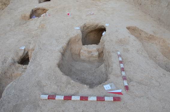
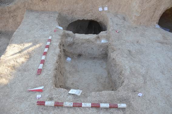
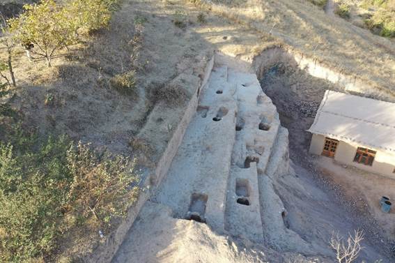
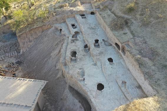
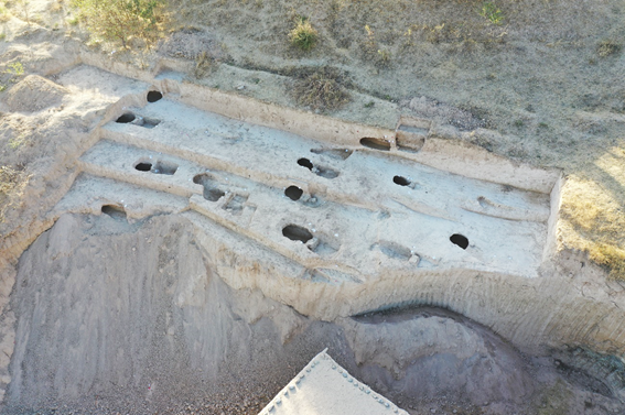
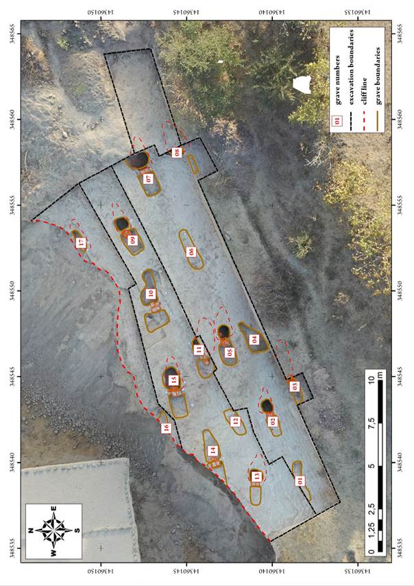
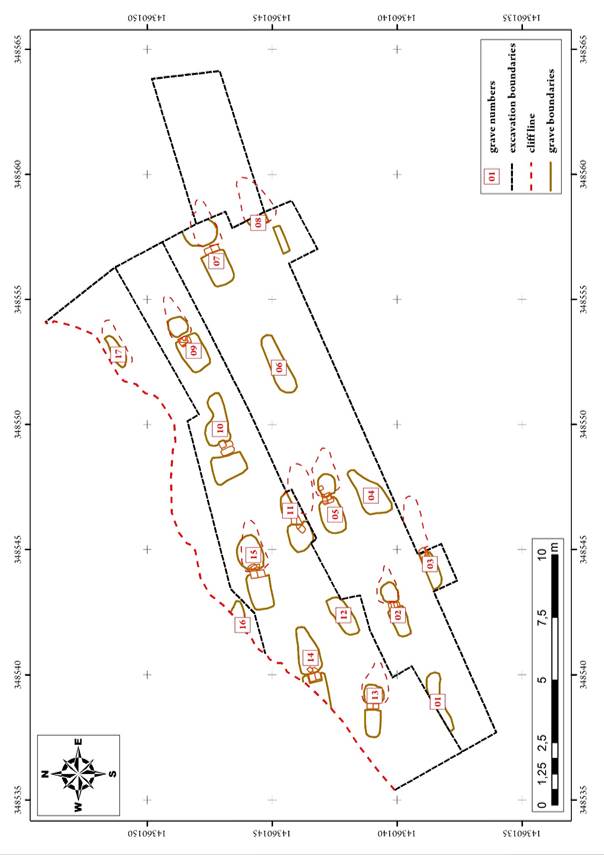
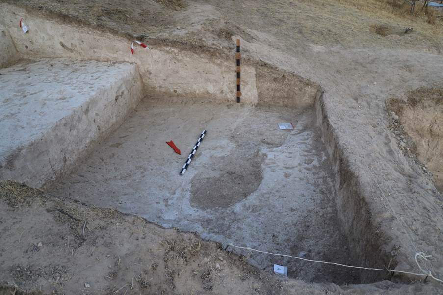
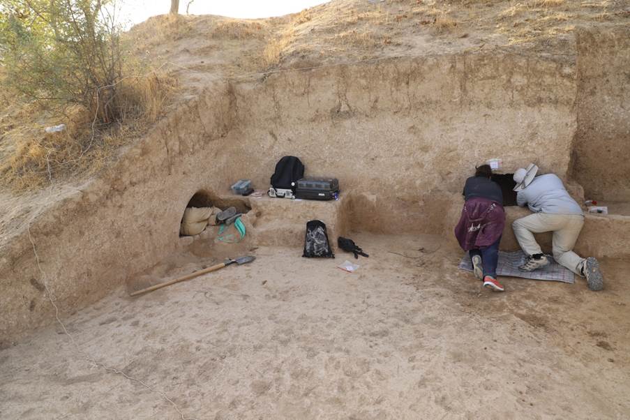
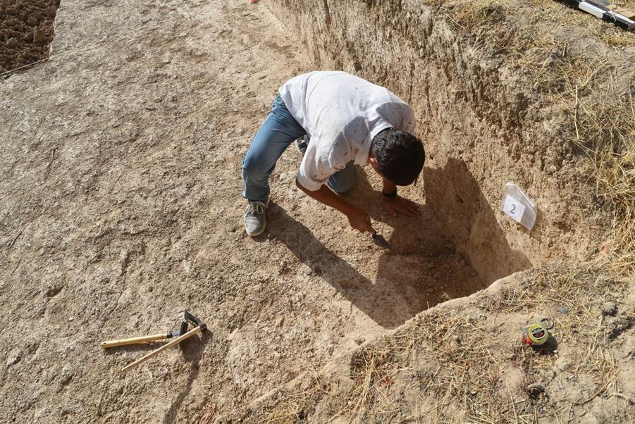
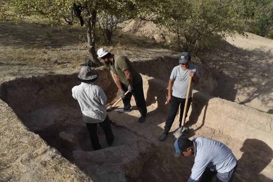
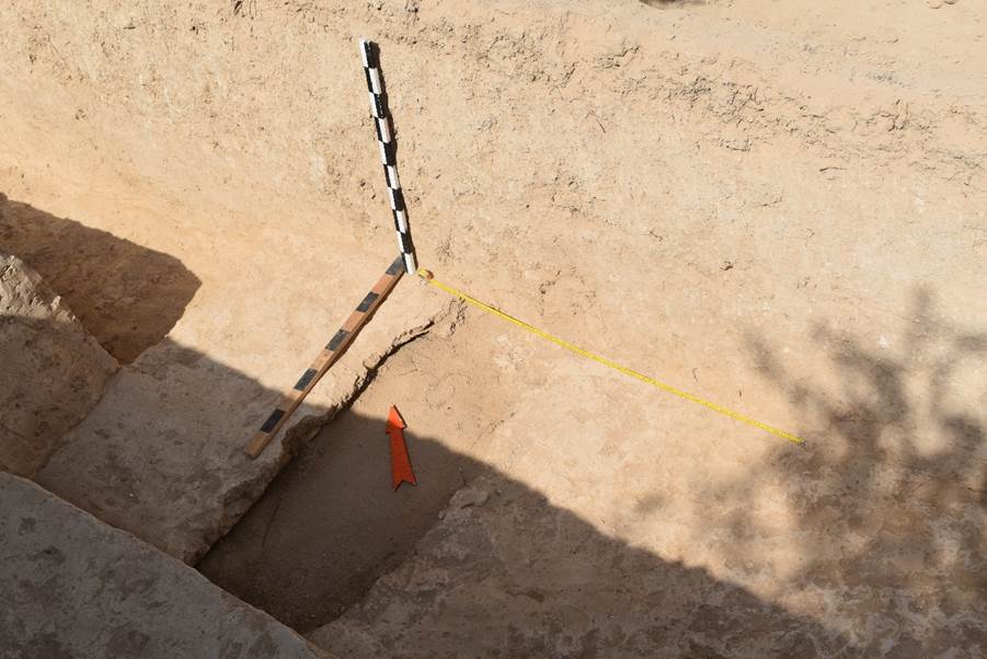
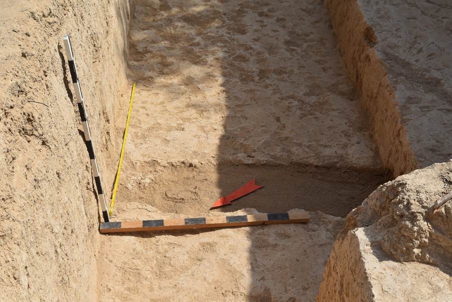
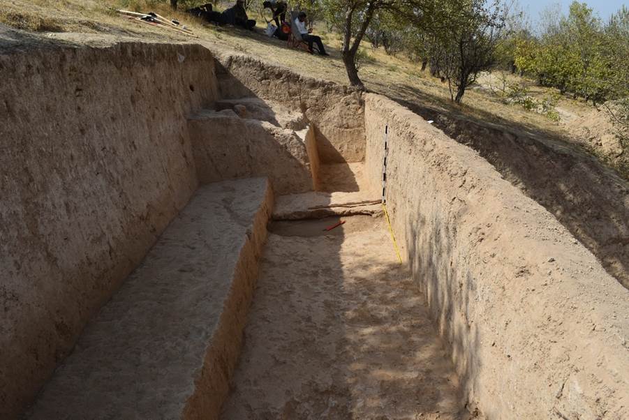
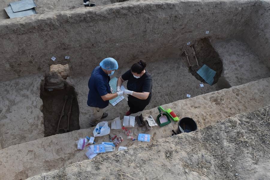
3.
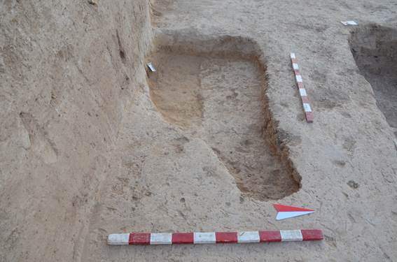
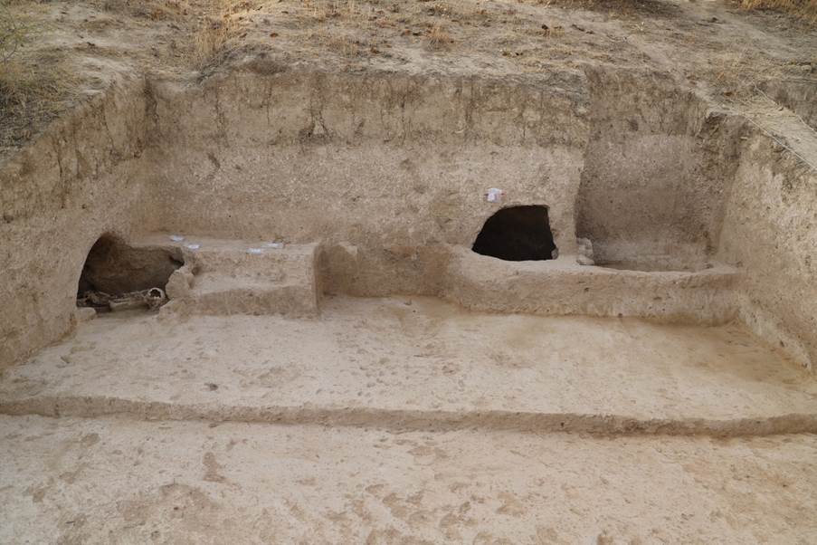
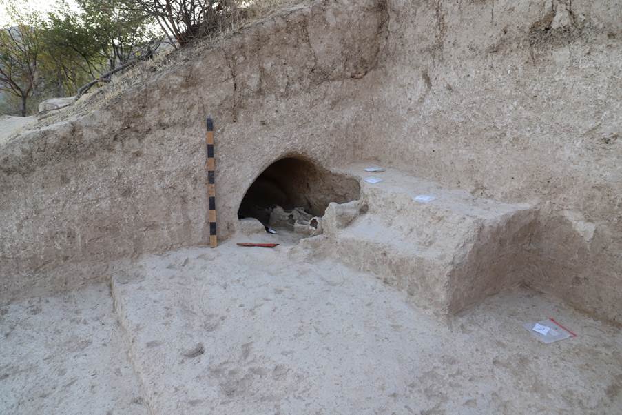
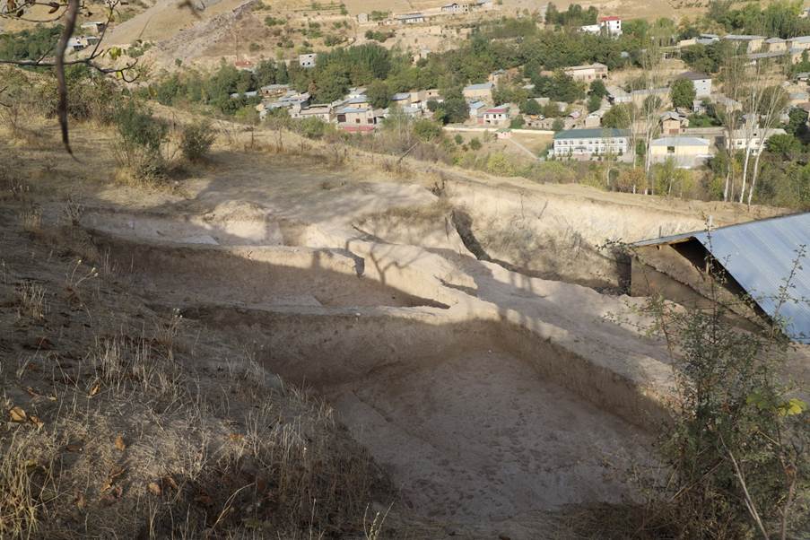
On the territory of the burial ground, an excavation was made, stretching from
south-west to north-east along the slope; the dimensions of the excavation are
22x7 m, the excavation consists of 3 terraces going down the slope from SE to
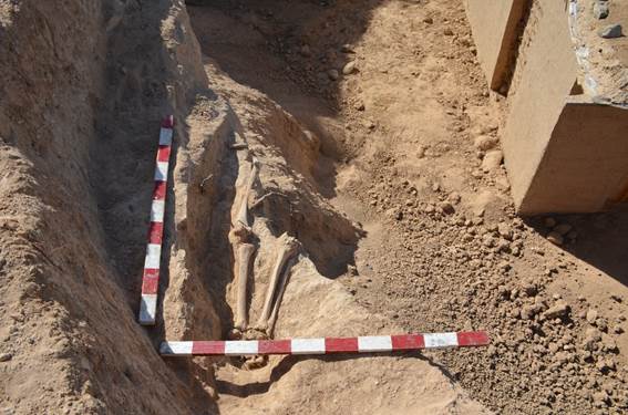
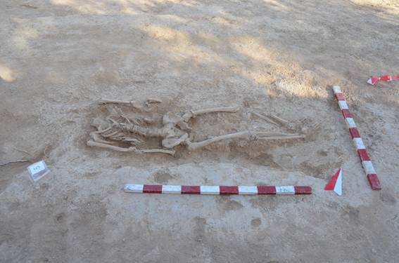
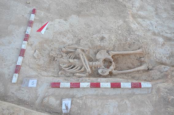
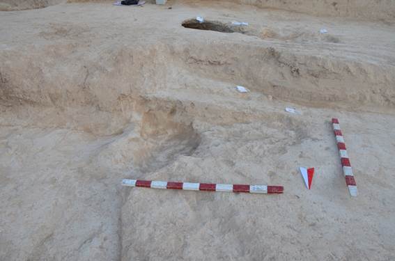
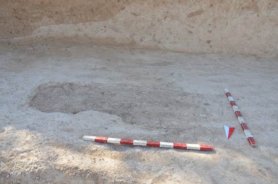
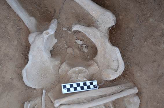
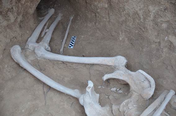
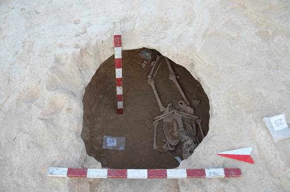
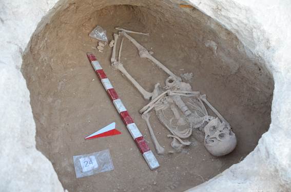
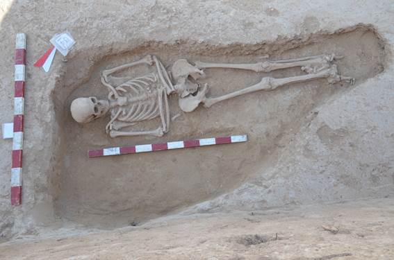
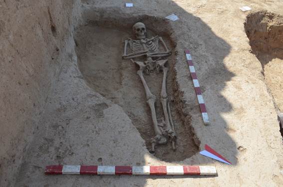
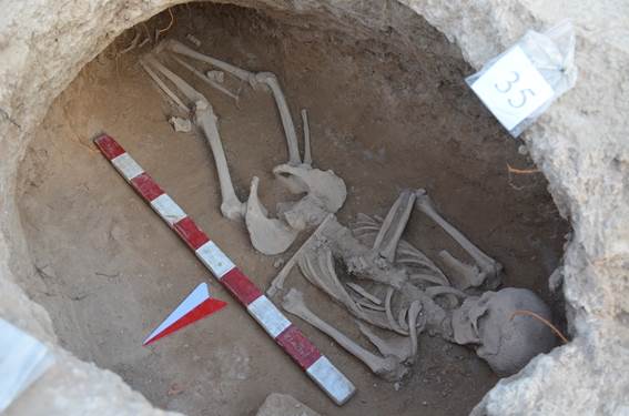
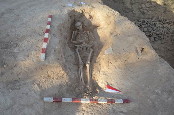
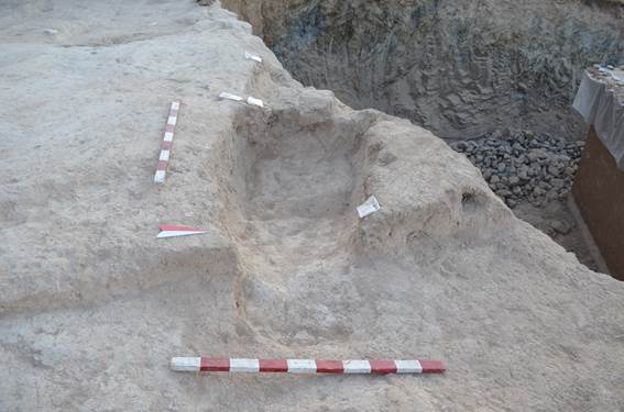
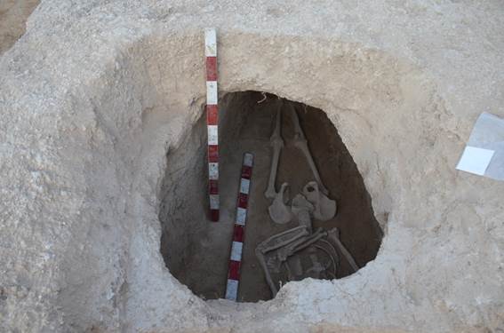
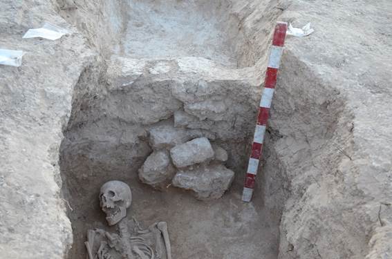
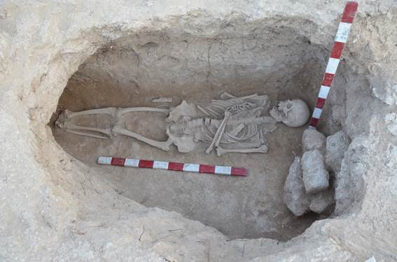
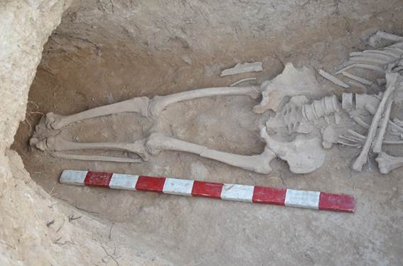
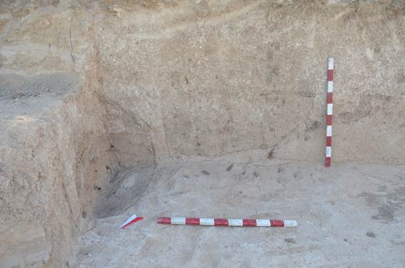
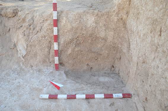
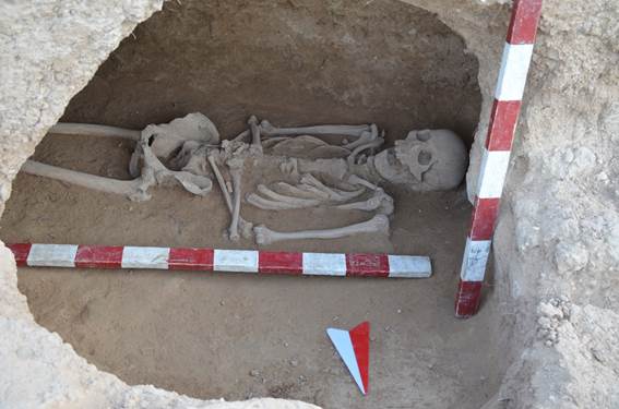
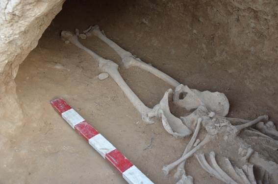
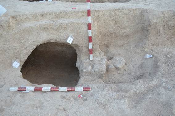
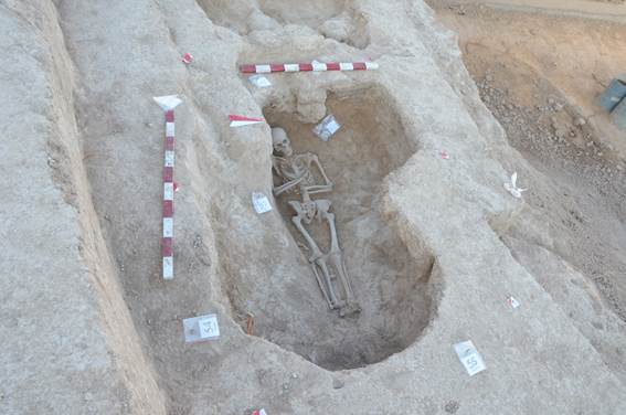
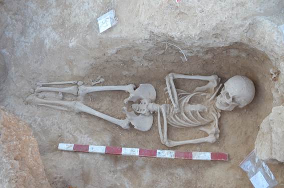
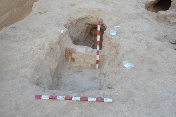
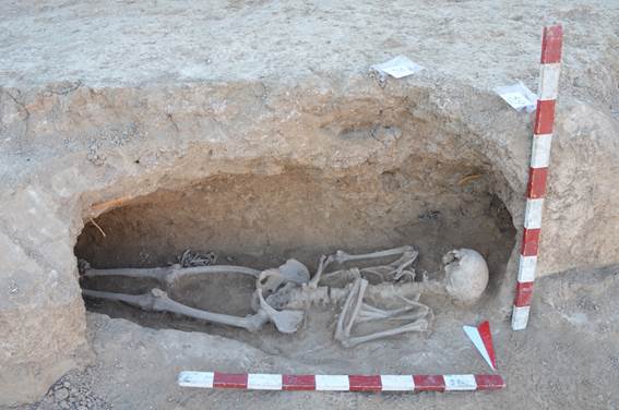
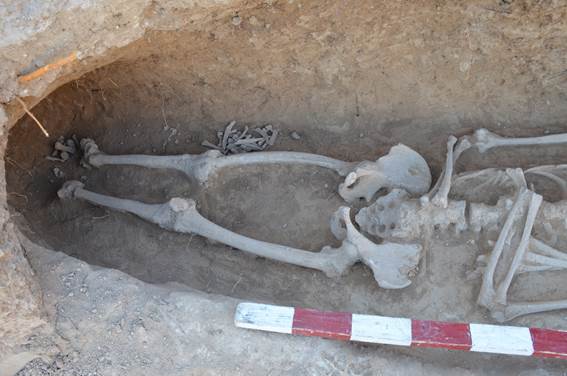
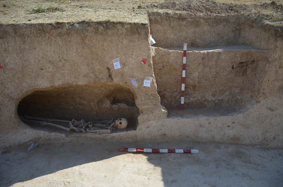
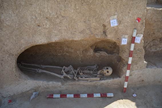
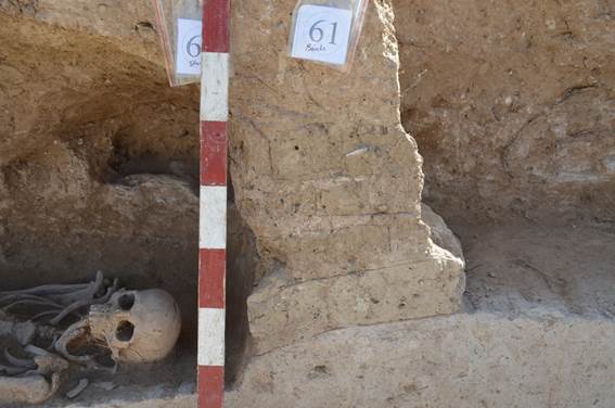
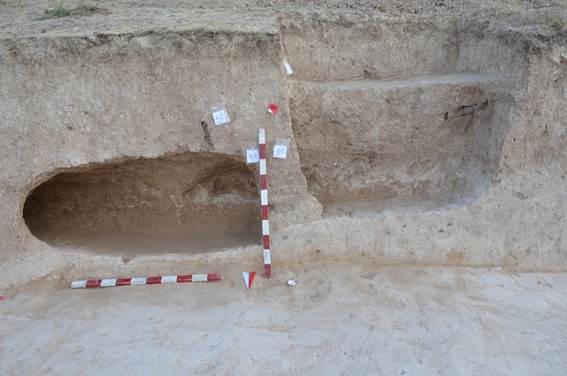
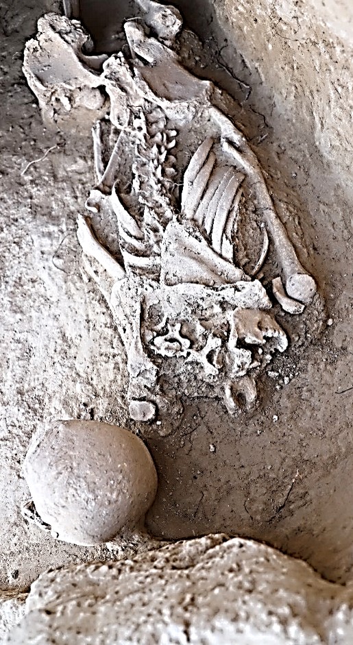
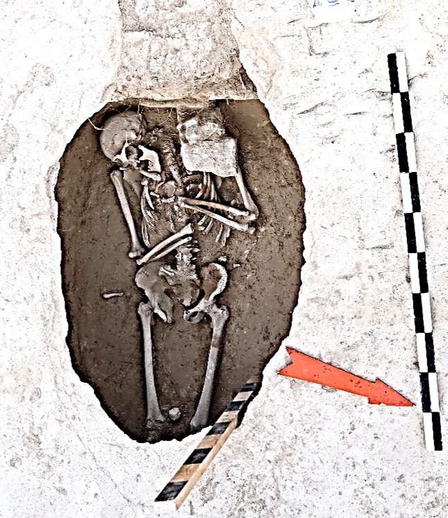
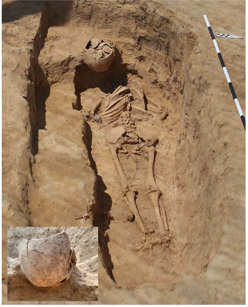
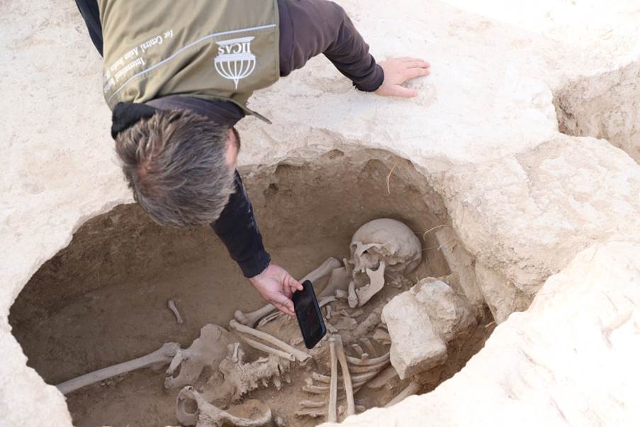
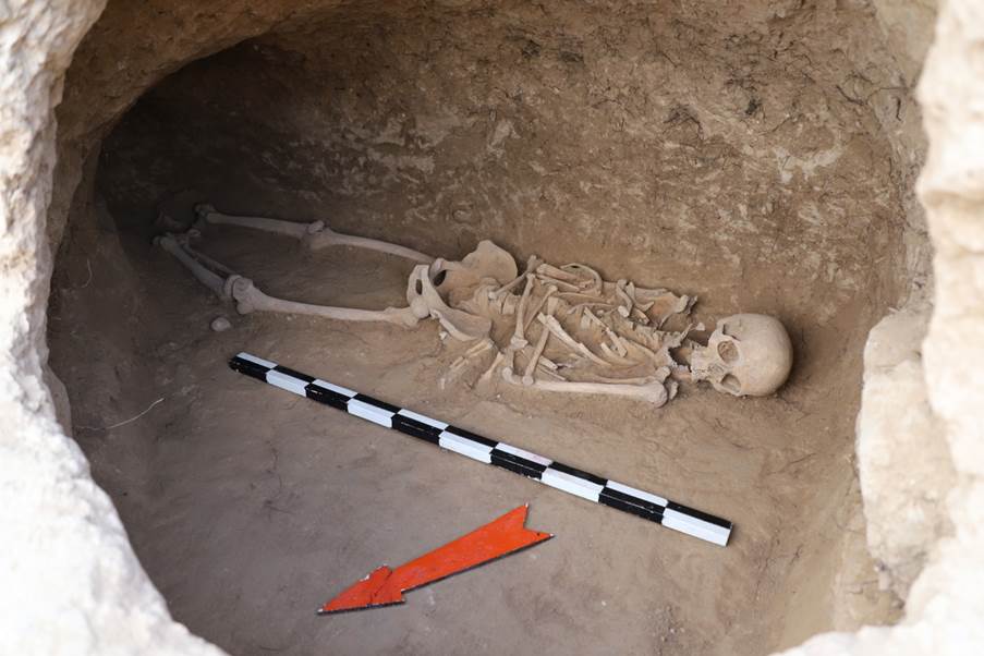
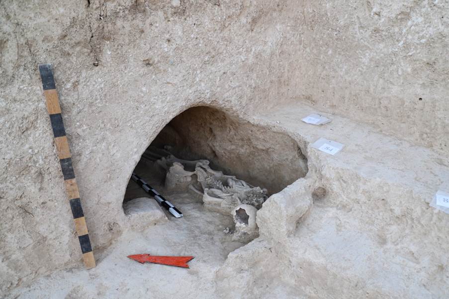
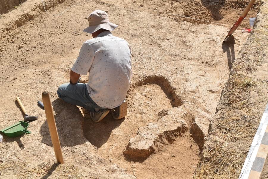
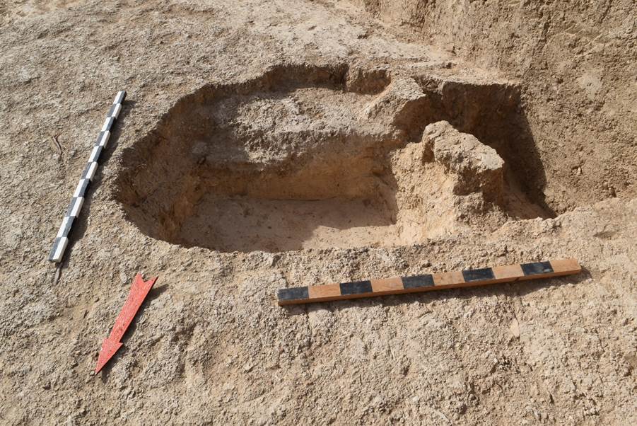
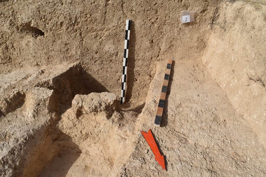
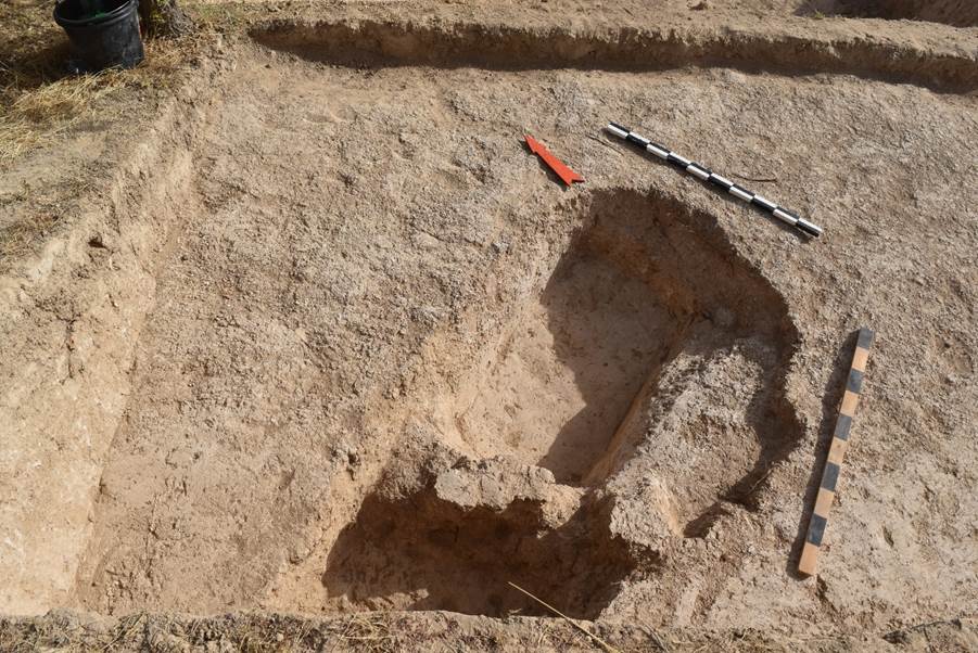
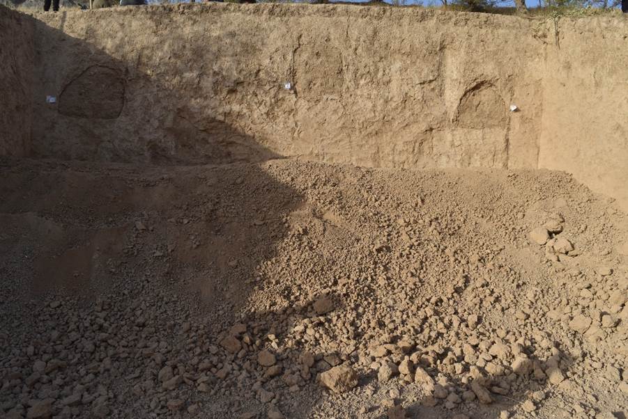
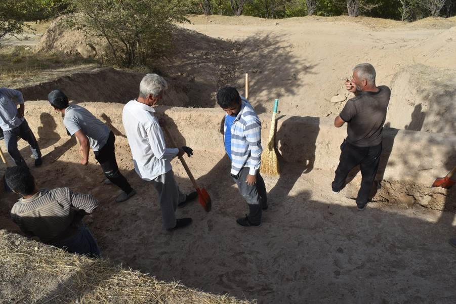
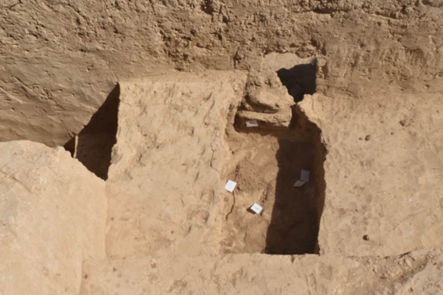
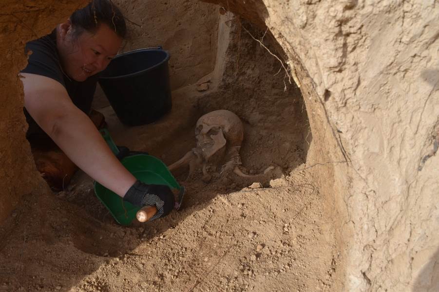
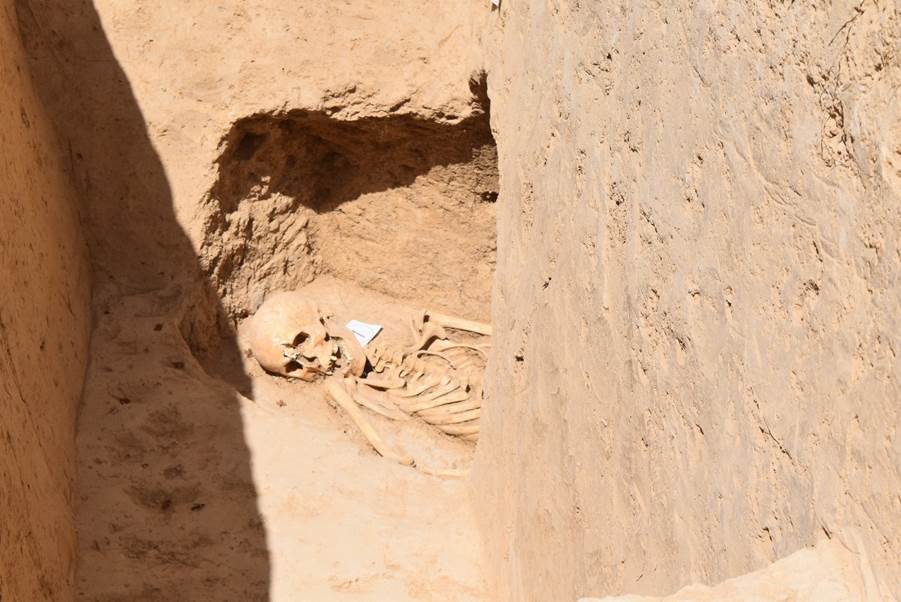
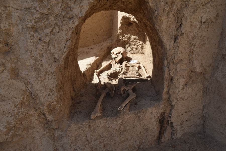
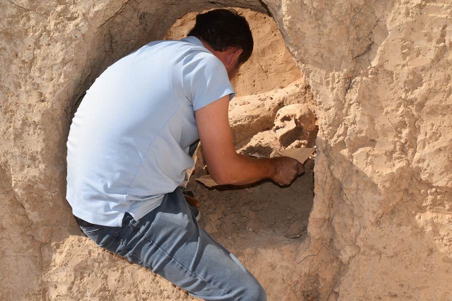
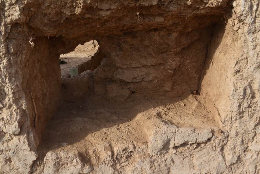
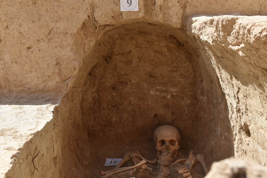
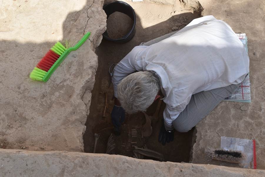
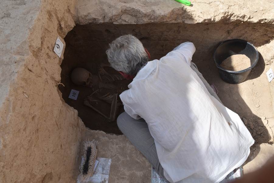
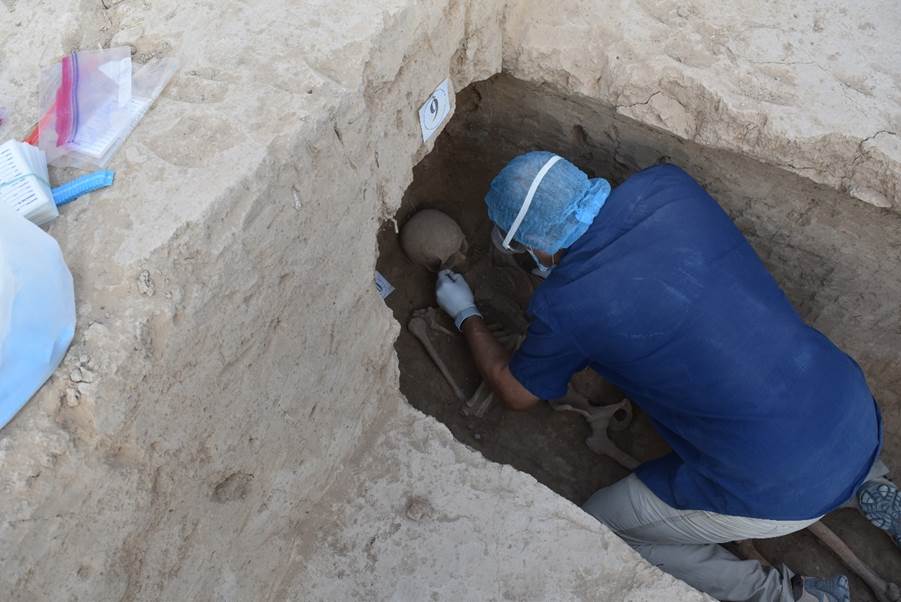
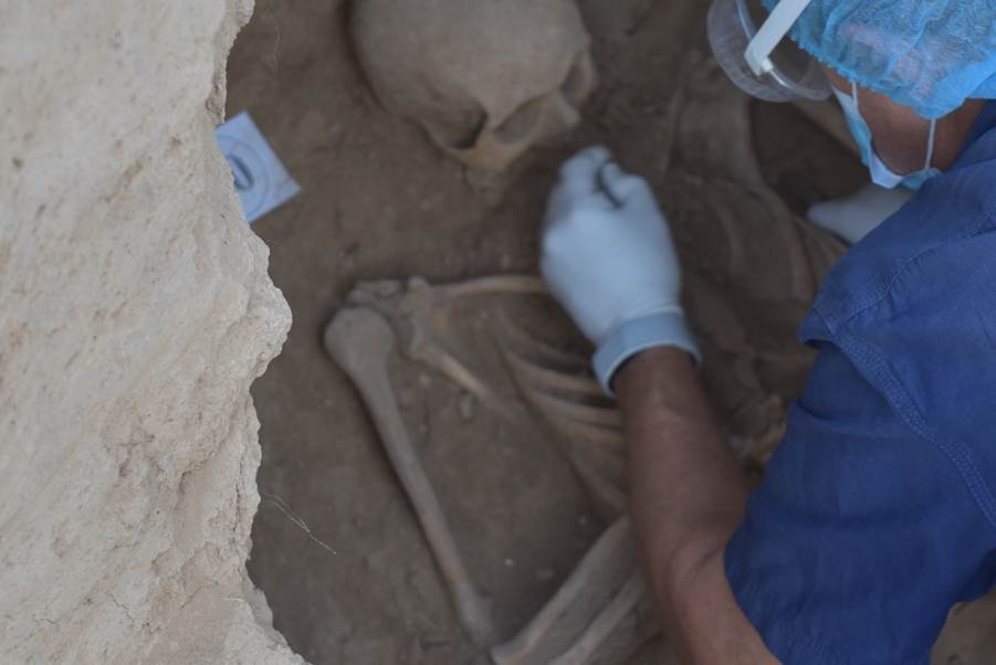
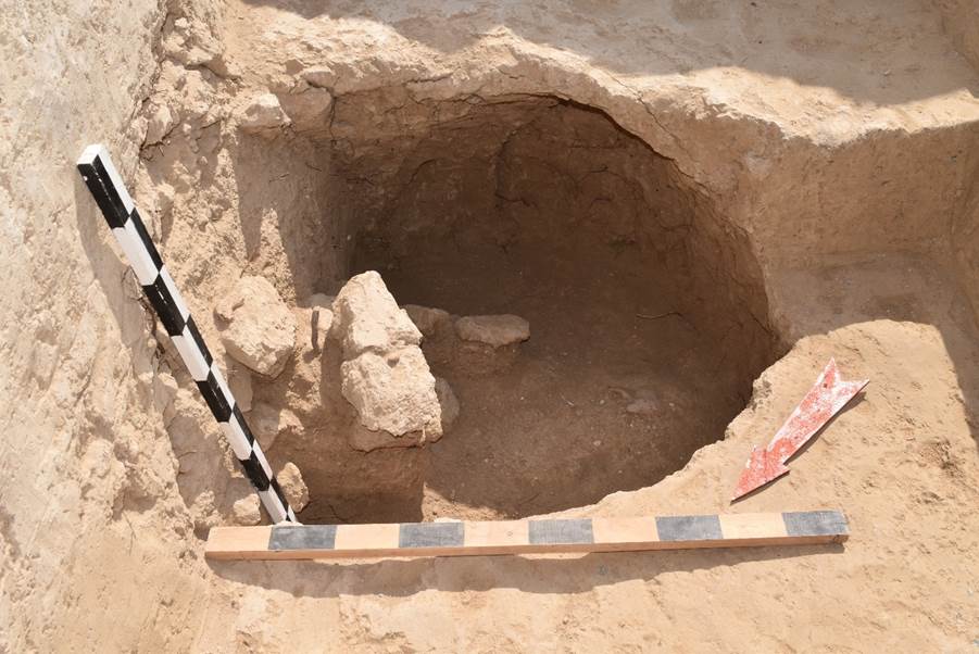
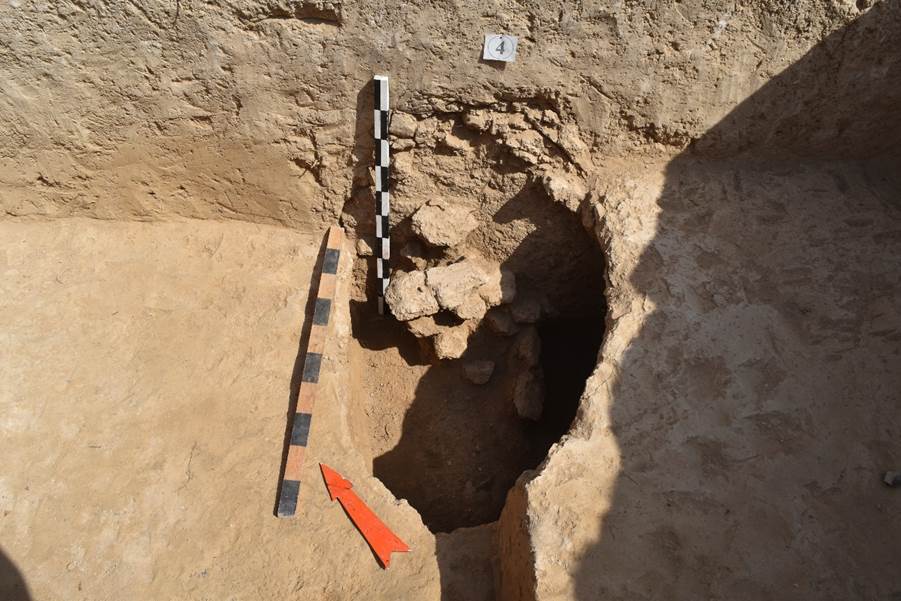
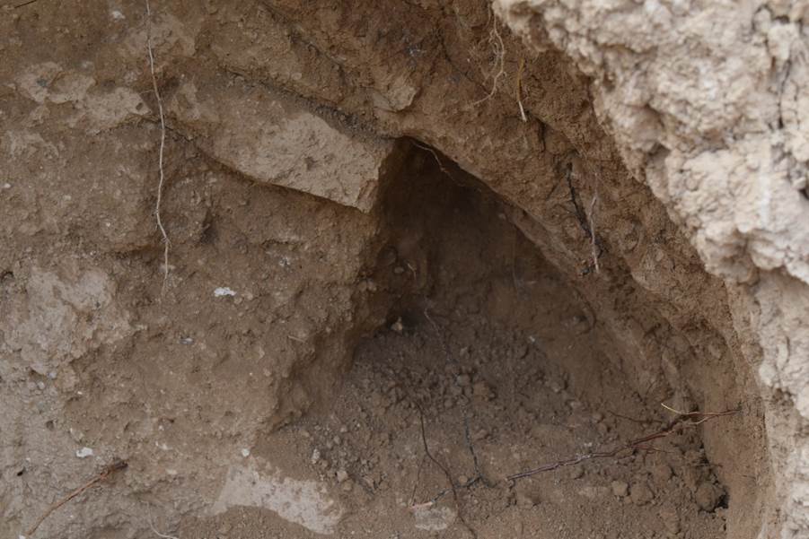
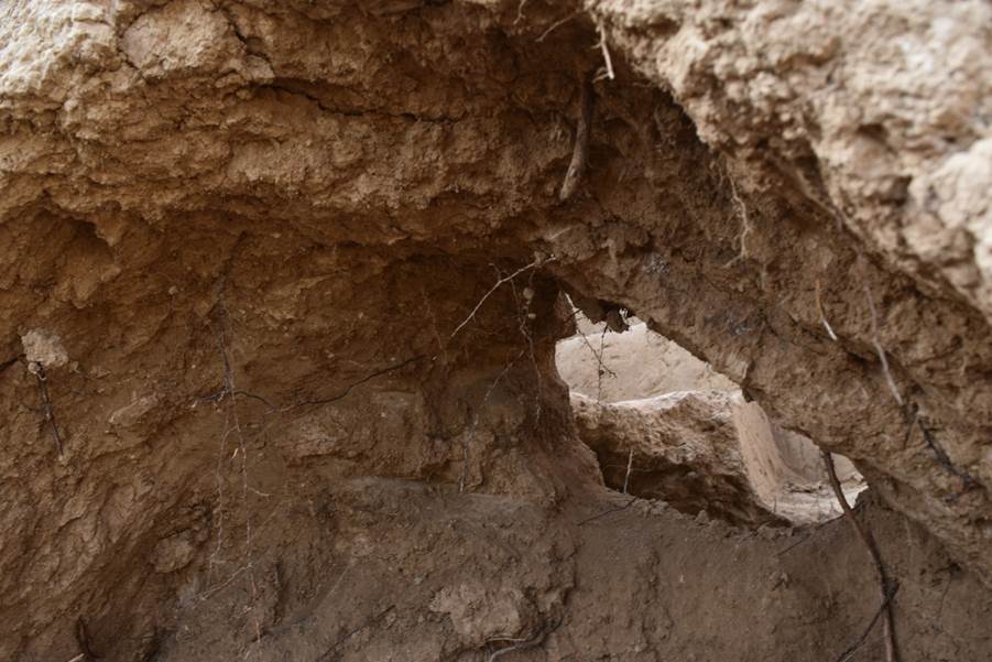
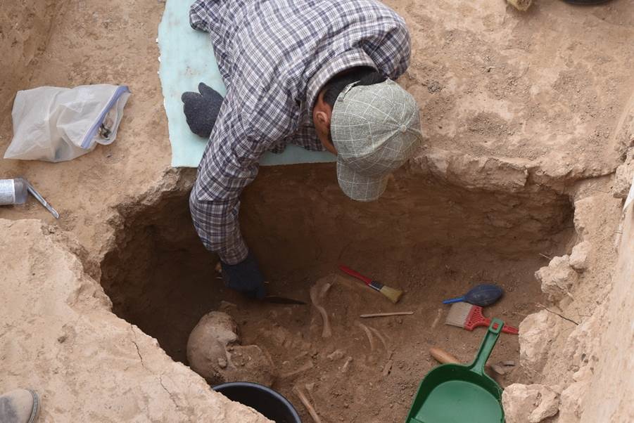
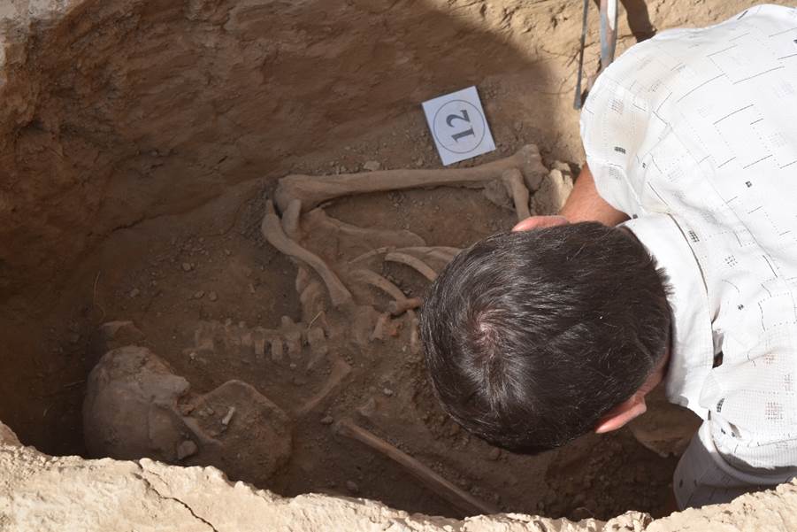
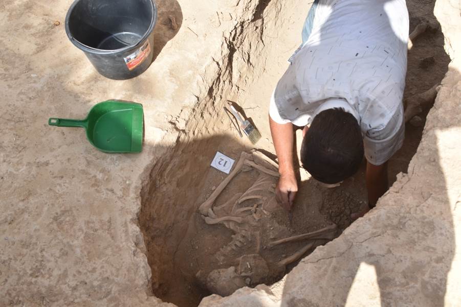
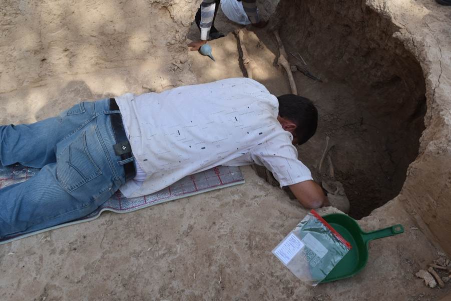
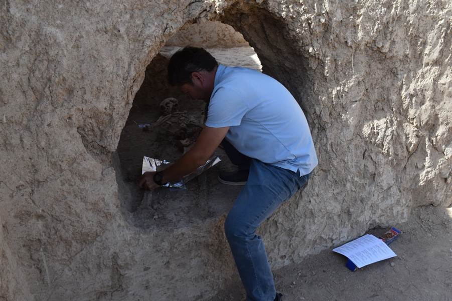
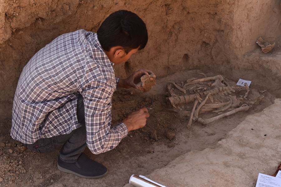
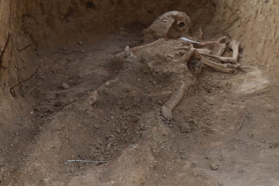
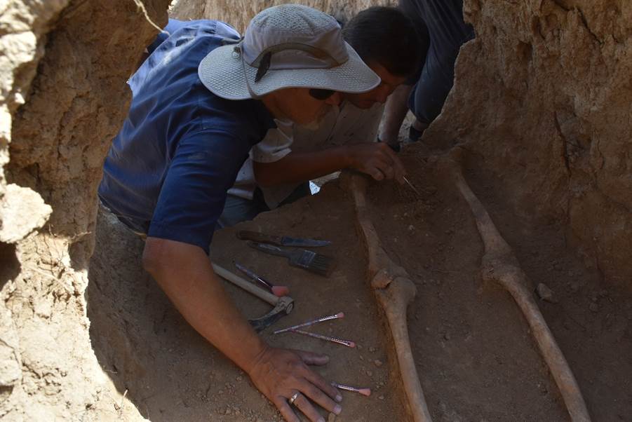
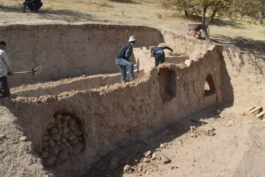
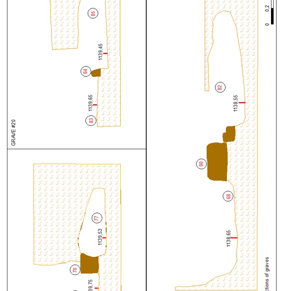
NW. In total, 17 burials were examined on the territory of the necropolis. The
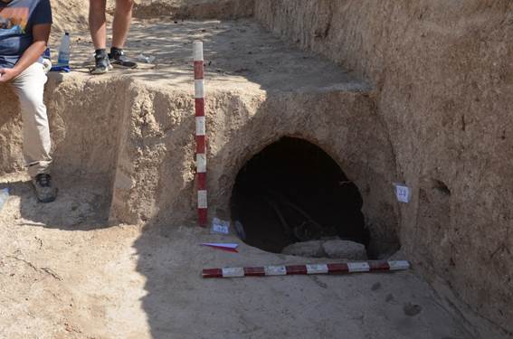
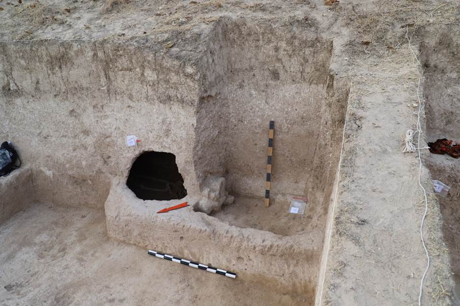
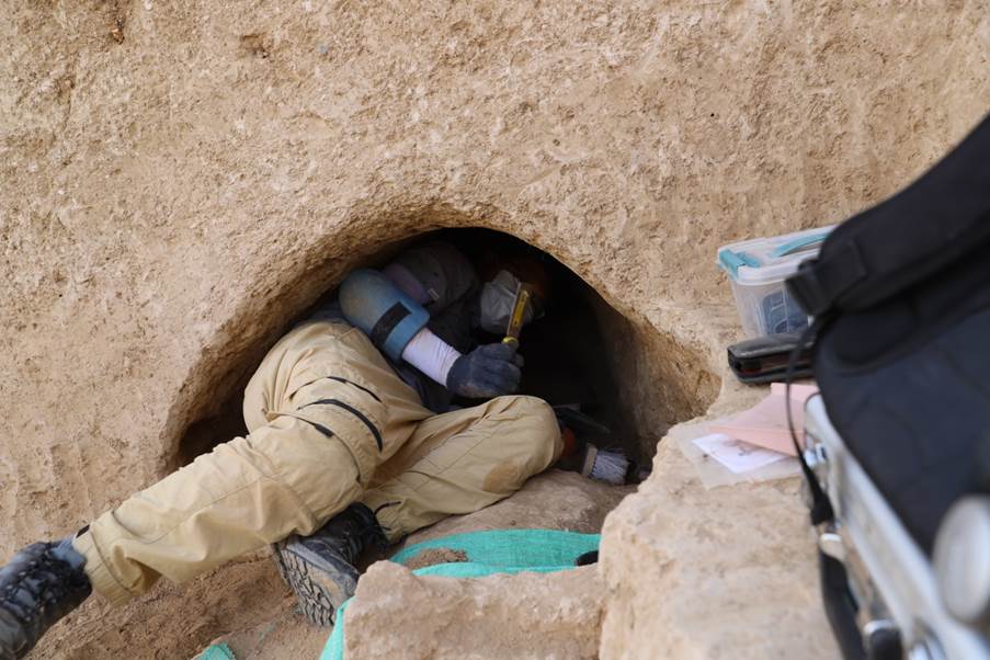
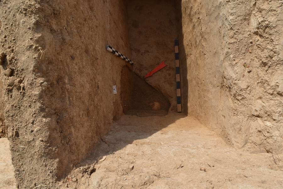
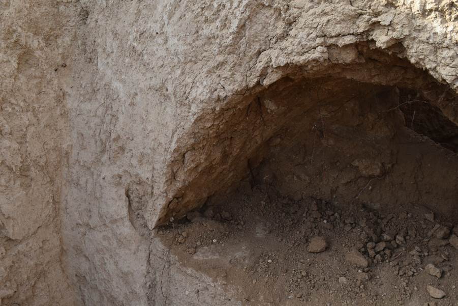
burials are oriented from west to east; structurally, the burials consist of an
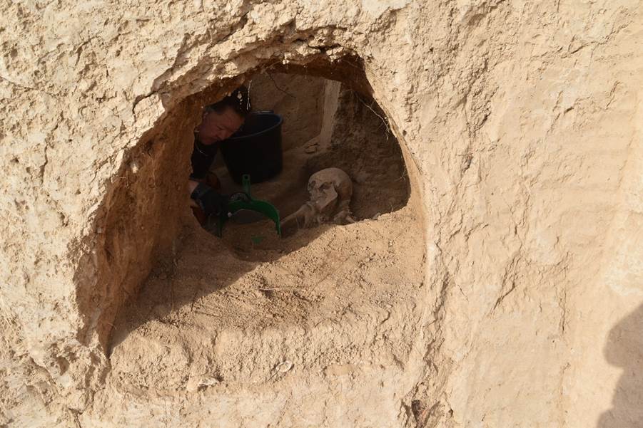
entrance pit from the east, dug to a depth of about 1.5 metres, and a burial
chamber undercut in the western direction for the entire length of a buried
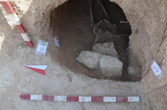
person; the passage between the entrance pit and the burial chamber was blocked
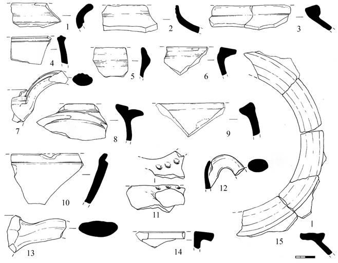
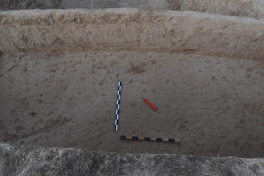
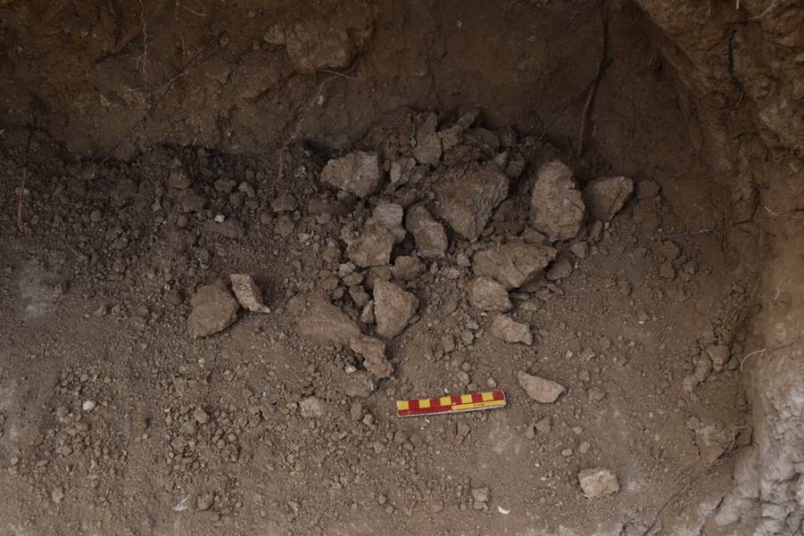
with mud bricks (see Appendix “Photos”, fig. 128-130).
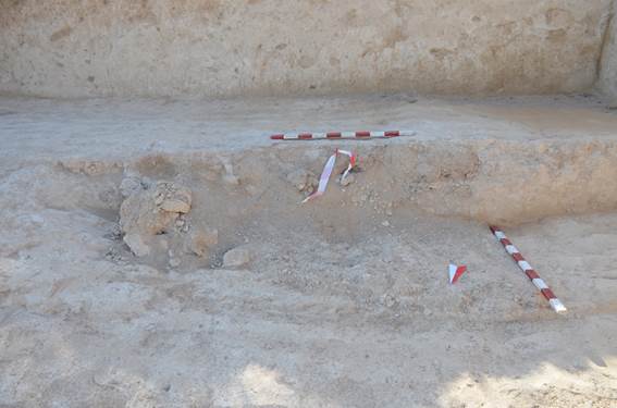
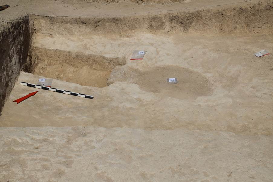
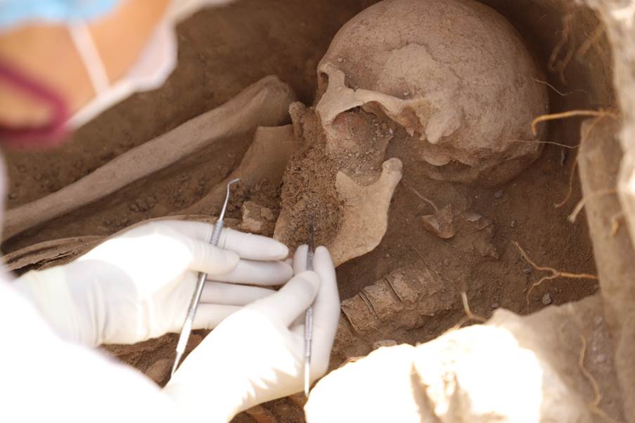
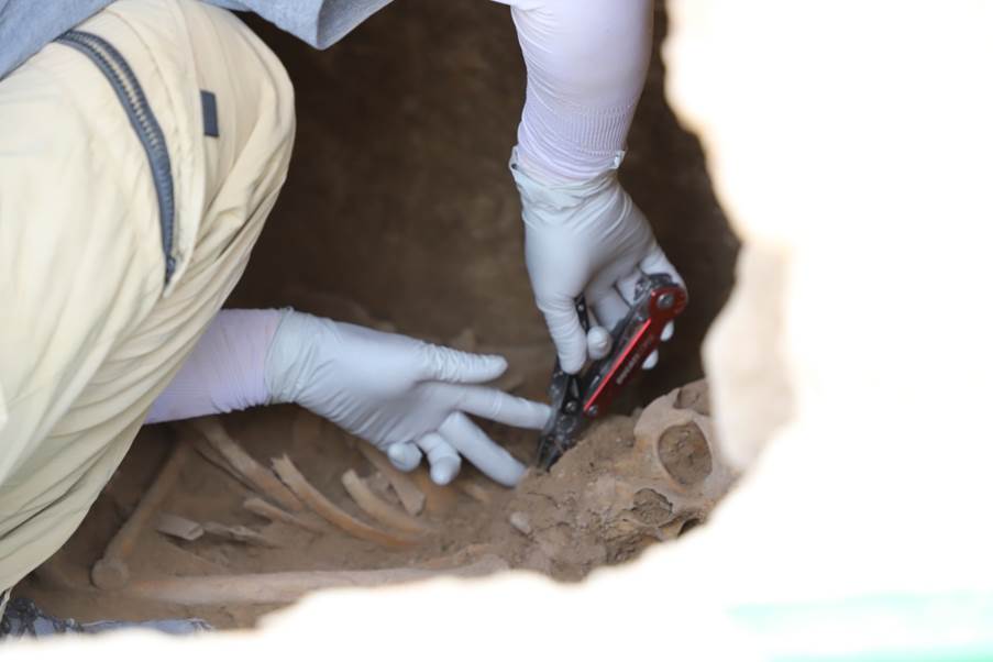
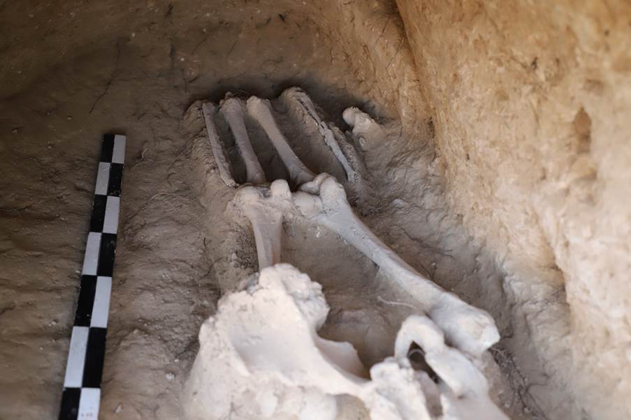
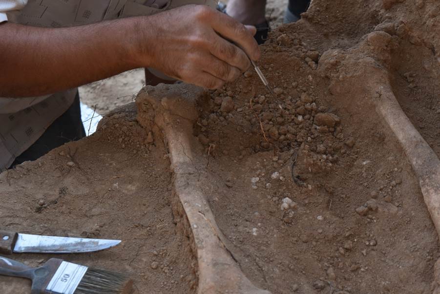
When
studying the inner surface of the burial chambers and grave pits, traces of a
tool used to dig out the soil and form the shape of a burial structure were
found – this tool most likely looked like a wooden stick with a pointed flat
plate 2 to 4 cm wide on the end.
The
burial chambers themselves were filled with soil before the passage into them
was blocked with mud bricks; soil was also poured on the floor of the burial
chamber before the body of the deceased person was placed there.
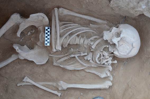
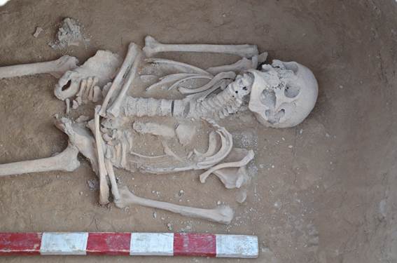
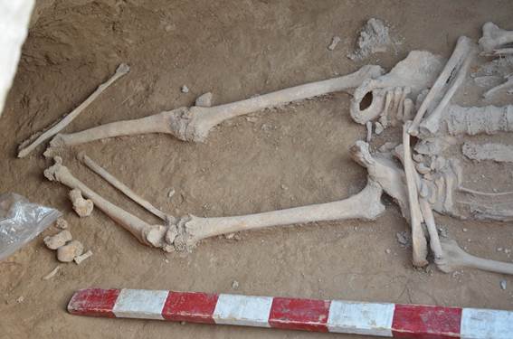
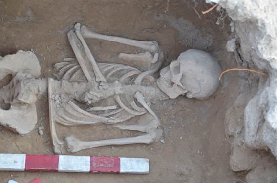
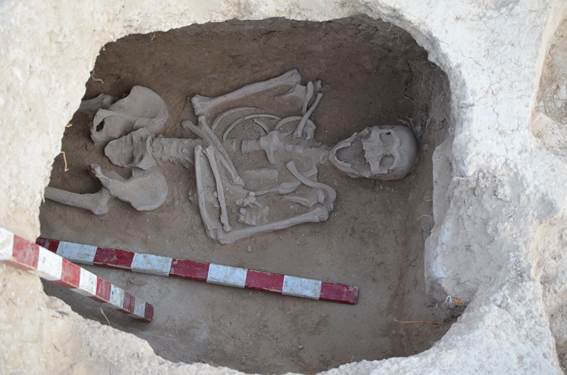
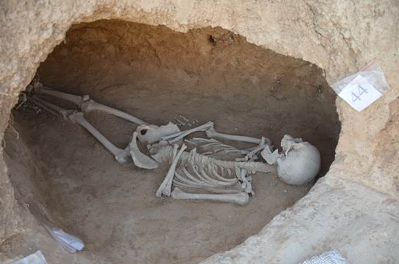
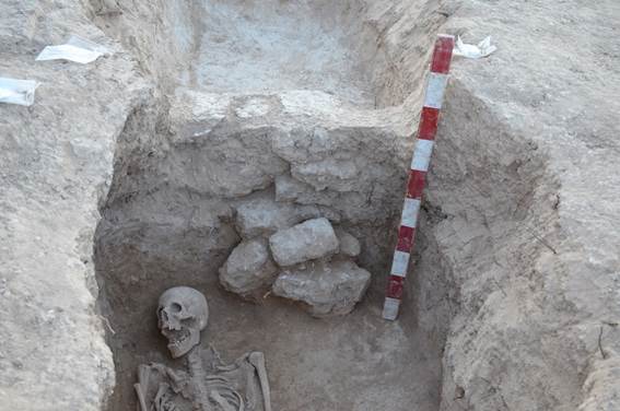
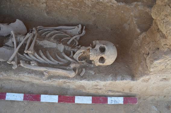
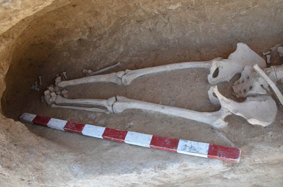
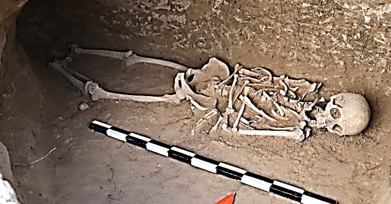
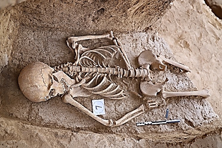
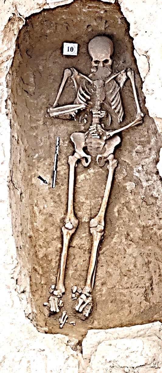
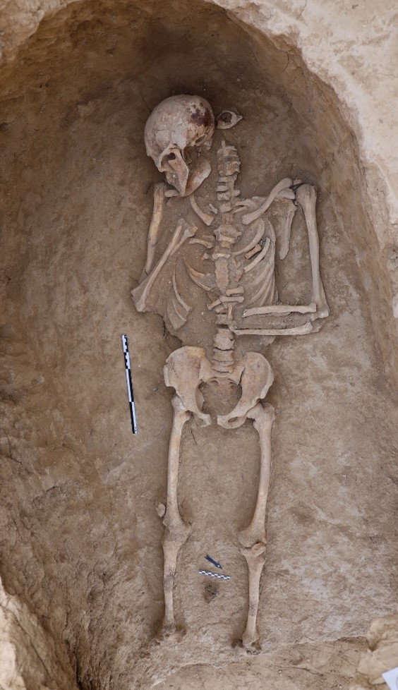
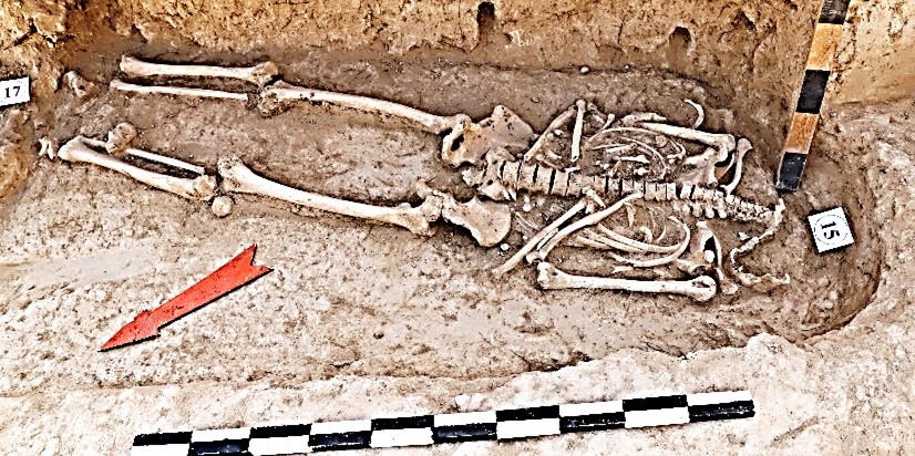
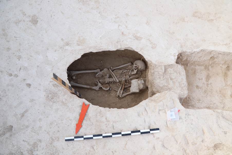
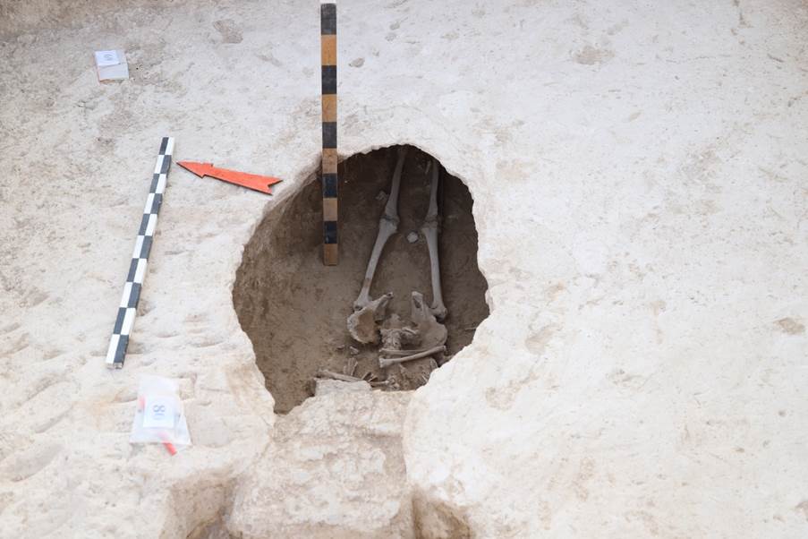
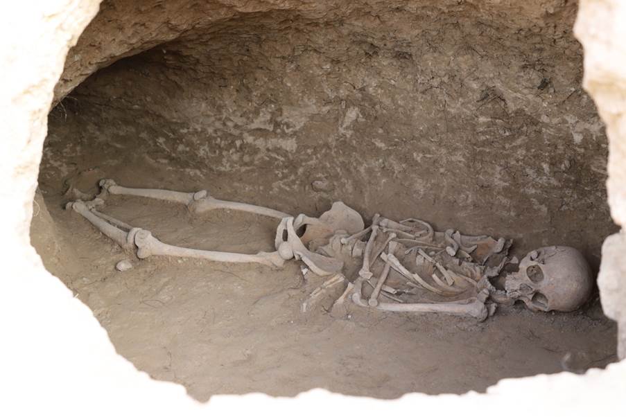
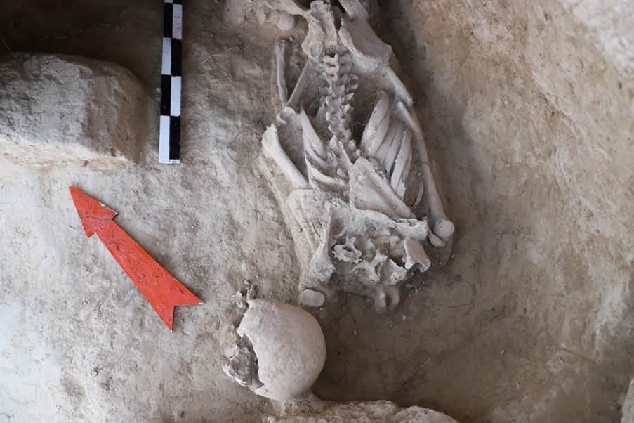
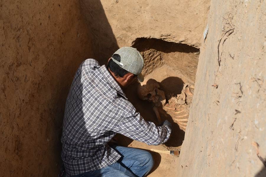
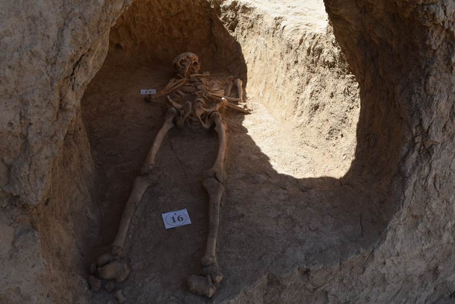
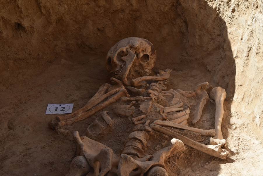
The
buried people lie on their backs in an outstretched position, arms crossed at
the waist, legs directed to the east, head to the west and slightly raised, the
face thus turned to the east. No grave goods were found; all the burials are
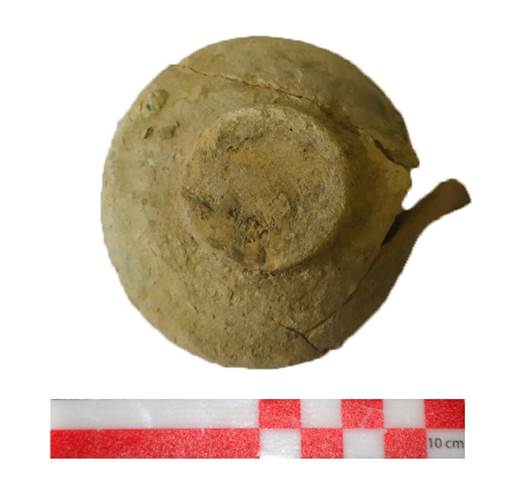
those of men; only a small ceramic lamp was found in one burial.
The
structure of the necropolis is quite definite – the burials are arranged in a
grid, the distances between them from west to east are about 1.5 metres, from
north to south about 1 metre. Some of the burials were found in the profile of
the excavation, as well as in a vertical slope next to the excavation – this
indicates that the boundaries of the necropolis extend beyond the current
excavation. Further research will allow us to get more information about the
boundaries of the monument, the study of anthropological material and DNA
analysis will allow us to better understand who lived on this territory during
the existence of the monastery and what were their living conditions.
4. Field material was processed:
o The finds were processed – descriptions were provided, drawings and photographs were made;
o Drawing documentation was prepared, which included schematic maps, plans of excavations and individual elements, cuts, stratigraphic profiles, altitudinal plans;
o A description of all excavation elements was prepared in accordance with the Ancient Merv Site Manual, Edited by Tim Williams, UCL, 2007
o All burials were described and a field description of anthropological material was made;
o All materials were packed and, according to certificates, forwarded to the Samarkand Archaeological Institute named after Ya. Gulyamov.
5.
The nearby mountains were inspected for rock inscriptions dating back to the
time of the monastery. Discovered inscriptions were already known and described
earlier; no new inscriptions were identified. This work will be carried out
more thoroughly in the following years. There is a plan to prepare cartographic
material with the locations of inscriptions, conduct detailed documentation, including
photo records, create three-dimensional models of surfaces, on which
inscriptions are applied, translate and interprete them (see Appendix “Photos”,
fig. 133-156).
Excavation Methodology and Equipment Utilized
Based on these goals and objectives, an expedition was organized which included several specific groups and specialists who were responsible for carrying out the planned excavation which included the following:
An international team of archaeologists. The task of this group was to carry out a series of investigations which involved the clearing and discovery of building structures aimed at providing detailed analysis of the cultural layers and cultural material including the discovery and analysis of materials from the ceramic and osteological collections; materials from metallurgy; and other artifacts.
Also, this group collected samples for carpology, palynology, C-14 and flotation using generally accepted guidelines.
A surveying team. This team carried out the documentation of the entire process of archaeological investigations with the analysis of the results of the data obtained through the study of individual components of the monastery and the graveyard by using advanced geodetic equipment. The resulting work of this group involved the construction of 3D models of the excavation sites; the creation of ortho-photomaps and stratigraphic profiles; detailed excavation plans; microtopography; and the development of plans which locate topographically the discovered materials.
Documentation was carried out using a Leica TCR-407 total station with subsequent data processed in the AutoCAD and ArcGIS environment in parallel with photographic recordation of building structures and photogrammetry utilizing a DJI Mavic 2 Pro unmanned aerial vehicle.
In the process of conducting preliminary aerial photography, the following tasks were performed:
Preparation of the site by clearing the areas of grass and underbrush which creates difficulties in scanning. In addition, the site was cleared of modern household waste (glass, metal, etc.)
A breakdown of the entire excavation area into sections/units was made. The findings are reflected in the appendix of this report.
A team of ceramic technologists was formed for the task of processing the cultural material to study the production technology and provide a description of the ceramic collection and other discovered materials; draw the ceramics and other finds and record them in a spreadsheet of arranged tables. This team also reconstructed ceramic vessels and collected statistical data.
A team for logistical processing. The task of this group was to process the discovered cultural materials of the ceramic and osteological collections, as well as metal products and other artifacts by means of washing and cleaning ceramic and osteological materials in compliance with the conditions and the storage location. Metallic materials were processed in accordance with methodological recommendations and interpreted by specialists. All materials were carefully processed, labeled, and described with an individual serial number for each piece of material. The obtained data is displayed in the appendices of this report.
The main priority involved the implementation of the planned activities for the analysis and documentation of materials and elements of the building structures of the area of occupation discovered during the archaeological excavation.
The cultural material found as a result of the abovementioned investigations were assigned a special serial number and special finds were measured using the theodolite-tacheometer and coordinates were obtained in the UTM system. These materials are displayed on the excavation top plan. All the material discovered as a result of the excavation have been carefully processed and cleaned in controlled conditions.
On the basis of the description and photographic record of the cultural materials from the excavation, a collection inventory was created, a general record was made, and statistical data of the revealed materials were established. Then, these materials were documented, packaged, and prepared for transfer in accordance with documentary regulations.
Once the excavation identified and cleared the building structures or graves, descriptions were made of the identified components followed by design and drawing documentation.
This particular work was carried out by documentary
specialists who know the latest methods and modern technologies in the field of
geodesy and planography. In the course of this work, drawings of the identified
elements, a general view of the excavation, and stratigraphic profiles were
created.
The methodological basis of the excavation was conducted with the following components:
o Excavations across wide areas;
o Layer-by-layer and elevation recordation of the work performed;
o Development of a detailed plan of the identified structures using electronic tacheometers;
o A methodical, comparative analysis for the study of finds;
o A recordation method for establishing the stratigraphic and planographic situation;
o A method of including archeological features into a geographic information system (GIS) for their precise positioning in space relative to each other and the landscape background.
The collection of documentation is based on a system developed by specialists from the University of Aachen under the guidance of Professor Michael Jansen and Dr. Thomas Urban. This system is based on the completion of specially designed forms, whereby a certain level of data collection is achieved. While the presence of a field diary does not serve as the basis for reaching the desired level, the researcher is presented with a series of so-called forms.
The "Main form," providing a general description of a site or a separate excavation, as well as a description of plans, goals, objectives and ways to achieve them.
An "Action sheet" is a type of field diary, in which the researcher enters daily information about the actions performed, as well as about the objects found, sizes, etc.
“A Locus Sheet” is a detailed account of each feature detected, the layer removed, or a specific feature noticed, etc., and is called a "locus" followed by being assigned a locus number.
"Find Tag or Label" is a form that is set up specifically for certain finds that are clearly different from the bulk of the excavated material.
A "Photograph Log" is a type of database with a catalog of photographs taken during the excavation, indicating the location, the direction of the shot, followed by a brief description, etc.
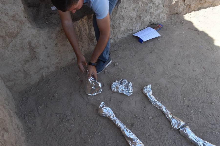
When human remains are discovered, an “Osteological Worksheet” is completed that aids the archaeologist in the process of examining the features of the burial and skeletal remains to provide rudimentary and preliminary identification of sex and age for adult remains. Our team does not have an osteoarcheologist or forensic scientist, therefore, any conclusions concerning human remains need to be considered as preliminary and in need of further examination by a specialist.
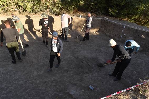
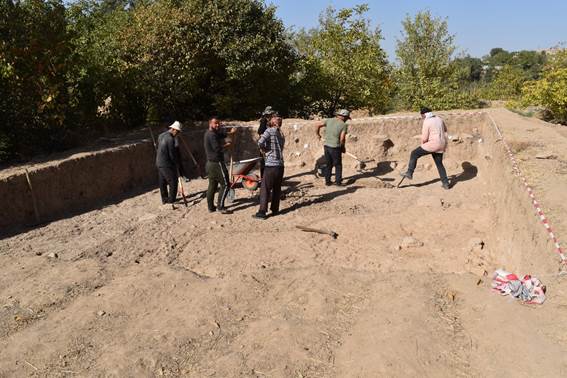
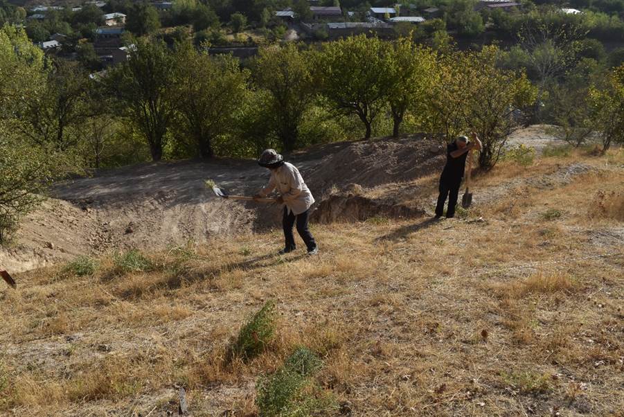
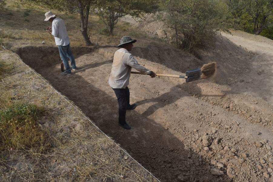
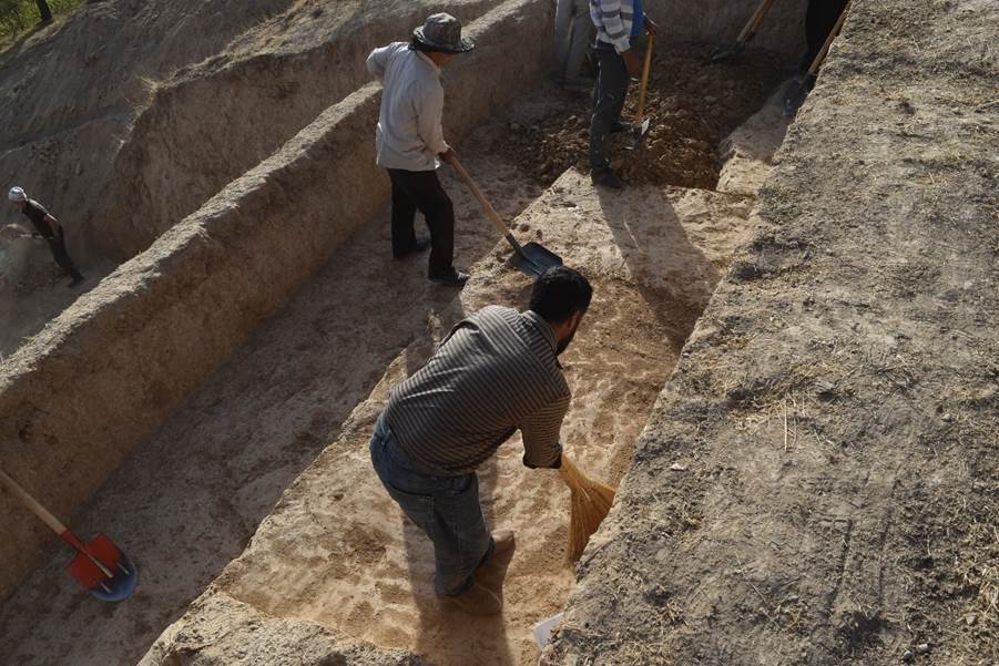
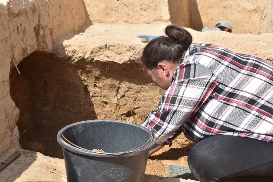
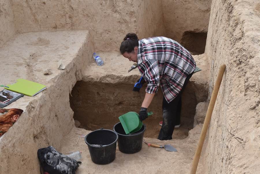
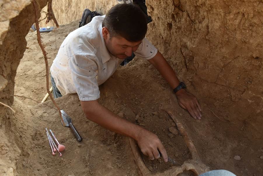
The team also included a brigade of local workers from the Urgut city itself who assisted with excavation, photography, soil shifting, and recordation. Excavation involved the use of shovels, small hand tools, trowels, and dental tools.
A metal detectorist was also used in controlled conditions to assist excavators with metal finds. Findspots were carefully recorded using the total station.
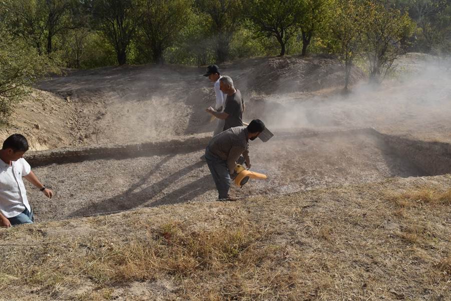
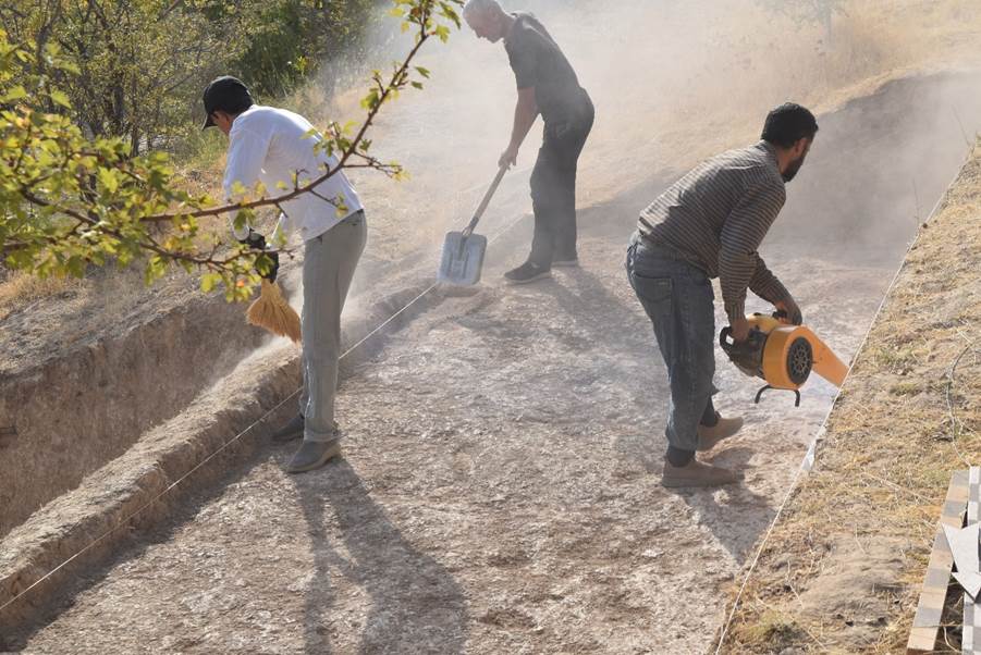
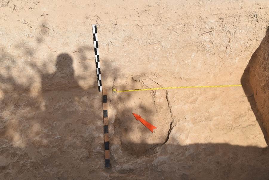
The sandy-loam soil at graveyard provides unique challenges to excavators. For example, the medieval mudbricks have the same color, consistency, and texture as the surrounding soil; to the untrained eye, mudbricks sometimes become invisible. Likewise, after excavation, the soil dries out and, especially in direct sunlight overhead, the distinction between features (cut, fill, layers, and mudbricks) can disappear. That is why the best visual analysis of units, as well as site photography, occur immediately after excavation while the soil still has moisture. Also, in the early morning, when the soil is less dry, and the sun is at an oblique angle, archaeological features are more visible. Moreover, during the day, when the soil dries out, a thin layer of fine dust forms on the surface and, if there is wind, this dust covers the units, thus obscuring the subtle distinction between features. Usually, sweeping with a hand brush and removing the dust solves this problem; however, the dust sometimes hovers in the air and soon new dust forms on the surface, sometimes caused by sweeping. In response, several techniques have been developed by the IICAS team to mitigate these issues.
The basic tool for excavation is the flat sharpened shovel and unsharpened trowel. The shovel is used to “shave” thin layers of soil both in a horizontal and vertical manner; by carefully scraping with the shovel, excavators can level transects and clarify sections. Likewise, the trowel is used to scrape the soil evenly and in a controlled manner, revealing changes in soil color and texture, and objects. In examining nuances, we use the Munsell Color Chart to classify differences of the soil. Smaller tools such as dental picks and hand brushes are used when artifacts and faunal remains are detected. Loose soil is removed by sweeping with the hand brush and, with a dustpan, soil is placed within a bucket. Depending on the unit, the soil is then sifted through a screen; otherwise, the loose soil is placed in a wheelbarrow and deposited on the soil heap. Always prior to photographing the excavated area and analysis (field-note writing), hand brushes are used to clean the troweled units. Sometimes it is necessary to use a fine-mist water-sprayer to evenly (and gently) rehydrate the soil; this method has become essential in distinguishing between soil and cultural features, especially regarding the pit burials during the afternoons. Likewise, sometimes it is necessary to use a mechanical leaf-blower to blow the fine dust away from surface of the excavated units—this method is only used by our site directors or under close supervision. The leaf-blower has a secondary advantage of clearing away the fine dust that is in between the mudbrick courses; and, in the case of the buildings, the leaf-blower reveals the distinction between the clay plaster that coated the walls, soil fill, surfaces, and mudbricks.
The following field report provides descriptions of each excavation unit and their revealed stratigraphy; discovered archaeological features (designated loci); artifact descriptions, photographs, and drawings including grave goods; and selected descriptions of special finds, field forensics and initial data from the graves excavated.
Excavations and Units Descriptions
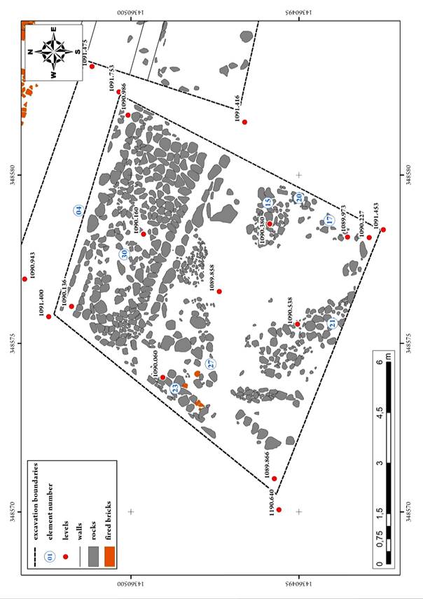
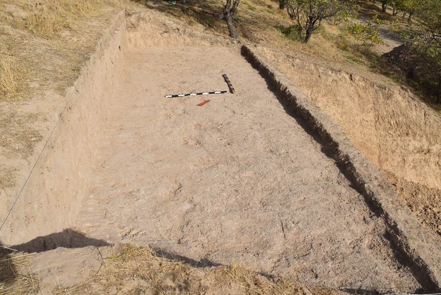
Excavation ST (monastery)
In 2022, archaeological excavations were resumed on the territory of the previously partially excavated medieval Christian monastery Suleyman-tepa. Three excavations were made on the territory of the monastery: excavation No. 1 was outside the monastery in its south-western part, the excavation has a trapezoidal shape, stretching from north to south, dimensions 8x7 m: excavation No. 2 is located east of excavation No. 1, also outside the monastery; it was made on the site of an old test trench, which was expanded to the size of 4.7x2.8 metres and stretched along the WE line; excavation No. 3 is located inside the monastery along the southern wall (dimensions 10.5x0.5 m) (see Appendix “Photos”, fig. 1-5, Appendix “Drawings”, fig. 32).
List of elements
Element 0.
Element 1. A layer of very dense lumpy layered loam, greyish-brown in colour.
Element 2. A layer of dense lumpy-layered loam, grey, grey-brown in colour.
Element 3. Collection of vessel fragments.
Element 4. A heap of stones in the northern part of the excavation near the wall.
Element 5. Accumulation of stones and chips of burnt brick near the eastern stratigraphic wall.
Element 6. Accumulation of bones and ceramics at the western stratigraphic wall of the excavation.
Element 7. Ash pit in the north-eastern corner of the excavation.
Element 9. Dense loam of light grey colour.
Element 10. Gravelly-loamy bright grey layer (lens).
Element 11. A layer of light brown lumpy loam.
Element 12. A layer of dense, light grey loam
Element 13. A layer of bright brown lumpy loam.
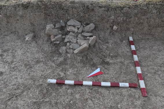
Element 14. Chaotic heap of stones and fragments of burnt bricks.
Element 15. Accumulation of stones and fragments of burnt bricks.
Element 16. A layer of lumpy, bright brown, sandy loam.
Element 17. A layer of lumpy loam, bright brown colour, with the inclusion of fine crushed stones.
Element 18. A layer of lumpy, brownish, bright brown colour, with the inclusion of small crushed stones, rock stones.
Element 19. A bulb-shaped spot with organic contents in the north of the excavation.
Element 20. An accumulation of rock stones in the eastern part of the excavation.
Element 21. An accumulation of rock stones in the southern part of the excavation.
Element 22. Accumulation of fragments of vessels.
Element 23. An accumulation of rock stones in the western part of the excavation.
Element 24. An accumulation of stones in the north-western corner of the excavation.
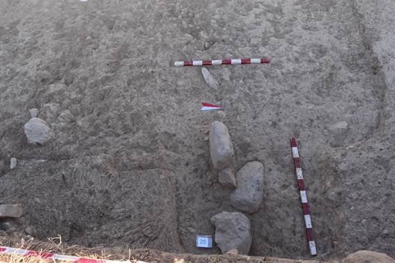
Element 25. Loam-stone structure – border.
Element 26. An accumulation of stones in the north-western part of the excavation
Element 27. A layer of grey loose lumpy loam
Element 28. A layer of thick light grey loose lumpy loam
Element 29. Light yellow dense alluvial loam.
Element 30. Boulder pavement along the northern wall of
the excavation.
Element 0
Element description
The surface of excavation 01 is an artificial terrace created for agricultural use.
The terrace slopes slightly westwards.
The surface of the terrace has traces of irrigated beds stretching from north to south. The depth of irrigation beds is 10-15 cm. No fragments of ceramics and bones were recorded on the surface during the marking and at the beginning of the study.
Code ST_22_01_01
Element 1
Element description
A layer of very dense lumpy layered loam, greyish-brown in colour.
A layer of very dense lumpy layered loam, greyish-brown in colour. The density of the layer is probably associated with agricultural activity and periodic watering.
In the layer there are mainly fragments of red clay ceramics, a small number of sheep and goat bones.
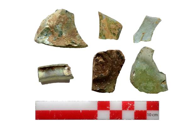
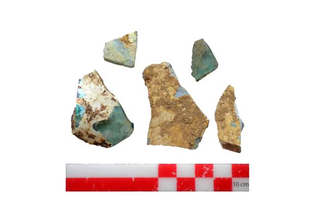
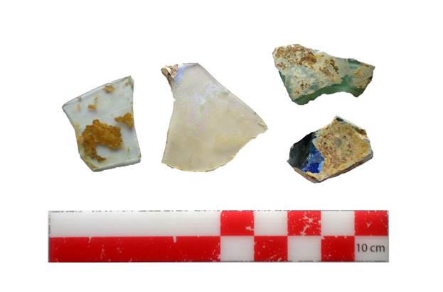
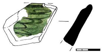
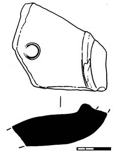
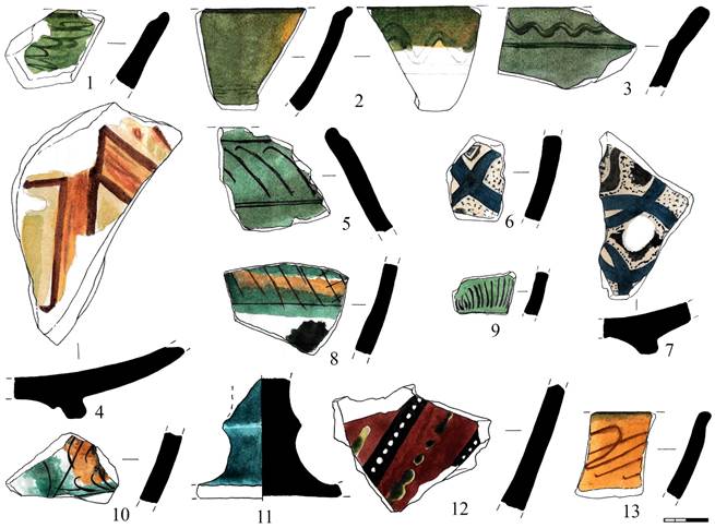
In the north-western corner of the excavation, a fragment of ceramics (St_22_01_01_01) covered with blue and brown glaze and a ceramic fragment coated with green glaze (St_22_01_01_02) were found.
A fragment of green glazed ceramics (St_22_01_01_03) was found in the south-western part of the excavation.
In the south-western part of the excavation, two fragments of glazed ceramics white-brown in hue (St_22_01_01_04), (St_22_01_01_05) were found; a fragment of a bowl (identified by a rim) decorated with green glaze (St_22_01_01_06) was found in the southern part alongside other fragments of green-glazed ceramics.
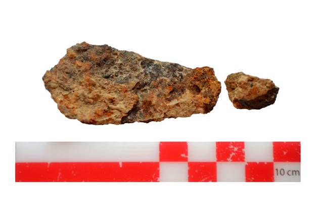
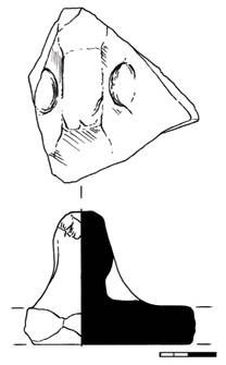
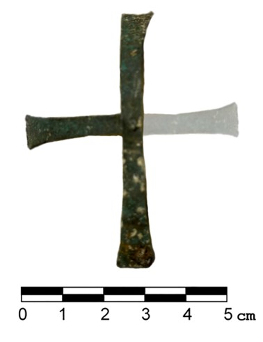
When removing a layer, a fragment of unglazed ceramics, a square stamp with an impressed image of a cross (St_22_01_01_21), as well as a fragment of glass (St_22_01_01_22) were found. There are few fragments of burnt bricks in the filling (see Appendix “Photos”, fig. 7).
Code ST_22_01_02
Element 2
Element description
A layer of dense lumpy-layered loam, grey, grey-brown in colour.
A layer 30 cm thick, very dense lumpy-layered loam, grey, grey-brown in colour.
When cleaning the surface, individual fragments of ceramics, burnt bricks, etc are visible.
Presumably, layer (2) is already lower (deeper) than the layer that has preserved traces of modern agricultural activity.
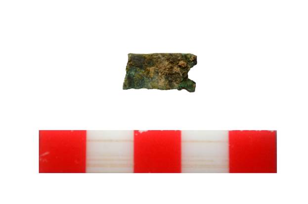
During the removal of the layer, several ferrous metal items were found: a rounded plate (St_22_01_02_01), a fragment of a nail (St_22_01_02_02), a rectangular plate (St_22_01_02_04).
In the northern part of the excavation, several large stones are recorded, located along the west-east line, partially hidden by a stratigraphic border.
There is a slight accumulation of charcoal in the north-eastern corner of the excavation (level 1090.869).
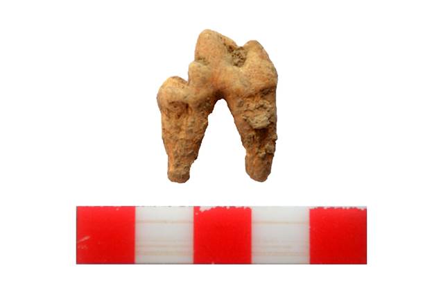
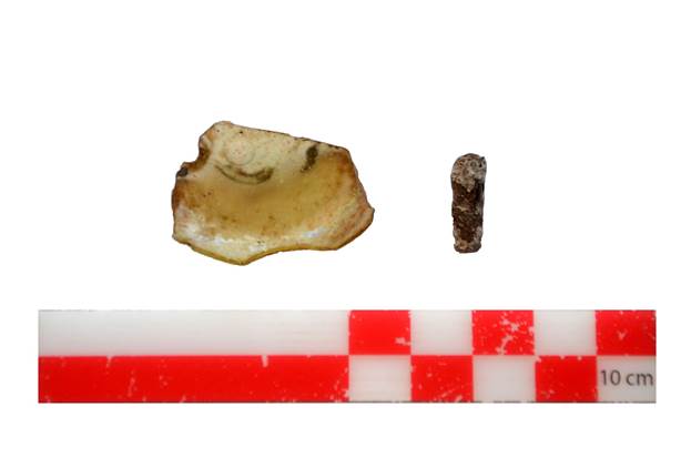
During the clearing of the layer in the western part of the excavation wall an accumulation of animal bones – sheep, goats and others – was found. A molar tooth of a predatory animal (wolf?) was found among the heap of bones. The find was assigned a field number (St_22_01_02_03).
When a layer of dense lumpy-layered loam, grey, grey-brown (02) in colour, was removed at the level of 1090.593, 1.2 m from the western wall of the excavation, a collection of vessel fragments was found (coordinates 348575.615 14360495. 304).
Digging the layer along the northern stratigraphic edge of the excavation, large stones were cleaned at the level of 1090.782, forming a structure resembling masonry. The masonry is laid along the wall from west to east.
Excavating a layer along the western stratigraphic wall of the excavation, at the level of 1090.431, an accumulation of bones belonging to cattle, sheep and goats was found. Fragments of white glazed ceramics and fragments of ceramics with green-brown glaze can be traced in the accumulation.
A heap of small and medium-sized black charcoal fragments was found in the north-eastern corner at the level of 1090.858. The ash pit is located between the northern and eastern walls of the excavation, discovered during the removal of a dense loamy layer light brown colour (see Appendix “Photos”, fig. 8).
Code ST_22_01_03
Element 3
Element description
Collection of vessel fragments.
During the removal of a layer of very dense lumpy-layered loam, grey, grey-brown in colour (02), 1.2 m from the western wall of the excavation at the level of 1090.593, a heap of vessel fragments was found (coordinates 348575.615 14360495. 304).
When cleaning the collection, fragments of unglazed ceramic water vessels and fragments of glazed ceramics were found: green glaze, white glaze with green glaze.
In the cluster there are bones of sheep and goats (see Appendix “Photos”, fig. 9).
Code ST_22_01_04
Element 4
Element description
A heap of stones in the northern part of the excavation near the wall.
During the removal of a layer of dense lumpy-layered grey, grey-brown loam, (02) along the northern stratigraphic edge of the excavation at the level of 1090.782, large stones forming a structure resembling masonry were recorded. The masonry is laid along the wall from west to east and adjoins the previously partially excavated pakhsa (adobe) wall (see Appendix “Photos”, fig. 10).
Code ST_22_01_05
Element 5
Element description
Accumulation of stones and chips of burnt brick near the eastern stratigraphic wall.
An accumulation of stones and chips of burnt bricks were found during the removal of dense lumpy-layered loam, grey, grey-brown in colour (02) at the eastern stratigraphic wall at the level of 1090.985. The accumulation, measuring 0.8 x 0.5 m, is elongated from south to north (coordinates 34858.777 14360497.623).
During the sorting of the stones and chips of burnt bricks, three fragments of ceramic items belonging to thin-walled unglazed red clay water vessels, and two fragments of a bowl with green-brown glaze were found (see Appendix “Photos”, fig. 11).
Code ST_22_01_06
Element 6
Element description
Accumulation of bones and ceramics at the western stratigraphic wall of the excavation.
During the clearing of a dense lumpy-layered loam, grey, grey-brown in colour, (02) along the western stratigraphic wall of the excavation at the level of 1090.431 (coordinates 348575.077 14360500.276), an accumulation of bones belonging to cattle, sheep and goats was discovered and cleared. Fragments of white glazed ceramics can be traced in the accumulation, as well as fragments of ceramics with green-brown glaze, the thickness of the walls of which reaches 2 cm (see Appendix “Photos”, fig. 12).
Code ST_22_01_07
Element 7
Element description
Ash pit in the north-eastern corner of the excavation.
A heap of small and medium-sized black charcoal fragments was found in the north-eastern corner at the level of 1090.858 (coordinates 348582.239 14360500.043). The ash pit is located between the northern and eastern walls of the excavation. The element was revealed when clearing a dense loamy layer of light brown colour.
The ash pit is actually adjacent to an accumulation of stones (4) located along the northern stratigraphic wall of the excavation, while being actually on the same level (see Appendix “Photos”, fig. 13).
Code ST_22_01_08
Element 8
Element description
A layer of dense grey-brown loam.
A layer of dense grey-brown loam, traced at the level of 1090.824, 1090.840 1090.847, 1090.824. In the southern part of the excavation, when a layer 30 cm deep was removed, changes in the density and colour of the layer were recorded on the surface. The soil in this part is more loose, lumpy, the colour is bright brown. Bone fragments are visible on the surface.
After removing the layer and subsequent cleaning, elements of vessel fragments (03), accumulation of stones in the northern part of the excavation at the wall (04), accumulation of stones and chips at the eastern stratigraphic wall (05), accumulation of bones and ceramics at the western stratigraphic wall of the excavation (06), and an ash pit (7) are recorded (see Appendix “Photos”, fig. 14).
Coal samples were taken for carbon 14 analysis (AMS C 14).
Code ST_22_01_09
Element 9
Element description
Dense loam of light grey colour.
A dense loam of light grey colour is located at the level of 1090. 702 and borders on the southern side with a layer of light brown lumpy loam, element (11).
When removing the layer, the presence of small crushed stone, medium-sized rock is observed everywhere. Large-sized rock boulders were partially cleared at the eastern wall of the excavation: 1) 30x17 cm; 2) 42x25 cm.
When cleaning the layer, fragments of water vessels, small fragments of glazed ceramics of blue colour, as well as small sheep and goat bones were found.
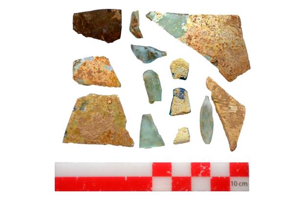
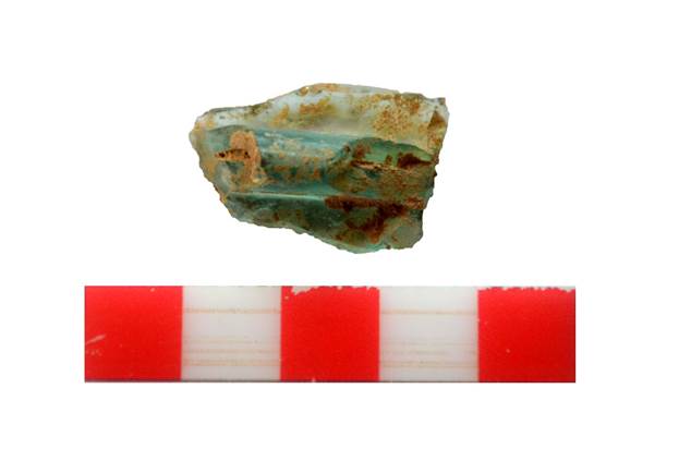
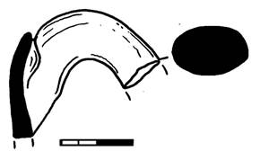
Along with ceramics, fragments of glassware were found. There was also a handle from a blue glass vessel. The wall has been preserved – the place of attachment of the handle. The handle is rounded in cross section (see Appendix “Photos”, fig. 15).
Code ST_22_01_10
Element 10
Element description
Gravelly-loamy bright grey layer (lens).
A gravelly-loamy bright grey layer (lens), with clear external boundaries, is located at the level of 1090.713, bordering on the northern side with dense loam of light grey colour, element (09).
The teardrop-shaped lens, measuring 92x40 cm, is a dense structure of fine crushed stone and bright grey loam. This lens is, as it were, embedded in a thick mass of light grey loam.
When clearing this element, ceramics, bones and other traces of human activity were not found (see Appendix “Photos”, fig. 16).
Code ST_22_01_11
Element 11
Element description
A layer of light brown lumpy loam.
A layer of light brown lumpy loam with a significant number of burnt brick fragments, medium size. See the level at 13.
A layer of light brown lumpy loam, with a significant amount of burnt bricks, medium-sized smoothed river pebbles and rock chips is located at the level of 1090.469. It adjoins on the eastern side a dense loam of light grey colour, element (09). In its structure, it has a similar content to element 13.
During the removal of the layer to a depth of 20 cm, fragments of red clay and grey clay ceramics belonging to water vessels, as well as glazed ceramics related to pialas and thin-walled bowls, were recorded in large numbers. In the layer, there are also sheep and goat bones and several small fragments of glass (see Appendix “Photos”, fig. 17).
Code ST_22_01_12
Element 12
Element description
A layer of dense, light grey loam
A layer of very dense loam of light grey colour, similar to element (09), is located at the level of 1090.634.
In this layer, crushed stone and medium-sized rocks can be traced. Along with this, small fragments of burnt bricks are found everywhere to a depth of 24 cm (see Appendix “Photos”, fig. 18).
During the clearing, a fragment of a thin-walled metal vessel was found in the southern part of the excavation, the outer side of which is decorated with plant embossing. The find was assigned a field number (St_22_01_12_01).
When clearing the layer, fragments of glass from glass vessels are found. The find was assigned a field number (St_22_01_12_02).
Code ST_22_01_13
Element 13
Element description
A layer of bright brown lumpy loam.
A layer of bright brown lumpy loam. The described layer 13 is located at the specified levels 1090.039, 1090.174, 1090.200, 1090.221, 1090.336, 1090.365, 1090.584, 1090.605 and it is similar to the previously excavated layer 11, located a level above (see Appendix “Photos”, fig. 19).
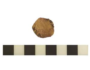
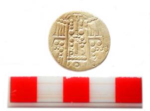
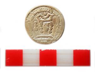
When removing the layer, a silver coin at the level of 1090.330 was found in the eastern part of the excavation 1.20 cm from the eastern edge. Bukharhudat-type silver coin (2.5 cm in diameter, 0.2 cm thick, good preservation). Purpose - tax money; Period of existence - Samanids, Karakhanids, Abbasids (IX-XII centuries A.D.); Year and mint on this type of coin was not specified. The presumptive date of this coin is the end of the IX century and the beginning of the X century. On the avers side minted the head of the ruler, turned to the right, with a crown on his head. The image schematized, made by strokes and dots. The inscription is in Arabic and contains the invocation and name of the ruler (Baghdad Caliph al-Mahdi). On the reverse side is an altar, in the flames of which is a profile image of the ruler's head. On the sides of the altar are the guards. Images on the coin are schematized, made by strokes and dots, as on the avers.
The find is assigned a field number (St_22_01_13_01).
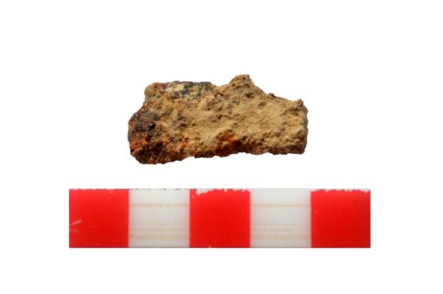
In the south-western part of the excavation, a bronze object was found, rectangular in shape, covered with oxide, 3.9x1.4x0.4 cm in size. The find was assigned a field number (St_22_01_16_01).
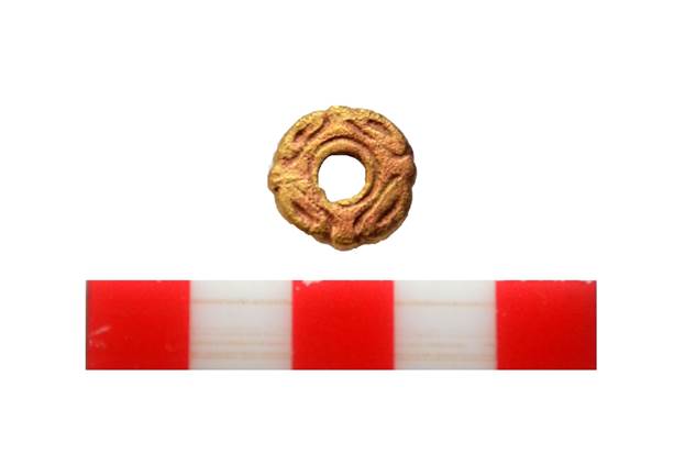
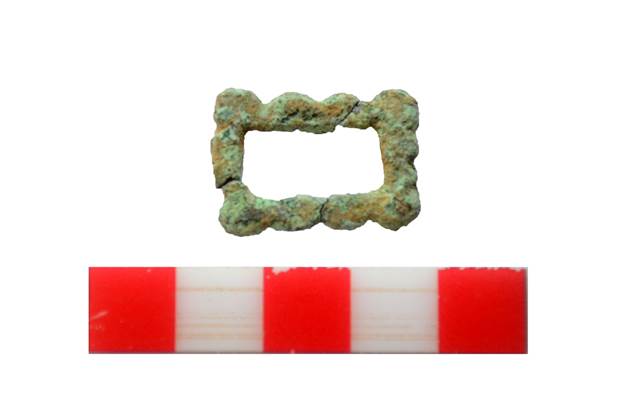
A bronze belt plaque of rounded shape, 1.6 cm in diameter, with rounded through holes 0.4 cm in diameter was found next to the coin. There are two fixing pins on the inside. The pins are rounded in cross-section, 0.3 cm high. The plaque is assigned a field number (St_22_01_13_02).
During the clearing of the described layer, several fragments of glass from different vessels were found in the northern, western, south-western and central parts of the excavation. The plaque is assigned a field number (St_22_01_13_04).
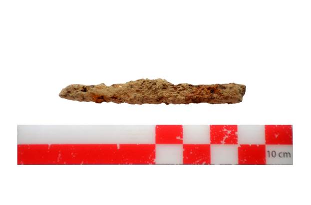
A fragment of a corroded iron knife (St_22_01_13_05).
A fragment of a corroded iron item of uncertain purpose has been assigned a field number (St_22_01_13_06).
Code ST_22_01_14
Element 14
Element description
Chaotic heap of stones and fragments of burnt bricks.
A heap of stones (grey rock chips) and fragments of burnt bricks, stretching along the west-east line, actually parallel to element (04) is located at levels 1090.216, 1090.424.
Lines of large stones, apparently forming a part of the wall, recorded in area 02 – element (4)
The approximate length of the heap is 2.30 m, width 50-90 cm.
This element was found during the removal of a layer of light brown lumpy loam (11).
Code ST_22_01_15
Element 15
Element description
Accumulation of stones and fragments of burnt bricks.
The accumulation of stones and fragments of burnt bricks was randomly located at levels 1090.249, 1090.465, in a chaotic manner, mainly represented by large and medium-sized rocks of bright grey colour. The accumulation of stones was found during the removal of a layer of bright brown lumpy loam (13) (see Appendix “Photos”, fig. 20).
Code ST_22_01_16
Element 16
Element description
A layer of lumpy, bright brown, sandy loam.
A layer of lumpy, bright brown, sandy loam was cleared at the levels of 1090. 040, 1080.198, 1090.215, 1090.364. The filling contains a large number of small pebbles, chipped fragments of burnt bricks.
The surface of the layer clearly appeared after removing layer (13) of loam, lumpy brown colour. The layer is similar to layer (10).
In the south-western part of the excavation, a bronze object was found, rectangular in shape, covered with oxide, 3.9x1.4x0.4 cm in size. The find was assigned a field number (St_22_01_16_01) (see Appendix “Photos”, fig. 21).
Code ST_22_01_17
Element 17
Element description
A layer of lumpy loam, bright brown colour, with the inclusion of fine crushed stones.
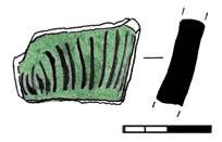
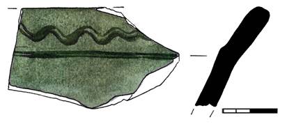
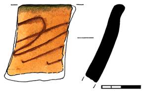
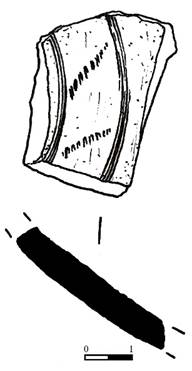
When clearing the layer of lumpy, bright brown loam, with the inclusion of fine crushed stones, small and medium fragments of burnt bricks, fragments of water vessels were found in the form of walls, rims and bottom parts. Part of the walls was decorated with a scratched horizontal, straight and wavy ornament
A bronze rectangular belt plaque with four pins was found in the eastern part of the excavation. The plaque is covered with green oxide. The plaque is assigned a field number (St_22_01_17_01).
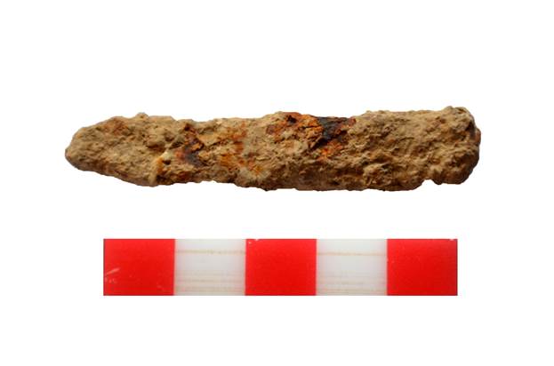
An iron forged nail, square in cross section, was found next to the plaque. The nail head has not been preserved. The size of the nail is 7.1x0.4-08 cm. The find was assigned a field number (St_22_01_17_02).
When clearing the layer in the western and southern parts of the excavation, an accumulation of rocky stones, as well as fragments of broken burnt bricks was found. In this layer there are small fragments of glass from vessels.
Small fragments of a glass vessel with a handle were found. The colour of the glass is light green. The fragments are assigned a field number (St_22_01_17_03).
In different parts of the excavation, when removing the layer, small fragments of glass from different vessels were found. 5 fragments were found, which were assigned a field number (St_22_01_17_04).
A fragment of a glass handle from a green vessel was found. Handle length – 2 cm, thickness – 0.7 cm.
In the eastern part of the excavation, when removing the layer, a fragment of facing ceramic tile was found, measuring 7.5 x 5.5 x 1 cm. The front side of the tile is covered with beige paint. The tile was assigned a field number (St_22_01_17_05) (see Appendix “Photos”, fig. 22).
Code ST_22_01_18
Element 18
Element description
A layer of lumpy, brownish, bright brown colour, with the inclusion of small crushed stones, rock stones.
A layer of lumpy, brownish, bright-brown colour, with the inclusion of small crushed stones, as well as medium and large-sized rock stones, in the centre of the excavation.
Large stones forming separate heaps can be traced in the western, eastern and northern parts of the excavation.
Fine crushed stones, found everywhere in the layers of elements (11, 12, 14, 16), in the layers of elements 17 and 18, when those are cleared, shrink towards the centre and west of the excavation in the form of depressions. In place of a bright brown sandy loam layer, comes a dense light yellow loam layer (28), which in turn, after cleaning, forms a kind of light yellow loamy alluvial area between a stone-loamy border (25) from the north and an accumulation of stones (21). In this described layer, when clearing, fragments of red clay and grey clay ceramics belonging to water vessels, pot-shaped vessels, are found.
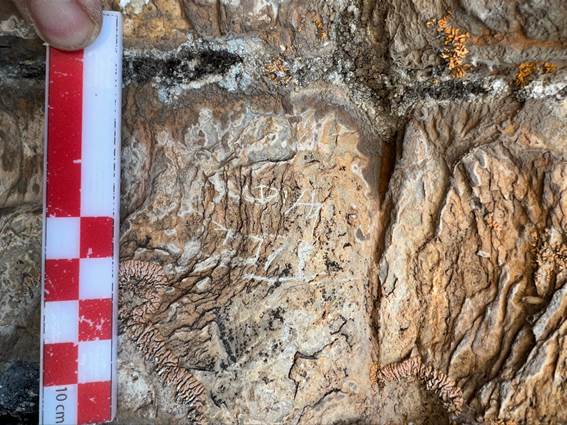
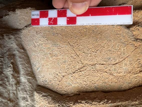
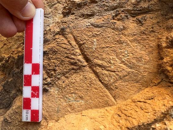
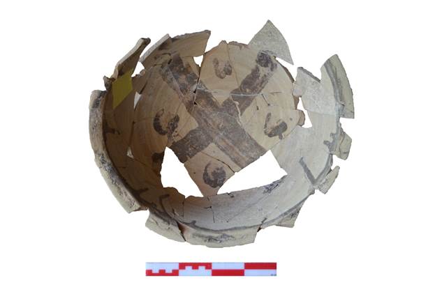
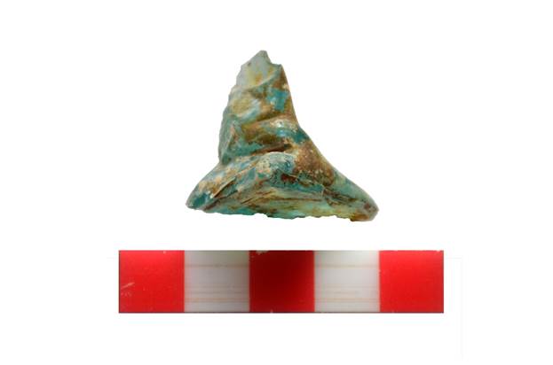
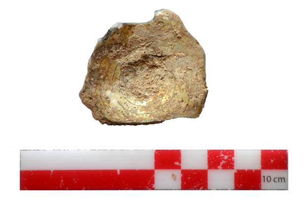
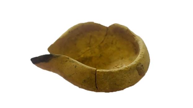
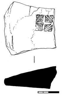
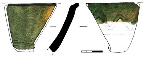
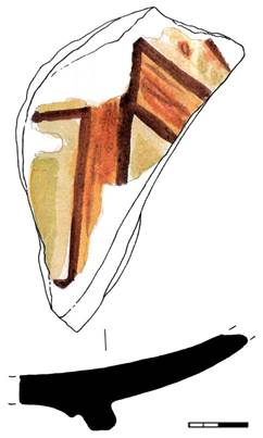
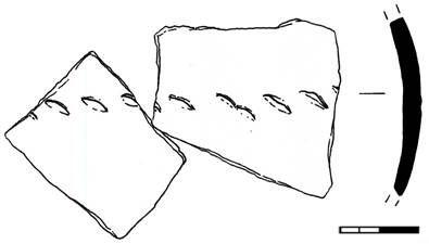
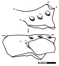
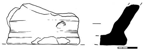
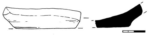
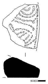
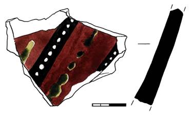
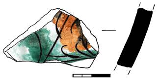
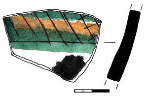
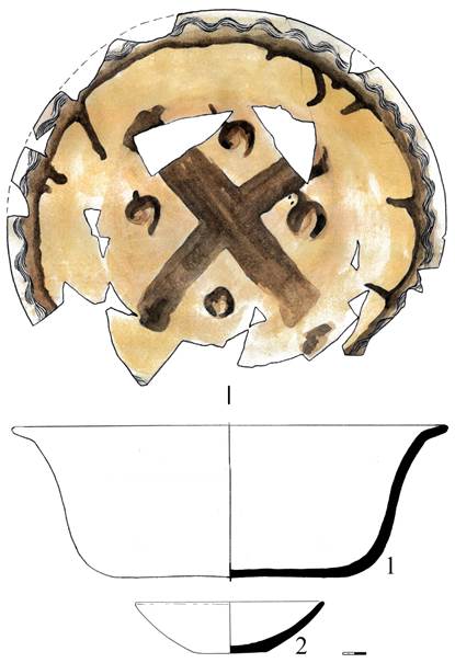
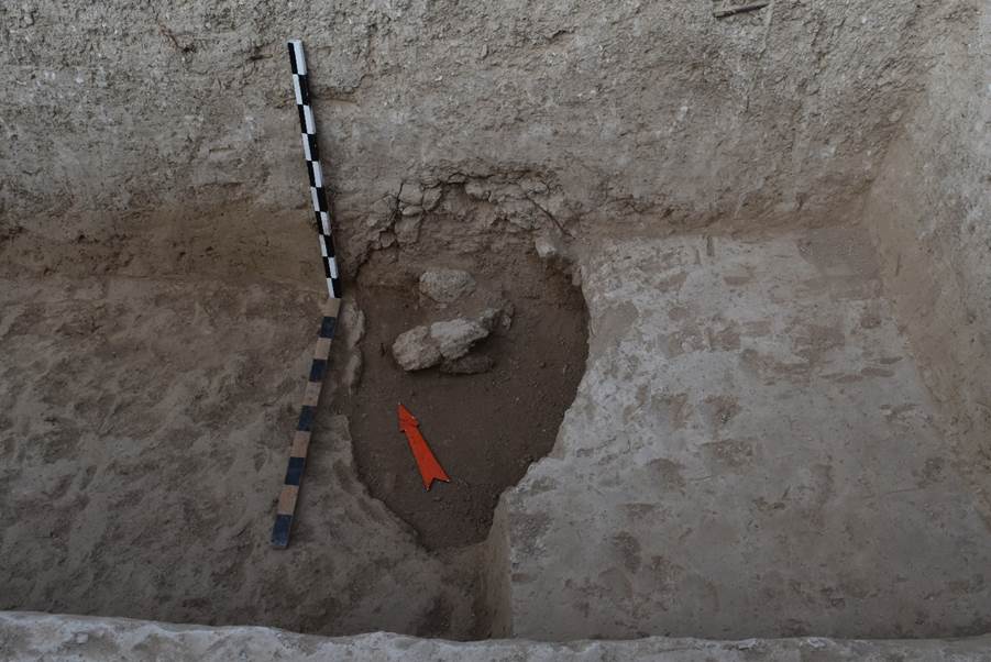
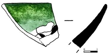
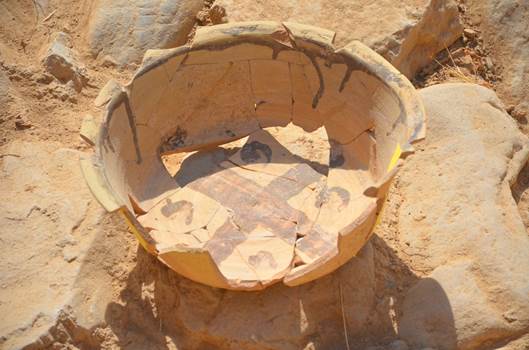
Fragments of a ceramic tagor basin were found in the north-western corner of the excavation during the clearing of the layer on an area of 57x72 cm. The fragments were located at different depths. On the inside, the walls of the tagor are decorated with a slip cross of dark brown colour.
Clearing the layer in the northern part of the excavation, a fragment of a glass handle from a glass vessel with a partially preserved wall at the place of attachment of the handle was found near the wall (4). The find was assigned a field number (St_22_01_18_01).
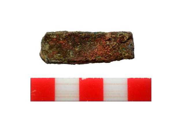
A copper plate coated with green oxide was found, measuring 1.5 x 0.8 x 0.2 cm. The find was assigned a field number: (St_22_01_18_02).
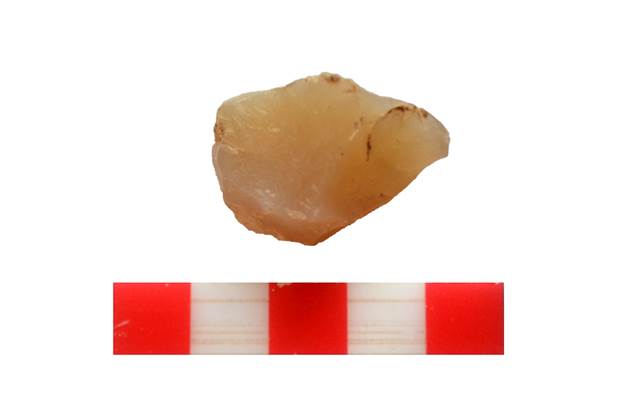
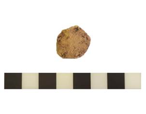
When clearing the ground, agate with chipped areas was found in the north-eastern corner of the excavation. The size of the agate is 3x2.6 cm.
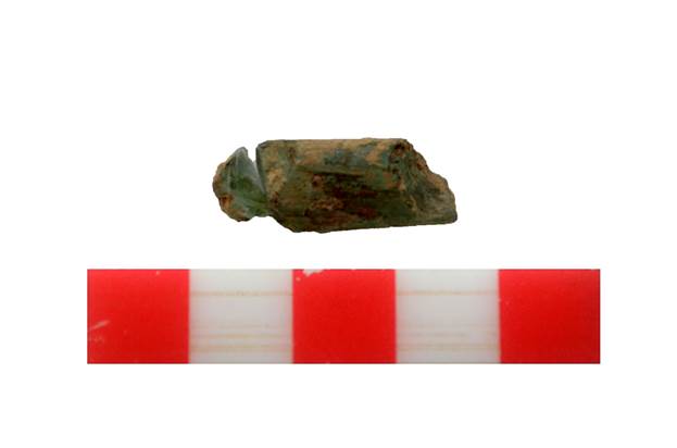
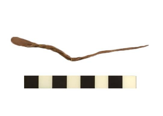
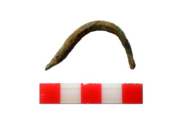
Clearing the layer at the northern wall of the excavation, a twisted bronze hairpin, partially deformed, was found. The lower part of the hairpin is sharp. The upper part is flattened. The find was assigned a field number: (St_22_01_18_03).
In the north-western corner of the excavation, when clearing a layer 60 cm thick from the found fragments of the vessel, a fragment of the wall of a cast-iron cauldron was found near the previously cleared wall (4). The cauldron wall is curved, 6.2 cm long, 1.9-3.2 cm wide, 0.5 cm thick. The wall is covered with brown corrosion. The find was assigned a field number: (St_22_01_18_04).
Clearing a layer of grey loose lumpy loam with the presence of fine crushed stones and rock in the northern part of the excavation, a corroded iron object of undefined purpose was found. Apparently, these are fragments of an iron vessel. The find was assigned a field number: (St_22_01_18_06).
When the northern part of the excavation was cleared to a depth of a spade head, a dense accumulation of stones was found, covered with a layer of grey loose lumpy loam (see Appendix “Photos”, fig. 23-24).
Code ST_22_01_19
Element 19
Element description
A bulb-shaped spot with organic contents in the north of the excavation.
Clearing a layer of dense grey loam along the wall (4), traces of organic contents of grey-black colour were found; they had the form of a bulb-shaped spot stretching from east to west. The spot was 1.68 m long, 3-4 cm deep. The rounded part of the spot is 45 cm in diameter. From the rounded spot to the west stretched a straight wide line 1.23 m long, 18-20 cm wide.
When clearing the spot, 3 fragments of ceramics were found in the organic content: two belonged to red clay manufactured vessels, one to glazed vessels – a bowl (lagan). After clearing the spot, a fragment of burnt brick measuring 13x15x5 cm was found on the loam (see Appendix “Photos”, fig. 25).
Code ST_22_01_20
Element 20
Element description
An accumulation of rock stones in the eastern part of the excavation.
The cluster of rock stones in the eastern part of the excavation consists of 54 large, medium and small stones. The largest stone is 31x22x13 cm in size. Medium sized stones 2) 40x14x12; 3) 18x16x12 cm; 4) 25x14x8cm. The stones were measured selectively. The largest and smallest stones were taken.
The space between the stones was filled with fine crushed stone and loam.
The area of the accumulation is 1.88 x 1.25 m (see Appendix “Photos”, fig. 26).
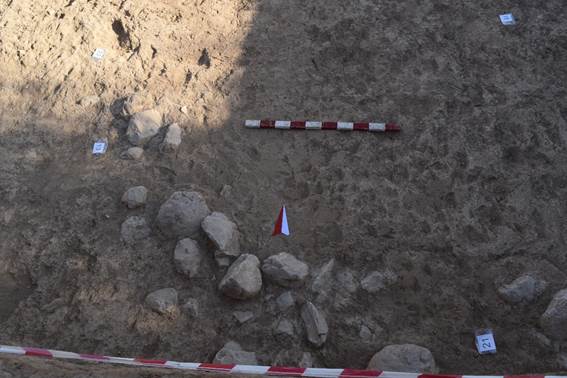
Code ST_22_01_21
Element 21
Element description
An accumulation of rock stones in the southern part of the excavation.
The accumulation of rock stones is located along the southern part of the excavation. In the described accumulation there are 25 stones of different sizes. The accumulation of stones has two adjacent branches. The first branch stretches from east to west and has a length of 1.82 m and a width of 53 cm. The second branch stretches along the southern wall of the excavation and is 2.45 m long, 85 cm wide.
The size of the stones of the first branch of the accumulation: 1) 48x22x13 cm 2) 30x23x13 cm; 3) 20x10x6 cm.
Stone sizes in the second accumulation: 1) 35x19x14 cm (part of the stone is located in the edge outside the excavation; 2) 25x10x6 cm; 3) 27x17x10 cm; 4) 21x20x19 cm; 5) 30x13x13 cm. 6) 18x13x8 cm 7) 32x28x17 cm; 8) 14x11x8 cm; 9) 30x20x6-8 cm.
During the clearing, the accumulation of stones was covered by a layer of lumpy, brownish loam, with the inclusion of small crushed stones (see Appendix “Photos”, fig. 27).
Code ST_22_01_22
Element 22
Element description
Accumulation of fragments of vessels.
During the removal of a layer of lumpy, brownish, bright brown colour, with the inclusion of small crushed stones, (18) an accumulation of fragments of vessels was found 2 m from the southern wall of the excavation.
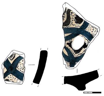
When sorting the accumulation, unglazed ceramics belonging to water and pot-shaped red clay and grey clay vessels were found in it. Fragments of glazed ceramics belonging to a bowl are also found in the accumulation. The ceramics are covered with white and blue glaze (see Appendix “Photos”, fig. 28).
Code ST_22_01_23
Element 23
Element description
An accumulation of rock stones in the western part of the excavation.
Clearing a layer of lumpy loam of brown and bright brown colour along the western wall of the excavation, we found an accumulation of large, medium and small rock stones numbering 28. The space between the stones was filled with fine crushed stone and loam.
The stones were originally located on an area of 2.71x1.99m. The size of the stones in the accumulation: 1) 41x39x8 cm 2) 35x30x11 cm; 3) 50x24x21 cm; 4) 31x25x7 cm; 5) 25x11x10 cm. The stones were measured selectively. The largest and smallest stones were taken.
Later, as we dug deeper by 30 cm and finished cleared the accumulation of stones, an accumulation of stones lying on an earlier cultural layer was completely cleared, too.
The accumulation of rock stones is located in the western part of the excavation, and consists of 60 large, medium and small stones: 1) 56x16x19 cm (the rest of the stone is located outside the excavation); 2) 42x37x10 cm (located in the centre of the excavation); 3) 37x25x13 cm; 4) 38x26x14 cm; 5) 23x15x6 cm. The stones were measured selectively. The largest and smallest stones were taken.
The space between the stones was filled with fine crushed stone and loam.
The size of the accumulation is 3.67 m from north-east to south-west, from east to west – 2.94 m.
A fragment of burnt brick was found next to the stones. The brick size is 16.5x17.5x5 cm (see Appendix “Photos”, fig. 29).
Code ST_22_01_24
Element 24
Element description
An accumulation of stones in the north-western corner of the excavation.
An accumulation of stones can be traced in the north-western corner of the excavation. The stones lie in a heap stretching in the north-south direction. The area of the accumulation is 1.67 m from north to south, and 67 cm from west to east. The number of stones is 16.
The rock stones ares of medium size, sizes vary 1) 30x21x10 cm; 2) 16x13x12 cm; 3) 32x15x4-6 cm; 4) 16x14x5 cm; 5) 15x5x6 cm.
A fragment of burnt brick, measuring 16x11x5 cm, was found on top of the stones when clearing the accumulation.
This accumulation was covered with a layer of grey compacted loam with the inclusion of fine crushed stones (17, 18, 28) (see Appendix “Photos”, fig. 30).
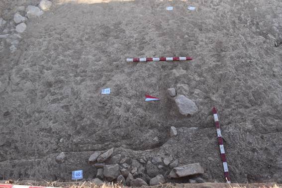
Code ST_22_01_25
Element 25
Element description
Loam-stone structure – border.
The accumulation of rock stones in the north-eastern corner of the excavation consists of large and medium-sized rock boulders, embedded in or laid on loamy soil. The space between the stones is filled with loam. Stone sizes: 1) 43x22x16 cm; 2) 46x24x10 cm; 3) 11x16x11 cm; 4) 33x25x14 cm; 5) 28x9x7 cm. The stones were measured selectively. The largest and smallest stones were taken.
The initial area of the accumulation of rocks is 1.90x0.50 m.
Further, as we excavated deeper and continued to reveal the accumulation of stones, a loam-stone masonry was revealed – a curb located on the southern part of the stone pavement (30).
The loam-stone stonework is made of large and medium-sized stones covered with loam, as well as small-sized rock stones. Initially, it was an accumulation of large boulders at the level of 1.30 cm, buried in and laid on a loamy surface. The largest stones have sizes: 1) 65x69x25 cm; 2) 44x24x10 cm; 3) 43x22x16 cm; 4) 33x25x14 cm.
Smaller stones in the stonework have sizes: 1) 28x9x7 cm; 2) 11x16x11 cm; 3) 33x25x14 cm (large and medium-sized stones were selected for measurement).
The original area of the wall, which appeared as an accumulation of stones, was 1.90 x 50 cm. Then, as we deepened during the clearing of the loamy site by 40-50 cm from east to west, larger boulders lying flat along the supposed stone platform (stone pavement) were found under the upper masonry of small and medium-sized stones. The masonry of the stones is even and in the eastern part slowly descends, making a kind of deflection, and then in the western part it rises sharply upwards.
There, in the western part, an accumulation of stones and fragments of bricks can be traced on the surface of the masonry (24, 26). Presumably, the rest of the stonework of the curb may be hidden outside the excavation (see Appendix “Photos”, fig. 31-32).
Code ST_22_01_26
Element 26
Element description
An accumulation of stones in the north-western part of the excavation
An accumulation of rock stones is located in the north-western part of the excavation. The accumulation of rock stones was revealed when removing layers of bright brown loam with the inclusion of fine crushed stone and chipped small rocks.
The area is regular and the accumulation is uniform, consisting of large and medium-sized rock stones. The stones lie at different depths and levels. The size of the accumulation from north to south is 1.32 m, from east to west – 1.63 m.
Code ST_22_01_27
Element 27
Element description
A layer of grey loose lumpy loam
A layer of grey loose lumpy loam can be traced in the south-eastern corner, partly in the central part. The described layer continues along the western wall of the excavation, as well as in the northern part of the excavation. Clearing a layer of grey loose lumpy loam with the presence of small crushed stones and rock stones in the south-western corner of the excavation, we found a thin copper plate of a pentagonal shape, which was identified as a coin. The coin was lying between an accumulation of rock stones and fragments of burnt bricks. The coin size is 2.1x1.9x0.2 cm. The find was assigned a field number: (St_22_01_27_01) (see Appendix “Photos”, fig. 33).
Code ST_22_01_28
Element 28
Element description
A layer of thick light grey loose lumpy loam
A layer of thick light grey loose lumpy loam with the presence of fine crushed stones was found in the northern part of the excavation. The described element was revealed during the clearing of a layer of lumpy light brown loam, with the inclusion of fine crushed stones, fragments of ceramics, chipped rocks of medium and small size. Clearing the upper layer at the eastern wall at a depth of 1.50 m, we discovered a dense compacted light grey loam, which formed a 10-15 cm cover for a stonework of boulders stretching from east to west 4.7 m. Compacted light grey loam, with the inclusion of small fragments of ceramics, as well as small charcoal fragments, is spread along the entire length and width of the stone pavement, covering the latter. After clearing the loam surface, the stone pavement appeared, composed of river boulders.
The surface of the cleared compacted loam, as well as the stone pavement hidden under it, is 4.70 m long, 2.10 m wide.
Code ST_22_01_29
Element 29
Element description
Light yellow dense alluvial loam.
The light yellow dense alluvial loam, heterogenous in composition, with an area of 5.20x4.90 m, 20-40 cm thick, is located in the central part, as well as between the eastern and southern walls of the excavation. In the south-eastern part, the loam is thick, up to 70 cm, then to the centre, to the north, towards the south and west, the alluvial loam slowly thins, as if spreading out, forming a kind of slope.
Along the southern wall of the excavation, the loamy mass coveres an elongated accumulation of rock stones of different sizes stretching along the wall (21).
On the eastern side, the accumulation of stones (20, 25) is also covered by a layer of light yellow loam. The upper horizon of the light yellow mass is covered from above by a layer of grey lumpy loam, crushed stones, small and medium-sized rock stones, among which there are fragments of red clay and grey clay ceramics, glazed fragments of bowls and pialas decorated with green, blue and dark blue glaze, with brown geometric and floral ornaments. The upper layer is made of grey lumpy loam, crushed stones, small and medium-sized rock stones, covering a massive layer of light grey loam by 30-40 cm.
Sloping towards the centre of the excavation, the layer of light yellow loamy mass is covered with a layer of grey lumpy loam, with the inclusion of crushed stones, small and medium-sized rock stones; in the excavated layers (10, 13, 16, 17, 18) the loamy mass grows increasingly more compact and gradually becomes from grey to light yellow in colour.
Along the eastern and southern walls of the excavation, an accumulation of rock stones continues to be recorded; they stretch along the south-north (east border), west-east (21, 25) and southeast-northwest (21) axes.
In the northern part of the excavation, this loamy mass is broken by an accumulation of small and medium-sized rock stones stretching from east to west.
During further clearing of the layer of dense light yellow alluvial loamy mass, ceramics and animal bones are not found in either the south and east or the centre of the excavation (see Appendix “Photos”, fig. 34).
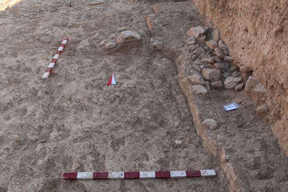
Code ST_22_01_30
Element 30
Element description
Boulder pavement along the northern wall of the excavation.
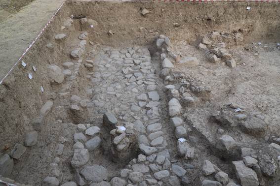
Clearing a layer of lumpy light brown loam with the inclusion of small crushed stones, fragments of ceramics, chipped rocks of medium and small size at the eastern wall at a depth of 1.50 m, we discovered a layer of dense light grey loam (28), which formed a 10-15 cm thick cover for a stonework of boulders stretching from east to west for 4.7 m. The compacted light grey loam included small fragments of ceramics, as well as small charcoal fragments. After clearing the loam surface at the levels 1089.616, 1089.681, 1089.953, 1089.969, a stone pavement composed of river boulders appeared.
Boulders are tightly fitted to each other, and the space between the stones is filled with loam.
On the southern side of the stone pavement, as we excavated from east to west, we found a curb 4.20 m long, up to 1 m wide, made of rock stones, the space between which was filled and with clay mortar. On the northern side there is a stone-adobe (pakhsa) wall (4) stretching in the east-west direction.
The surface of the cleared stone pavement is 4.70 m long, 2.10 m wide (see Appendix “Photos”, fig. 35-36).
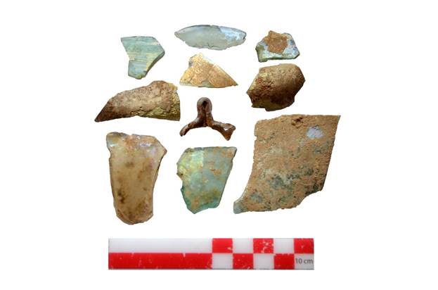
Description of finds from monastery
A fragment of glazed ceramics (St_22_01_01_01), with blue and brown glaze, as well as a fragment of green-glazed ceramics (St_22_01_01_02) were found.
A fragment of green glazed ceramics (St_22_01_01_03) was found in the south-western part of the excavation.
In the south-western part of the excavation, two fragments of glazed ceramics white-brown hue (St_22_01_01_04), (St_22_01_01_05), a fragment of a bowl (identified by a rim) decorated with green glaze (St_22_01_01_06) were found.
A fragment of unglazed ceramics, a square with a stamp with an impressed image of a cross (St_22_01_01_21), as well as a fragment of glass (St_22_01_01_22).
During the removal of the layer, several ferrous metal items were found: a rounded plate (St_22_01_02_01), a fragment of a nail (St_22_01_02_02), a rectangular plate (St_22_01_02_04).
A molar tooth of a predatory animal (wolf?) was found among the heap of bones. The find was assigned a field number (St_22_01_02_03) (see Appendix “Artefacts from the monastery”, fig. 2).
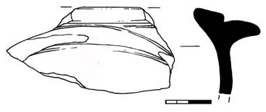
A fragment of a thin-walled metal vessel, on the outside of which the wall is decorated with floral embossing. The find was assigned a field number (St_22_01_12_01) (see Appendix “Artefacts from the monastery”, fig. 6).
Fragments of glass from glass vessels. The find was assigned a field number: (St_22_01_12_05).
Bukharhudat-type silver coin (2.5 cm in diameter, 0.2 cm thick, good preservation). Purpose - tax money; Period of existence - Samanids, Karakhanids, Abbasids (IX-XII centuries A.D.); Year and mint on this type of coin was not specified. The presumptive date of this coin is the end of the IX century and the beginning of the X century. On the avers side minted the head of the ruler, turned to the right, with a crown on his head. The image schematized, made by strokes and dots. The inscription is in Arabic and contains the invocation and name of the ruler (Baghdad Caliph al-Mahdi). On the reverse side is an altar, in the flames of which is a profile image of the ruler's head. On the sides of the altar are the guards. Images on the coin are schematized, made by strokes and dots, as on the avers. The find is assigned a field number (St_22_01_13_01) (see Appendix “Artefacts from the monastery”, fig. 27).
A bronze object, rectangular shape, coated with oxide, size 3.9x1.4x0.4 cm. The find was assigned a field number (St_22_01_16_01).
A bronze belt plaque of rounded shape, 1.6 cm in diameter, with rounded through holes 0.4 cm in diameter. There are two fixing pins on the inside. The pins are rounded in cross-section, 0.3 cm high. The plaque is assigned a field number (St_22_01_13_02) (see Appendix “Artefacts from the monastery”, fig. 9).
Fragments of glass from different vessels. The finds were assigned a field number (St_22_01_13_04).
A fragment of a corroded iron knife (St_22_01_13_05).
A fragment of a corroded iron item of uncertain purpose has been assigned a field number (St_22_01_13_06).
A bronze object, rectangular shape, coated with oxide, size 3.9x1.4x0.4 cm. The find was assigned a field number (St_22_01_16_01).
Rectangular bronze belt plaque with four pins. The plaque is covered with green oxide. The plaque is assigned a field number (St_22_01_17_01) (see Appendix “Artefacts from the monastery”, fig. 19).
Iron forged nail, square in cross-section. The nail head has not been preserved. The size of the nail is 7.1x0.4-08 cm. The find was assigned a field number (St_22_01_17_02).
Small fragments of a glass vessel with a handle. The colour of the glass is light green. The fragments are assigned a field number (St_22_01_17_03).
Small fragments of glass from different vessels. 5 fragments were found, which were assigned a field number (St_22_01_17_04).
A fragment of a glass handle from a green vessel was found. Handle length – 2 cm, thickness – 0.7 cm.
Fragment of facing ceramic tile, size 7.5x5.5x1 cm. The front side of the tile is covered with beige paint. The tile was assigned a field number (St_22_01_17_05).
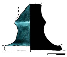
Fragments of a ceramic tagor basin. The fragments were located at different depths. On the inside, the walls of the tagor are decorated with a slip cross of dark brown colour (St_22_01_1) (see Appendix “Artefacts from the monastery”, fig. 15).
Fragment of a glass handle from a glass vessel with a partially preserved wall at the place of the attachment of the handle. The find was assigned a field number (St_22_01_18_01).
Copper plate coated with green oxide, size 1.5 x 0.8 x 0.2 cm. The find was assigned a field number: (St_22_01_18_02).
Twisted bronze hairpin, partially deformed, found when clearing a layer at the northern wall of the excavation. The lower part of the hairpin is sharp. The upper part is flattened. The find was assigned a field number: (St_22_01_18_03) (see Appendix “Artefacts from the monastery”, fig. 24).
In the north-western corner of the excavation, when clearing a layer 60 cm thick from the found fragments of the vessel, a fragment of the wall of a cast-iron cauldron was found near the previously cleared wall (4). The cauldron wall is curved, 6.2 cm long, 1.9-3.2 cm wide, 0.5 cm thick. The wall is covered with brown corrosion. The find was assigned a field number: (St_22_01_18_04).
When clearing the ground, agate with chipped areas was found in the north-eastern corner of the excavation. The size of the agate is 3x2.6 cm. The find was assigned a field number: (St_22_01_18_05).
Fragments of an iron vessel were found in a layer of grey loose lumpy loam in the northern part of the excavation. the fragments of the iron vessel are covered with traces of corrosion. Judging by the damages of the object, it is believed to be fragments of an iron vessel. The find was assigned a field number: (St_22_01_18_06).
A copper coin was found during the clearing of a layer of grey loose lumpy loam with the presence of small crushed stones and rock stones in the south-western corner of the excavation. The coin was lying between an accumulation of rock stones and fragments of burnt bricks. The coin is in the form of a thin pentagonal copper plate with a size of 2.1x1.9x0.2 cm. The find was assigned a field number: (St_22_01_27_01) (see Appendix “Artefacts from the monastery”, fig. 26).
Conclusion for Excavation ST (monastery)
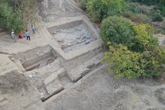
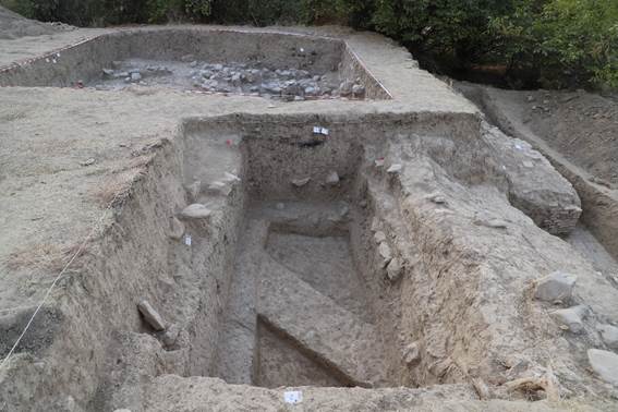
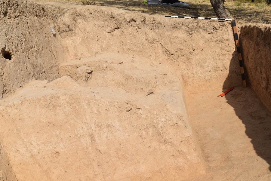
In 2022, archaeological excavations were resumed on the territory of the previously partially excavated medieval Christian monastery Suleyman-tepa. Three excavations were made on the territory of the monastery: excavation No. 1 was outside the monastery in its south-western part, the excavation has a trapezoidal shape, stretching from north to south, dimensions 8x7 m: excavation No. 2 is located east of excavation No. 1, also outside the monastery; it was made on the site of an old test trench, which was expanded to the size of 4.7x2.8 metres and stretched along the WE line; excavation No. 3 is located inside the monastery along the southern wall (dimensions 10.5x0.5 m).
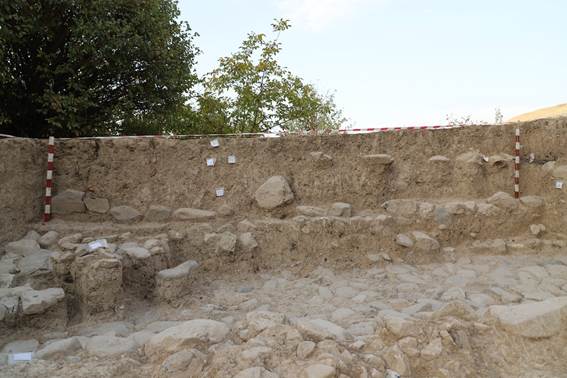
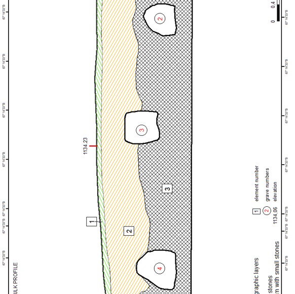
During the excavations on site No. 1, several upper alluvial layers were revealed, dated to the period of abandonment, when after the Mongol invasion the monastery was deserted.
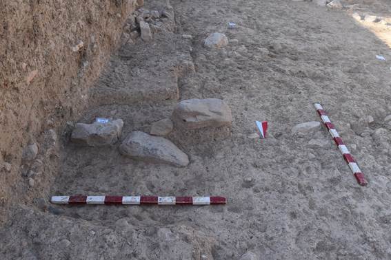
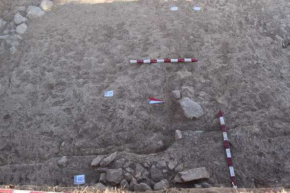
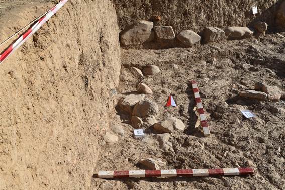
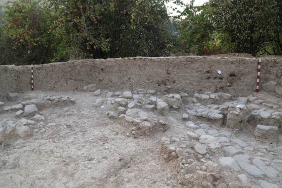
On the northern side, a partially excavated southern stone-loam wall (4) of the monastery was cleared.
Digging a layer of soil along the stone wall, we found traces of fire on the upper level, at a depth of 35 cm from the upper level; it was located on a partially destroyed wall. This fire burned at the time when the monastery was deserted, and the burnt bricks of the buildings, apparently, were taken away by local residents who lived in some other places for construction and other purposes.
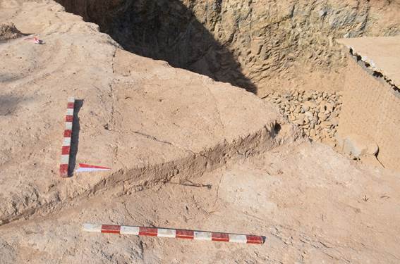
Large boulders were revealed in the central and lower parts of the wall brickwork.
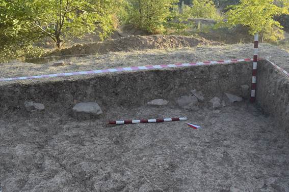
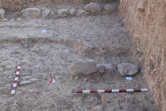
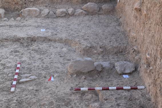
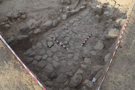
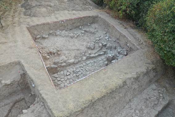
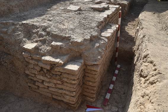
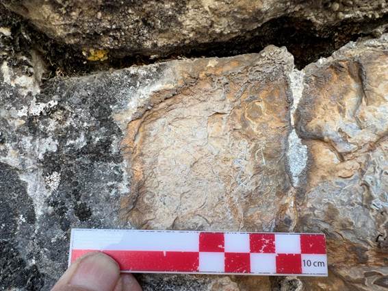
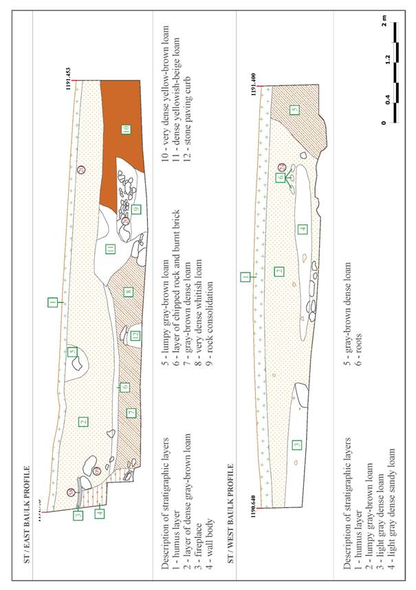
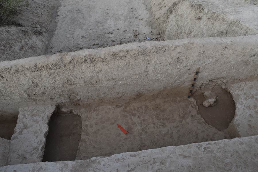
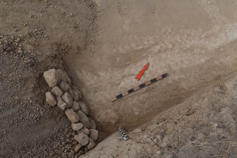
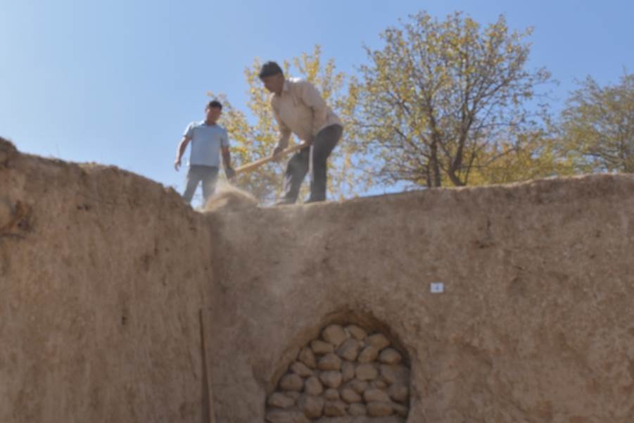
During the excavations a cobblestone pavement was cleared below the wall at a depth of 1.5-1.6 m. It was covered with dense light grey loam, which covered the masonry of boulders by 10-15 cm, stretching from east to west for 4.7 m. The compacted light grey loam included small fragments of ceramics and small charcoals. Under the light grey loam, the stonework of a stone pavement composed of river boulders was revealed. The surface of the cleared stone pavement is 6.5 m long, 2.4 m wide.
Boulders are tightly fitted to each other, and the space between the stones is filled with loam. A part of the stonework on the western side of the pavement is located outside the excavation. On the eastern side, a part of the pavement was disassembled during previous excavations. The true dimensions of the pavement were not established.
On the southern side of the stone pavement, as we excavated from east to west, we found a curb 4.20 m long, up to 1 m wide, made of rock stones, the space between which was filled and with clay mortar. On the northern side there is a stone-adobe (pakhsa) wall (4) stretching in the east-west direction.
During the excavations, accumulations of stones, the origin of which is not clear, were cleared from the southern and western sides of the curb at different levels and throughout the area. Apparently, these are the remains of the stonework of the curb or wall that collapsed after the abandonment or during the disassembly of the structures.
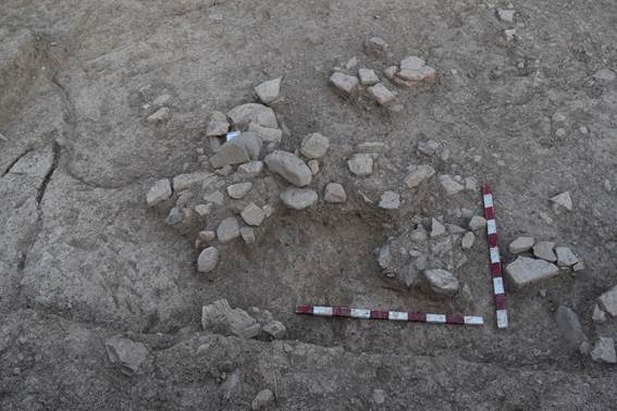
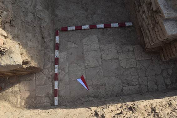
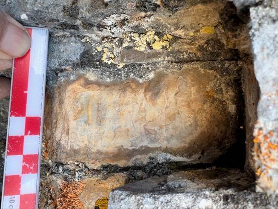
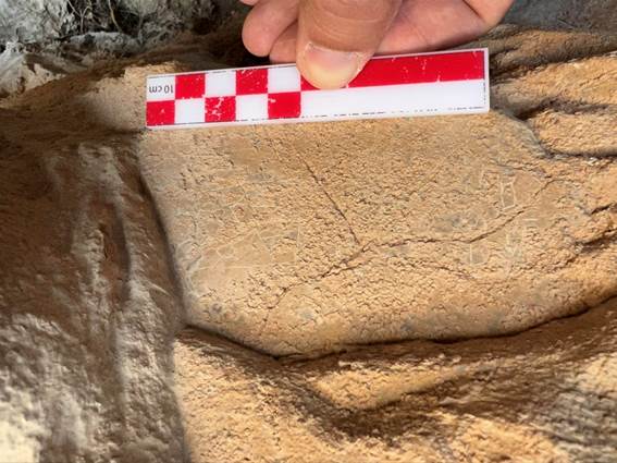
During the excavations, a fragmented ceramic tagor basin was discovered on this excavation site; it is decorated from the inside with an image of a cross. The cross is made with dark brown paint. This basin was found in the upper tiers, during the clearing of the wall on the southern side and the accumulation of stones that covered the pavement in the western part (see Appendix “Photos”, fig. 37-38, 43-45, Appendix “Drawings”, fig. 33-35).
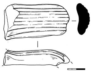
Along with manufactured red and grey clay ceramics, represented by fragments of water vessels and cauldrons, there are also fragments of glazed ceramic bowls and a piala, blue, white, green and brown colours.
Bukharhudat-type silver coin (2.5 cm in diameter, 0.2 cm thick, good preservation). Purpose - tax money; Period of existence - Samanids, Karakhanids, Abbasids (IX-XII centuries A.D.); Year and mint on this type of coin was not specified. The presumptive date of this coin is the end of the IX century and the beginning of the X century. On the avers side minted the head of the ruler, turned to the right, with a crown on his head. The image schematized, made by strokes and dots. The inscription is in Arabic and contains the invocation and name of the ruler (Baghdad Caliph al-Mahdi). On the reverse side is an altar, in the flames of which is a profile image of the ruler's head. On the sides of the altar are the guards. Images on the coin are schematized, made by strokes and dots, as on the avers. Attribution of the coin afte Luke Treadwell (2007) is following: type 10 (bi-ism allāh muḥammad rasūl allāh muḥammadiyya mimmā amara bi-hi al-amīnʿalī (ʿalā [yaday]?) sulaymān lillāh) was tentatively dated by Walker to the years 193-195 A.H. (Walker 1941). Masson (1955) dates them to Tahirid period. However 193 A.H. was the year in which the principal mints of Transoxania, Samarqand and Bukhara, began to mint large quantities of regular caliphal dirhams bearing the name of Amīn's brother, al-Ma’mūn (the only Transoxanian mint to have struck silver dirhams before 193 A.H. was the mint of Shash which produced massive quantities in the years 189–190 A.H): it is likely, as Walker (1941) noted, that the beginning of regular dirham production coincided with the end of the Bukharkhuda series. Therefore it seems reasonable to assume that Type 10 was minted during the reign of Amīn's father, Hārūn, possibly as early as 176 A.H., when Amīn's title first appears on dirhams of al-Muḥammadiya (Treadwell 2007).
A bronze belt plaque of rounded shape, 1.6 cm in diameter, with rounded through holes 0.4 cm in diameter was found next to the coin. There are two fixing pins on the inside. The pins are rounded in cross-section, 0.3 cm high.
When removing the loamy layer covering the pavement, a twisted bronze hairpin was found, partially deformed; it was found at the northern wall of the excavation. The lower part of the hairpin is sharp. The upper part is flattened.
Removing a layer of grey loose lumpy loam with the presence of small crushed stones and rocks in the south-western corner of the excavation between the accumulation of rock stones and fragments of burnt bricks, a coin in the form of a thin copper plate, pentagonal in shape, sized 2.1x1.9x0.2 cm, was found.
During the excavations, a layer of turf, and 20-30 cm of relatively loose loam of grey-brown colour were removed. Apparently, the loam layer is made up of the debris from the excavations of previous years and a layer of soil used as a preservation material (filling).
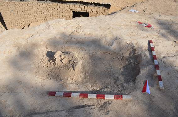
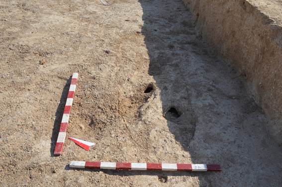
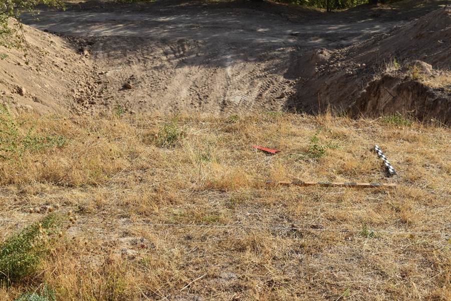
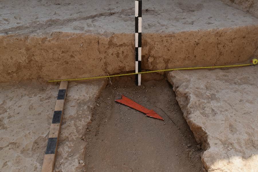
To the east of excavation No. 1, excavation No. 2 was marked on the site of a round-shaped pit, up to 1.5 m deep.
The pit is an eroded trench made by archaeologists to find out the thickness of the southern (outer) wall of the monastery (see Appendix “Photos”, fig. 46-47, Appendix “Drawings”, fig. 36).
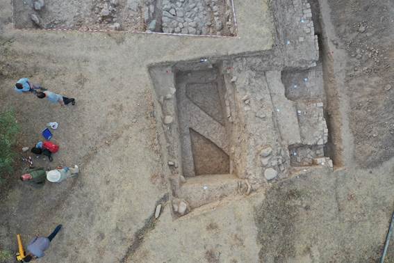
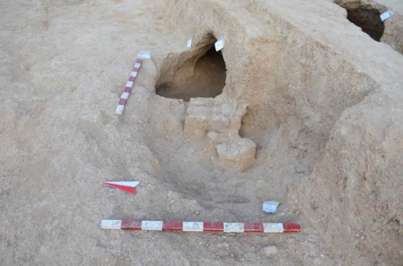
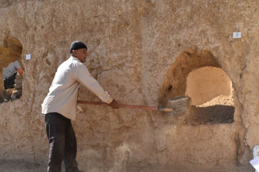
Excavation No. 3 is made on the eastern and northern sides in relation to excavation No. 1. The main purpose is to clear the earlier excavated structures, combine plans of structures studied recently and in previous years, and clarify details (see Appendix “Photos”, fig. 44-46, Appendix “Drawings”, fig. 37-38).
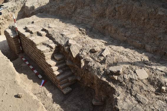
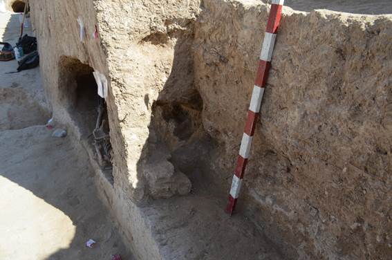
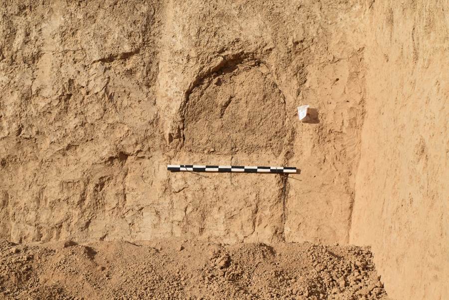
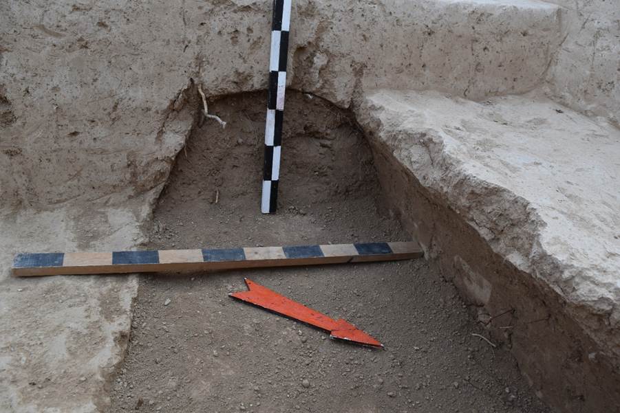
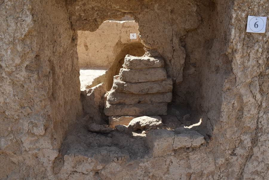
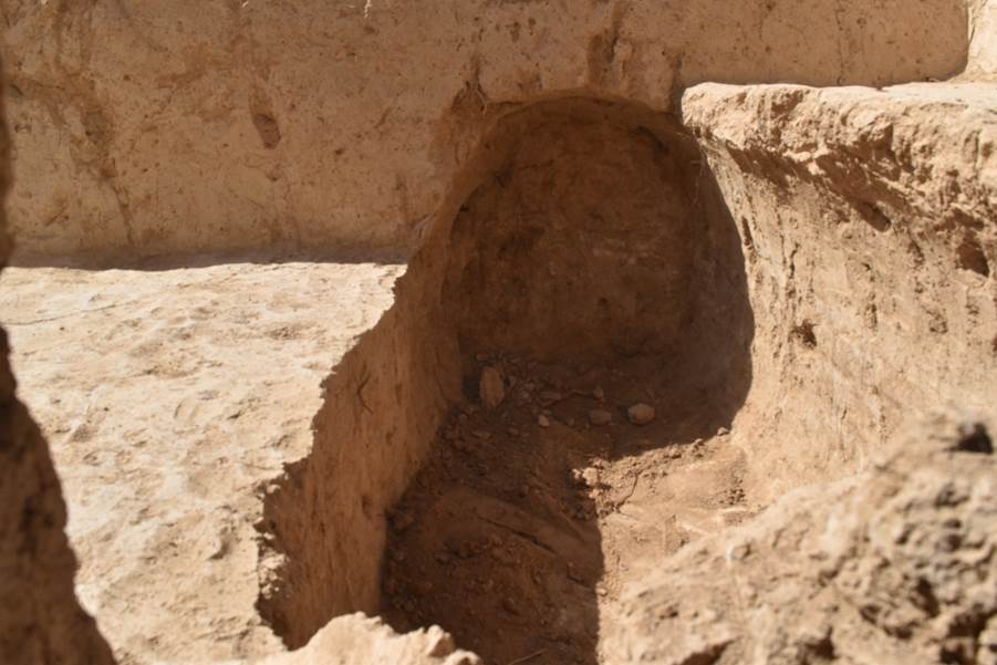
During the excavations, two niches and steps of burnt bricks were cleared. Presumably, the large niche was once the entrance from the southern side to the church, which could be reached through the already cleared stone pavement along the southern wall. In the small niche, a carved brick, never recorded during previous work, was found amid the brickwork. The purpose of the small niche could not be specified. The exact boundaries of the brickwork of the walls and the work of the southern adobe-stone wall were established.
Result: during the excavations on the southern side of the wall from the previously excavated monastic structures, a curb made of large and small rock stones was revealed, bordering the stone pavement from the outside. A cobblestone pavement has also been cleared, which had traces of damage, subsequent repair and covering at a later time with compacted dense loam. The monastery wall was cleared from the southern side, with damaged work of stones and pakhsa (adobe). There are traces of destruction and erosion from the outside, which occurred after the monastery had been in the late 13th century. All this suggests that after the 13th century, life stopped on the territory of the monastery, and resumed only in the early 20th century, when the monastery was in a ruined state, covered with a layer of soil and thick vegetation.
Excavation ST_1 (Graveyard)
Urgut_2022
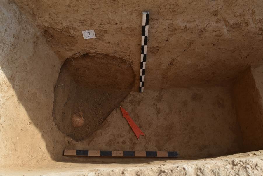
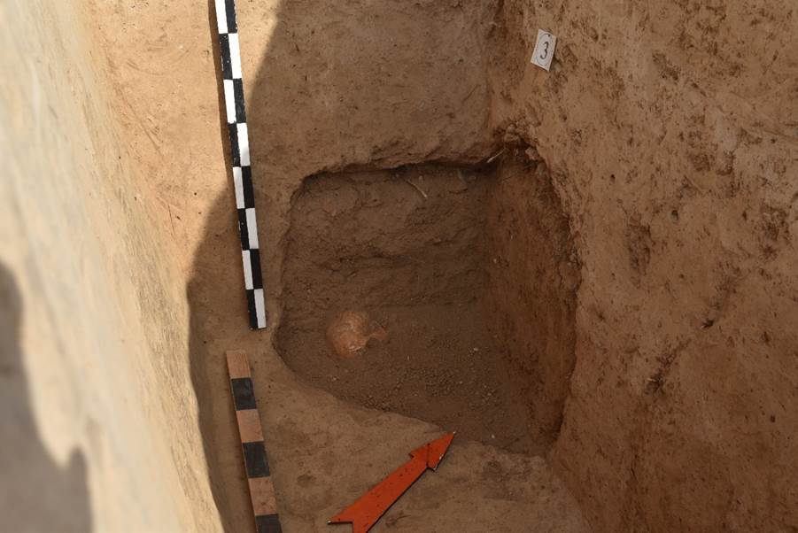
Emergency burial ground Suleiman tepa 1.
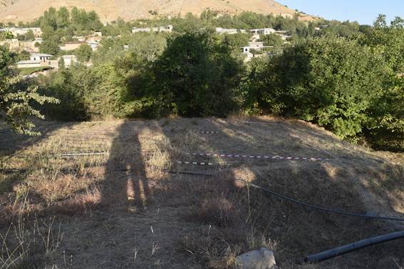
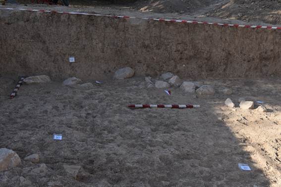
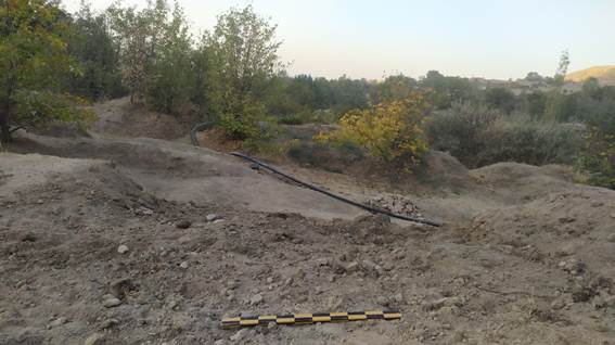
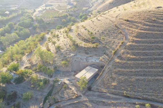
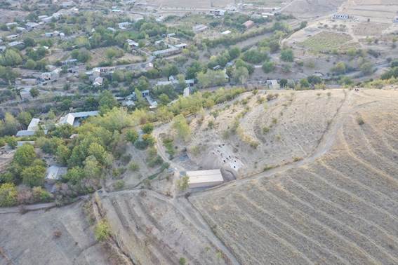
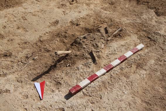
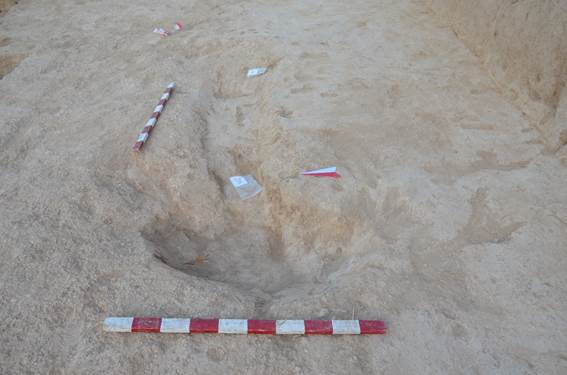
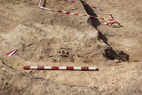
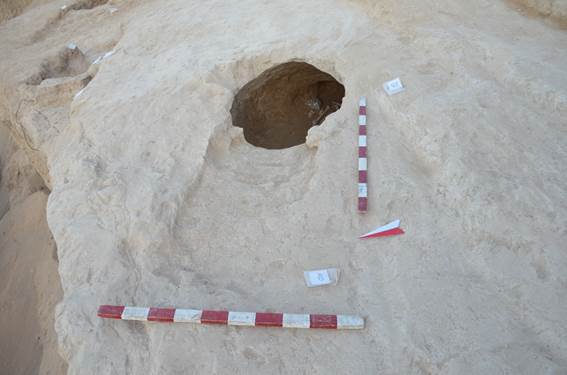
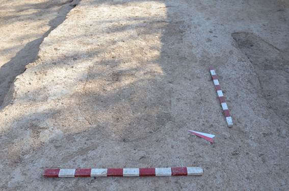
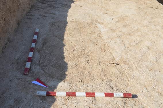
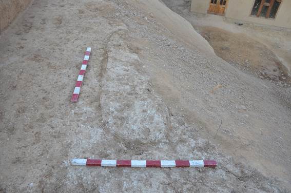
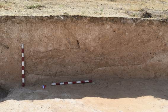
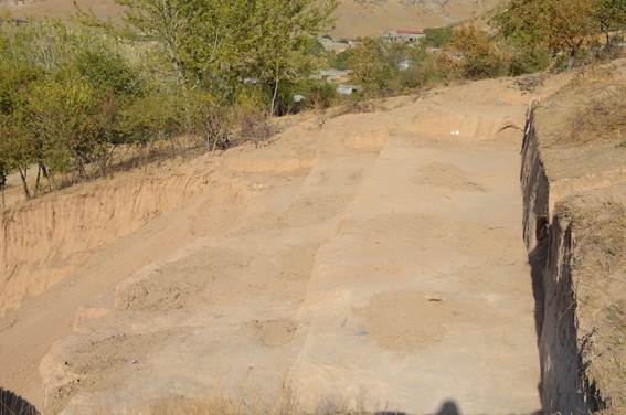
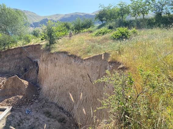
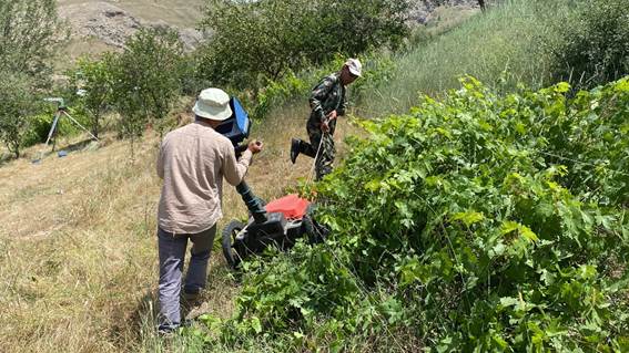
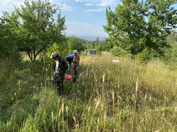
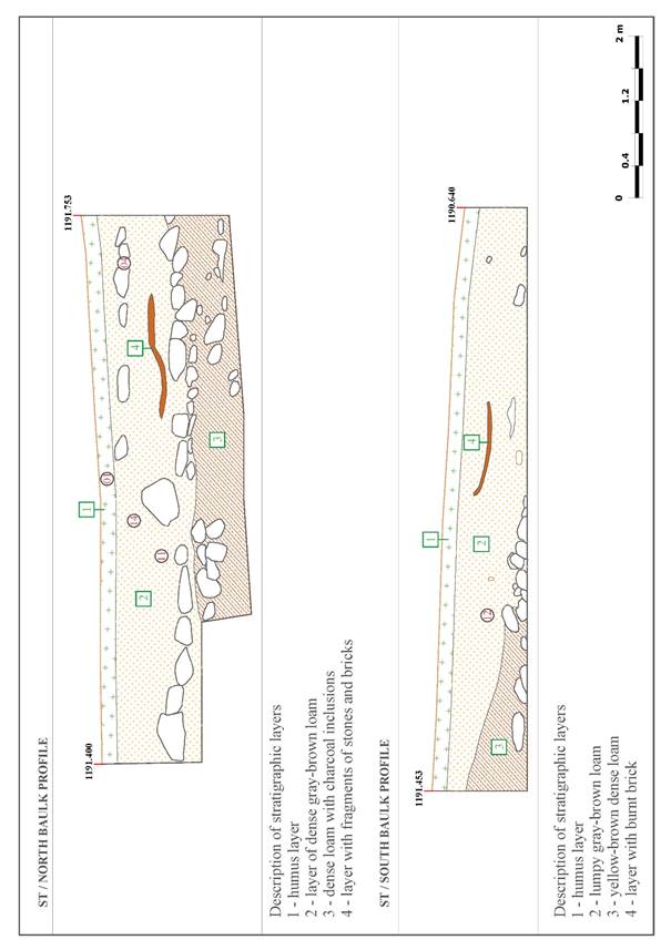
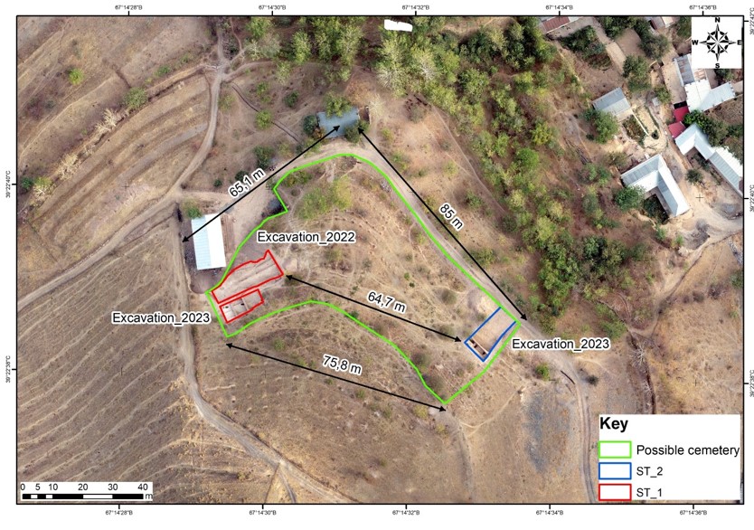
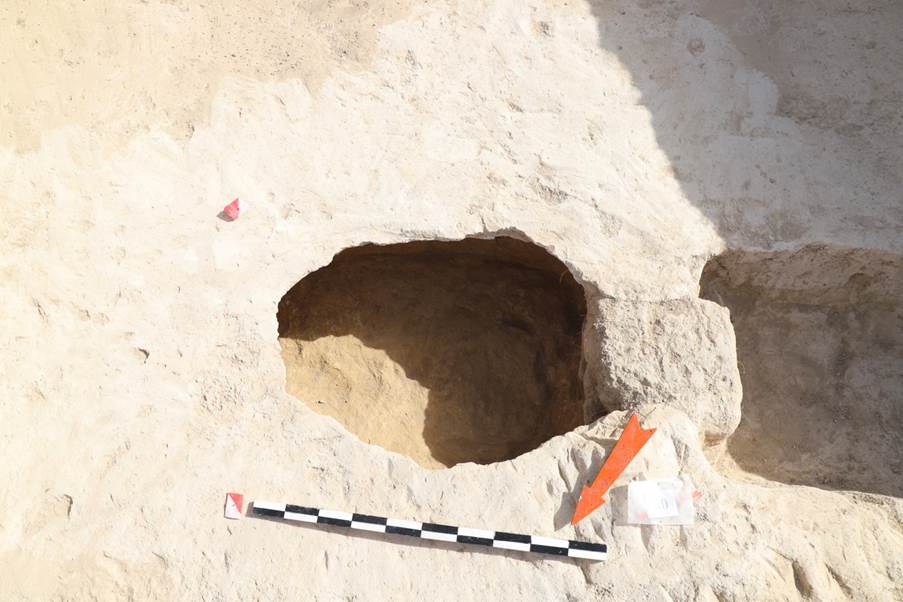
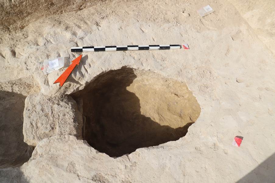
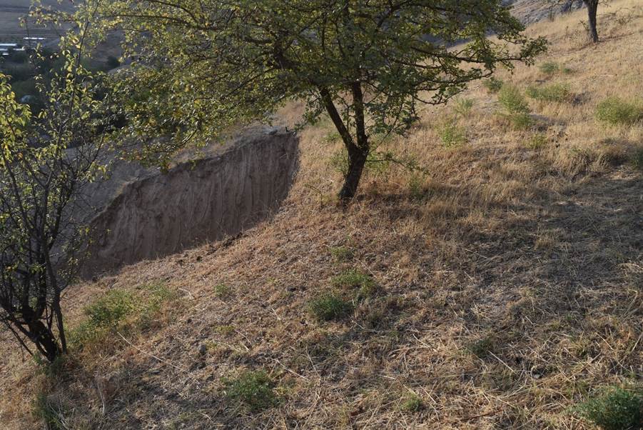
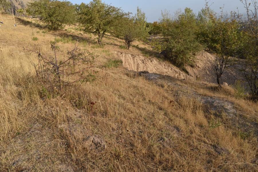
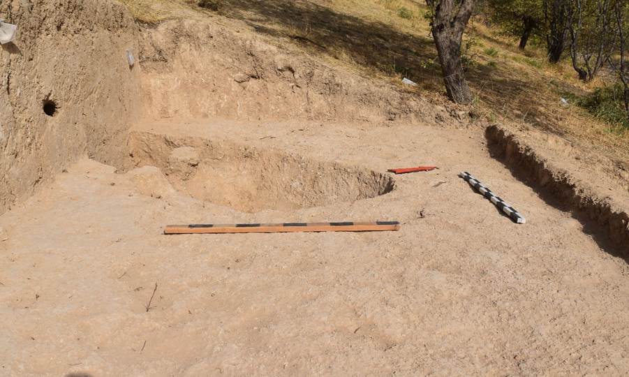
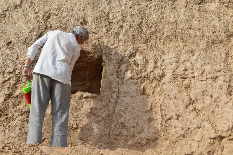
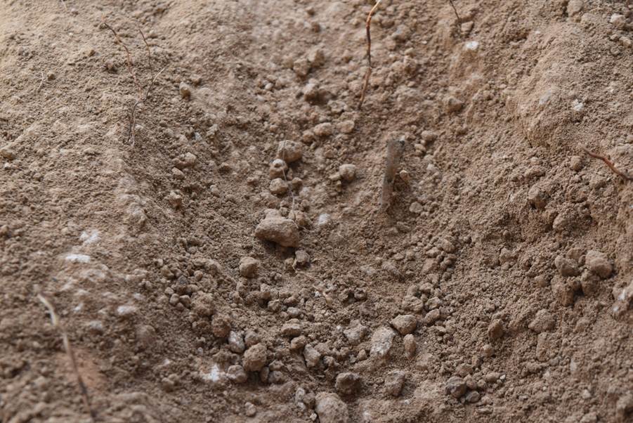
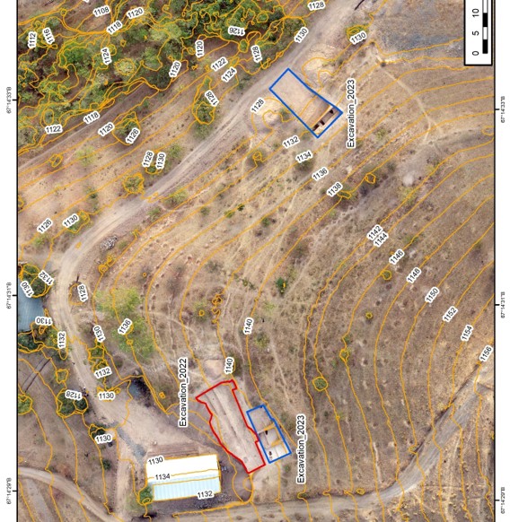
The Suleiman tepa 1 burial ground, discovered in April 2022, is located on a mountain slope formed on the western side of a range by a grey-bluish rock outcrop. The ground pits are arranged in loamy loess deposits of brown colour, rather loose.
On the slope there are irrigated plots, terraces with a network of canals stretching along the west-east line. Fruit trees cultivated: cherry, apple, walnut, hawthorn, as well as dog rose bushes and vines. The grass cover is very dense. The northern part of the slope was destroyed by heavy machinery during the preparation of the site for the construction of a residential building (see Appendix “Drawings”, fig. 4-5).
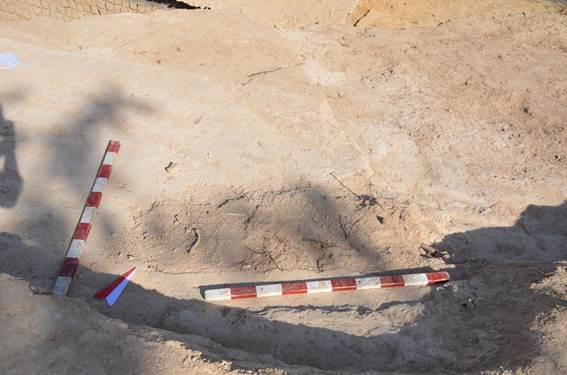
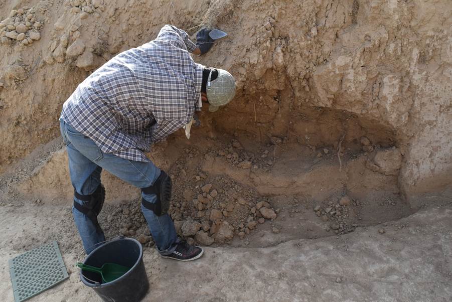
In the profile formed during the removal of soil using an excavator, at the time of the beginning of archaeological research, three sections of exposed bone remains (burials) were seen: two in the southern profile (01, 02) and one in the eastern one (03).
Where the ground was cut, in several places, fragmented grey-bluish rocks are visible.
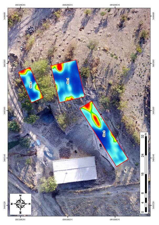
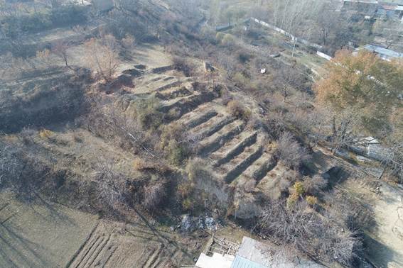
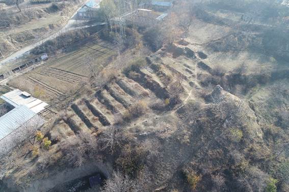
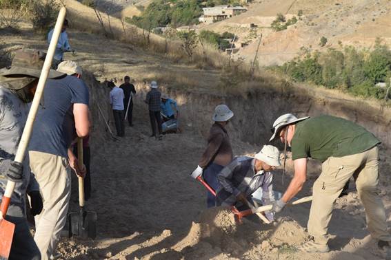
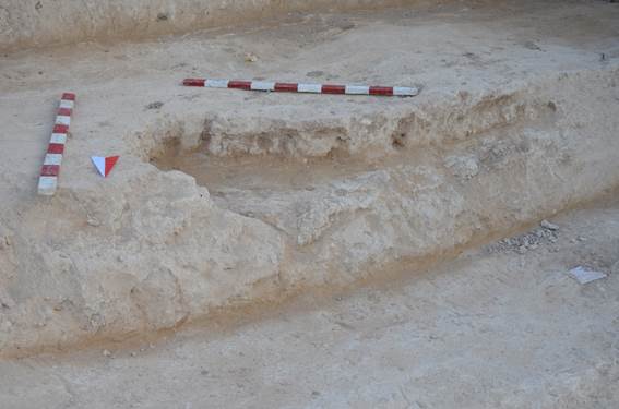
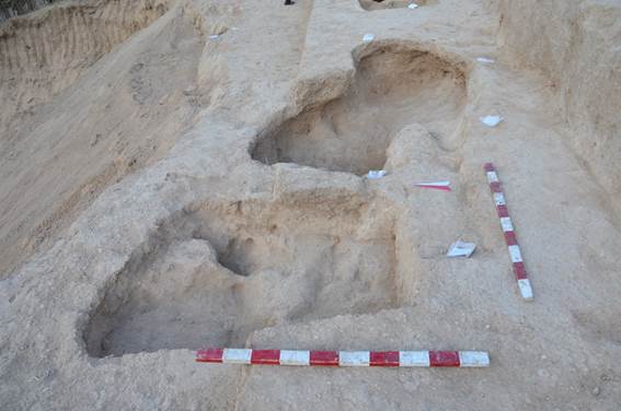
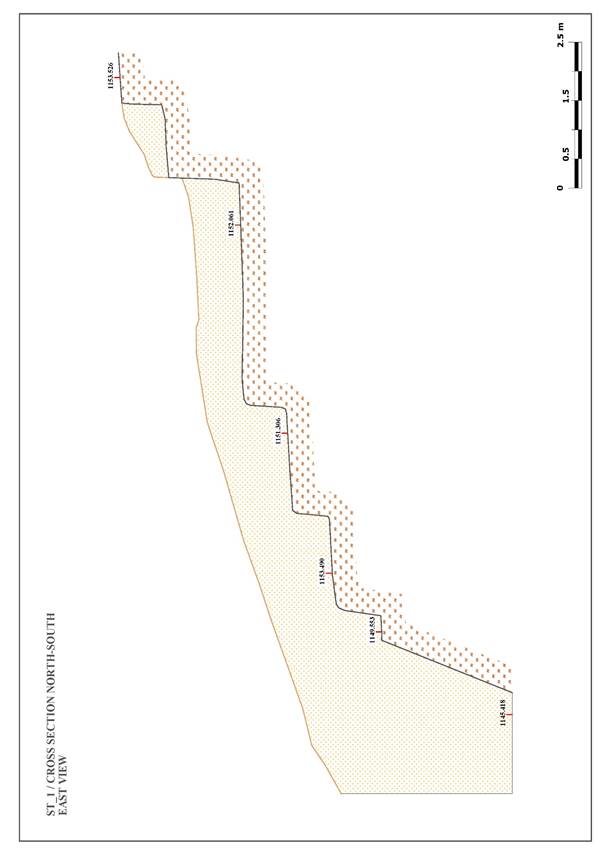
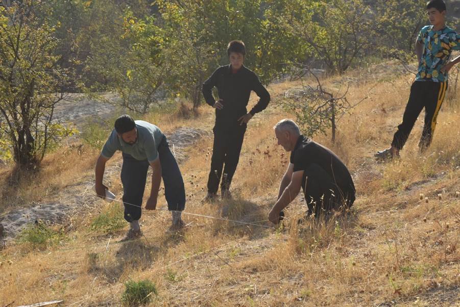
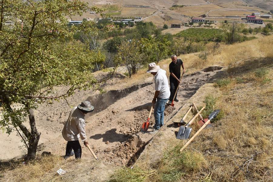
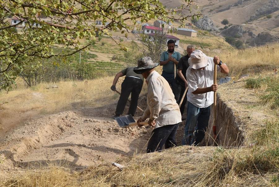
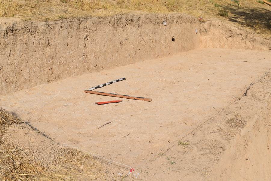
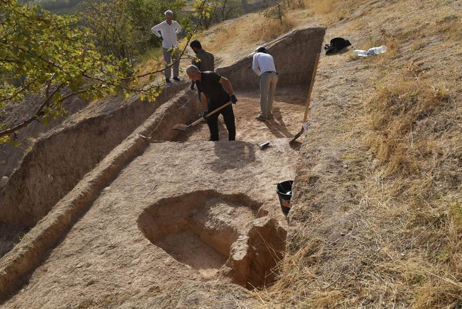
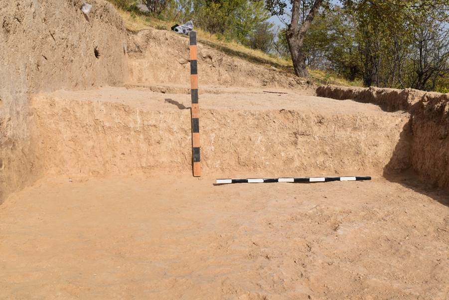
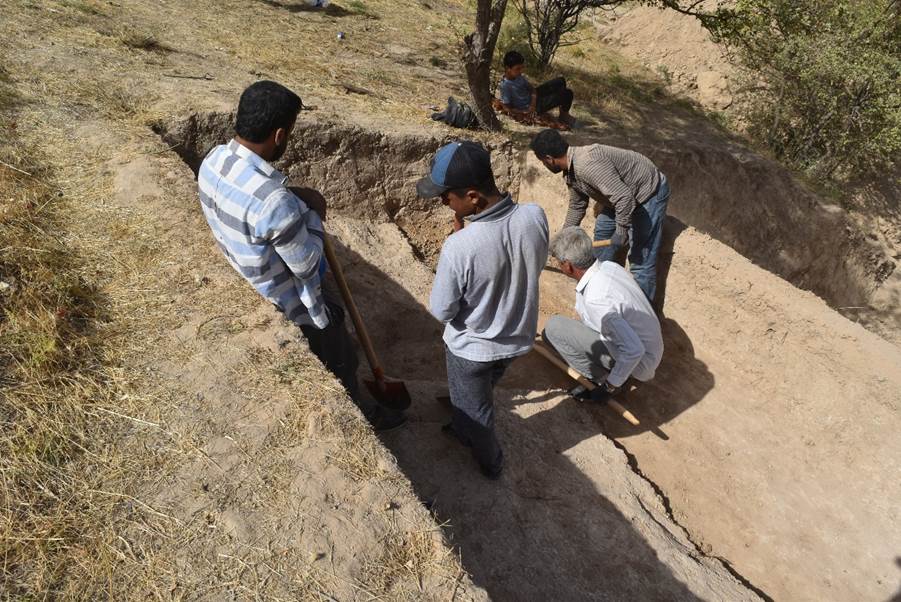
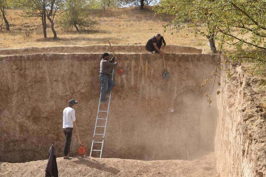
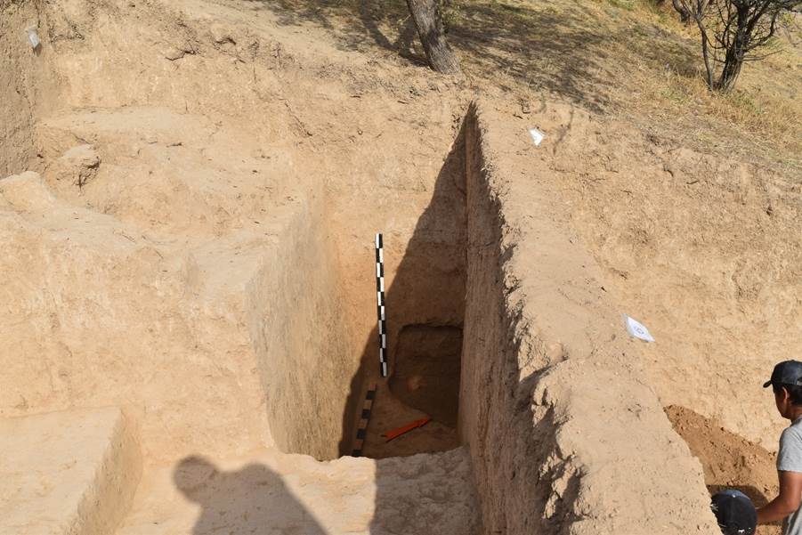
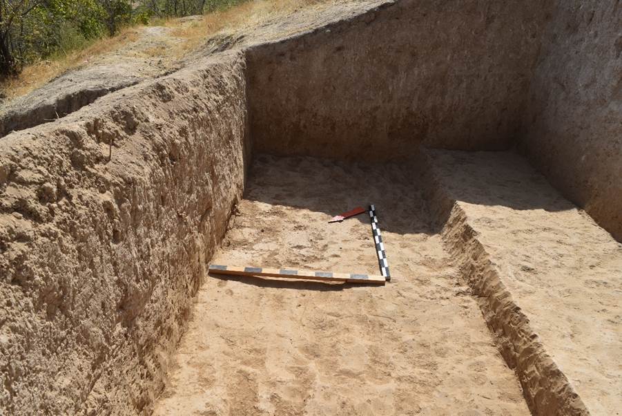
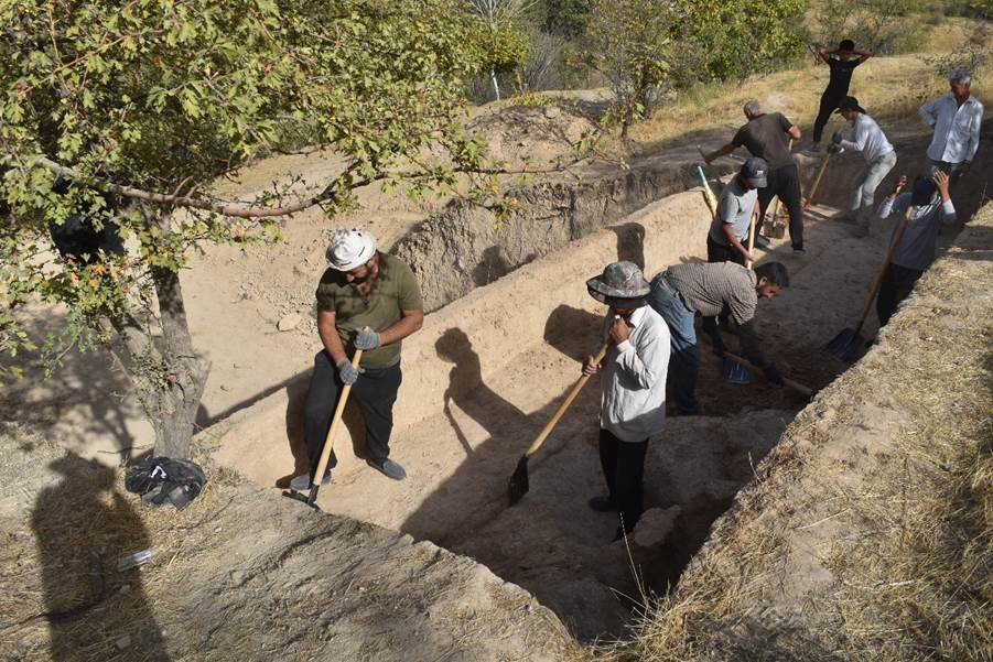
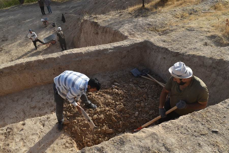
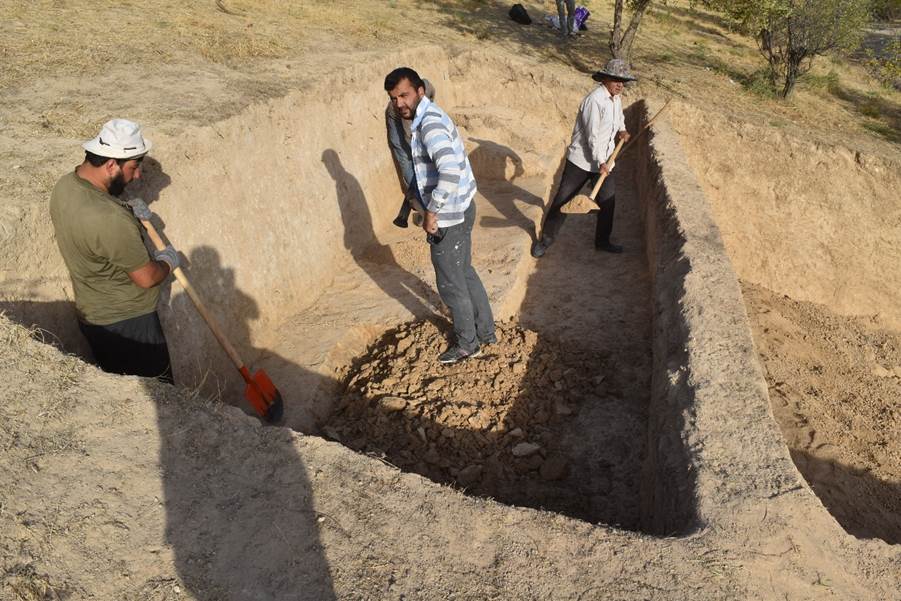
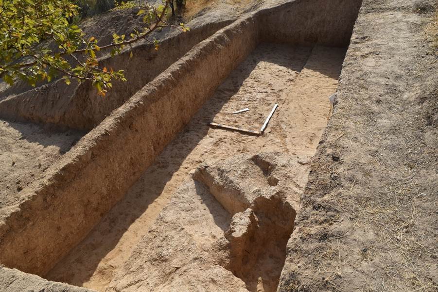
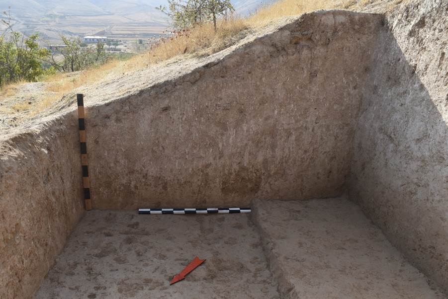
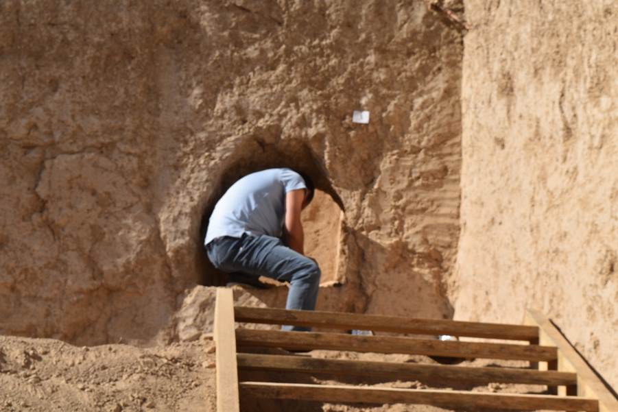
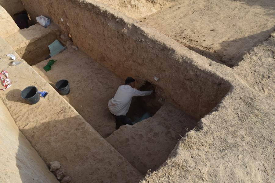
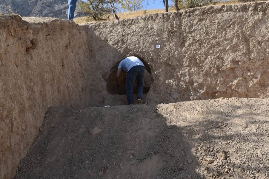
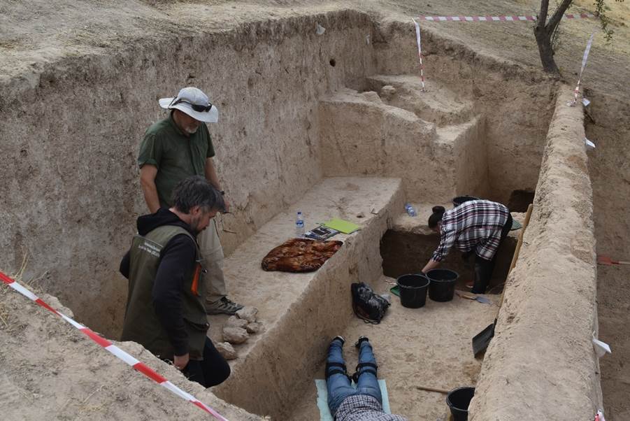
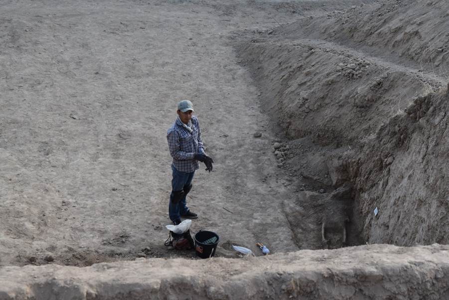
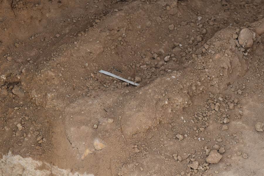
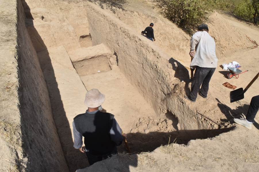
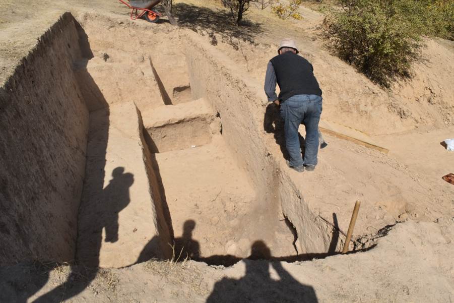
To study the exposed burials, a 23x8-meter excavation pit was dug (see Appendix “Photos”, fig. 48-50).
Suleman Tepa 1 (ST_1) is the designation for the site of the discovered remains first found in April 2022 near the city of Urgut, Uzbekistan. Because the owner of the house at the site was about to continue removing part of the mountainside with excavation equipment, a rescue excavation of the area due south of the newly constructed domicile was undertaken. Originally a 10 x 10 m trench had been delineated the previous day, however, on Sept. 6, an excavator tractor appeared on the scene with the specific purpose of removing more soil from the northern hillside which had already yielded human remains from previous work that had occurred at least as early as October 2020, and additional work that occurred after April 2022. In addition, a single-story domicile was constructed on this area of cleared land between April 2022 and September 2022. A previous grave discovered at the site in April 2022 as seen in the northern profile was now removed due to removal by excavation equipment, however, 3 additional graves were seen in the altered profile, once again confirming that the site was a cemetery.
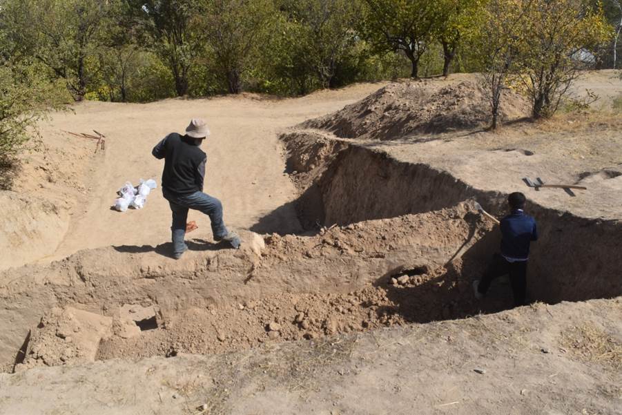
Additionally, human bones were again seen in and around the territory. These were bagged and later measured and analyzed. We were also informed by local residents that the bones that have been discovered in the course of excavations were collected and buried in a common pit. This pit’s location was known and examined.
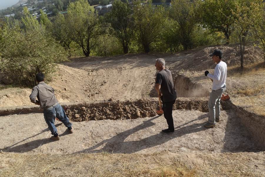
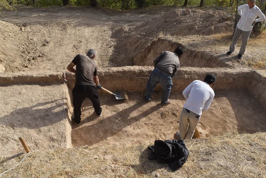
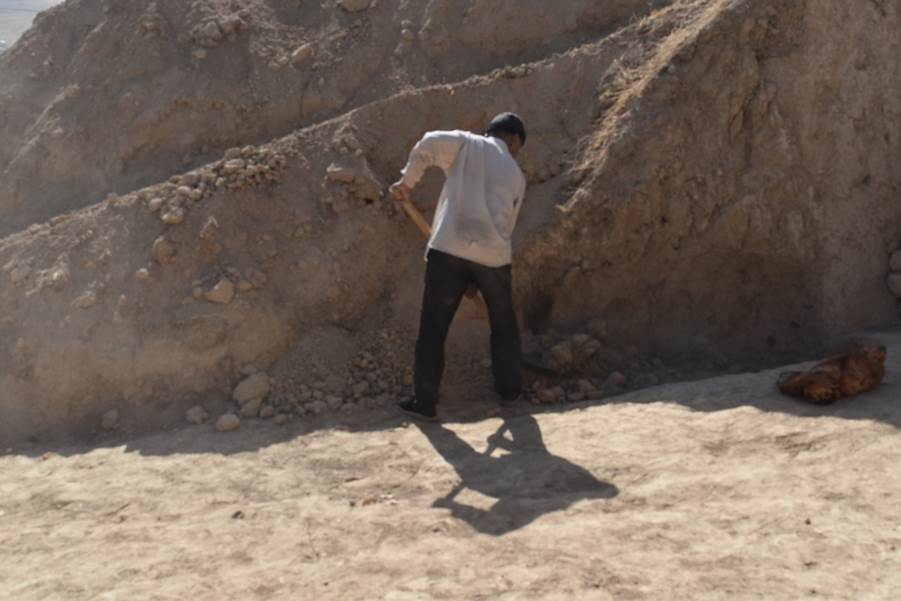
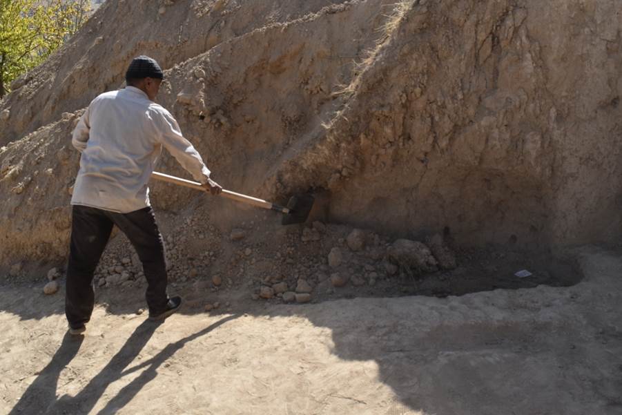
Archaeological team then hired the mechanical excavator to remove the upper 80 to 100 cm of soil on the mountainside to more quickly access the suspected graves to prevent further damage due to construction. The area excavated and revealed due to the use of the heavy equipment was considerably larger than the previously marked out 10 x 10 m trench, and became a 23 x 8 m trench with a terrace in between running E/W (see Appendix “Drawings”, fig. 6-8).
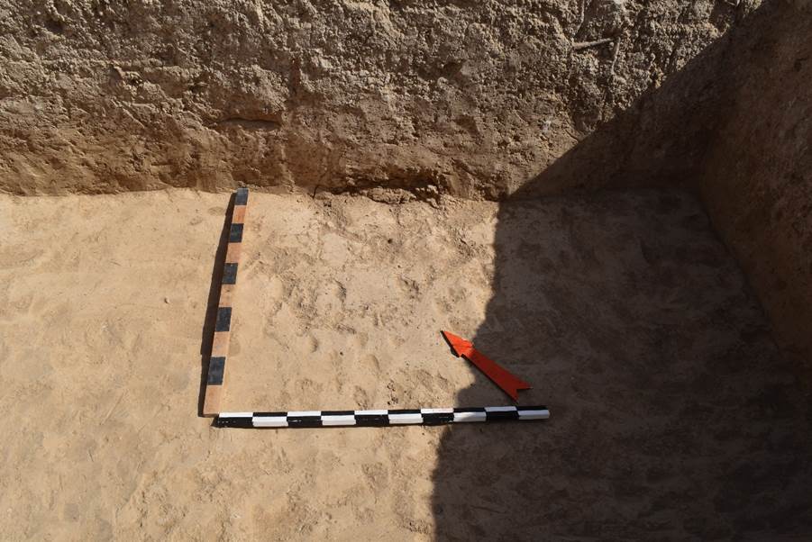
Following the previous day’s clearing by the mechanical excavator, the area of ST 1 was leveled using hand shovels and picks.
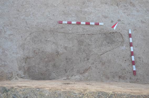
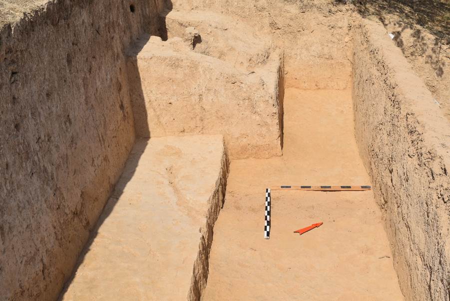
Once the area was cleared and swept by a mechanical blower, initially 8 graves and locations with human skeletal remains were revealed. Three of these were in the north profile, as mentioned above, and designated as Elements 01, 02, and 03. These remains were easily seen in the large profile cut done by the previous construction work.
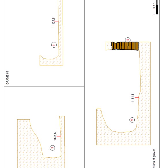
List of graves and related elements
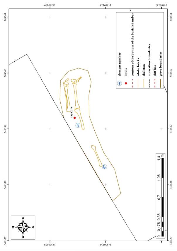
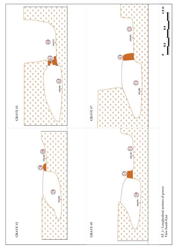
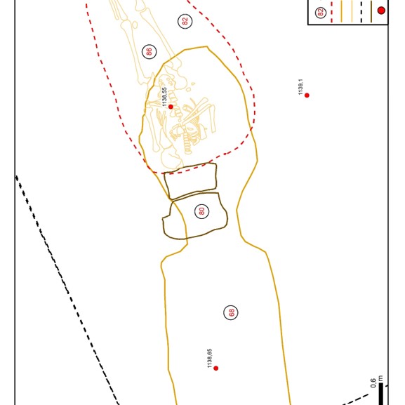
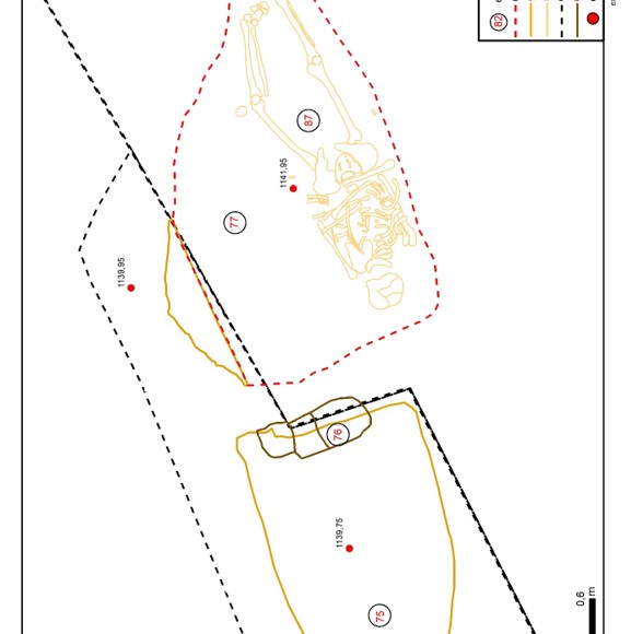
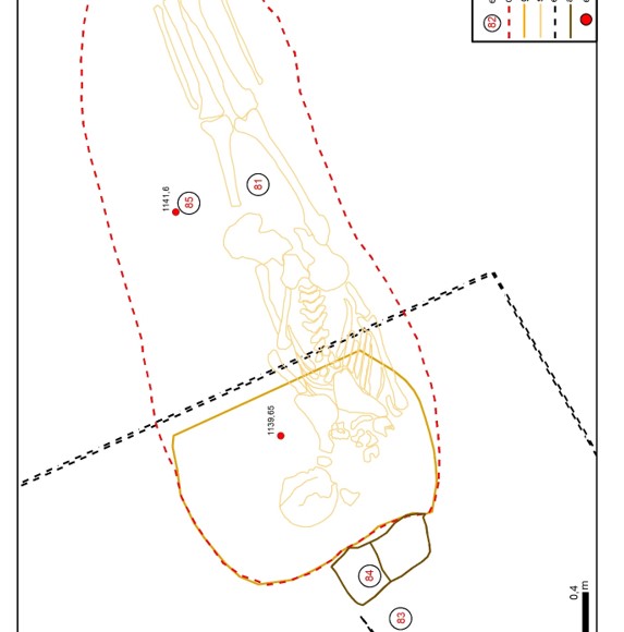
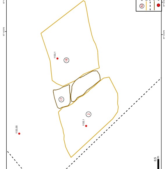
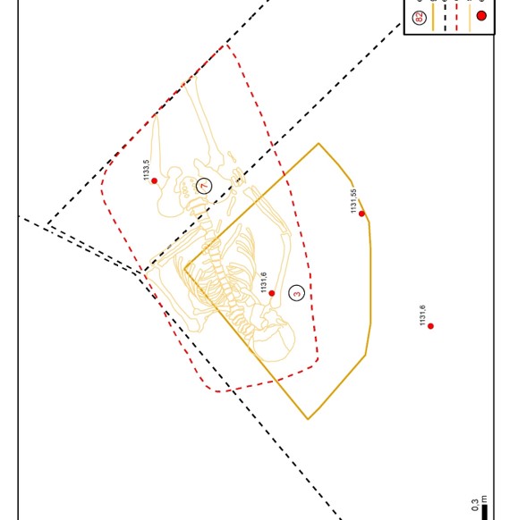
Grave#1 – element 07, 23 (see Appendix “Drawings”, fig. 9);
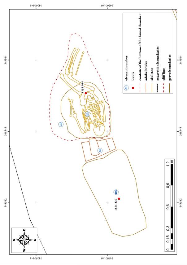
Grave#2 – element 08, 28, 29, 33 (see Appendix “Drawings”, fig. 10);
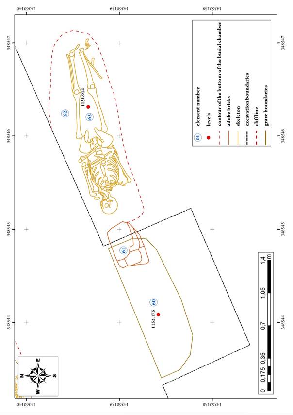
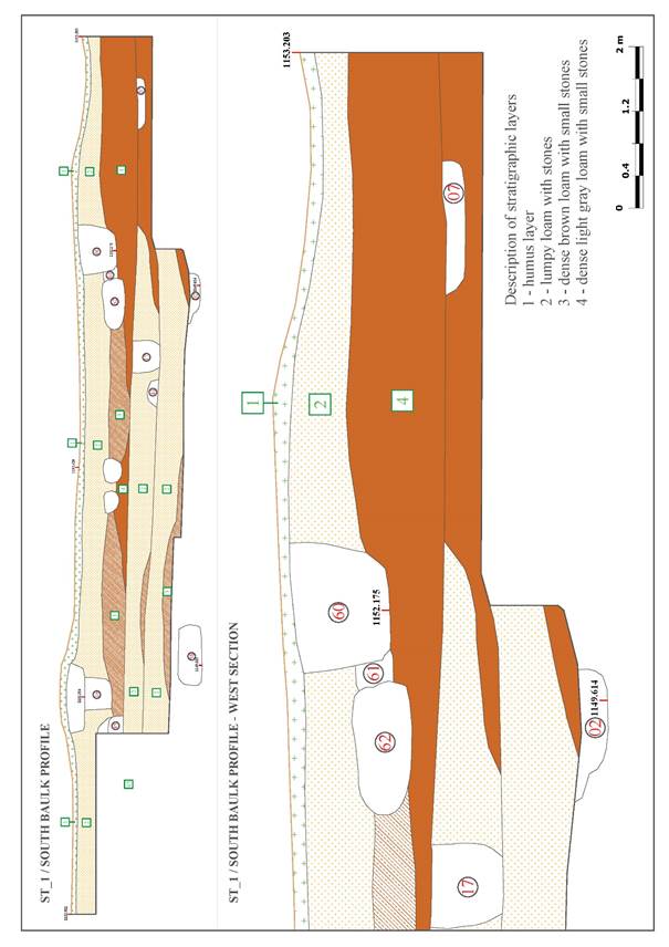
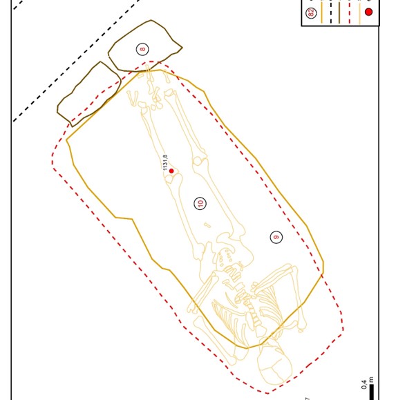
Grave#3 – element 60, 61, 62, 63 (see Appendix “Drawings”, fig. 11);
Grave#4 – element 10, 34 (see Appendix “Drawings”, fig. 12);
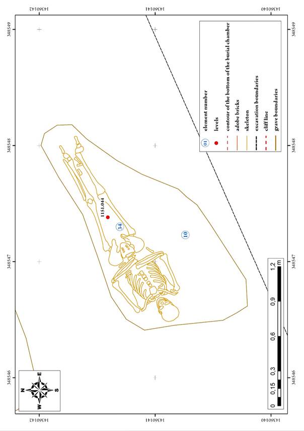
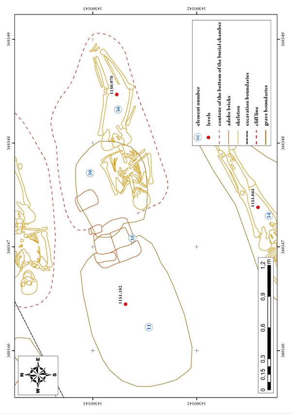
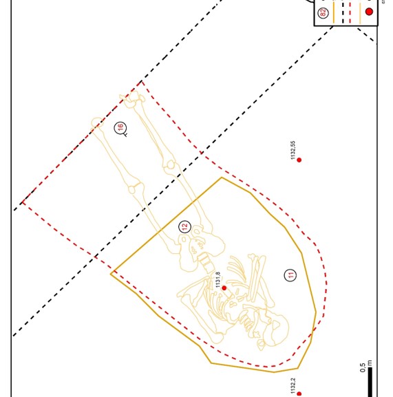
Grave#5 – element 11, 35, 36, 39 (see Appendix “Drawings”, fig. 13);
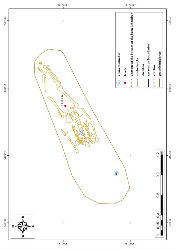
Grave#6 – element 05, 22 (see Appendix “Drawings”, fig. 14);
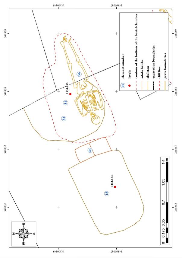
Grave#7 – element 15, 43, 51, 52, 56 (see Appendix “Drawings”, fig. 15);
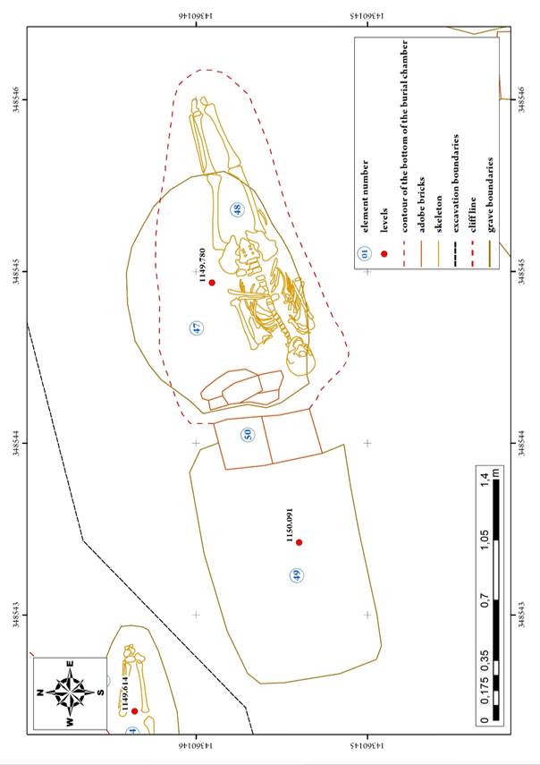
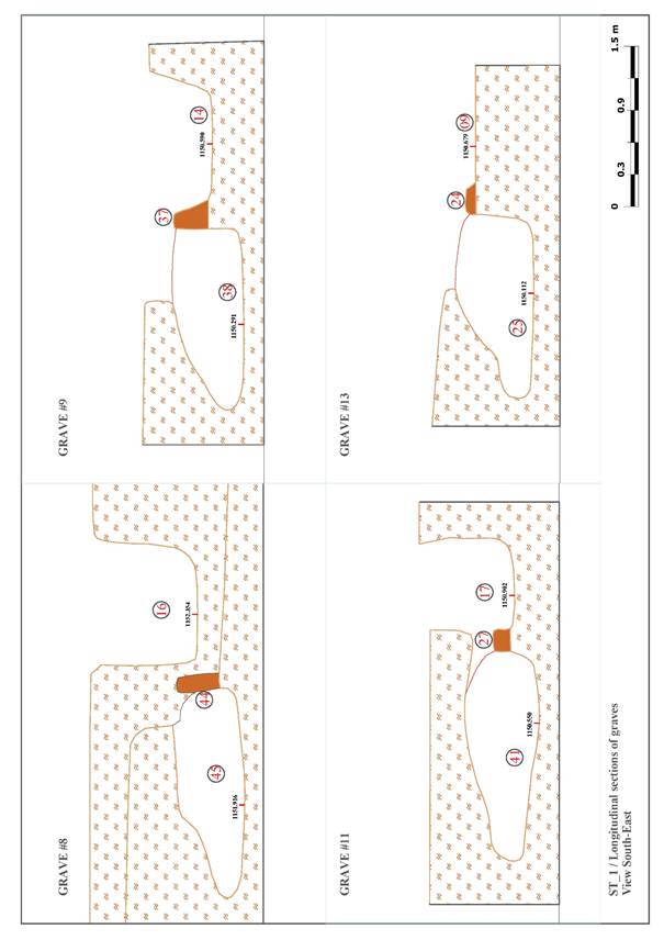
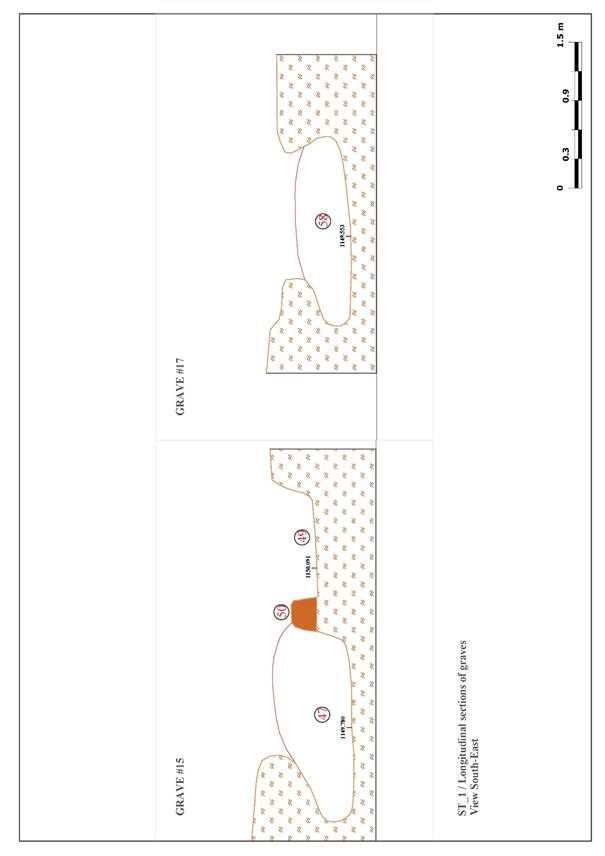
Grave#8 – element 44, 45, 46 (see Appendix “Drawings”, fig. 16);
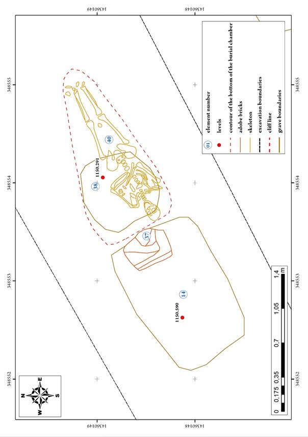
Grave#9 – element 14, 37, 38, 40 (see Appendix “Drawings”, fig. 17);
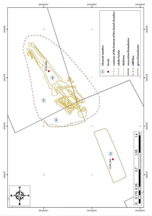
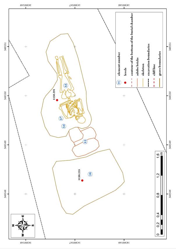
Grave#10 – element 18, 53, 54, 55, 57 (see Appendix “Drawings”, fig. 18);
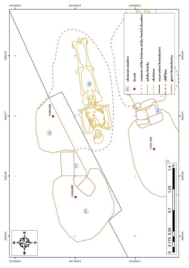
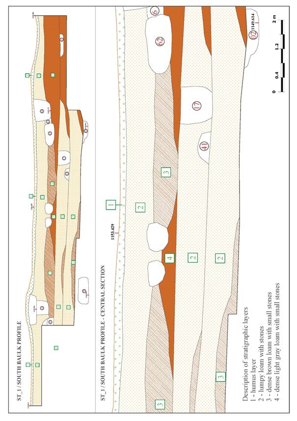
Grave#11 – element 17, 26, 27, 41 (see Appendix “Drawings”, fig. 19);
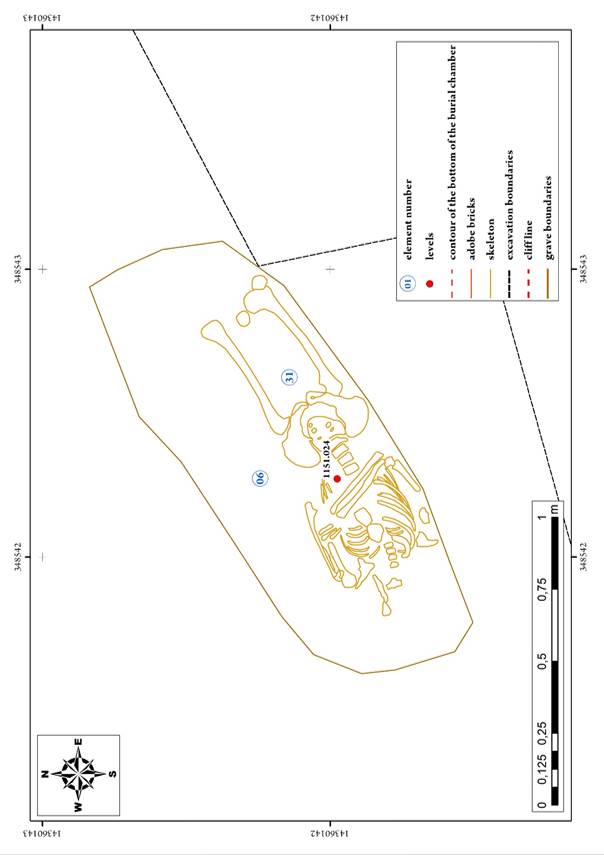
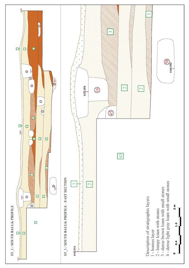
Grave#12 – element 06, 31 (see Appendix “Drawings”, fig. 20);
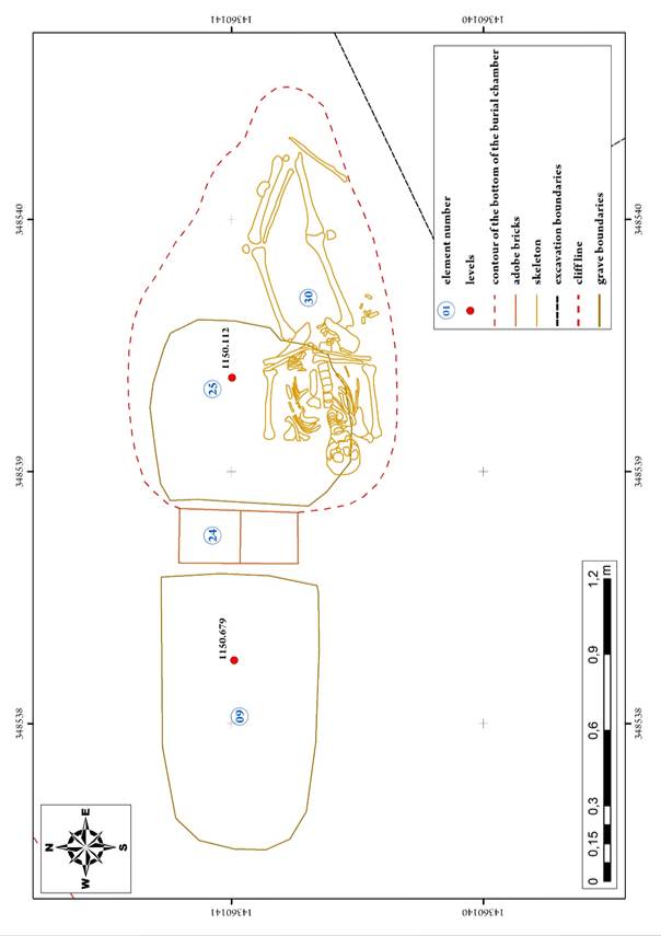
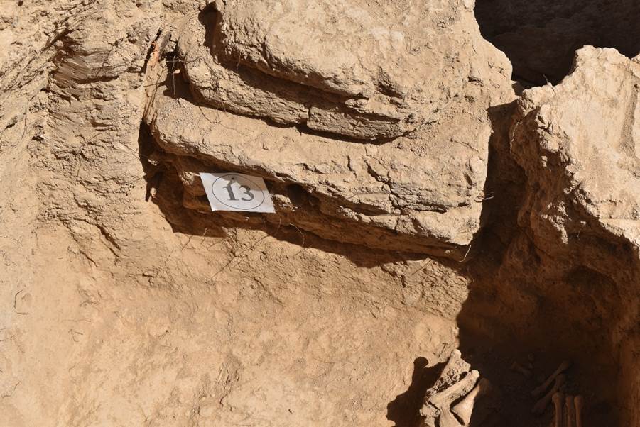
Grave#13 – element 09, 24, 25, 30 (see Appendix “Drawings”, fig. 21);
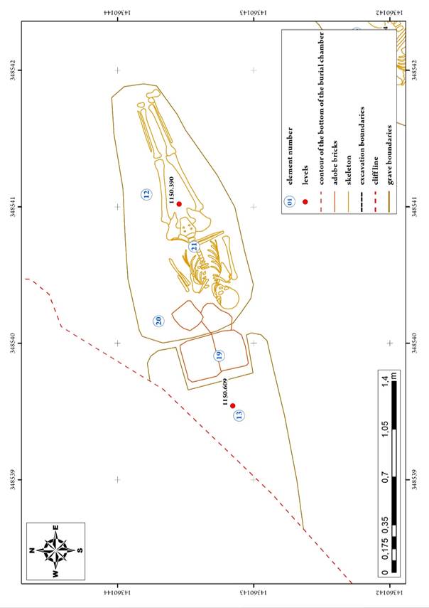
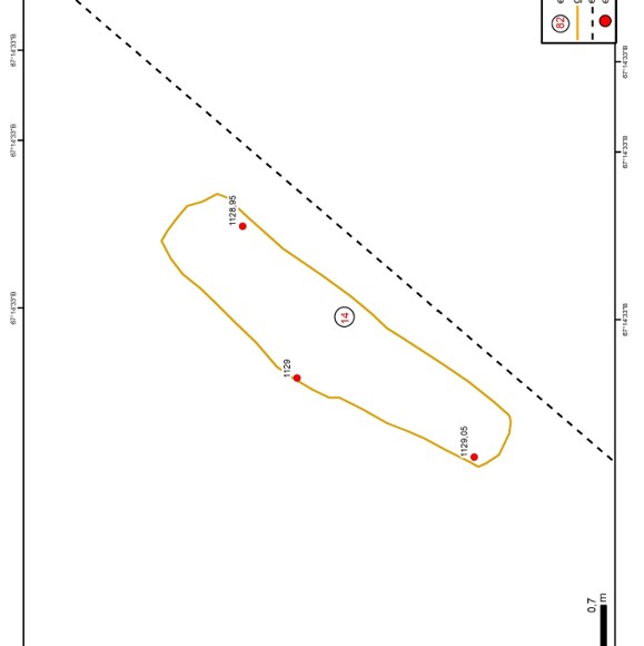
Grave#14 – element 12, 13, 19, 20, 21 (see Appendix “Drawings”, fig. 22);
Grave#15 – element 47, 48, 49, 50 (see Appendix “Drawings”, fig. 23);
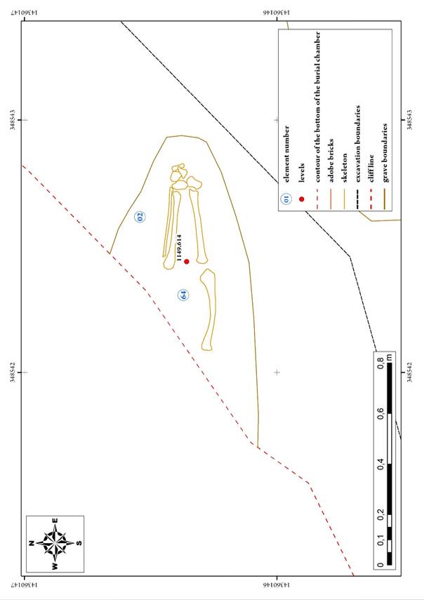
Grave#16 – element 02, 64 (see Appendix “Drawings”, fig. 24);
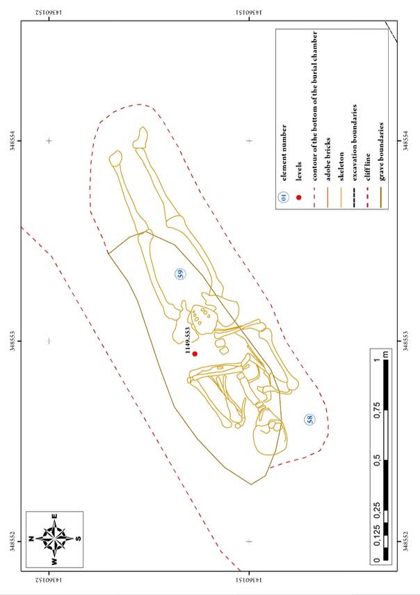
Grave#17 – element 58, 59 (see Appendix “Drawings”, fig. 25);
List of elements
Element 01. Exposed bone remains
Element 02. Exposed bone remains
Element 03. Exposed bone remains
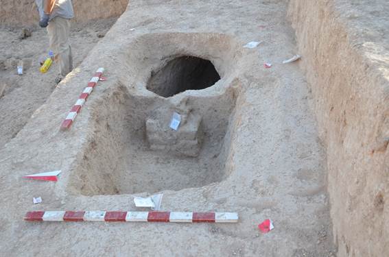
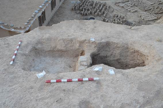
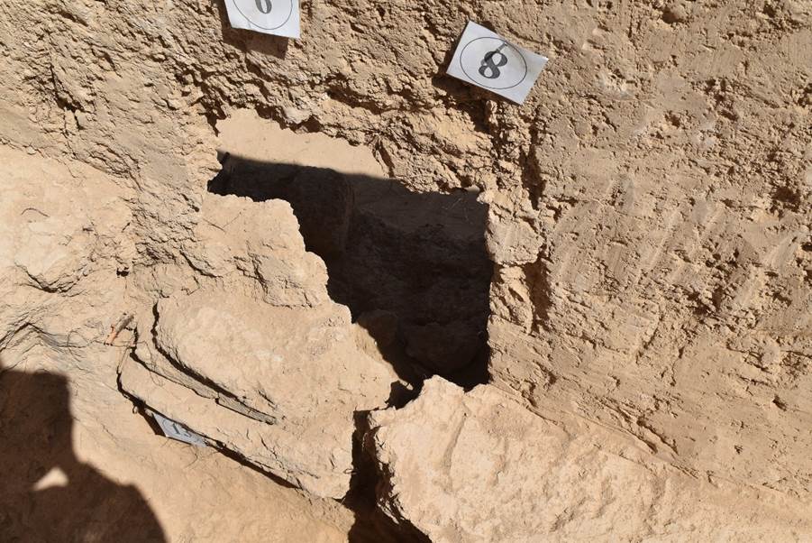
Element 06. Burial chamber
Element 07. Burial chamber
Element 08. Entrance ground pit
Element 09. Entrance ground pit
Element 10. Burial chamber
Element 11. Entrance ground pit
Element 12. Burial chamber
Element 13. Entrance ground pit
Element 14. Entrance ground pit
Element 15. Entrance ground pit
Element 16. Entrance ground pit
Element 17. Entrance ground pit
Element 18. Entrance ground pit
Element 19. Mud brickwork
Element 20. Mud brick blockage
Element 21. Skeleton
Element 22. Skeleton
Element 23. Skeleton
Element 24. Mud brickwork
Element 25. Burial chamber
Element 26. Skeleton
Element 27. Mud brickwork (partition)
Element 28. Mud brickwork
Element 29. Burial chamber
Element 30. Skeleton
Element 31. Skeleton
Element 32. Pit
Element 33. Skeleton
Element 34. Skeleton
Element 35. Mud brickwork
Element 36. Skeleton
Element 37. Mud brickwork
Element 38. Burial chamber
Element 39. Burial chamber
Element 41. Burial chamber
Element 43. Mud brickwork
Element 44_1, 2. Mud bricks/ Mud brickwork
Element 45. Burial chamber
Element 46. Skeleton
Element 47. Burial chamber
Element 48. Skeleton
Element 49. Entrance ground pit
Element 50. Mud brickwork
Element 51. Burial chamber
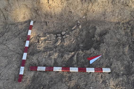
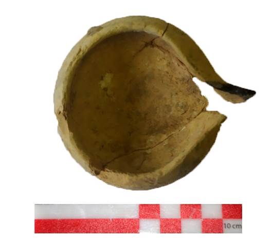
Element 52. Ceramic lamp
Element 53. Mud brickwork
Element 54. Burial chamber
Element 55. Skeleton
Element 56. Skeleton
Element 57. Brick blockage
Element 58. Burial chamber
Element 59. Skeleton
Element 60. Entrance ground pit
Element 61. Mud brickwork
Element 62. Burial chamber
Element 63. Skeleton
Element 64. Burial chamber
Code ST1_22_01_01
Element 01
Element description
Exposed bone remains (one bone) were recorded in the eastern part of the cut of the soil on the southern slope, made during activities to create a terrace for the construction of a residential building.
Element (01) is spatially located to the east of element (02).
Visually, the exposed bone remains are located in a layer of brown loam, where it passes into a layer of light grey dense loam.
Code ST1_22_01_02
Element 02
Element description
Exposed bone remains (one bone) were recorded in the eastern part of the cut of the soil on the southern slope, made during activities to create a terrace for the construction of a residential building.
Element (02) is spatially located to the west of element (01).
Visually, the exposed bone remains are located in a layer of brown loam, where it passes into a layer of light grey dense loam (see Appendix “Photos”, fig. 54).
Code ST1_22_01_03
Element 03
Element description
Exposed bone remains (one bone) were recorded in the eastern part of the cut of the soil on the southern slope, made during activities to create a terrace for the construction of a residential building.
Element (3) is spatially located to the west of element (01).
The bone apparently fell out of a burial, located somewhat higher, and lied on a small ledge formed by the teeth of the excavator bucket.
Code ST1_22_01_06
Element 06
Element description
Altitudes
1151.024
Burial chamber
Located in the western part of the excavation, most of the pit destroyed during construction activities. The lower contour of the pit with dimensions of 120x70 cm has been preserved, the pit is oriented along the WE line. The eastern part of the pit was originally 10 cm deeper than the western one, but after the removal of the soil, the bottom was levelled and the skeleton lay on the flat floor of the upper level.
The shape of the chamber is oval (see Appendix “Photos”, fig. 59-62).
Code ST1_22_01_07
Element 07
Element description
Altitudes
Top 1151.511
Bottom 1151.276
Burial chamber
Dimensions recorded on the surface:
Length 170-178 cm (current)
Width 57 cm (at the feet)
The chamber is a roughly rectangular shape, with rounded corners, oriented along the NW-SE line. Filling – loose loam of bright brown colour.
The skeleton (23) is in a fragmentary state (partially destroyed by construction machinery), which indicate that the buried person was laid on their back in a stretched position, NW-SE orientation. The bones are large, indicating the mature age of the buried person (see Appendix “Photos”, fig. 63-65).
Code ST1_22_01_08
Element 08
Element description
Altitudes:
Top 1151.564
Bottom 1151.439
An entrance ground pit, which is one of the structural elements of a burial consisting of the following components:
(08) – entrance ground pit;
(29) – mud brickwork blocking a passage between (49) and (47);
(28) – burial chamber;
(33) – skeleton.
The entrance ground pit has practically not been preserved, it has a roughly rectangular shape, the corners are rounded. The dimensions of the pit are 66-68x93 cm, the present-day depth is 27 cm.
The entrance pit is oriented along the NW-SE line, longitudinally passes into a burial chamber (29), while the burial chamber is located east of the entrance pit.
In the eastern wall of the entrance pit there is a passage 55 cm wide leading to a burial chamber. The passage narrows with the help of two protrusions (northern and southern) cut in the loamy mass of the mainland. The length of the southern protrusion is 30 cm, the width is 10 cm. The length of the northern protrusion is 36 cm, width 12 cm (see Appendix “Photos”, fig. 66-70).
Code ST1_22_01_09
Element 09 (see Appendix “Drawings”, fig. 27)
Element description
An entrance ground pit, which is one of the structural elements of a burial consisting of the following components:
(09) – entrance ground pit;
(24) – mud brickwork blocking a passage between (60) and (62);
(25) – burial chamber;
(30) – skeleton;
The pit is oriented along the WE line.
The pit has been preserved in traces – in the western part the contour of the bottom of the pit is visible, in the eastern part the walls up to 18 cm high are partially preserved.
The pit in the east has a narrowing in the form of a passage to the burial chamber (25), at the eastern edge on the floor of the pit there is a partition made of mud bricks (24). The width of the passage is 40 cm, the present-day height is 6 cm. Pit size: length about 125 cm, width about 65 cm (see Appendix “Photos”, fig. 71-76).
Code ST1_22_01_10
Element 10
Altitudes
Top: 1151.689
Bottom: 1151.516
Element description
Burial chamber
Dimensions: length 150 cm, width 108 cm. Destroyed in the upper part, there is no exit to the vault, the preserved height is 17-20 cm.
The chamber is a roughly rectangular shape, with rounded corners, oriented along the NW-SE line.
In the eastern part, the burial chamber narrows significantly into an appendix, 40 cm wide and 60 cm long, cut in the soil to place a dead person taller than the length of the burial chamber. Thus, the total length of the camera was 205 cm.
The dead person (34) was laid in a stretched position on their back along the northern side of the burial chamber. The southern part of the chamber remained unoccupied. Apparently, the burial chamber was made deeper by 17-20 cm in relation to the level of the entrance ground pit. The floor of the chamber is not smooth and has with numerous notches and holes (see Appendix “Photos”, fig. 77-80).
Code ST1_22_01_11
Element 11 (see Appendix “Drawings”, fig. 26)
Element description
Altitudes:
Top: 1151.655
Bottom: 1151.182
An entrance ground pit, which is one of the structural elements of a burial consisting of the following components:
(11) – entrance ground pit;
(39) – mud brickwork blocking a passage between (11) and (39);
(35) – burial chamber;
(36) – skeleton.
The entrance ground pit has been preserved to a height of 47-48 cm, has a roughly rectangular shape with cut corners. The dimensions of the pit are 130x82-88 cm.
The entrance pit is oriented along the NW-SE line, passing into a burial chamber (39), while the burial chamber is located east of the entrance pit.
In the eastern wall of the entrance pit there is a passage 39 cm wide leading to a burial chamber. The passage narrows through protrusions cut in the loam mainland from the northern and southern sides of the pit. The length of the southern protrusion is 10 cm, the width is 25 cm. The length of the northern protrusion is 20 cm, width 21 cm. The floor of the pit is not even. The passage is slightly shifted to the northern side (see Appendix “Photos”, fig. 81-84).
Code ST1_22_01_12
Element description
Altitudes:
1150.390
The burial chamber (dimensions recorded on the surface: length 190 cm, width 70 cm) is rectangular in shape with rounded corners, oriented along the NW-SE line.
Filling – loose loam of bright brown colour; small chips of dark blue rock and whitish large carbonates are found in small quantities in the filling.
At a depth of 26 cm, the skeleton of the buried person was cleared; it was stretched out on its back, head oriented to the west (21).
In the NW corner of the burial chamber, at the head of the buried, a blockage of mud bricks (20) was cleared; apparently, it was added to mud brickwork (19) blocking a passage to the burial chamber (12).
The walls of the burial chamber are practically vertical. The ceiling has not been preserved, but, apparently, it, like the ceilings of other burial chambers, was rounded. The vertical walls of the chamber passed into a rounded ceiling-vault approximately in the middle of their height at the level of 30-40 cm from the floor of the burial chamber.
On the western side, the burial chamber is separated from the entrance pit (12) by a narrowing entrance (width 43 cm wide, preserved height 20 cm, depth 15 cm) and mud brickwork (19) blocking the entrance (see Appendix “Photos”, fig. 85-87).
Code ST1_22_01_13
Element 13
Element description
Altitudes:
Top 1150.888
Bottom 1150.609
An entrance ground pit, which is one of the structural elements of a burial consisting of the following components:
(13) – entrance ground pit;
(19) – mud brickwork blocking a passage between (13) and (20);
(20) – burial chamber;
(21) – skeleton.
The entrance ground pit has practically not been preserved, it has a roughly rectangular shape, the corners are rounded. The dimensions of the pit are 190x70 cm, the preserved depth is 20-24 cm.
The entrance pit is oriented along the NW-SE line, longitudinally passes into a burial chamber (20), while the burial chamber is located east of the entrance pit.
In the eastern wall of the entrance pit there is a passage 48-50 cm wide leading to a burial chamber. The passage through a protrusion cut from the southern side in the loamy mainland, with dimensions of 17-18x13-23 cm (see Appendix “Photos”, fig. 88).
Code ST1_22_01_14
Element 14 (see Appendix “Drawings”, fig. 27)
Element description
Altitudes:
Top 1153.438
Bottom 1152.354
An entrance ground pit, which is one of the structural elements of a burial consisting of the following components:
(14) – entrance ground pit;
(37) – mud brickwork blocking a passage between (16) and (45);
(38) – burial chamber;
(40) – skeleton.
The entrance ground pit has been preserved to a height of 50-67 cm, has roughly rectangular shape, widening towards the east; the corners are not rounded. Dimensions: western wall 83 cm, northern wall 143 cm, eastern wall 105 cm, southern wall 133 cm (at the top). It has slanting walls narrowing to the bottom (to the floor), floor-level dimensions: western wall 62 cm, northern wall 116 cm, eastern wall 80 cm, southern wall 111 cm. The entrance pit is oriented with the long side in the direction of the NW-SE, in line with the burial chamber (38), while the burial chamber is located east of the entrance pit (14). In the eastern wall of the entrance pit there was a passage leading to a burial chamber. Passage dimensions: width 40 cm, height (complete preservation) 40 cm, depth not more than 15 cm. The height of the passage has been preserved completely, the upper part has not been destroyed.
The brickwork (37) covering the passage to the burial chamber (38) has been preserved insitu, not destroyed.
The floor of the entrance pit is uneven, has traces of holes.
The filling of the entrance pit consists of loose grey-brown loam (see Appendix “Photos”, fig. 89-92).
Code ST1_22_01_15
Element 15 (see Appendix “Drawings”, fig. 26)
Element description
Altitudes:
Top 1152.030
Bottom 1151.553
An entrance ground pit, which is one of the structural elements of a burial consisting of the following components:
(15) – entrance ground pit;
(53) – mud brickwork blocking a passage between (13) and (20);
(51) – burial chamber;
(56) – skeleton;
(52) – ceramic lamp
Element (15) is located in the eastern part of the excavation. It was found while cleaning the surface of the excavation.
Dimensions of the pit: length 140 cm, width 100 cm, depth 50 cm, rectangular shape in plan. The orientation of the pit is WE.
The pit is connected to the burial chamber (51) by means of a passage in the eastern part of the pit. Dimensions of the passage: width 50 cm, height 50 cm. The passage is blocked with mud bricks (53). The walls of the pit are uneven, the floor is flat. The pit is filled with loose soil light brown colour (see Appendix “Photos”, fig. 93-97).
Code ST1_22_01_16
Element 16 (see Appendix “Drawings”, fig. 27)
Element description
Altitudes:
Top 1153.438
Bottom 1152.354
An entrance ground pit, which is one of the structural elements of a burial consisting of the following components:
(16) – entrance ground pit;
(44) – mud brickwork blocking a passage between (16) and (45);
(45) – burial chamber;
(46) – skeleton.
The entrance ground pit has been preserved at a height of 100 cm (preserved and visible in the "main" southern profile of excavation 1), has a roughly rectangular shape in plan, the corners of the chamber are straight, not rounded. The northern side of the chamber has not been preserved, the dimensions can be specified as follows: length (preserved in the profile) 107 cm, width at least 100 cm (not specified more precisely due to the destruction in the northern part).
The entrance pit is oriented with the long side in the direction of the NW-SE, in line with the burial chamber (45), while the burial chamber is located east of the entrance pit (16).
In the eastern wall of the entrance pit there was a passage leading to a burial chamber. It is not possible to specify the dimensions of the passage due to the destruction of the northern part of the entrance pit and the burial chamber.
The brickwork (44) blocking the passage fell into the burial chamber (45) and partially on the skeleton lying on the left shoulder (46), which indicates the absence of ground filling of the burial chamber (45) and a skeleton (46).
The floor of the entrance pit is partially preserved, very smooth without traces of significant holes, the surface of the pit walls is similar to the floor surface.
The filling of the entrance pit consists of quite loose grey-brown loam (see Appendix “Photos”, fig. 98-103).
Code ST1_22_01_17
Element 17 (see Appendix “Drawings”, fig. 27)
Element description
An entrance ground pit, which is one of the structural elements of a burial consisting of the following components:
(17) – entrance ground pit;
(27) – mud brickwork blocking a passage between (60) and (62);
(41) – burial chamber;
(26) – skeleton;
Element (60) is located in the central part of the excavation.
The northern part of the burial chamber, the entrance pit and the partitions are lost. The contours of the bottom and the southern wall are what remains of the ground entrance pit. Dimensions of the pit: length 110 cm, width 90 cm, preserved height in the southern part 70 cm, in the northern part about 10 cm. The floor of the pit smoothly passes into walls, the surface of the floor and walls is smooth. In the eastern part of the pit there is a passage blocked with bricks (27) leading to the burial chamber (41). The width of the passage is 40 cm, height 40 cm, depth 40 cm.
The floor level of the entrance pit is 13 cm higher than the floor level of the burial chamber (see Appendix “Photos”, fig. 104-108).
Code ST1_22_01_18
Element description
Altitudes:
Top 1150.879
Bottom 1150.235
An entrance ground pit, which is one of the structural elements of a burial consisting of the following components:
(18) – entrance ground pit;
(15) – mud brickwork blocking a passage between (13) and (20);
(54) – burial chamber;
(55) – skeleton;
(57) – mud brick blockage
The entrance ground pit was destroyed by a root system, it was not possible to establish clear boundaries and dimensions.
Approximate dimensions: length 95 cm, width 125 cm, preserved height 30 cm. A passage blocked with mud bricks leads from the entrance pit to the burial chamber (54). Dimensions of the passage: width 50 cm, preserved height 48 cm.
The filling of the pit is loose, the walls have not been preserved, the floor is heavily cut by roots (see Appendix “Photos”, fig. 109-112).
Code ST1_22_01_19
Altitudes
Top 1150.794
Bottom 1150.605
Element description
A mud brickwork blocking the entrance from the entrance pit (13) to the burial chamber (12).
The width of the brickwork is 36 cm, the depth is 47 cm, the height (preserved) is 17 cm.
The dimensions of the mud brick are 31x31x13 cm, the brick is grey in colour, very similar to the inter-brick mortar traced on the surface of the upper row of bricks, about 0.5-1 cm thick.
2 rows of bricks are laid without bond. The upper row (two bricks) is slightly shifted towards the burial chamber (see Appendix “Photos”, fig. 25).
Element 20
Element description
Mud brick blockage.
Cleared in the southern part of the burial chamber, to the north of the skull of the buried person. The blockage consists, apparently, of two rows of mud bricks.
Brick size: 31х31х14 cm. The brick is formed of brownish-yellowish uniform loam. The blockage line is stretched along the WE line.
The blockage is connected with the mud brickwork (19), which blocked the entrance between the burial chamber and the entrance pit.
The size of the brick in the brickwork (19) is 31x31x14 cm, identical to element 20 (see Appendix “Photos”, fig. 86).
Code ST1_22_01_23
Element 23
Altitudes
1151.278
Element description
Skeleton
Only the lower limbs of the skeleton of the buried person were recorded. The skeleton was laid in the burial chamber (7) on its back, stretched along the NW-SE line.
The bones are large, which may indirectly indicate the mature age and strong physique of the buried person (see Appendix “Photos”, fig. 64).
Code ST1_22_01_24
Element 24
Altitudes
1150.783
Element description
Mud brickwork blocking the entrance from the entrance pit (9) to the burial chamber (28).
Brickwork width 23 cm, length 40 cm, height 10 cm. The dimensions of the mud brick are 40x22x8–9 cm.
The brickwork is made of two bricks lying one on top of another. The brick clay is a brown-grey loamy mass. The inter-brick mortar was not recorded.
Code ST1_22_01_25
Element 25
Element description
Altitudes
Top 1150.793
Bottom 1150.130
Burial chamber
Dimensions:
length
length 175 cm
width (in the central part) 107 cm
width (NW part) 115 cm
width (SW part) 74 cm
height (in the central part) 80 cm
height (in the NW part) 68 cm
height (in the SW part) 50 cm
In plan the burial chamber has an oval shape, the corners are rounded, oriented NW-SE.
The ceiling of the chamber has a spherical shape, the walls of the chamber very smoothly pass into the ceiling, which generally gives the chamber a spherical shape. The smooth transition into the sphere begins at about 28 cm from the floor level. The floor of the burial chamber is levelled.
In the area of the legs (actually at the level of the knee joints), the burial chamber narrows significantly to a width of 63 cm and a height of 35-40 cm. On the surface of the floor, walls and ceiling of the burial chamber, traces of the tool used to dig out the chamber in the thick brown-grey loam are clearly visible. The hand trench tool that left traces, apparently, had a flat blade 8 cm wide. The surface of the blade had numerous notches (about 6 notches along the entire width of the blade).
The material from which the trench tool was made is not known, perhaps it was wood. The metal blade is easily smoothed by hammering and does not leave a large number of marks from notches.
The tool was used vertically, the soil was removed by movements directed from top to bottom, leaving traces of 9 cm high on the loam surface.
The surface of the spherical ceiling was made with the same tool, but using not the hitting method, but the method of cutting the soil with longitudinal movements from the far (SE) side of the chamber towards the top and the NW.
The filling of the burial chamber is very loose bright brown loam, which filled the burial chamber almost completely up to its vault. Apparently, the filling is artificial, homogeneous in density, colour, and composition.
In the centre of the north-western wall of the chamber, a passage has been cut down connecting the burial chamber and the entrance pit (9).
The width of the passage is 43 cm, the height has not been preserved, the depth is 25 cm, while the width of the entrance pit is 63 cm. The passage is 20 cm narrower. The passage is blocked with mud brickwork (24).
The floor of the burial chamber (depth 1150.130) is deepened by 54 cm in relation to the floor of the entrance pit (09) (depth 1150.679).
Thus, the burial chamber (25), in addition to the entrance, is separated from the entrance pit (09) by a ledge (step) 54 cm high (see Appendix “Photos”, fig. 71-75).
Code ST1_22_01_27
Element 27
Element description
Mud brickwork (partition)
Element (27) separates the entrance pit (17) and the burial chamber (41).
The brickwork is made on the floor of the entrance pit (17). It is made of mud bricks 23x23x6 cm in size. The bricks form 2 lines, 2 bricks in 3 rows in each line. One brick lies nearby on the floor of the entrance pit.
Between the bricks there is an inter-brick mortar about 3 cm thick. The bricks are made of soil identical to the soil where the graves are located.
The brickwork in width completely blocks the passage, in height it does not reach the upper edge of the passage by about 10 cm. The top row of bricks is destroyed (see Appendix “Photos”, fig. 105-106).
Code ST1_22_01_28
Element 28
Altitudes
Top 1151.541
Bottom 1151.338
Element description
Mud brickwork blocking the entrance from the entrance pit (8) to the burial chamber (29).
The width of the brickwork is 33 cm, the depth is 45 cm, the height (preserved) is 23-24 cm.
The dimensions of the mud brick are 31x21x7-8 cm (badly damaged). The brick is grey in colour, poorly preserved. The presence of inter-brick mortar is difficult to determine. The upper part of the brickwork is destroyed. Apparently, one row of the brickwork has been preserved. Two rows of brickwork are recorded horizontally (see Appendix “Photos”, fig. 67-70).
Code ST1_22_01_29
Element 29 (see Appendix “Drawings”, fig. 26)
Element description
Altitudes
Top 1151.595
Bottom 1151.015
Burial chamber
Dimensions:
length
length 115 cm
width (in the central part) 86 cm
width (NW part) 64 cm
width (SW part) 45 cm
height (in the central part) 55 cm
height (in the NW part) 37 cm
height (in the SW part) 38 cm
In plan the burial chamber has an oval shape, the corners are absent, oriented NW-SE.
The ceiling of the chamber has a spherical shape, the walls of the chamber very smoothly pass into the ceiling, which generally gives the chamber a spherical shape. The smooth transition into the sphere begins at about 30-31 cm from the floor level. The floor of the burial chamber is levelled.
An interesting feature was revealed during the cleaning – the height of the buried person significantly exceeds the length of the pre-prepared burial chamber. To accommodate the buried person in the burial chamber of a shorter length than required, the legs of the buried person were bent at the knees, and additionally a recess 26 cm high, 29 cm wide, 38 cm deep was cut in the eastern wall of the burial chamber.
The surface of the walls and the vault of the burial chamber are made very roughly. Traces of numerous chips, irregularities are visible on the entire surface, as well as traces of a trench tool with a blade 2 cm wide.
The soil was removed in layers, chopped with multidirectional movements; after making the main volume of the chamber, the surface of its walls and ceiling was not additionally levelled.
The floor surface of the chamber was not additionally levelled.
The filling of the burial chamber consists of very loose bright brown loam.
The loose loam actually fills the burial chamber up to the upper level, which indicates its artificial nature. The filling is homogeneous in density, colour and composition.
In the centre of the north-western wall of the chamber, a passage has been cut to connect the burial chamber (29) and the entrance pit (8). The width of the passage is 53 cm, the preserved height (partially destroyed) is 23 cm, the depth is 36-37 cm. At the same time, the width of the entrance pit is 72 cm, that is, the passage is 35 cm narrower. The passage is blocked with mud brickwork (28).
The floor of the burial chamber (depth 1151.015) is deepened by 20-42 cm in relation to the floor of the entrance ground pit (8) (depth 1151.439).
Thus, the burial chamber (29) is separated from the entrance pit (8) by a 36-42 cm high ledge. The skeleton (33) is placed in the southern half of the chamber, the northern half is not occupied by anything (see Appendix “Photos”, fig. 67-70).
Code ST1_22_01_30
Element 30
Altitudes
1150.970
Element description
Skeleton
The skeleton was laid on the floor of the burial chamber (10) on its back, stretched along the NW-SE line.
The head of the buried person was raised by making a 2-3 cm thick soil cushion, so the face of the buried person was directed towards the east (sunrise).
The position of the arms: the right and left arms are stretched along the trunk, bent at right angles at the elbow joints, the hands lie at waist level.
Leg position: stretched.
The skeleton is located at the northern side of the burial chamber, while its southern side is not occupied by anything (see Appendix “Photos”, fig. 71-75).
Code ST1_22_01_32
Element 32
Altitudes
1150.945
Element description
Pit
The pit has a rounded shape, made of grey-brown loam, visually different from the surface of the excavation in a darker colour.
Code ST1_22_01_33
Element 33
Element description
Altitudes:
1151.044
Skeleton
The skeleton was laid on the floor of the burial chamber (29) on its back, stretched along the NW-SE line.
The head of the buried person was raised by making a 2-3 cm thick soil cushion, so the face of the buried person was directed towards the east (sunrise).
Arms: the right arm is bent at the elbow joint, the hand lie at waist level, the left arm is stretched along the trunk.
The legs are bent at the knees and turned to the left. The reason for this position of the legs is the discrepancy between the length of the burial chamber and the height of the buried person.
The skeleton is located at the southern wall of the burial chamber, while the northern half of the burial chamber is free (see Appendix “Photos”, fig. 67-70).
Code ST1_22_01_35
Element 35
Element description
Altitudes:
Top 1151.421
Bottom 1151.162
Mud brickwork blocking the entrance from the entrance pit (11) to the burial chamber (39).
The width of the brickwork is 44 cm, the height (preserved) is 26 cm. The dimensions of the mud brick are 24x28x8 cm.
The brick is grey-brown in colour. In total, three rows of bricks are recorded, laid without bond one on top of another (a total of six bricks). It is possible the two upper bricks were partially shifted and a kind of bond was formed. A half of a brick fell on the floor of the burial chamber, which indicates the burial chamber was not filled with soil at the time of the fall of the brick from the mud brickwork (35) onto the floor of the burial chamber.
Between the rows of the brickwork there is a layer of sandy loam richer grey-brown in colour, very loose, which is inter-brick mortar; the layer is up to 3 cm thick. One of the bricks in the brickwork has traces of ash, which possibly indicates the bricks were produced not at the burial site, but in places of active habitation and, accordingly, the use of fire (see Appendix “Photos”, fig. 82-83).
Code ST1_22_01_36
Element 36
Element description
Altitudes:
1150.970
Skeleton
The skeleton was laid on the floor of the burial chamber (39) on its back, stretched along the NW-SE line.
The head of the buried person was raised by making a 2-3 cm thick soil cushion, so the face of the buried person was directed towards the east (sunrise).
Arms: the right arm is bent at the elbow joint so that the hand rests below the chest, in the area of the iliac fossa. The left arm is also bent at the elbow joint, the hand lies at waist level.
The legs are slightly bent at the knees and, in this regard, have dropped to the right (southern) side.
The buried person is laid along the southern side of the burial chamber. The northern part of the chamber is free (see Appendix “Photos”, fig. 82-83).
Code ST1_22_01_37
Element 37
Element description
Altitudes:
Top 1151.977
Bottom 1151.584
Mud brickwork blocking the entrance from the entrance pit (14) to the burial chamber (38).
The width of the brickwork is 44-43 cm, the height (fully preserved) is 40 cm, the depth is 43 cm. The dimensions of the mud brick are 43х21х8 cm.
The brick is grey, made of very thick clay. The recorded part of the brickwork is four rows in height, two in width. The brick was laid without bond. A total of eight bricks are recorded.
The inter-brick mortar is practically not traced between the rows of bricks.
The brickwork is made in such a way that in the upward direction every next row is shifted by 1-1.5 cm towards the burial chamber, creating a kind of small ledges (see Appendix “Photos”, fig. 90-91).
Code ST1_22_01_38
Element 38
Element description
Burial chamber
Dimensions:
length 187 cm
width (in the central part) 77 cm
width (SE part) 90 cm
height (in the central part) 70 cm
height (in the NW part) 60-63 cm
height (in the SE part) 20 cm
In plan the burial chamber has a trapezoidal shape with rounded corners. The NW side is wide – 90 cm, the SE is narrow – 30 cm.
The walls of the chamber vertically rise to the level of 56 cm, after which they very abruptly pass into an arched vault. The floor of the chamber is levelled. The surface of the vault and the walls of the chamber are cut very roughly. The dimensions and shape of the trench tool blade: width 3-4 cm, traces of a tool resembling a pick axe are visible.
The burial chamber is filled to the top with loose loam the brown hue, which indicates the filling was purposeful. A passage connecting the burial chamber (38) and the entrance pit (14) was cut into the NW wall of the burial chamber. The width of the passage is 40-44 cm, height 40 cm, depth 15 cm.
The passage is blocked with mud bricks (37). The passage is located on the central axis of the entrance pit, but it is shifted from the central axis of the burial chamber. The southern side of the burial chamber (south of the passage) is 25-26 cm, the northern side (north of the passage) is 13 cm.
The buried person was laid along the southern side of the burial chamber, the passage was thus to the left (north) of the buried person. The width of the entrance pit is 105 cm, the width of the burial chamber is 85-87 cm, the width of the passage is 40-44 cm. The floor of the chamber is deepened in relation to the floor of the entrance pit – the height of the ledge / step is 17 cm (see Appendix “Photos”, fig. 91-92).
Code ST1_22_01_39
Element 39
Element description
Altitudes
Top 1151.646
Bottom 1150.970
Burial chamber
Dimensions:
length
length 175 cm
width (in the central part) 95 cm
width (NW part) 101 cm
width (SW part) 64 cm
height (in the central part) 52 cm
height (in the NW part) 59 cm
height (in the SW part) 39 cm
In plan the burial chamber has an oval shape with rounded corners, oriented NW-SE.
The walls of the chamber vertically rise to the level of 30-36 cm, after which they smoothly pass into an arched vault. The floor of the chamber is levelled.
The burial chamber narrows smoothly in the eastern part and has a rounded extention for the legs of the deceased. The width of the extension is 49 cm, height 30 cm, depth 45 cm. the buried person (36) is placed on the back in an stretched position. The legs are slightly bent at the knees, the bones are shifted to the right (to the south).
The surface of the walls and the vault of the burial chamber are cut very roughly with numerous traces of holes, without subsequent smoothing. The size of the blade of the trench tool is 1-2 cm.
The filling of the burial chamber consists of very loose bright brown loam. The loose loam actually fills the burial chamber up to the upper level, which indicates its artificial nature. In the north-western wall of the chamber, a passage has been cut to connect the burial chamber (39) and the entrance pit (11). The width of the passage is 39 cm, the present-day height is 32 cm. The burial chamber widens to the south by 40 cm in relation to the passage of the entrance pit (11). The buried person was laid along the southern side of the burial chamber, the passage was thus to the left (north) of the buried person (36).
In the northern direction of the burial chamber, in relation to the passage, it widens only by 6-8 cm. so the width of the entrance pit (11) is 82-88 cm, the width of the burial chamber is 100 cm, and the width of the passage is 39 cm. The passage is blocked with mud brickwork (35).
The floor of the burial chamber (level 1150.970) is deepened by 15-20 cm in relation to the floor of the entrance ground pit (11) (level 1151.182). The burial chamber (39) is separated from the entrance ground pit (11) by a ledge (step) 15-20 cm high (see Appendix “Photos”, fig. 82-83).
Code ST1_22_01_41
Element 41
Element description
The burial chamber (41) is oriented along the WE line.
The element is a continuation of the entrance pit (17) at SE. The northern part of the chamber is partially destroyed.
Dimensions:
length
length in the southern part 200 cm, in the northern part 100 cm
width (western part) 120 cm
width (centre) 90 cm
width (eastern part) 30 cm
height (western part) 55 cm
height (centre) 57 cm
height (eastern part) 30 cm
The walls of the burial chamber round smoothly to the ceiling, at a height of 30 cm from the floor there is a sharp rounding to the ceiling. The floor and walls of the chamber are quite smooth, the ceiling is rougher and uneven (see Appendix “Photos”, fig. 105-106).
Code ST1_22_01_43
Element 43
Element description
Altitudes:
Top 1151.972
Bottom 1151.460
Mud brickwork
Element (43) separates the entrance pit (15) and the burial chamber (51). A brickwork blocks the entire passage with dimensions of 50x50 cm. In the brickwork there are 5 rows of very eroded bricks, about 30 cm long; the height of the bricks is about 7-8 cm, the width is about 20 cm. A 2-3 cm thick inter-brick mortar is visible between the bricks (see Appendix “Photos”, fig. 94-96).
Code ST1_22_01_44_1
Element 44_1
Element description
Altitudes
Top 1152.103
Bottom 1151.911
Mud bricks that fell out of the brickwork in the eastern direction into the burial chamber (45). Three bricks fell on the left shoulder of a skeleton (46) buried in the burial chamber (45).
The inter-brick mortar is not visible. The material is dense loam of light grey colour.
There are two types of bricks:
Type 1 – 22x18x7 cm
Type 2 – 22x22x9 cm
One Type 2 brick is located at the bottom, two Type 1 bricks are located on top of the Type 2 brick. They stretch along the NS line.
Code ST1_22_01_44_2
Element 44_2
Element description
Mud brickwork
Blocking/closing the passage from the entrance pit (16) to the burial chamber (45).
The brickwork has collapsed into the interior of the burial chamber and is partially lying on the floor of the burial chamber, partially on the upper left part (shoulder girdle) of the skeleton of the buried person (46).
By the location of the fallen bricks, it is possible that it is shifted somewhat northwards in relation to the central axis of the burial chamber.
The dimensions of the brick are 26x26x7-7.5 cm. The brick is grey-brown in colour, the clay is very dense, but it cracks quite easily.
Element 45
Element description
Altitudes
Top 1152.665
Bottom 1151.916
Burial chamber
Dimensions:
length
length 193 cm
width (in the central part) 103 cm
width (NW part) 123 cm
width (SW part) 72 cm
height (in the central part) 69 cm
height (in the NW part) 74 cm
height (in the SW part) 52 cm
In plan the burial chamber has an oval shape with rounded corners, oriented NW-SE.
The ceiling of the chamber has a spherical shape, the walls of the chamber rise vertically to the level of 41 cm, after which they smoothly pass into a spherical vault. The entire northern side of the vault of the burial chamber has a spherical shape. The entire southern side opposite is not turned completely into a sphere. The southern wall of the chamber rises vertically up to the level of 54 cm, making up a virtually straight angle with a levelled ceiling, which only after 63-70 cm in the north direction passes into a spherical shape.
Deep inside, in the eastern direction, the ceiling of the chamber at a distance of 128 cm from the entrance to the chamber (from the ledge / step) separating the chamber from the entrance pit has a ledge 6-7 cm high, after which the burial chamber stretches and narrows, which is made to accommodate the buried person, whose height is larger than the length of the burial chamber. Dimensions: length 44 cm, width 57 cm, height 41 cm.
The buried person (46) is laid on his back in a stretched position along the southern wall of the burial chamber. The northern side of the chamber is free. Perhaps the passage connecting the entrance pit (16) and the burial chamber (45) was slightly shifted in the north direction. The surface of the walls of the vault of the burial chamber is cut in the continental loam very roughly, without subsequent smoothing. The size and shape of the blade of the tool is difficult to determine, the tool had a flat blade 3 cm wide, possibly an adze.
The filling of the burial chamber consists of very loose bright brown loam. This loam actually fills the chamber up to the vault, which indicates its artificial nature. Obviously, the burial chamber was wider than the entrance pit, but it is not possible to determine how much due to the fact that the entrance pit was partially destroyed.
The passage between the burial chamber (45) and the entrance pit (16) was blocked with mud brickwork (44), which probably collapsed while the burial structure was being filled in towards the burial chamber and is lying partly on the floor and partly on the left side of the skeleton. The burial chamber is separated from the entrance pit by a ledge/step 30-32 cm high (see Appendix “Photos”, fig. 101-102).
Code ST1_22_01_46
Element 46
Element description
Altitudes
1151.916
Skeleton
The skeleton was laid on the floor of the burial chamber (45) on its back, stretched along the NW-SE line.
The head of the buried is raised on the natural elevation of the floor of the burial chamber, possibly there was a ground cushion (height is not determined). Thus, the face of the buried person was directed to the eastern side.
Arms: the right arm is bent at the elbow joint in such a position that the hand is slightly below the waist. The left arm is also bent at the elbow joint at a right angle, the hand lies at waist level.
The legs are stretched straight, the knee joints are straightened.
The skeleton is located along the southern (right) side of the burial chamber, while the northern part of it is free (see Appendix “Photos”, fig. 101-102).
Code ST1_22_01_47
Element 47
Element description
Altitudes
Top 1150.582
Bottom 1149.780
Burial chamber
Dimensions:
length
length 210 cm
width (in the central part) 81 cm
width (NW part) 103 cm
width (SW part) 66 cm
height (in the central part) 65 cm
height (in the NW part) 65 cm
height (in the SW part) 53 cm
In plan the burial chamber has a trapezoidal shape with rounded corners. The NW side is wide, the SE one is narrow.
The walls of the chamber vertically rise to the level of 53-58 cm, after which they smoothly pass into an arched vault. The floor of the chamber is levelled. The surface of the vault and the walls of the chamber are cut very roughly.
The burial chamber is filled to the top with loose loam the brown hue, which indicates the filling was purposeful. A passage connecting the burial chamber (47) and the entrance pit (49) was cut into the NW wall of the burial chamber. Passage width is 56-57 cm, height 58 cm.
The passage is blocked with mud bricks (50). The passage is slightly shifted to the northern side. The passage is located on the central axis of the entrance pit, but it is shifted to the central axis of the burial chamber. The southern side of the burial chamber (south of the passage) is 32-37 cm, the northern side (north of the passage) is 15-21 cm.
The buried person was laid along the southern side of the burial chamber, the passage was thus to the left (north) of the buried person. The width of the entrance pit (49) is 92 cm, the width of the burial chamber is 101 cm, the width of the passage is 56-57 cm. The floor of the chamber (level 1149.780) is deepened in relation to the floor of the entrance pit (level 1150.077) by 29-30 cm – the height of the ledge / step is 25-27 cm (see Appendix “Photos”, fig. 113-116).
Code ST1_22_01_48
Element 48
Element description
Altitudes:
1149.780
Skeleton
The skeleton was laid on the floor of the burial chamber (47) on its back, stretched along the NW-SE line.
The head of the buried person was raised by making a 2-3 cm thick soil cushion, so the face of the buried person was directed towards the east (sunrise).
Arms: the right arm is bent at the elbow joint in such a way that the bones of the forearm are pressed against the bones of the shoulder, while the hand is in the area of the deltoids of the shoulder joint. The left arm is bent at the elbow joint by 75 °, the hand lies below the chest, in the region of the iliac fossa.
The legs are stretched out in a natural position.
The buried person is laid along the southern side of the burial chamber. The passage between the chamber and the entrance pit is shifted to the north, the northern part of the chamber is free (see Appendix “Photos”, fig. 113-116).
Code ST1_22_01_49
Element 49 (see Appendix “Drawings”, fig. 28)
Element description
Altitudes:
Top 1150.701
Bottom 1150.091
An entrance ground pit, which is one of the structural elements of a burial consisting of the following components:
(49) – entrance ground pit;
(47) – mud brickwork blocking a passage between (49) and (47);
(50) – burial chamber;
(48) – skeleton.
The entrance ground pit has been preserved to a height of 65-68 cm, has a roughly rectangular shape, the corners are not practically rounded. The dimensions of the pit are 128-138x98 cm.
The entrance pit is oriented along the NW-SE line, longitudinally passes into a burial chamber (47), while the burial chamber is located east of the entrance pit.
In the eastern wall of the entrance pit there is a passage 45 cm wide leading to a burial chamber. The passage narrows with the help of two protrusions (northern and southern) cut in the loamy mass of the mainland. The length of the southern protrusion is 13 cm, the width is 24 cm. The length of the northern protrusion is 15 cm, width 18 cm. The floor of the pit is not even. The passage is located on the central axis of the pit, but not on the central axis of the burial chamber – the chamber extends southwards (see Appendix “Photos”, fig. 113-116).
Code ST1_22_01_50
Element 50
Element description
Altitudes:
Top 1150.396
Bottom 1150.064
Mud brickwork
Blocking/closing the passage from the entrance pit (49) to the burial chamber (47).
The width of the brickwork is 45 cm (in the lower part), in the upper part it reaches 70 cm. That is, the passage roughly trapezoidal in shape narrows towards the bottom. The preserved height of the brickwork is 33-40 cm. The dimensions of the mud brick are 21х23x8–9 cm. The brick is grey, very dense, differing in density from bricks from other burials. In total, there are four rows of bricks recorded. The brick is laid in bonds, the width of the brickwork is one brick. Five brick halves 21x9-10x8 cm fell into the burial chamber, and lie on a layer of loose brownish soil 2-3 cm thick.
This is another evidence of the absence of the filling of the burial chamber with soil at the time of blocking the passage with mud bricks. Between the rows of bricks there is a layer of lumpy loose sandy loam of grey colour, which is inter-brick mortar, 1-4 cm thick (see Appendix “Photos”, fig. 113-116).
Code ST1_22_01_51
Element 51
Element description
Altitudes:
Top 1151.927
Bottom: 1151.182
The burial chamber (51) is located east of the entrance pit (15), the eastern half of the chamber goes beyond the edge of the excavation, the western half is open from above. In plan the chamber is a rectangle with an additional extension in the SE part (for the legs).
Chamber dimensions: length without extension 150 cm, length with extension 205 cm, width in the western part 110 cm, in the central part 100 cm, extension 48 cm, height of the western part 60 cm, central part 60 cm, eastern part 43 cm.
The burial chamber is located 25 cm below the level of the entrance pit. The floor of the burial chamber is flat, the walls and ceiling are uneven (see Appendix “Photos”, fig. 94-96).
Code ST1_22_01_52
Element 52
Element description
A ceramic lamp (chirag) was found in the northwestern part of the burial chamber (51). The object has a rounded shape with a diameter of 10 cm, the bottom is spherical, there is a spout on the edge, partially destroyed. It is made by the technique of hand modeling (see Appendix “Artifacts”, fig. 31-33).
Code ST1_22_01_53
Element 53
Element description
Altitudes:
Top 1151.972
Bottom 1151.460
Mud brickwork (partition)
Element (53) separates the entrance pit (18) and the burial chamber (54).
The brickwork is made on the floor of the entrance pit (18). The brickwork consists of two lines of bricks laid in three rows, the lines also consist of two bricks. Brickwork dimensions: height 34 cm, width 50 cm, length 50 cm. The dimensions of the brick are 20x25x10 cm.
The brick is light grey with an admixture of small stones and pieces of limestone, very dense. The material of the brick is similar to the soil in which the graves are arranged.
Inter-brick mortar about 3 cm thick is visible between the bricks (see Appendix “Photos”, fig. 110-111).
Code ST1_22_01_54
Element 54
Element description
Altitudes:
Top 1150.875
Bottom 1150.291
The burial chamber is oriented along the WE line.
The element is located in the southern part of the excavation, when clearing the surface, a rounded spot with loose filling and a large number of roots was found. During the excavation, it turned out that the roots destroyed the southern part of the burial chamber (54), which thus did not make it possible to identify its southern wall. In the northern part, a small fragment of the ceiling was excavated.
Dimensions of the chamber: length 210 cm, width in the eastern part 40 cm, in the central part 65 cm, in the western part 40 cm, preserved ceiling height in the central part 35 cm.
The shape of the chamber in plan was presumably a rough rectangle with an extension in the SE part. The filling of the chamber is dense loam interspersed with mud bricks of an amorphous shape (57) lying on the chest of the skeleton (55).
The walls and floor of the burial chamber are strongly cut by roots, the western edge of the chamber is vertical, the eastern rounded (see Appendix “Photos”, fig. 110-111).
Code ST1_22_01_58
Element 58 (see Appendix “Drawings”, fig. 28)
Element description
Altitudes
Top 1150.112
Bottom 1149.553
Burial chamber (58)
The element is located in the NE part of the excavation near the steep edge. Part of the burial chamber – the floor, part of the ceiling, the western and eastern walls – is what has remained of this burial. The partition and the entrance pit are destroyed.
Dimensions:
length
length 190 cm
width (western part) 55 cm
width (centre) 60 cm
width (eastern part) 45 cm
height (western part) 50 cm
height (centre) 50 cm
height (eastern part) 35 cm
The shape of the pit is rectangular with rounded western and eastern edges.
The western wall is vertical, the eastern one is rounded, the chamber narrows in height from west to east. The walls and floor of the chamber are smooth (see Appendix “Photos”, fig. 117-119).
Code ST1_22_01_60
Element 60
Element description
Altitudes:
Top 1153.206
Bottom 1152.175
An entrance ground pit, which is one of the structural elements of a burial consisting of the following components:
(60) – entrance ground pit;
(61) – mud brickwork blocking a passage between (60) and (62);
(62) – burial chamber;
(63) – skeleton;
Element (60) is located in the southern profile of the excavation, the northern half is lost.
Pit parameters: height 110 cm (on top of the ground pit there is a turf layer 30 cm thick), length 150 cm, preserved depth 40 cm. According to the preserved part of the pit, its shape in plan was probably roughly rectangular. The orientation of the pit as well as the entire burial is WE.
Element (60) is connected to element (62) by means of a passage blocked with brickwork (61). This passage is also destroyed in the northern part. Dimensions of the passage: height 30 cm – the level of the lower part of the passage is 10 cm higher than the level of the entrance pit (60), the preserved width of the passage is 50 cm, depth 25 cm.
The pit is filled with loose loamy soil light brown colour. The walls of the pit have an uneven surface, the floor is more even, in the western part the floor smoothly passes into the western wall – the corner is rounded (see Appendix “Photos”, fig. 120-127).
Code ST1_22_01_61
Element 61
Element description
Altitudes:
Top 1152.490
Bottom 1152.113
Mud brickwork (partition)
Element (61) separates the entrance pit (60) and the burial chamber (62).
The brickwork is made on the floor of the entrance pit (60). The northern part of the partition is lost. The preserved width of the masonry is 30 cm at the base, 17 cm at the top, the depth of the brickwork in 1 brick is 40 cm at the base, 25 cm at the top.
At the base of the masonry are 2 large grey bricks with dimensions of 40x22x10 cm, on the top there are three rows of dark grey bricks with a length of 25 cm, a height of 9 cm. There is a small layer of inter-brick mortar 2 cm thick between the bricks.
The brickwork does not block the entire passage – in the southern part there is an open section of the passage 35 cm wide, 30 cm high (see Appendix “Photos”, fig. 120-127).
Code ST1_22_01_62
Element 62 (see Appendix “Drawings”, fig. 26)
Element description
Altitudes
Top 1152.573
Bottom 1151.914
Burial chamber
Dimensions:
length
length 210 cm
width (head) 43 cm
width (centre) 55 cm
width (feet) 53 cm
height (head) 70 cm
height (centre) 64 cm
height (feet) 40 cm
In plan the pit is a rectangle with a rounded eastern edge.
The western wall of the chamber is almost vertical, the ceiling lowers to the east and rounds in the extreme western part. The northern part of the chamber is partially lost. In the southern part, in the chamber wall there is a recess 40 cm long, 12 cm deep, 20 cm high. Most likely, this is the result of digging the burial chamber. The walls of the chamber from the floor to the level of 30 cm are smooth, higher, where they pass to the ceiling, they are looser. The floor of the chamber is flat (see Appendix “Photos”, fig. 120-127).
Code ST1_22_01_63
Element 63
Element description
Altitudes:
1151.914
Skeleton
Placed in the burial chamber (62).
It is oriented with its feet to the east, with its head to the west. It lies on the back, legs stretched out, arms crossed on the trunk at 90°, head turned to the left.
The skeleton lies close to the southern edge of the chamber, from the west there is a distance of 14 cm between the skull and the wall of the chamber, in the eastern part between the phalanges of the feet and the edge of the chamber about 10 cm.
The phalanges of the hands and feet are scattered chaotically around the grave chamber. The lower jaw lies on the left collarbone. The main bones of the skeleton are arranged in an anatomical order.
The length of the skeleton from the top of the skull to the shin is 173 cm, the width at the shoulders is 44 cm, the width of the pelvis is 37 cm (see Appendix “Photos”, fig. 121-126).
Code ST1_22_01_64
Element 64
Element description
Altitudes:
1149.614
Burial chamber (64)
Located in the northern part of the excavation, at the steep edge. Fragments of human bones were recorded in the section of the edge.
When the upper layer was removed to the level of bones in the profile of the edge, remains of a burial chamber – its SE part – were revealed. The length of the preserved part is 120 cm, width 60 cm.
Field Forensics
The 2022 excavations at the cemetery at Suleman Tepa (Exc. ST_1) near the medieval monastery at Urgut, Uzbekistan revealed 17 graves, 13 of which were complete skeletons. The following osteological data are summaries of those grave excavations with a focus upon burial practice, osteological condition, preliminary investigation of sex and age range, and any obviously observable pathology. The excavations were conducted by trained archaeologists with experience in grave excavation, but not by forensic anthropologists or osteologists. For that reason, the results taken in the field during the excavation process should not be considered the definitive results that later laboratory analysis can correct or clarify.
Care was taken to expose the graves utilizing small hand tools and brushes. The remains were kept in place for recordation purposes that included burial chamber measurements, photography, 3D-photogrammatry and, in some cases, scanning with a hand-held LIDAR (Light, Imaging, Detection and Ranging) sensor on an Apple iPhone 13. Once this process was completed, the remains were then carefully exhumed, cleared of excess soil, the appendicular bones and pelvis was measured, the remains were packed in aluminum foil, bagged, and boxed, and labeled. Additional examination and photographs were taken of the skull and mandible of each skeleton in which the skull was intact to assist with examination of the sex and non-metric traits as well as dentition to assist with age estimation.
Sex and age estimation was based on Tim D. White and Pieter A. Folkens 2005, The Human Bone Manual. Amsterdam: Elsevier Academic Press and J. E. Buikstra, J.E. and D. H. Ubelaker, (eds) 1994, Standards for Data Collection from Human Skeletal Remains, Arkansas Archaeological Survey Research Series No. 44, Fayetteville. No attempt was made in the field to provide scale numbers regarding either cranial or pelvic data for sex identification, but instead only a basic observation within the various ranges. Age categories were based on the broad categories of Fetus (before birth); Infant (0-3 yrs); Child (3-12 yrs); Adolescent (12-20 yrs); Young Adult (20-35 yrs); Middle Adult (35-50 yrs); Old Adult (50+ yrs). In this case, no sub-adult skeletons and only one possible adolescent was discovered in the cemetery. A concluding general summary of the findings is provided at the conclusion of this section.
![]() E-02 (Unit-ST-1)
E-02 (Unit-ST-1)

Measurements: not taken
Body Description:
Body position: extended, supine.
Directional orientation of the body:
west-to-east.
Position of hands: N/A
Head position: N/A
Grave Goods: None
Overall State of Preservation: Grade 1 (less than 30%)
Age determination estimation features:
Epiphyses fused: yes (in observable bones)
Deciduous teeth: N/A
Signs of osteoarthritis: N/A
Age Estimation: Adult (?)
Cranial sex determination observations: no skull or pelvis present
Possible Sex: Unknown
Additional comments/observations: This grave (E-64) was discovered in the far northern side of excavation unit ST-1. The grave was disturbed due to construction work that occurred prior to excavations and was seen in the north profile of the hillside. Only the eastern end of the grave encompassing part of the lower appendicular skeleton was preserved. These partial remains included the right and left tibia’s, right femur, Right and left fibula’s, distal toe phalanges, 2 taluses, 2 calcanei, 1 femoral head, and a proximal ulna fragment. With no skull or pelvis present, sex and age determination were impossible. Based on size of bone and fused epiphyses of the legs, assumption is that the remains belonged to an adult (>18 yrs).
Excavation year: 2022
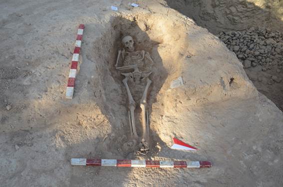
![]() E-21 (Unit-ST-1)
E-21 (Unit-ST-1)
Measurements:
Femur: R-48 L-48 cm
Humerus: R-32.3 L-29 cm
Radius: R-26.5 (damaged) L- 21 (damaged) cm
Ulna: R-26 (damaged) L-23.5 (damaged) cm
Tibia: R-38.5 L-39 cm
Fibula: R- 30 (damaged) L-34.5 cm
Pelvis (width): 35 cm
Entire length: 172 cm
Body Description:
Body position: extended, supine.
Directional orientation of the body: west-to-east
Position of hands: left arm folded back on itself with radius and ulna parallel to humerus (on top), right arm crossed over midsection at 90-degree angle.
Head position: raised
Grave Goods: none
Overall State of Preservation: Grade 3 (over 60%)
Age determination estimation features:
Epiphyses fused: no
Deciduous teeth: yes (one-behind lower left I 5-6)
Signs of osteoarthritis: no
Age Estimation: Adolescent, (12-20 yrs)
Cranial sex determination observations: Due to age of skeleton at time of death, no field sex determination was made.
Possible Sex: Adolescent skeleton could have been either male or female. However, if female it would be the only one discovered in this unit.
Additional comments/observations: Body had a slight build; maxilla had a deciduous tooth behind lower left 5-6 incisor. The proximal heads of both tibia’s did not appear to have been fully fused, sacrum also possibly not fused. Damage to many long bones due to taphonomy, although some of could be attributed to bones not being fully fused. Many of the right ribs appeared to be in better condition than the left. Lack of M3 molars suggest sub-adult adolescent, (pre-18 yrs). Dentition showed little attrition, though lower right M1 molar may have been missing pre-mortem. Teeth samples taken of lower right premolars (P1/P2) for possible future aDNA analysis.
Excavation year: 2022
E-22 (Unit-ST-1)
Measurements:
Femur: R-44.5 L- 40 (damaged) cm
Humerus: R-32.5 L- 21.5 (damaged) cm
Radius: R-21.5 (damaged) L-N/A cm
Ulna: Both damaged, only heads present
Tibia: R-37 L-13.5
(damaged) cm
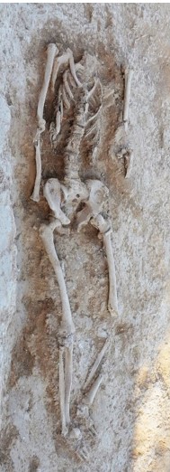
![]() Fibula: R-40 L- 27
(damaged) cm
Fibula: R-40 L- 27
(damaged) cm
Pelvis (width): 31 cm
Entire length: 150 cm (skull missing)
Body Description:
Body position: extended, supine.
Directional orientation of the body: west-to-east
Position of hands: prone along sides and under the pelvis
Head position: N/A
Grave Goods: none.
Overall State of Preservation: Grade 2 (30%-60%)
Age determination estimation features:
Epiphyses fused: yes
Deciduous teeth: N/A
Signs of osteoarthritis: no
Age Estimation: Adult (at least over 28 years)
Cranial sex determination observations: Skull missing
Possible Sex: Male (?)
Very little diagnostic information to make estimation, however, what remains of the pelvis suggests possible male since ischiopubic ramus is blunt and the pelvic girdle is narrow.
Additional comments/observations: These skeletal remains were disturbed by initial mechanical excavations during topsoil removal, leaving it badly damaged, including the complete removal of the skull. Several hand phalanges were discovered underneath the pelvis, suggesting that the hands were placed either at the sides or bound to the sides of the body at burial. Most remaining bones were fragmented post-mortem to varying degrees. The ribs and vertebrae were poorly preserved. Also, many remaining bones were brittle and some further fragmented upon exhumation. Both the sciatic notch and blunt ischiopubic ramus suggests male, however, due to damage and the lack of a skull, a definitive determination was not possible. The epiphysis of the clavicles appeared to be fully fused, along with all the other remaining long bones, thus, the skeleton is an adult, at least older than 28-30 years. The inability to observe detention made any further age estimates impossible.
Excavation year: 2022
E-23 (Unit-ST-1)
Measurements:
Femur: R-35 (damaged) cm L-N/A
Humerus: not taken
Radius: N/A
Ulna: N/A
Tibia: R-40 L-40.4 cm
Fibula: R-N/A L-37.5
cm
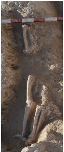
![]() Pelvis (width):
N/A
Pelvis (width):
N/A
Entire length: N/A
Body Description:
Body position: Extended, supine.
Directional orientation of the body: legs at east.
Position of hands: N/A
Head position: N/A
Grave Goods: none
Overall State of Preservation: Grade 1 (less than 30%)
Age determination estimation features:
Epiphyses fused: Yes (from the bones present)
Deciduous teeth: N/A
Signs of osteoarthritis: none
Age Estimation: Probable adult, data insufficient.
Cranial sex determination observations: Skull not present
Possible Sex: Unable to determine due to lack of skull or pelvis
Additional comments/observations: Grave was disturbed by initial mechanical excavations on first day of excavation. Only bones remaining were the lower appendicular remains and the right humerus. Both feet were present with the right foot laying on the distal side and left foot on its medial side both pointing to the south. The epiphyses of the tibias were both fused, suggesting that the interred was an adult.
Excavation year: 2022
E-26 (Unit-ST-1)
Measurements:
Femur: R-48 L-48 cm
Humerus: R-35.5 L-33.5 cm
Radius: R-24.6 L-24.5 cm
Ulna: R-25.7 L-25.5 cm
Tibia: 39.5 L-39.5 cm
Fibula: R- 35.7 (damaged) L-35.7 cm
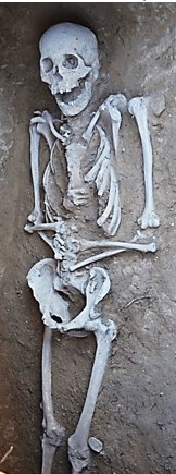
![]() Pelvis (width): 32.5 cm
Pelvis (width): 32.5 cm
Entire length: 167 cm
Body Description:
Body position: extended, supine.
Directional orientation of the body: west-to-east.
Position of hands: folded over lower abdomen/pelvis at a 45-degree angle.
Head position: slightly raised
Grave Goods: none
Overall State of Preservation: Grade 3 (over 60%)
Age determination estimation features:
Epiphyses fused: yes
Deciduous teeth: no
Signs of osteoarthritis: possibly
Age Estimation: Old Adult (50+ yrs)
Cranial sex determination observations:
Orbital shape: square
Orbital rim: blunt
Sub-orbital ridges: pronounced
Forehead: upright
Mandible breadth:
Nuchal crest: large
Mastoid process: smooth
Mental eminence: pronounced
Possible Sex: Male
Additional comments/observations: Some post-mortem damage to the anterior left humeral head Possible ossified cartilage found below the mandible. Due to the fragile nature of the maxilla, 5 teeth became dislodged: two incisors, canine, 2 pre-molars. Both proximal fibula heads were missing. All thoracic and lumbar vertebrae were extremely degraded and many broke upon exhumation. Some of the lumbar vertebrae appeared compressed. Significant root activity in the soil. Teeth samples taken of lower left P1 & P2 premolars for future aDNA analysis.
Excavation year: 2022
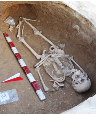
![]() E-30 (Unit-ST-1)
E-30 (Unit-ST-1)
Measurements:
Femur: R-42.5 L-42.5 cm
Humerus: R-30 L-29 cm
Radius: R-23 L-21.5 cm
Ulna: R-25 L-24 cm
Tibia: R-34 L-35 cm
Fibula: R-31.5 L-30 cm
Pelvis (width): 30 cm
Entire length: 141 cm
Body Description:
Body position: extended, supine.
Directional orientation of the body: west-to-east.
Position of hands: crossed at pelvis, right over left, at 45-degree angle
Head position: raised (possibly due to kyphosis)
Grave Goods: none
Overall State of Preservation: Grade 3 (over 60%)
Age determination estimation features:
Epiphyses fused: yes
Deciduous teeth: no
Signs of osteoarthritis: yes
Age Estimation: Old Adult (50+ yrs)
Cranial sex determination observations:
Orbital shape: square
Orbital rim: blunt
Sub-orbital ridges: pronounced
Forehead: upright
Mandible breadth: wide
Nuchal crest: smooth
Mastoid process: large
Mental eminence: pronounced
Possible Sex: Male (also based on pelvic girdle data).
Additional comments/observations: These remains are from a what appeared to be a quite elderly male who suffered from kyphosis (i.e. ‘hunch-backed) resulting in spinal pathology that bent his back at an almost 90 degree angle. The cervical vertebrae were quite damaged pre-mortem and additional dirt appeared to have been packed under the head to compensate for failure to lay this person’s back completely supine at time of burial due to the kyphosis. Most of the teeth appeared to be missing pre-mortem with all the molars missing pre-mortem except for the lower M3 molars with the alveoli filled in with bone. Both lower left and right P1/P2 premolars were present, but quite worn. The mandible displayed significant atrophy. Maxilla contained right and left M1/M2, canines, and the front left incisor, all with significant attrition. Right 10th rib appeared to be fused to its connected vertebrae. Four of the thoracic vertebrae were fused together with a left rib (5th or 6th?) still attached. A small piece of weaved fabric discovered on left temporal lobe.
Excavation
year:2022
E-31 (Unit-ST-1)
Measurements:
Femur: R-43 L-42 cm
Humerus: R-16 (damaged) L-30.5 cm
Radius: R-23.5 L-24 cm
Ulna: R-25.5 L-25 cm
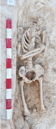
![]() Tibia: N/A
Tibia: N/A
Fibula N/A
Cranium N/A
Pelvis (width) 31 cm
Entire length 112 cm (skull missing)
Body Description:
Body position: extended, supine.
Directional orientation of the body: west-to-east.
Position of hands: left folded back on itself, radius and ulna parallel (on top) of humerus. Right crossed over the chest, touching left forearm.
Head position: N/A
Grave Goods: none
Overall State of Preservation: Grade 2, (30%- 60%)
Age determination estimation features:
Epiphyses fused: yes
Deciduous teeth: N/A
Signs of osteoarthritis: no
Age Estimation: Adult
Cranial Sex determination observations: skull missing.
Possible Sex: Male
Additional comments/observations: Mechanical excavation disturbed the gave resulting in destruction of skull and lower appendicular skeleton. No obvious pathology on remaining bones. Right humerus was fragmented with the proximal head found between the knees. Pelvis seems to indicate male with a blunt ischiopubic ramus. Significant root activity throughout the grave, including some than extended through the lumbar vertebrae and the sacrum. Many bones were brittle or had post-mortem damage. Definite age determination could not be made, though observable epiphyses appear fused.
Excavation year: 2022
E-33 (Unit-ST-1)
Measurements:
![]() Femur:
R-45 L-45 cm
Femur:
R-45 L-45 cm
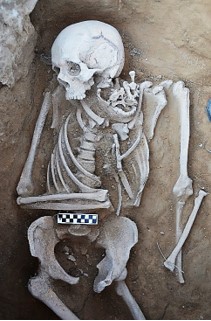
Humerus: R-31.5 L-31.4 cm
Radius: R-25 L-24.5 cm
Ulna: R-26.5 L-25.5 cm
Tibia: R-41 L-40.5 cm
Fibula: R- 36.5 (damaged) L-37.5 cm
Pelvis (width): 27 cm
Entire length: 131 cm (legs flexed)
Body Description:
Body position: extended (legs partially flexed), supine.
Directional orientation of the body: west-to-east
Position of hands: left arm prone alongside, right across abdomen at 90-degree angle.
Head position: raised, gaze S/SE due to soil disturbance
Grave Goods: small cloth fragment (~6x6 mm) at elbow
Overall State of Preservation: Grade 3, over 60%
Age determination estimation features:
Epiphyses fused: yes
Deciduous teeth: no
Signs of osteoarthritis: possible lipping on some vertebrae.
Age Estimation: Middle Adult (35-50 yrs)
Cranial sex determination observations:
Orbital shape: square
Orbital rim: blunt
Sub-orbital ridges: pronounced
Forehead: upright
Mandible breadth: narrow
Nuchal crest: rugged
Mastoid process: small
Mental eminence: triangular
Possible Sex: Male.
Additional comments/observations: Legs flexed with the femurs facing north/northeast while at the knee the lower legs faced southeast. It was possible that those who interred the body failed to position the legs into the east side chamber extension that had been created for the legs, thus this caused the legs to flex. The left radius was slightly askance in situ. Cranium, mandible, and top vertebrae displaced north by 8 cm. C1-C-4 vertebrae were found within the mandible due to this displacement. The skull’s gaze was to the south/southeast. Considerable attrition on the upper incisors and all remaining teeth. Some teeth have a glassy appearance. Lower left M1, upper right M1 and M2, upper left M1 and M2 were missing pre-mortem with the alveoli partially for left M2 healed pre-mortem. Possible piece of cloth fragment (~6 x 6 mm) discovered at right forearm. Fragment of possible ossified cartilage found resting on clavicle. Possible pathology on the distal left humerus and medial right clavicle. Lipping on T7-L5, L-3 appears to be the worst. Teeth samples of lower right premolars (P1,P2) taken for future aDNA analysis.
Excavation year: 2022
E-34 (Unit-ST-1)
Measurements:
Femur: R-46.5 L-46.5 cm
Humerus: 33.5 L-33.5 cm
Radius: R-26.75 L-26.75 cm
Ulna: R-29 L-29 cm
Tibia: R-41.5 L-41.5 cm
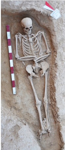
![]() Fibula: R-40 L-40 cm
Fibula: R-40 L-40 cm
Pelvis (width): 34 cm
Entire length: 186 cm
Body Description:
Body position: extended, supine.
Directional orientation of the body: west-to-east.
Position of hands: crossed over abdomen,
90-degree angles, left above right.
Head position: raised
Grave Goods: none
Overall State of Preservation: Grade 3 (over 60%)
Age determination estimation features:
Epiphyses fused: yes
Deciduous teeth: no
Signs of osteoarthritis: no
Age Estimation: Young Adult (20-35 yrs)
Cranial sex determination observations:
Orbital shape: square
Orbital rim: blunt
Sub-orbital ridges: pronounced
Forehead: upright
Mandible breadth: wide
Nuchal crest: no recorded
Mastoid process: large
Mental eminence: pronounced.
Possible Sex: Male
Additional comments/observations: The overall condition of this skeleton was excellent. Right fibula proximal head and left radius distal end broken on removal. On the right temporal lobe of the skull, a small 2 x 2 mm piece of fabric was found. Damage from taphonomy occurred to the distal head of the left femur and the proximal end of the left tibia. All the teeth, both in the maxilla and mandible were present, with some significant, yet uniform attrition. Male characteristics predominate on both the skull and pelvis. Age based on dentition (3rd molar present), epiphysial fusion, and pubic symphyseal surface suggest a young adult (20-35 yrs). Teeth samples from lower right premolars (P1/P2) for future aDNA analysis.
Excavation year: 2022
E-36 (Unit-ST-1)
Measurements:
Femur:
R-44.5 L-44.5 cm
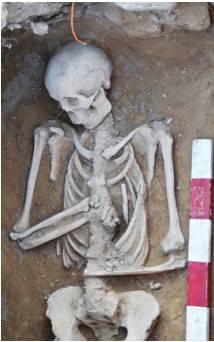
![]() Humerus: R- 30.5 (damaged) L-32 cm
Humerus: R- 30.5 (damaged) L-32 cm
Radius: R-23 (damaged) L-22.5 (damaged) cm
Ulna: R-25.5 L-25.5 cm
Tibia: R-36.5 L- 36 (damaged) cm
Fibula: R- 32 (damaged) L- 30 (damaged) cm
Pelvis (width): 27.5 cm
Entire length: 163 cm
Body Description:
Body position: extended, supine.
Directional orientation of the body: west-to-east
Position of hands: right arm crossed over thoracic cavity at 60-degrees, left arm over abdomen at 90-degrees.
Head position: raised
Grave Goods: none
Overall State of Preservation: Grade 3 (over 60%)
Age determination estimation features:
Epiphyses fused: yes
Deciduous teeth: no
Signs of osteoarthritis: no
Age Estimation: Middle Adult (35-50 yrs), or possible Old Adult (over 50 yrs).
Cranial sex determination observations:
Orbital shape: square
Orbital rim: blunt
Sub-orbital ridges: pronounced
Forehead: sloped
Mandible breadth: wide
Nuchal crest: smooth
Mastoid process: large
Mental eminence: triangular
Possible Sex: Male
Additional comments/observations: Both legs bow at the knees which point southward, but the tibia’s/fibula’s point east. Several tarsals and metatarsals were disarticulated during excavation. Left radius displaced to the north and lay perpendicular to the humerus by 10 cm This bone was moved during the excavation parallel to the right femur. Ischiopubic ramus was blunt. Pelvic girdle was narrow, and the sacrum was “chair-like.” Post-mortem damage present on right humerus, right ulna, left ulna, right and left tibia, and both fibulas. Some lipping present on lower thoracic vertebrae, ribs highly fragmented and fragile. Top of the sacrum either not fully fused or broke off during exhumation. Teeth sample from the lower left P1 and P2 (pre-molars) were taken for future aDNA analysis.
Excavation year: 2022
E-40 (Unit-ST-1)
Measurements:
Femur: R-45.5 L-45.5 cm
![]() Humerus: R-32 L-32 cm
Humerus: R-32 L-32 cm
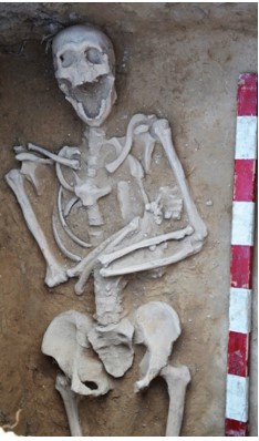
Radius: R-24 L-24 cm
Ulna: R-25.5 L-26 cm
Tibia: R-36 L-36.5 cm
Fibula: R-34.5 L-34 cm
Pelvis (width): 36 cm
Entire length 177 cm
Body Description:
Body position: extended, supine.
Directional orientation of the body: west-to-east
Position of hands: crossed over abdomen right arm at 70-degree angle, over left at 90-degree angle.
Head position: raised
Grave Goods: none.
Overall State of Preservation: Grade 3 (over 60%)
Age determination estimation features:
Epiphyses fused: yes
Deciduous teeth: no
Signs of osteoarthritis: yes (lipping in vertebrae)
Age Estimation: Middle Adult (35-50 yrs)
Cranial sex determination observations:
Orbital shape: round
Orbital rim: blunt
Sub-orbital ridges: pronounced
Forehead: upright
Mandible breadth: wide
Nuchal crest: smooth
Mastoid process: large
Mental eminence: triangular
Possible Sex: Male
Additional comments/observations: Remains were brittle within the grave and several bones fragmented upon exhumation, including the splanchnocranium (facial skeleton). All the mandibular teeth were present expect left incisor which was missing post-mortem. Damage to the right temporal possibly due to root damage. The anterior of the orbits where the zygomatic meets the glabella were not connected. Significant lipping of the lumbar vertebrae and the upper thoracic suggests an older adult. Pelvic and cranial sex characteristics are male. Damage to the maxilla meant that only the right half of the dentition was observable. Uniform attrition along with examination of the pubic symphysis with a distinct rim suggests a person of middle age (35-50 yrs).
Excavation year: 2022
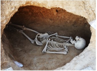
![]() E-46 (Unit-ST 1)
E-46 (Unit-ST 1)
Measurements:
Femur: R-47 L-47 cm
Humerus: R-32 L-32 cm
Radius: R-24.5 L-24.7 cm
Ulna: R-26.5 L-26.3 cm
Tibia: R-41 L- 36 (damaged) cm
Fibula: R-37.5 L-33 (damaged) cm
Pelvis (width): 29.5 cm
Entire length: 172 cm
Body Description:
Body position: extended, supine.
Directional orientation of the body: west-to-east
Position of hands: crossed over lower abdomen, at 95-degree angle, left over right
Head position: not raised, head askance to south.
Grave Goods: none
Overall State of Preservation: Grade 3 (over 60%)
Age determination estimation features:
Epiphyses fused: yes
Deciduous teeth: no
Signs of osteoarthritis: no
Age Estimation: Middle Adult (35-50 yrs).
Cranial sex determination observations:
Orbital shape: square
Orbital rim: blunt
Sub-orbital ridges: unpronounced
Forehead: upright
Mandible breadth: wide
Nuchal crest: smooth
Mastoid process: small
Mental eminence: triangular
Possible Sex: Male
Additional comments/observations: Initial excavations of the grave pit and around the skeleton, resulted in some disarticulation of the feet bones. Head askance to the south/ southeast. Missing upper-right 2nd molar alveolus was healed over. The right femur distal had post-mortem damage to the epicondyle. Post-mortem damage to both proximal and distal ends of both tibias. Left distal tibia was missing (post-mortem). Proximal and distal ends of left fibula missing. Right pelvic acetabulum partially detached due to post-mortem damage. Many ribs were fragmented (post-mortem) on both sides. Some damage to the thoracic and lumbar vertebrae, probably caused by extensive root activity and some during exhumation due to the brittle nature of the bones. Lipping present on the L-4/5 vertebrae. Teeth samples were taken for future aDNA analysis.
Excavation year: 2022
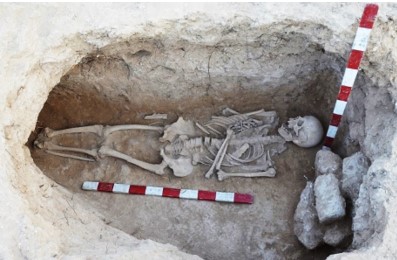
![]() E-48 (Unit-ST-1)
E-48 (Unit-ST-1)
Measurements:
Femur: R-45 L-44 cm
Humerus: R-32 L-32 cm
Radius: R-24.5 L-24.5 cm
Ulna: R-26.5 L-26.5 cm
Tibia: R-38 L-38 cm
Fibula: R-37 L-35.5 (damaged) cm
Pelvis (width): 36 cm
Entire length: 182 cm
Body Description:
Body position: extended, supine.
Directional orientation of the body: west-to-east.
Position of hands: left arm folded across abdomen at 75-degrees, right arm folded back on itself.
Head position: raised
Grave Goods: none
Overall State of Preservation: Grave 3 (over 60%)
Age determination estimation features:
Epiphyses fused: yes
Deciduous teeth: no
Signs of osteoarthritis: no
Age Estimation: Middle Adult (35-50 yrs)
Cranial sex determination observations:
Orbital shape: square
Orbital rim: blunt
Sub-orbital ridges: pronounced
Forehead: upright
Mandible breadth: wide
Nuchal crest: rugged
Mastoid process: large
Mental eminence: pronounced
Possible Sex: Male
Additional comments/observations: Several teeth of the maxilla were disarticulated post-mortem yet were present. Left femur bifurcated at the midpoint of the shaft post-mortem. At least 6 ribs broken post-mortem, also left clavicle. Possible osteoma on the right mandible under the 2nd molar. All mandible teeth were present, lower left 3rd molar had cavity, and the upper left 3rd molar and upper right 2nd molar had evidence of tooth decay. Attrition was uniform but wear suggests an age of over 40. Brief analysis of the epiphysial symphysis suggests and age of 50 or under. Depending on environmental circumstances of the period, this person may have been older than 50 yrs, however, skeletal features suggest a Middle Adult (35-50 yrs) at time of death.
Excavation year: 2022
![]() E-55 (Unit-ST-1)
E-55 (Unit-ST-1)
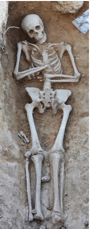
Measurements:
Femur: R-39.8 L-39.6 cm
Humerus: R-31 L-30 cm
Radius: R-22.7 L-22.5 cm
Ulna: R-(damaged) 23.3 L-24.5 cm
Tibia: R-35 L-35 cm
Fibula: R-33 L-33 cm
Pelvis (width): 29 cm
Entire length: 147 cm
Body Description:
Body position: extended, supine.
Directional orientation of the body: west-to-east
Position of hands: crossed over abdomen, right arm at 70-degrees above left arm 90-degrees.
Head position: raised
Grave Goods: none
Overall State of Preservation: Grade 3 (over 60%)
Age determination estimation features:
Epiphyses fused: yes
Deciduous teeth: no
Signs of osteoarthritis: no
Age Estimation: Young Adult (20-35 yrs)
Cranial sex determination observations:
Orbital shape: square
Orbital rim: blunt
Sub-orbital ridges: pronounced
Forehead: upright
Mandible breadth: wide
Nuchal crest: rugged
Mastoid process: large
Mental eminence: pronounced
Possible Sex: Male
Additional comments/observations: A slightly built individual, with a long, angular skull, but both cranial and pelvic characteristics favor male (blunt ischiopubic ramus). All teeth present, with uniform, yet slight attrition. Third molars and all long bones appear to be fully fused. Pubic symphyses had a distinct rim with no lipping. Based on teeth attrition and public symphyses, this male ranges between 20-35 years at time of death.
Excavation
year: 2022
E-56 (Unit-ST-1)
Measurements:
Femur:
R-46 L-46 cm
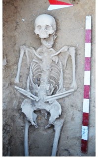
![]() Humerus: R-31 L-30 cm
Humerus: R-31 L-30 cm
Radius: R-24 L-23 cm
Ulna: R-24.5 L-23.5 cm
Tibia: R-40 L-40.5 cm
Fibula: R-36 L-36 cm
Pelvis (width): 32 cm
Entire length: 173.5 cm
Body Description:
Body position: extended, supine.
Directional orientation of the body: west-to-east
Position of hands: crossed at pelvis, 75-degree angle.
Head position: not raised
Grave Goods: none
Overall State of Preservation: Grade 3 (over 60%)
Age determination estimation features:
Epiphyses fused: yes
Deciduous teeth: no
Signs of osteoarthritis: yes (proximal finger, slow growth arthritis; three fused lumbar vertebrae)
Age Estimation: Old Adult (50+ yrs)
Cranial sex determination observations:
Orbital shape: square
Orbital rim: blunt
Sub-orbital ridges: pronounced
Forehead: sloped
Mandible breadth: wide
Nuchal crest: smooth
Mastoid process: large
Mental eminence: triangular
Possible Sex: Male
Additional comments/observations: Most upper teeth present (all in the maxilla), right M1 was missing pre-mortem. First right lower incisor in mandible missing post-mortem. Skull features mixed as to sex, but this combined with pelvic characteristics (narrow sciatic notch, chair-like sacrum) suggests male. Right zygomatic bone broken probably due to root damage, underside of skull damaged in some way. Proximal finger, probably P1 or P2 shows evidence of arthritis. Large robust bones suggest male. Lumbar vertebrae 3 through 5 were fused together.
Excavation year: 2022
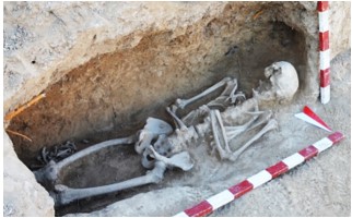
![]() E-59 (Unit-ST-1)
E-59 (Unit-ST-1)
Measurements:
Femur: R-46.3 L-46 cm
Humerus: R-32 L-31.6 cm
Radius: R-24.5 L-24.6 cm
Ulna: R-27 L-27 cm
Tibia: R-38 L-37 cm
Fibula: R-35 L-36 cm
Pelvis (width): 36 cm
Entire length: 174 cm
Body Description:
Body position: extended, supine.
Directional orientation of the body: west-to-east
Position of hands: right hand across lower abdomen (L-4/5 vertebrae) at 90-degree angle, left hand across thoracic cavity (T-9 vertebra) at 110-degree angle.
Head position: raised
Grave Goods: none
Overall State of Preservation: Grade 3 (over 60%)
Age determination estimation features:
Epiphyses fused: yes
Deciduous teeth: no
Signs of osteoarthritis: no
Age Estimation: Old Adult (50+ yrs)
Cranial sex determination observations:
Orbital shape: N/A
Orbital rim: blunt
Sub-orbital ridges: N/A
Forehead: upright
Mandible breadth: wide
Nuchal crest: smooth
Mastoid process: large
Mental eminence: pronounced
Possible Sex: Male
Additional comments/observations: Significant damage to the maxilla and the front of the skull due to a shovel strike during excavation. Femurs appear slightly bowed. Most of the skull inferior to the frontal bone on the anterior side was damaged, but the mandible was mostly intact. While anterior of skull was significantly damaged during excavation, the remaining features such as the mastoid process and mental eminence have male characteristics. The pelvic girdle with its blunt ischiopubic ramus and lack of subpubic concavity also suggested male. The mandible was atrophied, with all the molars and premolars, except the 3rd molar, on the lower right side completely missing. Left side of mandible still had premolars, but M1 and M2 were missing. All the alveoli on the mandible had grown over. Due to damage, only 2 teeth remained in the maxilla. All the remaining teeth showed significant attrition. Thus, remains should be considered over 50 yrs.
Excavation year: 2022
![]() E-63 (Unit-ST-1)
E-63 (Unit-ST-1)
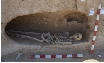
Measurements:
Femur: R-50.5 L-51 cm
Humerus: R-35 L-36 cm
Radius: R-25 L-24.5 cm
Ulna: R-27.5 L-27 cm
Tibia: R-40.5 L-40.5 cm
Fibula: R-36.5 L-37.5 cm
Pelvis (width) 36 cm
Entire length 175 cm
Body Description:
Body position: extended, supine.
Directional orientation of the body: west-to-east.
Position of hands: crossed over upper abdomen at 90-degree angles, right above left.
Head position: not raised, gaze to north
Grave Goods: none
Overall State of Preservation: Grade 3 (over 60%)
Age determination estimation features:
Epiphyses fused: yes
Deciduous teeth: no
Signs of osteoarthritis: possible degeneration of the joint in the L-5 lumbar.
Age Estimation: Old Adult (50+ yrs)
Cranial sex determination observations:
Orbital shape: square
Orbital rim: blunt
Sub-orbital ridges: pronounced
Forehead: sloped
Mandible breadth: wide
Nuchal crest: rugged
Mastoid process: large
Mental eminence: pronounced
Possible Sex: Male
Additional comments/observations: This grave was discovered in the south baulk of excavation unit ST-1, thus the grave was excavated in the profile. The right fibula proximal end fragmented. Some ribs were also fragmented post-mortem. Possible ossified cartilage found. Lower left molar was cracked to the root. Cracked upper left second molar. Missing first and second upper right molars pre-mortem. Some lipping on the L-5 lumbar vertebra. Calculus build-up on the teeth. One of the thoracic vertebrae was broken post-mortem and many have had post-mortem damage. While, the overall dental attrition was good, based on the teeth and a quick analysis of the pubic symphysial surface along with the presence of ossified cartilage, suggests an age over 50. Both pelvic and cranial sex indicators suggest male.
Excavation year: 2022
By accelerated mass spectrometry of organic samples from the excavations of the Suleimantepa 1 necropolis[1]
In order to determine the absolute age, three organic samples were analyzed in the mass spectrometry laboratory of the Center for Physical Sciences and Technology, Vilnius, using a Single stage accelerator mass spectrometer (SSAMS, NEC, USA), Automated Graphitization Equipment AGE-3 (IonPlus AG) (Table 1). The dates obtained were calibrated in OxCal V 4.4.2 software using the IntCal20 calibration curve[2].
On April 10, 2022, in the vicinity of Sulemin Tepe and the Islamic pilgrimage site of Chor Chinor just outside the town of Urgut, Uzbekistan approximately 125 m from the site of a church/monastery first excavated in late 1990s/early 2000s, four people (Dr. Dmitry Voyakin, Natasha Voyakin, Dr. Steven Gilbert, and Elizabeth Gilbert) discovered human remains (two cranial fragments, a femur with the distal and proximal ends missing, a right radius also with the distal and proximal ends missing, and a vertebrae, either from the lower thoracic region or the lumbar region) (see Fig. 1).
Sample No. URG_22_01_01
For radiocarbon analysis, sample were taken from the human radius bone (Fig. 2).
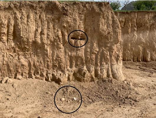
Fig. 1 - Construction area (24 x 23) with skull fragments (below) and feature in baulk
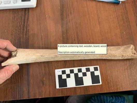
Fig. 2 - Human radius (inferior view)
The cumulative calibrated chronological interval at a probability of 95.4 % covers a range of actually two centuries – from 772 AD to 979 AD. At 85.8 % probability the date interval ranges from 821 AD to 979AD. (See Table 1). As indicated in the reference data on the calibration curve and calibration procedure, the context and features of the selected sample shall be taken into account.
As a result of the laboratory studies the necropolis can be dated by 8-10 cc AD. The radiocarbon date corresponds to the relative dating of the monastery suggested by archaeologists.
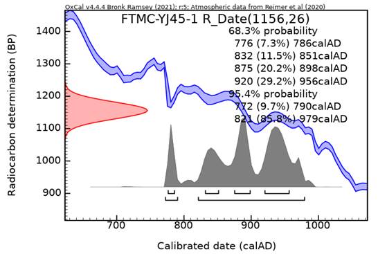
Table 1 - Results of radiocarbon dating analysis of sample No. URG_22_01_01
Conclusion for Excavation ST_1 (graveyard)
The excavations which have revealed a cemetery and human remains at Suleyman Tepa (ST-1) in Urgut, Uzbekistan provide significant information regarding the inhabitants of the early medieval monastery, a structure revealed by previous excavations just over two decades ago. The current interpretation is that this cemetery contained the remains of the monks who lived at this monastery (and based on radiocarbon data obtained from remains discovered at the site in April 2022) date to the 9th and 10th century and the osteological information provides strong evidence for this interpretation.
Just a cursory examination of the skeletal data demonstrates the most obvious conclusion that all the interred which could be conclusively identified (13 of 17 graves) were male. Three of the four graves for which sex determination could not be determined did not have a skull and pelvis due to damage either from either previous construction work or from mechanical excavation during the initial revealing of the cemetery. The fourth grave for which sex determination was inconclusive was from a possible adolescent which made a definitive conclusion less certain. Even these four graves all had adult-sized, robust bones which support the conclusion that all the interred were male. Comparison with other Church of the East Christian cemeteries within Central Asia reveal a broad mixture of adult and sub-adult burials interspersed and even buried together, possibly in familial groups. No other strictly segregated male cemetery is known within Central Asia.
Such evidence seems to affirm Savchenko’s initial conclusion that the structure just 500 meters to the north of the cemetery was a monastery and Dickens and Savchenko’s observation that the cave inscriptions on the cliffs and caves encircling both the cemetery and the monastic site have male names and were locations in which the monks held prayer vigils.
That the cemetery is Christian is undisputed by the presence of west-to-east burials. Every grave is oriented in this fashion with the body placed supine with the head of the interred placed on the west side and the feet on the east end of the burial chamber. Ten of the thirteen burials with intact skulls (77%) all had the head raised slightly and backed by a soil “pillow.” This practice has been documented in Central Asian Christian individual graves in Sogd (Uzbekistan) as well as cemeteries in Semirechye/Zhetisu (Kyrgyzstan and Kazakhstan) during the medieval period. It was also a wide-spread practice throughout Christendom at the time.
The regimental nature of the burials in which the entrance chambers visible from the surface appear regularly in north-south rows along with the consistency of the burial type speak to order in the community. Hand positions of the deceased were relatively uniform, with some variation. Only one body had both arms prone along the side. Three of the bodies had one of the arms folded back, with the hand probably placed over the thoracic cavity— probably covering the heart—and the other arm crossed over the abdomen. Four of the interred had both arm folded across the abdomen at either 90 or 45 degrees, usually with one hand above the other. One of the interred had the right arm at 60 degrees over the thoracic cavity, again, covering the heart, with the left across the abdomen; another with the right hand at 70 degrees over the heart and left hand over the chest.
None of the graves in ST_1 contained any grave goods. In fact, the cultural material was almost non-existent in the soil fill of the whole cemetery with only 2 pottery fragments discovered across the entirety of the revealed unit. Even for Christian cemeteries, which are notorious for their lack of grave goods, the complete absence of even small pieces of jewelry on the body such as a ring—which have been discovered in other Christian burial contexts in Central Asia—provides another possible piece of evidence that the burials in ST-1 were a group of aesthetic monks, accustomed to a life of self-imposed poverty.
Three of the graves (E-30, E-33, E-34) all had micro-sized fragments of cloth (two on the temporal lobe, one at the elbow). These were from rough material (yet to be analyzed as to composition) of a simple weave. These were either from the clothes they may have been buried in, or potentially may come from a burial shroud. Evidence for a shroud in at least one case comes from E-33. This body appeared to have been placed in the grave in such a way that the lower appendages (specifically the tibias and fibulas) were partially flexed possibly since those who interred the body misplaced the legs which should have extended into a small tunnel-like extension dug especially for the legs. Such placement in a dark burial chamber that extended to the east from the initial entrance pit would be understandable, particularly if the body was previously enclosed in a shroud making identification of individual limbs difficult. Another possibility is that the deceased was buried in his monastic habit which could have included a hood or headpiece as a part of the garment; thus, these fabric fragments were from the monks’ clothing, specifically in and around the head, and preserved for more than 1000 years.
Another striking feature is that 10 out of the 13 age estimable skeletons were probably over the age of 35 at time of death, with five of those (38%) over age 50. In fact, in a couple of instances the interred was probably much older than 50 years at time of death (see E-30). While age determination in the field is difficult and many factors such as dentition and pelvic feature (i.e. pubic symphyses, auricular surface of the pelvis) have to be carefully examined to make an accurate estimate, preliminary findings suggest that this community of men lived—for the period in question— lengthy and relatively healthy lives. Is this potential evidence to confirm Ibn-Hawqal’s statement concerning the reason for locating the monastery at Urgut (ancient Wazkird) due to its “healthiness?” (Ibn-Hawqal quoted in Dickens, 2017, 206) Even today, the area has fresh air and clean streams that flow from the mountain glaciers with thriving fruit orchards and grapes still growing in the valley (including on the site of the monastery remains). Fresh water sources alone, combined with a strict, simple diet, play a significant factor in community health which appears to have created an environment that allowed those interred at Suleman Tepe to thrive physiologically under such conditions.
More can be learned physiologically and genetically if aDNA analysis can be conducted on the remains. Excavators carefully extracted teeth samples from six skeletons (E-21, E-26, E-33, E-34, E-36, E-46) which involved using protective gear to guard against contamination once the teeth had been revealed to extract teeth, usually the premolars, which have the best potential of retaining blood in the roots, thus sufficient for adequate sampling. Of course, those remains with intact skulls can also have the auditory ossicles extracted to insure the best samples with the least outside contamination. Modern laboratory analysis including both aDNA and stable isotope could provide a wealth of information regarding genetic ancestry, pathology, and migration.
Bibliography
Ashurov, B. (2013) Tarsakya: An Analysis of Sogdian Christianity Based on Archaeological,
Numismatic, Epigraphic and Textual Sources, PhD Diss. (London: Department of Religious Studies, SOAS, University of London).
Ashurov, B. (2018) “’Sogdian Christianity’: Evidence from Architecture and Material
Culture,” Journal of the Royal Asiatic Society, Series 3:1-42.
Baumer, C. (2014) History of Central Asia, Vol 2: The Age of the Silk Roads.London:
I.B. Tauris.
Baumer, C. (2015) “Archäologie schreibt Geschichte“, in Neue Zürcher Zeitung (11 April) 83: 59-60.
Baumer, C. (2016) The Church of the East: An Illustrated History of Assyrian Christianity (New Ed. London: I.B. Tauris).
Baumer, C. (2016) History of Central Asia, Vol. 3: The Age of Islam and the Mongols (London: I.B. Tauris).
Dickens,
M. (2009) “Syriac Gravestones in the Tashkent History Museum,” Hidden
Treasures and Intercultural Encounters,
eds. D. Winkler and L. Tang. Münster, Lit Verlag.
Dickens, M. (2010) “Patriarch Timothy I and the Metropolitan of the Turks,” Journal of the Royal Asiatic Society, 3rd Ser.,20, 2: 117-139.
Dickens, M. (2017) “Syriac Inscriptions Near Urgut, Ubekistan” Studia Iranica 46:205-260.
Dickens, M. (2020) Echoes of a Forgotten Presence: Reconstructing the History of the Church of the East in Central Asia. Orientalia-Patristica-Oecumenica, Vol. 15, ed. D. Winkler. Zurich, Lit Verlag.
Fox,
Sherry C. and Paraskevi Tritsaroli, (2019) “Burials and Human Remains of the
Eastern
Mediterranean in Early Christian Context” in David K. Pettegrew, et.
al., eds. The Oxford Handbook of Early Christian Archaeology (New York:
Oxford University Press): 105-126.
Gilbert, S. (2022) “The Church of the East Cemetery at Ilibalyk,” Silk Road Traces: Studies on Syriac Christianity in China and Central Asia. Eds. Li Tang and D. Winkler (Berlin: Lit Verlag).
Haas, Christopher (2014) “The Caucasus“ in William Tabbernee, ed., Early Christianity in Contexts: An Exploration across Cultures and Continents: 111-141.
Jullien, F. (2018). “Forms of the Religious Life and Syriac Monasticism,” The Syriac World. Ed. D. King. London: Routledge.Kolchenko, Valery (2002) “Заметки О Христианстве В Чуйской Долине В Средние Века,” (Notes about Christianity in the Chui Valley in the Middle Ages)”, Коомдук илимдер журналга (Bishkek: Kyrgyz-Turkish University "Manas”): 163-182.
Kolchenko, V. (2003) “Периодизация распространения христианства в Средней
Азии по данным археологии” (The periods when Christianity Spread into Central Asia according to Archeology), Буддизм и христианство в культурном наследии Центральной Азии (Buddhism and Christianity in the cultural heritage of Central Asia) (Bishkek): 53-73.
Kolchenko, V. (2013)
“Кара-Джигачское
(При-Пишпекское)
средневековое
кладбище
(археологический
аспект)” [Kara-Dzhigachskoe (Pre-Pishpek)
medieval cemetery (the archaeological aspect)], An International Paschal
Reader: Collection of Materials (Bishkek): 81-83.
Kolchenko, V. (2018) “Кыргызстан, (Kyrgyzstan) ”in D. A. Voyakin, ed., Религии Центральной Азии и Азербайджана. Том IV. Христианство, (Religions in Central Asia and Azerbaijan. Vol. 4, Christianity) Samarkand: International Institute for Central Asian Studies, 2018: 48-103.
Savchenko, A. (1996) “Urgut Revisited”, ARAM.The Journal of the Society for Syro-MesopotamianStudies 8. 1-2: 333-54.
Savchenko, A. (2005) “По поводу кхристианского селения Ургут” (On the Christian settlement of Urgut), Zapiski Vostochnogo otdeleniya Rossiĭskogo arkheologicheskogo obshchestva 2. 27 (St. Petersburg). [Version also in English]
Savchenko, A. (2010) “Östliche Urkirche in Usbekistan,“ Antike Welt 2.10: 73-82.
Savchenko, A. and M. Dickens (2009), “Prester John’s Realm: New Light on Christianity between Merv and Turfan,” The Christian Heritage of Iraq (Gorgias Eastern Christian Studies 13), ed. Erica C.D. Hunter (Piscataway, NJ: Gorgias): 121-135.
Stewart, Charles A. (2018) “Churches,” in The Oxford Handbook of Early Christian Archaeology, eds. T. Davis, W. Caraher and D. Pettegrew (Oxford/New York: Oxford University Press): 127-146.
Stewart, Charles. A. (2020) “The Four-Petal Almond Rosette in Central Asia” Bulletin of the
International Institute of Central Asian Studies 30. IICAS: Samarkand. 69-84. [English & Russian].
Sweetman, Rebecca (2019) “Community, Church, and Conversion in the Prefecture of Illyricum and the Cyclades” in David K. Pettegrew, et. al., eds. The Oxford Handbook of Early Christian Archaeology (New York: Oxford University Press): 515-536.Walker John (1941) A catalogue of the Arab-Sassanian coins, London: The British Museum: xcv–xcvi.
White, T. and P. Folkens (2005) The Human Bone Manual. (Amsterdam: Elsevier Academic Press).
| copyright by The Society for the Exploration of EurAsia| E-mail | Home | ![]()