Archaeological excavation of an ancient city in a former delta of river Syr Darya
| 2008 | 2009 | 2010 | 2011 | 2012 | 2013 | 2014 | 2015 | 2016 | 2017 | 2018 | 2019 | 2020 | 2021 | 2022 | 2023 |

SCIENTIFIC REPORT
"Scientific research of the archaeological work on the medieval monument - the Kesken-Kuyuk kala settlement, which consists of a fortified settlement and a necropolis”.VOLUME 1
Annex A. Drawings.
ABSTRACT
Report: - 360 p., Chapters: - 3, Annexes – 4, Tables – 15. Drawings – 490. MEDIEVAL TOWN OF KESKEN-KUYUK KALA, NECROPOLIS,
TOMBAGE CHAMBER, BELT SET, ARTIFACTS, THIRD BUILDING HORIZON.
The object of scientific research is the survey of several sections of the of Kesken-Kuyuk kala medieval settlement, consisting of a fortified settlement and a necropolis.
This historical and cultural heritage monument is located in the Kazaly district of the Kyzylorda region, 22.8 kilometers west of the village of Bozkol.
The Kesken Kuyuk-kala settlement is located on the southern coast of the now dry, densely overgrown with bushes canals of the ancient delta. This is a vast settlement of irregularly rounded outlines, 560-700 m in size, stretched from east to west. The necropolis is located in about one kilometer from the settlement, in a valley, on a relatively hilly plain, composed of an alluvial type of soil cover, with exposed takyr areas.
The necropolis consists of many unpaved flattened mounds of the same type, hemispherical in shape, composed of dense yellow loess. The burial mounds of the necropolis do not have any order, and they are located chaotically. The average size of the mound embankments varies from 8-10 to 12-15 and up to 20 m. The surface of the mound embankments is heavily pitted as a result of the vital activity of rodents.
During the period of the archaeological work, the burial chamber of mound No. 2 has been further explored at the necropolis, and the burial structures of mound No. 4 have been fully studied.
During the study of two burial mounds three burials on the necropolis were investigated, materials of metal and ceramic complexes and other artifacts were discovered and further processed in office conditions.
In total, 43 intact and archaeologically intact artifacts of the metal complex were discovered, which are subdivided into items: equestrian uniforms, weapons, and jewelry, and everyday objects. Preliminary dating of the discovered artifacts indicates the period of the 9th-11th centuries.
Archaeological surveys for additional exploration of the cultural layers and strata of excavation No. 1 were carried out at the site of the archaeological work implemented in 2018-2020. The research site is located in the central part of the Shakhristan territory, it is a quarter-type household in the north-western part.
Excavation No. 1 is located in the central part of the shahristan territory of the Kesken-Kuyuk kala settlement behind the street in the north-western part. The excavation has a rectangular shape, oriented along the west-east axis, the area of the excavation was 269.5 m2, of which 193.6 m2 was opened and investigated. The length from west to east is 24.5 m, the width is 11 m.
In total, nine residential premises of the household were identified in the excavation area (one Premises - No. 9 was excavated partly as the rest of the area situated outside the study area). The home ownership is located 5 meters north of the premises and Premisess of the palace and temple complex. The complex consisted of three households, which were previously excavated during 2008-2018. After determining the location of structures and their structural elements of Premisess 2-7, layer-by-layer cleaning of the cultural layer of the third building horizon with mandatory photographic recording and documentation of each stage of the work was started. As well as with the identification of materials of ceramic, osteological and metal complexes. The necessary samples and analyzes were
collected for radiocarbon dating and natural science research.
During carrying out comprehensive research work on the study of cultural layers and strata of excavation No. 1 of the Kesken-Kuyuk kala settlement, materials of metal, ceramic, and osteological complexes and other artifacts on the territory of the investigated household were found.
The total number of archaeological finds of excavation No. 1 consists of 551 discovered artifacts, including materials from the metal complex - 23 items, materials from the ceramic complex - 528 items, including lifting material, which is represented by beads made using the technology of drilling and grinding from glass paste, lapis lazuli and carnelian.
The materials of the metal complex are largely represented by materials both as a whole and in fragmentary form: earrings, rings, plaques, fragments of coins, fragments of articles in the form of a key, a fragment of a wall from a cauldron, and a horse harness lining.
The materials of the ceramic complex are mainly represented by clusters of ceramics of various sizes and names, among which the most significant are the incense burner, archaeologically intact mugs and bowls, as well as fragments of the upper part of the protome.
INTRODUCTION
The object of scientific research is the survey of several sections of the Kesken- Kuyuk kala medieval settlement, consisting of a fortified settlement and a necropolis.
This monument of historical and cultural significance is located in the Kazaly district of the Kyzylorda region, 22.8 kilometers west of the village of Bozkol.
The Kesken-Kuyuk kala settlement is located on the southern coast of the now dry, densely bushy channel of the ancient delta. It is a vast settlement of irregularly rounded outlines, 560-700 m in size, stretched from east to west. The area of the medieval settlement, surrounded by a heavily washed rampart, slightly protruding above the surface of the inner part, which is the result of erosion of mud brick walls, rises above the surrounding area to a height of about 2 m (1).
The northeastern part of the monument is a rectangular shakhristan, 230 x 210 m in size, rises 5-10 m above the surrounding area. In the southwestern corner of was the citadel of the settlement. Rabad, surrounding the central hillock (citadel and shahristan), clearly outlined by the line of the outer defensive wall, consists of two parts separated from each other by a wall in the southern part. The Kesken-Kuyuk kala necropolis is located southeast of the medieval settlement of the same name, at a distance of about one kilometer from it.
The necropolis is located in a valley, on a relatively hilly plain, composed of an alluvial type of soil cover, with exposed takyr areas.
The necropolis consists of many unpaved mounds of the same type, flattened hemispherical in shape, composed of dense yellow loess. The burial mounds of the necropolis do not have any order, they are located chaotically. The average size of the mound embankments varies from 8-10 to 12-15 to 20 m. The surface of the mound embankments is heavily pitted as a result of the vital activity of rodents.
1Tolstov S.P. City of Guzov (historical and ethnographic sketches), "Soviet Ethnography", volume - 3. Moscow; Leningrad: Academy of Sciences of the USSR. 1947 - 186 s.
Objective of the work:
- Carrying out comprehensive archaeological surveys at the medieval settlement and the Kesken-Kuyuk kala necropolis, by means of layer-by-layer clearing of cultural layers and strata, with the identification of building structural elements of the third building horizon, and a complete survey of burial structures.
Tasks:
- Additional exploration and research of previously identified objects at the necropolis and settlement of Kesken-Kuyuk kala (mound 2).
- Collecting soil samples for carpology and palynology for carrying out natural science research;
- Collection of organic materials for radiocarbon subsidies;
- Collection of paleozoological materials to determine the species composition of domestic and wild animals;
- Fixation of all revealed elements of the third horizon of excavation No. 1, study of stratigraphy;
- Documenting the identified elements of the archaeological excavation by conducting aerial photography, microtopography, tacheometric survey, photographic recording;
- Office work of the found materials and graphic presentation of the results of the work;
- Monitoring of the entire cycle of aerial photography using an unmanned aerial vehicle;
- Conservation of excavated structures using the backfill method;
- Removal of dump soil outside the boundaries of the historical and cultural heritage site.
Based on the goal and the tasks formed, a research archaeological expedition was organized. It included several specialized groups and individual specialists who were responsible for carrying out planned types of work:
A group of specialists-archaeologists simultaneously carried out work on two burial mounds of the necropolis, and on one excavation site of the medieval settlement of Kesken-Kuyuk kala.
The task of this group was to carry out a number of scientific research of archaeological works, to clear and identify building structures of the premises of the housing complex of the third building horizon at excavation No. 1 of the settlement, and to study two burial structures of the necropolis.
The activities of the group's specialists is aimed to fulfill detailed fixation of cultural strata, and materials revealed in the process of archaeological work: metal, ceramic, and osteological complexes, as well as other artifacts.
The specialists of this group carried out activities for a detailed step-by-step description of the archaeological works, detection and fixation of elements of building structures of residential premises and burial structures. The collection of samples of the necessary materials for natural science research was carried out, as well as the collection of organic materials for radiocarbon dating.
A group of documentary specialists implemented the documentation of the entire process of planned research works with the analysis of the results of the data obtained, in the study of individual components of the excavation, using advanced geodetic equipment.
The result of the work of this group was the construction of 3D models of excavation sites, the creation of orthophotomaps and stratigraphic profiles, detailed excavation plans, microtopography, creation of plans for the location of the discovered materials, using the rectification method.
Documenting was carried out using a Leica TCR-407 total station with subsequent data processing in the AutoCAD and ArcGis tools, and in parallel, photographic recording of building structure elements and photogrammetry with using a Phantom-4 unmanned aerial vehicle.
A group of ceramic technologists was engaged in the processing of materials identified in the process of research work.
The task of the group was, in the complete processing of the found material, and the study of itemion technology with a description of the ceramic complex, and other found materials. Artistic rendering of ceramic fragments and finds in the form of arranged tables, partial reconstruction of archaeologically intact ceramic vessels, collection of statistical data.
The cameral processing group was engaged in the processing of the found materials. The task of this group included the processing of the discovered materials of ceramic, osteological complexes, as well as metal items and other artifacts by means of washing and cleaning.
Metallic materials were processed in compliance with methodological recommendations and interpreted by specialists. All materials were carefully processed, encrypted and described with an individual number recorded for each piece of material. All obtained data are displayed in the annexes of this report.
During the period of research of several excavations of the necropolis and excavation No. 1 of the of Kesken-Kuyuk kala medieval settlement, the entire planned scope of work was fully implemented.
In the performed work, data on the planigraphy and stratigraphy of the studied objects, their cultural and chronological features and place in the system of historical and archeological monuments of the studied region was obtained.
Dating materials were also found, which made it possible to determine the relative age of the discovered burial structures of the necropolis and the building horizons of the premises of the housing and economic complex of excavation No. 1. An integrated approach applied in the course of scientific research of the archaeological work made it possible to obtain a significant amount of information about the historical and cultural processes of the region, to identify cause-and-effect relationships about the interaction of cultures and economic activities of the
population of this region, and to determine the main directions of economic life.
The main priority of the planned activities was the fixation and documentation of materials found during archaeological work, and elements of building structures of the residential complex and the necropolis of the settlement.
During the archaeological investigations of the Kesken-Kuyuk kala medieval settlement, the generally accepted methodology for the study of such monuments was applied.
The standard, accepted methodology provides for a complete excavation of the study area and bringing the excavation to the level of the mainland. If the excavation covers a multi-layer monument (settlement, settlement, etc.), it can only be brought to the level of the cultural layer belonging to a certain building horizon, and conserved (filled up) until the entire monument or the intended object, with the adjacent territory, has been examined.
Monuments where it was possible to obtain additional information using the methods of natural sciences should be studied with the involvement of specialists in the natural sciences by taking appropriate samples for further analysis (soil scientists, geologists, geomorphologists, paleobotanists, etc.).
Archaeological excavations of a monument should be preceded by a detailed survey of both the monument itself and the surrounding area, as well as the compulsory drawing up of an instrumental topographic plan and photographing.
The choice of a site for laying excavations at a monument and the determination of their size are dictated by the tasks of research, excavations of previous years, the technical feasibility of excavations and other factors.
Since the excavations are ongoing, first, photographs of the area were taken, a topographic plan is taken using a laser tacheometer, and lifting material is collected. The excavation process is accompanied by photographs. The identified structures are to be cleaned, instrumented and described. It is mandatory to photograph the entire excavation process, starting with the general view of the monument and its site selected for study, the excavation at different levels of removal of the layer, as well as all uncovered objects: the bases of walls and foundations, hearths, sufas, courtyards, streets, clusters and single stones, vessels
and their fragments, stratigraphic profiles, etc.
All types of work on the opening and analysis of the cultural layer, clearing structural elements, layouts and finds, are carried out exclusively by hand using shovels, spatulas, scoops and brushes. Over the entire area of the excavation, the top layer of earth (turf) is removed to a bayonet depth (25 cm) and smoothly cleaned to reveal the presence of traces of building structures, the location of garbage pits, various spots, ash accumulations. As the excavation proceeds, the soil is removed from the excavation into dump heaps. A layer-by-layer collection of finds is carried out: fragments of ceramics, kitchen remains of pets (osteological material), metal or other objects.
The analysis of the soil is carried out in layers with a thorough examination of the soil for the detection of finds, leaving the exposed structural elements and layouts. After removing each layer, the surface is cleaned and the location of the architectural and other elements is visually determined. Accumulations of stones are left on the earthen posts.
Then a layer-by-layer (25-30 cm) deepening to the floor level over the entire area of the excavation or in separate designated Premisess was made up. Stripping and documentation is in progress.
During the study of the Kesken-Kuyuk kala settlement, identification and instrumental fixation of all objects in the cultural layer (fragments and whole ceramic vessels, iron items and items made of other materials), remnants of walls and foundations of residential, industrial and religious premises, elements of planning of quarters, streets , courtyards, estates and premises.
All layers and objects are documented on the plans of the excavated sites of the settlement. During excavations, graphic documentation recorded the location and depth of all finds, including heavily destroyed and displaced ones, since these data are important for reconstructing the original structure and topography of the ancient settlement.
The study of cultural deposits should be carried to the mainland, if this is not hindered by the building and architectural remains of paramount importance, found in the excavations, the preservation of which seems necessary. When conducting security excavations, a researcher has the right, if scientifically necessary, to make an addition to an excavation site that goes beyond the excavation site for a complete study of archaeological objects.
When building and architectural remains are identified in the cultural layer, the work that do not disturbe or destroy the layers until they are fully identified and comprehensively fixed. Structures are not disassembled.
If the building structures are poorly preserved and not intended for conservation measures, scientific plans provide for the continuation of the opening over the entire area or in place of individual objects, then the opened structures are removed after fixation, the site is leveled and deepening continues to the required cultural layer.
When examining the mounds, identification and instrumental fixation of all objects in the mound (inlet burials, funeral feasts, individual finds, etc.), structural features and composition of the mound itself, the level of the buried soil, the presence of bedding, crepes or other structures within the embankment, should be provided, under her or around its.
On the plans of the excavated mounds, all layers and objects are documented, and not just burials. When excavating fully or partially looted burials, graphic documentation should record the location and depth of all finds, including those displaced, since these data are important for the reconstruction of the original burial complex.
It is allowed to use earthmoving machines when examining the mounds until structures, burials, grave pits or other elements are found. The type of equipment, as scraper, bulldozer or loader are selected at the discretion of the excavation manager based on the conditions and specifics of the work. The removal of soil should be carried out in thin layers with the organization of continuous careful monitoring of the exposed area and should stop at the first appearance of signs of burials, burial structures, pits, funeral feasts, etc.
The study of cultural deposits should be carried out to the mainland, if this is not hindered by the building and architectural remains of paramount importance found in the excavations, the preservation of which seems necessary. When conducting security excavations, a researcher has the right, if scientifically necessary, to make an addition to an excavation site that goes beyond the construction and earthworks site for a complete study of archaeological objects.
When building and architectural remnants are found in the mound, the work must be carried out so that these remnants are not disturbed or destroyed until they are fully identified and comprehensively fixed.
For conducting and fixing stratigraphic observations, edges may be left inside large excavations. When excavating mounds with the help of technology, one or several parallel (in the direction of the movement of the mechanisms) edges are left, depending on the size and structure of the mound embankment. When excavating mounds by hand, one or two perpendicular edges are left. When excavating large mounds (over 20 m in diameter), it is necessary to leave at least two or three edges with the obligatory fixation of the most informative profiles of all of them. The eyebrows must be disassembled after their drawing and photographic fixation.
All drawings (plans and sections of excavations, stratigraphic profiles, plans and profiles of burial mounds, plans and sections of burials, etc.) should be drawn up directly at the site of work and reproduce all details to the maximum extent, including such as the relative position of layers and structures and their attitude to mark marks, composition, structure and color of layers, presence of soil, ash, coal and other spots, distribution of finds in the plan of the excavation, conditions and depth of their occurrence, position of skeletons and things in the grave, etc.
During the excavation process, it is mandatory to keep daily field records reflecting all the structural features of cultural layers and various observations. Field records serve as the basis for a scientific report.
If the investigated monument is subject to conservation in order to prepare it as a tourist site, then some of the conserved sites are left open, and its condition is monitored in the open air. As necessary, repair work is carried out with a change in preservative materials and reagents.
Conservation and restoration work is carried out on the basis of field observations During excavations, the experience of similar work in the settlements and cities of Semirechye and South Kazakhstan, and the knowledge and skills accumulated by archeology on the conservation and restoration of settlement monuments with adobe architecture were implemented. For restoration, materials are used in physical, chemical properties, identical or close to those from which the identified archaeological objects are arranged. They must provide historical accuracy, resistance to adverse external influences and have high presentation properties.
All found artifacts must be recorded, described, documented and entered into the collection inventory. At the end of the research work, the excavation should be reclamated (full backfilling) or archaeological conservation (partial backfilling of structures) should be carried out. The entire process of work must be fully recorded and its results are presented in written report, a description of the finds, their sketches, a photo application, a drawing and graphic application.
Photo fixation is carried out using a scale ruler (rail), with an explanation in which direction the camera lens was directed.
When examining an excavation site, identification and instrumental fixation of all found objects, artifacts, layers, pits, and various structural details should be provided.
Finds should be completely washed, cleaned and, if possible, restored, drawn and photographed with a scale ruler.
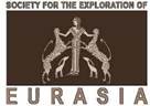
The fixation of finds should be done with an indication of the exact depth and location of the finds, and an indication of the point of their location on a separate plan. Materials are packed in bags, a label is placed in the bag indicating the source data. The label should be packed in a separate small bag to prevent damage.
The finds obtained during excavations should be taken for museum storage and further scientific processing.
The collection of documentation is based on a system developed by specialists from the University of Aachen under the guidance of Professor Michael Jansen and Dr. Thomas Urban. The system is based on the completion of specially designed forms, whereby a certain level of data collection is achieved. While the presence of a field diary does not serve as the basis for reaching the desired level, the researcher is presented with a series of so-called forms. "Main form", providing a general description of the monument or a separate excavation, as well as a description of plans, goals, objectives and ways to achieve them;
- "action sheet" is a kind of field diary in which every day the researcher enters information about the actions performed, as well as about the objects found, sizes, etc .; "sheet of elements".
- each detected structure, peelable layer, specific observed feature, etc. It is called "element" followed by a serial number assigned to it; "tag for finds" is a form, that is set up specifically for certain finds that are clearly different from the bulk of the excavated material; "Index of photographs" is a kind of database, a catalog of photographs taken during excavations with an indication of the location, direction of the code, brief description, etc.
In 2021, research work was carried out on the territory of the Kesken-Kuyuk kala necropolis. The main purpose of the study is:
- A comprehensive study of the features of the construction of building structures of burial structures.
During the period of the archaeological work, the burial chamber of mound No. 1 was further explored, and the structure of the burial structure in mound No. 2 was partially studied, and the structure of the burial structure of mound No. 4 was fully studied.
During the study of three burial mounds of the necropolis in the course of research work, materials of the metal complex and other artifacts were found and further processed in office conditions. Cleaning and partial restoration of heavily damaged materials was carried out.
In total, 43 intact and archaeologically intact artifacts of the metal complex were discovered, which are subdivided into the following items: equestrian uniforms, weapons, and jewelry.
Weapons found in the burial chamber of mound No. 2 consist of an archaeologically intact small dagger in a birch bark sheath, and a set of 5 petioled three-bladed arrowheads.
Jewelry items are represented by a set of overlays made of gold foil and metal parts from a silver belt set. Also, in the burials, two archaeologically intact molded vessels were discovered.
Items of equestrian uniforms, fragments of stirrups, bit and one whole girth buckle.
Excavation No. 1 is located in the central part of the shakhristan area of the Kesken-Kuyuk kala settlement behind the street in the northwestern part. The excavation has a rectangular shape, oriented along the west-east axis, the area of the excavation was 269.5 m2, of which 193.6 m2 was opened and examined. The length from west to east is 24.5 m, the width is 11 m.
In total, nine residential premises of the household were identified in the excavation area (one Premises - No. 9 was excavated partly due to the location of the rest outside the study area of the excavation). The home ownership is located 5 meters north of the premises and Premisess of the palace and temple complex, which consisted of three households, which were previously excavated during 2008-2018. After determining the location of structures and their structural elements of premises No. 2-7, a layer-by-layer cleaning of the cultural layer of the third building horizon began with mandatory photographic recording and documentation of each stage of the work carried out, as well as with the identification of materials of ceramic, osteological and metal complexes. The necessary samples and analyzes
were collected for radiocarbon dating and natural science research.
During comprehensive research work of cultural layers and strata of excavation No. 1 of the Kesken-Kuyuk kala settlement, materials of metal, ceramic, and osteological complexes and other artifacts on the territory of the investigated household were found.
The total number of archaeological finds of excavation No. 1 consists of 551 discovered artifacts, including materials from the metal complex - 23 items, materials from the ceramic complex - 528 items, including lifting material, which is represented by beads made using the technology of drilling and grinding from glass paste, lapis lazuli and carnelian.
The materials of the metal complex are largely represented by materials both as entire and in fragmentary form: earrings, rings, plaques, fragments of coins, fragments of articles in the form of a key, a fragment of a wall from a cauldron, and a horse harness lining.
The materials of the ceramic complex are mainly represented by clusters of ceramics of various sizes and names, among which the most significant are the censer, archaeologically entire mugs and bowls, as well as fragments of the upper part of the protome.
MAIN PART
- Research work of the third building horizon at excavation site No. 1, Kesken-Kuyuk kala settlement;
- De-conservation of previously investigated structures. Carrying out research work at excavation site No. 1, Kesken-Kuyuk kala settlement
In 2021, on the territory of the citadel of the Kesken Kuyuk kala settlement in its central part, scientific research and archaeological work was resumed. The main goal was to study of cultural layers and strata of the second and third building horizons, in the aisles of the territory of excavation No. 1 (Annex B, Figure 1-4).
Archaeological surveys for additional exploration of the premises of the housing and economic complex of excavation No. 1 at the site of early archaeological work were carried out. The premises of the investigated household have the following building structures: load-bearing interior walls lined with mud bricks and grooved blocks and thin layers of clay floor preserved with soil after excavations in 2020 (Annex B, Figure 6-8).
At the time of the resumption of archaeological work in the field season of 2021 on the territory of excavation No. 1, the surface of the excavation consisted of buried walls, building structures and the floor inside the premises. The fill soil was covered with a thin crust. The covered surface, in places exposing the walls is partially swollen, and is overgrown with undersized grass and rare herbaceous bushes.
On the eve of the preparatory work and the implementation of the topographic survey, the territory of the investigated area was cleaned from the grass cover and debris.
After that, documentation and photograph the territory of archaeological research work was carried out.
De-conservation works were carried out before initiation of the archaeological research. The dumping soil was stored in a pre-designated place.
The removed layer of the second building horizon is a soil of a loose consistency of gray and brown shades, saturated with gray ash and charcoal. The excavated layer was removed in layers to a depth of 20 cm. (Annex B, Figure 6-14).
Fragments of molded and easel ornamented and non-ornamented ceramics, as well as whole bones and fractional fragments of animal bones were found everywhere in the excavated soil. The walls of previously excavated premises and other structures were cleaned from the filled-in soil.
After the de-conservation, the previously investigated elements of the second building horizon of the premises of the excavation No. 1 in made of brickwork of walls appeared from all sides (Annex B, Figures 15, 17, 21, 26, 39-40). The walls of the premises are lined with mud bricks.
On the eastern side of Premises No. 7 of excavation No. 1, there is a corridor area folded by the pakhsa method (Annex B, Figures 30, 34, 40). The western boundary of the site wall is deformed, presumably as a result of the impact of an external anthropogenic factor (Annex B, Figures 30, 40).
1.2. Description of premises and elements from excavation No. 1
The excavation No. 1 is located in the central part of the shakhristan area of the Kesken-Kuyuk kala settlement behind the street in the northwestern part. The excavation is rectangular in shape, oriented along the west-east axis, the excavation area was 269.5 m2, of which 193.6 m2 was opened and examined. Length from west to east 24.5 m, width 11 m (Annex A).
During scientific research archaeological work since 2018, the entire territory of excavation No. 1 was explored within the first and second construction horizons. In total, nine residential premises of the household were identified in the excavation area (one Premises - No. 9 was excavated partly due to the location of the rest outside the study area of the excavation). The household is located 5 meters north of the premises and Premisess of the palace and temple complex, which consisted of three households, which were previously excavated during 2008-2018. (Annex A).
The previously excavated household is stretched from west to east along an unexcavated road in the central part of Shakhristan.
The fixed elements of building structures and their fragments have been examined and documented. After each field season, the excavated and explored building horizons of the household premises were reclaimed by the backfill method using the selected filling soil until the next stage of research on this archaeological site was resumed.
After clearing the elements of building structures from soil filling, documentation and mandatory photographic recording of the cleared elements were carried out, after which an assessment of the safety of these elements, structures, walls and clay pouring of the floor of the second building horizon was made.
The next stage of the study was geodetic work and aerial photography of excavation No. 1 and the settlement. The microtopography and geomorphology of the nearby objects of the settlement have been studied. At the same time, photographic recording and documentation of the obtained data on the object under study was carried out (Annex B, Figures 121-126).
At the end of all the cumulative preparatory measures on the territory of excavation No. 1, archaeological work of the third building horizon was resumed, with the fixation of the discovered materials.
Comprehensive research work of building structures and cultural strata began with the stage of overburden work, which were carried out simultaneously in several Premisess No. 2-7 (according to the numbering of the third building horizon) (Annex B, Figures 55-56, 63-64, 67-69, 71-76).
Overburden work was carried out by layer-by-layer cleaning. The soil filling was selected manually. After clearing the ground fill, the entire area was cleaned to fix the elements of building structures. Layers of soil filling, each discovered structure, accumulations of ceramics and osteological material, traces of calcination were assigned an element number as they found excavation No. 1 in a particular Premises.
After determining the location of structures and their structural elements of premises No. 2-7, a layer-by-layer cleaning of the cultural layer of the third building horizon began with mandatory photographic recording and documentation of each stage of the work that has been carried out, as well as with the identification of materials of ceramic, osteological and metal complexes. The necessary samples and analyzes were collected for radiocarbon dating and natural science research. (Annex A).
During comprehensive research work of cultural layers and strata of excavation No. 1 of the Kesken-Kuyuk kala settlement, materials of metal, ceramic, and osteological complexes and other artifacts on the territory of the investigated household were found.
The total number of archaeological finds of excavation No. 1 consists of 551 discovered artifacts, including materials from the metal complex - 23 items, materials from the ceramic complex - 528 items, including lifting material, which is represented by beads made using the technology of drilling and grinding from glass paste, lapis lazuli and carnelian.
The materials of the metal complex are largely represented by materials both as entire and in fragmentary form: earrings, rings, plaques, fragments of coins, fragments of articles as a key, a fragment of a wall from a cauldron, and a horse harness lining.
The materials of the ceramic complex are mainly represented by clusters of ceramics of various sizes and names, among which the most significant are the censer, archaeologically entire mugs and bowls, as well as fragments of the upper part of the protome.
All materials discovered during research work have been processed and partially restored in office conditions, each artifact has been assigned an individual cipher number. Items are carefully packed and placed in storage containers.
During comprehensive research work on the territory of excavation No. 1, the third building horizon of six premises of the household was cleared and investigated.
Premises No 2. It is located in the central part on the northern side of excavation No. 1. The sub-square Premises has dimensions 7.3x3 m. The highest preservation height of the walls is 74 cm. The eastern wall of Premises No. 2 adjoins Premises No. 5, the southern wall adjoins Premises No. 3, and the western wall borders with Premises No. 2 of the second building horizon, which research has not been carried out in the current field season (Annex A), Annex B, Figure 142).
The Premises consists of the following elements:
Element 9 - Sufa Element 12 - soil filling
Element 29 - floor of the Premises
Premises No 3. It is located in the central part on the southern side of excavation No. 1. It is a sub-rectangular Premises, elongated along the north-south axis, has dimensions of 4.4x2.8 m. The eastern wall of Premises 3 adjoins Premises 4, the north wall adjoins Premises 2, and the western wall borders with Premises 2 of the second building horizon , which has not been studied in the current field season. The southern wall is bordered by a load-bearing wall (the longest house building wall), oriented west-east, which separates the area above the indicated Premises from the street and the earlier excavated house premises (Annex B, Figure 6). Belonging to the palace and temple complex, excavated during the study of the settlement, carried out in 2008-2016. (Annex A), Annex B, Figure 142).
The Premises consists of the following elements:
Element 14 - tandoor stain Element 15 - soil filling
Element 27 - incense burner with traces of soot Element 28 - groin protrusion
Element 30 - floor of the Premises
Premises No. 4. It is located in the eastern part, on the southern side of excavation No. 1. The sub-square Premises has dimensions of 4.7x3.8 m. The eastern wall of Premises 4 is adjacent to Premises 7, the north wall - to Premises 5, and the western wall borders on Premises 3. The southern wall is bordered by a load-bearing wall (the longest house building wall), oriented in the west-east direction (Annex B, Figure 6), which separates the area above the indicated Premises from the street and the earlier excavated premises of households belonging to the palace and temple complex, excavated in during the study of the settlement, carried out in 2008- 2016. (Annex A), Annex B, Figure 142).
The Premises consists of the following elements:
Element 5 - pole pit
Element 7 - hearth with a piercing Element 8 - sufa
Element 13 - hearth with a piercing Element 17 - soil filling
Element 21 - central hearth with a piercing Element 31 - floor of the Premises
Premises No. 5. It is located in the eastern part on the northern side of excavation No. 1. The Premises is rectangular in shape, measures are 4.4x3.7 m. The eastern wall of Premises 5 adjoins Premises 6, the southern wall borders with Premises 4. The north-western part of the wall borders on Premises # 2, and the south-western part - on Premises # 3. The northern wall borders on the area not issue of archaeological excavations at the given time of research work (Annex A), Annex B, Figure 142).
The Premises consists of the following elements:
Element 10 - a cluster of ceramics Element 11 - tandoor
Element 20 - soil filling Element 25 - utility pit
Element 26 - laying of mud bricks Element 32 - floor of the Premises
Premises No. 6. It is located in the extreme northern part on the northern side of excavation No. 1. The sub-square Premises has dimensions of 5.3x4 m. The eastern wall of the Premises goes to the border of the studied excavation area. The northern wall borders on the territory not related to archaeological excavations of this research work. The southern wall is adjacent to Premises 7, the eastern wall - to Premises 5 (Annex A), Annex B, Figure 142).
The Premises consists of the following elements:
Element 2 - a cluster of ceramics
Element 3 - fragments of large ceramic vessels Element 4 - ash spot
Element 6 - a fragment of a grain grater and a mug Element 16 - central focus
Element 18 - ash spot Element 19 - wall hearth Element 22 - soil filling
Element 24 - a cluster of ceramics Element 33 - floor of the Premises
Premises No. 7. It is located in the southeastern corner of the household on the eastern side of excavation No. 1. The sub-square Premises has dimensions of 4.6x3.2 m. The western walls of the Premises adjoin Premises 4, the northern wall borders with Premises 6. The southeastern wall, forming an angle, separates the described Premises from the other Premises located outside the excavation site practically along its entire length (Annex A), Annex B, Figure 142).
The Premises consists of the following elements:
Element 1 - ash spot Element 23 - soil filling
Element 34 - floor of the Premises
Element 1 - Ash spot located in the southeastern part of the Premises at a distance of 0.4 m north of the southern side of the sufa at the floor level of the third building horizon (element 34). The ash spot has an oval shape with rounded edges 0.9x0.4 m in size, oriented along the west-east axis. The soil filling of the spot consists of loose loam of a light shade with the inclusion of combustion items of charcoal with gray ash, as well as household items of fish scales and bones (Annex
B, Figure 45-46). The ash patch was covered with a loamy floor of the second building horizon.
Element 2 - Accumulation of fragments of large ceramic vessels, found during the excavation of soil filling (element 22) among the blockage of adobe bricks and household waste at floor level (element 33) in the extreme northeastern part of Premises No. 6, an accumulation of fragments of large ceramic vessels was revealed, consisting of mainly from massive bottoms. The size of the formed blockage of fragments of ceramic vessels was 0.5x0.5 m (Annex B, Figure 62).
Element 3 - An accumulation of fragments of large ceramic vessels and an archaeologically intact ceramic bowl. It was revealed as a result of layer-by-layer clearing of the soil filling (element 22) from Premises 6 among the rubble of bricks and charcoal at the floor level (element 33), 80 cm south of the accumulation of ceramics (element 2), an accumulation of fragments of large ceramic vessels was revealed and archaeologically intact ceramic bowl. The bowl was located 60 cm west of the main pottery cluster (item 2) and the wall hearth (item 19) (Annex B, Figure 84).
Element 4 - The ash spot has a rounded shape with uneven edges 0.7x0.36 m in size, oriented along the northwest, southeast axis. At the edges of the spot circumference, a soil with a brick-colored burnt is fixed. The soil filling of the ash spot consists of mixed gray loam with the inclusion of combustion items in the form of black charcoal with gray ash of a silty structure. The thickness of the filling layer is 25 cm relative to the floor level of the third building horizon (Annex B, Figure 81).
Element 5 - A pillar pit of a sub-oval shape with beveled edges, 0.4x0.3 m in size, oriented along the north-east, south-west axis. The soil filling of the pit consists of gray loam with inclusions of combustion items in the form of charcoal with gray ash of a silty structure, as well as small fragments of animal bones and fragments of ceramics (Annex B, Figure 92).
Element 6 - A fragment of a grain grater and an archaeologically whole circle. At the time of cleaning, the mug was on its side, 60 cm to the west of a large fragment
of the grain library. The grater is made of a flat stone on one of the sides of which shallow grooves are fixed, located parallel to each other. In the upper part of the stone grain grinder on the left, there is a round-shaped through hole (Annex B, Figure 77-78).
Element 7 - A large spot with a powerful burnt of a pronounced yellow- red and gray shades. The filling of the spot is a loose soil consistency mixed with household waste items of small and medium-sized animal bones and ceramic fragments with inclusions of charcoal combustion items. The suboval shape of the hearth is oriented along the west-east, north-south axis, with measure of 1.4x0.6 m (Annex B, Figure 89-90).
Element 8 - Pakhsa sufa with lenth of 3.6 m and width of 1x0.4 m, is located in the northern part of Premises No. 4. The height of the side is 12 cm. The sufa was laid out of light gray loam using the pakhsa masonry method along the northern wall. In the northwestern corner, the sufa merges with the sufa located along the western wall of the Premises, lined with a similar pakhsa masonry. In the east, the end part of the sufa masonry joins the wall (Annex B, Figure 89-90).
Element 9 – Sufa with lenth of 2.10 m and width of 80x50 cm, is located in the southern part of Premises No. 2. The height of the side is 20 cm. The sufa was made of light gray loam brickwork along the wall of the third horizon. In the east, the end part of the sufa masonry joins the wall. From the south side, the sufa is connected with the end side to the dividing wall (Annex B, Figure 118-120).
Element 10 - An accumulation of fragments of large ceramic vessels, consisting mainly of massive bottoms and walls of large container vessels of the jumcha type. On the inner and outer surfaces of the fragments, traces of soot and smudges of a brick-colored engobe are observed. The size of the blockage of ceramic fragments was 0.55x0.56 m. (Annex B, Figure 105-106).
Element 11 - Fragments of the tandoor. The tandoor has a rounded shape elongated to the top. The sides of the bright yellow tandoor oven are melted. The remains of the tandoor make it possible to determine the manufacturing technology of the structure by the method of tape molding. Tandoor without a bottom, built into the floor of the third horizon (element 32). The remains of the tandoor are poured with a clay solution. The upper part of the kiln was badly destroyed by the rubble of bricks from the eastern wall. On the surface of the tandoor, traces of a powerful brick-colored calcination are recorded (Annex B, Figure 104).
Element 12 - Ground filling of Premises No. 2, with 70 cm in thick, is located under a loamy dense floor and consists of whole and broken mud bricks mixed with light loam. A thick layer of ash, household waste, intire and fragments of mud bricks can be traced under the floor. Fragments of stucco and easel ornamented ceramics of various sizes are found locally in the filling in a disorderly state. An osteological complex was found together with the ceramics (Annex B, Figure 116-120).
Element 13 - The hearth is oval in shape with demetions 1.04x0.55 cm. The hearth is oriented along the west-east, north-south axis. On the eastern side of the hearth, a blockage of brickwork oriented north-south is recorded. The size of the raw bricks is 32x24x6 cm. In the western part of the hearth, a powerful calcination of a pronounced red hue can be traced. The filling of the hearth is represented by gray loam with ash of a dusty structure of a light gray shade mixed with combustion items in the form of charcoal (Annex B, Figure 90-91).
Element 14 - A stain from a tandoor built into the floor equipment. A spot with demetions 40x31cm is oriented along the west-east axis and has a regular oval shape. Due to the high thermal effect, the walls of the tandoor were melted, causing changes in the structure of the dough walls. As a result, a red tint was formed, which appeared on the floor surface (Annex B, Figure 110).
Element 15 - Ash Spot. Under the clay pouring of the floor of Premises No. 3, a thick loamy layer of 68 cm thickness covered with mud bricks and mixed with combustion items: fine fractions of charcoal of a dusty structure, ash of a whitish shade and a ceramic complex covered with traces of soot and a burnt of a bright yellow hue, as well as osteological complex of whole and fractional animal bones was found. (Annex B, Figure 109, 111, 115-116)
Element 16 - An oval-shaped hearth with rounded edges. The hearth, 130x60 cm in size, is oriented along the west-east axis and the minor north-south axis. In the center of the hearth, a powerful calcination of a bright yellow hue is traced, that mixed with combustion items: ash of a silty structure of a light gray hue and fractions of charcoal, as well as small fragments of ceramics and animal bones (Annex B, Figure 80-83).
Element 17 - Filling with the inclusion of combustion items: charcoal and ash, as well as fragments of ceramics and animal bones. The thickness of the ground filling level is 125 cm. Under the dense clay floor of the second horizon, a rammed loam surface, consisting of poured mud bricks is fixed. The filling contains fragments of stucco and easel ceramics (Annex B, Figure 71).
Element 18 - Ash Spot. In the southeastern part of Premises 6, at floor level, an oval-shaped ash spot is recorded. The size of the spot is 60 cm along the east- west axis and 45 cm along the north-south axis. The spot filling is represented by gray loam mixed with combustion items: fine fraction of charcoal and ash (Annex B, Figure 80-81).
Element 19 - Wall-mounted hearth. An amorphous spot 50x30 cm in size. The hearth is filled with a thick layer of combustion items: a fine fraction of charcoal and black ash mixed with small bones of animals and fish, fragments of ceramics with traces of soot (Annex B, Figure 84).
Element 20 - Ash Spot. During the dismantling of the clay pouring of the floor of the second building horizon in Premises No. 5, a thick overlapped layer with 74 cm in thick was recorded from combustion items, household waste, whole and fragmentary mud bricks. At a depth of 0.74 m, after removal of the infill, a loamy dense floor of the third building horizon (element 32) was found (Annex B, Figure 95).
Element 21 - Hearth with a burnt is located in the central part of Premises 4 in a raw floor. The size of the hearth is 140x64 cm. The hearth is rounded, built into the loamy floor of the third horizon (element 31). Inside, the hearth is covered with gray loam. The edges of the floor around the hearth bear burn marks. During the redevelopment inside the building, the hearth was closed by filling the second building horizon (Annex B, Figure 91).
Element 22 - Fill layer. During the dismantling of the clay fill of the floor of the second building horizon of Premises No. 6, a thick overlapped layer of filling 63 cm thick from combustion items, household waste, intire and fragmentary mud bricks was recorded. Fragments of molded and easel ceramics were found in the filling. At a depth of 0.63 m, after removal of the infill, a loamy dense floor of the third building horizon (element 33) was found (Annex B, Figure 52).
Element 23 - Ash Spot. In the process of disassembling the clay pouring of the floor of Premises No. 7, a thick layer of 54 cm was recorded from combustion items, household waste, entire and fragmentary mud bricks. Fragments of molded and easel ceramics were found in the filling. At a depth of 0.54 m, after removal of the filling, a loamy dense floor of the third building horizon was found (element 34). During the sampling of soil filling at the floor level, no structures were found (Annex B, Figure 55).
Element 24 - Sets of fragments of large ceramic vessels. In the process of sampling soil filling (element 22), among the blockage of bricks at the floor level (element 33) in the southeastern part of Premises 6, an accumulation of fragments of large ceramic vessels, consisting mainly of massive bottoms, was revealed. The size of the blockage of ceramic fragments was 0.3x0.4 m (Annex B, Figure 80-81).
Element 25 - Household pit. After sampling of soil filling (element 20) at the floor level of the third building horizon (element 32), in the central part of Premises No. 5, an oval-shaped utility pit, elongated along the west-east axis and dimention of 160x57 cm was recorded. Along the edges of the utility pit, a wide strip of powerful calcined brightly yellow tint. In the central part of the pit, a filling of gray loam mixed with combustion items in the form of charcoal and ash was found. The filling also contains complexes of fragments of ceramics and osteological material (Annex B, Figure 98).
Element 26 - Laying of raw bricks. In the western part of Premises No. 5, at a distance of 34 cm to the east of the groove at the level of the floor of the third horizon (element 32), a masonry of mud bricks mounted into the floor of the third building horizon is fixed. The dimensions of the bricks are 30x34x16 and 19x8x10 cm. The brickwork is laid along the north-south axis (Annex B, Figure 103).Element 27 - Fragment of an ornamented incense burner. In the southwestern part of Premises No. 3, at the floor level of the third building horizon (element 30), in the lower part of the ground filling (element 15), an archaeologically intact item an incense burner with traces of soot was discovered. The shape of the item is elongated trapezoidal, in section it is flattened-oval. The diameter is approximately 5 cm, the height of the protruding edge is 2 cm. There is an oval through hole with the edges protruding outward in the upper part of the incense burner (Annex B, Figure 70, 112-114, 132-133, 138).
Element 28 - A fragment of a raw construction. In the process of sampling the ground filling of Premises No. 3 (element 15) in the near-wall southeastern part, a cubic protrusion, composed of two parallel rows of groin blocks with dimensions 31x21x9 and 30x24.5x10 cm (Annex B, Figure 113) was revealed.
Element 29 - The floor of Premises No. 2 of the third building horizon is a surface coated with clay mortar, covered with a layer of intact and broken mud bricks mixed with light loam and household waste, in which, together with intact and broken mud bricks, fragments of stucco and easel ceramics were found. A total of 9 fragments were found, of which: bottoms - 2 pieces, unornamented sidewalls - 6 pieces, handles - 1 piece. In addition to fragments of ceramics, materials of the osteological complex were identified as an intact and in fractional form. Under a layer of backfilled bricks and household waste, a layer of calcination and charcoal, covered with a backfill (Annex B, Figure 75-76) was found.
Element 30 - The floor of Premises No. 3 of the third building horizon is made of clay with a thickness of about 0.4x0.5 cm. The surface of the pour is covered with entire and broken mud bricks mixed with gray loam. Fragments of stucco and easel ceramics were found on the floor surface. A total of 32 fragments were found, of which: rims - 1 piece, bottoms - 3 pieces, unornamented sidewalls - 28 pieces (Annex B, Figures 73, 109).
Element 31 - The floor of Premises No. 4 of the third building horizon is a clay fill with 3x4 cm in thick. The fill surface is covered with entire and broken mud bricks mixed with light loam. Ash and small charcoal are included in the soil filling layer (element 17). The layer contains entire and broken raw bricks, among which there are fragments of molded and easel ceramics. In total, three fragments were found: a rim - 1 piece, an unornamented sidewall - 1 piece, the other - 1 piece (Annex B, Figure 109).
Element 32 - The floor of Premises No. 5 of the third building horizon is a tamped surface filled with liquid clay 1.5x2 cm thick. In the southeastern part of the Premises, there is a tandoor oven built into the floor (element 11). During the dismantling of the floor of the Premises, fragments of stucco and easel ceramics in a packed loamy layer of entire and broken raw bricks were found. In total, 184 fragments were found, of which: rims - 21 pieces, bottoms - 13 pieces, unordered sidewalls - 136 pieces, ornamented sidewalls - 9 pieces, covers - 2 pieces, the other
- 3 pieces (Annex B, Figure 106).
Element 33 - The floor of Premises No. 6 of the third building horizon is a rammed loamy surface consisting of entire and broken mud bricks mixed with household waste, consisting of animal bones and ceramic fragments of different sizes. The ceramics found in the ground filling (element 22) of the Premises are represented by fragments of easel and molded utensils. A total of 332 fragments were found, of which: rims - 44 pieces, unordered sidewalls - 219 pieces, ornamented sidewalls - 32 pieces, bottoms - 31 pieces, covers - 4 pieces, the other - 2 pieces. Also in the central part of the floor, an oval-shaped utility pit was revealed, previously used as a hearth, built into the loamy surface of the floor (element 15) (Annex B, Figure 81-82).
Element 34 - The floor of Premises 7 of the third building horizon is a surface smeared with clay mortar, which was covered by a layer of full and broken mud bricks mixed with light loam and household waste, in which fragments of stucco and easel ceramics were found. A total of 14 fragments were found, of which: rims - 1 piece, non-ornamented sidewalls - 10 pieces, bottoms - 2 pieces, the other - 1 piece. In addition to ceramic fragments, materials from the osteological complex were identified (Annex B, Figure 40).
- List of Items
Element 1 - Ash Spot. Premises number 7; Element 2 - Cluster of ceramics. Premises No. 6; Element 3- Cluster of ceramics. Premises No. 6; Element 4 - Ash Spot. Premises No. 6;
Element 5 - Post pit. Premises No. 4;
Element 6 - A fragment of a grain grater. Cup. Premises No. 6; Element 7 - Hearth with a burnt. Premises No. 4;
Element 8 - Sufa. Premises No. 4; Element 9 - Sufa. Premises No. 2;
Element 10 - Cluster of ceramics. Premises No. 5; Element 11 - Tandoor. Premises No. 5;
Element 12 - Ground filling. Premises No. 2; Element 13 - Hearth with a burnt. Premises No. 4; Element 14 - Tandoor stain. Premises No. 3; Element 15 - Ground filling. Premises No. 3; Element 16 - Central hearth. Premises No. 6; Element 17 - Ground filling. Premises No. 4; Element 18 - Ash Spot. Premises No. 6;
Element 19 - Wall-mounted hearth. Premises No. 6; Element 20 - Ground filling. Premises No. 5;
Element 21 - Central hearth with a piercing. Premises No. 4; Element 22 - Ground filling. Premises # 6;
Element 23 - Ground filling. Premises No. 7; Element 24 - Cluster of ceramics. Premises No. 6; Element 25 - Household pit. Premises No. 5; Element 26 - Laying of raw bricks. Premises No. 5; Element 27 - Censer. Premises No. 3;Element 28 - Groin protrusion. Premises No. 3; Element 29 - Floor of Premises no. 2;
Element 30 - Floor of Premises No. 3; Element 31 - Floor of Premises 4; Element 32 - Floor of Premises 5; Element 33 - Floor of Premises 6; Element 34 - Floor of Premises No. 7.
- Description of stratigraphic profiles from excavation No. 1 Stratigraphic profile of the section of the eastern wall in Premises 5.
Stratigraphic profile of the eastern segment of the southern wall, located
on the southern side of Premises 5, with 3.80 m long and 90 cm high from the floor of
the 2nd building horizon. The wall is oriented east-west by masonry.
The stratigraphic profile of the eastern section of the eastern wall, Premises 5, consists of three horizons and three building levels: The first horizon - sufa and loamy floor of the Premises; Second horizon, level 1 - Wall, loamy floor and near-wall hearth; The second horizon, level 2 - Wall, loamy floor. The third horizon, level 1 - wall, wall, loamy floor (Annex A, Photo 94).
- The first horizon. The eastern section of the southern wall of the sufa and the floor of the Premises 5. Located on the southern side of the Premises 5. The section of the wall of the Premises, with dimention of 3.80 m and 30 cm high from the level of the sufa, is laid out in three rows of raw bricks with dimention 34x17x cm. Along the wall in the direction of the east- the west is laid out of sufa loam, with soze 3.80x1.20 m and a height of 60 cm from the floor of the first horizon. The sufa and the floor of the first horizon overlap the floor and elements of the second building horizon.
- Second horizon, first level. The eastern section of the southern wall is the wall hearth and the floor of the Premises 5. Located on the southern side of the Premises 5. The section of the wall of the Premises is 3.80 m in size, 90cm high from the raw floor of the first level of the second horizon. The masonry of the wall was made of raw bricks 34x17x cm in size. At the wall, on the raw floor of the first level, there was a hearth with size 1x0.40 cm. The floor level was 10-12 cm thick. The floor of the first level covered the loamy floor of the second level during the redevelopment of the premises.
- Second horizon, second level. East wall of Premises 5. They are located on the eastern side of Premises 5. Section of the Premises wall, with sizeof 3.80 m, 1-1.08 m high from the raw floor of the second level of the second horizon. The masonry of the wall is made of raw bricks 34x17x cm in size. Near the wall there is a raw floor of the second level, covered during redevelopment with the floor of the first level of the second. Structures and elements at this building level are not traced in the stratigraphic section.4
- The third building horizon, the eastern wall of Premises 5.
It is located on the east side of Premises 5. The eastern wall of the Premises is 3.80 cm long and 0.18 m high from the dense loamy floor of the second horizon. Combined masonry walls in the northern, central parts are lined with raw bricks 34 x 17 cm in size, which overlaps layers of pakhsa blocks with dimensions of 56 x 25 cm and a backing made of dense clay mass mixed with fragments of mud bricks along the total length of the Premises. In the extreme northern and central parts of the eastern wall, large lenses has a size of 60x21 cm and 63x14 cm of dark gray loam mixed with combustion items in the form of small fractions of charcoal and animal bones are fixed. Structures and elements in this building horizon are not fixed.
- Reclamation of building structures of the third horizon of excavation No. 1
After the end of the research work, the area of the excavated premises, walls and structures were reclaimed.
Before reclamation, a tacheometric survey of the structures of the third building horizon was carried out in the premises of the household of excavation No. 1 (Annex B, Figures 127, 130, 144).
The next stage of the final phase of the work was carried out aerial photography of excavation No. 1 after the main horizontal cleaning of all the investigated premises and their structures of the third building horizon (Annex B, Figure 149-152)
Reclamation of structures was carried out using previously excavated soil. Backfilling of walls, Premisess and structures was carried out using wheelbarrows and shovels (Annex B, Figure 143-147).
The soil of the embankment on the surface of the premises of the household of excavation No. 1 was leveled.
As a result of overburden stripping, since 2016, a soil dump has accumulated on the territory of the central part of Shakhristan, which, according to the standards of excavation technology, had to be reclaimed as well.
The blade leveling process was carried out using a piece of special equipment
- a heavy-duty wheeled tractor with a three-cube bucket. The dump was removed outside the Kesken-Kuyuk kala settlement.
The day surface from under the dump was leveled (Annex B, Figure 153-156).
CHAPTER 2. Research work on the study of burial structures of the Kesken- Kuyuk kala necropolis
- Mound 2. General description of the mound
Mound No. 2 is located in the southeastern part of the Kesken-Kuyuk kala necropolis, in the valley of a small hilly plain formed by an alluvial type of soil cover, with exposed takyr areas, located south of mound No. 1, at a distance of about 50 meters from it.
It has a flattened hemispherical shape, with a slightly displaced center, and gently sloping edges (Annex B, Figure 161-164).
The barrow embankment is oriented along the north-south axis, in the southern part it has a slight rise, which decreases to the north. The diameter of the mound is 10 m, the height of its central part is equal to 0.3 m. The height in the northern part at the edge of the foot of the embankment is 0.2 m, the height in the southern part at the edge of the sole is 0.26 m.
The mound embankment consists of a loose soil base, folded with yellow loess, the surface of the embankment is pitted with small burrows, as a result of the vital activity of rodents.
The mound is practically not sodded, the vegetation cover is very primitive, represented mainly by low-growing wild-growing cereals, and small shrubs of a reduced type. On the surface of the embankment, small outcrops are recorded, where vegetation is completely absent.
The type of soil in open areas of the embankment surface belongs to a variety of aeolian deposits, with the inclusion of coarsely dispersed sand and loess of different shades.
The soil mound embankment is in a satisfactory condition. Upon visual inspection of its surface, no items were found.
- Carrying out research work on the study of the burial structure of the mound No. 2
Before the research work on the study of the building structure of the soil embankment of mound No. 2, preparatory measures were taken. The center of the mound, its top and edge along the bottom have been determined (Annex A).
After that, the excavation was divided into sectors, into the east and west, leaving a stratigraphic edge in the central part oriented along the north-south line, the width of the edge is 0.4 m.
Further, measures were taken to document this object, a topographic plan was drawn up, aerial photography and photographic recording were made.
Research work on the study of the structure of the soil embankment of mound No. 2, started from the stage of overburden work (Annex B, Figure 165-168).
Excavation work was carried out simultaneously in the eastern and western sectors of the burial mound. The soil embankment was opened manually, using the method of layer-by-layer clearing, and removal from the soil surface (Annex B, Figure 169-180).
After clearing the soil filling of the western and eastern sectors of the burial mound, photographs and documentation of the identified elements of the building structure and burial structure were carried out (Annex B, Figure 181-188).
Also, the stratigraphy of the eastern and western faces of the edge, located between the sectors of the excavation, was recorded, delimiting the embankment into two equal parts (Annex A, Annex B, Figure 189-192).
The edge was disassembled, the entire territory of the mound site was cleaned up to the pre-continental surface, which consists of dense gray loam (Annex B, Figure 193-202).
After a visual inspection of the area of the sub-mound site, no changes and anomalies were found in the pre-maternal layer.
Therefore, an exploration pit was laid in the central part in order to identify the elements of the burial structure.
The pit is rectangular, oriented along the north-south line with 2.6x1.8 m in size. The soil filling of the pit is composed of gray mixed loam with the coarse sand.
After clearing the soil filling of the first tier of the pit with 18 cm thick, a small spot filled with yellow loess was found in the southwestern part. The slick had an ellipsoidal shape, its boundaries were clearly distinguished. It is oriented along the north-south line. The size is 2.5x1.3 m, the depth relative to the surface of the sod horizon is 1.2 m. The pit itself breaks through the continental surface, made of dense, very plastic clay of a green saturated shade with the inclusion of carbonate granules. The ground filling of the pit consists of mixed light yellow loess, with the coarse sand. A detailed study of the soil filling and the bottom of the pit revealed no
materials.
After the taken measures for the identified components, the burial structure of the site under the mound, the whole area was again cleaned up. As a result, in the extreme northern part of the sub-mound area, at its foot, a grave spot was revealed.
The grave spot had a sub-square shape, with slightly rounded edges, oriented along the north-south line. The edges of the grave spot are almost even; along its border from the eastern side, a part of the wood covering is fixed on the surface of a long thin line. The size of the burial pit is 3.57x1.6 m. The inner part is filled with displaced light brown soil, with the inclusion of lumps of dense clay of saturated green color and coarse sand. (Annex B, Figure 203-207).
During of clearing the soil filling of the grave pit, at the mark of 1.2 m, relative to the daytime horizon, and the coordinates in the UTM system: (x-379578.41; y- 5040695.470; z-23.652.), a burial shoulder covered with wood flooring was found. It is located in its eastern part and closely adjacent to the inner face of the eastern wall of the burial chamber. The burial shoulder is oriented along the north-south line and fixed along the entire length of the burial chamber. The height of the burial shoulder relative to the bottom of the burial chamber is 0.36 m in the northern part,
0.32 m in the central part and 0.20 m in the southern part (Annex A).
Initially, the burial part was cut out of dense plastic continental clays of a rich green hue, and covered with a tree-like covering (presumably green branches of saxaul). Over time, the tree-like covering has decayed and acquired a light ash shade.
During clearing the soil filling above the structure of the burial area in the southwestern part of the burial chamber, at the mark of 1.3 m, relative to the daytime horizon, and the mark of coordinates in the UTM system: (x-379578.596; y- 5040694.059; z-24.442.), collapsed of a large stucco ceramic vessel covered with a red engobe was investigated. Near this place scattered anthropological materials were found.
The next stage in the study of the burial structure of mound No. 2, nrcrssary measures to document the identified elements, photographs, and rectification (Annex B, Figure 214-238) were taken.
Also, soil samples and other materials were collected for conducting natural science research.
After the exploration of this horizon, the burial structure was carefully preserved with the use of packing material and dump soil, to carry out archaeological research in the following year. (Annex B, Figure 239-250).
In automn of 2021, research work was resumed at the Kesken-Kuyuk kala necropolis, to make additional study of the burial structure of an earth embankment of mound No. 2.
The first stage of research work began with a visual examination and photographic recording of the preserved elements of the burial structure. The condition of the preserved burial chamber is satisfactory, no damage was found.
After all the necessary measures were taken, the second stage of scientific research, which consisted in de-conservation of the burial chamber of mound No. 2, using the means of sampling the dump soil was carried out.
The de-conservation process was carried out with particular care and thoroughness, since at the bottom of the preserved structure earlier, a burial edge covered with wood was found. The whole process of de-conservation was accompanied by photographic recording of working moments.
After taken of the measures of the reopen burial chamber, a visual inspection of the burial structure was carried out. The wood flooring of the edge of the burial chamber was very well preserved, and had a satisfactory condition, the materials of the ceramic and anthropological complex were also in good condition.
After that, a photographic record of the recovered items was made. Control measurements of the elements of the burial chamber were carried out, and a geodetic survey was made.
The third stage of research work consisted in the study of the soil filling of the burial chamber, and the study of the materials found.
Initially, work to clear the area with collapse of a large stucco ceramic vessel, which was located in the ground filling in the central part of the burial chamber (Annex B, Figure 208-213) was carried out.
Under the fragments of the disintegration of a ceramic vessel at the mark of
1.4 m, relative to the surface of the daytime horizon, an entire human skull without a lower jaw with several ribs and vertebrae was found. Coordinates of detection in the UTM system (x-379578.596; y-5040694.059; z-24.445.)
The human skull is oriented with its eye sockets to the west, the bone remains were not in anatomical order. Large fragments of a molded vessel were fixed tightly on the skull.
To the north, where the human skull was found at a distance of 0.35 m, from it, at the mark of 1.43 m relative to the surface of the daytime horizon, anthropological materials of intact human bone remains (sternum, vertebrae, ribs) and a entire fragment of a pallet with a flattened a cone-shaped recess, a stucco ceramic vessel were found. The pallet was fixed with the back up.
After clearing the ground fill and photographing the found materials, a geodetic survey was carried out, then these materials were collected in special containers, with a label and information about the place and field of the collection. After that, the soil filling over the entire area of the burial chamber (Annex B, Figure 251-280) was cleared.
The soil filling was cleared from south to north. The soil was manually selected in a small layer, this technique made it possible to reveal in more detail the materials of the ceramic and osteological complex, as well as to give a complete picture of the structure of the burial chamber.
After taking the necessary measures and photographing, the scattered materials of the anthropological and ceramic complex were collected. After that, sampling of soil filling of the next horizon began (Annex B, Figure 281-286).
In the northern part of the burial chamber, at the mark of 1.42 m, relative to the surface of the daytime horizon, a large fragment of a wooden structure, which was located vertically on the end side of the western wall of the burial chamber was cleared. Coordinates of detection in the UTM system (x-379578.382; y- 5040694.046; z-28.382.)
A fragment of a timber structure with long side oriented along the north-south line was discovered. In section it had an arched shape (it bent under the pressure of the soil filling of the burial chamber). Presumably, it served as a cover for the lining of the burial chamber.
A fragment of wood flooring has a rectangular shape with a size of 0.53-0.47 m, the thickness of which varies from 2 to 5 cm. Under this structure, at the mark of
1.47 m, relative to the surface of the daytime horizon, fragments of the body in situ, a large ceramic molded vessel were found.
The size of the preserved part is 0.42-0.16 m. The ceramic fragments are arranged vertically on the preserved wood floor covering the bottom of the burial chamber. Coordinates of detection in the UTM system (x-379578.541; y- 5040693.707; z-28.049.). (Annex B, Figure 329).
From the side of the burial chamber, along its entire length, in the continental clays from the western face, at the mark of 0.97 m, relative to the daytime horizon, a cut lining was recorded, the width of which is about 0.32-0.35 m.
The structure of the lining was originally filled with an earthen slurry and shade of the walls of the burial chamber, which did not differ from the mainland clay.
After clearing the ground filling, in the southern part of the burial chamber between the burial edge and the lining at the mark of 1.45 m, relative to the daytime surface, a fragment of the wood flooring appeared. It has a rectangular shape, oriented with long sides along the west-east line and was located horizontally. The size of a fragment of the wood structure of the flooring of the burial chamber is 1.05x0.76 m, the thickness of the layer is from 1.8 to 2.5 cm (Annex B, Figure 287- 303).
The flooring consists of a multi-layered wood base, a fibrous structure, a rich ash shade (presumably densely packed branches of saxaul or other tree-like shrub). Discovery coordinates in the UTM system:
(x-379579.364; y-5040692.570; z-28.080.);
(x-379578.956; y-5040692.391; z-28.140.);
(x-379579.588; y-5040691.613; z-28.167.);
(x-379579.196; y-5040691.483; z-28.216.).
To the south of the structure of the wood flooring, at a distance of about 0.25 cm from it, in the southwestern part of the lining of the burial chamber at its bottom, at the mark of 1.43 m, relative to the surface of the daytime horizon, an altar in the form of a fragment of the skull of a domestic goat was found. It was partially preserved the bones of the metacarpus, with dimentions of 0.24x0.16 m. The skull was turned with its eye sockets to the east. At the base of the skull bones of the metacarpus and phalanx of a domestic animal were partially preserved. Coordinates of detection in the UTM system (x-379579.116; y-5040691.469; z-28.012.).
Abundant traces of calcination with the presence of soot and small fragments of charcoal were recorded in the area of the altar. (Annex B, Figure 304-306).
After the photographic fixation and visual examination, a tooth was taken from the lower jaw of the skull for radiocarbon analysis (C-14).
During the analysis of a fragment of the wooden structure of the flooring, fragments of partially preserved poles with traces of combustion were found. At this places a saturated black hue with the remnants of combustion items was discovered. Fragments of wooden poles are oriented along the west-east line were in poor condition. They are tightly packed between the structure of the burial edge and the line, located on clay fillings of a rich green hue (the clay fill in shade and structure did not differ from the mainland clays, the walls of the burial chamber). The length of the remaining fragments of the poles was from 40 to 55 cm.
After clearing this timber structure, a clay fill, which covered the area of the entire burial chamber with the lower part of the lining structure, with the exception of the burial edge appeared. (Annex B, Figure 307-316).
In the clay pot of the southwestern part of the burial chamber, at the mark of
1.45 m, relative to the surface of the daytime horizon, a partially preserved human skeleton was discovered. Coordinates of detection in the UTM system: (x- 379579.077; y-5040693.052; z-28.046), (x-379578.890; y-5040692.665; z-28.153).
A partially preserved human skeleton (presumably a man from 30 to 40 years old) is located lying on his back in an extended position, the skull, the left side of the chest and the left forearm were found earlier, in different parts of the burial chamber at a level from 1.2 to 1.35 m.
All other bones of the human skeleton were in anatomical order. Before the plundering process, the human skeleton was oriented with its head to the north, the bones of the arms and hands were located along the body, right on both sides in an extended position. The leg bones are straight and elongated, the left foot is slightly bent towards the east.
The burial inventory is very rich, represented by various materials of the ceramic and metal complex, household items and weapons. (Annex B, Figure 317- 328).
At the headboard in the lining, in the northwestern part of the burial chamber, on a wood floor covering the bottom of the burial structure, at the mark of 1.47 m, relative to the daytime surface was discovered. A fragment of the body of a large stucco ceramic pear-shaped vessel with four adhesions is located. Coordinates of detection in the UTM system (x-379578.541; y-5040693.707; z-28.049.).
In the lining of the burial chamber, at the mark of -1.45 m, relative to the daytime surface, fragmentary clay fill of the lining of the burial chamber, on the right side of the pelvic bone, an open birch bark quiver with 5 three-bladed arrowheads was found. There were made of ferrous metal. Coordinates of detection in the UTM system (x-379578.614; y-5040692.876; z-27.969.). The item has a very poor condition, completely decayed.
Under the bone remains of the right hand, a small archaeologically intact dagger, in a birch bark sheath, was found. Coordinates of detection in the UTM system (x-379578.639; y-5040692.629; z-27.972.). A fragment of a dagger, in a satisfactory condition, the hilt is lost.
On the surface of the pelvic bone, metal parts from the belt set, at mark of 1.45 m, relative to the surface of the daytime horizon, in the central part of the burial chamber on the human pelvic bone were found. Coordinates of detection in the UTM system (x-379578.967; y-5040692.836; z-27.963.).
Initially, the belt set consisted of a leather belt, in the head of which a large ornamented buckle, with movable arcuate tongue was attached. Following the buckle to the base of the leather belt with a peg attachment, silver heart-shaped overlays were attached. A silver tip was fixed in the tail part of the belt (on which part of the belt fabric was preserved). In the gap on the belt set on the left side, another belt was attached. It was decorated with figured plaques, to which a birch bark sheath with a small partially preserved dagger was fixed.
The metal components from the men's belt set consist of as many as 18 metal items equipped with a pin fastener.
At the remains of the elbow joints of both bones of the hands, small wooden stripes, presumably attached to clothes in the amount of 2 units, having an oval shape of 6x4.5 cm in size were found. The front surface is framed with thin strips of skin in the form of intersecting rays, similar to imitate a cross, the formed four sectors are decorated with gold. Coordinates of detection in the UTM system (x- 379578.908; y-5040692.988; z-27.946.), (X-379578.663; y-5040692.935; z-27.970.) (Annex B, Figure 317-318).
During clearing the soil filling of the burial chamber of mound No. 2, in the southwestern part, at the mark of 1.43 m, relative to the surface of the daytime horizon, gold foil was found. It was made using the technology of cold forging from a gold alloy. It has various shapes, from oval to triangular. These items were intended to decorate clothing and weapons.
During clearing the soil filling of the burial chamber of mound No. 2, in its western part, at the mark of 1.45 m, relative to the surface of the daytime horizon. A metal item, made using the technology of molded casting from an alloy of ferrous metals, has a sub-triangular shape, size - 8.6x3 cm, wall thickness - 2.7 mm, weight
21.6 g was discovered. The tail section has a through hole for fastening a rectangular shape, with size of 10x0.5 mm. Presumably it was used for the lower part of the framing of a birch bark quiver.
A quiver hook with 7 cm to the north, at the mark of 1.45 m, relative to the surface of the day was found. Quiver hook has a rectangular shape with a lancet shank, hook-shaped. The size is 4.8x3 cm, the thickness is 2 mm, the weight of the item is 36.3 g. The hook is one-piece, has a size of 2.8x0.9 mm.
On its edge, the quiver are fixed along the edges of the item. They have growths and are highly corroded.
After clearing all the revealed elements of the burial structure, all measures were taken to document and photograph the revealed materials, as well as geodetic filming and rectification. All planned collection of soil samples for carpology and palynology, and for radiocarbon analysis (C-14) were carried out. (Annex B, Figure 353-364).
Further, after the whole cycle of the activities carried out, the collection of anthropological materials, metal and ceramic complexes was carried out. (Annex B, Figure 330-335).
After that, the burial chamber was cleared from all sides of wood flooring and other structures. Photo fixation and the final stage of the research process - reclamation was carried out. During reclamation, the burial structure was covered with dump soil, the whole process was recorded (Annex B, Figure 343-352).
Analyzing the stages of the research work, on the study of the burial structure, and the conduct of the burial rite of a person was done. It was made based on the materials found and the surviving structural elements of the burial chamber.
A burial chamber was built on the site under the mound, in the eastern part of which, in the continental sediments, consisting of dense green clays. A burial edge was cut down, located along the entire length of the burial structure. The edge on all sides had wood covering, presumably with small green branches of saxaul, or any other tree-like shrub; to the west of the burial edge, a small lining was also cut down along the entire length of the burial structure.
Then, the bottom of the burial chamber, together with the lining, was densely laid with a similar wood flooring, which was used to cover the burial shoulder. After that, as a result of the funeral rite, a human body was placed on the wood flooring in the lining of the burial chamber, and the grave goods were laid out. Subsequently, the forehead of the buried person covered with clay throughout the entire area of the burial chamber, exept of the burial edge. Further, in the southern part of the burial structure, a sacrifice ceremony was performed. In this ceremony the cut limbs and skull of a kid were burned, as evidenced by the calcination and fragments of combustion items on the animal's bone remains.
After this ceremony, from the edge to the lining, wooden poles at an angle over the body of the buried were installed. This is evidenced by the remains of round- shaped wooden fragments in the southern and northern parts of the burial chamber above the bottom. Wood flooring is tightly laid on top of the wooden poles.
Then a similar wooden ceiling over the structure of the burial chamber, so that a cavity remained inside was constructed. And from above, the burial structure was covered with soil.
After that, an embankment was built over the burial chamber.
2.3
Mound 4. General description of mound No. 4
Mound No. 4 is located in the southeastern part of the Kesken-Kuyuk kala necropolis, in the valley of a small hilly plain with alluvial soil cover, with exposed takyr areas. The mound is located, 50 meters east of the mound No. 3, and 100 meters north of the mound No. 2.
The mound embankment consists of a loose soil base, composed of yellow loess-like loam with leached granite. A fine fraction, the central part of the embankment is pitted with small burrows, as a result of the vital activity of rodents (Annex B, Figure 365-368).
The mound is oriented along the north-south line, diameter is - 10 m, the height of its central part, relative to the surface of the sod horizon, is equal to - 0.20 m, from the center in all directions there is a decrease in heights (Annex A).
The mound is practically not sodded, the vegetation cover is very primitive, represented mainly by small shrubs of a reduced type. On the surface of the embankment, exposed areas, where vegetation is completely absent are recorded.
The type of soil in open areas of the embankment surface belongs to the type of aeolian deposits, with the inclusion of coarse sand and loess.
The soil mound embankment is in a satisfactory condition. Upon visual inspection of its surface, no materials were found.
2.4 Research work on the study of the burial structure of mound No. 4 Before carrying out research work on the study of the building structure of the earth embankment of mound No. 4, preparatory measures were taken. The center of the mound, its top and edge along the bottom have been determined.
After that, the excavation was divided into sectors, into the east and west, leaving a stratigraphic edge in the central part oriented along the north-south line. The width of the curb was 0.40 m.
Documentation measures were taken, a topographic plan was drawn up, aerial photography and photographic recording were made.
Research work on the study of the structure of the soil embankment of mound No. 4, started from the stage of overburden work. (Annex B, Figure 369-376).
Excavation work was carried out simultaneously in the eastern and western sectors of the burial mound. The soil embankment was opened manually, using the method of layer-by-layer clearing, and removal from the soil surface.
Further, the stratigraphy of the eastern and western faces of the edge located between the excavation sectors, delimiting the embankment into two equal parts, was recorded and described (Annex B, Figure 392-398).
The edge was disassembled, the entire territory of the mound site was cleaned to the pre-continental surface, which consists of dense brown loam (Annex B, Figure 399-404).
After a visual inspection of the site under the mound, in the central part, a grave spot was revealed.
The boundaries of the grave spot were clearly visible, with the exception of the border in the western part due to the vital activity of rodents (Annex B, Figure 405-416).
The grave pit had a slightly elongated sub-square shape, its borders were clearly distinguished by the soil filling. The grave pit was oriented along the northwest and southeast line. The size of the burial pit is 2.68x2.35 m. The soil filling of the pit consisted of mixed loess of a light yellow hue, and small lumps of plastic clay of a rich green hue (Annex B, Figure 417-418).
After sampling a small amount of soil filling and blowing out dust, at the mark of 0.27 m, relative to the surface of the day horizon at the bottom of the burial pit, clear outlines of two burials, separated by a continental wall were identified. The burials are oriented along the northwest and southeast line. They are rectangular in shape with slightly oval edges.
Burial No. 1 is located in the central part of mound No. 4, the extreme eastern burial. It has a rectangular shape, the inner part of the wall and the bottom, lined with a wood covering of a light ash shade. The burial is oriented northwest, southeast. The size is 2.35x0.88 m, height relative to the bottom, was 0.54 cm (Annex A).
The grave pit is filled with a loose soil filling, at the base of which yellow loess and mixed gray loam with the inclusion of lumps of plastic clay of a green hue and wood fragments of the flooring were fixed.
After clearing the ground filling, on the walls of the burial pit, areas of partially preserved wood covering were recorded; at the bottom of the burial pit, at an the mark of 0.4 m, relative to the surface of the daytime horizon, bone remains of a person and in a fragmentary state were found. Coordinates of detection in the UTM system (x-379609.650; y-5040791.741; z-29.408.).
Most of the human bone remains, were not in anatomical order, were scattered, as a result of robbery, throughout the inner part of the grave pit. Initially, the human skeleton was lying on the back in an extended position, the bones of the legs and arms were straight, the head was oriented to the north. Most of the bones were not in anatomical order. The human skull was fixed in the central part of the burial pit on the upper femur of the left leg, oriented with its eye sockets to the east.
In the southern part of the burial pit, close to the wall of the inner face, at an the mark of 0.45 m, relative to the daytime horizon, an altar was found. Coordinates of detection in the UTM system (x-379609.916; y-5040791.058; z-29.471.).
The altar was an accumulation of bones of a domestic sheep's skull with jaws and bone remains of the metacarpus. A fragment of the skull of a domestic sheep, orbits oriented to the northeast (Annex B, Figure 419-420) was discovered.
In the northern part of the burial pit, at the mark of - 0.42 m, relative to the surface of the daytime horizon, at the head of the headboard, a collapse of a small ceramic vessel of the aquifer type, which was located on its side was found. As a result of the robbery of the grave pit, the rim of the vessel was lost, its fragments were not found. Coordinates of detection in the UTM system (x-379609.454; y- 5040792.850; z-29.471.) (Annex B, Figure 421-425).
Visual inspection of the cleared burial structure revealed no more materials. After all, the planned measures to study the structure of burial No.1 were taken, also photographs were taken and documentation of all identified elements was carried out. Samples for carrying out natural science research, and organic materials were selected for radiocarbon analysis (Annex B, Figure 426-431).
Initially, during the funeral procession, a burial pit was prepared on the mound site, which was covered with a wood layer, its covered both the bottom of the burial pit and its walls, imitating a kind of box. After that, an altar in the form of the meat and bone remains of a sheep was placed in the southern part of the grave pit, after which, the buried person was placed on the flooring, the grave goods were laid out, and a jug was placed at the head. At the end of the burial ceremony, the grave pit in the upper part was covered with a wooden structure and covered with soil.
As a result of the robbery of the grave pit, the upper tree roof was destroyed, the human skeleton was partially displaced, and the grave goods were plundered. (Annex B, Figure 426-433).
Burial No. 2 is located in the central part of burial mound No. 4, the extreme western burial, has a rectangular shape, the inner part of the wall and the bottom, overlaid with a wood covering of a light ash shade. The burial is oriented northwest and southeast. The size is 2.47x1.46 m, the height relative to the bottom was 0.76 m.
The grave pit is filled with a loose soil filling, at the base of which yellow loess and mixed gray loam were fixed with the inclusion of lumps of plastic clay of a green hue and wood fragments of the flooring (Annex B, Figure 334-339).
After clearing the ground fill, on the walls of the burial pit, areas of partially preserved wood cover were recorded; at the bottom of the burial pit, at the mark of 0.67 m, relative to the surface of the daytime horizon, in the northwestern part, human bone remains were found in general and in a fragmentary state. Coordinates of detection in the UTM system (x-379608.691; y-5040790.778; z-29.036.). Together with the human bone remains, a fragment of an iron blade from a cold weapon was found (Annex B, Figure 440-444).
All fragments of the human skeleton are scattered and fixed in small clusters. The bone remains were scattered as a result of the robbery of the grave pit. Initially, the human skeleton was lying on its back in an extended position, with its head oriented to the north. The human skull was fixed in the southern part of the burial pit, at its bottom, at an elevation of 0.68 m, relative to the surface of the daytime horizon, lying sideways, oriented with its eye sockets to the northwest (Annex B, Figure 445-450).
Coordinates of detection in the UTM system (x-379608.585; y-5040790.921; z-29.036.).
In the southwestern part of the burial pit, close to the wall of the inner face, at the mark of 0.67 m, relative to the daytime horizon, an altar was found. Coordinates of detection in the UTM system (x-379609.916; y-5040790.287; z-29.077.) (Annex B, Figure 451).
The altar was an accumulation of bones of a domestic sheep's skull with jaws and bone remains of the metacarpus. A fragment of the skull of a domestic sheep, with its eye sockets were oriented to the north-east.
Five cm to the north of the altar at a mark of 0.69 m, relative to the surface of the daytime horizon, an accumulation of fragments of metal items was found, among which there was a whole metal girth buckle of a trapezoidal shape with rounded edges.
Visual inspection of the cleared burial structure revealed no more materials. After all the planned measures to study the structure of burial No. 2 were taken, also photographs were taken and all identified elements were documented. Samples for carrying out natural science research were collected, and organic materials were selected for radiocarbon analysis (Annex B, Figure 452-458).
After that, measures to document the walls of the burial chamber, with a description and photographic record of stratigraphic profiles were taken. And, in the final stage of studying the structure of the burial structure, work to reclaim the burial chamber by backfilling using soil was carried out (Annex B, Figure 459-464).
2.5 Description of stratigraphic profiles of burial mounds
Stratigraphic profile of the eastern facet of the curb mound No. 2. (view to the west)
The stratigraphic profile of the central ridge is 10 m long, the highest point is in its central part is 30 cm, relative to the surface of the foot of mound No. 2. The height in the northern part at the edge of the foot of the embankment is 20 cm, the height in the southern part at the edge of the sole is 26 cm. It is oriented along the north-south axis, has a slight rise in the southern part, which decreases in the north direction. In cross-section, the profile has an arcuate shape with gently sloping, relatively smooth edges (Annex A).
The stratigraphic profile of the eastern edge consists of two layers, sod layer; layer of yellow loess. The zero point of the marks along the length was taken from the extreme northern part of the foot of the mound.
- Sod layer. The described sod layer is the uppermost layer of the soil embankment of mound No. 2. This layer completely covers the surface of the mound, together with a rare herbaceous cover; along its length in the profile, it is fixed at marks from 0 to 10 m.
The thickness of the layer is 1–2 cm, the structure of the layer consists of finely dispersed alluvial soil with a low humus content. In height, this layer in the profile is fixed at marks from 0 to 1-2 cm. The sod layer completely overlaps the layer of yellow loess.
- A layer of yellow loess. It is the second layer of the stratigraphic profile, the thickness of the layer is from 15 to 25 cm. The length is fixed from 0 to 10 m. In height in the northern part from 2 to 18 cm, in the central part from 2 to 30 cm, in the southern part from 2 to 26 cm. The described layer in the lower part completely overlaps the pre-continental layer, consisting of dense gray loam.
- Layer of loess-like loam of gray shade. It is fixed in length at the mark from 0 to 3.47 m, in height at the mark in the northern part from 0 to 23 cm, in the southern part from 0 to 26 cm. In the lower part it overlaps the continental layer, consisting of dense plastic dark green clay shade, with the inclusion of sand and carbonates, in which the lining was cut.
- Layer of a fragment of the wooden ceiling of the burial chamber. This layer is fixed in the extreme northern part of the profile. It has a size of 46x32 cm. It consists of a wood covering, which has a light ash tint, the wood is decayed, laid tightly, oriented along the north-south line. Along the length in the stratigraphic profile it is fixed at the mark of 3.01 to 3.46 m. In height in the northern part - from 0.96 m. It is partially overlaps with the undercut.
- The continental layer of green clay with the inclusion of sand and carbonates. It is the main layer of the burial chamber, the thickness of the layer is1.45 m. In length it is fixed at the mark from 0 to 3.46 m. In height in the northern part from 0.23 to 1.45 m, in the southern part from 0.27 to 1.48 m.
In the extreme lower part along the length of the profile, a wooden flooring, with a thickness of 1.8 to 3.5 cm is fixed. The flooring is partially damaged, it has been preserved almost only in the lining. - Wood covering of the bottom of the burial chamber. This layer has a thickness of 1.8 to 3.5 cm. The woody component has a light ash shade, decayed wood, densely packed, oriented along the north-south line. Along its length in the stratigraphic profile, it is fixed at the mark from 0 to 3.46 m. It passes along the bottom of the burial chamber.
- The level of the lining of the burial chamber. Carved out of the green clay mainland with the inclusion of sand and carbonates. Relative to the level of the bottom of the burial chamber in the southern part is fixed at the mark of 0.42 m, in the northern part at an elevation of 0.52 cm. Initially, the lining was filled with similar continental clay, the length of the lining structure corresponds to the length of the burial chamber.
Stratigraphic profile of the eastern wall of the burial chamber mound No. 2. (inner front, western wall.)
The stratigraphic profile of the burial chamber is 3.57 m long. It is oriented to the north-south. The zero point of the length marks was taken from the extreme southern part of the burial chamber. The entire length of the burial chamber is included in the stratigraphic section of the central ridge (Annex B, Figure 336-342).
The stratigraphic profile of the western wall of the burial chamber consists of five layers: a layer of gray loess-like loam; a layer of a fragment of a wooden ceiling of the burial chamber, a continental layer of green clay with the inclusion of sand and carbonates, a woody covering of the bottom of the burial chamber, the level of the lining of the burial chamber (Annex A).
Stratigraphic profile of the eastern facet of the central edge mound No. 4.
(view to the west.)
The stratigraphic profile of the central ridge is about 10 m long, the highest point is in its central part. The height of the mark is 38 cm, relative to the surface of the foot of mound 4. The height in the northern part at the edge of the foot of the embankment is 32 cm, the height in the southern part at the edge of the sole is 28 cm. It is oriented along the north-south axis, has a slight rise in the northern part, which decreases in the northern direction (the uplift is formed by the vital activity of rodents). In cross-section, the profile has an arched shape with gentle with edges (the bend is fixed in the profile) (Annex B, Figure 392-394).
The stratigraphic profile of the eastern edge consists of four layers: sod layer, layer of gray loess-like loam, light mixed loess and lens of yellow loam. The zero point of the marks along the length is taken from the extreme northern part of the foot of the burial mound (Annex A).
- Sod layer. The described sod layer is the uppermost layer of the soil embankment of mound No. 4. This layer completely covers the surface of the mound, together with a rare herbaceous cover; along its length in the profile, it is fixed at marks from 0 to 10 m. The thickness of the layer is 1–2 cm. The structure of the layer consists of finely dispersed alluvial soil with a low humus content. In height, this layer in the profile is fixed at elevations from 0 to 1-2 cm. The sod layer completely overlaps in the upper part all layers of the stratigraphic profile.
- A layer of gray loesslike loam. It is recorded only in the southern and northern parts of the stratigraphic profile. In the southern part its layer is about 23 cm, in the northern part is 30 cm. In length it is fixed from 0 to 10 m. The described layer in the lower part completely overlaps the pre-continental layer, consisting of dense yellow loam. At the mark of 3.2 m, along its length, this layer is bordered by mixed light loess (this layer is formed as a result of the vital activity of rodents).
- Light mixed loess. This lens is fixed in the central part of the stratigraphic profile, at the mark from 3.2 m to 5.65 m, in height from 2 to 38 cm. The layer consists of finely dispersed loess. On the southern and northern sides, this layer is closely adjacent to a layer of gray loess-like loam.
- Lens of yellow loam. Located at the bottom of the stratigraphic profile, overlapped by all layers. In length, it fixed at marks from 0 to 10 m. In height from 3 to 5 cm.
Stratigraphic profile of the western wall of grave pit No. 2 mound No. 4 (inner front, western wall).
The stratigraphic profile of the burial chamber is 2.65 m long relative to the surface of the day. It is oriented along the north-south line. The zero point of the length marks was taken from the northern part of the burial chamber.
The stratigraphic profile of the western wall of the burial chamber consists of three layers: a layer of dense yellow loam, a layer of wood flooring of the burial chamber and a continental layer of green clay with the inclusion of sand and carbonates.
- A layer of dense yellow loam. It is fixed in length at the mark from 0 to 2.65 m, in height at the mark in the northern part from 0 to 27 cm, in the southern part from 0 to 17 cm and in the central part from 0 to 22 cm. In the lower part it overlaps the continental layer, consisting of a dense plastic clay of a dark green hue, with the inclusion of sand and carbonates.
- A layer of wood covering of the burial chamber. This layer has a thickness of 5 to 12 cm. The tree-like covering has an ashy shade and decayed. It is densely packed and oriented along the north-south line. Along the length in the stratigraphic profile, it is fixed at the mark of 0.25 to 2.45 m. In height in the northern part - 0.6 m, in the southern part at the mark of 0.68 m
- The continental layer of green clay with the inclusion of sand and carbonates. It is the main layer of the wall of the burial pit, the thickness of the layer is 55 cm. In length is fixed at the mark from 0 to 2.65 m. In height in the northern part from 0.18 to 0.65 m, in the southern part 0.26 to 0, 72 m. In the central and lower parts, a wooden flooring is fixed in this layer.
- Wood covering of the bottom of the burial chamber. This layer has a thickness of 3 to 5 cm. The tree has an ashy light shade and decayed. It is densely packed and oriented along the north-south line. Along the length in the stratigraphic profile is fixed at the mark of 0.32 to 2.65 m. In height in the northern part is 0.64 m, in the southern part at an elevation of 0.7 m.
PRACTICAL PART
3. Cameral processing of materials revealed during research work at the excavation site of the Kesken-Kuyuk kala settlement and the necropolis
3.1 Collection of samples for scientific research
During research work, on completing the study of mound 2, the study of mound No. 4 and the third building horizon of excavation No. 1, at the medieval monument of the Kesken-Kuyuk kala settlement, consisting of a fortified settlement and a necropolis, the necessary materials were collected for carrying out natural science research.
At the necropolis, 11 samples, of which: 4 samples were taken for carpology; palynology - 3 samples; at С-14 - 4 samples were collected.
At excavation site No. 1, 10 samples, of which: 3 samples were taken for carpology; palynology - 2 samples; on С-14 - 5 samples. (Annex B, Figure 353-364, 465-466) were collected.
Sampling from loess-loamy deposits and loams were very poor in pollen and spores should be at least 200 g for loess and loess-like deposits, sandy loam. The sampling interval can be from 0.05 m to 0.2 m. When the thickness of the sediments is 5-10 meters, the sampling interval is 20 cm. The paleosoil horizons are punched out more thoroughly, with an interval of 3-5 cm, or with a solid scuff, the weight of the sample is for carpology sampling is 1.7-4 kg, for palynology sampling is the aisles 250-350 gr.
The collection of samples was carried out according to generally accepted methodological recommendations, each sample was taken individually, a clean instrument was used. Eeach sample was carefully packed and placed in an airtight container for temporary storage, all materials were assigned an individual code number
Table No. 1. Collection of samples for natural science research
п/н |
Sample codes |
Short description |
Photo of the sample collection process |
Collection of samples for palynology from the Kesken-Kuyuk kala burial mound. |
|||
Mound 2 |
|||
1. |
Кs21_02_2_1_01. |
Sample № 1 was taken for palynology from the soil filling of burial chamber no. 1, which is located in the northern part of mound № 2. Coordinates in the UTM system (x-379579.453; y- 5040691.578; z- 28.125). |
|
2. |
Кs21_02_2_1_02. |
Sample № 2 for palynology was taken from the soil filling of the sidewall of burial chamber № 1, which is located in the northern part of mound №2. Coordinates in the UTM system (x- 379579.151; y- 5040692.682; z- 28.063). The |
|
Collection of samples for carpology from the Kesken-Kuyuk kala burial mound |
|||
3. |
Кs21_02_2_1_001. |
Sample № 1 for carpology was taken from the soil filling of burial chamber № 1, which is located in the northern part of mound № 2. Coordinates in the UTM system (x- 379578.652; y- 5040694.201; z- |
|
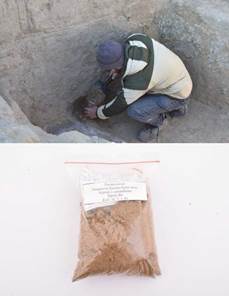
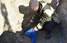
|
|
The sample is a loose mixed gray soil with the inclusion of organic |
|
4. |
Кs21_02_2_1_002. |
Sample № 2 for carpology was taken from the soil filling of burial chamber № 1, which is located in the northern part of mound № 2. Coordinates in the UTM system (x- 379578.906; y-5040692.843; z- |
|
5. |
Кs21_02_2_1_003. |
Sample № 3 for carpology was taken from the bottom of burial chamber no. 1, which is located in the northern part of mound № 2. Coordinates in the UTM system (x- 379579.285; y-5040692.042; z- |
|
Collection of samples at S-14 from the Kesken-Kuyuk kala burial mound |
|||
6. |
Кs21_02_2_1_1. |
Sample № 1 on C-14 was taken from the ground filling of burial chamber no. 1, which is located in the northern part of mound № 2. Coordinates in the UTM system (x- 379579.178; y-5040691.824; z- |
|
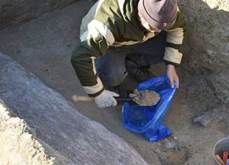
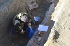
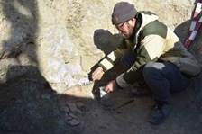
7. |
Кs21_02_2_1_2. |
Sample № 2 at С-14 was taken from the soil filling of burial chamber № 1, which is located in the northern part of mound № 2. Coordinates in the UTM system (x- 379579.149; y- 5040693.816; z- 28.363). |
|
Collection of samples for carpology from the Kesken-Kuyuk kala burial mound |
|||
Mound 4 |
|||
8. |
Кs21_02_4_1_001. |
Sample № 1 for carpology was taken from the soil filling of the grave pit No 1, which is located in the central part of the mound No 4. Coordinates in the UTM system (x- 379609.405; y-5040792.776; z- 29.471) |
|
Collecting samples for palynology from the Kesken-Kuyuk kala burial mound |
|||
9. |
Кs21_02_4_1_01. |
Sample № 1 for palynology was taken from the ground filling of grave pit No 1, which is located in the central part of mound No 4. Coordinates in the UTM system (x- 379609.454; y-5040792.850; z- |
|
Collection of samples at S-14 from the Kesken-Kuyuk kala burial mound |
|||
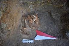
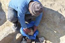
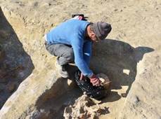
10. |
Кs21_02_4_1_1. |
Sample № 1 at С-14 was taken from the southern wall of burial pit No 1, which is located in the central part of mound № 4. Coordinates in the UTM system (x- 379581.344 y- 5040790.889; z- 29.573). |
|
11. |
Кs21_02_4_2_2. |
Sample № 2 at C-14 was taken from the southern wall of grave pit № 2, which is located in the central part of mound No 4. Coordinates in the UTM system (x- 379608.781; y- 5040790.287; z- 29.077). The |
|
Collection of samples for carpology from the third horizon of excavation No 1 of the Kesken- |
|||
12. |
Кs21_01_23_001. |
Sample № 1 for carpology was taken from the soil filling of the ash spot (element 23) located in the southeastern part of Premises № 7. Coordinates in the UTM system (x- 379642.836; y- 5041740.574; z- |
|
13. |
Кs21_01_4_002. |
Sample № 2 for carpology was taken from the soil filling of the ash spot (element 4), which is located in the southwestern part of Premises No 6. Coordinates in the UTM system (x- 379643.316; y-5041746.975; z- |
|
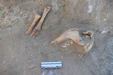
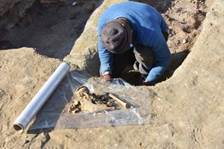
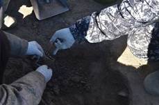
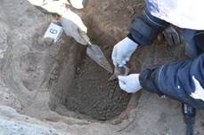
|
|
layer at a depth of 120 cm, from the day surface of the settlement. The sample is a loose mixed gray loam with the inclusion of charcoal and |
|
14. |
Кs21_01_10_003. |
Sample № 3 for carpology was taken near the northern wall of Premises No 5 from soil filling (element 10) located in the north-western part of Premises No. 5. Coordinates in the UTM system (x-379640.340; y- 5041743.713; z-34.562). |
|
Collection of samples for palynology from the third horizon of excavation No 1 of the Kesken- |
|||
15. |
Кs21_01_23_01. |
Sample № 1 for palynology was taken from the floor surface of Premises no. 7 (element 23) in the southern part of excavation № 01. Coordinates of collection, in the UTM system (x-379642.836; y- 5041740.574; z-34.158) |
|
16. |
Кs21_01_04_02. |
Sample № 2 of palynology was taken from the floor surface of Premises no. 6 (element 4) in the eastern part of excavation no. 1. Coordinates of collection, in the system Coordinates in the UTM system (x-379643.316; y- 5041746.975; z-34.385). |
|
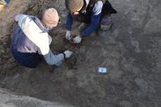
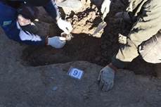
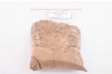
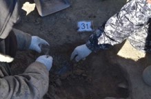
|
|
The sample is a gray loam with the inclusion of fine charcoal and small animal bones. |
|
Сбор проб на С-14 с третьего горизонта раскопа №Collection of samples at С-14 from the third horizon of excavation No. 1 of the Kesken-Kuyuk kala settlement 1 settlements Kesken-Kuyuk |
|||
17. |
Кs21_01_20_01. |
Sample № 1 at С-14, was taken from filling the Premises (element 20) in the southeastern part of Premises № |
|
18. |
Кs21_01_22_02. |
Sample №. 2 at С-14, was taken from filling the Premises (element 4) in the southern part of Premises № 6 on the floor, excavation № 1. Coordinates of collection, in the UTM system (x- 379643.316; y- 5041746.975; z- 34.385) |
|
19. |
Кs21_01_23_03. |
Sample № 3 at С-14, was taken from filling the vessel (element 1), on the floor of Premises № 7, in the southeastern part of No. 1. Coordinates of collection, in the UTM system (х-379642.836; у- 5041740.574; z-34.158 ). |
|
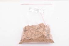
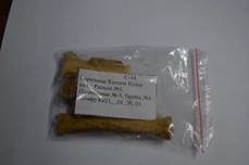
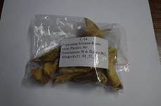
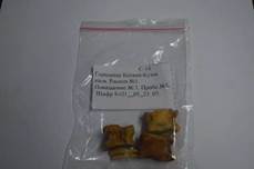
20. |
Кs21_01_12_04. |
Sample № 4 at С-14 was taken from filling the tandoor (element 14) on the floor in the southeastern part of Premises № 3. Coordinates of collection, in the UTM system (х- 379632.345; y-5041744.660; z- |
|
21. |
Кs21_01_22_05. |
Sample № 5 at C-14 was taken from filling the tandoor (element 11) on the floor in the southeastern part of Premises № 5. Collection coordinates, in the UTM system (x- 379640.196; y-5041745.058; z- |
|
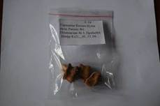
3.2 Flotation
In this section, there is a table on the flotation of carpalogic samples taken in the soil filling of the necropolis burial mounds and several Premisess of excavation No. 1 of the Kesken-Kuyuk kala settlement.
During research work, samples were taken for analysis for carpology, the number of samples taken from the burial mounds of the necropolis is 4 units, samples from the premises of excavation No. 01 are 3 units. The sample collection process is documented, photographic recording was carried out, each sample has its own collection point in the UTM coordinate system.
All selected samples are assigned a unique code number, the collected materials are carefully packed.
The processing of carpalogic samples was carried out in office, by means of rinsing with running water, at least 100 liters of water per soil sample, and filtration of the soil with collection of the resulting sediment, and drying it at Premises temperature.
Table № 2. Washed carpological samples after flotation
№ |
Code |
Description |
Photo |
Carpological samples after flotation. Materials from the Kesken-Kuyuk kala necropolis |
|||
Mound 2 |
|||
1. |
Кs21_02_2_1_00 1. |
Sample № 1 had a net weight of 2.6 kg prior to flotation. The resulting sediment was 124 g. |
|
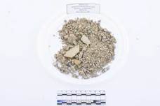
|
|
dispersed quartz sand of various shades with the presence of an organic component. The sample also contains a fragmented bregchevili mineral. |
|
2. |
Кs21_02_2_1_00 2. |
Sample № 2 before flotation had a net weight of |
|
3. |
Кs21_02_2_1_003 |
Sample № 3 had a net weight of 3.2 kg prior to flotation. The resulting sediment was 154 g. |
|
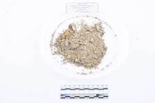
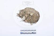
Mound №4 |
|||
4. |
Кs21_02_4_1_001. |
Sample № 4 had a net weight of 1.3 kg prior to flotation. The resulting sediment was 142 g. |
|
Carpological samples after flotation, excavation No. 1, Kesken-Kuyuk kala |
|||
5. |
Ks_21_01_23_001. |
Sample № 1 had a net weight of 2.5 kg prior to flotation. The resulting sediment was - 197 g. |
|
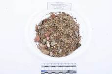
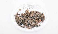
6. |
Ks_21_01_4_002. |
Sample № 2 had a net weight of 3.7 kg prior to flotation. The resulting sediment was 221 g. |
|
7. |
Ks_21_01_22_003. |
Sample №3 had a net weight of 3.1 kg prior to flotation. The resulting sediment was 64 g. |
|

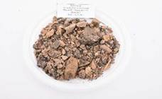
3.3. Description of the discovered materials of metal and ceramic complexes, as well as other artifacts
During scientific research archaeological work on the study of the cultural layer of the third building horizon of excavation No. 1, and two burial mounds of the necropolis and the Kesken-Kuyuk kala settlement, materials of metal and ceramic complexes, as well as other artifacts were found (Annex B, Figure 475-490).
During the study of two burial mounds of the necropolis, all artifacts were found and studied in office conditions, a partial restoration of heavily damaged materials was carried out. In total, 43 intact and archaeologically intact artifacts of the metal and ceramic complex were discovered, which are subdivided into weapons, jewelry, equestrian uniforms and household items.
Weapons found in the burial chamber of mound No. 2 consist of an archaeologically intact small dagger in a birch bark scabbard, and a set of 5 petioled three-bladed arrowheads.
Jewelry items are represented by a set of overlays made of gold foil and metal parts from a silver belt set. Also, in the burials, two archaeologically intact molded vessels were discovered.
Items of equestrian uniforms, fragments of stirrups, bit and one whole girth buckle.
During studying cultural layers and strata of the third building layer of excavation No 1. The materials of the ceramic complex were revealed: a fragment of an altar protome, an incense burner, archaeologically intact vessels, and fragments of easel and molded ornamented ceramics. Total is of 551 artifacts.
All materials discovered during research work have been processed and partially restored in office, each artifact has been assigned an individual cipher number. Items are carefully packed and placed in storage containers.
Copper items were cleaned with a solution of Trilon B (C10H14N2Na2O8 + H2O, at t = 80 C) (2)
2 Vorobyova S.L. Acquisition, registration, storage and scientific description of archaeological collections in museums: legal aspects and practical experience. Scientific and methodological manual. Ufa: National Museum of the Republic of Bashkortostan, 2019.160 p.
Materials of the Kesken-Kuyuk kala necropolis Mound 2 burial 1
Ceramic vessel
Archaeologically, entire ceramic vessel, has a pronounced pear-shaped shape, made of hand molding technology from clay-containing material.
The height of the vessel is 48 cm, the outer diameter of the body is 40 cm. The height of the wound pallet is 1.5 cm, the diameter of the pallet is 16 cm. The pallet has a conical flattened notch on the back. On the body there are four triangular moldings, on which finger indentations are fixed in the end parts. The size of the moldings is 5x2.8x1.6 cm. The rim is funnel-shaped and bent outward, the width is 5 cm. The inner part of the neck has a diameter of 14.5 cm. The diameter of the rim is 20 cm. The vessel is covered with a light engobe on the outside. The weight of the vessel is 7.9 kg.
It is found in a fragmentary state in the ground filling of the burial chamber, part of the body was in its original place in the northwestern part of the undercap of the burial chamber at a depth of 1.47 m relative to the day surface. Coordinates of discovery in the UTM system (x-379578.541; y-5040693.707 ; z-28.049.)
The ceramic vessel is in a satisfactory condition; several small fragments are missing. The item has been assigned a unique code number
Ks21_02_2_1_1 Birch bark quiver
Quiver has three-bladed metal arrowheads of open type and made of birch bark. It has a size of 82x12 cm, the lower part is slightly widened - 16.7 cm. A small pocket 12x7.5 cm is fixed in the upper part.
The quiver was found in a fragmented state in the clay fill of the underburning of the burial chamber, relative to the day surface at a depth of 1.45 m. Coordinates of discovery in the UTM system (х-379578.614; y-5040692.876; z-27.969.) In open quivers, arrows were placed with their tips up. The birch bark receivers of such quivers had a downward extension.
Quiver clips for fastening a belt, one pair, were found on the surface of the upper and lower parts of a birch bark quiver.
They consist of a rectangular frame with rounded edges. Manufactured using copper alloy molding technology. The outer size of one item is 13.6x10.5 mm, the inner size is 10x7.3mm, the thickness is 1.1 mm, the weight of one item is 0.6 g. The items are well preserved, an individual code number has been assigned: Ks21_02_2_1_2.
Wooden patches inlaid with gold foil
Wooden stripes, presumably attached to clothes in the amount of 2 units. Its have an oval shape with 6x4.5 cm and 2.5 mm in thick. The front surface is framed with thin strips of black leather with intersecting rays, similar to the imitation of a cross, the formed four sectors are decorated with gold.
Items were found in the area of the remains of the elbow joints of both bones of the hands, at an elevation of 1.45 m, relative to the surface of the daytime horizon. Coordinates of detection in the UTM system (x-379578.908; y-5040692.988; z- 27.946.), (X-379578.663; y-5040692.935; z-27.970.). The items are in an
unsatisfactory condition and are very badly damaged. The wood base is partially cracked and appears to be cracked.
Quiver hook
Quiver hook, made using of black metal casting technology, and forging. It has a rectangular shape with a lancet shank and hook-shaped. The size is 4.8x3 cm, the thickness is 2 mm, the weight is 36.3 g. The hook is one-piece and has a size of 2.8x0.9 mm.
Through attachments to the quiver along the edges of the item are fixed. There is highly corroded growths.
It is found in the central part of the burial chamber of mound 2 on under a birch bark quiver, at a depth of 1.45 m, relative to the daytime surface.
The item is in a satisfactory condition; there is cracks and chips. The item has been assigned a unique code number: Ks21_02_2_1_3.
Arrowhead set
A set of metal petiole arrows (five units), made using molding technology from an alloy of ferrous metals. It is found in the central part of the burial chamber of mound 2 on the surface of a birch bark quiver, at a depth of 1.44 m, relative to the surface of the day. Coordinates of detection in the UTM system (x-379671.911; y- 5040771.555; z-24.32). The items are assigned a unique code number: Ks21_02_2_1_4 - Ks21_02_2_1_8.
It is triangular iron arrowhead and dart type. The body of the arrow has a triangular shape in cross-section, the blades are symmetrical. The blades at the tail end of the fuller taper towards the head and join together. The feathers converge at a slight obtuse angle to the petiole; in the tail, they are slightly narrowed. The length of the blade is 7 cm, the width in the central part of the fuller is 8.2 mm, the thickness is 2.6 mm. The petiole is whole, rounded in cross-section: the length is 6 cm, the diameter in the central part is 0.6 mm. The weight of the item is 22.7 grams.
The item is in a satisfactory condition; cracks and chips is recorded. The item has been assigned a unique code number: Ks21_02_2_1_4.
Triangular iron arrowhead, dart type has body of the arrow triangular in cross- section. The blades are symmetrical. The blades at the tail end of the fuller taper are towards the head and join together. The feathers converge at a slight obtuse angle to the petiole; in the tail, they are slightly narrowed. The length of the blade is 7 cm, the width in the central part of the fuller is 7.1 mm, the thickness is 2.6 mm. The petiole is whole, rounded in cross-section, the length is 5.5 cm, the diameter in the central part is 0.6 mm. The weight of the item is 26.3 g.
The item is in a satisfactory condition; cracks and chips is recorded. The item has been assigned a unique code number: Ks21_02_2_1_5.
Three-blade iron arrowhead has triangular type. The body of the arrowhead has a triangular shape in cross-section, the blades are symmetrical. The blades taper towards the head and join together. The feathers converge at a slight obtuse angle to the petiole, in the tail. The length of the blade is 5.2 cm, the width in the tail section is 10 mm, and the thickness of the blade is 2.1 mm. The petiole is broken off, rounded in cross-section, the length is 4.4 cm, the diameter is 10 mm. The weight of the item is 16.3 grams.The item is in a satisfactory condition; cracks and chips is recorded. The item has been assigned a unique code number: Ks21_02_2_1_6.
A fragment of a three-bladed iron arrowhead is triangular type. The body of the arrowhead has a triangular shape in cross-section, the blades are symmetrical. The blades taper towards the head and join together. The feathers converge at a slight obtuse angle to the petiole, in the tail. The length of the blade is 7 cm, the width in the tail section is 12 mm, the thickness is 2.1 mm. The petiole is whole, rounded in cross-section, length is 3 cm, diameter is 10 mm. The weight of the item is 23.2 grams.
The item has an unsatisfactory condition; cracks and chips is recorded. The item has been assigned a unique code number: Ks21_02_2_1_7.
A fragment of the head of a three-bladed iron arrowhead and triangular type. The arrowhead body has a triangular shape in cross-section, the blades are symmetrical. The blades taper towards the head and join together. The length of the blade is 4 cm, the width in the tail section is 0.7 mm, the thickness is 1.9 mm. Item weight is 8 g.
The item has an unsatisfactory condition; cracks and chips is recorded. The item has been assigned a unique code number: Ks21_02_2_1_8.
Gold leaf
Gold foil is made of gold alloy using cold forging technology. It has various shapes, from rectangular and oval to triangular. These items were intended to decorate clothing and weapons.Found during the clearing of the soil filling of the burial chamber of mound 2, in the southwestern part, at the mark of 1.43 m, relative to the surface of the daytime horizon. The size is from 1.2x1.2 to 3.4x0.9 mm. Total weight is 1.1 g.
The items are in an unsatisfactory condition; cracks and chips is recorded. The items have been assigned a unique code number: Ks21_02_2_1_9.
Metal item
A metal item, made using the technology of molded casting from an alloy of ferrous metals, has a sub-triangular shape. The size is 8.6x3 cm, wall thickness is
2.7 mm, weight is 21.6 g. The tail section has a through hole for mounting a rectangular shape, measures are 10x0.5 mm.
It was found during the clearing of the soil filling of the burial chamber of mound 2, in its western part, at the mark of 1.45 m, relative to the surface of the daytime horizon.
The item is in a satisfactory condition; cracks and chips is recorded. The item has been assigned a unique code number: Ks21_02_2_1_10.
Belt set
The metal components from the men's belt set are made using the technology of molding casting, brazing, and engraving and grinding from a silver alloy.
Initially, the belt set consisted of a leather belt, in the head of which a large ornamented buckle, with a movable arcuate tongue was attached. Following the buckle to the base of the leather belt with the help of a peg attachment, a silver heart- shaped pads were attached in a row, and a silver tip was fixed in the tail part of the belt. In the gap on the belt set on the left side, another belt, decorated with figured plaques was attached, to which a birch bark sheath with a small partially preserved dagger was fixed.
Metal parts from the belt set were found at the mark of 1.45 m, relative to the surface of the daytime horizon, in the central part of the burial chamber on the human pelvic bone. Coordinates of detection in the UTM system (x-379578.967; y- 5040692.836; z-27.963.).
The metal components from the men's belt set consist of as many as 18 metal items equipped with a pin fastening. The items have been assigned a unique code number: Ks21_02_2_1_11- Ks21_02_2_1_16.
The complex-compound belt buckle consists of a flap, a frame and a movable tongue. The size of the item is 4.9 x 2.7 cm, thickness is from 0.8 to 0.9 mm. Item weight is 21.2 g.
The buckle plate has a lancet-arched shape with demetions 23.8x22.8 mm, the tail is rounded and smoothed. On the front surface there is a rich plant ornament in the form of a "kashkar horn", the type of ornamentation on the surface of the shield is engraving with blackening. The head part of the shield in the central part from the end has a rectangular slot for attaching a movable tongue, with dimentions 7.4x7.7 mm.
The protrusions of the head part of the shield on the front and back sides have a molded stamped ornament of alternating vertical notches. The back side of the flap is slightly convex, in cross-section it has an arched shape, along the edges a peg attachment is fixed of three whole pegs. The size of the pegs is 5-7 mm. From the end, along the head of the shield, there is a rod fastening of a movable tongue with a diameter of 0.6 mm.
The frame has an oval shape. It is arcuate and convex in cross-section, expanding towards the base. The size of the upper part is 28.2x8.8 mm and thickness is 0.94 mm. The lower part at the base is bent outward and has a size of 36.2x19.2 mm. The border of the frame is wide and has a width of 8.4 mm. In the head part on the front side along the contour there are alternating decorative notches in the form of straight lines. At the point of contact with the movable tongue on the side of the frame, relief alternating notches are fixed. The shield and frame are soldered together.
Belt plaques of the portal type with a lancet-arched slot were found (4 units). Items have a figured shape, size - 32.4x32.55 mm, wall thickness is 0.9 mm, the weight of one item is 6.4 g. On the front surface, a small smoothed bead is fixed in the center, which slightly protrudes beyond the edge of the item. In the central part, a large lancet-arched through hole with a size of 15x8.2 mm is fixed. The back side of the flap is slightly convex, in cross-section it has an arched shape, along the edges a peg attachment is fixed three whole pegs. The size of the pegs is 6-7 mm, the pegs are slightly bent.
The items are in good condition, from visible damage, corrosive pits and scratches. The items have been assigned a unique code number: Ks21_02_2_1_12.
Arrow-shaped belt plaques were found (9 units). The size is 18.8x17.9 mm, the wall thickness is 0.96 mm, the weight of one item is 4.1 g. On the front surface, a small smoothed bead is fixed in the center, which slightly protrudes beyond the edge of the item.
The back side is slightly convex, in cross-section it has an arcuate shape, along the edges a peg fastening is fixed in the form of three whole pegs. The size of the pegs is 5-6 mm, the pegs are slightly bent. On one of the plaques in the back there is a drilled hole for the ear-pin attachment, the hole diameter is 1.3 mm.
The items are in good condition and visible damage oxides and scratches are presented. The items have been assigned a unique code number: Ks21_02_2_1_13. A small figured plaque with a slightly widened carved edge has a size of 9.9x9.2 mm, wall thickness is 0.95 mm, item weight - 1.4 g. The back side is slightly convex, in section it has a U-shape, in the central part a pin fastening is fixed in the form of one whole pin. The pin size is from 4 mm.
The item is in good condition, there are visible damages, oxides and scratches.
The item has been assigned a unique code number: Ks21_02_2_1_14.
A small subrectangular arrow-shaped plaque has a size of 14x11.2 mm, a wall thickness of 1 mm, and the weight is 1.8 g.
The back side is slightly convex, it has an arched shape in section, in the central part hemp fasteners are fixed in the form of two pegs. The size of the pegs is 3 mm or more.
The item is in good condition, there are visible damages, oxides and scratches.
The item has been assigned a unique code number: Ks21_02_2_1_15.
The clip for fastening the belt consists of a rectangular frame, with rounded edges from the end part, it has an angular protrusion along the perimeter. The outer size of the item is 8 x 3.3 mm, the inner size is 16.5 x 12.4 mm, the thickness is 1.8 mm, the weight is 1.3 g.
The items are in good condition. Visible damage oxides and scratches are present. The items have been assigned a unique code number: Ks21_02_2_1_16.
Mound 4 Burial 1 Ceramic vessel
Archaeologically, entire ceramic vessel, according to its typology, belongs to water-bearing jugs, made using hand-made technology. The height of the vessel is
22.5 cm, the outer diameter of the body is 16 cm. The bottom of the vessel is flat, and has a diameter of 12 cm.
The vessel lacks a rim, it was lost as a result of the robbery of the burial structure. On the neck of the vessel, a fragment of a molded crank handle is fixed, with size of 5.7x2.2x1.5 cm. The surface of the vessel is covered with red engobe and has a polish. The wall thickness of the vessel body is 0.9 cm. The weight of the vessel is 600 g.
The ceramic vessel is in a satisfactory condition; several small fragments are missing. The item has been assigned a unique code number: Ks21_02_4_1_1.
Burial 4 mound No 2 Spring buckle
One-piece girth buckle is made using metal rod forging technology. The item has a trapezoidal shape with rounded edges. Size is 5x3.7 cm, thickness is 5.5 mm, weight is 28 g. The one-piece metal buckle is slightly widened in the head part, with size 4.8 cm. In the tail part, in the center, a hook is attached to the buckle, which extends beyond the border of the shield. The size of the hook is 5.6x0.8 cm, in the tail part the hook is slightly widened, has a size of 1.1 cm. On the buckle shield, the hook in the tail part has a forged fastening.
A blade fragment was found in the southwestern part of burial No. 2, in an accumulation of human bone remains, at an elevation of 0.58 m, relative to the surface of the daytime horizon. A fragment of the item is in poor condition, the metal is corroded, crumbles, there are oxides. The item has been assigned a unique code number: Ks21_02_4_2_2.
Materials found in the study of the third building horizon of excavation No. 1
A fragment of a rim from a molded, large vase-shaped vessel.
The surface on the outside and inside is covered with a light engobe, an orange-beige shade, the inside is polished. The rim is bent outward, in a subrectangular section. The diameter of the rim is 26 cm, the thickness of the walls is 1-1.5 cm, on the outside on the bent side of the rim there are squeezed, slightly inclined to the right alternating lines with 4-4.2 cm long. Weight is 46.7 g., width-is
3.2 cm, length is 4.6 cm. The item has been assigned a unique code number: Ks21_1_3_15_1.
A flat, slightly concave bottom from the outside of a molded vessel.
The surface on the inside and outside is covered with a dense layer of soot and soot. The bottom expands in the lower part, the walls slightly narrow, the edges are oval, the diameter is 9.8 cm, the wall thickness is 0.7-1.1 cm, the height of the preserved part of the vessel is 8.7 cm, a fragment presumably from a large circle. Weight is 276 gr. A fragment of the bottom was found in the ground filling of Premises No. 3. The item has been assigned a unique code number: Ks21_1_3_15_2. Fragment of a flat lid for vessels. From the outside of the lid, the surface is covered with a light yellow-beige engobe; from the inside and outside, traces of soot are visible on the surface. The edges of the lid are thickened, in a sub-rectangular section, decorated with alternating finger traces, the diameter is about 20 cm, the thickness of the lid is 1.4-1.5 cm, on the outside there is a drawn ornamentation in the form of oval lines, the full appearance of the pattern cannot be determined. Weight is 207 gr. The item has been assigned a unique code number: Ks21_1_3_15_3.
Fragment of a reservoir from a molded chiraq, open form.
The surface on the inside is covered with black engobe, traces of soot and soot spots are also visible. The reservoir is in the form of a saucer, with a slightly bent edge, a spout, the edges are oval in cross-section, the walls are 0.7-1 cm thick. The bottom has not survived, there are traces of the pallet fastening, the shape of which is not determined. The preserved height of the vessel is 2.7 cm, the diameter of the tank is approximately 8.5 cm. Weight is 20 g. The reservoir was found in the ground filling of Premises No. 3. The item has been assigned a unique code number: Ks21_01_3_15_4.
Metal item s made using molding technology from a copper alloy. Consists of two parts: the handle and the pommel are welded together. The handle has an elongated cone-spherical shape. The head part has a relief ornament in the form of a flute. The surface of the handle has a circular alternating ornament. The flap is rectangular in cross-section. The upper part of the shield is bent and has a semicircular annular base. The length is 8.3 cm. The diameter of the top is 9 cm. The diameter of the through hole of the top is 3 mm. The top section is 4 mm. Thickness is 10.27 mm, hole is 4.47 mm. The thickness of the plate is 1.28 mm. The length of the plate is 33.36 mm, weight is 23 gr. The item has been assigned a unique code number: Ks21_1_3_15_8.
An archaeological whole, molded pottery - incense burner.
The surface on the outside is covered with a layer of light dense engobe, pale beige, due to uneven firing. The shape of the item is elongated trapezoidal, in the upper part there is an oval hole, with outwardly protruding edges, in a flattened-oval section. The diameter is approximately 5 cm, the height of the protruding edge is 2 cm. The sides of the item and the corner parts are decorated with an ornament. In the corners there are drawn alternating inclined the lines forming the Christmas-tree ornament, on the sides of the wall, are decorated with a drawn ornament made in the vegetative style with elements of geometric cuts, triangular or teardrop-shaped, as well as small protruding tubercles, complementing the general pattern. The holes are through, perform a ventilating function, in the upper part, the corners with thickened horn-shaped projections raised upward, which is partial preserved. Downward, the walls expand, at the base there are thickenings, and traces of soot are visible, in the section of the edge of a rectangular shape. The height of the item is 28.3 cm, the width of the upper side is 10.4 cm, the width of the lower side is 18.9 cm, the thickness of the walls is 0.8-1.5 cm.
Weight is 1.5 kg. The item has been assigned a unique code number: Ks21_1_3_27_1.
A fragment of a sidewall from a molded vessel, made of a medium-mixed red, pink-beige shade. The surface from the outside is covered with a layer of dense engobe of light yellow-beige hue, traces of soot are visible. The wall thickness is 0.7-0.8 cm, there is no ornamentation. Weight is 28 gr. The item has been assigned a unique code number: Ks21_1_4_17_1.
Fragment of a sidewall from a large thick-walled vessel. The surface on the outside and inside is covered with a red engobe, traces of glazing with gloss are also visible from the outside, there is a cone-shaped protrusion on the wall, protruding by 1 cm, the wall thickness is 1.2-1.4 cm. Weight is 152 g.
The item has been assigned a unique code number: Ks21_01_4_17_2. Fragment of the rim from a large vessel, with the edges bent outwardly truncated. The surface of the vessel from the outside and inside is covered with a partially preserved layer of red engobe; polishing without shine is visible. The edges of the rim have a wavy curved surface of two large, wide plum trees that have survived. The diameter of the rim is difficult to determine, the edges in the cross-section are subrectangular, the walls are 1.5-1.8 cm thick, the length of the remaining part of the vessel is 12 cm, there are several through holes on the edge on the walls, presumably made for the restoration of the broken vessel and fastening the fragments. Weight is 460 gr. The item has been assigned a unique code number: Ks21_01_5_20_1.A fragment of a large ceramic stucco item, presumably a part of the table top from the dastarkhan. The surface of the fragment from the outside is covered with a layer of dense light engobe, from the inside the surface is covered with red engobe, polished without shine is visible. Outside, the surface of the item is decorated with pressed straight lines and oval finger impressions. The edges of the item are oval in cross-section, the thickness is 3.8-4 cm, the dimensions are 12.3-10.8 cm. Weight is 416 g. The item has been assigned a unique code number: Ks21_1_5_20_2.
Fragment of a rim from a molded vessel, presumably of a vase-like shape. The surface of the fragment from the inner and outer sides is covered with a red engobe; banded glazing is also visible. The edges of the bPremises with a bell are bent outward, in a sub-rectangular section. The diameter is 18 cm and the wall thickness is 0.8-1.5 cm. The rim passes into a cylindrical body with a diameter of 11 cm, along the inner side. Weight is 175 gr. The item has been assigned a unique code number: Ks21_01_5_25_1.
Fragment of a rim from a large molded vessel, presumably from a pot. The surface of the fragment from the outside and inside is covered with a layer of light red engobe, in some places on the surface there are dark spots of calcination and soot. From the inside and outside on the surface traces of polishing to a shine are visible. The rim with a slightly bent outward edge. In a sub-rectangular-oval section, outside under the rim there is a protruding diametrical belt, the surface of which and the edge of the rim are decorated with alternating inclined notches on the outside, forming a geometric ornament, along the edge of the rim is horizontal, on the ledge there is a vertical “fir-tree” belt. On the side, on the edge, there is a spout-shaped projection of a sub-triangular-oval shape, presumably a pseudo-handle. The diameter of the rim is 23 cm, on the outside, the wall thickness is 0.6-0.7 cm. Weight is 136 g. The item has been assigned a unique code number: Ks21_1_5_25_2.
A fragment of a rim from a large vessel, presumably cigar-shaped. The surface on the outside is covered with a light engobe, the edges of the rim are straight, slightly narrowed, in an oval section, diameter is 14 cm, wall thickness is 0.4-0.6 cm. From the inside on the walls there are concentric alternating pressed lines, from the fingers, left during the manufacture vessels. Weight is 77 gr. The item has been assigned a unique code number: Ks21_1_5_25_3.
A fragment of a rim from a large vessel, presumably cigar-shaped. The surface on the outside is covered with a light engobe, the edges of the rim are straight, slightly narrowed, in an oval section. The diameter is 14 cm, wall thickness is 0.4-
0.6 cm. From the inside on the walls there are concentric alternating pressed lines from the fingers, left during the manufacture vessels. Weight is 81 gr. The item has been assigned a unique code number: Ks21_1_5_25_4.
Fragment of a rim from a molded vessel, presumably from a bowl. The surface on the outside and inside is covered with a light gray engobe, traces of polishing are also visible. The edges of the rim are straight, oval in cross-section, the diameter is 36 cm. On the outside of the vessel wall there is a roller-like protruding line along the entire diameter, the wall thickness is 0.8-1 cm. Weight is 50 g. The item has been assigned a unique code number: Ks21_01_5_25_5.
Fragment of a sidewall from a molded vessel. The surface on the outside is covered with a partially preserved layer of red engobe, traces of banded glazing with glitter are visible, and on the outside, the fragment has ornamentation made in a plant style in the form of alternating curls and oval lines depicting elements of an ethnic pattern. The wall thickness is 0.8-0.9 cm and weight is55 gr. The item has been assigned a unique code number: Ks21_1_5_25_6.
Fragment of the wall from a molded vessel. The surface on the outside is covered with a partially preserved layer of red engobe, traces of banded glossy gloss are visible, and on the outside, the fragment has ornamentation made in a plant style in the form of alternating curls and oval lines. The wall thickness is 0.7-0.9 cm. Weight is 38 g. The item has been assigned a unique code number: Ks21_1_5_25_7.
Fragment of a sidewall from a molded vessel. The surface on the outside is covered with a partially preserved layer of red engobe, traces of banded glazing with glitter are visible, and on the outside, the fragment has ornamentation made in a plant style in the form of alternating curls and oval lines depicting elements of an ethnic pattern. The wall thickness is 0.7-0.8 cm. Weight is 38 g. The item has been assigned
a unique code number: Ks21_1_5_25_8.
Fragments of two sides from a molded vessel. The surface on the outside is covered with a partially preserved layer of red engobe, traces of banded glazing with glitter are visible, and on the outside, the fragment has ornamentation made in a plant style in the form of alternating curls and oval lines depicting elements of an ethnic pattern. The wall thickness is 0.7-0.8 cm. Weight is 57 g and weight is 40 gr, width is 4.1cm. The item has been assigned a unique code number: Ks21_1_5_25_9.
Fragment of a sidewall from a molded vessel. From the outside, the surface is covered with a layer of light red engobe, spots of soot are also visible. Outside, the fragment has ornamentation that fills the entire surface, made of alternating nail indentations that form horizontal lines. The wall thickness is 0.6-0.7 cm, the weight is 79 g. The item has been assigned a unique code number: Ks21_1_5_25_10.
Fragment of a sidewall from a molded vessel. From the outside, the surface is covered with a layer of light red engobe, spots of soot are also visible. Outside, the fragment has ornamentation that fills the entire surface, made of alternating nail indentations that form horizontal lines. The wall thickness is 0.6-0.7 cm. Weight is 80 g. The item has been assigned a unique code number: Ks21_1_5_25_11.
1.2 cm, the bottom is oval forms. Weight is 404 gr. The item has been assigned a unique code number: Ks21_1_5_25_13.
Fragment of a modeled small pot-shaped vessel with a low, slightly narrowed neck. The surface of the rim is decorated with alternating inclined incisions forming a vertical Christmas tree ornament. The diameter of the vessel rim is 20 cm, on the outside, the height of the outside edge is 2 cm, the wall thickness is 0.6-0.7 cm. Fragment weight is 87 g. The item has been assigned a unique code number: Ks21_1_5_10_1.
Fragment of a rim from a molded vessel, presumably from a pot. The rim with a low, slightly narrowed neck, is sub-rectangular-oval in cross-section, the outside edge of the rim is decorated with alternating inclined notches, forming a geometric ornament a vertical Christmas tree belt. The rim diameter is 22 cm, on the outside, the wall thickness is 0.7-0.8 cm. Fragment weight is 66.5 g. The item has been assigned a unique code number: Ks21_1_5_10_2.
Fragment of a bPremises from a small molded vessel, presumably a pot (or mug). The surface of the vessel is covered with brown engobe from the outside and inside. A vessel with a slightly narrowed neck, the edges of the rim in the cross- section of a rounded shape, the diameter is 8 cm, on the inner side. On the side of the rim of the bPremises and to the shoulder is attached a loop-shaped vertical handle, oval in cross-section, 2.1 cm wide, 1.2 cm thick. On the rim of the vessel from the outside there is a carved ornamentation in the form of alternating small notches inclined to the right and a horizontal straight line slightly down. The thickness of the walls of the vessel is 0.5-0.6 cm. Weight is 31 gr. The item has been assigned a unique code number: Ks21_01_5_10_3.
Fragment of a sidewall from a molded vessel. On the outside and inside, the surface is covered with a partially preserved layer of light engobe, beige. Outside, the fragment has a drawn ornamentation that fills half of the fragment, made in geometric style in the form of alternating inclined small lines that form a vertical Christmas tree ornament. The wall thickness is 0.6-0.7 cm. Weight is 20 g. The item has been assigned a unique code number: Ks21_01_5_10_4.
A fragment of the edge of the lid, made. On the outside of the lid, the surface is covered with a light, partially preserved engobe, on the inside, the surface is heavily smoked and has a black surface, and a glossy polish is also visible from the outside. The edges of the lid are narrowed in an oval cross-section, the diameter is about 17 cm, the thickness of the lid is 0.9-1 cm, on the outer side of the lid there is a drawn ornamentation in the form of oval and slightly curved lines, it is impossible to determine the full appearance of the pattern. Weight is 37 gr. The item has been assigned a unique code number: Ks21_01_5_10_5.
Fragment of the edge of the lid. On the outside of the lid fragment, the surface is covered with a light engobe, on the inside and along the edge there are spots of soot, and a glossy polish is visible. The edges of the lid are slightly narrowed in an oval cross-section, the diameter is 29 cm, the thickness of the lid is 2.5-2.7 cm, on the outside of the lid there is a drawn ornamentation in the form of oval lines, the full appearance of the pattern cannot be determined. Weight is 41g. The item has been assigned a unique code number: Ks21_01_5_10_6.
Archaeologically entire circle. The surface on the outside and partly on the inside is covered with a layer of red engobe, and traces of glossy polishing are also visible. The mug is cylindrical in shape, the edges of the rim are bellied, slightly bent outward, in a flattened-oval section. The diameter of the rim is 10 cm, the wall thickness is 0.6-0.8 cm. On the side there is a loop-shaped handle, in a sub-triangular section is 1 , 7 cm, the thickness is 1.1 cm. In the upper part of the handle there is a flat projection (platform) with a sub-triangular edge, its dimensions are 2x2.3x0.7. The bottom of the mug is flat, with a diameter is 5.7 cm, the height of the mug is 10.5 cm. Weight is 254 g. The item has been assigned a unique code number: Ks21_1_5_24_1.
g. The item has been assigned a unique code number: Ks21_1_5_24_2.
A fragment of a rim from a vessel, presumably from a small vase, with a funnel-shaped rim bent outward. The surface on the outside and inside is covered with a partially preserved layer of red engobe, a pink-beige shade, gloss is also visible. The rim edges are sub-rectangular in section, the length of the bent edge is 3.3-5.5 cm. Outside there is a conical molding protruding by 0.8 cm, the rim passes into a part of the neck with a diameter is 4.5 cm, wall thicknessis 0.8- 1.5 cm. Weight is 72 gr. The item has been assigned a unique code number: Ks21_1_5_19_1.
Fragment of a sidewall from a molded vessel. Outside, on the fragment, a dense layer of light red engobe is preserved, the preservation of which is satisfactory, with multiple cracks and detachments, from the inside the surface is covered with red engobe, glazing is visible. On the outside, there are squeezed alternating wide lines from the fingers, decorating the wall, the thickness of the sidewall is 1 cm. Weight is 73 g. The item has been assigned a unique code number: Ks21_1_5_19_2.
Fragment of a rim from a molded vessel, presumably from a large jug. The surface on the outside and inside is covered with a light brown-beige engobe, and soot spots are also visible. The edges of the rim are thickened, roller-shaped, in a flattened-oval section, the diameter is 19 cm, the wall thickness is 0.6-0.7 cm. Weight is 38 g. The item has been assigned a unique code number: Ks21_1_6_5_1.
Fragment of a sidewall from a molded vessel. From the outside, the surface is covered with a layer of gray engobe, spots of soot are also visible. Outside, the fragment has ornamentation that fills the entire surface, made in alternating nail indentations that form horizontal lines. The wall thickness is 0.7-0.8 cm. Weight - 45gr. The item has been assigned a unique code number: Ks21_1_6_5_2.
A fragment of a sidewall from a molded vessel with a large molding, raised to the top, horn-shaped. On the surface of the molding there are pressed vertical lines, the length of the molding is 6.4 cm, the width is 4.5 cm, the wall thickness is 1-1.1 cm. Weight is 57 g. The item has been assigned a unique code number: Ks21_01_6_5_3.
A whole bowl, with small splinters along the rim. The surface of the vessel from the inside and outside is covered with a dense layer of light engobe, a yellow- beige shade, on top of which streaks and spots of light red color were also applied. The rim with a straight cylindrical edge. The rim is slightly thickened, in an oval section, the diameter is 15.5 cm, the wall thickness is 0.7 cm.The body is oval, tapers into a flat bottom with a diameter of 7.5 cm, the bottom is oval from the inside, the height of the vessel is 7.5 cm. Weight is 600 g. The item has been assigned a unique code number: Ks21_1_6_22_1.
Fragment of a rim from a large bowl, hemispherical. The surface on the inside and outside is covered with a dense layer of red engobe, traces of polishing are also visible. The rim is straight, the edges are thickened in a subrectangular section, with a platform 1.6 cm wide. Outside, on the edge, there are concentric pressed lines in two rows, a part of the protrusion, presumably from a pseudo-handle, is also preserved on the side, the shape is not determined, the length of the preserved part is 0, 9 cm. The diameter of the rim is 41 cm, the thickness of the walls is 1.2-1.3 cm. Weight is 242 g. The item has been assigned a unique code number: Ks21_1_6_22_2.
Fragment of a rim from a pot-type vessel. The surface of the vessel from the outside and inside is covered with a red engobe; polished without shine is also visible. The rim with a high straight cylindrical neck, the edges are thickened, in a sub- rectangular-oval section, the diameter is 10 cm, the wall thickness is 0.6-1.2 cm. A loop-shaped handle is attached to the neck and shoulder, in the upper part of which there is a subtriangular molding , the edge of which has been lost, the width of the molding is 3.3 cm, the remaining length is 3.2 cm, the handle is oval-shaped, 2.2 cm wide and 1.4 cm thick. Weight is 186 gr. The item has been assigned a unique code number: Ks21_1_6_22_3.
Fragment of a whisk from a small bowl. The surface on the outside or inside is covered with a layer of red engobe, a reddish-brown shade. The rim with a low straight cylindrical rim, smoothly merging into the vessel wall, the rim edges are slightly thickened oval in cross-section, the diameter is 8 cm, the wall thickness is 0.5-0.7 cm. Weight is 16.5 g. The item has been assigned a unique code number: Ks21_1_6_22_4.
Fragment of a bPremises from a small molded vessel, presumably a pot (or mug). The surface of the vessel from the outside and inside is covered with a brown- beige engobe, in some places spots of a darker shade are visible, and a banded glossy gloss is also visible. A vessel with a straight cylindrical neck, 4.6 cm high, the edges of the rim are thickened, in a sub-rectangular-oval section, the diameter is 7.5 cm, on the inner side. The neck passes into a slightly protruding shoulder, to which a loop- shaped vertical handle is attached to the side and to the rim of the bPremises, slightly rising above the edge of the rim of a sub-triangular cross-section, 1.6 cm wide, 1.4 cm thick. The thickness of the vessel walls is 0.7-1 , 2 cm. Weight is 87.2 gr. The item has been assigned a unique code number: Ks21_1_6_22_5.
Fragment of a rim, presumably from a small hemispherical bowl (bowl). The surface on the inner and outer sides is covered with a layer of dense engobe of a dark, almost black color; traces of banded burnishing and soot are also visible. The rim is straight, the edges are flattened-oval in cross-section, the diameter of the rim is 20 cm, the wall thickness is 0.8-1.1 cm. Weight is 37.4 g. The item has been assigned a unique code number: Ks21_1_6_22_6.
Fragment of a rim from a molded vessel, presumably from a large pot. The surface on the outside and inside is covered with a layer of light engobe, a yellow- beige shade, soot spots are also visible, and traces of banded glazing. A thickened rim, forming a shallow platform 2.9 cm wide, on the surface of which and along the edge there is an ornamentation in the form of a wavy line, and small notches inclined to the left along the rim. The diameter of the rim is 33 cm, on the inner side, thethickness of the walls is 1.3-1.4 cm. Weight is 221 g. The item has been assigned a unique code number: Ks21_1_6_22_7.
Fragment of a rim from a large molded vessel, presumably from a pot. The surface of the fragment from the outer and inner sides is covered with a layer of dough, which is more liquid in consistency, of a light pink-beige hue. The rim with a slightly bent outward edge, in a sub-rectangular-oval section, on the outside, the rim edge is decorated with alternating inclined notches, forming a geometric ornament of a belt consisting of vertical elements of the Christmas tree ornament. On the side, on the edge, there is a spout-shaped projection of a subtriangular-oval shape, presumably a pseudo-handle, with a slightly raised edge. The diameter of the rim is 21 cm, on the outside, the wall thickness is 0.8-1.1 cm. Weight is 140 g. The item has been assigned a unique code number: Ks21_1_6_22_8.
Fragment of a rim from a large vessel of the jumchi type. The surface of the vessel from the outside is covered with a layer of light red partially preserved engobe, from the inside the surface is covered with a light engobe, from both sides a partial glaze is visible. The rim is sub-rectangular-oval in cross-section, with a platform 2.2 cm wide. On the side a loop-shaped is attached, vertically positioned handle, oval in cross-section, 3.8 cm wide, 2.3 cm thick, there are two pressed lines on the back of the handle, in the bottom parts of the handle attachment to the body on the surface have small cuts, the thickness of the vessel wall is equal to 1.5-2.7 cm. Weight is 1 kg. The item has been assigned a unique code number: Ks21_1_6_22_9.
Fragment of a rim from a molded vessel, presumably from a pot. The surface of the vessel from the inside and outside is covered with a dark engobe, with a brown shade of banded gloss with a glint. The rim is straight, the edges are thickened, in a subrectangular section, the diameter of the rim is 19 cm, outside along the edge there is a carved ornament in the form of a narrow belt in the form of a straight concentric line and alternating small lines inclined to the left, the wall thickness is 0.8-1.1 cm . Weight is 62.4 g. The item has been assigned a unique code number: Ks21_1_6_22_10.
Fragment of a sidewall from a molded vessel. The surface on the outside is covered with a light engobe, there is also a drawn ornamentation on the outside in the form of elements of ethnic ornament, made in floral style, the wall thickness is 0.7-0.9 cm. Weight is 48.6 g. The item has been assigned a unique code number: Ks21_1_6_22_12.
A flat bottom from a molded vessel. The surface on the outside is covered with a light red engobe, spots of soot are also visible, and a banded glossy gloss. Outside, on the walls of the vessel, there is a carved ornamentation made in the floral style in the form of wavy lines and curls depicting plant stems. The bottom diameter is 6.6 cm, the wall thickness is 0.4-0.5 cm. Weight is 88.8 g. The item has been assigned a unique code number: Ks21_1_6_22_13.
Flat bottom from a molded vessel. The surface of the fragment from the outside is covered with a dark gray engobe, and traces of soot are visible, from the inside. The surface is covered with a dense layer of light engobe. The bottom diameter is
4.7 cm, the wall thickness is 0.7 cm, and the inner part of the bottom is oval. Weight is 58.5 gr. The item has been assigned a unique code number: Ks21_1_6_22_14.
Flat bottom from a molded vessel. The surface of the fragment from the outside is covered with a dark gray engobe, and traces of soot are visible, from the inside, the surface is covered with a dense layer of light engobe. The bottom diameter is 4.7 cm, the wall thickness is 0.7 cm, and the inner part of the bottom is oval. Weight is 60.6 gr. The item has been assigned a unique code number: Ks21_1_6_22_15.
A flat bottom from a vessel, presumably cigar-shaped made on a potter's wheel, as evidenced by the horizontal pressed lines on the inner surface of the walls. The surface on the outside and inside is covered with a partially preserved layer of light engobe. The body of the vessel almost does not swell, the walls slightly taper to a flat bottom with a diameter of 9.5 cm, in the bottom part, the surface on the outside has vertical alternating edges of light sections. A conical molding is attached to the side of the wall, 1.5 cm high, the thickness of the walls is 0.6-0.8 cm, the inner part of the bottom is oval. Weight is 620 gr. The item has been assigned a unique code number: Ks21_1_6_22_16.
Fragment of the edge of the lid. On the outside of the lid, the surface is covered with a light, partially preserved engobe, on the inside, the surface is heavily smoked and has a black surface. The edges of the lid are thickened in a sub-rectangular section, the diameter is about 14 cm, the thickness of the lid is 0.7-1 cm. There is a drawn ornamentation of oval lines on the outside of the lid and along the edge, and a belt along the edge, consisting of alternating small notches, it is impossible to determine the full appearance of the drawing. Weight - 41.7 gr. The item has been assigned a unique code number: Ks21_1_6_22_17.
Fragment of the cover. On the outside of the lid, the surface is covered with a light engobe, on the inside and outside the surface is heavily smoked and has a black surface. The edges of the lid are slightly thickened in the oval section, the diameter is about 16 cm, the thickness of the lid is 0.9-1.1 cm, on the outer side of the lid and along the edge there is a drawn ornamentation of oval lines, and a belt along the edge, consisting of alternating small notches. Weight is 43.5 gr. The item has been assigned a unique code number: Ks21_1_6_22_18.
Archaeologically a whole stucco mug. The surface of the vessel from the outside and partly from the inside is covered with a red engobe, there is a banded glazing inside and out. The mug is cylindrical, the edges of the rim are bell-shaped, slightly bent outward, in a flattened-oval cross-section. The diameter of the rim is 9 cm, the wall thickness is 0.4-0.5 cm. There is a loop-shaped handle on the side, in a flattened-oval section, 2.3 cm wide, 0.7 cm thick. The bottom is flat, its diameter is 6 cm, the height of the mug is 11.4 cm. Weight is 239 g. The item has been assigned a unique code number: Ks21_1_6_24_1.
Archaeologically entire stucco mug. The surface of the vessel from the outside and partly from the inside is covered with a red engobe; banded glazing is visible from the inside and outside. The mug is cylindrical, the edges of the rim are bell-shaped, slightly bent outward, in a flattened-oval section, the diameter of the rim is
7.5 cm, the wall thickness is 0.5 cm. There is a loop-shaped handle on the side of the body, in a flattened-oval section is 1 , 9 cm, 0.7 cm thick. The walls gradually taper into a flattened bottom 4.8 cm in diameter, the height of the circle is 11.2 cm, under the handle, on the wall in the bottom part there are small inclined lines, presumably tamga. Weight is 255 gr. The item has been assigned a unique code number: Ks21_1_6_24_2.
A fragment of the neck from a vessel with an attached large cranked handle, presumably from a water-bearing jug. The surface on the outside is covered with a light engobe, the neck has a thickened edge, in an oval section, the diameter is 7 cm, on the inside. The handle has an oval cross-section, 3.7 cm wide, 2 cm thick. Weight is 167 g. The item has been assigned a unique code number: Ks21_1_6_24_3.
A rim from a molded pot-type vessel. The surface of the fragment from the outer and inner sides is covered with a layer of dough, which is more liquid in consistency, of a light color and yellow-beige hue. Most of the surface is covered with soot and has dark spots of calcination. The rim with a slightly bent outward edge, in a sub-rectangular section. The outside of the rim is decorated with alternating inclined incisions, forming a geometric ornament of a vertical "Christmas tree" belt. The diameter of the rim is 29 cm, the wall thickness is 0.9-1 cm. Weight is 161 g. The item has been assigned a unique code number: Ks21_1_6_24_4.
Fragment of a rim from a molded vessel, presumably from a pot. The surface of the fragment from the outside and inside is covered with a layer of light engobe, in some places on the surface there are dark spots of calcination and soot, from the inside on the surface traces of polishing to a shine are visible. Corolla with a slightly bent outward edge, in a sub-rectangular-oval section. The surface and edge of the rim are decorated on the outside with alternating inclined notches, forming a geometric ornament. Along the edge of the rim there is a horizontal, on the ledge there is a vertical "Christmas tree" belt. The diameter of the rim is 17 cm, on the outside, the wall thickness is 0.6-0.7 cm. Weight is 28 g. The item has been assigned a unique code number: Ks21_1_6_24_5.
Fragment of a sidewall from a vessel, presumably cigar-shaped. The surface on the outside is covered with a light engobe. There are also two moldings on the wall, located one above the other. The height of the moldings is 2.1 cm, the base diameter is 2.2 cm, the thickness of the walls is 0.6-0.8 cm. Weight is 87 g. The item has been assigned a unique code number: Ks21_1_6_24_6.
Fragment of a sidewall from a molded vessel. From the outside, the surface is covered with a layer of dense red engobe, spots of soot are also visible, partially preserved traces of banded burnishing are visible. Outside, the fragment has ornamentation that fills the entire surface, made of alternating small impressions that form horizontal lines. The wall thickness is 0.7-0.8 cm. Weight is 20 g. The item has been assigned a unique code number: Ks21_1_6_24_8.
Fragment of a vessel on an annular pallet. The surface on the inner and outer sides is covered with a light dense layer of engobe, polished is also visible. The height of the pallet is 2.1 cm. From the inside on the bottom there is a carved ornamentation made in the floral style in the form of curls and oval lines, depicting flowers and stems of plants. The diameter of the pallet is 13 cm, the thickness of the walls is 1.1-1.3 cm, the thickness of the pallet is 0.8 cm. Weight is 145g. The item has been assigned a unique code number: Ks21_1_6_24_9.
Archaeologically intire stucco cover. The surface on the outside is covered with a light beige engobe, and on the outside there is a drawn ornamentation in the form of oval lines, which form a pattern, the full appearance of which is not determined. The diameter is 15 cm, the thickness of the walls is 0.8-1 cm. In the upper part there is a handle on the leg, the pommel of which is expanded, partially preserved with spalls. The height of the handle is 2.6 cm, the height of the lid is 5.8 cm. Weight is 124 g. The item has been assigned a unique code number: Ks21_1_6_24_10.
Loop-shaped handle from the molded cover. The handle is elongated upward in a sub-rectangular-oval section, 2.2 cm wide, 1.8 cm thick, the handle height is 4.2 cm, the thickness of the lid walls is 1-1.2 cm. The surface is heavily smoked on the inner surface of the lid. Weight is 95 gr. The item has been assigned a unique code number: Ks21_1_6_24_11.
Fragment from a vessel lid. The surface of the fragment is covered with light gray engobe from the outside and inside. A fragment from a hemispherical lid, the edges are flattened-oval in cross-section, from the inner side the edge surface is cut off. On the outside, the fragment has a carved ornamentation in the form of oval lines that form a pattern. The diameter of the lid is 18 cm, the wall thickness is 1-1.3 cm, the weight is 65 g. The item has been assigned a unique code number: Ks21_1_6_24_12.
A large fragment of a hand grater made of sandstone. In cross-section, the grain grinder has a flat shape. On the inner surface of the grain grinder there is a through hole with an expanded channel, hole diameter is 3.5 mm. Weight is 1.8 kg, length is 27 cm, thickness is 3.2 cm. The item has been assigned a unique code number: Ks21_1_6_24.
Fragment of a rim from a molded vessel, presumably of a vase-like shape. The surface of the fragment from the inner and outer sides is covered with a red engobe; banded glazing is also visible. The edges of the bPremises with a bell are bent outward, in a sub-rectangular section, the diameter is 18 cm, the wall thickness is 0.8-1.5 cm. The rim passes into a cylindrical body with a diameter of 11 cm on the inner side. Weight is 175 gr. The item has been assigned a unique code number: Ks21_01_5_25_1.
Fragment of a rim from a large vessel, presumably cigar-shaped. The surface on the outside is covered with a light engobe, the edges of the rim are straight, slightly narrowed, in an oval section, diameter is 14 cm, wall thickness is 0.4-0.6 cm. From the inside on the walls there are concentric alternating pressed lines, from the fingers, left during the manufacture vessels. Weight is 77gr. The item has been assigned a unique code number: Ks21_1_5_25_3.
Fragment of a rim from a large vessel, presumably cigar-shaped. The surface on the outside is covered with a light engobe, the edges of the rim are straight, slightly narrowed, in an oval section. Diameter is 14 cm, wall thickness is 0.4-0.6 cm, from the inside on the walls there are concentric alternating pressed lines, from the fingers, left during the manufacture vessels. Weight is 81 gr. The item has been assigned a unique code number: Ks21_1_5_25_4.
Fragment of a sidewall from a molded vessel. The surface on the outside is covered with a partially preserved layer of red engobe, traces of banded glazing with glitter are visible, and on the outside, the fragment has ornamentation made in a plant style in the form of alternating curls and oval lines depicting elements of an ethnic pattern. The wall thickness is 0.8-0.9 cm. Weight is 55 gr. The item has been assigned a unique code number: Ks21_1_5_25_6.
Fragment of the wall from a molded vessel. The surface on the outside is covered with a partially preserved layer of red engobe, traces of banded gloss are visible, and on the outside, the fragment has ornamentation made in a plant style of alternating curls and oval lines. The wall thickness is 0.7-0.9 cm. Weight is 38 g. The item has been assigned a unique code number: Ks21_1_5_25_7.
Fragment of a sidewall from a molded vessel. The surface on the outside is covered with a partially preserved layer of red engobe, traces of banded glazing with glitter are visible, and on the outside. The fragment has ornamentation and made in a plant style of alternating curls and oval lines depicting elements of an ethnic pattern. The wall thickness is 0.7-0.8 cm. Weight is 38 g. The item has been assigned a unique code number: Ks21_1_5_25_8.
Fragment of a sidewall from a molded vessel. From the outside, the surface is covered with a layer of light red engobe, spots of soot are also visible. Outside, the fragment has ornamentation that fills the entire surface, made of alternating nail depressions that form horizontal lines. The wall thickness is 0.6-0.7 cm. Weight is 79 g. The item has been assigned a unique code number: Ks21_1_5_25_10.
A fragment of a flat bottom from a large vessel, presumably cigar-shaped. The surface on the outside is covered with a light engobe, the edges of the bottom are oval, 9.8 cm in diameter. On the inside, there are concentric alternating pressed lines from the fingers, left during the manufacture of the vessel. The wall thickness is 0.6- 1.2 cm, the bottom is oval forms. Weight is 404 gr. The item has been assigned a unique code number: Ks21_1_5_25_13.
Fragment of the rim from a large vessel, with the edges bent outwardly truncated. The surface of the vessel from the outside and inside is covered with a partially preserved layer of red engobe; polishing without shine is visible. The edges of the rim have a wavy curved surface in the form of two large, wide plum trees that have survived. The diameter of the rim is difficult to determine, the edges in the cross-section are subrectangular, the walls are 1.5-1.8 cm thick, the length of the remaining part of the vessel is 12 cm. There are several through holes on the edge on the walls, presumably made for the restoration of the broken vessel and fastening the fragments. Weight is 460 gr. The item has been assigned a unique code number: Ks21_01_5_20_1.
Fragment of a large ceramic stucco item, presumably a part of the table top from the dastarkhan. The surface of the fragment from the outside is covered with a layer of dense light engobe, from the inside the surface is covered with red engobe, polished without shine is visible. Outside, the surface of the item is decorated with pressed straight lines and oval finger impressions. The edges of the item are oval in cross-section, the thickness is 3.8-4 cm, the dimensions are 12.3-10.8 cm. Weight is 416 g. The item has been assigned a unique code number: Ks21_1_5_20_2.
Fragment of a small molded pot-shaped vessel. The rim with a thickened sub- rectangular-oval rim and the edges are cut inward. Outside there is a rectangular diametrical protrusion, the surface of which is decorated with alternating sloping inclines, which form a vertical “Christmas tree” ornament. On the side, on the edge, there is a spout-shaped projection of a sub-triangular-oval shape, presumably a pseudo-handle. The diameter of the vessel rim is 20 cm, on the outside, the height of the outside edge is 2 cm, the wall thickness is 0.5-0.7 cm. Weight is 105 g.Fragment of a flat bottom from a molded vessel. The surface of the vessel from the outside and partly from the inside is covered with a dark gray engobe, large spots of soot and smokiness of the surface are visible. There is also ornamentation on the outside that fills the upper part of the preserved walls, made of alternating nail depressions, forming horizontal lines. The edges of the bottom are slightly smoothed, the diameter is 8 cm. The walls of the body are slightly inflated above, narrowing in the bottom part, the thickness of the walls is 0.5-0.8 cm, weight is 328
g. The item has been assigned a unique code number: Ks21_1_7_23_2.
A fragment of a metal item of a flattened shape with beveled edges on both sides. Size 96.3 x 76.5 cm.Weight is 336 g. Thickness is 28 mm. It was found in Premises 5 in the central part of the third building horizon. The item has been assigned a unique code number: Ks21_1_5_15_16.
Glass bead with a ribbed surface (flute), made of yellow matte fiberglass, using turning and drilling technology. The item has a barrel-shaped shape with a ribbed surface, in cross-section it has a figured shape, a through channel is fixed at the end for fastening, the shape of the through channel is cylindrical. The diameter of the through hole of the mounting channel is 1 mm. The length of the item is 12.3 mm, the diameter of the central part in the section is 10 mm, the diameter of the edge is 8 mm, the weight of the item is 2 g. The item has been assigned a unique code number: Ks21_1_1.
Glass bead made of transparent paste using grinding and drilling technology. The item has a spherical shape with a polished surface. A through hole for fastening is fixed in the flattened part of the bead. The shape of the through channel is cylindrical. The diameter of the through hole of the fixing channel is 0.05mm, diameter is 5.23 mm. The thickness of the item is 0.92 mm. The weight is 0.3 g. The item is well preserved, with a large interspersed with a dark red hue. The item has been assigned a unique code number: Ks 21_1_2.
Glass bead made of glass paste using grinding and drilling technology. The item has a spherical-flattened shape with a polished surface. A through hole for fastening is fixed from the flattened part of the bead. The shape of the through channel is cylindrical. The diameter of the through hole of the fixing channel is 1mm. The diameter is 10.43 mm. The thickness is 7.68 mm, the weight is 1.3 grams. The item is well preserved. The item has been assigned a unique code number: Ks 21_1_3.
Glass bead made of white paste with ornamentation of four concentric rings with a dot inside of a brown shade. Grinding and drilling technology. The item has a spherical shape with a polished surface. A through hole for fastening in the flattened part of the bead is fixed. The shape of the through channel is cylindrical. The diameter of the through hole of the fixing channel is 1.43mm. The diameter of the item is 7.69 mm. The thickness is 8.48 mm. The weight is 2.1 g. The item is well preserved. The item has been assigned a unique code number: Ks 21_1_4.
Glass bead made of a dark blue shade of paste using grinding and drilling technology. The item has a disc-shaped flattened shape with a polished surface. A through hole for fastening is fixed in the flattened part of the bead. The shape of the through channel is bicylindrical. The diameter of the through hole of the mounting channel is 0.74mm. The diameter is 9.21 mm. The thickness is 3.90 mm., The weight is 0.6 g. The item is well preserved. The item has been assigned a unique code number: Ks 21_1_5.
A bead made of agate using grinding and drilling technology. The item has a lenticular-flattened shape with alternating veins of red, white and yellow minerals. A through hole for fastening is fixed in the flattened part of the bead. The form of the through channel, widened on the inside. The diameter of the through hole of the fixing channel is 2.35mm. Diameter is 16.94 mm, thickness is 7.34 mm, weight is 1.9 g. The item is well preserved, the Item has been assigned a unique code number: Ks 21_1_6.
Round shank ring with caste rim with instructed oval-shaped black shade glass. Weight is 6 gr. The outer diameter of the ring is 25.44 mm, inner diameter is 17.34 mm, length is 12.58 mm. The glass diameter is 10.98 mm. The item has been assigned a unique code number: Ks21_1_7.
Fragment of jewelry made using copper wire forging technology. It consists of two parts. A fragment of the item has a spiral forged protrusion in the form of two flattened spheres. The second fragment has a teardrop shape. Weight is 0.4 gr. The item has been assigned a unique code number: Ks21_1_8.
A fragment of a ring made of metal in the form of a wire. The section is sub- oval with an inner rim. Weight is 4.4 gr, thickness is 0.07 mm, diameter is 30 mm. Found on the surface of the Kesken Kuyuk-kala settlement. The item has been assigned a unique code number: Ks21_1_9.
Coin made of colored metal, round in shape. A poorly readable legend on both sides of the coin is fixed. Weight is 30.38 gr, diameter is 26.14 mm, thickness is 1.02 mm. The item has been assigned a unique code number: Ks21_1_10.
Polychrome glass bead made of blue glass paste using grinding and drilling technology. The item has a spherical shape with a polished surface. A through hole for fastening is fixed in the flattened part of the bead. The shape of the through channel is cylindrical. The diameter of the through hole of the fixing channel is 2.05mm. Item diameter - 8.05 mm. The thickness is 7.34 mm, the weight is 0.6 g. The item is well preserved. The item has been assigned a unique code number: Ks 21_1_6.
Fragment of an elongated rectangular patch. Made of non-ferrous metal foil. There are two through holes on the surface of the patch. The size of the item is 18x2.64 mm, the weight of the item is 0.08 g. The item is well preserved, minor damage in the form of dents was revealed. Found in the western part on the sod surface of the Kesken Kuyuk-kala settlement. The item has been assigned a unique code number: Ks21_1_12.
An amorphous metal onlay, stylized in a floral ornament. With the use of molding technology. Size is 0.8x0.3 mm, weight is 0.4 g. The front side is flat, two pins are fixed on the back side. The item has been assigned a unique code number: Ks21_1_13.
The ceramic spindle has a rounded shape, one of the sides is conical, the other is slightly convex. Diameter is 28.38 mm. The spindle height is 13.22 mm. A through hole with a diameter is 0.5 cm is fixed in the center of the spinner. The front side of the spinner is decorated with a geometric ornament in the form of five rhombuses, one in one. Weight is 9.6 gr. The item has been assigned a unique code number: Ks21_1_14.
Glass and polychrome bead, made of white paste using grinding and drilling technology. The item has a spherical flattened shape with a polished surface. The flattened part of the bead is fixed through hole for fastening. The shape of the through channel is cylindrical. The diameter of the through hole of the fixing channel is 1.43 mm. Diameter - 12.02 mm. The thickness of the item is 7.95 mm., The weight of the item is 1.5 g. The item is well preserved. The item has been assigned a unique code number: Ks 21_1_4.
Glass and polychrome bead, made of paste using grinding and drilling technology. The item has a ribbed-rounded shape with a polished surface. The bead for fastening is fixed through hole in it. The shape of the through channel is cylindrical. The diameter of the through hole of the fixing channel is 1.43mm. Item diameter - 2.58 mm. The thickness is 1.84 mm., The weight is 0.8 g. The item is well preserved. The item has been assigned a unique cipher number. The item has been assigned a unique cipher number: Ks21_1_16.
Metal heel of amorphous shape. Manufacturing technology: copper alloy molding casting. The back side is convex with one peg. Pad size: 9.46x0.65 mm. Weight -0.7gr. The item has been assigned a unique code number: Ks21_1_17.
Plaque with pins made of non-ferrous metal of amorphous shape. Manufactured using of a molding molding. The front side of the plaque is convex, the back side is concave. A row of convex hemispheres are located on the dorsum of the plaque. There is a pin mount. Width is 8.67 mm, length is 12.06 mm, thickness is 0.15mm, weight is 1.1g. The item has been assigned a unique code number: Ks21_1_18.
The "weight" button has a spherical slightly flattened shape with fastening in the form of a closed ring. Diameter is 6.76 mm. Length - 12.83 mm, hole is 3.35 mm, weight is 1.5 gr. The item has been assigned a unique code number: Ks21_1_19.
Belt buckle made of non-ferrous metal. Made using of a molding molding. The item consists of a one-piece cast lancet frame. The back side has a rectangular shaped hole. There are a pin mounts. Length is 13 mm, width-17mm, hole - 15x6 mm,
weight is 1.9 gr. The item has been assigned a unique code number: Ks21_1_20.
Heart-shaped belt plaque. On the front side it has an embossed ornament. There are alternating notches along the edge of the item. Width is 15 mm. Length is 15 mm. Weight is 1.9 gr. The item has been assigned a unique code number: Ks21_1_21.
3.4 Paleozoological descriptions
During studying the layers and strata of the soil filling of the third building horizon, excavation No. 1, materials of the osteological complex as entire and in a fragmentary state were revealed in the amount of 330 units of bone remains. Over 70% of bone remains have been identified to species.
During the study of the burial structures of the Kesken-Kuyuk kala necropolis, in mound 2 and mound 4, altars were revealed, from partially preserved bone remains. In total of 41 fragments of bone materials of two species of animals were identified. Bone remains of animals were determined in laboratory using special literature and methods3.
Description of osteological materials from the third building horizon of the Kesen- Kuyuk kala settlement.
Excavation site No. 1 Premises 5 (element 20)
During the study of the ground filling consisting of mixed soil and an ash pan with the remnants of combustion products of charcoal particles (element 20), 162 specimens of animal bone remains in entire and fragmentary form were identified. Of these, 83 bones were identified to the species (Table 3), 79 specimens of bone remains cannot be identified due to poor preservation and fragmentation.
4 species of animals were identified: horse, cattle, small ruminants and camel, and 2 fragments of a large bird's bone. The number of intact bones was 34 units, and
49 units were found disassembled. According to the preserved elements, the proximal and thoracic and distal parts of the skeleton was discovered.
Horse - Equus caballus.
There were found 14 specimens of bone remains in entire and in fragmentary form, belonging to horses. The bones are well preserved. Traces of soot are recorded on almost all bone remains.
3 Popesko P. Atlas of topographic anatomy of farm animals. In 3 volumes Bratislava: Slovak Agricultural Literature Publishing House. 1961 .-- 580 s.
Cattle - Bos taurus.
Revealed 15 specimens of bones and bone remains belonging to cattle. Synostosis of the pineal gland of cattle is completely imperfect. Traces of mechanical effects were found on the bone remains. (the bones were crushed to remove the medulla).
Small ruminants - ovis-capra.
Revealed 52 specimens of entire and bone remains belonging to small ruminants. In the lower jaw, a tooth м3 is found, which confirms that the age of the animal is more than 24 months. Bites in the form of traces of predatory animals were found on the bone remains of the radius bones (radius).
Camel - Camelus bactrianus.
Revealed 6 specimens of whole bones belonging to a camel.
Table 3. Composition and number of skeletal elements.
№ |
Elements of the skeleton |
International name |
Horse |
Cattle |
Small cattle |
Elements of the skeleton |
||||||||||
S |
|
F |
|
S |
|
|
|
S |
|
F |
|
S |
|
|||
|
|
|
|
|
|
|||||||||||
1. |
Lower jaw |
mandibular |
1 |
3 |
0 |
0 |
1 |
8 |
0 |
0 |
||||||
2. |
Tibia |
tibia |
1 |
0 |
0 |
0 |
0 |
0 |
0 |
0 |
||||||
3. |
Central |
оssa tarsi |
2 |
0 |
2 |
3 |
0 |
3 |
0 |
0 |
||||||
4. |
Ribs |
costa |
0 |
4 |
0 |
0 |
1 |
9 |
0 |
0 |
||||||
5. |
Teeth |
dente |
3 |
0 |
0 |
0 |
5 |
0 |
0 |
0 |
||||||
6. |
Vertebra |
vertebra |
0 |
0 |
0 |
0 |
2 |
5 |
0 |
0 |
||||||
7. |
Scapula |
scapula |
0 |
0 |
0 |
0 |
0 |
3 |
0 |
0 |
||||||
8. |
Pelvic bone |
os coxae |
0 |
0 |
0 |
0 |
0 |
1 |
0 |
0 |
||||||
9. |
Hoof |
ungula |
0 |
0 |
3 |
0 |
0 |
0 |
0 |
0 |
||||||
10. |
Talus |
talus |
0 |
0 |
1 |
0 |
3 |
0 |
0 |
0 |
||||||
11. |
Radius |
radius |
0 |
0 |
0 |
0 |
3 |
8 |
0 |
0 |
||||||
12. |
Pastern |
metacarpus |
0 |
0 |
0 |
3 |
0 |
0 |
6 |
0 |
||||||
13. |
Trail bone |
os phalangis |
0 |
0 |
3 |
0 |
0 |
0 |
0 |
0 |
||||||
Total |
7 |
7 |
9 |
6 |
15 |
37 |
0 |
0 |
||||||||
7/7 |
9/6 |
15/37 |
6/0 |
|||||||||||||
37/50 |
||||||||||||||||
Excavation site No. 1 Premises 5 (element 19)
Durig clearing the soil filling of the utility pit, consisting of mixed soil and an ash pan with the remnants of combustion products of charcoal particles (element 19), 83 specimens of animal bone remains in general and fragmentary form were identified. Of these, 63 bones were identified to the species (Table 4), 20 bone remains cannot be identified due to poor preservation and fragmentation.
4 types of animals are identified: horse, cattle, small ruminants and camel. The number of intact bones was 34 and disassembled bones were found 29 units. According to the elements of the department, the proximal cranial, thoracic, and distal parts of the skeleton prevail.
Horse - Equus caballus.
7 specimens of bone remains in general and a fragmentary form, belonging to horses, were revealed. The bones are well preserved.
Cattle - Bos taurus.
Revealed 19 specimens of bones and bone remains belonging to cattle. Synostosis of the epiphysis of cattle is totaly completed. Traces of mechanical effects were found on the bone remains (the bones were crushed to remove the medulla).
Small ruminants - ovis-capra.
Revealed 34 specimens of entire and bone remains belonging to small ruminants. In the lower jaw, a m3 tooth is found, which confirms that the age of the animal is more than 24 months. On bone remains
Camel - Camelus bactrianus.
Revealed 3 specimens of entire bones belonging to a camel. Most of the bone remains show traces of ash, a rich black shade.
Table 4. Composition and number of skeletal elements
№ |
Elements of the skeleton |
International name |
Horse |
Cattle |
Small cattle |
Elements of the |
|||||||||
S |
|
F |
|
S |
|
|
|
|
S |
|
F |
|
|||
|
|
|
|
|
|||||||||||
1. |
Lower jaw |
mandibular |
0 |
3 |
0 |
0 |
0 |
2 |
0 |
1 |
|||||
2. |
Upper jaw |
maxilla |
0 |
2 |
0 |
3 |
0 |
0 |
0 |
1 |
|||||
3. |
Scapula |
scapula |
0 |
0 |
0 |
2 |
2 |
0 |
0 |
0 |
|||||
4. |
Vertebra |
vertebra |
0 |
0 |
3 |
0 |
1 |
0 |
0 |
0 |
|||||
5. |
Radius |
radius |
0 |
0 |
0 |
3 |
0 |
6 |
0 |
1 |
|||||
6. |
Tibia |
tibia |
0 |
0 |
0 |
1 |
0 |
0 |
0 |
0 |
|||||
7. |
Ribs |
costa |
1 |
0 |
0 |
2 |
1 |
1 |
0 |
0 |
|||||
8. |
Teeth |
dente |
1 |
0 |
3 |
0 |
3 |
0 |
0 |
0 |
|||||
9. |
Horn |
cornu |
0 |
0 |
0 |
1 |
0 |
0 |
0 |
0 |
|||||
10. |
Talus |
talus |
0 |
0 |
1 |
0 |
18 |
0 |
0 |
0 |
|||||
11. |
Trail bone |
os phalangis |
0 |
0 |
1 |
0 |
0 |
0 |
0 |
0 |
|||||
Total |
2 |
5 |
7 |
12 |
25 |
9 |
0 |
3 |
|||||||
2/5 |
7/12 |
25/9 |
0/3 |
||||||||||||
34/29 |
|||||||||||||||
Excavation site No. 1 Premises 4 (element 19)
During clearing of the identified bone remains (element 19), 41 specimens of animal bone remains in general and fragmentary form were found. Of these, 25 bones were identified to the species (Table 5), 16 specimens of bone remains cannot be identified due to poor preservation and fragmentation.
2 types of animals have been identified: cattle and small ruminants. The number of intact bones was 9 units, fragments of 20 units. The elements of the thoracic and distal parts of the skeleton prevail were discovered.
Cattle - Bos taurus.
Revealed 1 specimen of bone remains belonging to cattle. On the bone remains, traces of mechanical stress were revealed (the bones were crushed to remove the medulla).
Small ruminants - ovis-capra.
Revealed 25 specimens of intact and bone remains belonging to animals of cattle and small cattle.
Table 5. Composition and number of skeletal elements
№ |
Elements of the skeleton |
International name |
Horse |
Cattle |
||||||
S |
|
F |
|
S |
|
F |
|
|||
|
|
|
|
|||||||
1. |
Lower jaw |
mandibular |
0 |
0 |
0 |
2 |
||||
2. |
Tibia |
tibia |
0 |
1 |
0 |
5 |
||||
3. |
Scapula |
scapula |
0 |
0 |
0 |
1 |
||||
4. |
Pelvic bone |
os coxae |
0 |
0 |
0 |
1 |
||||
5. |
Ribs |
costa |
0 |
0 |
0 |
4 |
||||
6. |
Radius |
radius |
0 |
0 |
4 |
1 |
||||
7. |
Vertebra |
vertebra |
0 |
0 |
4 |
0 |
||||
8. |
Pastern |
metacarpus |
0 |
0 |
1 |
0 |
||||
Total: |
0/1 |
9\16 |
||||||||
Excavation site No. 1 Premises 2 (element 25)
During clearing the bone remains (element 25), 21 specimens of animal bone remains in general and fragmentary form were identified. Of these, 14 bones were identified to the species (Table 6), 7 specimens of bone remains cannot be identified due to poor preservation and fragmentation.
- species of animals has been identified: small ruminants. The number of intact bones was 3 units, fragments - 11 units. The elements of the thoracic and distal parts of the skeleton prevail were identified.
Table 6. Composition and number of skeletal elements
№ |
Skeleton elements |
International name |
Small cattle |
|||
S |
|
F |
|
|||
|
|
|||||
1. |
Lower jaw |
mandibular |
0 |
2 |
||
2. |
Tibia |
tibia |
0 |
1 |
||
3. |
Scapula |
scapula |
0 |
1 |
||
4. |
Ribs |
costa |
0 |
3 |
||
5. |
Radius |
radius |
0 |
4 |
||
6. |
Vertebra |
vertebra |
1 |
0 |
||
7. |
Talus |
talus |
2 |
0 |
||
Total: |
3\13 |
|||||
Excavation No. 1 Premises 6 (element 4)
During clearing of the ground filling of the ash spot (element 4), 23 specimens of animal bone remains were revealed in general and in fragmentary form. Of these, 15 bones were identified to the species (Table 7), 8 specimens of bone remains cannot be identified due to poor preservation and fragmentation.
2
types of animals have been identified: cattle and small ruminants. The number of intact bones was 4 units, fragments of 11 units. By the elements of the department, the thoracic and distal parts of the skeleton prevail.
Table 7. Composition and number of skeletal elements
№ |
Elements of the skeleton |
International name |
Cattle |
Small cattle |
||
Ц |
Ф |
Ц |
Ф |
|||
1. |
Horn |
cornu |
1 |
0 |
0 |
0 |
2. |
Lower jaw |
mandibular |
0 |
0 |
0 |
3 |
3. |
Pelvic bone |
os coxae |
0 |
0 |
0 |
1 |
4. |
Scapula |
scapula |
0 |
0 |
0 |
1 |
5. |
Ribs |
costa |
0 |
0 |
0 |
4 |
6. |
Vertebra |
vertebra |
1 |
0 |
0 |
0 |
7. |
Talus |
talus |
0 |
0 |
2 |
0 |
Total: |
2\0 |
2\11 |
||||
Description of osteological materials Mound - 2, burial - 1.
During examining the contents of the ground filling of burial 1, mound 2, in the southern part of the structure of the burial chamber, a small altar consisting of fragments of the skull, lower jaws, and bones of the metatarsus and tarsus (almost all of the bone remains are in poor destroyed condition) was found. All discovered bone remains belong to one individual of the domestic goat (Capra hircus.). In total, 8 specimens of bone remains of the animal as a whole and 5 specimens in a fragmentary state were found. All bone remains identified (Table 8-9).
This type of animal belongs to the subspecies Capra hircus - domestic goat. Judging by the abrasion of the enamel on the teeth of the lower jaw, and the size of
the bones of the metatarsus and lower jaws at the time of life, the age of the animal has reached one year (Annex B, Figure 467-474).
Some bone remains show traces of soot and combustion.
Table 8. Composition and number of elements of the small cattle skeleton.
№ |
Elements of the skeleton |
International name |
Domestic sheep (Сapra hircus) |
|
Intact bones |
Fragments |
|||
1. |
Horn |
buccina |
0 |
1 |
2. |
Lower jaw |
mandibular |
0 |
2 |
3. |
Tooth (incisor) |
dentes incisivi |
1 |
0 |
4. |
Scull |
Cranium |
0 |
1 |
5. |
Heel bone |
calcaneus |
6 |
0 |
6. |
Metatarsus |
metatarsus |
1 |
1 |
Total: |
8 |
5 |
||
13 |
||||
Table 9. Ratio of intact bones of their fragments among the remains of small cattle.
Skeleton |
small cattle |
Head (skull, lower jaw) |
4 |
Teeth (incisor, premolar, molar) |
1 |
Distal parts of the legs |
8 |
Total: |
13 |
Description of osteological materials Mound - 4, burial - 1.
During the examining of the contents of the soil filling of burial 1, mound No. 4, in the southern part of the structure of the burial pit, a small altar consisting of fragments of the skull, lower jaws, and bones of the metatarsus and tarsus was found. All discovered bone remains belong to one individual of domestic sheep (Ovis-capra.). In total, 12 specimens of bone remains of the animal as intact and 3 specimens in a fragmentary state were found. All bone remains identified (Table 10- 11).
This type of animal belongs to the subspecies Ovis-capra - ordinary sheep. The bones from the altar are in good condition. Judging by the abrasion of the enamel on the teeth of the lower jaw, and the size of the bones of the metatarsus and lower jaws at the time of life, the age of the animal has reached one year. (Table 12).Some bone remains show traces of soot.
Table 10. Composition and number of elements of the small cattle skeleton
№ |
Elements of the skeleton |
International name |
Domestic sheep (Оvis-capra) |
|
Intact bones |
Fragments |
|||
1. |
Upper jaw |
maxilla |
0 |
1 |
2. |
Lower jaw |
mandibular |
2 |
0 |
3. |
Tooth (incisor) |
dentes incisivi |
1 |
1 |
4. |
Scull |
Cranium |
0 |
1 |
5. |
Heel bone |
calcaneus |
2 |
0 |
6. |
Zapusna |
tarsum |
2 |
0 |
7. |
Metatarsus |
metatarsus |
5 |
0 |
Total: |
12 |
3 |
||
15 |
||||
Table 11. Ratio of intact bones of their fragments among the remains of small cattle.
Head (skull, lower jaw) |
small cattle |
Teeth (incisor, premolar, molar) |
4 |
Distal parts of the legs |
2 |
Total: |
9 |
Head (skull, lower jaw) |
15 |
Table 12. Dimensions of intact bones (Оvis-capra).
№ |
Elements of the skeleton |
International name |
Size |
1. |
Upper jaw |
maxilla |
7,4х5,6 см |
2. |
Lower jaw |
mandibular |
15,7х3,8 см |
3. |
Tooth (incisor) |
dentes incisivi |
3,5х1,5 см |
4. |
Scull |
Cranium |
8,6х6,4 см |
5. |
Heel bone |
calcaneus |
3,2х1,1 см |
6. |
Zapusna |
tarsum |
3,4х2,7 см |
7. |
Metatarsus |
metatarsus |
13,3х2,1 см |
Description of osteological materials from the altar Mound - 4, burial - 2.
During the examining of the soil contents filling of burial 2, mound No. 4, in the southern part of the structure of the burial pit, from the inner face of the wall of the burial pit, an altar consisting of fragments of the skull, lower jaws, and bones of the metatarsus and tarsus was found. All found bone remains belong to one individual of the domestic sheep (Ovis-capra.). In total, 10 specimens of bone remains of the animal as a whole and 3 specimens in a fragmentary state were found. All bone remains identified (Table 13-14).
This type of animal belongs to the subspecies Ovis-capra - ordinary sheep. The bones from the altar are in excellent condition. Judging by the distal parts of the bone remains, and the size of the bones of the metatarsus and lower jaws at the time of life, the age of the animal has reached more than two years. (Table 15).
Traces of soot are seen on almost all bone remains.
Table 13. Composition and number of elements of the small cattle skeleton
№ |
Elements of the skeleton |
International name |
Domestic sheep (Оvis-capra) |
|
Intact bones |
Fragments |
|||
1. |
Lower jaw |
mandibular |
1 |
1 |
2. |
Tooth (incisor) |
dentes incisivi |
1 |
0 |
3. |
Scull |
Cranium |
0 |
1 |
4. |
Heel bone |
calcaneus |
4 |
0 |
5. |
Zapusna |
tarsum |
3 |
1 |
6. |
Metatarsus |
metatarsus |
1 |
0 |
Total |
10 |
3 |
||
13 |
||||
Table 14. The ratio of whole bones of their fragments among the remains of a horse, cattle, small cattle.
Skeleton Department |
МРС |
Head (skull, lower jaw) |
2 |
Teeth (incisor, premolar, molar) |
1 |
Distal parts of the legs |
10 |
Total: |
15 |
Table 15. Dimensions of intact bones (Оvis-capra).
№ |
Elements of the skeleton |
International name |
Size |
1. |
Lower jaw |
mandibular |
19,3х4,2 см |
2. |
Tooth (incisor) |
dentes incisivi |
3,8х2,1 см |
3. |
Skull (fragment) |
Cranium |
14,3х7,4 см |
4. |
Heel bone |
calcaneus |
3,8х1,2 см |
5. |
Zapusna |
tarsum |
3,7х3,1 см |
6. |
Metatarsus |
metatarsus |
16,4х1,7 см |
CONCLUSION
The object of scientific research was the survey of several earthen mounds of the medieval necropolis, and the third building horizon, excavation No. 1 of the Kesken-Kuyuk kala settlement.
During the archaeological work, the third building horizon of excavation No. 1 was studied. Some work was also carried out to investigate the mound No. 2, and the study of the mound No. 4, located near the settlement on the necropolis.
In 2021, in the central part of the shahristan of the medieval settlement of Kesken-Kuyuk kala, at the site of 2018, archaeological surveys at the site of a previously identified household were carried out.
Excavation No. 1 is located in the central part of the shakhristan area of the Kesken-Kuyuk kala settlement behind the street in the northwestern part. The excavation has a rectangular shape, oriented along the west-east axis, the area of the excavation was 269.5 m2, of which 193.6 m2 was opened and examined. The length from west to east is 24.5 m, the width is 11 m.
In total, nine residential premises of the household were identified in the excavation area (one Premises - No. 9 was excavated partly due to the location of the rest outside the study area of the excavation). The home ownership is located 5 meters north of the premises and Premisess of the palace and temple complex, which consisted of three households and were previously excavated during 2008-2018.
After determining the location of structures and their elements of Premisess 2- 7, layer-by-layer cleaning of the cultural layer of the third building horizon was started. Each stage of the work was mandatory photographic recorded and documented, as well as with the identification of materials of ceramic, osteological and metal complexes were recorded. The necessary samples and analyzes were collected for radiocarbon dating and natural science research.
During comprehensive research work on the study of cultural layers and strata of excavation No. 1 of the Kesken-Kuyuk kala settlement, materials of metal, ceramic, and osteological complexes and other artifacts were found.
The total number of archaeological finds of excavation No. 1 consists of 551 discovered artifacts, including materials of the metal complex - 23 items, materials of the ceramic complex - 528 items, including lifting material, which is represented by beads made using the technology of drilling and grinding from glass paste, lapis lazuli and carnelian.
The materials of the metal complex are largely represented by materials both as intact and fragmentary forms: earrings, rings, plaques, fragments of coins, fragments of articles in the form of a key, a fragment of a wall from a cauldron, and a horse harness lining.
The materials of the ceramic complex are mainly represented by clusters of ceramics of various sizes and names, among which the most significant are the censer, archaeologically intact mugs and bowls, as well as fragments of the upper part of the protome.
During comprehensive research work on the territory of excavation No. 1, the third building horizon of six premises of the household was cleared and investigated. Premises No 2. It is located in the central part on the northern side of excavation No. 1. The sub-square Premises has dimensions 7.3x3 m. The highest preservation height of the walls is 74 cm. The eastern wall of Premises No. 2 adjoins Premises No. 5, the southern wall adjoins Premises No. 3, and the western wall borders with Premises No. 2 of the second building horizon, which research was not
carried out in the current field season (Annex A), Annex B, Figure 142).
Premises No 3. It is located in the central part on the southern side of excavation No. 1. The rectangular Premises, elongated along the north-south axis, has dimensions of 4.4x2.8 m. The eastern wall of Premises 3 adjoins Premises 4, the north wall - to Premises 2, and the western wall borders with Premises 2 of the second building horizon, the study of which was not carried out in the current field season. The southern wall is bordered by a load-bearing wall (the longest house building wall), oriented west-east, which separates the area above the indicated Premises from the street and the earlier excavated house premises (Annex B, Figure 6). Belonging to the palace and temple complex, excavated during the study of the settlement, carried out in 2008-2016. (Annex A), Annex B, Figure 142).
Premises No. 4. It is located in the eastern part, on the southern side of excavation No. 1. The sub-square premises has dimensions of 4.7x3.8 m. The eastern wall of Premises 4 is adjacent to Premises 7, the north wall - to Premises 5, and the western wall borders on Premises 3. The southern wall is bordered by a load-bearing wall (the longest house building wall), oriented in the west-east direction (Annex B, Figure 6), which separates the area above the indicated Premises from the street and the earlier excavated premises of households belonging to the palace and temple complex, excavated in during the study of the settlement, carried out in 2008-2016. (Annex A), Annex B, Figure 142).
Premises No. 5. It is located in the eastern part on the northern side of excavation No. 1. The Premises is rectangular in shape, measures 4.4x3.7 m. The eastern wall of Premises 5 adjoins Premises 6, the southern wall borders with Premises 4. The north-western part of the wall is bordered by Premises No. 2, and the south-western part - with Premises No. 3. The northern wall borders on the area were not studied during the archaeological excavations in this research work (Annex A), Annex B, Figure 142).
Premises No. 6. It is located in the extreme northern part on the northern side of excavation No. 1. The sub-square Premises has dimensions of 5.3x4 m. The eastern wall of the Premises goes to the border of the studied excavation area. The northern wall borders on the area were not studied during the archaeological excavations in this research work. The southern wall is adjacent to Premises 7, the eastern wall - to Premises 5 (Annex A), Annex B, Figure 142).
Premises No. 7. It is located in the southeastern corner of the household on the eastern side of excavation No. 1. The sub-square room has dimensions of 4.6x3.2
m. The western walls of the room adjoin room 4, the northern wall borders with room 6. The southeastern wall, forming an angle, separates the described room from the other room located outside the excavation site practically along its entire length (Annex A), Annex B, Figure 142). During studying of the layers and strata of the soil filling of the third building horizon, excavation No. 1, materials of the osteological complex as entact and in a fragmentary state were revealed in the amount of 330 units of bone remains. Over 70% of bone remains have been identified to species.
All discovered osteological materials were determined in accordance with the individual anatomical characteristics of domestic animals.
4 types of animals are identified: camel, horse, cattle and small ruminants. According to the elements of skeleton, the proximal and thoracic parts of the skeleton were discovered.
During research work on the territory of the Kesken-Kuyuk kala necropolis, the burial chamber of mound No. 2 was further explored, and the structures of the burial structure of mound No. 4 were fully studied.
Analyzing the stages of the done research work, on the study of the burial structure, and the conducting of the burial ceremony of a person. It was based on the materials found and the surviving structural elements of the burial chamber.
It can be assumed that this burial chamber was originally arranged to imitate a dwelling, inside which, as a result of the funeral rite, a human body was placed.
A burial chamber was built on the site under the mound, in the eastern part of which, in the continental sediments, consisting of dense green clays, a burial edge was cut down, located along the entire length of the burial structure. The edge on all sides was covered with a wood covering, presumably with small green branches of saxaul, or any other tree-like shrub; to the west of the burial edge, a small lining was also cut down along the entire length of the burial structure.
Then, the bottom of the burial chamber, together with the lining, was densely laid with a similar wood flooring, which was used to cover the burial shoulder. After that, as a result of the funeral rite, a human body was placed on the wood flooring in the lining of the burial chamber, and the grave goods were laid out. Subsequently, the forehead of the buried person was covered with clay solution throughout the entire area of the burial chamber, with the exception of the burial edge. Further, in the southern part of the burial structure, a sacrifice ceremony was performed, in which the cut limbs and skull of a kid were burned, as evidenced by the calcination and fragments of combustion products on the animal's bone remains.
After this ceremony, from the edge to the lining, wooden poles were installed at an angle over the body of the buried. This is evidenced by the remains of round- shaped wooden fragments in the southern and northern parts of the burial chamber above the bottom. Wood flooring is tightly laid on top of the wooden poles.
Then, over the structure of the burial chamber, a similar wooden ceiling was constructed, so that a cavity remained inside. And from above, the burial structure was covered with soil.
In the study of two burials of mound No. 4, in burial No. 1 (the easternmost burial structure). A partially preserved burial was revealed. Initially, during the funeral procession, a burial pit was prepared on the mound site, which was covered with a wood covering, the wood covered both the bottom of the burial pit and its walls, imitating a kind of box. After that, an altar of the meat-and-bone remains of a sheep was placed in the southern part of the grave pit, after which, the buried person was placed on the flooring, the burial implements were laid out, and a jug was placed at the head. At the end of the burial ceremony, the grave pit in the upper part was covered with a wooden structure and soil.
As a result of the robbery of the grave pit, the upper tree roof was destroyed, the human skeleton was partially displaced, and the grave goods were looted. (Annex B, Figure 426-433).
Study of the second burial structure of kurgan No. 4 (the westernmost burial structure).
All fragments of the human skeleton are scattered and fixed in small clusters. The bone remains were scattered as a result of the robbery of the grave pit. Initially, the human skeleton was lying on its back in an extended position, with its head oriented to the north. The human skull was fixed in the southern part of the burial pit, at its bottom, at an elevation of 0.68 m, relative to the surface of the daytime horizon, lying sideways, oriented with its eye sockets to the northwest (Annex B, Figure 445-450).
In the southwestern part of the burial pit, close to the wall of the inner face, at an elevation of 0.67 m, relative to the daytime horizon, an altar was found (Annex B, Figure 451).
The altar was an accumulation of bones of a domestic sheep's skull with jaws and bone remains of the metacarpus. A fragment of the skull of a domestic sheep, with its eye sockets oriented to the north-east.
Five cm to the north of the altar at a mark of 0.69 m, relative to the surface of the daytime horizon, an accumulation of fragments of metal objects was found. Among which there was entact metal girth buckle of a trapezoidal shape with rounded edges.
Visual inspection of the cleared burial structure revealed no more materials. After all the planned measures to study the structure of burial No. 2 were taken, photographs were taken and all identified elements were documented. Samples were collected for carrying out natural science research, and organic materials were selected for radiocarbon analysis.
During the study of two mound burials of the necropolis, they were found and further processed in office, all the materials revealed in the process of research. Partial restoration of severely damaged artifacts was carried out.
Contains a detailed description of the discovered materials of ceramic and metal complexes, as well as other artifacts discovered during research work. During the study of two burial mounds of the necropolis, all artifacts were found and studied in office, a partial restoration of heavily damaged materials was carried out. In total, 43 intact and archaeologically intact artifacts of the metal and ceramic complex were discovered, which are subdivided into weapons, jewelry, and equestrian uniforms, and household items.
Weapons found in the burial chamber of mound No. 2 consist of an archaeologically intact small dagger in a birch bark scabbard, and a set of 5 petioled three-bladed arrowheads. Jewelry items are represented by a set of overlays made of gold foil and metal parts from a silver belt set. Also, two archaeologically intact molded vessels were found in the burials.
Items of equestrian uniforms, fragments of stirrups, bit and one whole girth buckle.
Preliminary dating of the discovered artifacts indicates the period of the 9th- 11th centuries.
Research work on completing the study of mound 2, the study of mound No. 4 and the third building horizon of excavation No. 1 were implemented at the medieval monument of the Kesken-Kuyuk kala settlement, consisting of a fortified settlement and a necropolis, the necessary materials were collected for carrying out natural science research.
At the necropolis, 11 samples were collected, of which: 4 samples were taken for carpology; palynology - 3 samples; at С-14 - 4 samples.
At excavation site No. 1, 10 samples were collected, of which: 3 samples were taken for carpology; palynology - 2 samples; on С-14 - 5 samples. (Annex B, Figure 353-364, 465-466).
During research work, samples were taken for carpology analysis, the number of samples taken from the burial mounds of the necropolis is 4 units, samples from the premises of excavation No. 01 are 3 units. The sample collection process is documented, photographic recorded, each sample has its own collection point in the UTM coordinate system.
All selected samples are assigned a unique code number, the collected materials are carefully packed.
The processing of carpalogic samples was carried out in office, by means of rinsing with running water, at least 100 liters of water per soil sample, and filtration of the soil with collection of the resulting sediment, and drying it at room temperature.
BIBLIOGRAPHY
- Tolstov S.P. City of Guzov (historical and ethnographic sketches), "Soviet Ethnography", volume - 3. Moscow; Leningrad: Academy of Sciences of the USSR. 1947 - 186 p.
- Garustovich G.N., Ivanov V.A. Oguzes and Pechenegs in the Eurasian steppes. Ufa: Gilem 2001. С-212.
- Vorobyova S.L. Acquisition, registration, storage and scientific description of archaeological collections in museums: legal aspects and practical experience. Scientific and methodological manual. Ufa: National Museum of the Republic of Bashkortostan, 2019.160 p.
- Khudyakov Yu.S. Golden wolf head on battle banners. Weapons and wars of the ancient Turks in the steppes of Eurasia. SPb .: Petersburg Oriental Studies, 2007 .-- 194 p.
- B.B. Ovchinnikov. Turkic antiquities of the Sayan-Altai in the 6th-10th centuries. // Sverdlovsk: USU. 1990.223 s. ISBN 5-7525-0086-9.
- Popesko P. Atlas of topographic anatomy of farm animals. In 3 volumes Bratislava: Slovak Agricultural Literature Publishing House. 1961, 580 p.
FIELD REPORT
ON THE
ARCHAEOLOGICAL EXCAVATIONS
AT KESKE KUYUK KALA,
KAZAKHSTAN IN 2022
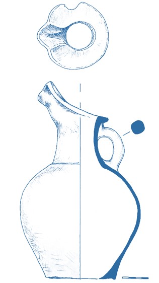
Ceramic vessel from the Keske Kuyuk Kala site
Introduction
Sponsor: Society for the Exploration of EurAsia (Switzerland).
Performers: International Institute for Central Asian Studies (IICAS) in cooperation with the LLC RUTRUM (Almaty).
The work at the Kesken-Kuyuk Kala archaeological site in 2022 continues the research activities started in 2008 by the Margulan Institute of Archaeology.
Over the research period, various studies were conducted and a huge amount of information was obtained, with most of the research carried out on the territory of the site and some archaeological work done in the necropolis located east of the site. An irrigation system surrounding the site was studied based on cartographic and carpological analyses.
Goals/Tasks
Goal #1
Study of the stratigraphic situation at the site
Tasks:
- Deepening and expanding the existing stratigraphic excavation, preparation of detailed documentation, including the creation of a three-dimensional model of the profiles, photofixation, description, drawings.
- Collection of analyses for radiocarbon dating.
Goal #2
Irrigation studies
Tasks:
- Analysis of cartographic material (topographic maps, satellite images, archival maps)
- Digitization of agricultural fields and canals, as well as water sources
- Exploration excavations of ancient canals in order to reveal their structure
- Taking the analyses from the profiles of canals for radiocarbon dating
Goal #3
Research of the burial ground
Tasks:
- Photogrammetric survey by UAV on the territory of the burial ground, settlement
- Creation of the current plan of the burial site on the basis of orthophotomosaic and digital elevation model
Goal #4
Study of ceramic material, preparation of the scientific report
Tasks:
- Conducting the collection of ceramic material at the settlement
- Preparation of the scientific report on the results of the work
Excavation Methodology and Equipment Utilized
Based on these goals and objectives, an expedition was organized which included several specific groups and specialists who were responsible for carrying out the planned excavation which included the following:
An international team of archaeologists. The task of this group was to carry out a series of investigations which involved the clearing and discovery of building structures aimed at providing detailed analysis of the cultural layers and cultural material including the discovery and analysis of materials from the ceramic and osteological collections; materials from metallurgy, and other artifacts.
Also, this group collected samples for carpology, palynology, C-14 and flotation using generally accepted guidelines.
A surveying team. This team carried out the documentation of the entire process of archaeological investigations with the analysis of the results of the data obtained through the study of individual components of the monastery and the graveyard by using advanced geodetic equipment. The resulting work of this group involved the construction of 3D models of the excavation sites; the creation of ortho-photomaps and stratigraphic profiles; detailed excavation plans; microtopography; and the development of plans which locate topographically the discovered materials.
Documentation was carried out using a Leica TCR-407 total station with subsequent data processed in the AutoCAD and ArcGIS environment in parallel with photographic recordation of building structures and photogrammetry utilizing a DJI Mavic 2 Pro unmanned aerial vehicle.
In the process of conducting preliminary aerial photography, the following tasks were performed:
Preparation of the site by clearing the areas of grass and underbrush which creates difficulties in scanning. In addition, the site was cleared of modern household waste (glass, metal, etc.)
A breakdown of the entire excavation area into sections/units was made. The findings are reflected in the appendix of this report.
A team of ceramic technologists was formed for the task of processing the cultural material to study the production technology and provide a description of the ceramic collection and other discovered materials; draw the ceramics and other finds and record them in a spreadsheet of arranged tables. This team also reconstructed ceramic vessels and collected statistical data.
A team for logistical processing. The task of this group was to process the discovered cultural materials of the ceramic and osteological collections, as well as metal products and other artifacts by means of washing and cleaning ceramic and osteological materials in compliance with the conditions and the storage location. Metallic materials were processed in accordance with methodological recommendations and interpreted by specialists. All materials were carefully processed, labeled, and described with an individual serial number for each piece of material. The obtained data is displayed in the appendices of this report.
The cultural material found as a result of the abovementioned investigations were assigned a special serial number and special finds were measured using the theodolite-tacheometer and coordinates were obtained in the UTM system. These materials are displayed on the excavation top plan. All the material discovered as a result of the excavation have been carefully processed and cleaned in controlled conditions.
On the basis of the description and photographic record of the cultural materials from the excavation, a collection inventory was created, a general record was made, and statistical data of the revealed materials were established. Then, these materials were documented, packaged, and prepared for transfer in accordance with documentary regulations.
Once the excavation identified and cleared the building structures or graves, descriptions were made of the identified components followed by design and drawing documentation.
This particular work was carried out by documentary specialists who know the latest methods and modern technologies in the field of geodesy and planography. In the course of this work, drawings of the identified elements, a general view of the excavation, and stratigraphic profiles were created.
The collection of documentation is based on a system developed by specialists from the University of Aachen under the guidance of Professor Michael Jansen and Dr. Thomas Urban. This system is based on the completion of specially designed forms, whereby a certain level of data collection is achieved. While the presence of a field diary does not serve as the basis for reaching the desired level, the researcher is presented with a series of so-called forms.
The "Main form," providing a general description of a site or a separate excavation, as well as a description of plans, goals, objectives and ways to achieve them.
An "Action sheet" is a type of field diary, in which the researcher enters daily information about the actions performed, as well as about the objects found, sizes, etc.
“A Locus Sheet” is a detailed account of each feature detected, the layer removed, or a specific feature noticed, etc., and is called a "locus" followed by being assigned a locus number.
"Find Tag or Label" is a form that is set up specifically for certain finds that are clearly different from the bulk of the excavated material.
A "Photograph Log" is a type of database with a catalog of photographs taken during the excavation, indicating the location, the direction of the shot, followed by a brief description, etc.
The team also included a brigade of local workers from the Boskol city itself who assisted with excavation, photography, soil shifting, and recordation. Excavation involved the use of shovels, small hand tools, trowels, and dental tools.
The following field report provides descriptions of each excavation unit and their revealed stratigraphy; discovered archaeological features, artifact descriptions, photographs, and drawings.
Excavations Descriptions
Excavation 1 (stratigraphic section in shahristan)
In order to study the stratigraphy of the settlement, we continued work on the stratigraphic excavation located in the southwestern part of Shakhristan. For this purpose, the existing excavation was expanded to 5.5x5.5 meters and deepened to 3.5 meters (see Appendix “Drawings”, fig. 11). Detailed documentation of the stratigraphy was carried out, a three-dimensional model of the profiles was created, and a detailed description was prepared.
Collected 17 carbon 14 analyses from the stratigraphic profile of the pothole (Excavation #1), 7 of which were sent to the laboratory (see Appendix “Photos”, fig. 5-15, Appendix “Drawings”, fig. 1-2, 34-36).
List of samples taken for carbon analysis 14
Number |
Name/Description |
Status |
Sample #1 |
Layer #6 (KS_22_01_06_01) |
An analysis was made for carbon 14 |
Sample #2 |
Layer #8 (KS_22_01_08_01) |
An analysis was made for carbon 14 |
Sample #3 |
Layer #21 (KS_22_01_21_01) |
An analysis was made for carbon 14 |
Sample #4 |
Layer #20 |
The material is stored in the laboratory of RUTRUM LLC |
Sample #5 |
Fish scale |
The material is stored in the laboratory of RUTRUM LLC |
Sample #6 |
Layer #15 |
The material is stored in the laboratory of RUTRUM LLC |
Sample #7 |
Layer #10. |
The material is stored in the laboratory of RUTRUM LLC |
Sample #8 |
Layer #22 |
The material is stored in the laboratory of RUTRUM LLC |
Sample #9 |
Layer #27 (KS_22_01_27_01) |
An analysis was made for carbon 14 |
Sample #10 |
Layer #28 (KS_22_01_28_01) |
An analysis was made for carbon 14 |
Sample #11 |
Layer #37 (KS_22_01_37_01) |
An analysis was made for carbon 14 |
Sample #12 |
Layer #44 |
The material is stored in the laboratory of RUTRUM LLC |
Sample #13 |
Layer #64 (KS_22_01_64_01) |
An analysis was made for carbon 14 |
Sample #14 |
Layer #67. |
The material is stored in the laboratory of RUTRUM LLC |
Sample #15 |
Layer 61 (fish scales). |
The material is stored in the laboratory of RUTRUM LLC |
Sample #16 |
Layer #61 (bone). |
The material is stored in the laboratory of RUTRUM LLC |
Sample #17 |
Layer 61 (charcoal). |
The material is stored in the laboratory of RUTRUM LLC |
Stratigraphic excavation #1
The excavation is located in the southern part of the Kesken Kuyuu Kala ancient settlement. This excavation is a continuation of the previously laid stratigraphic excavation (see Appendix “Photos”, fig. 1-4).
The purpose of this excavation is to identify the stratigraphic situation of the settlement and determine its chronological range of existence.
In the process of work, 75 layers related both to the constructions (floors, walls) and traces of the site activity (garbage pits, mud layers) were revealed (see Appendix “Photos”, fig. 5-15, Appendix “Drawings”, fig. 11-33).
Profile name
Eastern stratigraphic profile
General parameters
Profile dimensions - length in the upper part of 4.5 m, length in the lower part of 2.7 m, height 3.1 m, the profile contains 22 layers (#1-22), from layer #6, 8, 21 are taken samples for radiocarbon dating (see Appendix “Drawings”, fig. 12-17).
Layer number
#1
Layer description
Gray sandy loam, very dense, with lots of carbonates
Layer location
The upper layer of the eastern stratigraphic profile, located between the sod layer above and layer #2, 3 below.
Layer dimensions
Average layer thickness about 60 cm, length 416 cm
Elevation mark
The top 0,000 м
The bottom -0,600 м
Layer number
#2
Layer description
Yellow-gray dense lumpy loam (fragments of raw bricks)
Layer location
The layer is located in the left part of the stratigraphic profile, overlapped from above by layer #1, from below by layer #3
Layer dimensions
Average layer thickness about 28 cm, length 194 cm
Elevation mark
The top 0,000 м
The bottom -0,550 м
Layer number
#3
Layer description
Layer of dense grayish loam, above it a layer of orange-jelly colored
Layer location
The layer is located along the entire stratigraphic profile, overlapped by layer #1 from above, and by layers #4, 5 from below.
Layer dimensions
Average layer thickness about 35 cm, length 430 cm
Elevation mark
The top 0,000 м
The bottom -1,000 м
Layer number
#4
Layer description
Dark gray loose loam with large amounts of carbonates
Layer location
The layer is located in the right part of the stratigraphic profile, overlapped by layer #3 from above and by layer #5 from below.
Layer dimensions
Average layer thickness about 25 cm, length 82 cm
Elevation mark
The top -1,000 м
The bottom -1,270 м
Layer number
#5
Layer description
Very dense bright brown loam (rubble of raw blocks measuring 32x10x16x? cm).
Layer location
The layer is located along the entire stratigraphic profile, overlapped by layer #3 from above, and by layer #6 from below.
Layer dimensions
Average layer thickness about 64 cm, length 420 cm
Elevation mark
The top -0,740 м
The bottom -1,400 м
Layer number
#6
Layer description
Very dense bright brown loam (rubble of raw blocks measuring 32x10x16x? cm).
Layer location
The layer is located along the entire stratigraphic profile, overlapped by layer #5 from above, and by layer #7 from below.
Layer dimensions
Average layer thickness about 11 cm, length 413 cm
Elevation mark
The top -1,440 м
The bottom -1,550 м
Layer number
#7
Layer description
Слоистый плотный ярко-коричневый суглинок, незначительное количество угольков
Layer location
The layer is located along the entire stratigraphic profile, overlapped by layer #6 from above, and by layer #8 from below.
Layer dimensions
Average layer thickness about 14 cm, length 280 cm
Elevation mark
The top -1,560 м
The bottom -1,700 м
Layer number
#8
Layer description
Black sandy loam layers (ashes, charcoal), fragments of charcoal, ceramics, carbonate white interlayers, alternating with sandy loam layers with inclusions of charcoal and ceramics
Layer location
The layer is located along the entire stratigraphic profile, overlapped by layer #7 from above, and by layer #9 from below.
Layer dimensions
Average layer thickness about 14 cm, length 280 cm
Elevation mark
The top -1,700 м
The bottom -1,840 м
Layer number
#9
Layer description
Dense loam in the upper part of the green, bright green color, turning to a brown shade in the lower part
Layer location
The layer is located along the entire stratigraphic profile, overlapped by layer #8 from above, and by layer #10 from below.
Layer dimensions
Average layer thickness about 10 cm, length 280 cm
Elevation mark
The top -1,700 м
The bottom -2,000 м
Layer number
#10
Layer description
Black sandy loam - ashes, ashes, embers
Layer location
The layer is located along the entire stratigraphic profile, overlapped by layer #9 at the top and layer #12 at the bottom.
Layer dimensions
Average layer thickness about 11 cm, length 280 cm
Elevation mark
The top -1,860 м
The bottom -2,100 м
Layer number
#11
Layer description
Grayish-brown sandy-loam (pit), loose, lumpy
Layer location
The layer is located in the right part of the stratigraphic profile, overlapped above by layer #12, below by layer #13.
Layer dimensions
Average layer thickness about 27 cm, length 56 cm
Elevation mark
The top -2,000 м
The bottom -2,560 м
Layer number
#12
Layer description
Bright yellow-brown, dense lumpy loam (raw brick breakdown)
Layer location
The layer is located along the entire stratigraphic profile, overlapped by layer #10 from above, and by layers #11, 13, 14 from below.
Layer dimensions
Average layer thickness about 11 cm, length 220 cm
Elevation mark
The top -1,900 м
The bottom -2,010 м
Layer number
#13
Layer description
Bright brown, dense plastic loam (raw brick rubble)
Layer location
The layer is located in the right part of the stratigraphic profile, overlapped above by layer #12, below by layer #18, on the left by layer #14, on the right by layer #11.
Layer dimensions
Average layer thickness about 94 cm, length 70 cm
Elevation mark
The top -2,000 м
The bottom -2,940 м
Layer number
#14
Layer description
Layer of dense, bright brown loam
Layer location
The layer is located along the entire stratigraphic profile, overlapped above by layer #12, below by layer #21, to the right by layer #13.
Layer dimensions
Average layer thickness about 71 cm, length 200 cm
Elevation mark
The top -2,000 м
The bottom -2,760 м
Layer number
#15
Layer description
Sandy loose gray-black layer with lots of charcoal
Layer location
The layer is located inside layer #14
Layer dimensions
Average layer thickness about 13 cm, length 68 cm
Elevation mark
The top -2,170 м
The bottom -2,300 м
Layer number
#16
Layer description
Alternating layers of loosely organic sandy loam, numerous inclusions of coal, carbonates
Layer location
The layer is located along the entire stratigraphic profile, overlapped above by layer #19, below by layer #22, to the right by layer #18.
Layer dimensions
Average layer thickness about 50 cm, length 126 cm
Elevation mark
The top -2,380 м
The bottom -3,000 м
Layer number
#17
Layer description
Bright orange-red heated layer, loose loamy sandy loam
Layer location
The layer is located in the right part of the stratigraphic profile, overlapped by layer #20 from above and by layer #13 from below.
Layer dimensions
Average layer thickness about 4 cm, length 14 cm
Elevation mark
The top -2,800 м
The bottom -2,880 м
Layer number
#18
Layer description
Dark gray loose sandy loam with large amounts of charcoal and carbonates
Layer location
The layer is located in the right part of the stratigraphic profile, overlapped on top by layer #13, on the left by layer #16.
Layer dimensions
Average layer thickness about 14 cm, length 130 cm
Elevation mark
The top -2,940 м
The bottom -3,090 м
Layer number
#19
Layer description
Gray-white very loose loamy sandy loam
Layer location
The layer is located in the central part of the stratigraphic profile, overlapped by layer #21 from above and by layers #16, 18 from below.
Layer dimensions
Average layer thickness about 11 cm, length 180 cm
Elevation mark
The top -2,760 м
The bottom -2,870 м
Layer number
#20
Layer description
Layer of gray - ashes, embers
Layer location
The layer is located in the right part of the stratigraphic profile, overlapped by layer #13 from above and by layer #17 from below.
Layer dimensions
Average layer thickness about 2 cm, length 20 cm
Elevation mark
The top -2,790 м
The bottom -2,810 м
Layer number
#21
Layer description
Black layer - coal, ash
Layer location
The layer is located in the central part of the stratigraphic profile, overlapped by layer #14 from above and by layer #19 from below.
Layer dimensions
Average layer thickness about 3 cm, length 118 cm
Elevation mark
The top -2,740 м
The bottom -2,770 м
Layer number
#22
Layer description
Loose gray sandy loam with large amounts of charcoal
Layer location
The layer is located in the lower left corner of the stratigraphic profile, overlapped by layer #16
Layer dimensions
Average layer thickness about 8 cm, length 44 cm
Elevation mark
The top 0,000 м
The bottom -0,080 м
Profile name
Western stratigraphic profile
General parameters
Profile dimensions - length at the top of 3.8 m, length at the bottom of 2.5 m, height 3.1 m, the profile contains 16 layers (#23-38), from layer #27, 37 are taken samples for radiocarbon dating (see Appendix “Drawings”, fig. 18-23).
Layer number
#23
Layer description
Loose lumpy layered dark gray sandy loam
Layer location
The upper layer of the western stratigraphic profile, located between the sod layer above and layer #24 below
Layer dimensions
Average layer thickness about 11 cm, length 380 cm
Elevation mark
The top 0,000 м
The bottom -0,600 м
Layer number
#24
Layer description
Dense bright brown loam (raw material)
Layer location
The layer is located along the entire stratigraphic profile, overlapped by layer #23 from above, and by layers #25, 26 from below.
Layer dimensions
Average layer thickness about 22 cm, length 380 cm
Elevation mark
The top -0,120 м
The bottom -0,340 м
Layer number
#25
Layer description
Traces of the calcined ground black
Layer location
The layer is located in the right part of the stratigraphic profile, overlapped by layer #23 from above and by layers #25, 26 from below.
Layer dimensions
Average layer thickness about 3 cm, length 117 cm
Elevation mark
The top -0,190 м
The bottom -0,220 м
Layer number
#26
Layer description
Gray-brown sandy loam with inclusions of charcoal and carbonates
Layer location
The layer is located along the entire stratigraphic profile, overlapped by layer #24 from above, and by layer #27 from below.
Layer dimensions
Average layer thickness about 55 cm, length 375 cm
Elevation mark
The top -0,330 м
The bottom -0,720 м
Layer number
#27
Layer description
Masonry raw bricks of bright brown color, brick dimensions 32x8x10x? cm, interlayer mortar of dark brown color - 1-3 cm
Layer location
The layer is located along the entire stratigraphic profile, overlapped by layer #26 from above, and by layer #28 from below.
Layer dimensions
Average layer thickness about 120 cm, length 375 cm
Elevation mark
The top -0,330 м
The bottom -0,720 м
Layer number
#28
Layer description
Gray-black sandy loam layer with large amounts of charcoal, calcite, ceramics, carbonates
Layer location
The layer is located along the entire stratigraphic profile, overlapped by layer #27 from above, and by layer #29 from below.
Layer dimensions
Average layer thickness about 18 cm, length 246 cm
Elevation mark
The top -1,880 м
The bottom -2,080 м
Layer number
#29
Layer description
Dense bright brown uniform loam
Layer location
The layer is located along the entire stratigraphic profile, overlapped by layer #28 from above, and by layer #30 from below.
Layer dimensions
Average layer thickness about 26 cm, length 269 cm
Elevation mark
The top -1,980 м
The bottom -2,450 м
Layer number
#30
Layer description
Dense loamy gray-black layer with lots of charcoal and carbonates
Layer location
The layer is located along the entire stratigraphic profile, overlapped by layer #29 from above, and by layer #31 from below.
Layer dimensions
Average layer thickness about 16 cm, length 265 cm
Elevation mark
The top -2,300 м
The bottom -2,450 м
Layer number
#31
Layer description
Dense dark brown homogeneous loam
Layer location
The layer is located along the entire stratigraphic profile, overlapped by layer #30 from above, and by layers #32, 33 from below.
Layer dimensions
Average layer thickness about 13 cm, length 265 cm
Elevation mark
The top -2,450 м
The bottom -2,570 м
Layer number
#32
Layer description
Layer of coal, carbonates and ceramics
Layer location
The layer is located in the central part of the stratigraphic profile, overlapped by layer #31 from above, and by layer #33 from below.
Layer dimensions
Average layer thickness about 7 cm, length 88 cm
Elevation mark
The top -2,570 м
The bottom -2,640 м
Layer number
#33
Layer description
Green-gray dense loam, inclusions of carbonates, charcoal fragments
Layer location
The layer is located along the entire stratigraphic profile, overlapped at the top by layer #31,32, at the bottom by layer #34.
Layer dimensions
Average layer thickness about 12 cm, length 260 cm
Elevation mark
The top -2,550 м
The bottom -2,680 м
Layer number
#34
Layer description
Dense bright brown uniform loam
Layer location
The layer is located along the entire stratigraphic profile, overlain by layer #33 from above, and by layer #35 from below.
Layer dimensions
Average layer thickness about 15 cm, length 260 cm
Elevation mark
The top -2,690 м
The bottom -2,880 м
Layer number
#35
Layer description
Gray loamy interlayers with large amounts of coals
Layer location
The layer is located along the entire stratigraphic profile, overlapped by layer #34 from above, and by layer #36 from below.
Layer dimensions
Average layer thickness about 16 cm, length 256 cm
Elevation mark
The top -2,740 м
The bottom -2,920 м
Layer number
#36
Layer description
Bright yellow-green dense loamy layer
Layer location
The layer is located along the entire stratigraphic profile, overlapped by layer #35 from above, and by layer #37 from below.
Layer dimensions
Average layer thickness about 11 cm, length 256 cm
Elevation mark
The top -2,900 м
The bottom -3,020 м
Layer number
#37
Layer description
Loose sandy gray-black layer with large amounts of charcoal and carbonates
Layer location
The layer is located along the entire stratigraphic profile, overlapped by layer #36 from above, and by layer #38 from below.
Layer dimensions
Average layer thickness about 7 cm, length 253 cm
Elevation mark
The top -2,970 м
The bottom -3,050 м
Layer number
#38
Layer description
Layer of dense green, loam, homogeneous, with carbonates
Layer location
The layer is located along the entire stratigraphic profile, overlain by layer #37
Layer dimensions
Average layer thickness about 10 cm, length 253 cm
Elevation mark
The top -3,050 м
The bottom -3,150 м
Profile name
Southern stratigraphic profile
General parameters
Profile dimensions - length in the upper part of 6.9 m, length in the lower part of 6.35 m, height 3.25 m, the profile contains 75 layers (#39-75), from layer #64 are taken samples for radiocarbon dating (see Appendix “Drawings”, fig. 24-33).
Layer number
#39
Layer description
Dense dark brown loam in the form of raw bricks of the first construction horizon
Layer location
The upper layer of the southern stratigraphic profile, located between the sod layer above and layer 40, 41, 45 below.
Layer dimensions
Average thickness of the layer is about 16 cm, length 6.9 m
Elevation mark
The top 0,000 м
The bottom -0,160 м
Layer number
#40
Layer description
Gray-brown loamy sandy loam with large amounts of carbonates and charcoal
Layer location
The layer is located in the left part of the stratigraphic profile, overlapped by layer 39 from above, layer 50 from below, and layer 41 from the right.
Layer dimensions
Average layer thickness about 33 cm, length 3.16 m
Elevation mark
The top -0,160 м
The bottom -0,51 м
Layer number
#41
Layer description
Brown-gray sandy loam, clumpy, friable, large amounts of carbonates
Layer location
The layer is located in the right part of the stratigraphic profile, overlapped by layer 39 from above, layer 42, 43 from below, layer 40 from the left, layer 45 from the right.
Layer dimensions
Average layer thickness about 48 cm, length 3.5 m
Elevation mark
The top -0,160 м
The bottom -0,660 м
Layer number
#42
Layer description
A crumbly bright gray layer of ash
Layer location
The layer is located in the right part of the stratigraphic profile, overlapped by layer 41 from above and layer 4 from below.
Layer dimensions
Average layer thickness about 3 cm, length 23 cm
Elevation mark
The top -0,640 м
The bottom -0,670 м
Layer number
#43
Layer description
Gray-brown, greenish, loose loam with lots of carbonates and brownish iron oxide interlayers
Layer location
The layer is located in the right part of the stratigraphic profile, overlapped above by layer 41, below by layer 44, on the left by layer 51, on the right by layer 46.
Layer dimensions
Average layer thickness about 22 cm, length 317 cm
Elevation mark
The top -0,630 м
The bottom -0,860 м
Layer number
#44
Layer description
Layer of ash and coal black, in the upper part of the layer ash layer of gray
Layer location
The layer is located in the right part of the stratigraphic profile, overlapped by layer #43 from above, layer #54 from below, layer #51 from the left, layer #46 from the right.
Layer dimensions
Average layer thickness about 8 cm, length 310 cm
Elevation mark
The top -0,850 м
The bottom -0,910 м
Layer number
#45
Layer description
Dense bright brown loam with charcoal flecks
Layer location
The layer is located in the right part of the stratigraphic profile, overlapped by layer 39 from above, layer 46 from below, and layer 41 from the left.
Layer dimensions
Average layer thickness about 53 cm, length 17 cm
Elevation mark
The top -0,150 м
The bottom -0,680 м
Layer number
#46
Layer description
The body of the wall (raw bricks), masonry raw bricks of bright brown color, brick size 32x8x10x?, interlayer mortar of dark brown color - 1-3 cm
Layer location
The layer is located in the right part of the stratigraphic profile, overlapped above by layer 45, below by layer 48, on the left by layers 43, 44, 54, 56, 57, 62
Layer dimensions
Average layer thickness about 156 cm, length 135 cm
Elevation mark
The top -0,830 м
The bottom -2,350 м
Layer number
#47
Layer description
Gray in the upper part, bright brown in the lower part, the layer of dense loam bends into layer 28 of the western profile
Layer location
The layer is located in the right part of the stratigraphic profile, inside the layer number 46
Layer dimensions
Average layer thickness about 5 cm, length 56 cm
Elevation mark
The top -1,730 м
The bottom -1,810 м
Layer number
#48
Layer description
Layer of very dense homogeneous bright brown loam, identical to layer 29 of the western profile
Layer location
The layer is located in the right part of the stratigraphic profile, overlapped by layer 46 from above, layer 69 from below, and layer 62 from the left.
Layer dimensions
Average layer thickness about 60 cm, length 140 cm
Elevation mark
The top -1,980 м
The bottom -2,600 м
Layer number
#49
Layer description
Lens of black-brown dense sandy loam with large amounts of ash and charcoal
Layer location
The layer is located in the right part of the stratigraphic profile, overlapped by layer 46 from above, layer 69 from below, and layer 62 from the left.
Layer dimensions
Average layer thickness about 14 cm, length 46 cm
Elevation mark
The top -2,390 м
The bottom -2,520 м
Layer number
#50
Layer description
Dense interlayer (surface), carbonates and ceramics
Layer location
The layer is located in the left part of the stratigraphic profile, overlapped by layer 40 from above, layer 51 from below, and layer 40 from the right.
Layer dimensions
Average layer thickness about 2 cm, length 146 cm
Elevation mark
The top -0,500 м
The bottom -0,520 м
Layer number
#51
Layer description
Gray-yellow-brown, very dense loam, consisting of alternating layers, carbonates
Layer location
The layer is located in the left part of the stratigraphic profile, overlapped on top by layer 50, below by layers 52, 53, 54, on the right by layer 41.
Layer dimensions
Average layer thickness about 37 cm, length 260 cm
Elevation mark
The top -0,520 м
The bottom -0,880 м
Layer number
#52
Layer description
Bright brown, very dense lumpy loam with carbonates, possibly pit and raw bricks
Layer location
The layer is located in the left part of the stratigraphic profile, overlapped above by layer 51, below by layer 54, left and right by layer 54
Layer dimensions
Average layer thickness about 51 cm, length 71 cm
Elevation mark
The top -0,870 м
The bottom -1,380 м
Layer number
#53
Layer description
Pit filled with homogeneous sandy loam of bright gray color, very loose
Layer location
The layer is located in the left part of the stratigraphic profile, overlapped above by layer 51, below by layer 54, left and right by layer 54
Layer dimensions
Average layer thickness about 51 cm, length 79 cm
Elevation mark
The top -0,790 м
The bottom -1,300 м
Layer number
#54
Layer description
Very dense, bright-brown loam, possibly a raw material pile, similar to layer 5 of the eastern profile
Layer location
The layer is located along the entire stratigraphic profile, overlapped by layer 51, 43 from above, layer 56 from below, layer 46 from the right.
Layer dimensions
Average layer thickness about 61 cm, length 600 cm
Elevation mark
The top -0,860 м
The bottom -1,380 м
Layer number
#55
Layer description
Layered, very dense, bright brown loam, a few flecks of coal, similar to layer #7 of the eastern profile
Layer location
The layer is located in the left part of the stratigraphic profile, overlapped by layer 54 from above, layer 56 from below, layer 60 from the right.
Layer dimensions
Average layer thickness about 11 cm, length 160 cm
Elevation mark
The top -1,530 м
The bottom -1,650 м
Layer number
#56
Layer description
Several interlayers of black color (ash, coal), a lot of carbonates, identical to layer #8 of the eastern profile
Layer location
The layer is located along the entire stratigraphic profile, is depressed from right to left, overlapped at the top by layers # 55, 54, at the bottom by layer # 57, on the right by layer # 46.
Layer dimensions
Average layer thickness about 20 cm, length 520 cm
Elevation mark
The top -1,150 м
The bottom -1,750 м
Layer number
#57
Layer description
Dense green loam, identical to layer 9 of the eastern profile
Layer location
The layer is located along the entire stratigraphic profile, is depressed from right to left, overlapped at the top by layer 56, at the bottom by layer 58, at the right by layer 46.
Layer dimensions
Average layer thickness about 15 cm, length 520 cm
Elevation mark
The top -1,410 м
The bottom -1,890 м
Layer number
#58
Layer description
Brown-black sandy-loam, identical to layer 10 of the eastern profile
Layer location
The layer is located along the entire stratigraphic profile, is depressed from right to left, overlapped by layer 57 from above, layer 62, 61 from below, and layer 46 from the right.
Layer dimensions
Average layer thickness about 8 cm, length 510 cm
Elevation mark
The top -1,640 м
The bottom -1,960 м
Layer number
#59
Layer description
Grayish-brown sandy mass (possibly a pit), identical to layer 11 of the eastern profile
Layer location
The layer is located in the left part of the stratigraphic profile, within the layer number 62
Layer dimensions
Average layer thickness about 53 cm, length 21 cm
Elevation mark
The top -2,090 м
The bottom -2,610 м
Layer number
#60
Layer description
Very dense gray-brown loam, lots of charcoal, identical to layer #6 of the eastern profile
Layer location
The layer is located in the left part of the stratigraphic profile, overlapped above by layer #54, below by layer #56, right and left by layer #54
Layer dimensions
Average layer thickness about 14 cm, length 132 cm
Elevation mark
The top -1,390 м
The bottom -1,520 м
Layer number
#61
Layer description
Pit, loose gray-brown loam, fragments of fish bones, coals
Layer location
The layer is located in the left part of the stratigraphic profile, overlapped above by layer #58, below by layer #62, right and left by layer #62
Layer dimensions
Average layer thickness about 24 cm, length 79 cm
Elevation mark
The top -1,880 м
The bottom -2,130 м
Layer number
#62
Layer description
Bright brown dense plastic loam, identical to layer #12 of the eastern profile
Layer location
The layer is located along the entire stratigraphic profile, overlapped above by layer #58, below by layer #64, on the right by layer #69, on the left by layer #59.
Layer dimensions
Average layer thickness about 117 cm, length 79 cm
Elevation mark
The top -1,880 м
The bottom -5,000 м
Layer number
#63
Layer description
Burnt bright orange, identical to layer #17 of the eastern profile
Layer location
The layer is located in the left part of the stratigraphic profile, inside layer #62
Layer dimensions
Average layer thickness about 3 cm, length 25 cm
Elevation mark
The top -2,850 м
The bottom -2,880 м
Layer number
#64
Layer description
Dark gray loose sandy loam with large amounts of charcoal and carbonates, identical to layer #18 of the eastern profile
Layer location
The layer is located along the entire stratigraphic profile, slopes from right to left, overlapped by layer #62 from above, layer #69 from below, and layer #62 from right.
Layer dimensions
Average layer thickness about 11 cm, length 470 cm
Elevation mark
The top -2,300 м
The bottom -3,130 м
Layer number
#65
Layer description
A gray-white fouling layer of very friable loamy sand, identical to layer #19 of the eastern profile
Layer location
The layer is located in the left part of the stratigraphic profile, overlapped above by layer #62, below by layer #64, right and left by layer #64
Layer dimensions
Average layer thickness about 10 cm, length 100 cm
Elevation mark
The top -2,960 м
The bottom -3,060 м
Layer number
#66
Layer description
Very loose loam of greenish-brown color
Layer location
The layer is located in the central part of the stratigraphic profile, inside layer #62
Layer dimensions
Average layer thickness about 21 cm, length 176 cm
Elevation mark
The top -1,990 м
The bottom -2,190 м
Layer number
#67
Layer description
Burned reeds (grass), ashes, black and white ashes
Layer location
The layer is located in the central part of the stratigraphic profile, overlapped above by layer #66, below, right and left by layer #62.
Layer dimensions
Average layer thickness about 5 cm, length 50 cm
Elevation mark
The top -2,180 м
The bottom -2,230 м
Layer number
#68
Layer description
Light gray very dense loam - fragments of raw bricks
Layer location
The layer is located in the central part of the stratigraphic profile, inside layer #62
Layer dimensions
Average layer thickness about 8 cm, length 177 cm
Elevation mark
The top -2,280 м
The bottom -2,360 м
Layer number
#69
Layer description
Bright brown dense plastic loam (pakhsa wall), identical to layer #13 of the eastern profile
Layer location
The layer is located in the central part of the stratigraphic profile, overlapped above by layer #64, below by layer #72, to the right by layer #69.
Layer dimensions
Average layer thickness about 60 cm, length 280 cm
Elevation mark
The top -2,270 м
The bottom -3,220 м
Layer number
#70
Layer description
Brownish, with traces of red calcined layer and large amounts of charcoal, loam layers of very loose
Layer location
The layer is located in the central part of the stratigraphic profile, overlain by layer #62 from above and by layer #62 from below.
Layer dimensions
Average layer thickness about 2 cm, length 60 cm
Elevation mark
The top -2,700 м
The bottom -2,720 м
Layer number
#71
Layer description
A layer of gray ash with lots of charcoal
Layer location
The layer is located along the entire stratigraphic profile, slopes from right to left, and is overlapped above and below by layer #69
Layer dimensions
Average layer thickness about 5 cm, length 193 cm
Elevation mark
The top -2,700 м
The bottom -3,200 м
Layer number
#72
Layer description
A black and gray layer of ash and coal
Layer location
The layer is located in the central part of the stratigraphic profile, in the form of an arc, overlapped above and below by layer #69, below by layer #73.
Layer dimensions
Average layer thickness about 5 cm, length 315 cm
Elevation mark
The top -2,920 м
The bottom -3,230 м
Layer number
#73
Layer description
Dense greenish loam with iron oxide inclusions of brownish-reddish-brown color
Layer location
The bottom layer of the profile is located in the central part of the stratigraphic profile, in the form of an arc of the segment, from above is overlapped by layer #72
Layer dimensions
Average layer thickness about 26 cm, length 290 cm
Elevation mark
The top -2,940 м
The bottom -3,230 м
Layer number
#74
Layer description
Dense yellow-green loam
Layer location
The layer is located in the right part of the stratigraphic profile, overlapped by layer #69 from above and by layer #72 from below.
Layer dimensions
Average layer thickness about 7 cm, length 76 cm
Elevation mark
The top -2,950 м
The bottom -3,140 м
Layer number
#75
Layer description
Black loose loamy loam (soot, ash)
Layer location
The layer is located in the right part of the stratigraphic profile, overlapped by layer #73
Layer dimensions
Average layer thickness about 13 cm, length 60 cm
Elevation mark
The top -3,080 м
The bottom -3,230 м
Excavation 2 (stratigraphic section #1 - irrigation)
Stratigraphic test pit #1 (irrigation)
The stratigraphic excavation was made at the site of the presumed bed of an ancient canal located 720 meters to the northwest of the settlement. Two ancient agricultural fields are located to the south of the channel. Five layers were recorded.
Profile name
Northern stratigraphic profile
General parameters
Profile dimensions - length 12.6 m, height 1 m, the profile contains 5 layers (#1-5), from layer #4 samples were taken for radiocarbon dating (see Appendix “Drawings”, fig. 37-38, Appendix “Photos”, fig. 20-24).
Layer number
#1
Layer description
Dense light yellow loam (top layer)
Layer location
The top layer of the northern stratigraphic profile, located in the right part of the profile below is layer #2
Layer dimensions
Average layer thickness about 15 cm, length 157 cm
Elevation mark
The top 0,000 м
The bottom -0,200 м
Layer number
#2
Layer description
Sandy gray layer with red interlayers
Layer location
Located in the right and left parts of the stratigraphic profile, with layer #1, 4 on top
Layer dimensions
The average thickness of the layer is about 90 cm, the length of the right part is 560 cm, the left part is 240 cm
Elevation mark
The top 0,000 м
The bottom -1,000 м
Layer number
#3
Layer description
Layered loam - dark brown, yellowish, light gray, dense
Layer location
Located in the central part of the stratigraphic profile, below is layer #2, 4
Layer dimensions
Average layer thickness about 51 cm, length 568 cm
Elevation mark
The top -0,060 м
The bottom -0,770 м
Layer number
#4
Layer description
Sandy loam layer, stratified - yellowish, grayish with orange glandular inclusions
Layer location
Located in the left part of the stratigraphic profile, below is layer #2
Layer dimensions
Average layer thickness about 76 cm, length 830 cm
Elevation mark
The top -0,110 м
The bottom -1,000 м
Profile name
Southern stratigraphic profile
General parameters
Profile dimensions - length 12.6 m, height 1 m, the profile contains 3 layers (#2-4) (see Appendix “Drawings”, fig. 39-40).
Layer number
#2
Layer description
Sandy gray layer with red interlayers
Layer location
Located in the right and left parts of the stratigraphic profile, with layer #3, 4 on top
Layer dimensions
The average thickness of the layer is about 100 cm, the length of the right part is 380 cm, the left part 650 cm
Elevation mark
The top 0,000 м
The bottom -1,000 м
Layer number
#3
Layer description
Layered loam - dark brown, yellowish, light gray, dense
Layer location
Located in the central part of the stratigraphic profile, layer #2 is located below
Layer dimensions
Average layer thickness about 51 cm, length 490 cm
Elevation mark
The top -0,060 м
The bottom -0,690 м
Layer number
#4
Layer description
Sandy loam layer, stratified - yellowish, grayish with orange glandular inclusions
Layer location
Located in the left part of the stratigraphic profile, below is layer #2
Layer dimensions
Average layer thickness about 100 cm, length 617 cm
Elevation mark
The top 0,000 м
The bottom -1,000 м
Excavation 3 (stratigraphic section #2 - irrigation)
Stratigraphic test pit #2 (irrigation)
The stratigraphic excavation is laid out on the site of a presumably ancient canal. The canal stands out well enough on the surface, traces of the sides of the canal are visible. The canal is located 1800 meters to the southeast of the settlement. Four layers have been recorded.
Profile name
Western stratigraphic profile
General parameters
Profile dimensions - length 5 m, height 1, 25 m, the profile contains 4 layers (#1-4), from layer #3 are taken samples for radiocarbon dating (see Appendix “Drawings”, fig. 41, Appendix “Photos”, fig. 16-19).
Layer number
#1
Layer description
Brown loamy layer (sod layer)
Layer location
The upper layer of the western stratigraphic profile, located along the entire length of the profile below is layer #2, 4
Layer dimensions
Average layer thickness about 20 cm, length 500 cm
Elevation mark
The top 0,000 м
The bottom -0,300 м
Layer number
#2
Layer description
Dark brown loamy layer
Layer location
Located in the left and right parts of the stratigraphic profile, above layer #1, below layer #3
Layer dimensions
The average thickness of the layer is about 20 cm, the length of the right part of 170 cm, the left part of 141 cm
Elevation mark
The top -0,100 м
The bottom -0,340 м
Layer number
#3
Layer description
The loamy layer is yellowish and light gray with flecks of orange spots
Layer location
Located along the entire stratigraphic profile, above is layer #4, 2
Layer dimensions
Average layer thickness about 88 cm, length 500 cm
Elevation mark
The top -0,400 м
The bottom -1,250 м
Layer number
#4
Layer description
Loose homogeneous loamy layer of light gray color
Layer location
Located in the central part of the stratigraphic profile, above layer #1, below layer #3
Layer dimensions
Average layer thickness about 40 cm, length 200 cm
Elevation mark
The top -0,310 м
The bottom -0,720 м
Results of radiocarbon dating
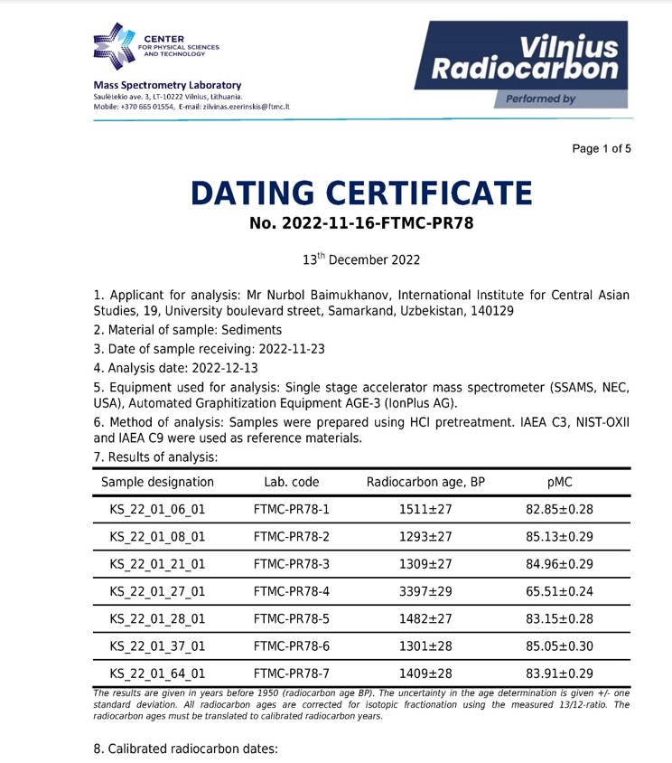
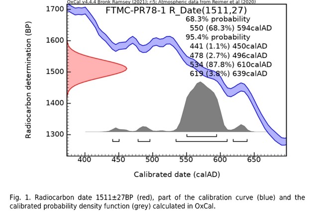
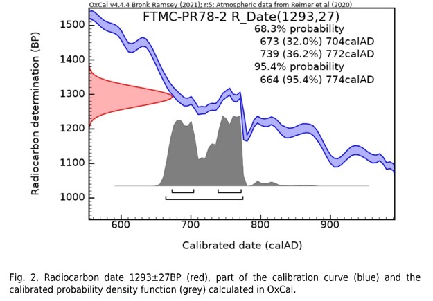
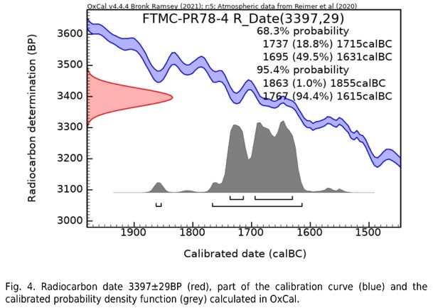
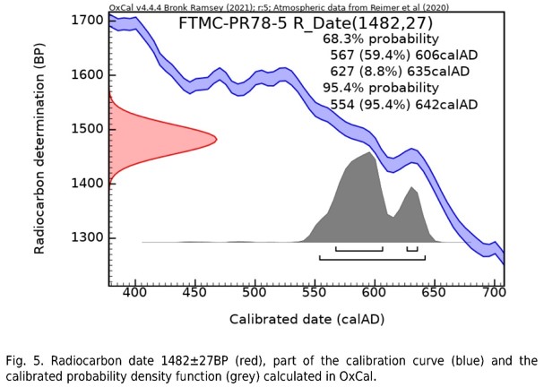
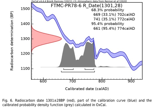
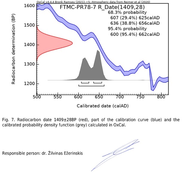
Description of ceramic materials 2022
Ks22_1_0. Archaeological remains from the excavation #1 (Stratigraphic excavation). Kesken Kuyuk Kala site
Unbroken, integrate vessels
Archaeologically integrate large jug-like vessel was found, made of medium-mixed dense paste of light red color, orange-beige tint, with the shard section showing multiple impurities of small and large particles of sand, mica and minerals. The surface of the vessel from the outside and partially from the inside is covered with light-colored engobe; some glazing can be seen. The rim of the vessel with widened edges, subrectangular in cross-section, narrows up to the cylindrical neck, smoothly turning into a sloping shoulder. There is a drawn concentric line at the transition point, the body is pear-shaped, swollen in the upper part, the walls narrowing down into a flat bottom with oval-shaped edges in the cross section. In the upper part of the body there are four subtriangular moldings, the diameter of the rim is 16.7 cm, the diameter of the body in the wider part is 29.3 cm, the neck length is 15.2 cm, the bottom diameter is 14.5 cm, the height of the vessel is 55.2 cm, (Figure 1).
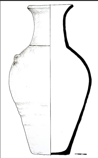
Figure 1. Ks22_1_0_1
An unbroken, integrate small jar was also found, made of well-mixed dense paste of light-red color, yellowish tint, with the shard section showing minor impurities of fine sand particles and white inclusions. The surface of the vessel is coated with red engobe on the outside and partially on the inside, and there is also some glaze with sheen effect. The rim has a bell mouth with outwardly bent edges, and a pouring lip raised upward, the rim turns into a low cylindrical neck, the body is spherical, rather swollen in the upper part, the shoulder is abruptly rounded, the walls of the body narrow down towards the bottom, a part of which is lost. On the opposite side of the pouring lip of the vessel, a loop-shaped handle is attached, subrectangular in cross section, 2 cm wide, 1.7 cm thick, in the central part of the bottom there is a through hole, the approximate diameter of the bottom is 11 cm. The diameter of the rim without the pouring lip is 12.2 cm, the height of the vessel is 32.4 cm (Figure 2).
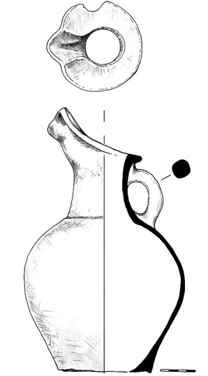
Figure 2. Ks22_1_0_2
Ks22_0_0. Archaeological remains from the settlement of the 14th century. Kesken 1
Unglazed fragments of pottery (ceramic materials)
A total of 44 items were found, out of which: 7 rims, 5 bottoms, 4 undecorated sidewalls, 8 ornamented sidewalls, 14 handles, 1 lid, and 5 other miscellaneous pieces.
Rims
During the excavations, a fragment of a rim from a vessel, presumably from a deep bowl, was found, made of well-mixed dense gray paste, with minor impurities of small particles of sand visible in the shard section. The surface of the fragment is not engobed, partially preserved traces of glaze are visible from the inside against a dark background. The rim with a straight, slightly outward-bent edge, oval in the cross section, a wall with a smooth break, the diameter of the rim is 23 cm, the wall thickness is 0.4-0.5 cm (Figure 3).
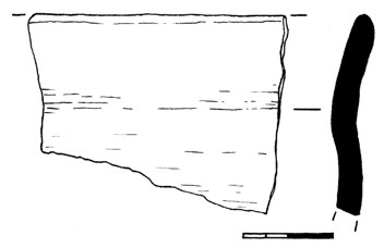
Figure 3. Ks22_0_0_3
A fragment of a rim from a vessel in the form of a bowl was found, made of dense medium mixed paste of gray color, yellowish tint, with multiple impurities of small and large sand particles visible in the break section. The surface of the fragment is covered with a dense layer of dark gray-brown engobe on the outer and inner sides. A rim with an outward-bent edge, forming a straight platform 2.1 cm wide, the rim diameter being 26 cm, the body swells just below the rim, tapering downwards, the wall thickness is 0.4-0.5 cm (Figure 4).
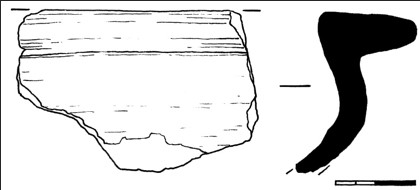
Figure 4. Ks22_0_0_4
A fragment of a rim from a vessel was found, made of dense, medium-mixed paste of gray color, with minor impurities of small and large sand particles visible in the break section. On the surface of the vessel on the outside, a partially preserved layer of dark, almost black engobe can be seen. The rim with a thickened wide edge has a flat, outwardly inclined platform, 1.7 cm wide, subrectangular in cross section, the walls straight, rim diameter 33 cm, the wall thickness 0.6-1 cm. On the inner side of the wall there are concentric pressed lines located horizontally in several rows (Figure 5).
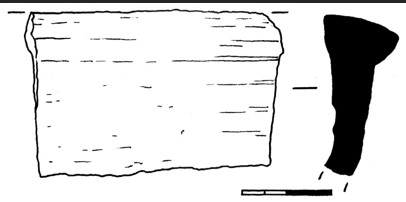
Figure 5. Ks22_0_0_5
Two shards were also found, presumably from the rim of one vessel, made from medium-mixed loose paste of red-gray color, with multiple impurities of small and large sand particles, as well as minerals. A molded vessel, presumably a large pot, with a low straight neck, the rim subrectangular in section, a wide line is stuck on the outside along the edge, on the surface of which alternating dents were made on slightly liquid, raw paste. The diameter of the rim is 25 cm, the wall thickness is 0.5-0.6 cm (Figure 6).
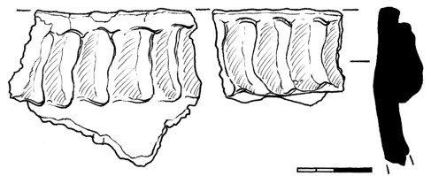
Figure 6. Ks22_0_0_6
A fragment of a rim from a vessel, presumably from a small jug, was found, made of well-mixed paste of light-red color, pale-yellow tint, with minor impurities of fine sand particles. The surface of the fragment is coated with light engobe on both the inside and outside. The rim with edges slightly bent outward, oval-shaped in the cross section, rim diameter 12 cm, sidewall thickness 0.4-0.5 cm, on the inner side of the vessel wall there are concentric horizontal lines (Figure 7).
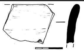
Figure 7. Ks22_0_0_7
A fragment of a rim of a large hand-molded pot was found, made of poorly mixed, loose paste of red color, gray-brown tint, with multiple impurities of small and large particles of sand, minerals and fireclay. On the outer side of the shard there is a partially preserved layer of dark engobe, from the inside the surface is coated with a layer of light dingy engobe, with calcined spots of red and dark color. A vessel with a high, straight neck, 5.3 cm high, the edges of the rim are straight, of a subrectangular shape in cross-section, along the edge of the rim on the outside, a wide strip in the form of a belt was molded, on which alternating dents were made, which are only partially preserved. The diameter of the rim is 23 cm, the neck turns into a swollen body, the wall thickness is 0.8-0.9 cm (Figure 8).
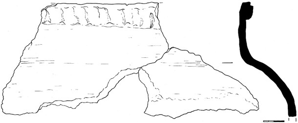
Figure 8. Ks22_0_0_8
Ornamented sides
During the excavations, a fragment of a sidewall of a vessel was found, made from well-mixed dense gray paste, with minor impurities of small sand particles and white inclusions can be seen in the break section. The outer surface of the fragment is covered with a light engobe, of a yellowish-green hue, and there is also an incised ornamentation on the outside, made with tools in the form of a thin stick. The drawing is made in the geometric style and covers the entire surface of the shard, in the form of straight and inclined alternating lines, which also intersect diagonal alternating lines parallel to each other. The wall thickness is 0.4-0.5 cm (Figure 9).
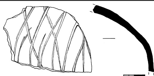
Figure 9. Ks22_0_0_9
A fragment of the sidewall of a vessel was found, made of well-mixed dense gray paste, with slight impurities of fine sand particles visible in the break section. The surface of the shard is not engobed, on the outside there is an incised ornamentation in the form of vertical lines, between which in one of the sectors there are vertical wavy lines intercrossing with each other. The wall thickness is 0.6-0.7 cm (Figure 10).
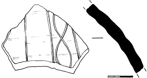
Figure 10. Ks22_0_0_10
A fragment of a sidewall of a vessel was found, presumably part of the shoulder, made of dense, well-mixed red paste, with slight impurities of small white particles visible in the shard section. The surface of the fragment is covered with light engobe on the outer side, and there is also an ornamentation on the outside in the form of a horizontal belt, consisting of concentric lines, made with a comb-like tool. The wall thickness is 0.9-1 cm (Figure 11).
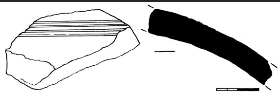
Figure 11. Ks22_0_0_11
A fragment of a sidewall of a vessel was also found, made of well-mixed dense gray paste, with minor impurities of small and large sand particles visible in the shard section. The surface of the fragment is coated with a layer of a light yellowish tint on the inside and outside, on the outside there are wide sagging concentric lines on the wall, the vessel is made on a potter’s wheel. The wall thickness is 0.5-0.7 cm (Figure 12).
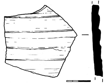
Figure 12. Ks22_0_0_12
A fragment of a sidewall from a vessel was found, presumably a part of a shoulder from a jug, made of well-mixed dense paste of light red color, yellowish tint, with minor impurities of fine sand particles, the break section of the wall shows porosity. The outer surface of the shard is covered with the light-beige engobe, and on the outside there is an incised ornamentation in the form of wide and thin lines forming belts, applied with a comb-like tool, and there are also wavy lines. The wall thickness is 0.5-0.9 cm (Figure 13).
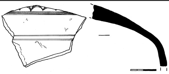
Figure 13. Ks22_0_0_13
A fragment of a rim from a vessel in the form of a bowl was found, part of the shoulder from a boiler vessel, made of medium-mixed dense gray paste, with multiple impurities of small and large sand particles. The surface of the fragment is covered with a layer of gray engobe on the inside and partly on the outside; there is also a brown paint drip on the inside. Outside, on the surface there is an incised ornamentation in the form of wide belts, consisting of straight and wavy concentric lines, in several rows. The wall thickness is 0.4-0.6 cm (Figure 14).
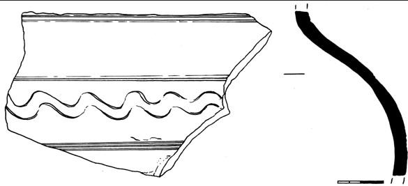
Figure 14. Ks22_0_0_14
During the excavations, a fragment of a sidewall of a vessel was found, made of medium-mixed dense gray paste, with multiple impurities of small and large particles of sand, mica and minerals can be seen in the break section, the wall is not uniform, there are small cracks in the break section. On the outside, the surface is coated with a partially preserved layer of dark brown engobe, and on the outside there is an incised ornamentation in the form of wide wavy lines, in several rows. The wall thickness is 0.9-1 cm (Figure 15).
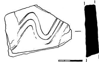
Figure 15. Ks22_0_0_15
A fragment of a sidewall from a vessel was found, presumably a part of the neck from a pot, made from medium-mixed loose paste of gray color, with multiple impurities of small and large particles of sand, mica and minerals. The outer surface of the fragment is coated with dark engobe, glaze with the sheen effect can be seen, on the outside the shard has ornamentation in the form of pressed alternating oval lines, made with a hollow tube, forming some wide curved lines. The wall thickness is 0.5-0.7 cm (Figure 16).
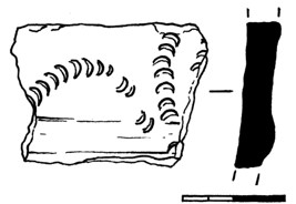
Figure 16. Ks22_0_0_16
Handles
A fragment of a loop-shaped handle from a vessel, its upper part, was found, made of well-mixed dense gray paste, with minor impurities of fine sand particles. The surface of the handle is coated with a layer of black engobe, there is also the glaze. The handle is attached to the outer edge of the rim, slightly raised upwards, rounded in the cross section, 2.4 cm wide, 2.2 cm thick (Figure 17).
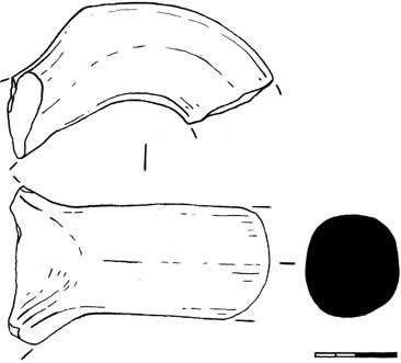
Figure 17. Ks22_0_0_17
A fragment of a loop-shaped handle from a vessel was also found, made of medium-mixed loose gray paste, with multiple impurities of small and large particles of sand and minerals visible in the break section. The surface of the handle on the outer side of the back is coated with the dark engobe, the handle is in the form of two large strips of shaped oval in the cross section, fastened together, in the place of their fastening, on the outside there are small round-shaped moldings. The handle is oval in the cross section, with dents on both sides, 2.7 cm wide, 1.3 cm thick (Figure 18).
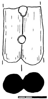
Figure 18. Ks22_0_0_18
A fragment of a loop-shaped flat handle from a vessel was found, made of well-mixed dense gray paste with slight impurities of fine sand particles visible in the break section. The surface of the fragment is not engobed, the handle is flattened-oval in the cross section, 2.3 cm wide, 0.9 cm thick, on the outer side along the back side there are vertical slightly pressed lines (Figure 19).
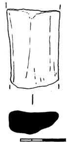
Figure 19. Ks22_0_0_19
A fragment of the sidewall of a vessel was found, with a partially preserved loop-shaped handle (pseudo-handle?) attached to the side, made of medium-mixed, not dense red paste, with multiple impurities of large and small particles of sand, fireclay and minerals visible in the shard sections. The surface from the outer and inner sides is coated with a layer of dense red engobe, orange tinted. The handle is wide, with a horizontal hole made in it, 0.9 cm in diameter, subrectangular in the cross section, 2.5 cm wide, 0.7 cm thick (Figure 20).
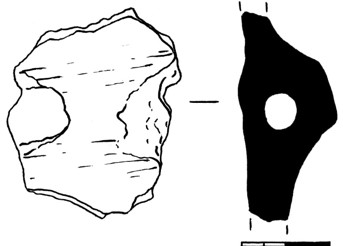
Figure 20. Ks22_0_0_20
During the excavations, 3 fragments of large cranked handles from jugs were found, made of well-mixed dense gray paste, with slight impurities of small and large sand particles visible in the break section, as well as some white inclusions. The surface of all the fragments is coated with a partially preserved layer of dark engobe, and on the sides and on the backs of the handles there are longitudinal alternating vertical stripes. The handles are rounded in the cross section, 3.2-3.3 cm wide, 3.2-3.4 cm thick (Figure 21).
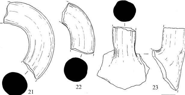
Figure 21. Ks22_0_0_21, 22, 23
5 fragments of small cranked handles from jugs were found, made from well- and medium-mixed dense gray paste, both with minor and with major clusters of small and large sand particles. The surface of the handles (for some handles) is coated with a layer of light gray engobe, some do not have an engobe coating. On the outer side of the handles, laterally and on the back sides, there are vertical, alternating lines that have been pressed onto the material. Fragments in the cross section are round or oval in shape, their width is from 2 to 2.4 cm, thickness is from 2.2 to 2.4 cm (Figure 22).
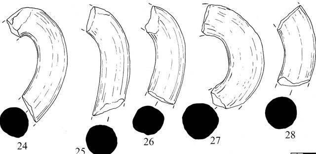
Figure 22. Ks22_0_0_24, 25, 26, 27, 28
2 fragments of cranked handles from jugs were found, the middle and lower parts, made of medium mixed dense gray paste, with multiple impurities of small and large sand particles and mica inclusions visible in the shard section. The surface of the handles on the outside is partially coated with gray or dark-gray engobe, the handles are oval and rounded in the cross section, 2.6 and 2.5 cm wide, 2.2 and 2.5 cm thick (Figure 23).
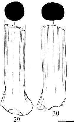
Figure 23. Ks22_0_0_29, 30
Also found were 7 fragments of large jug handles, their lower, middle and upper parts, made of well and medium mixed dense gray paste, with both minor and major impurities of small and large sand particles. The surface of the handles (for some handles) is coated with a layer of light gray engobe, some do not have the engobe coating. The fragments are oval or round in the cross section, 3.2-4 cm wide, 3-3.7 cm thick (Figure 24).
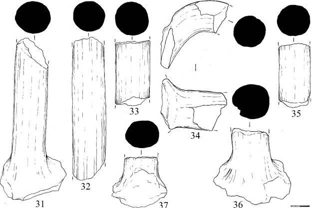
Figure 24. Ks22_0_0_31, 32, 33, 34, 35, 36, 37
Bottoms
A fragment of an annular tray from a vessel was found, made of well-mixed dense gray paste, with minor impurities of small particles of sand, as well as white inclusions. The surface of the shard is not engobed, the pallet is 1.3 cm high, its diameter is 10 cm, the wall thickness is 1-1.3 cm, there is a conical protrusion in the central part of the bottom (Figure 25).
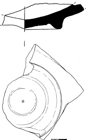
Figure 25. Ks22_0_0_38
A fragment of an annular tray from a vessel was found, made of well-mixed dense gray paste, with slight impurities of fine sand particles visible in the shard section. The surface is not engobed, on the outside on the bottom there are traced concentric circles with a diameter of 1.7 cm on the inside in the center of the bottom. The height of the pallet is 0.9 cm, the wall thickness is not determinable, because the inner part of the bottom surface is lost, the diameter is 7.4 cm, (Figure 26).
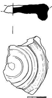
Figure 26. Ks22_0_0_39
During the excavations, a fragment of an annular tray from a vessel was found, made of well-mixed dense paste of light-red color, yellowish tinted, with minor impurities of fine sand particles and white inclusions. The surface of the fragment is coated on the outside with a light yellow-beige engobe, the height of the pallet is 1.1 cm, the diameter is 8 cm, the thickness of the walls in the bottom part is 0.9 cm, the thickness of the bottom is 0.6 cm. On the outside, on the bottom, traced are concentric circles (Figure 27).
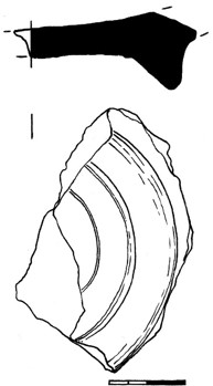
Figure 27. Ks22_0_0_40
A fragment of a flat bottom from a vessel was found, made of dense, well-mixed gray paste, with minor impurities of small and large sand particles visible in the shard section. On the outer and inner surfaces there is the engobe coating of a light color, green-beige, and on the outside at the base of the bottom there is an incised ornamentation in the form of inclined straight lines located horizontally as relative to the vessel. The bottom diameter is 13 cm, the wall thickness is 0.7-1 cm, the bottom thickness is 0.7 cm, there are concentric lines on the surface of the fragment from the inside, the vessel is made on a potter’s wheel (Figure 28).
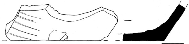
Figure 28. Ks22_0_0_41
A fragment of a flat bottom from a vessel was found, made of dense, well-mixed paste of gray color, dark shade with slight impurities of small and large sand particles visible in the shard section, along with some white inclusions. On the outer surface of the fragment there is light-colored engobe coating, as well as dark-colored spots formed by uneven firing. The diameter of the bottom is 16 cm, the wall thickness is 0.7-1.1 cm, the thickness of the bottom is 0.8 cm. There are convex tubercles on the walls of the vessel in the bottom part, possibly formed during firing at a high temperature (Figure 29).
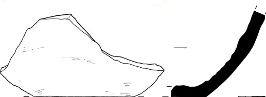
Figure 29. Ks22_0_0_42
Lids
A shard of a lid of a vessel was found, made from a medium-mixed loose paste of gray color, with multiple impurities of small and large sand particles visible in the shard section, as well as white inclusions. The surface of the lid is coated on the outside with a dark engobe, or paste with a more liquid consistency, some glazing is visible. The outside of the lid is also decorated with incised ornaments in the form of alternating oval lines, the edges of the lid are oval in cross section, its diameter is 19 cm, thickness 1-1.2 cm, the lid is slightly curved outward (Figure 30).
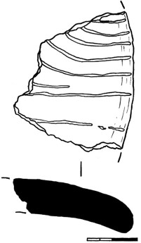
Figure 30. Ks22_0_0_43
Other
A fragment of a ceramic product was found, presumably a part of a tabletop of a dastarkhan, made of well-mixed dense gray paste, with minor impurities of fine sand particles. On the one side, the surface of the item is decorated with small straight lines drawn randomly, and there is also a molded straight strip on the surface, with alternating finger impressions pressed into it. The edges of the item are not preserved, the thickness is 0.7-0.9 cm (Figure 31).
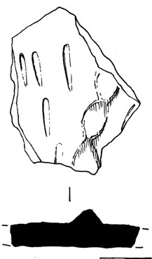
Figure 31. Ks22_0_0_44
During the excavations, a fragment of a large ceramic item was found, presumably the bottom part of a jug, or a part of a kubur. The fragment is made of well-mixed dense paste of light-red color, yellow-beige tint, with minor impurities of fine sand. The surface on the outer side is coated with a partially preserved layer of light engobe, the lower part of the fragment has vertical wide edges formed from the situation where part of the wall was cut off on the still raw item. On the walls inside and out pressed are concentric lines; the vessel had been made on a potter’s wheel, the wall thickness is 0.8-1.2 cm (Figure 32).
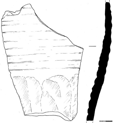
Figure 32. Ks22_0_0_45
A fragment of the lower part of a spherocone with a wall was also found, made of well-mixed dense gray paste, without visible impurities. The surface of the vessel is coated on the outside with a light green-beige engobe, the walls of the spherocone are swollen on the outside and there are pressed concentric lines on the inside, tapering to a conical base, the edge of which is lost, the thickness of the walls of the vessel is from 0.5 to 1.4 cm, the preserved length of the item is 8.7 cm (Figure 33).
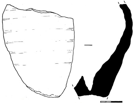
Figure 33. Ks22_0_0_46
A small item of a spindle whorl type was found, made from the wall of a vessel made of well-mixed dense gray paste, with minor impurities of fine sand particles visible in fractures. The spindle whorl is subrectangular in shape, the edges are not trimmed, in the central part there is a through-hole with a diameter of 0.6 cm, wall thickness 0.5 cm. The item dimensions are 3.1x2.7 cm (Figure 34).
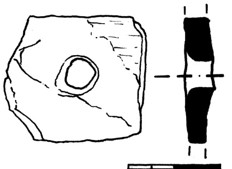
Figure 34. Ks22_0_0_47
A part of a ceramic item was found, presumably a leg from a stand, made of medium-mixed loose red paste, with multiple impurities of small and large particles of sand and minerals. The item is cylindrical in shape, slightly tapering in one part, rounded in the cross section with a diameter of 3.7 cm, the surface is uneven with some roughness, coated with a partially preserved layer of light yellow-beige engobe, the preserved fragment height is 6.1 cm (Figure 35).
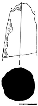
Figure 35. Ks22_0_0_48
Glazed fragments of pottery (ceramic materials).
A total of 25 items were found, out of which: 4 rims, 1 bottom, 20 sidewalls.
Rims
During the excavations, a fragment of a rim from a small vessel, presumably from a bowl, was found, made from well-emulsified dense paste of light red color, yellow-beige hue, with slight impurities of small particles of sand visible in the break. The surface of the fragment is coated with a dark red engobe on the outer and partially on the inner (along the edge) side. Besides, on the outer edge of the rim, a layer of dense blue glaze is visible, this glaze is of poor quality, has pores and cracks, and is not transparent. The rim with a straight edge, flattened-oval in the cross section, the diameter is 17 cm, the wall thickness is 0.4 cm (Figure 36).
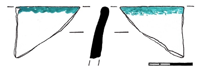
Figure 36. Ks22_0_0_49
A fragment of a rim from a small vessel, presumably a rim of a chirag, was found, made from well-mixed dense paste of light color, yellowish tinted, with minor impurities of small particles of sand. The surface of the fragment on the outer and inner sides is coated with a partially preserved layer of blue glaze, against a light engobe background, the glaze is not transparent, of poor quality. A rim with a low, straight neck, 0.6 cm high, with oval-shaped edges in the cross section, with a smooth transition to the shoulder of the vessel, wall thickness 0.4-0.5 cm, rim diameter 5 cm (Figure 37).
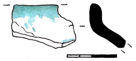
Figure 37. Ks22_0_0_50
A fragment of a rim from a bowl-type vessel was found, made of well-mixed dense paste of light color, yellowish tint, with minor impurities of small particles of sand. The surface of the fragment on the outer and inner sides is coated with a partially preserved layer of opaque blue glaze; with no ornamentation. The rim is straight, the edges are flattened-oval in the cross section, the diameter is 18 cm, the wall thickness is 0.5-0.6 cm (Figure 38).
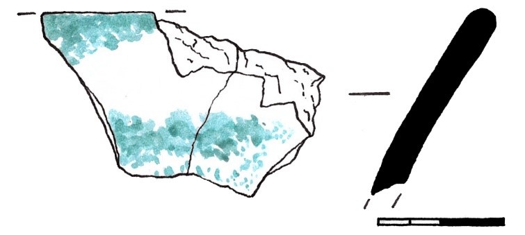
Figure 38. Ks22_0_0_51
Vessel wall shards
A small fragment of the sidewall of a vessel was also found, made of well-mixed dense paste of light color, yellow-beige, with minor impurities of small particles of sand. The surface of the fragment from the outer and inner sides is coated with a layer of opaque white glaze on a light engobe background; and, from the inside, the fragment has the underglaze one-color ornamentation made in blue in the form of an oval line. The thickness of the sidewall is 0.4-0.6 cm (Figure 39).
Figure 39. Ks22_0_0_52
A small shard of the wall from the vessel was found, made of well-mixed dense paste of light color, pale beige, with slight impurities of small particles of sand visible in the shard section. The surface of the shard on the inside is coated with a dense layer of opaque dark blue glaze, on the outside it is also coated with a layer of pale blue, dingy-color glaze, with no ornamentation. The wall thickness is 0.5 cm (Figure 40).
Figure 40. Ks22_0_0_53
A fragment of the sidewall of the vessel was found, presumably part of the shoulder, turning into the neck, from a small juglet. The fragment is made of a well-mixed dense paste of light red color, yellowish tinted, from the inside the surface is coated with a layer of dense green glaze. The wall thickness is 0.6-0.7 cm, the neck base diameter is 8 cm, the shoulder of the vessel is flat (Figure 41).
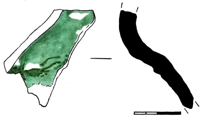
Figure 41. Ks22_0_0_54
Vessel bottoms shards
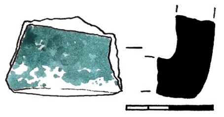
Figure 42. Ks22_0_0_55
Ks22_1_1. Fragments of ceramic vessels found in the layer of pit 01, organic filling.
A total of 30 items were found, out of which: 9 rims, 16 undecorated sidewalls, 4 ornamented sidewalls, 1 handle.
Unglazed fragments of pottery (ceramic materials).
Rims
A fragment of a rim from a vessel of the large pot type was found, made from a medium-mixed loose paste of red color, with multiple impurities of small and large particles of sand, fireclay and organic matter. The surface of the fragment is not uniform, the color in the shard section is from dark-gray to light-beige, there are soot spots on the outside, against a light dense engobe background. The rim of the vessel has a low neck bent outward, the edges are oval in cross section, the diameter is 23 cm, the wall thickness is 0.9–1 cm. On the outside the vessel is ornamented with alternating finger imprints, in the area of transition of the neck into a shoulder (Figure 1).
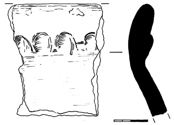
Figure 1. Ks22_1_1_1
A fragment of a rim from a small pot was found, made of well-mixed dense red paste, with slight impurities of fine sand particles visible in the shard section. The surface of the vessel is coated on the outside and inside with a light orange-beige engobe, and there is also glaze with the sheen effect. A vessel with a high neck 2.7 cm high, the edges of the rim in a flattened-oval cross-section, the diameter is 8 cm, the wall thickness is 0.5-0.7 cm (Figure 2).
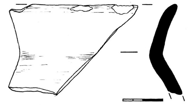
Figure 2. Ks22_1_1_2
Also found was a fragment of a rim from a large hand-molded pot, made of medium-mixed loose red paste, with numerous impurities of small and large sand particles, minerals and organic inclusions visible in the shard section. Due to uneven firing, the color of the paste in the shard section has a dark gray tint, some soot spots can be seen. The edges of the rim are slightly bent outward in an oval cross-section, the diameter is approximately 43 cm, the wall thickness is 1.4 cm. Outside and inside, the surface of the vessel is coated with a layer of a more fluid consistency paste, of a light-beige tint, and on the outside there is a molded bead-like strip, with crushed alternating finger imprints (Figure 3).
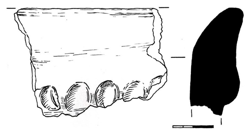
Figure 3. Ks22_1_1_3
A fragment of a rim from a hand molded vessel, of a pot type, was found, made from medium-mixed, loose gray paste, with multiple impurities of small and large particles of sand, chamotte and minerals visible in the shard section. The surface is coated with a light engobe on the inside and outside, there are also spots of calcination and soot on the outside, the edges of the rim are oval in the cross section, on the outside there is ornamentation in the form of pressed elongated teardrop-shaped lines forming an X-shaped pattern. The diameter of the rim is 26 cm, the wall thickness is 0.9 cm (Figure 4).
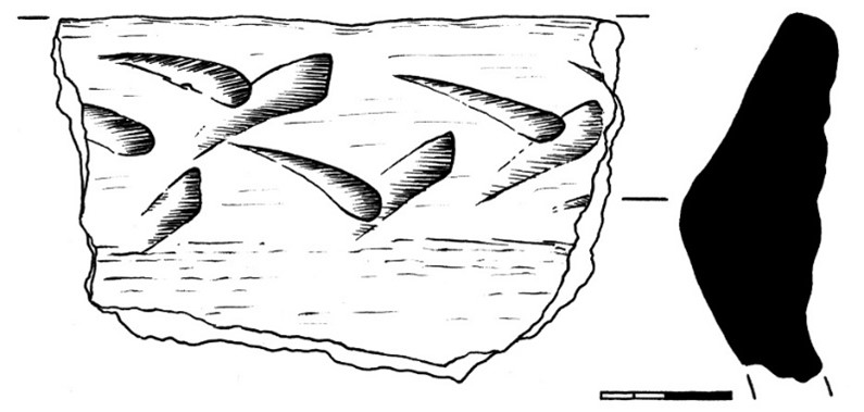
Figure 4. Ks22_1_1_4
A fragment of a rim from a hemispherical bowl was found, made of well-mixed dense paste of light red color, orange-beige, with slight impurities visible in the break section - being some fine sand particles and white inclusions. The surface of the fragment is coated with a light red engobe on the inside, with a dark brown engobe on the outside, and is also coated with glossy glaze. The edges of the rim are flattened-oval in the cross section, the diameter is 21 cm, the wall thickness is 0.6-0.7 cm (Figure 5).
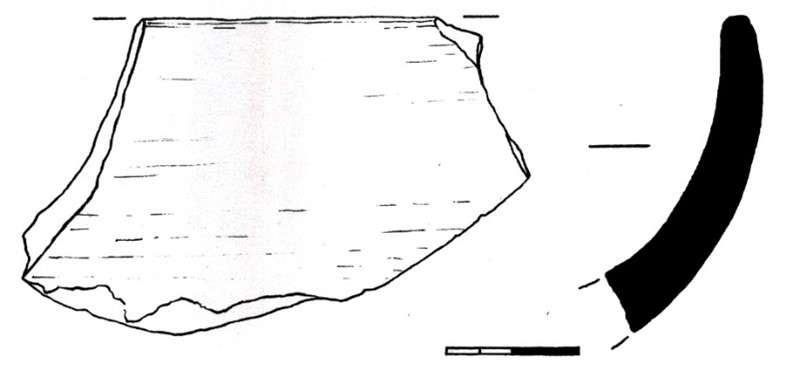
Figure 5. Ks22_1_1_5
In the course of the excavations, a fragment of a rim from a molded pot was found, made of medium-mixed, loose gray paste, with multiple impurities of small and large sand particles visible in the shard section. The surface of the fragment is coated with light yellow-beige engobe on the outer and inner sides, and spots of calcination and soot are also visible. The rim with a straight neck slightly bent outward, 3.6 cm high, and where the neck is transforming into a shoulder there is a protrusion of a subtriangular shape, 2 cm high, as well as a strip consisting of pressed alternating finger dents. The rim diameter is 23 cm, the wall thickness is 0.9 cm (Figure 6).
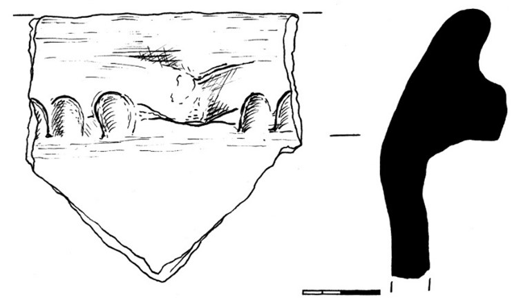
Figure 6. Ks22_1_1_6
Tables. Ks22_1_0
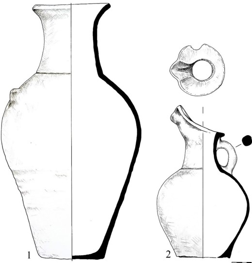
Table 1. 1) Ks22_0_0_1, 2) Ks22_0_0_2
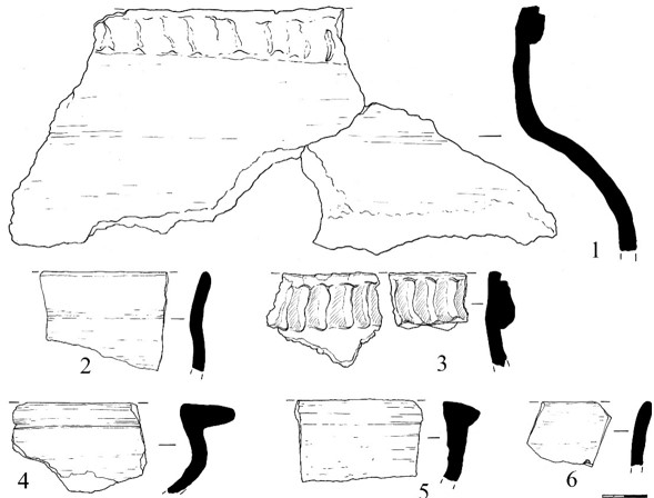
Table 2. 1) Ks22_0_0_8, 2) Ks22_0_0_3, 3) Ks22_0_0_6, 4) Ks22_0_0_4, 5) Ks22_0_0_5, 6) Ks22_0_0_7
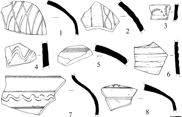
Table 3. 1) Ks22_0_0_9, 2) Ks22_0_0_10, 3) Ks22_0_0_16, 4) Ks22_0_0_15, 5) Ks22_0_0_11, 6) Ks22_0_0_12, 7) Ks22_0_0_14, 8) Ks22_0_0_13
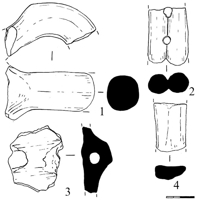
Table 4. 1) Ks22_0_0_17, 2) Ks22_0_0_18, 3) Ks22_0_0_20, 4) Ks22_0_0_19
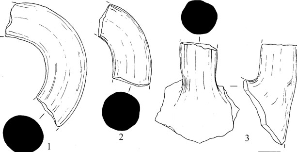
Table 5. 1) Ks22_0_0_21, 2) Ks22_0_0_22, 3) Ks22_0_0_23
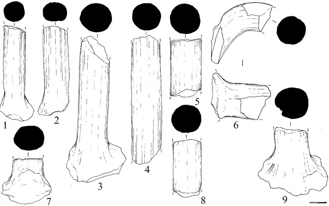
Table 6. 1) Ks22_0_0_29, 2) Ks22_0_0_30, 3) Ks22_0_0_31, 4) Ks22_0_0_32, 5) Ks22_0_0_33, 6) Ks22_0_0_34, 7) Ks22_0_0_37, 8) Ks22_0_0_35, 9) Ks22_0_0_36
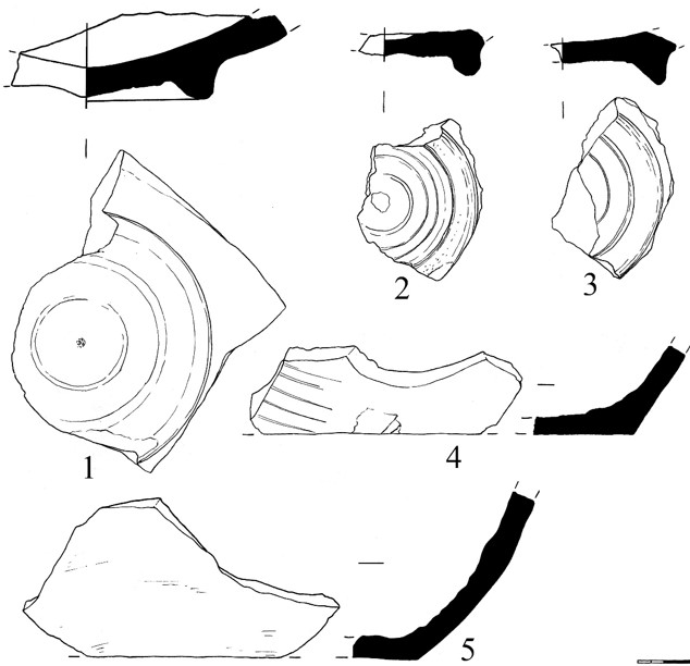
Table 7. 1) Ks22_0_0_38, 2) Ks22_0_0_39, 3) Ks22_0_0_40, 4) Ks22_0_0_41, 5) Ks22_0_0_42
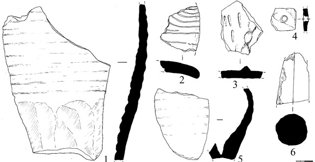
Table 8. 1) Ks22_0_0_45, 2) Ks22_0_0_43, 3) Ks22_0_0_44, 4) Ks22_0_0_47, 5) Ks22_0_0_46, 6) Ks22_0_0_48
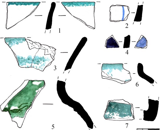
Table 9. 1) Ks22_0_0_49, 2) Ks22_0_0_52, 3) Ks22_0_0_51, 4) Ks22_0_0_53, 5) Ks22_0_0_54, 6) Ks22_0_0_50, 7) Ks22_0_0_55
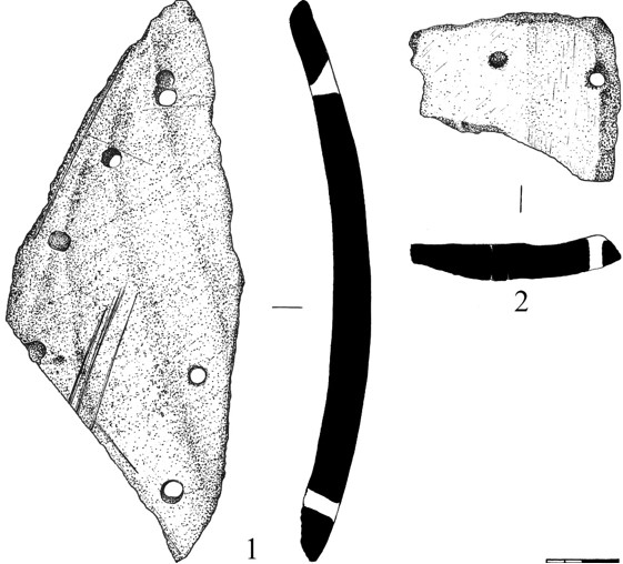
Table 10. 1) Ks22_0_0_56, 2) Ks22_0_0_57
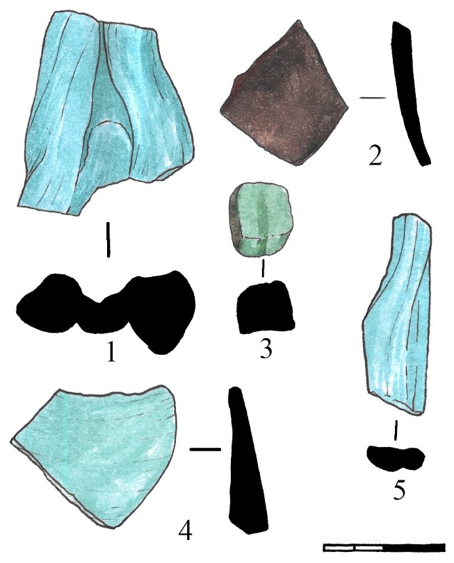
Table 11. 1) Ks22_0_0_58, 2) Ks22_0_0_62, 3) Ks22_0_0_61, 4) Ks22_0_0_59, 5) Ks22_0_0_60
Tables. Ks22_1_1
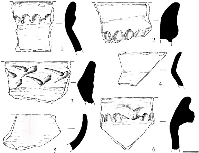
Table 12. 1) Ks22_1_1_1, 2) Ks22_1_1_3, 3) Ks22_1_1_4, 4) Ks22_1_1_2, 5) Ks22_1_1_5, 6) Ks22_1_1_6
Appendix. Photos
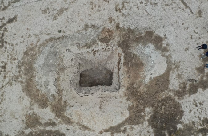
Figure 1 – General view of the Excavation #1 (Stratigraphic trench). Before excavation work
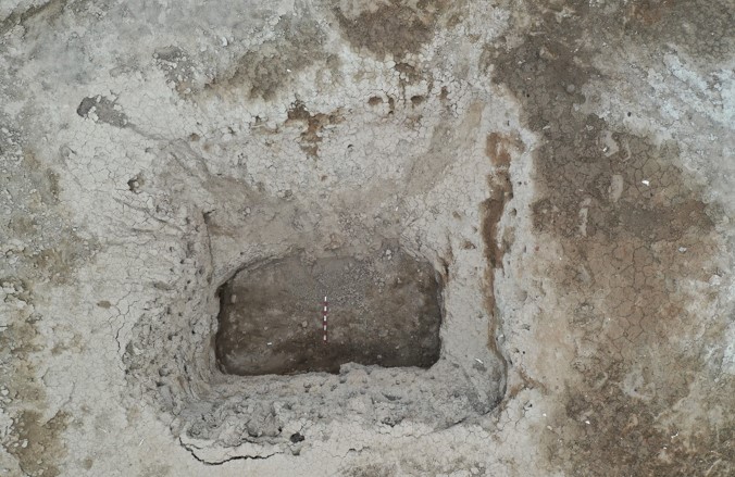
Figure 2 – General view of the Excavation #1 (Stratigraphic trench). Before excavation work
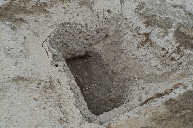
Figure 3 – General view of the Excavation #1 (Stratigraphic trench). Before excavation work
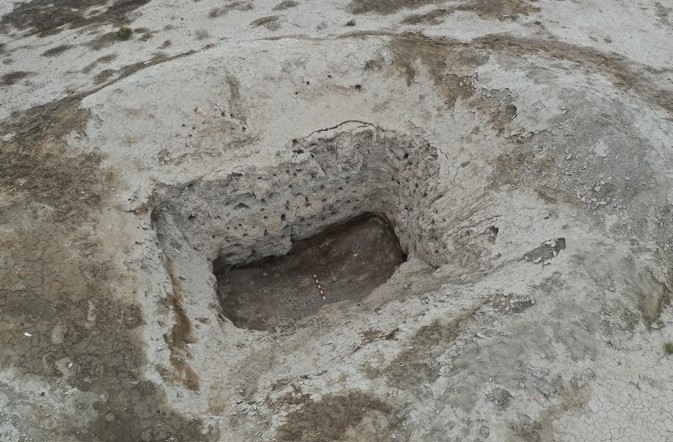
Figure 4 – General view of the Excavation #1 (Stratigraphic trench). Before excavation work
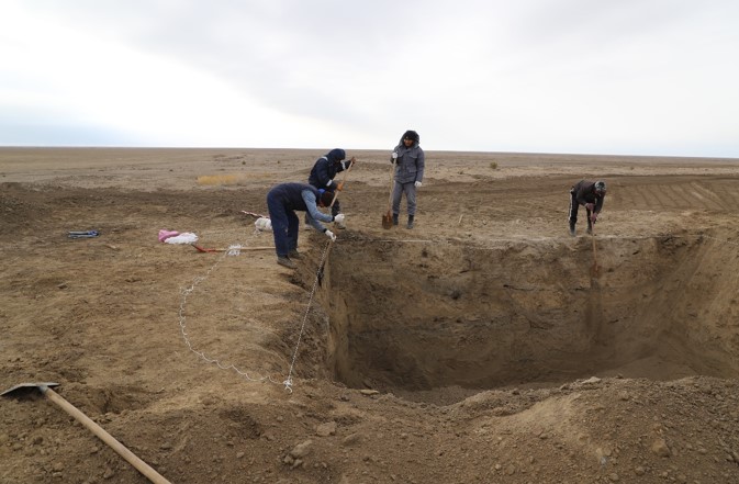
Figure 5 – General view of the Excavation #1 (Stratigraphic trench). Marking of the excavation. Working moment
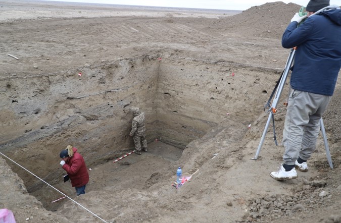
Figure 6 – General view of the Excavation #1 (Stratigraphic trench). Collection of documentation. Working moment
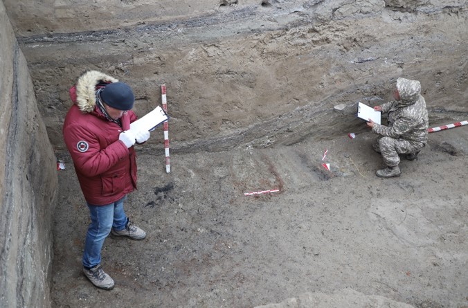
Figure 7 – General view of the Excavation #1 (Stratigraphic trench). The process of describing stratigraphy. Working moment
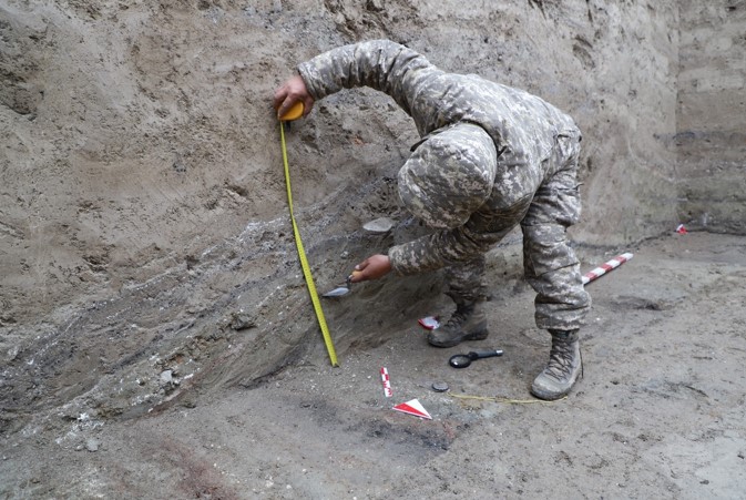
Figure 8 – General view of the Excavation #1 (Stratigraphic trench). Sample collection process. Working moment
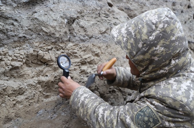
Figure 9 – General view of the Excavation #1 (Stratigraphic trench). Sample collection process. Working moment
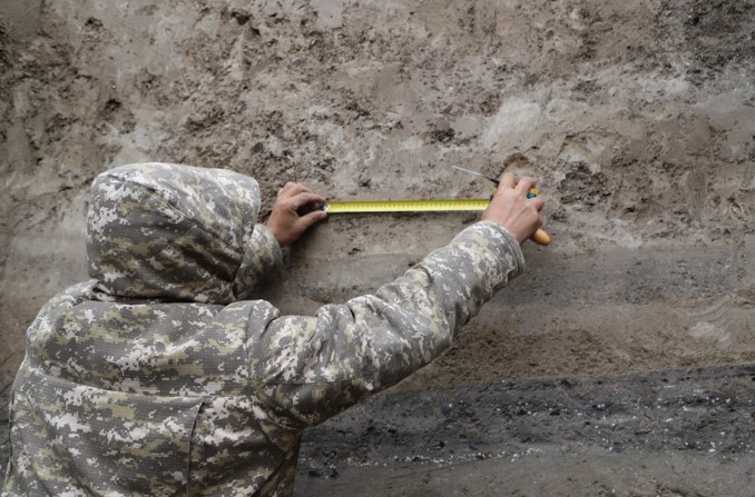
Figure 10 – General view of the Excavation #1 (Stratigraphic trench). Measurements and description. Working moment
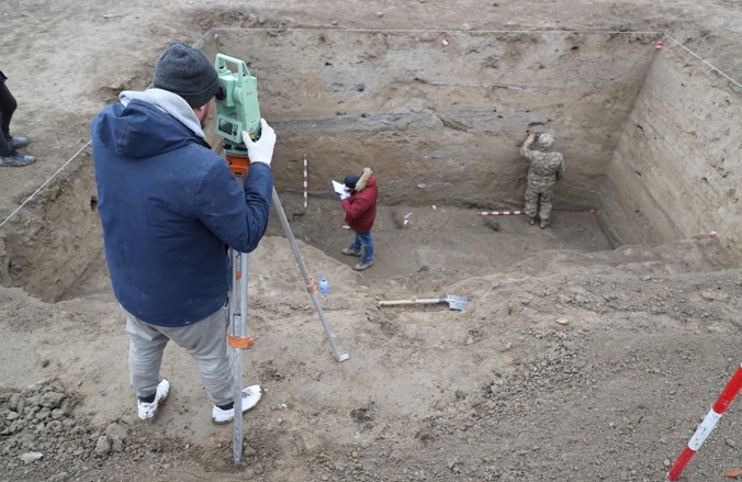
Figure 11 – General view of the Excavation #1 (Stratigraphic trench). Measurements and description. Working moment
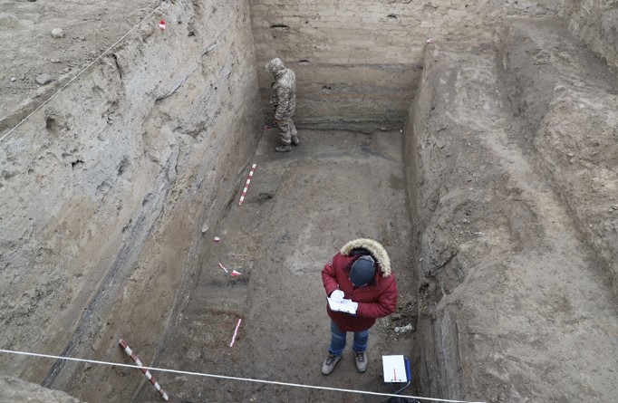
Figure 12 – General view of the Excavation #1 (Stratigraphic trench). Measurements and description. Working moment
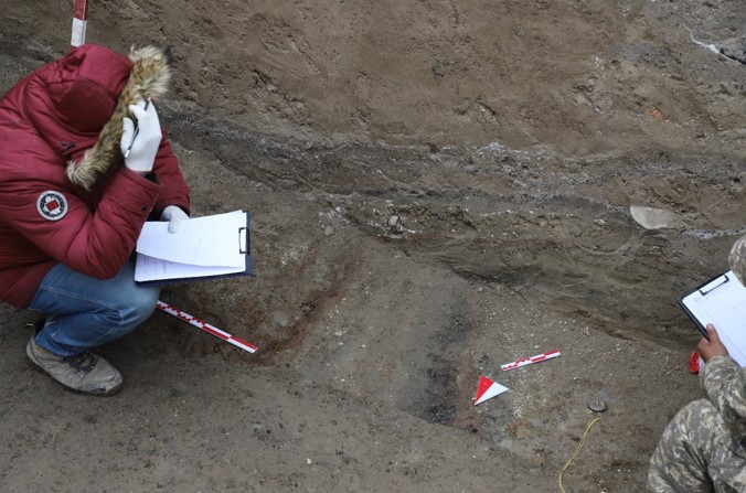
Figure 13 – General view of the Excavation #1 (Stratigraphic trench). The process of taking carbon tests 14. Working moment
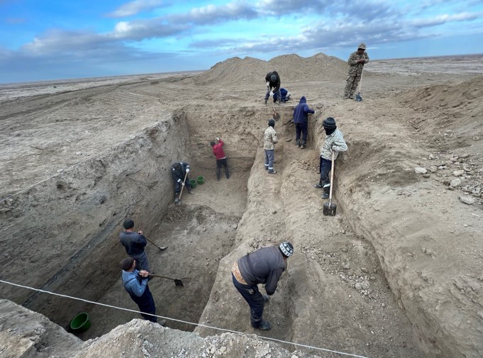
Figure 14 – General view of the Excavation #1 (Stratigraphic trench). Profile Cleaning. Working moment
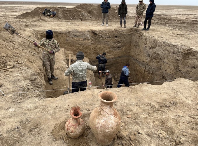
Figure 15 – General view of the Excavation #1 (Stratigraphic trench). Profile Cleaning. Working moment
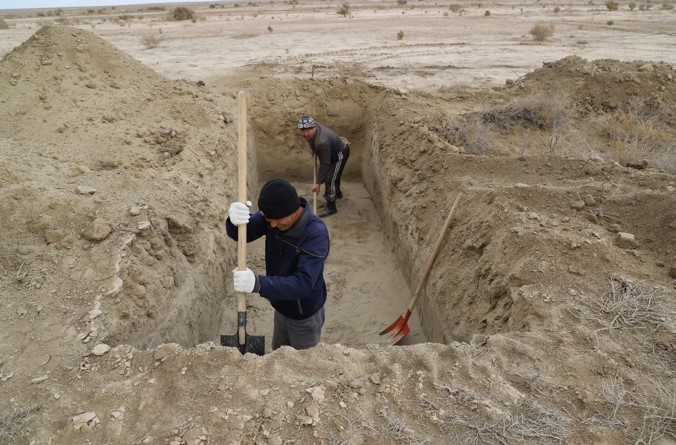
Figure 16 – General view of the Excavation #3 (Test trench #2 - irrigation canal). Profile Cleaning. Working moment
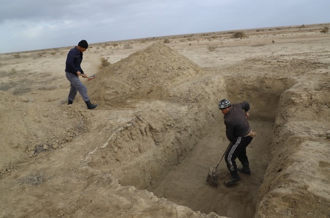
Figure 17 – General view of the Excavation #3 (Test trench #2 - irrigation canal). Profile Cleaning. Working moment
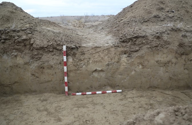
Figure 18 – General view of the Excavation #3 (Test trench #2 - irrigation canal). West profile
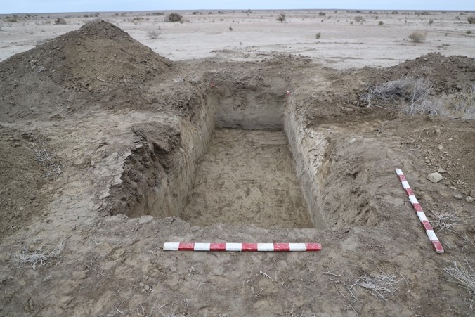
Figure 19 – General view of the Excavation #3 (Test trench #2 - irrigation canal). General view. North view
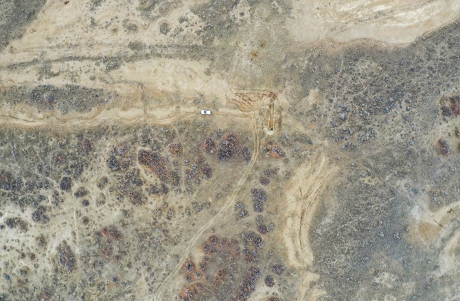
Figure 20 – General view of the Excavation #2 (Test trench #1 - irrigation canal). General view. Top view
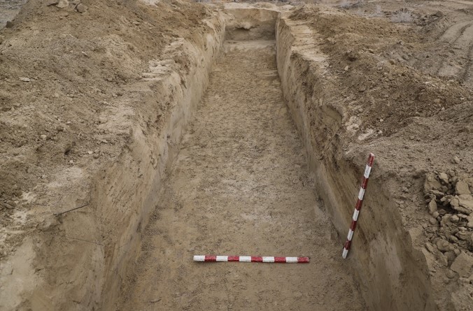
Figure 21 – General view of the Excavation #2 (Test trench #1 - irrigation canal)
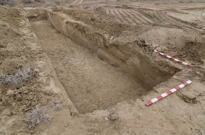
Figure 22 – General view of the Excavation #2 (Test trench #1 - irrigation canal)
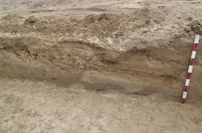
Figure 23 – General view of the Excavation #2 – layer #3. (Test trench #1 - irrigation canal)
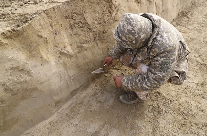
Figure 24 – General view of the Excavation #2 – layer #3. (Test trench #1 - irrigation canal). The process of taking samples
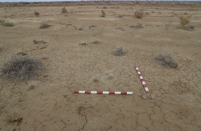
Figure 25 – General view of the Excavation #4. (Test trench #3). Ancient agricultural field. Before work.
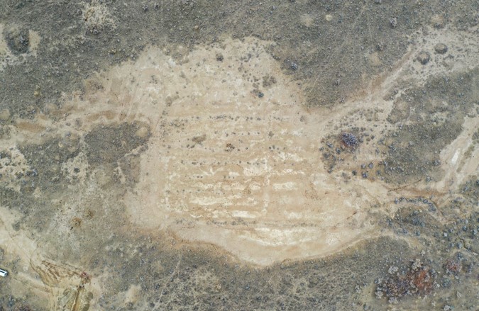
Figure 26 – General view of the Excavation #4. (Test trench #3). Ancient agricultural field. Before work. Top view
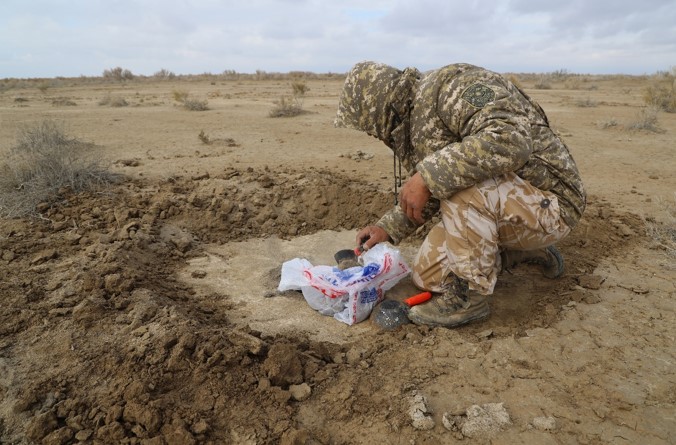
Figure 27 – General view of the Excavation #4. (Test trench #3). Ancient agricultural field. The sampling process for carpology
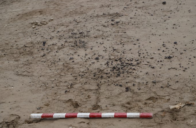
Figure 28 – Traces of metallurgical production at the irrigation canal
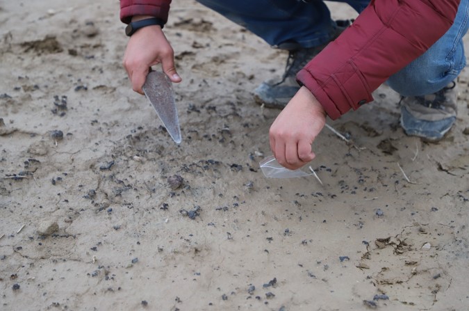
Figure 29 – Traces of metallurgical production at the irrigation canal. Process of taking analyses for radiocarbon dating
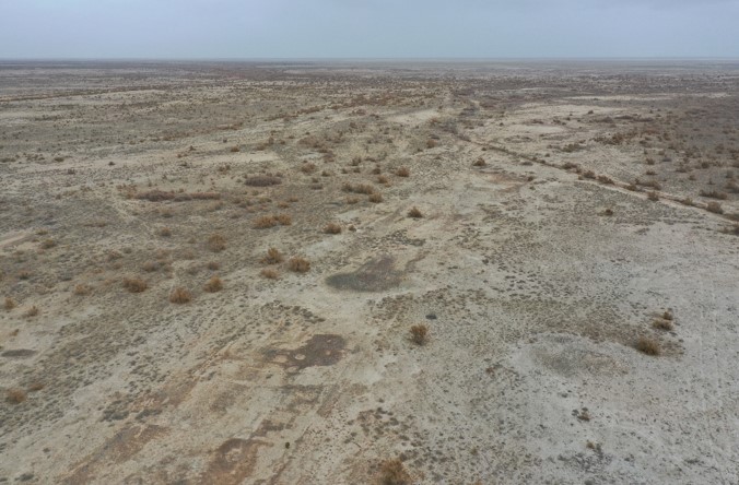
Figure 30 – Remains of ancient furnaces on the territory of the settlement. General view
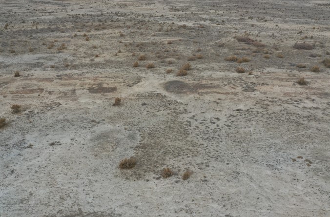
Figure 31 – Remains of ancient furnaces on the territory of the settlement. General view
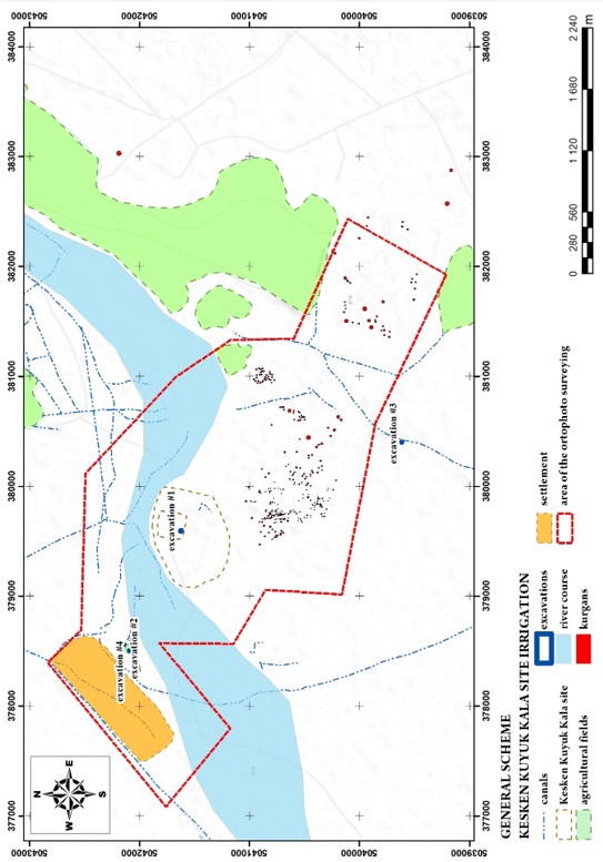
Figure 1 – General scheme with UAV surveying and excavations
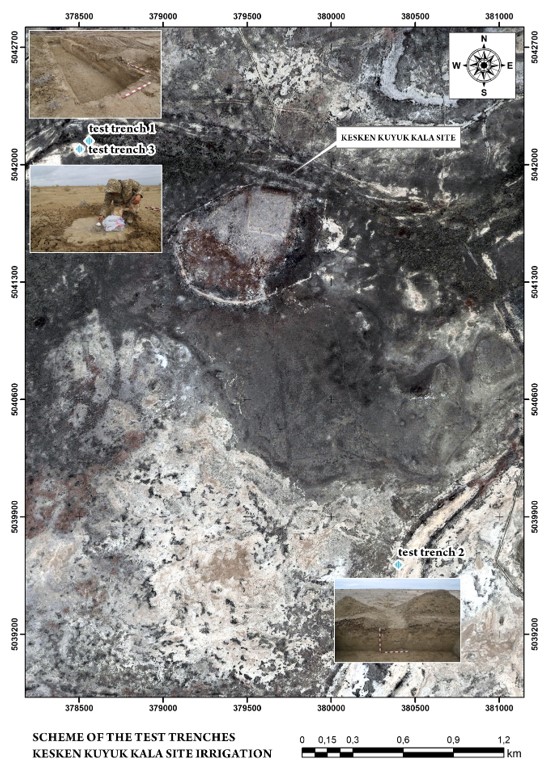
Figure 2 – Location of the test tranches #1-3
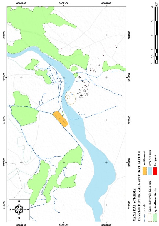
Figure 3 – Analysis of the irrigation situation. General view
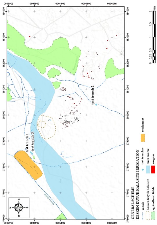
Figure 4 – Burial ground plan. General view
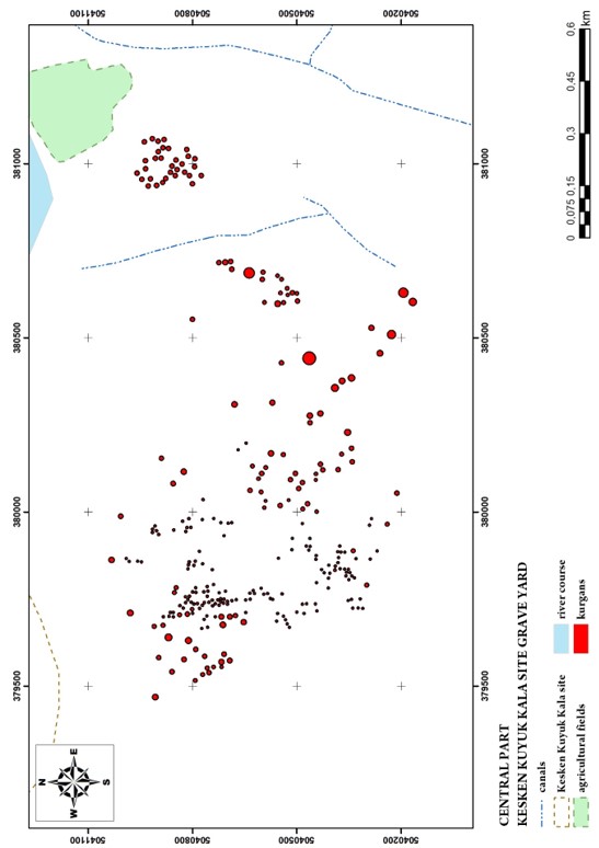
Figure 5 – Burial ground plan. Central part (Topo background)
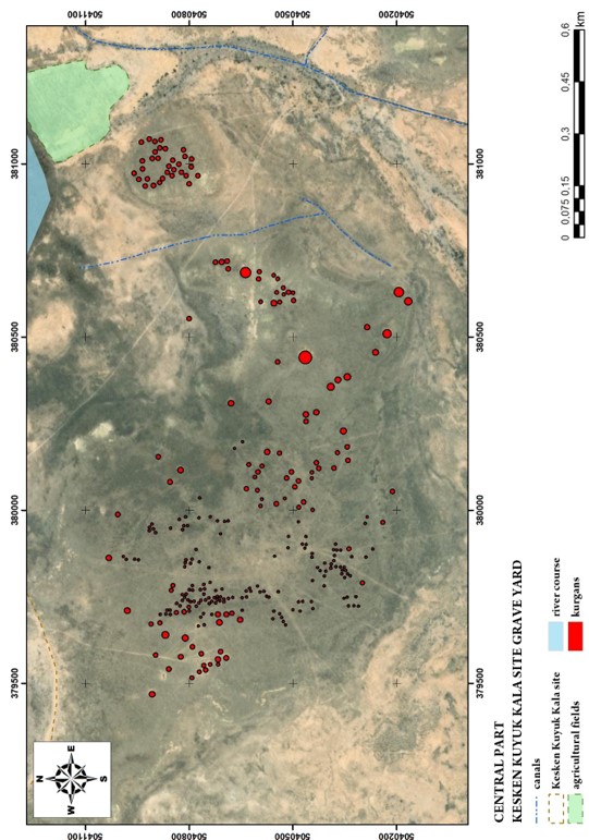
Figure 6 – Burial ground plan. Central part (Satellite background)
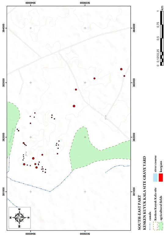
Figure 7 – Burial ground plan. South-East part (Topo background)
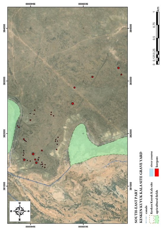
Figure 8 – Burial ground plan. South-East part (Satellite background)
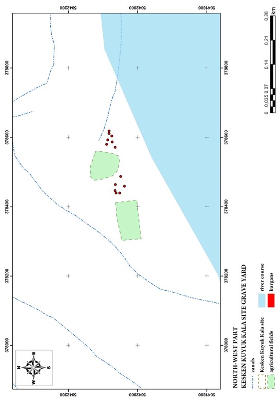
Figure 9 – Burial ground plan. North-West part (Topo background)
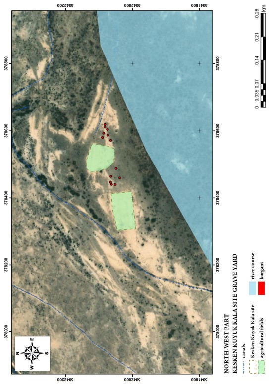
Figure 10 – Burial ground plan. North-West part (Satellite background)
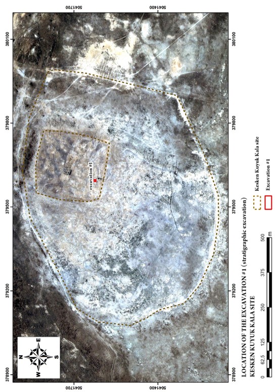
Figure 11 – Scheme of the location of the stratigraphic excavation #1 (Satellite background)
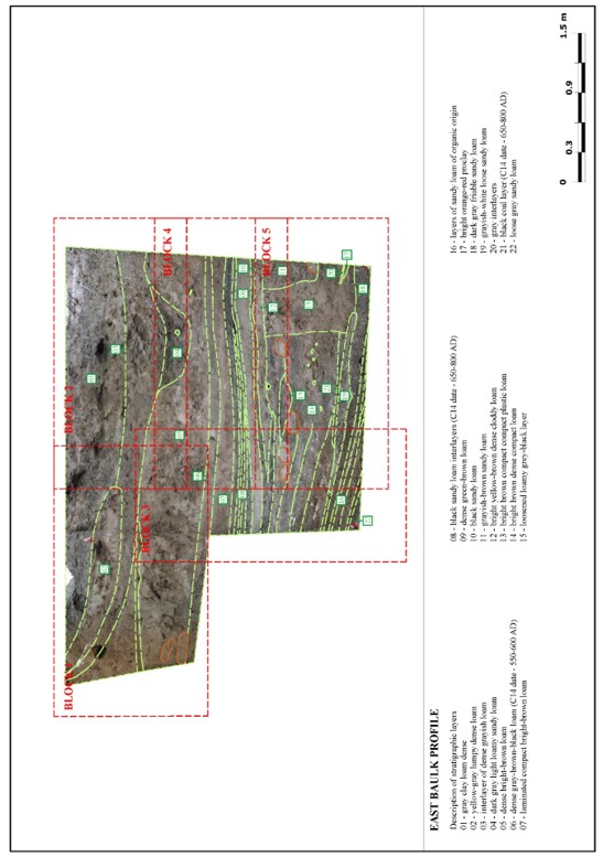
Figure 12 – Excavation No. 1. Stratigraphy. Eastern profile. General view
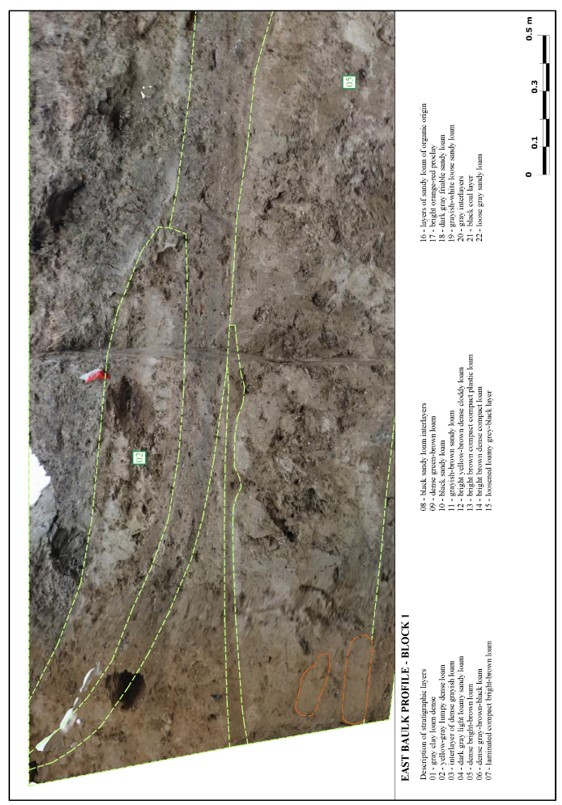
Figure 13 – Excavation No. 1. Stratigraphy. Eastern profile. Block 1
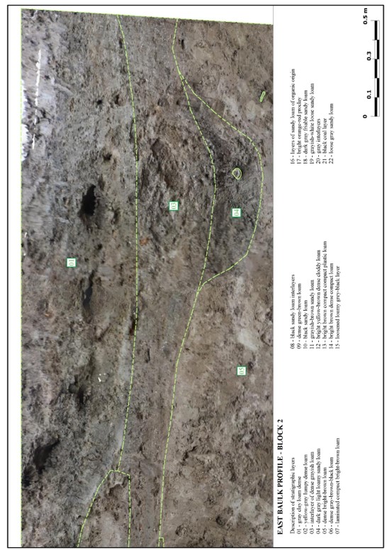
Figure 14 – Excavation No. 1. Stratigraphy. Eastern profile. Block 2
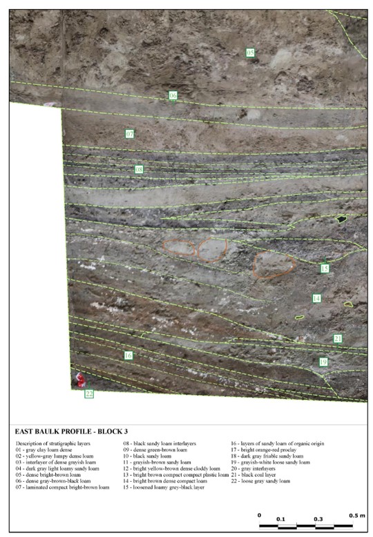
Figure 15 – Excavation No. 1. Stratigraphy. Eastern profile. Block 3
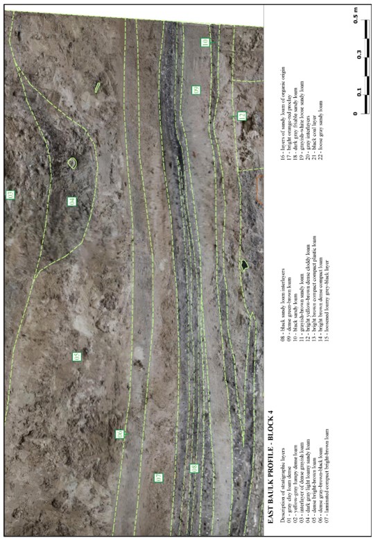
Figure 16 – Excavation No. 1. Stratigraphy. Eastern profile. Block 4
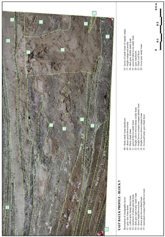
Figure 17 – Excavation No. 1. Stratigraphy. Eastern profile. Block 5
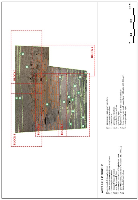
Figure 18 – Excavation No. 1. Stratigraphy. Western profile. General view
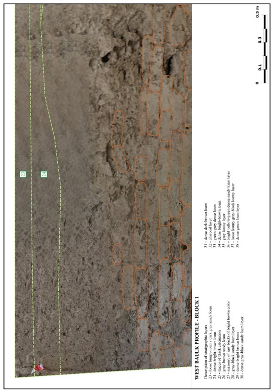
Figure 19 – Excavation No. 1. Stratigraphy. Western profile. Block 1
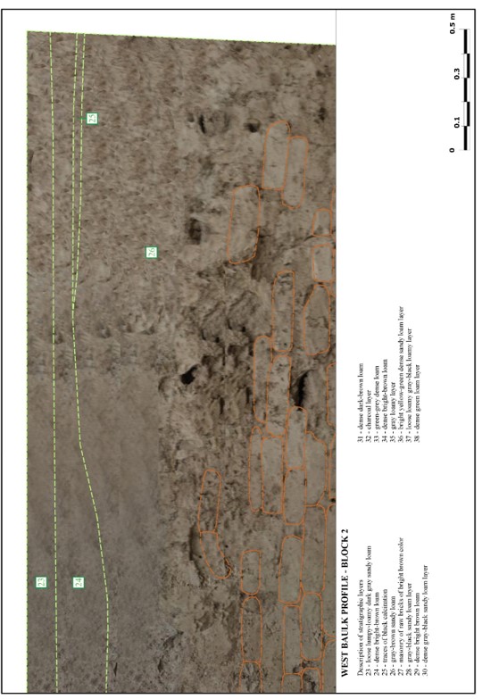
Figure 20 – Excavation No. 1. Stratigraphy. Western profile. Block 2
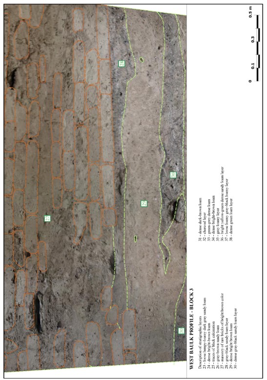
Figure 21 – Excavation No. 1. Stratigraphy. Western profile. Block 3
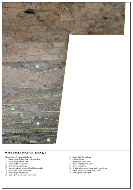
Figure 22 – Excavation No. 1. Stratigraphy. Western profile. Block 4
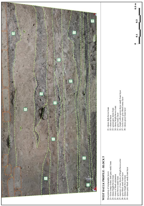
Figure 23 – Excavation No. 1. Stratigraphy. Western profile. Block 5
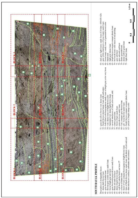
Figure 24 – Excavation No. 1. Stratigraphy. Southern profile. General view
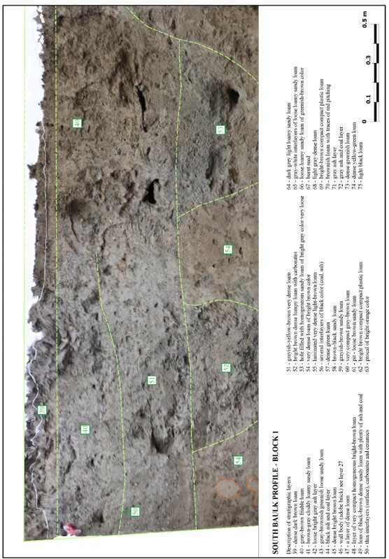
Figure 25 – Excavation No. 1. Stratigraphy. Southern profile. Block 1
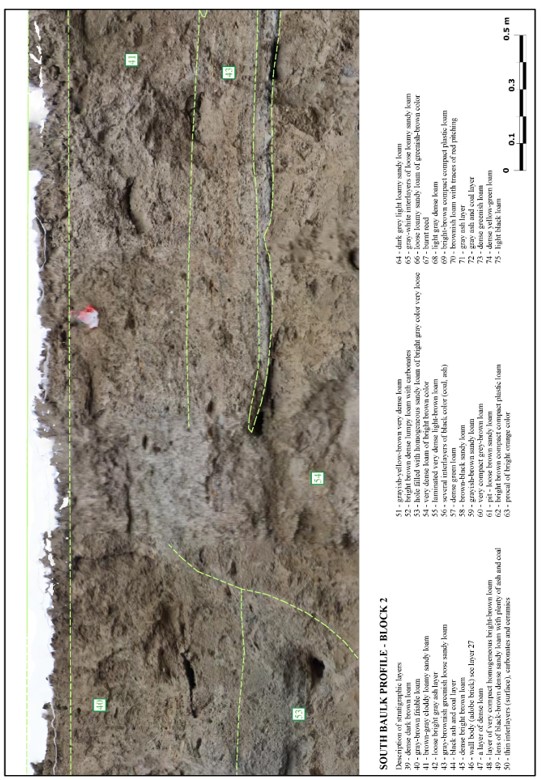
Figure 26 – Excavation No. 1. Stratigraphy. Southern profile. Block 2
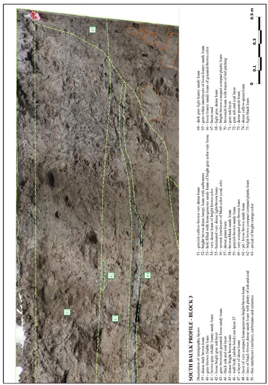
Figure 27 – Excavation No. 1. Stratigraphy. Southern profile. Block 3
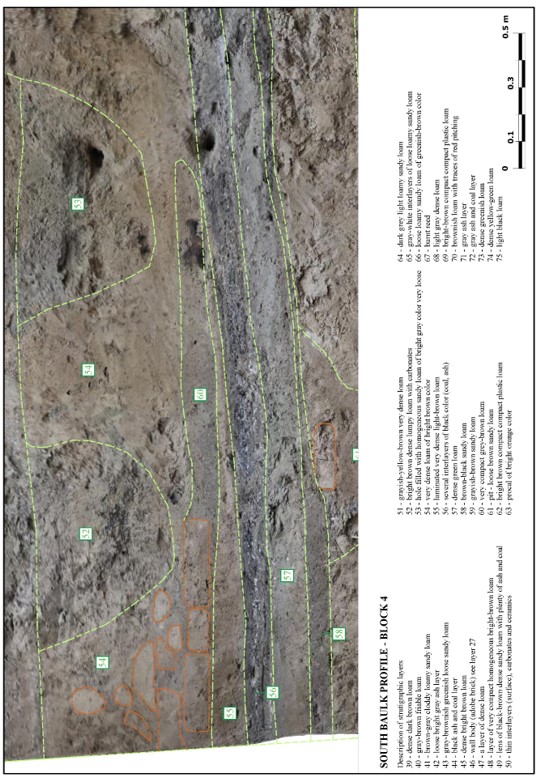
Figure 28 – Excavation No. 1. Stratigraphy. Southern profile. Block 4
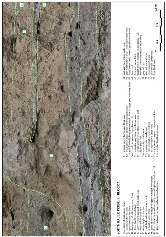
Figure 29 – Excavation No. 1. Stratigraphy. Southern profile. Block 5
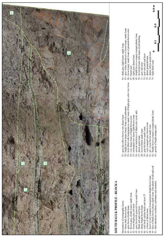
Figure 30 – Excavation No. 1. Stratigraphy. Southern profile. Block 6
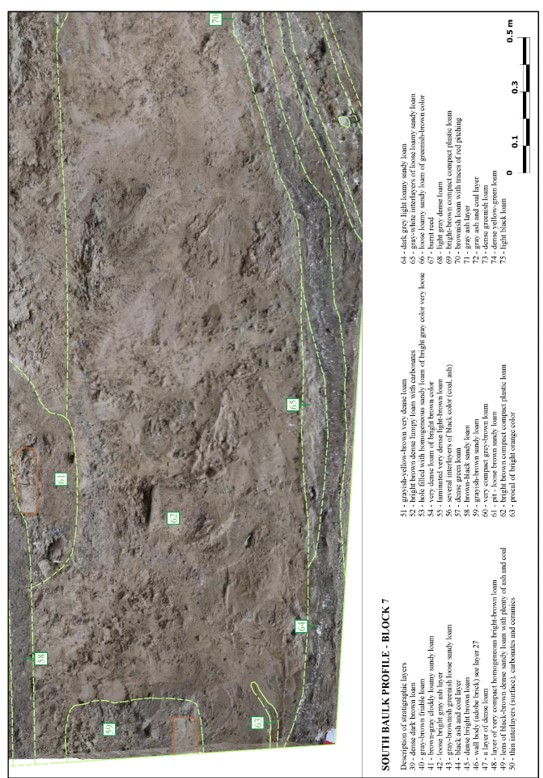
Figure 31 – Excavation No. 1. Stratigraphy. Southern profile. Block 7
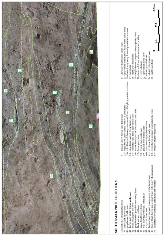
Figure 32 – Excavation No. 1. Stratigraphy. Southern profile. Block 8
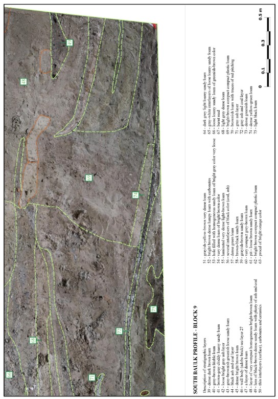
Figure 33 – Excavation No. 1. Stratigraphy. Southern profile. Block 9
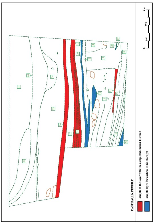
Figure 34 – Excavation No. 1. Stratigraphy. Eastern profile. Scheme of selecting analyses for radiocarbon dating
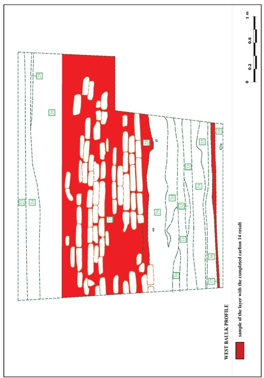
Figure 35 – Excavation No. 1. Stratigraphy. Western profile. Scheme of selecting analyses for radiocarbon dating
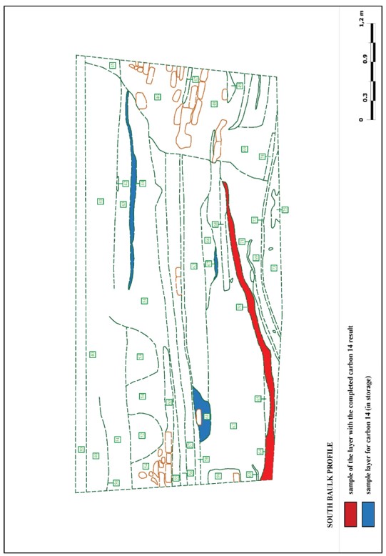
Figure 36 – Excavation No. 1. Stratigraphy. Southern profile. Scheme of selecting analyses for radiocarbon dating
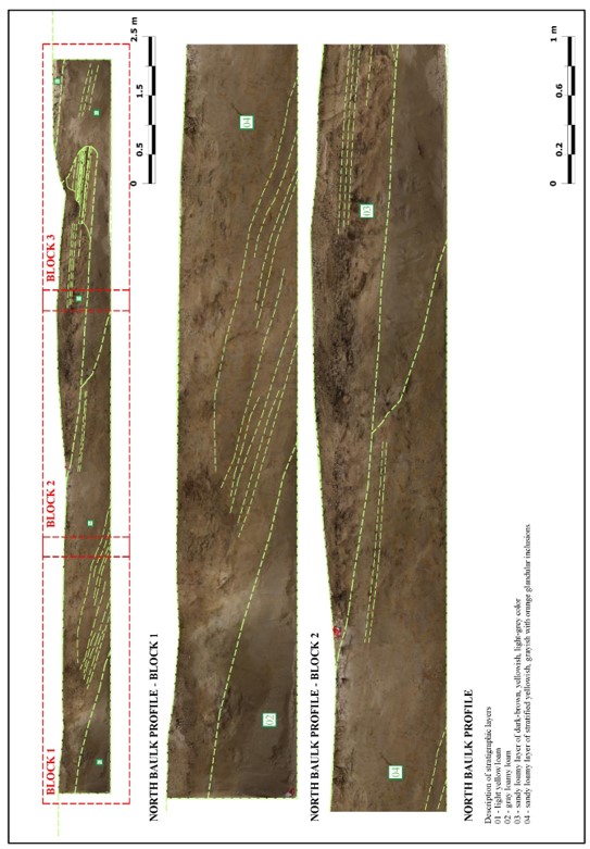
Figure 37 – Excavation No. 2. Stratigraphy. Northern profile. Block 1-2
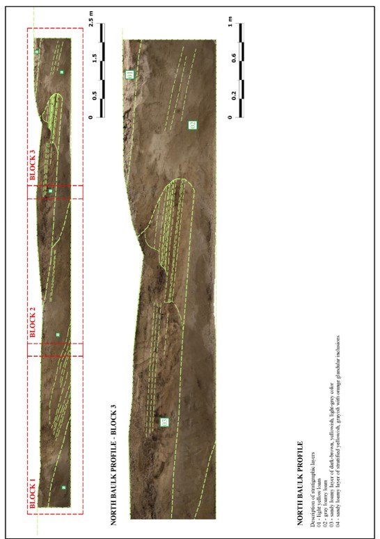
Figure 38 – Excavation No. 2. Stratigraphy. Northern profile. Block 3
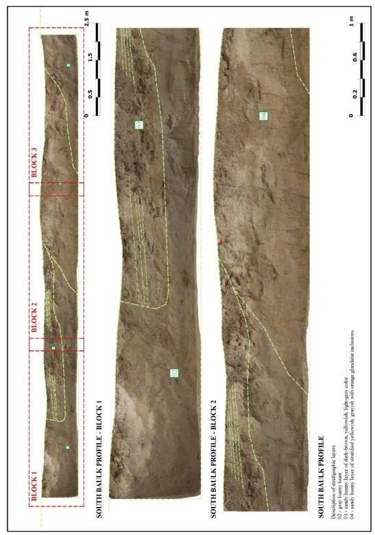
Figure 39 – Excavation No. 2. Stratigraphy. Southern profile. Block 1-2
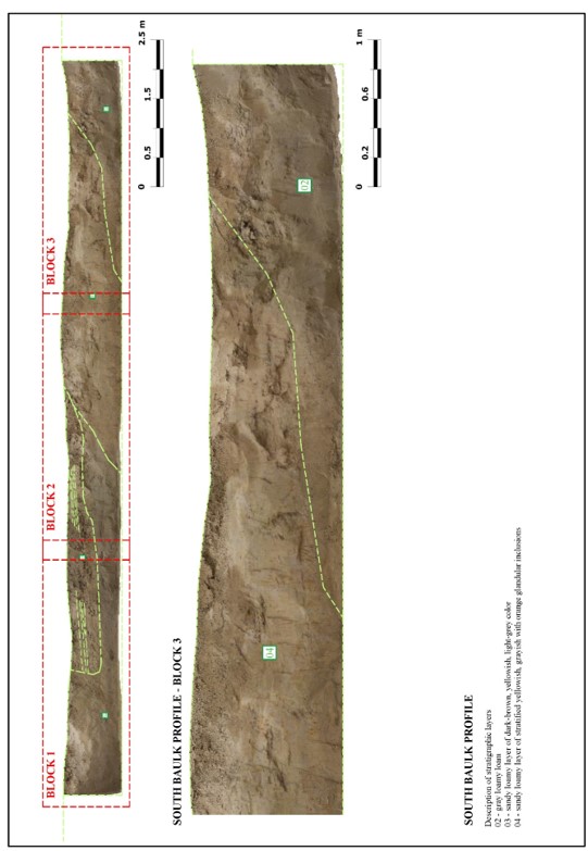
Figure 40 – Excavation No. 2. Stratigraphy. Southern profile. Block 3
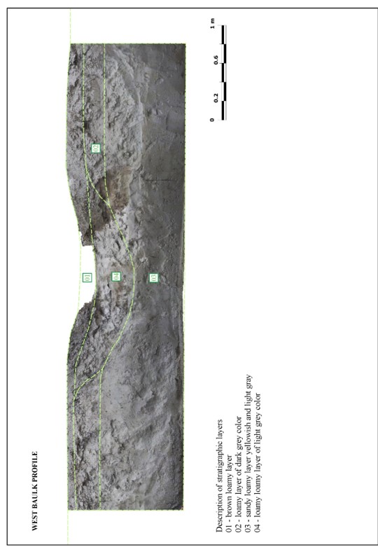
Figure 41 – Excavation No. 3. Stratigraphy. Western profile